
 Submit Manuscript
 Peer Review
 Editor Work
2022 Vol. 11, No. 1
 Previous Issue
 Abstract
 4750KB


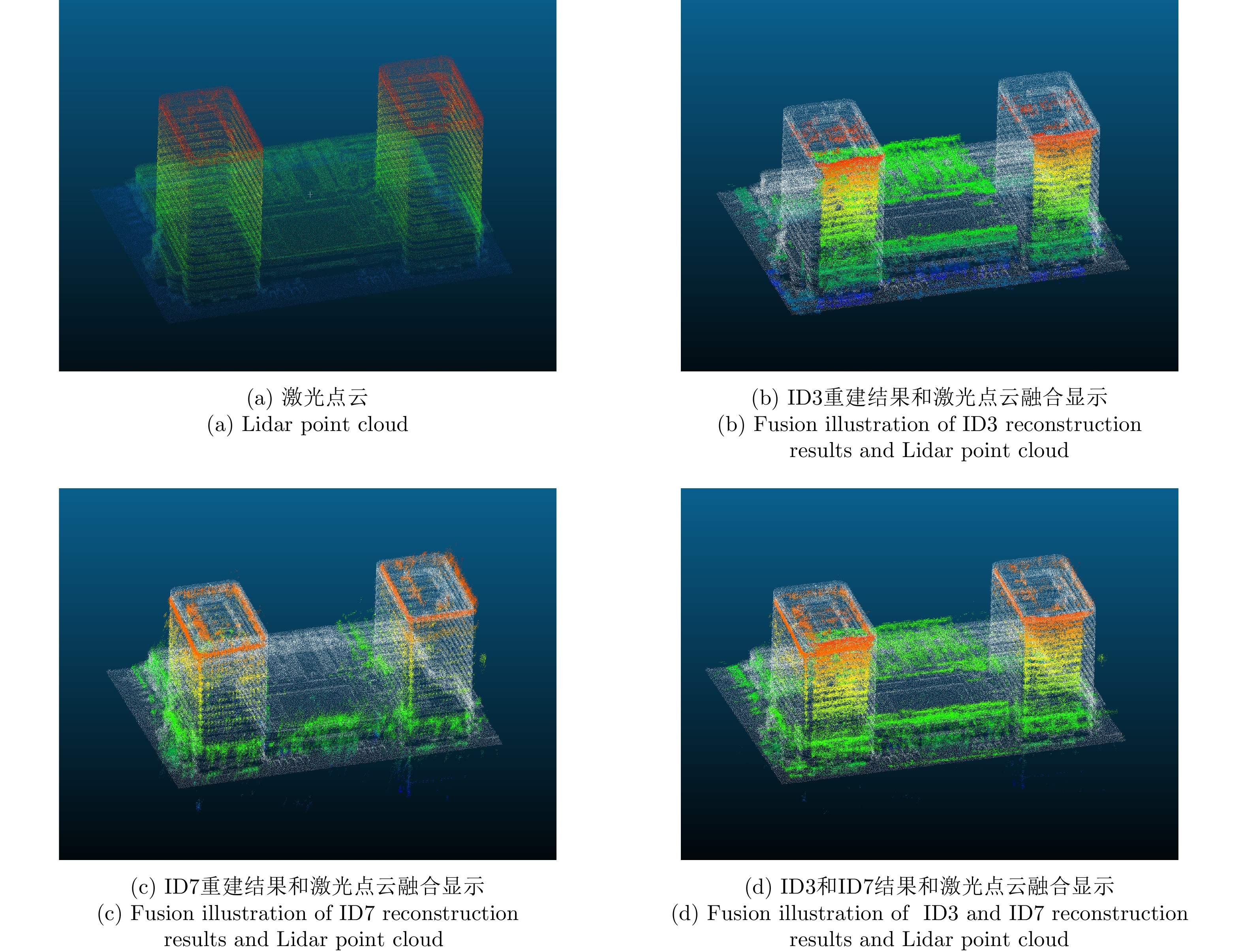


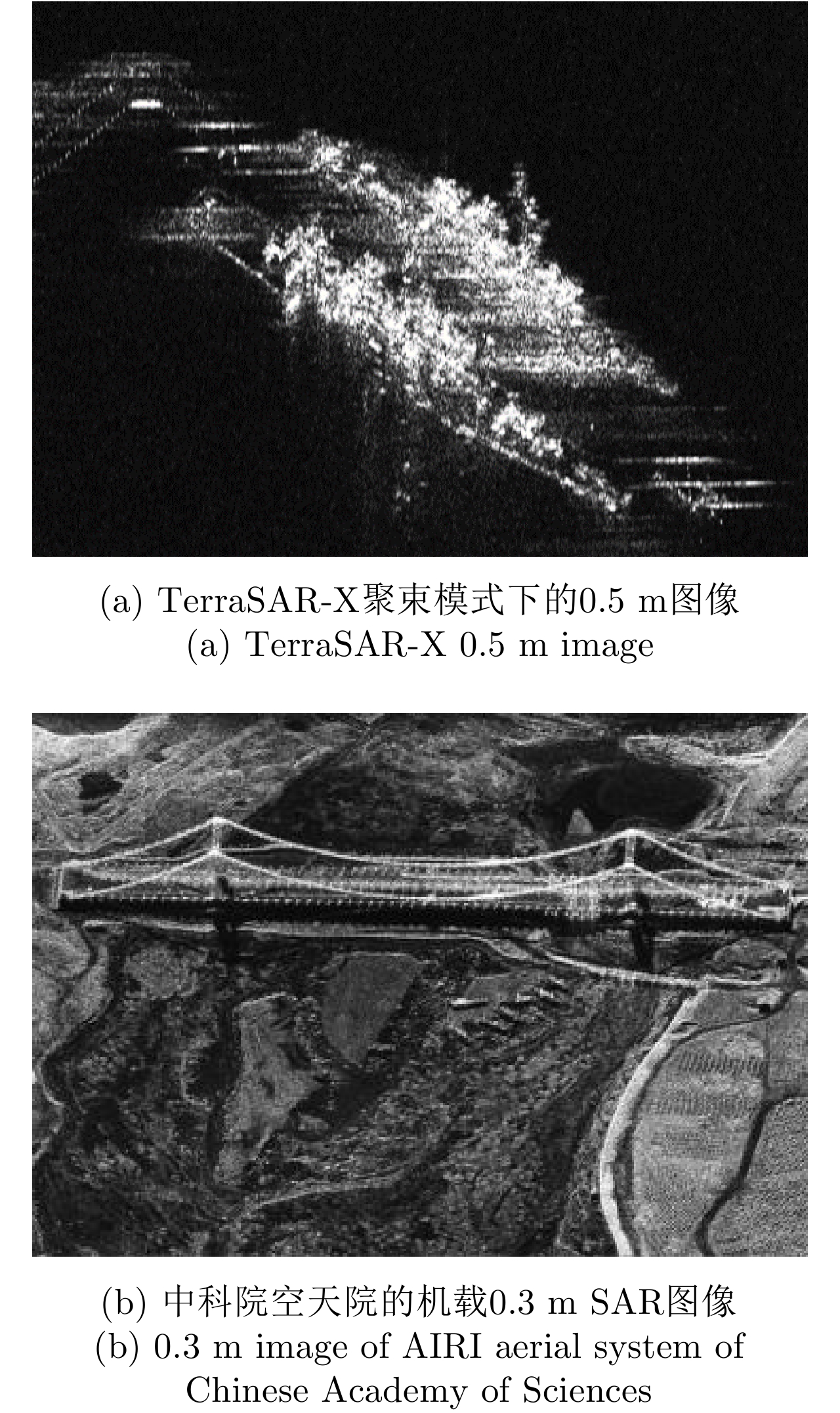
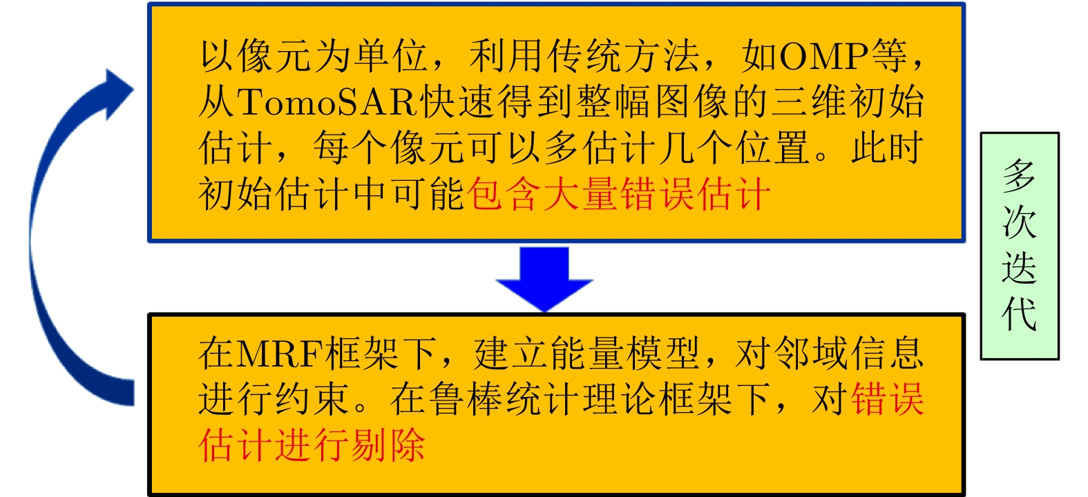
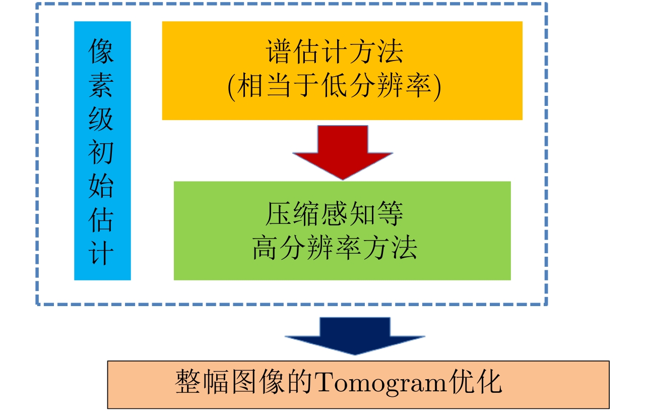


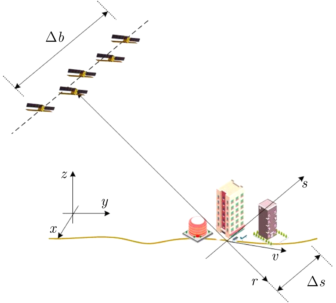

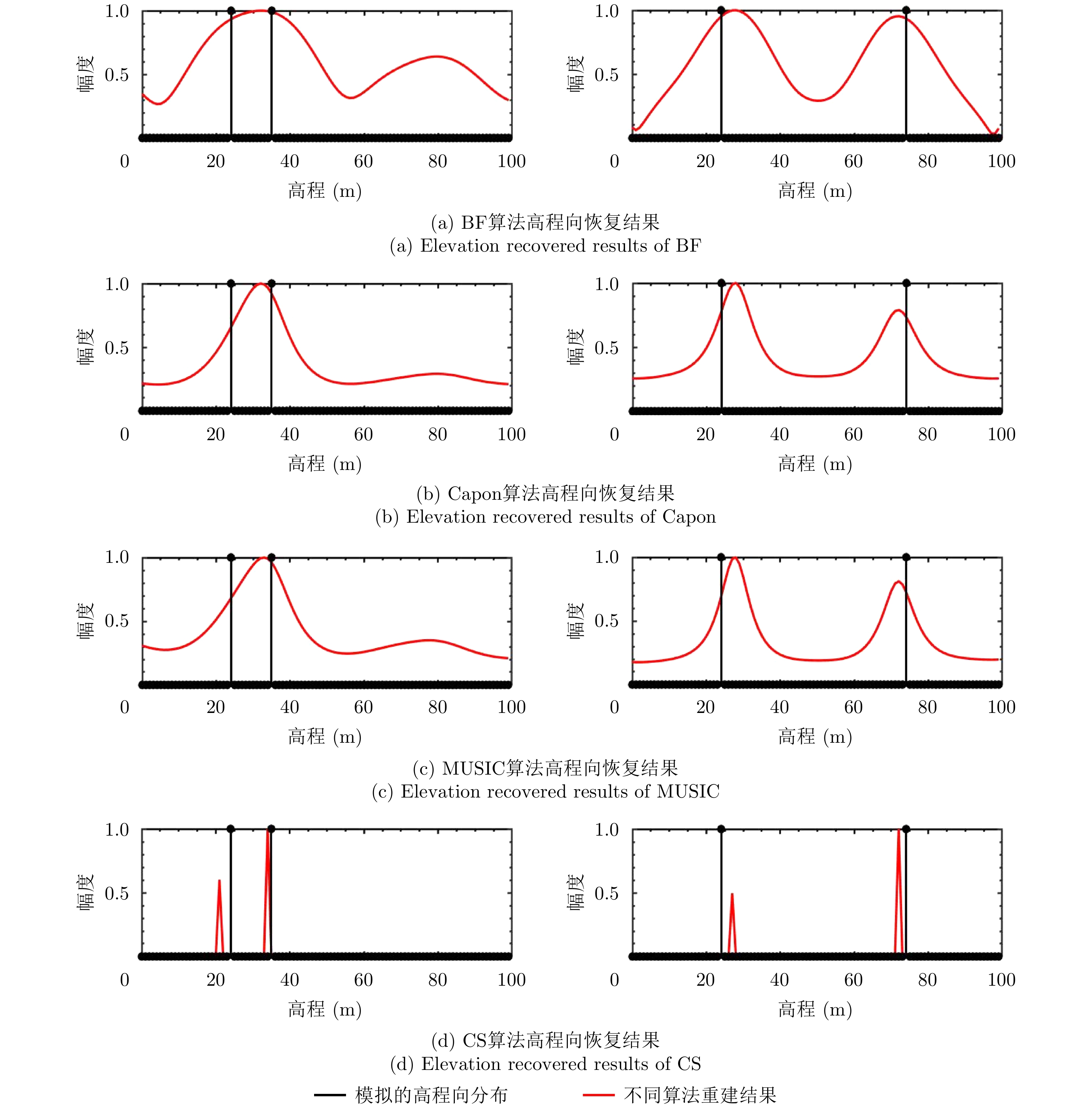


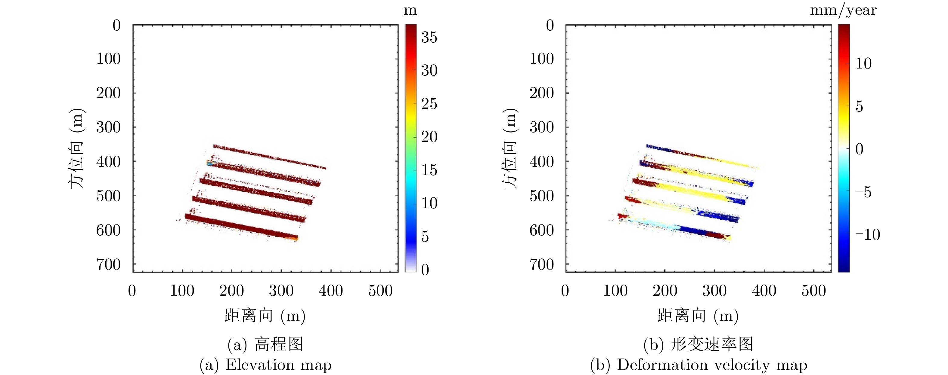
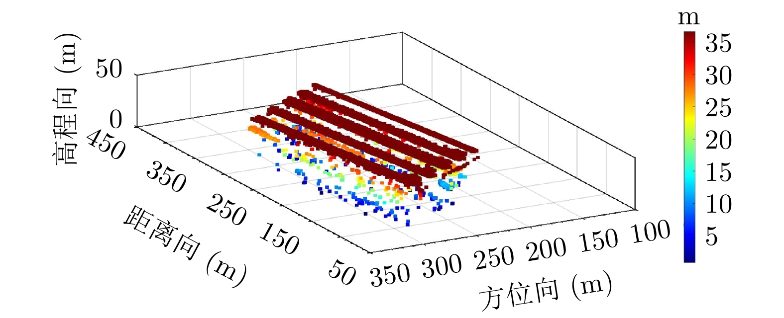


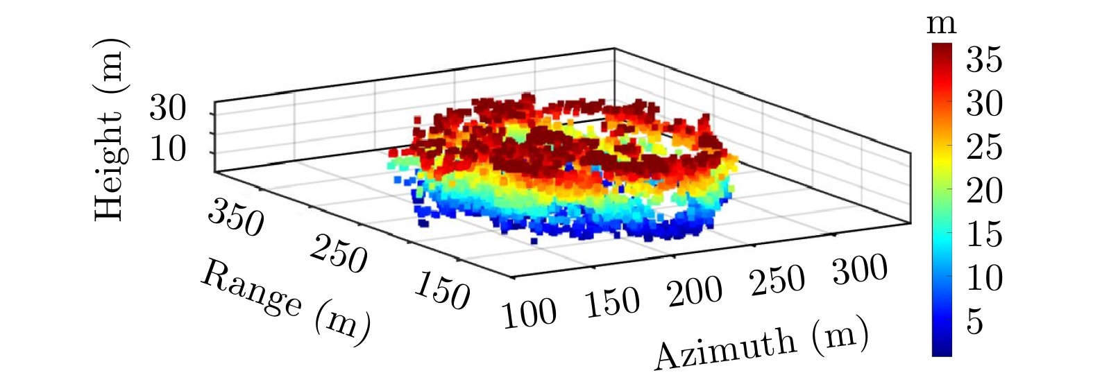


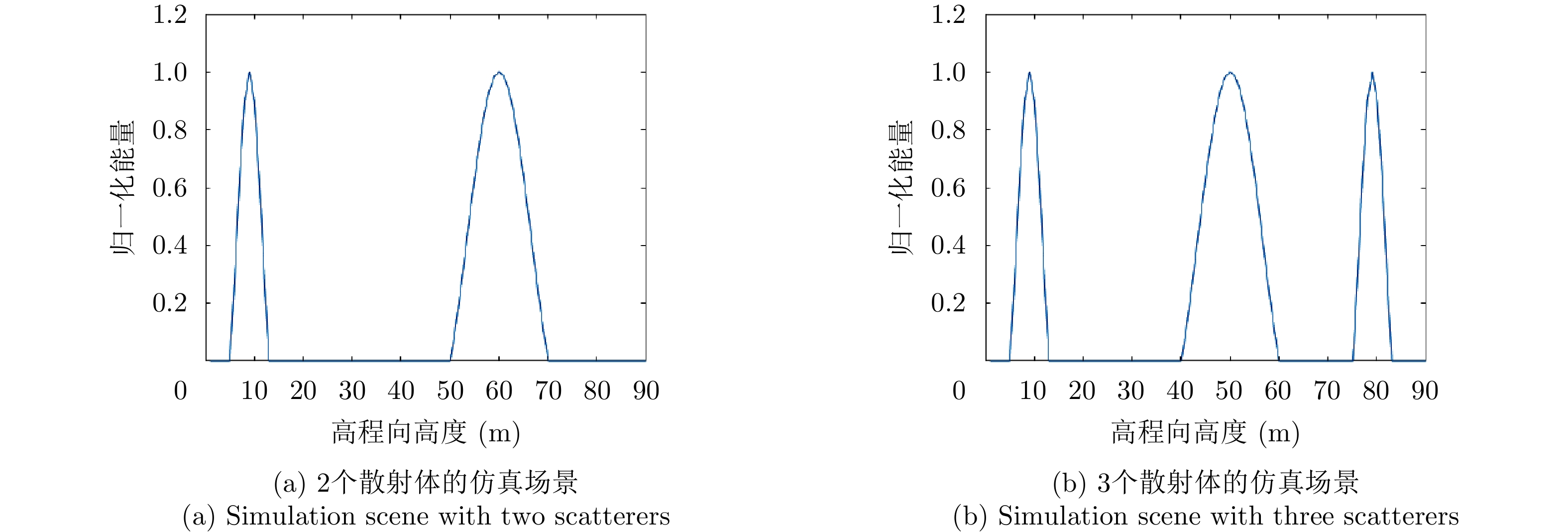


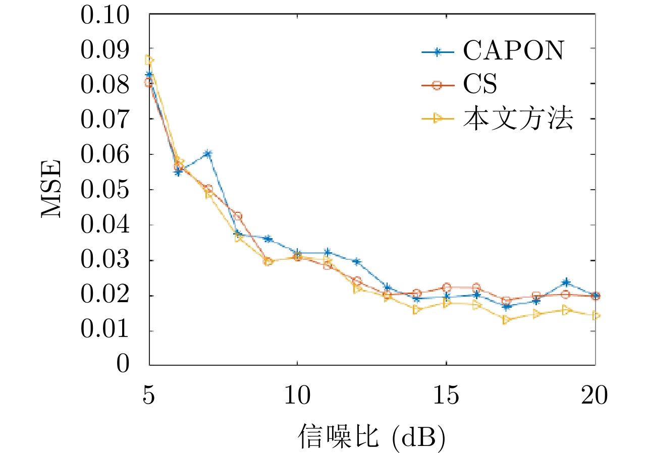
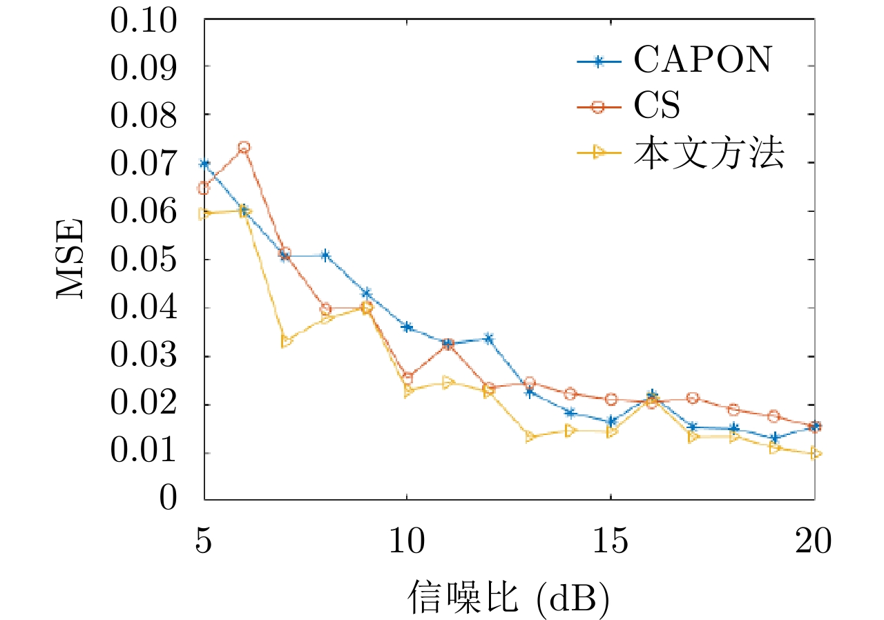
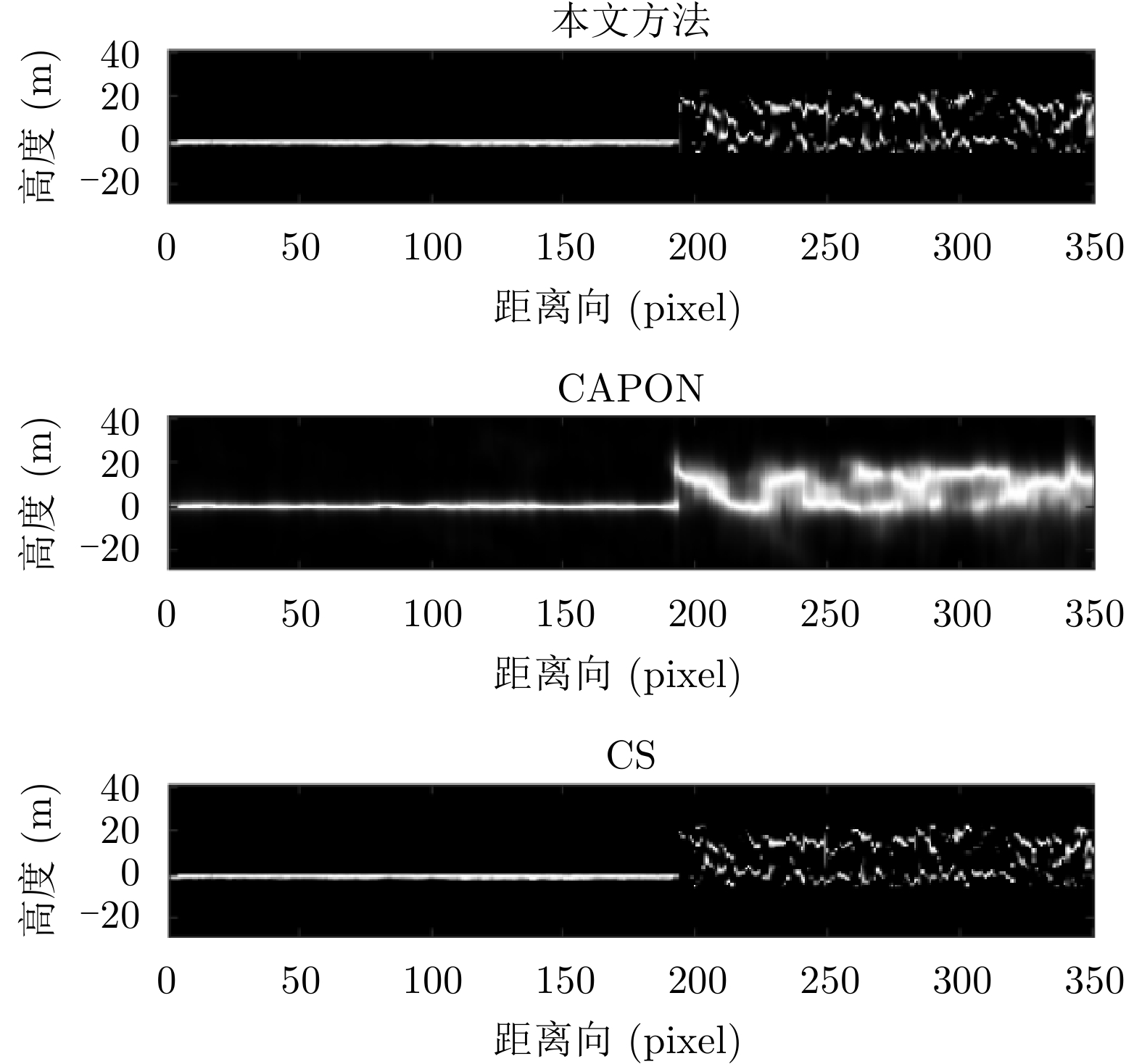
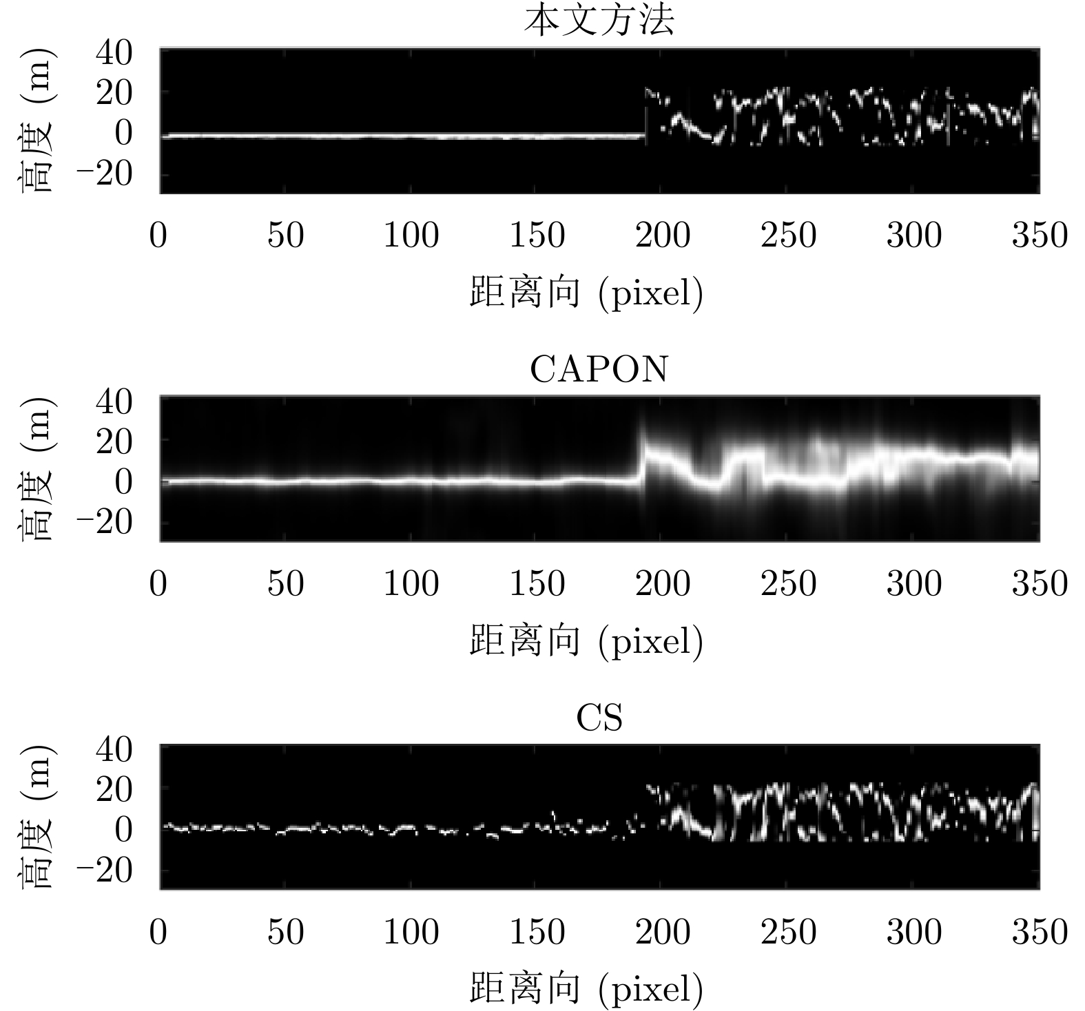


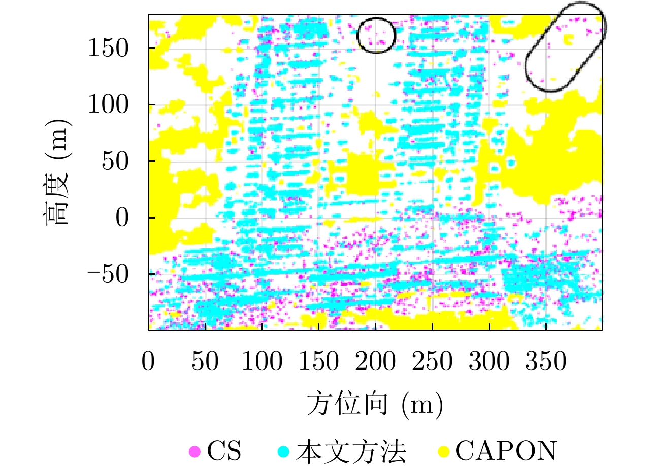
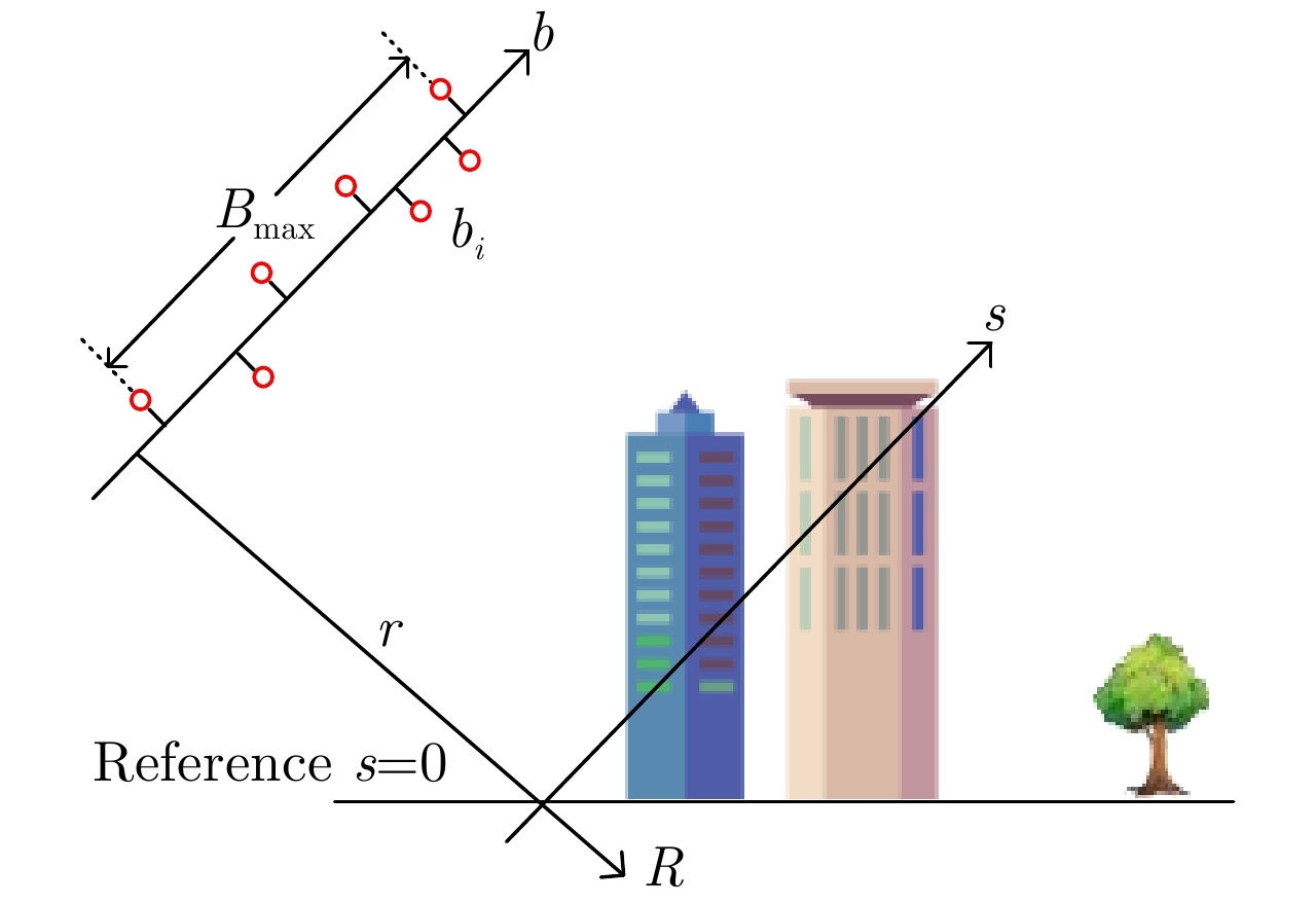
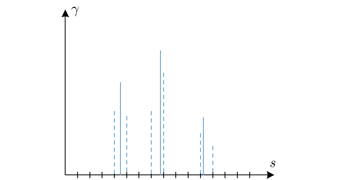

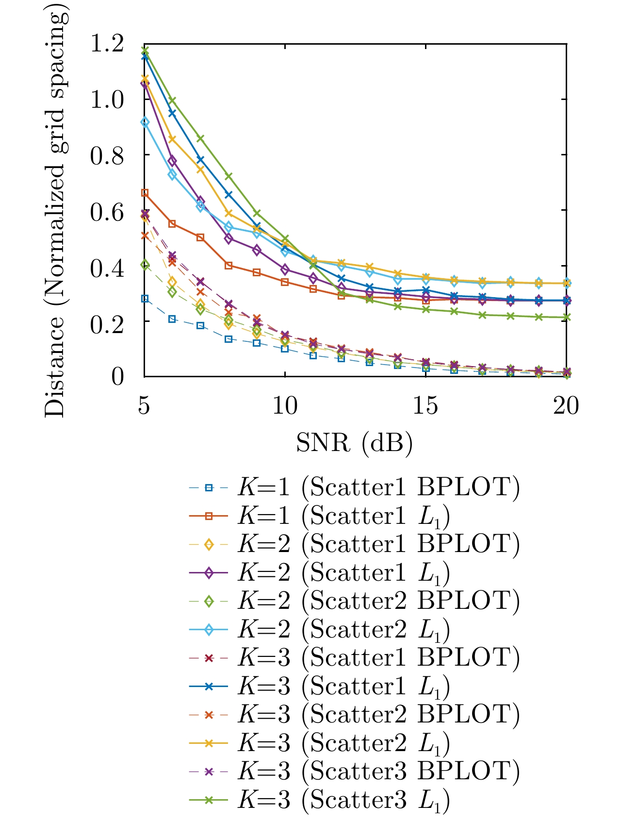


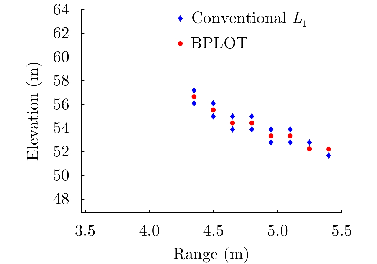
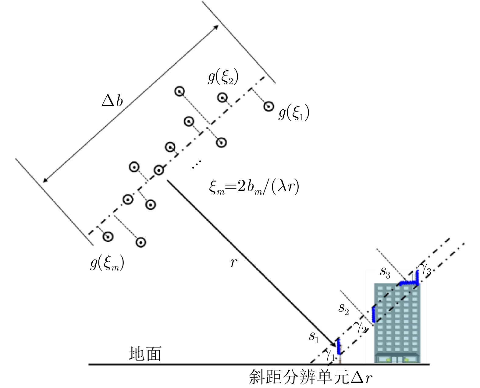
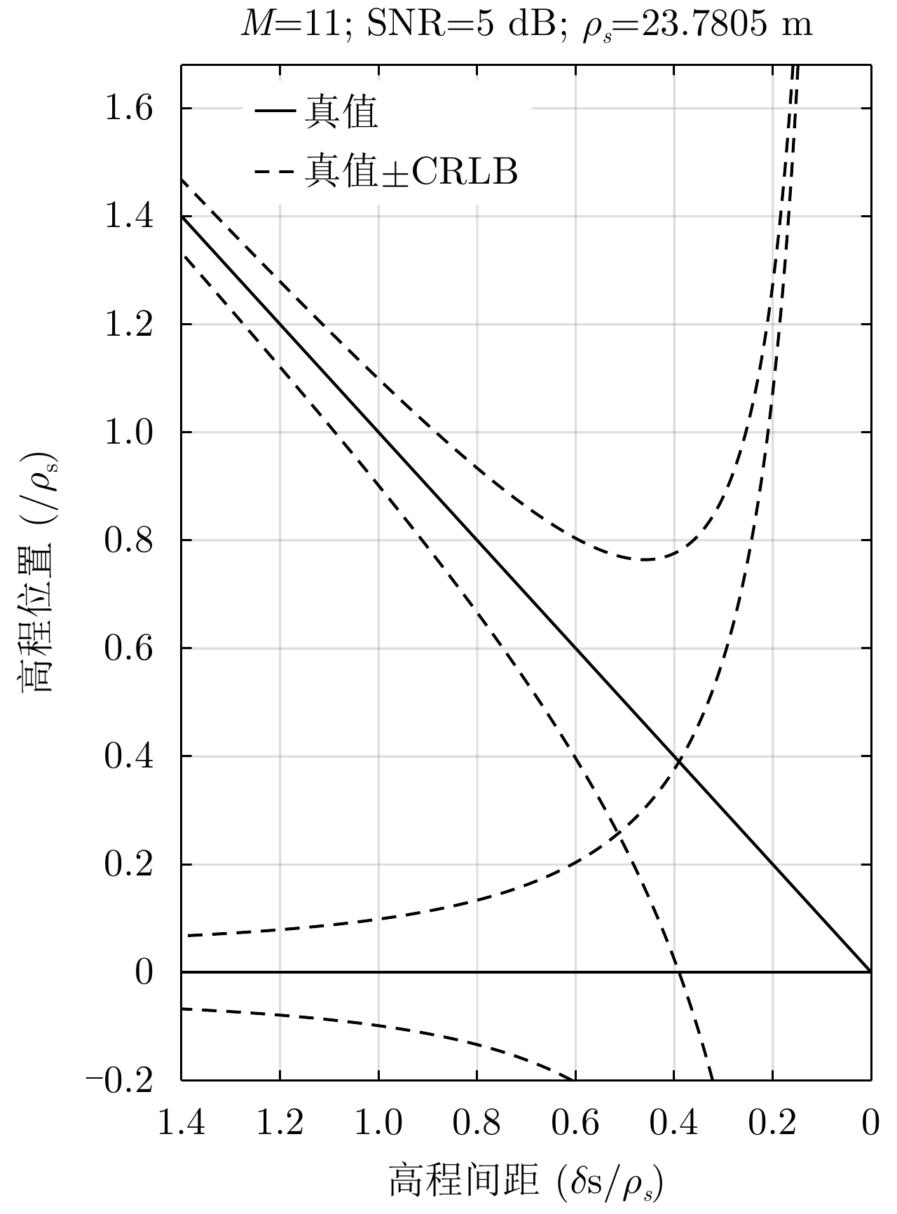

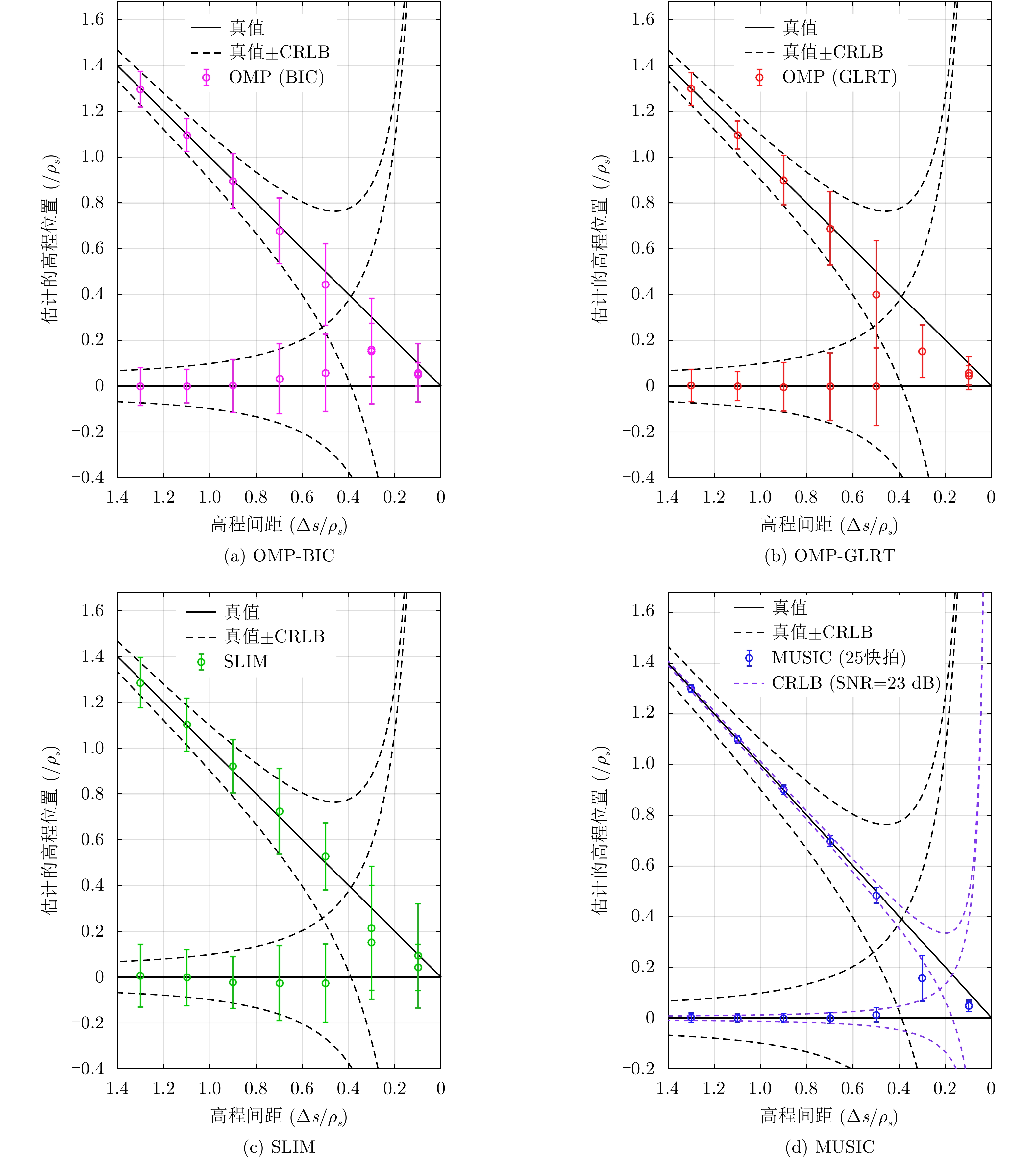


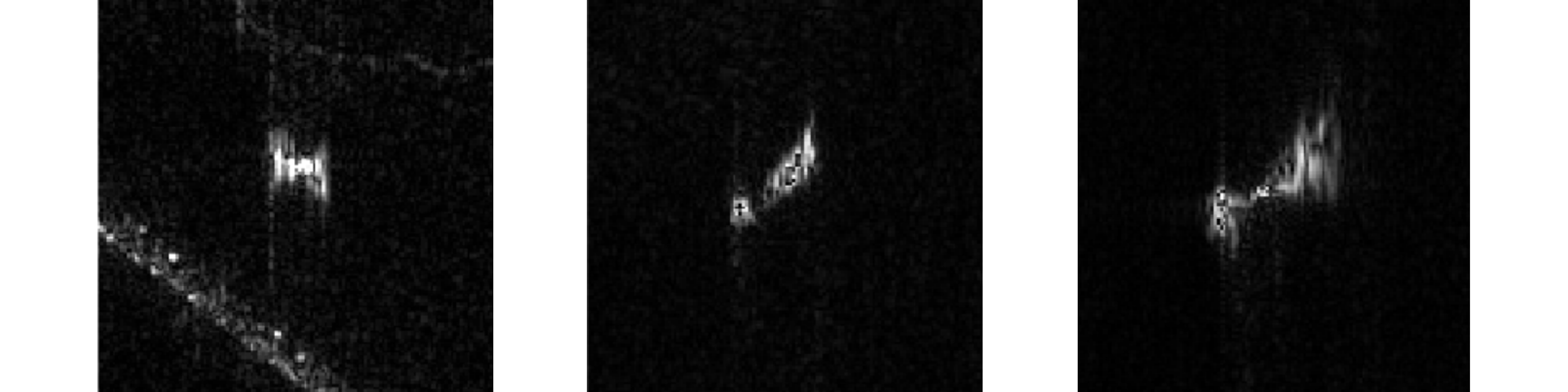
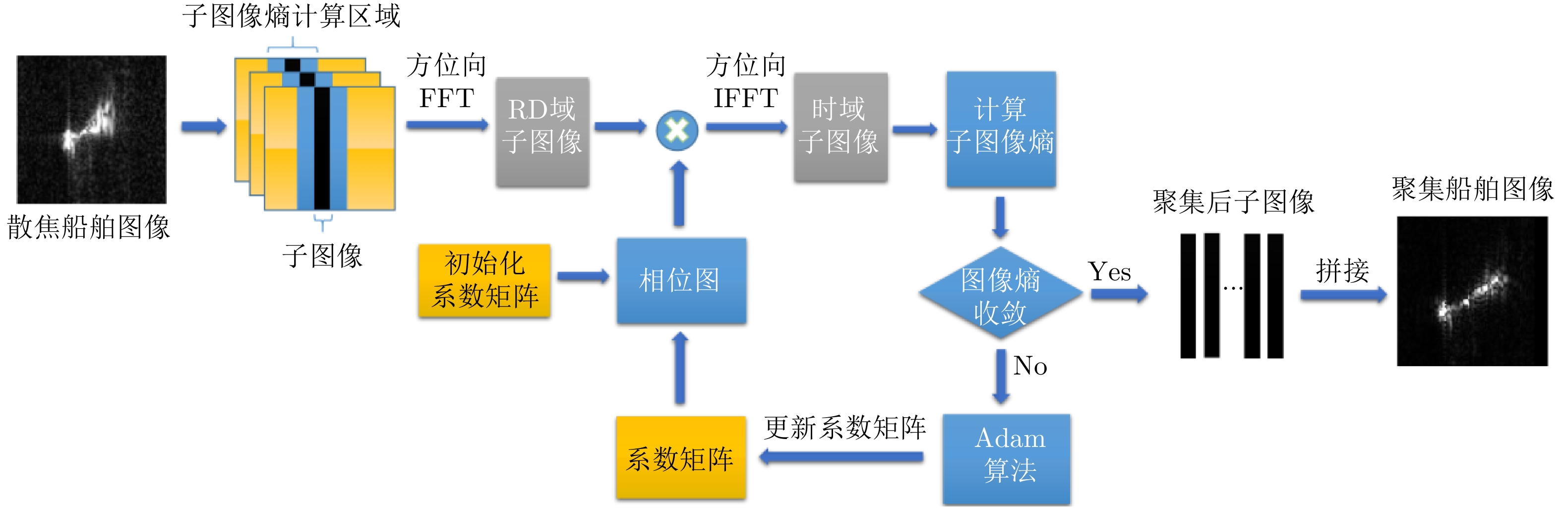

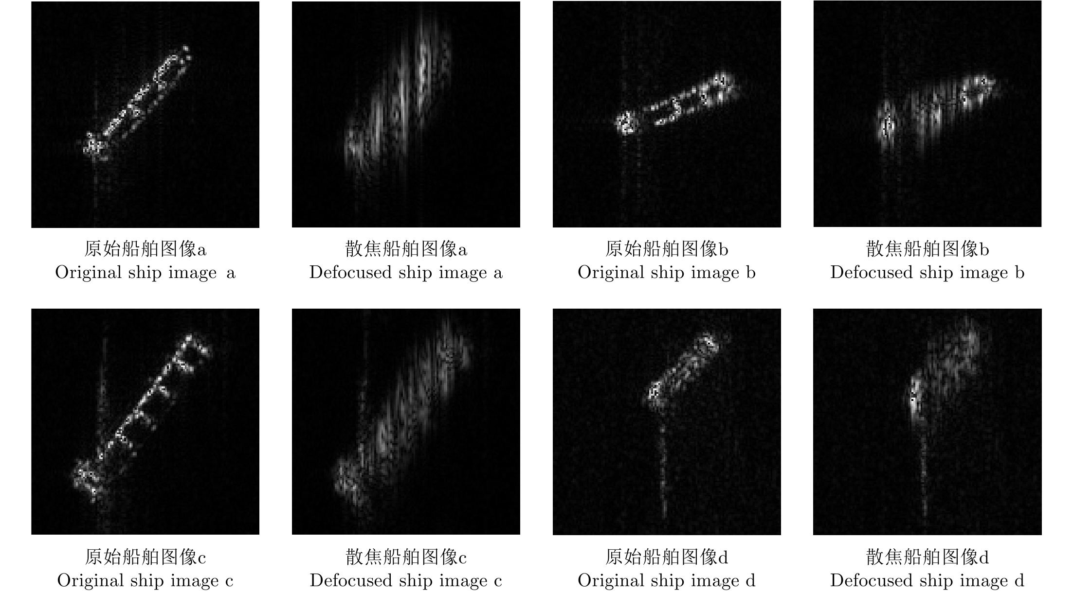

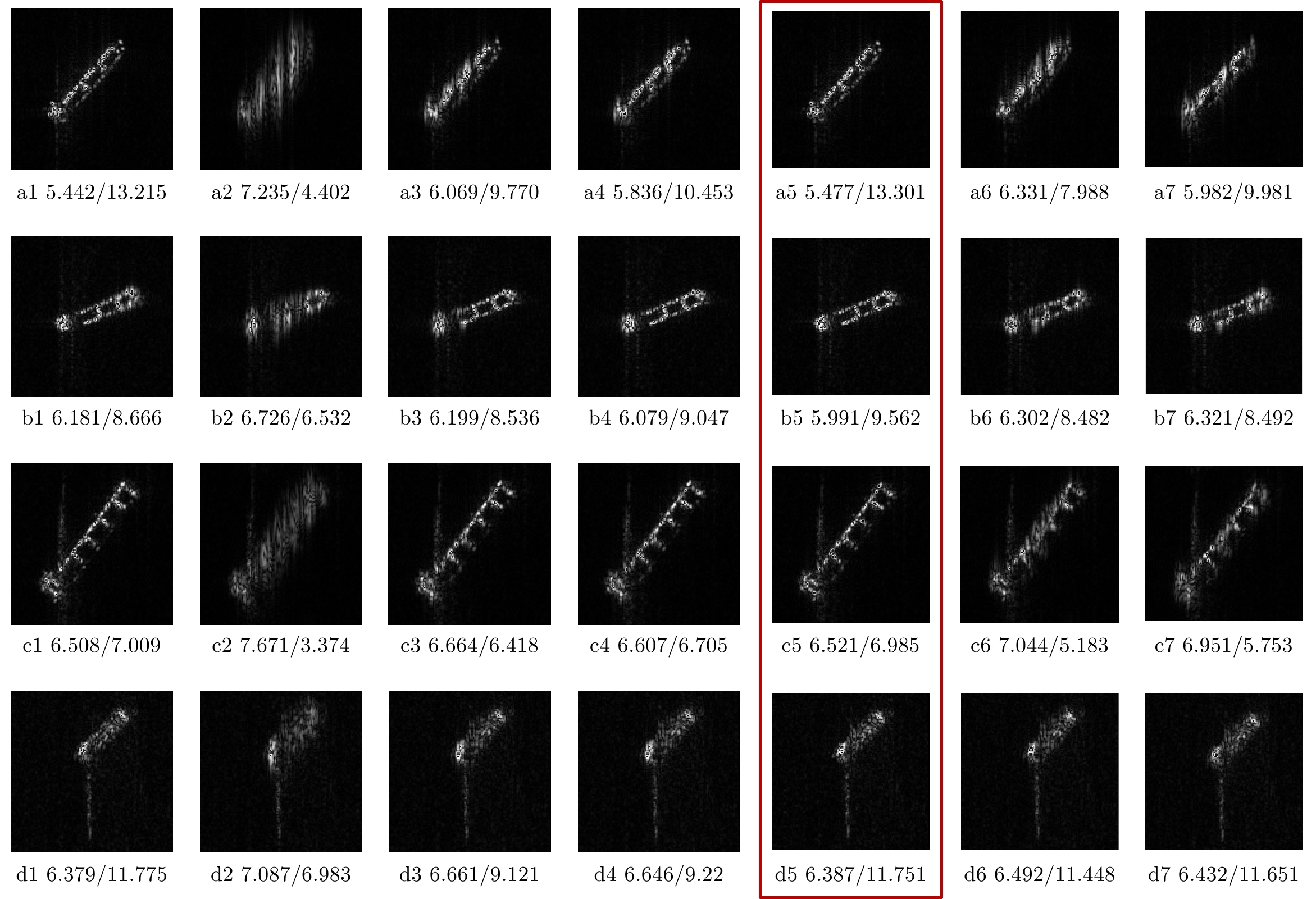


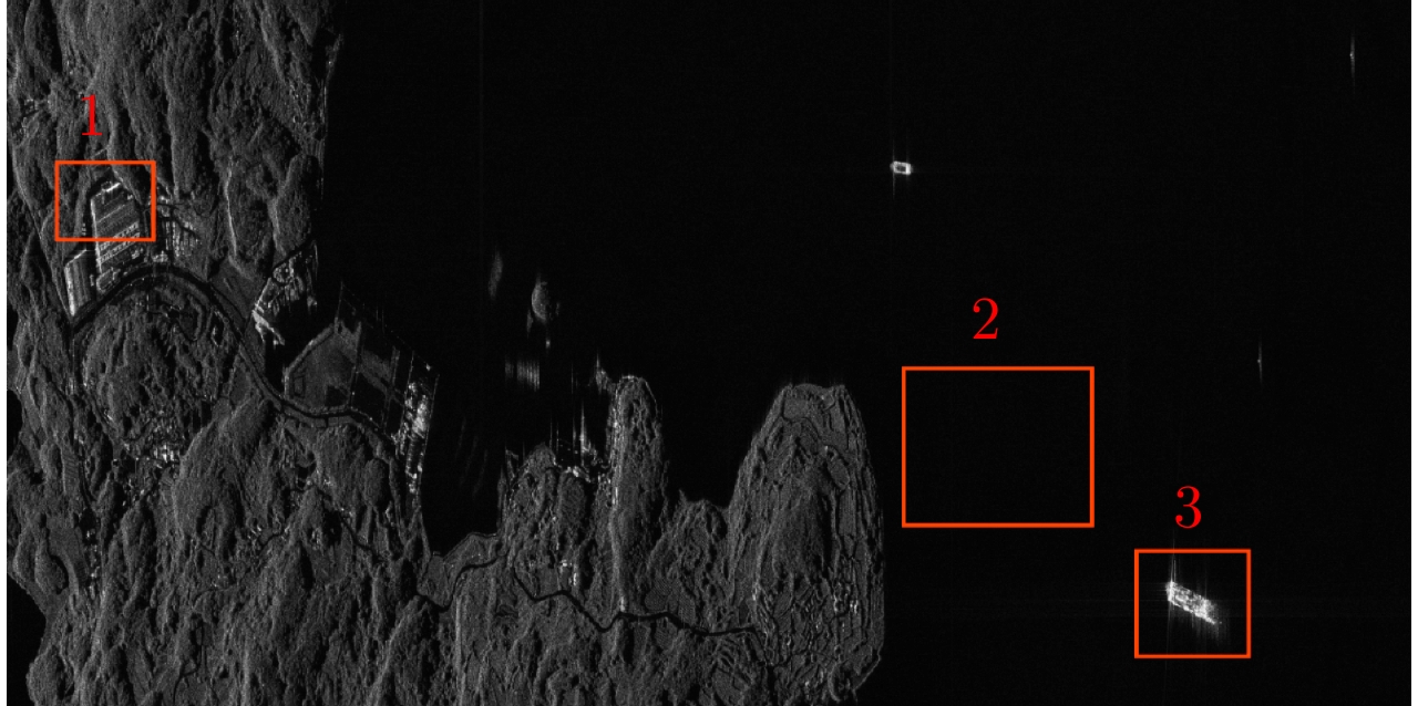
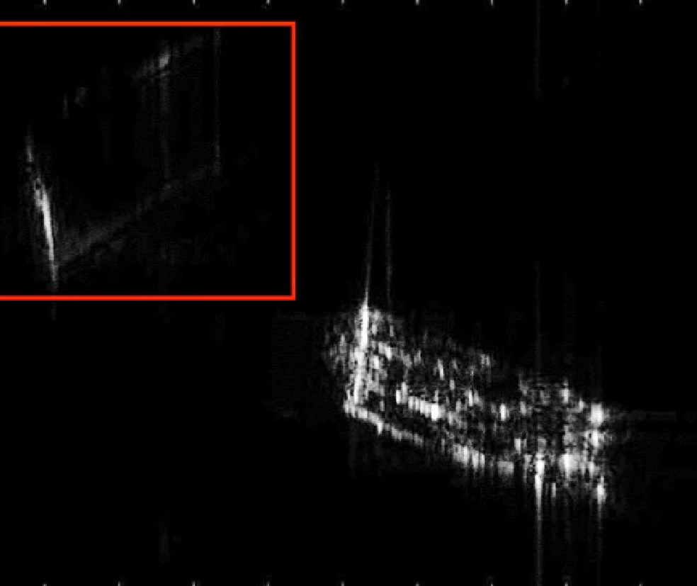

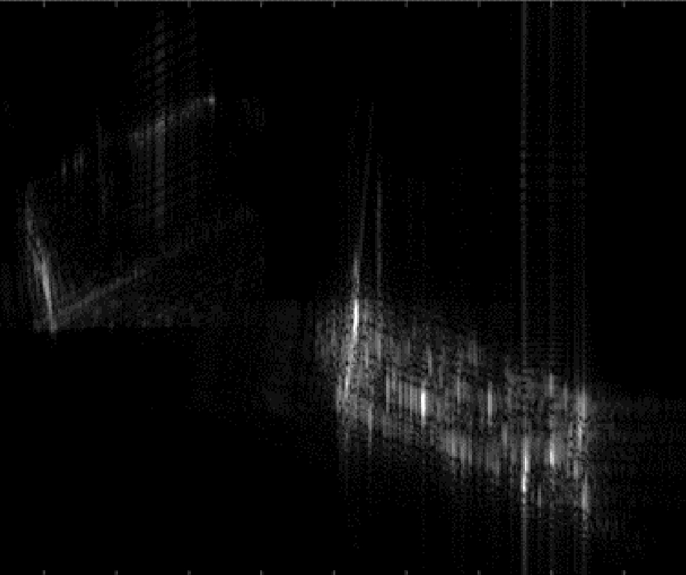
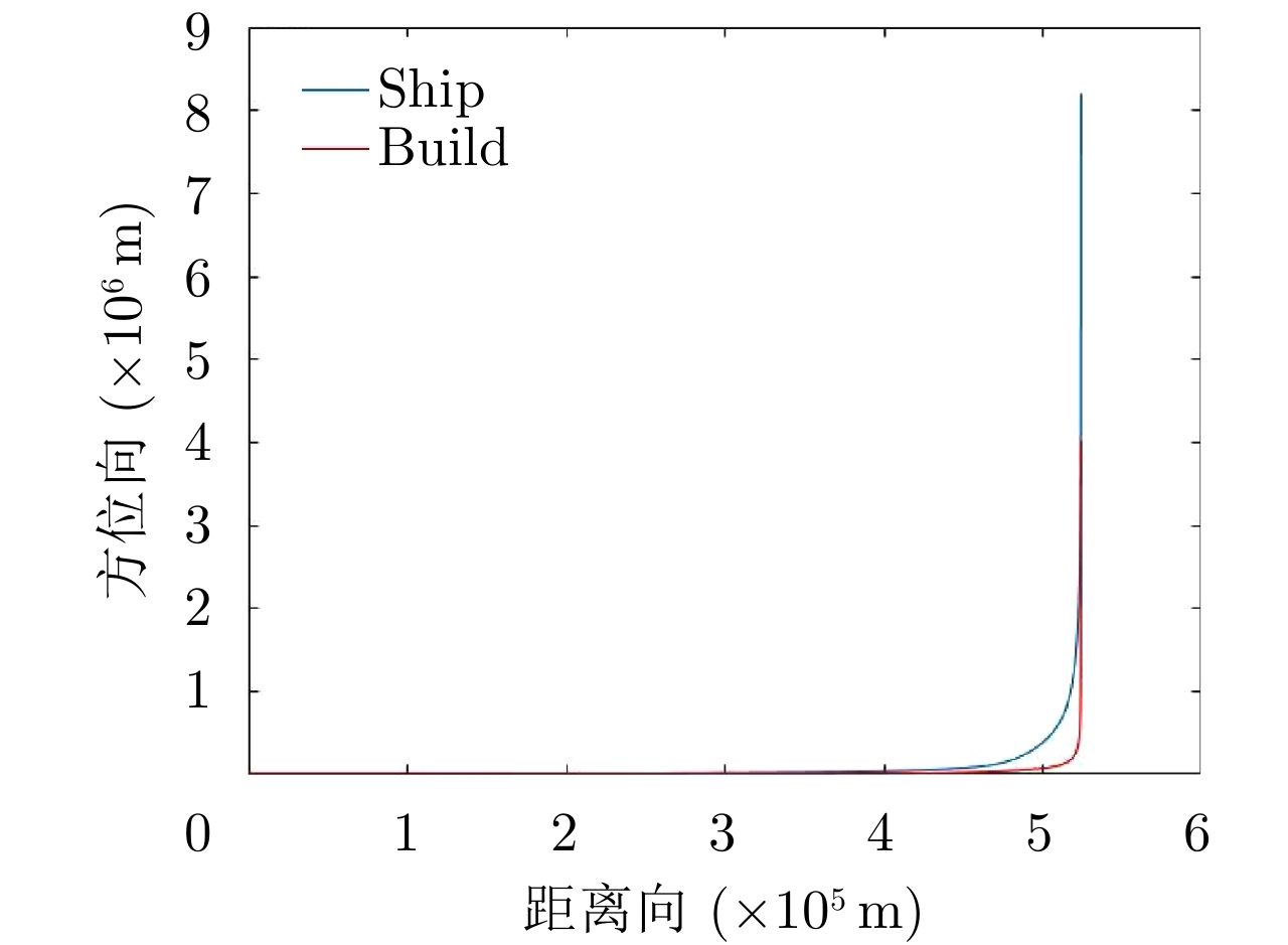
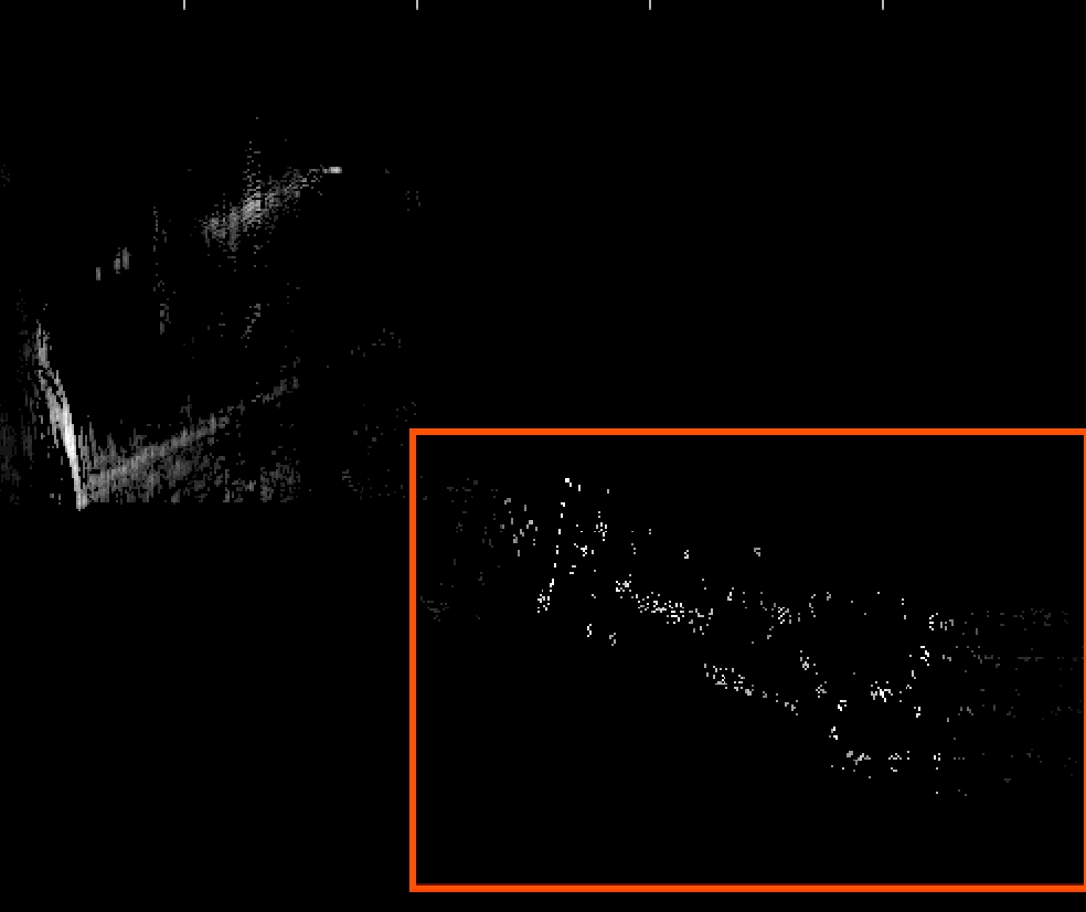
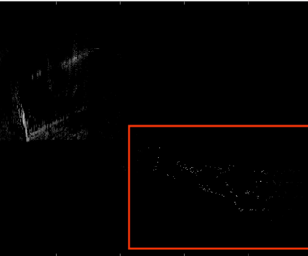

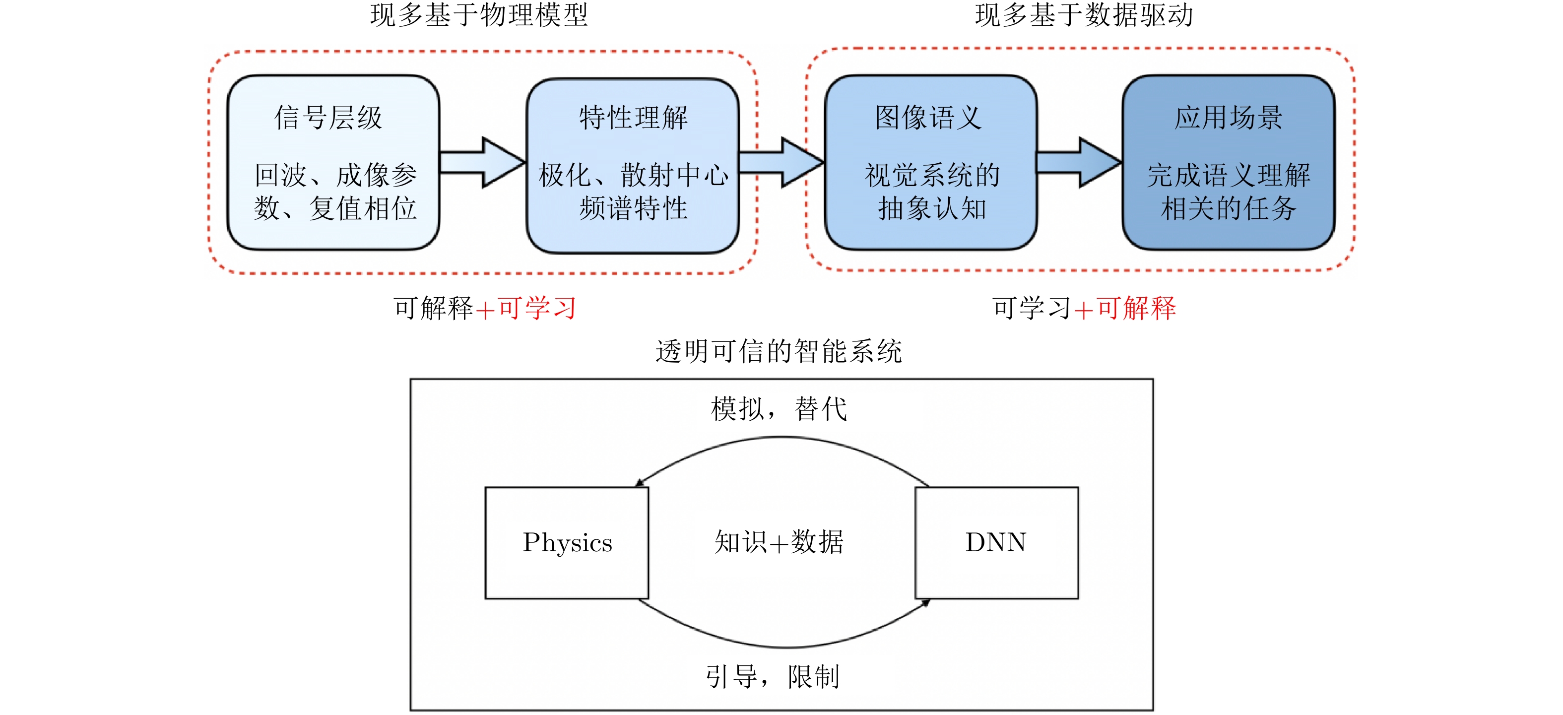
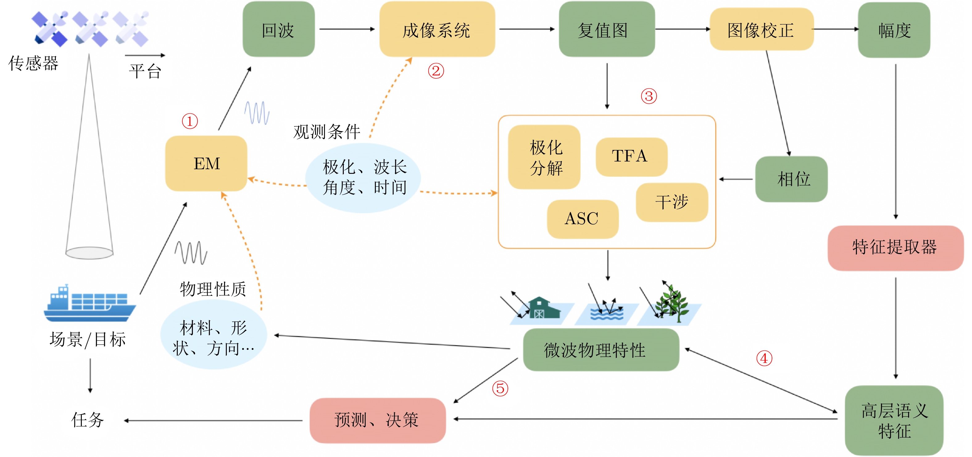
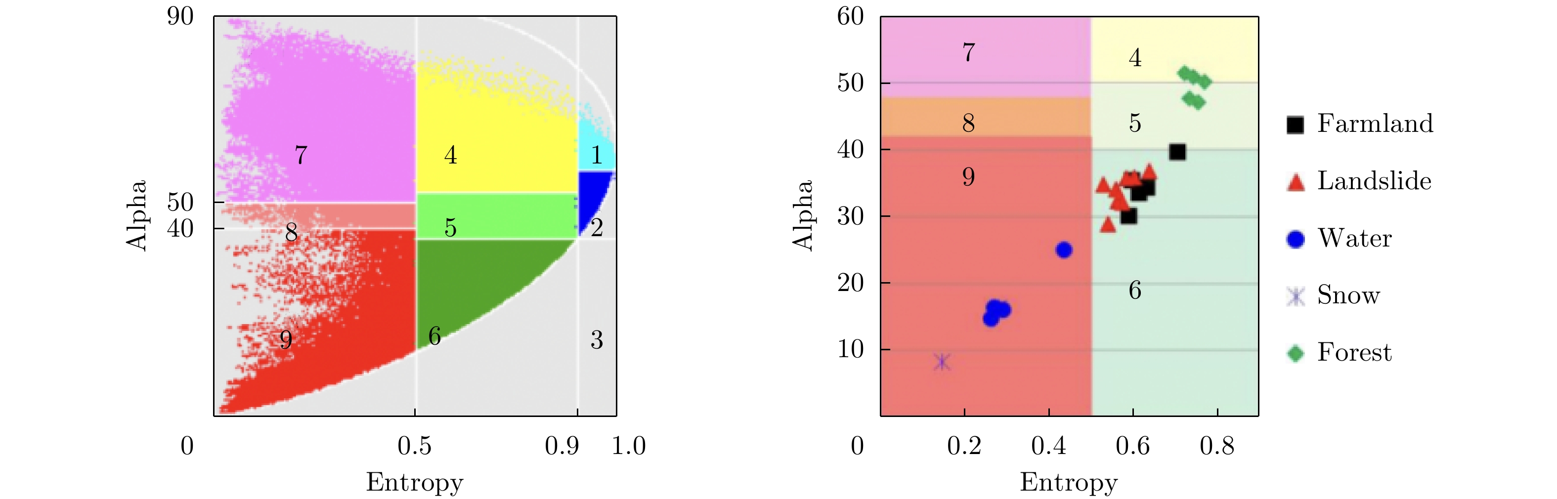
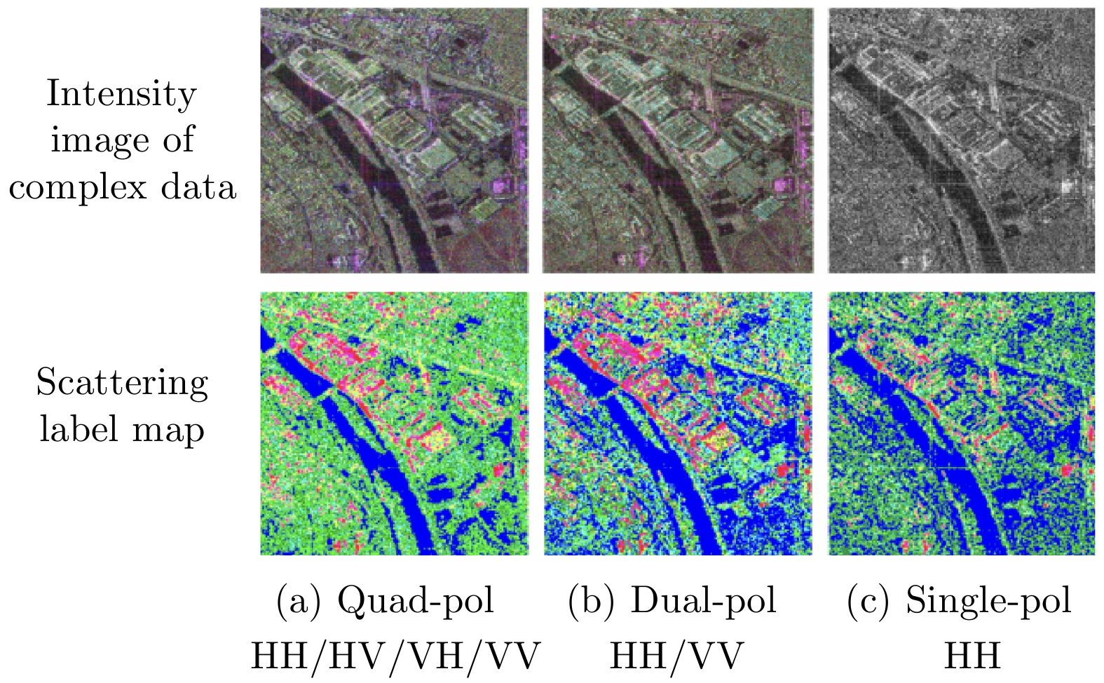
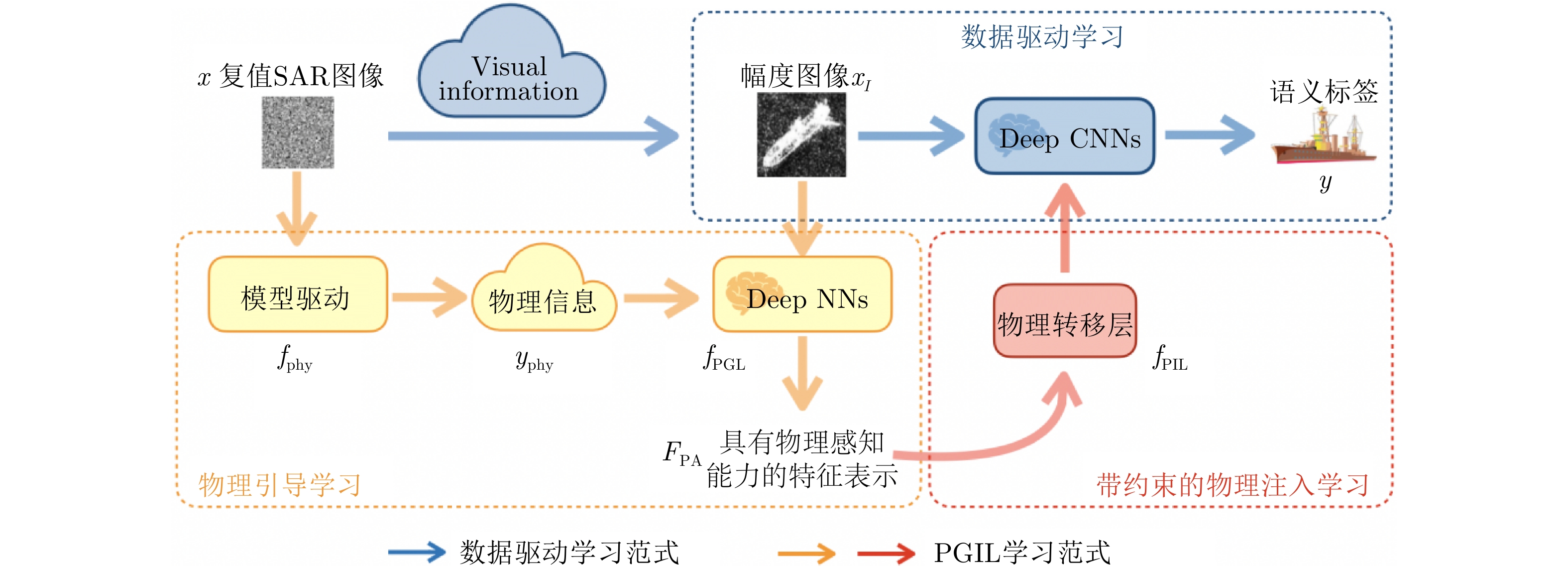
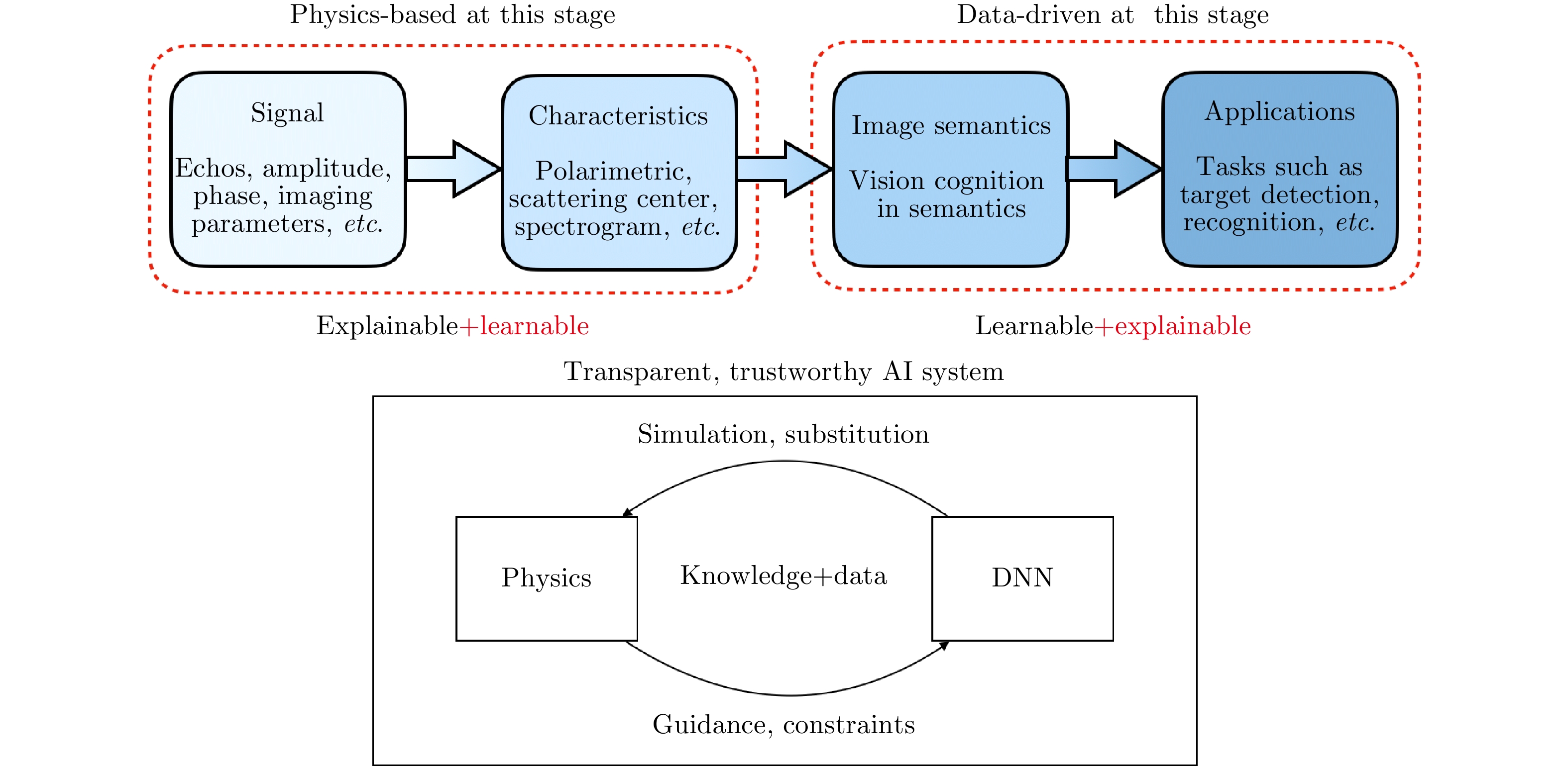
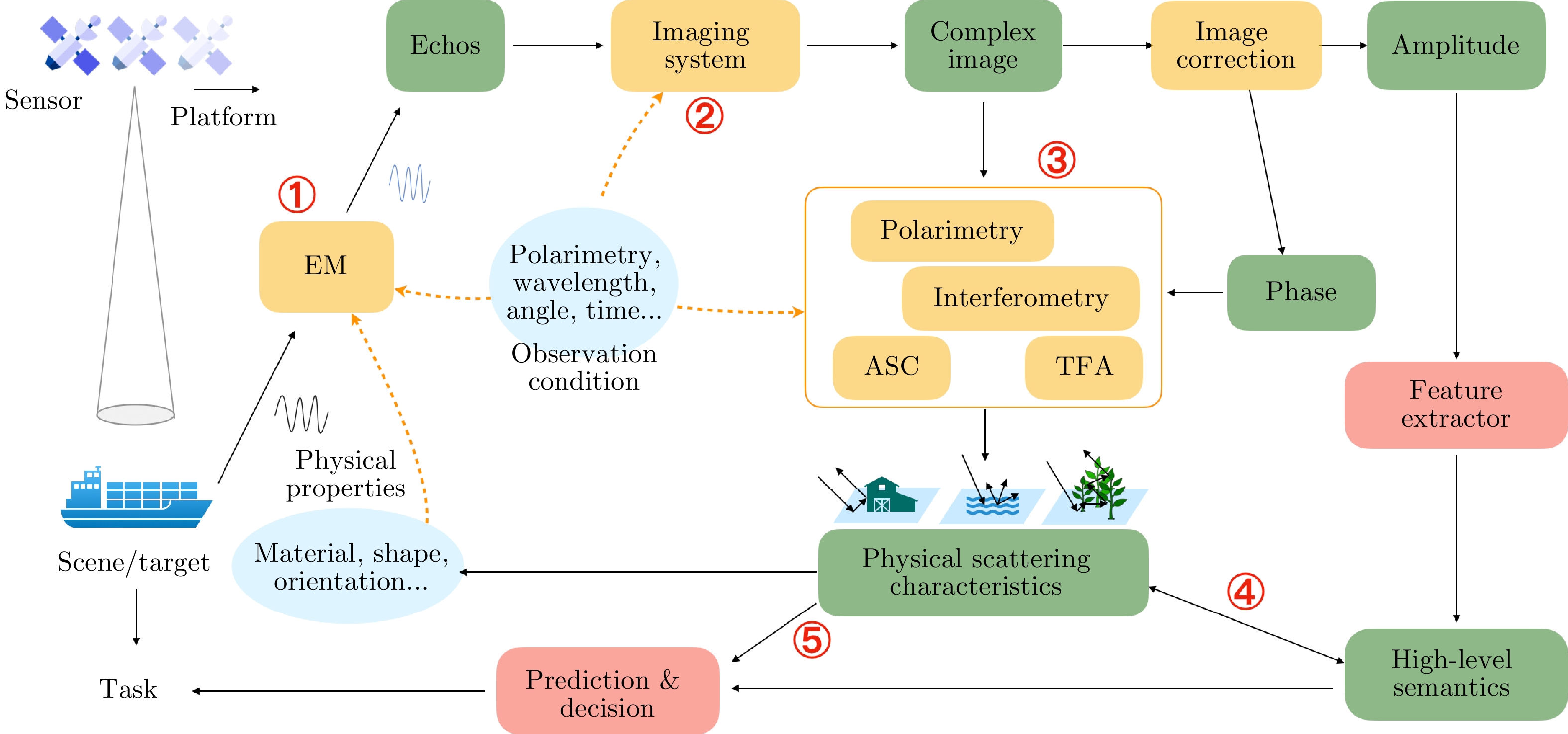
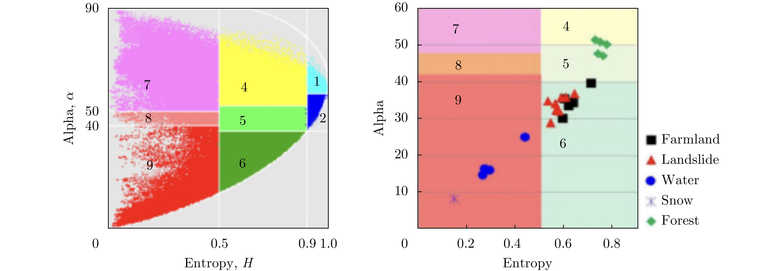
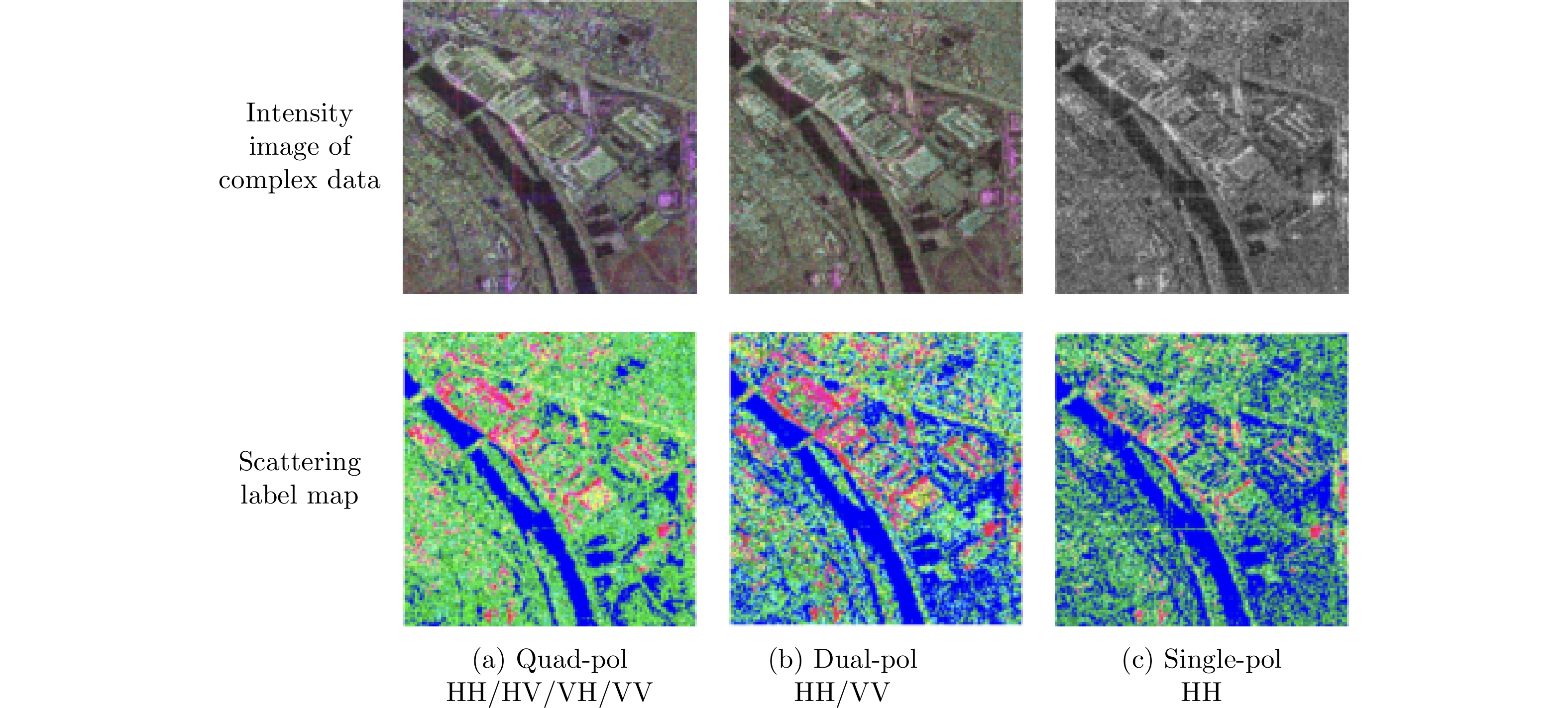
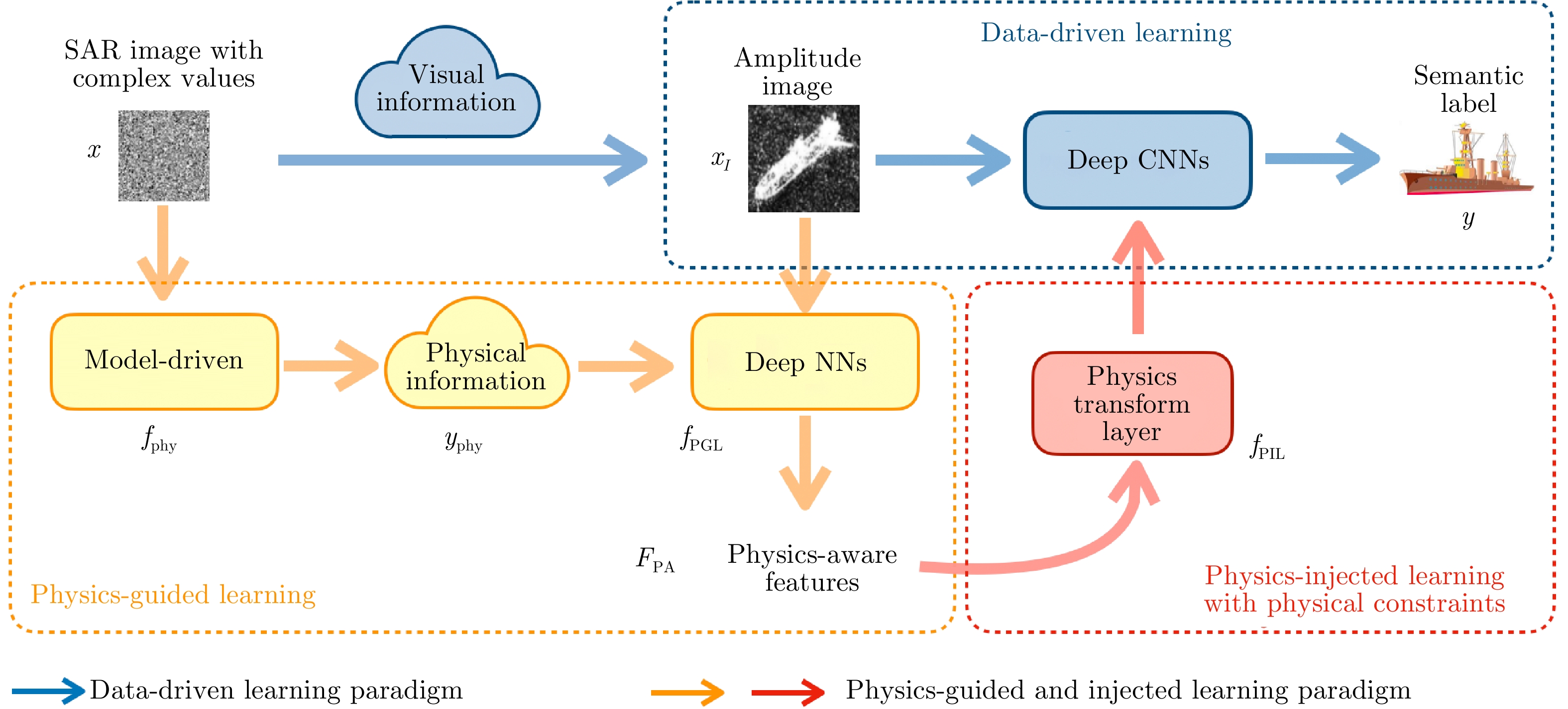
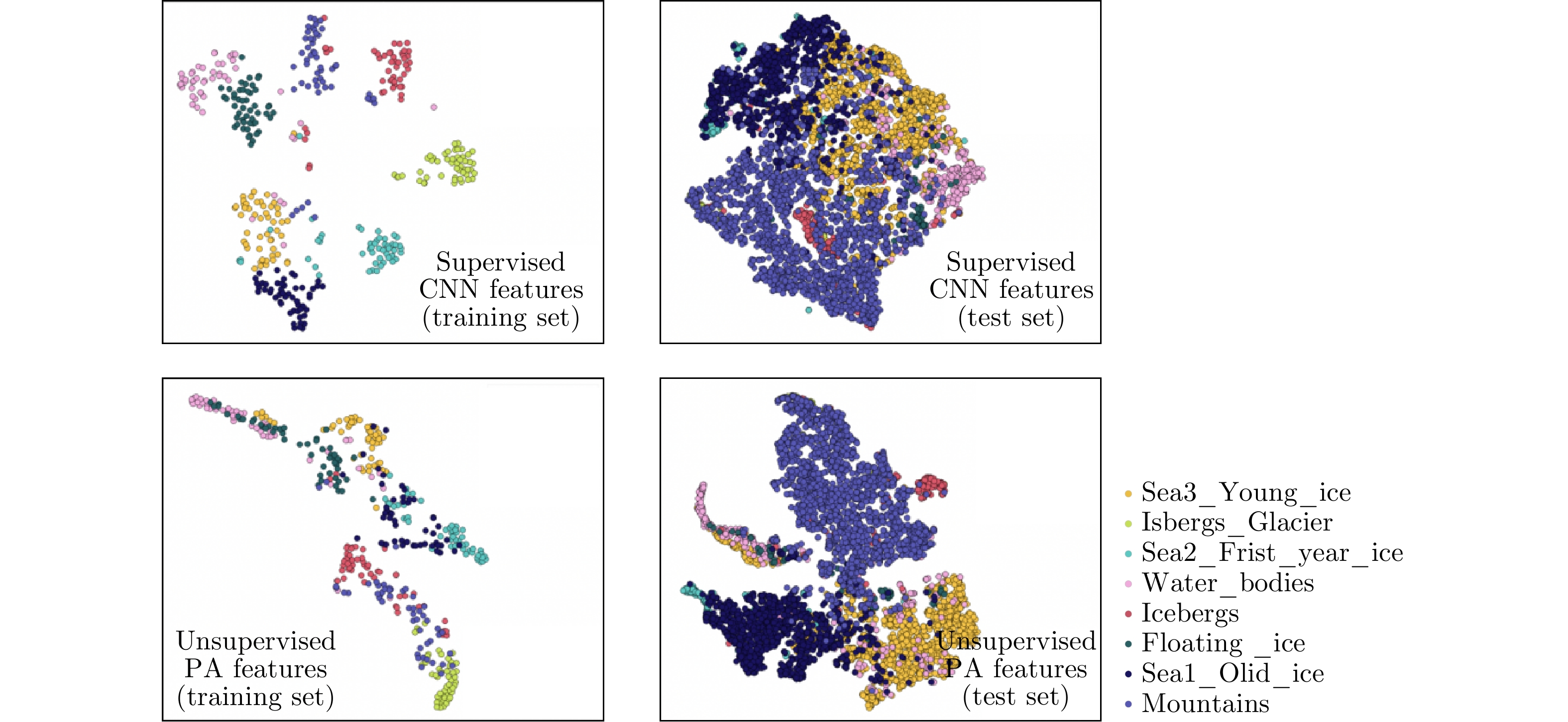
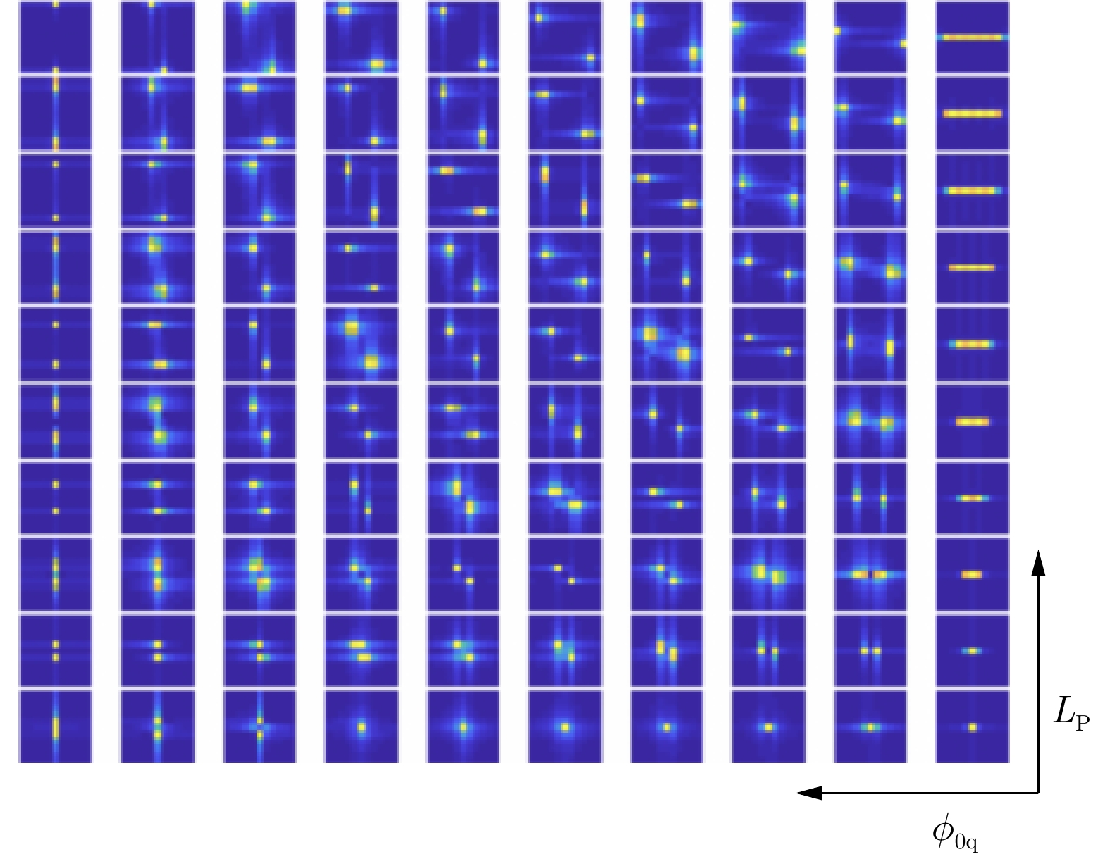
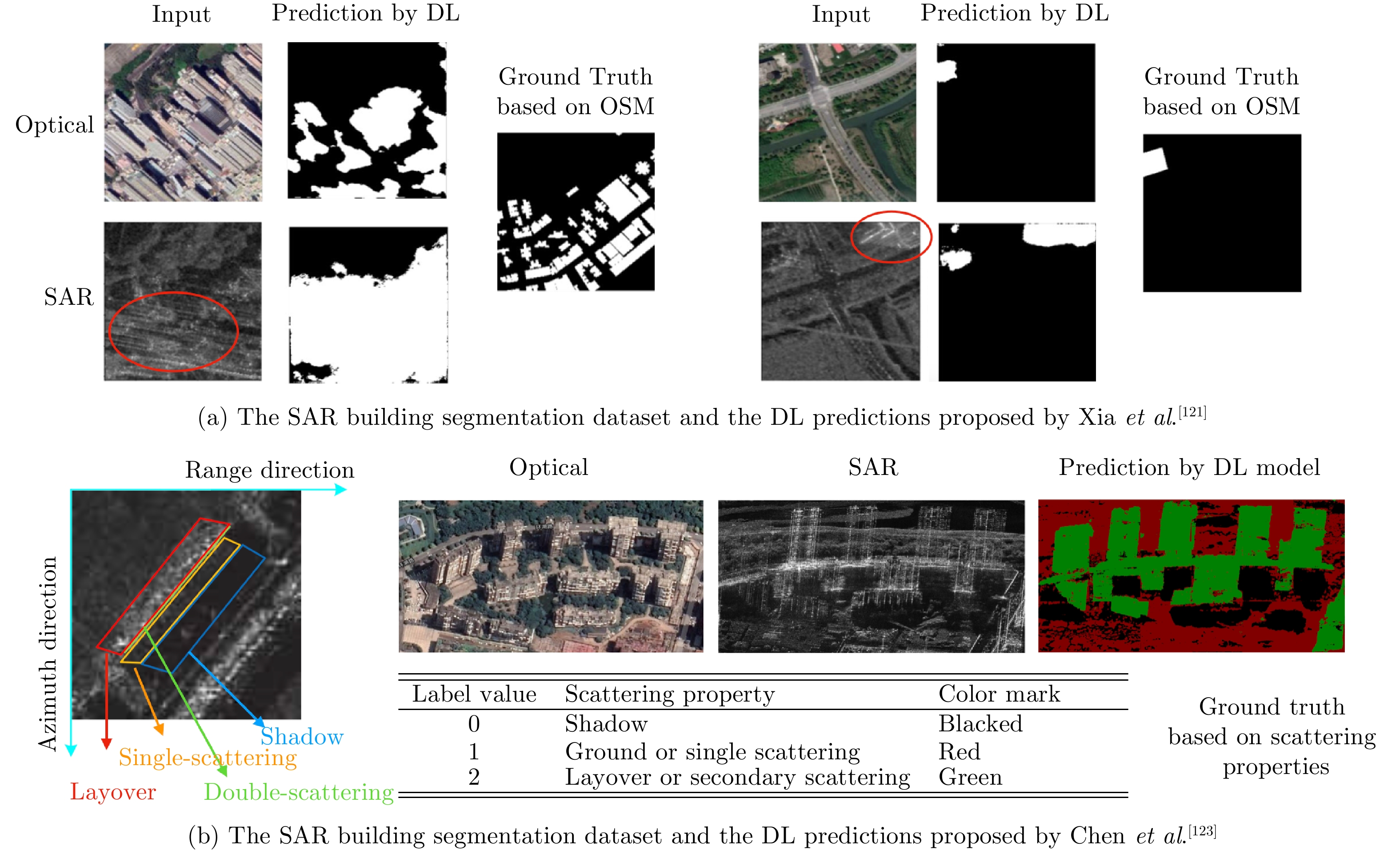
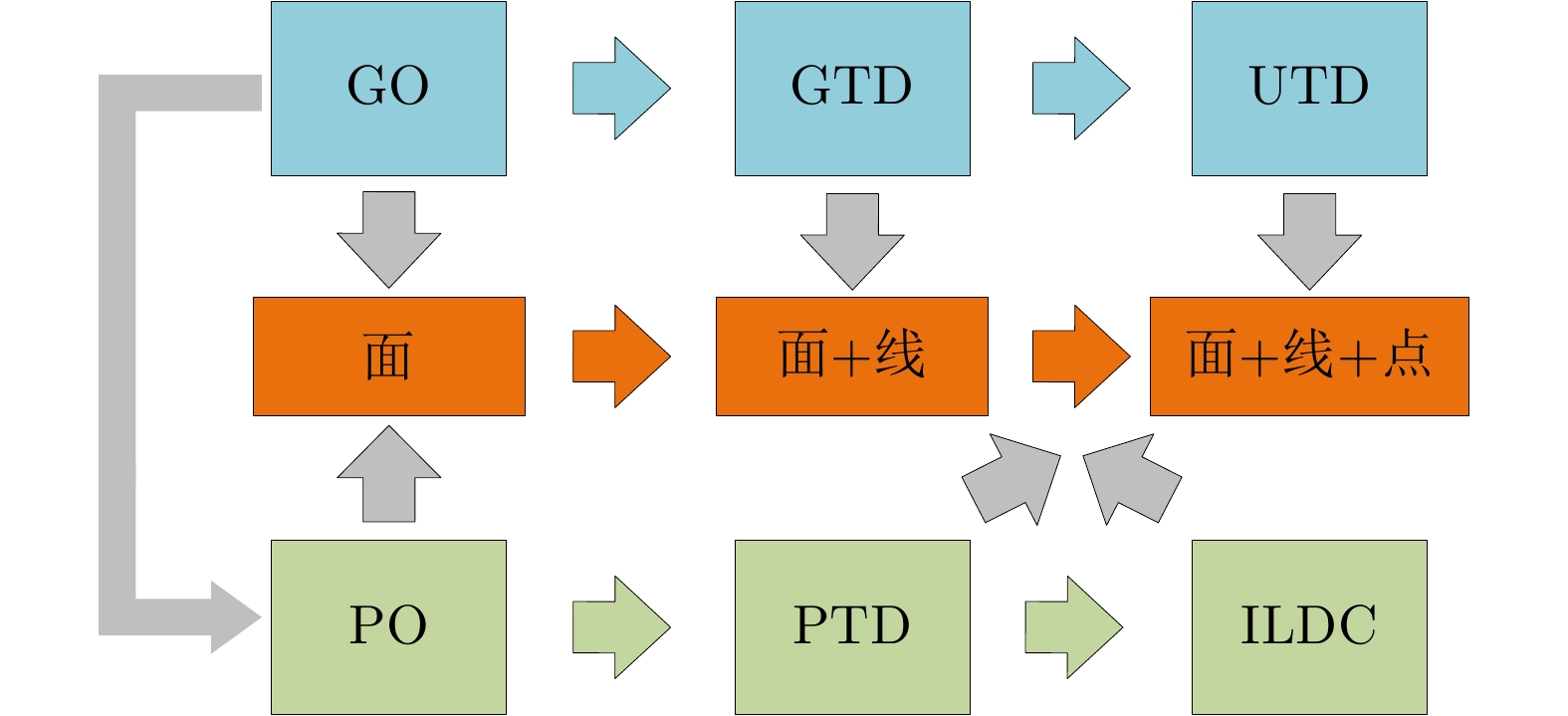
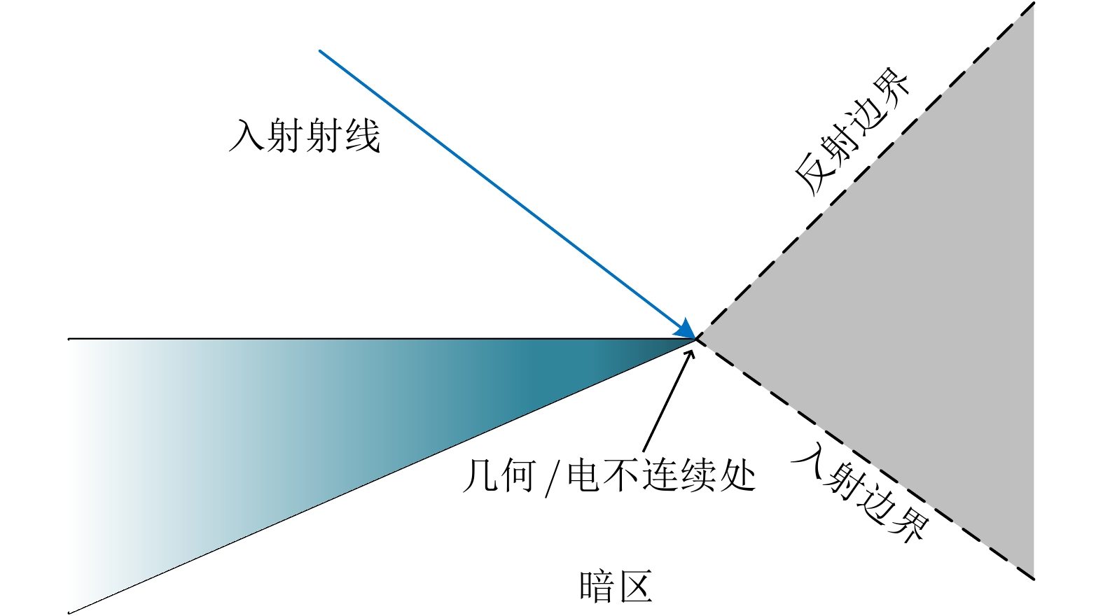
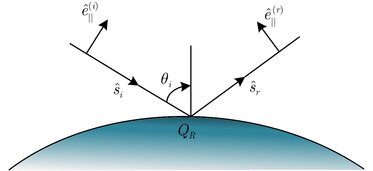
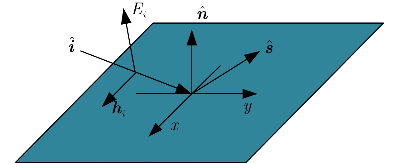
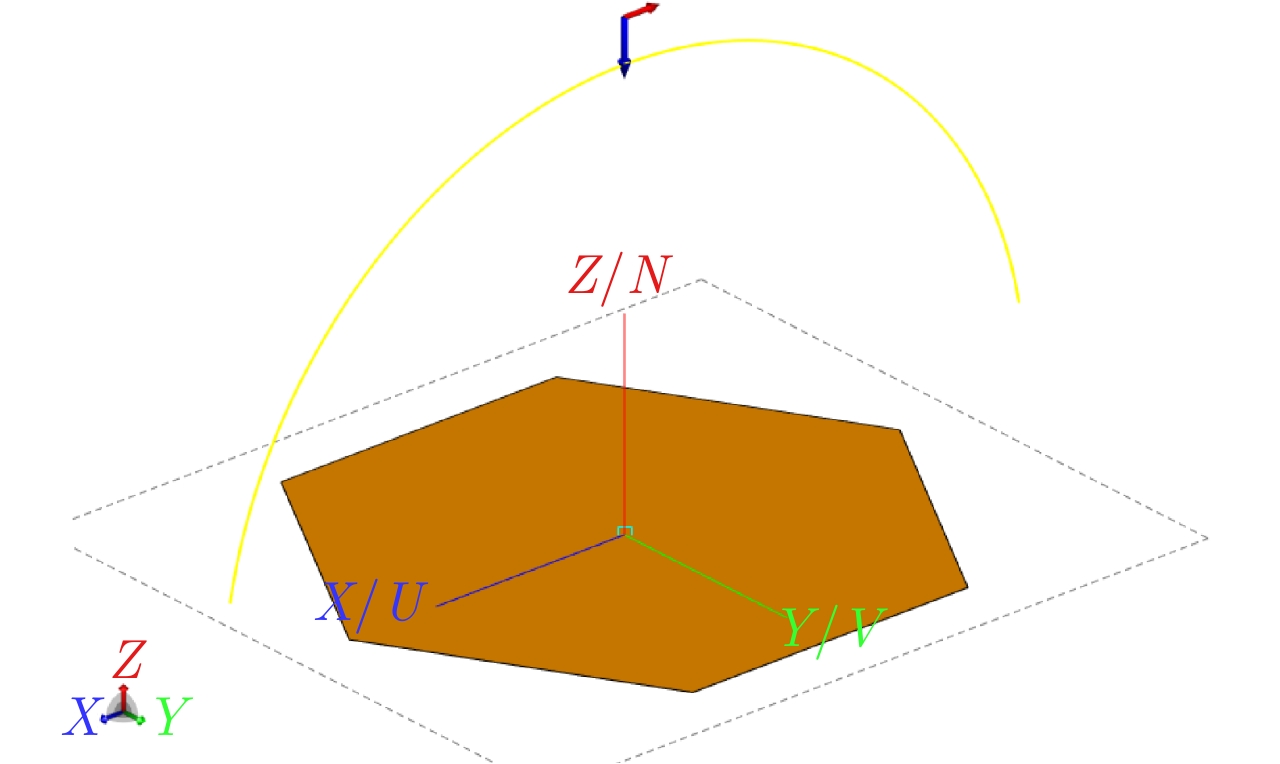
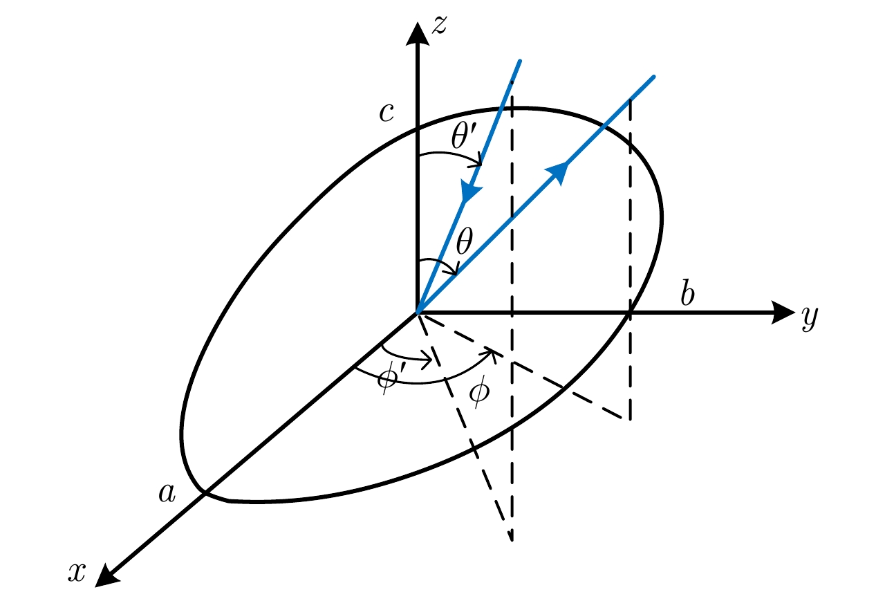
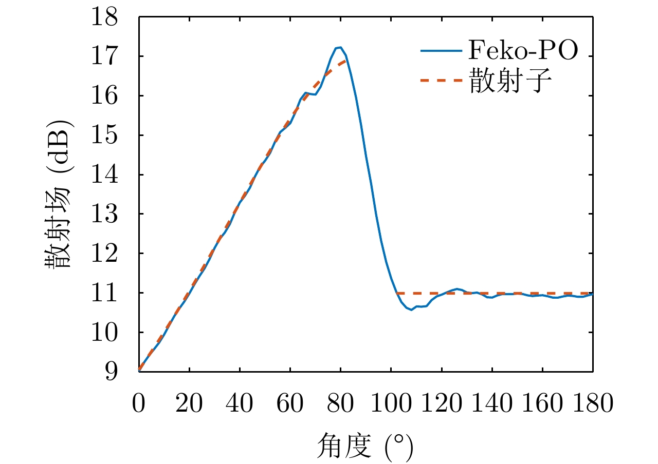
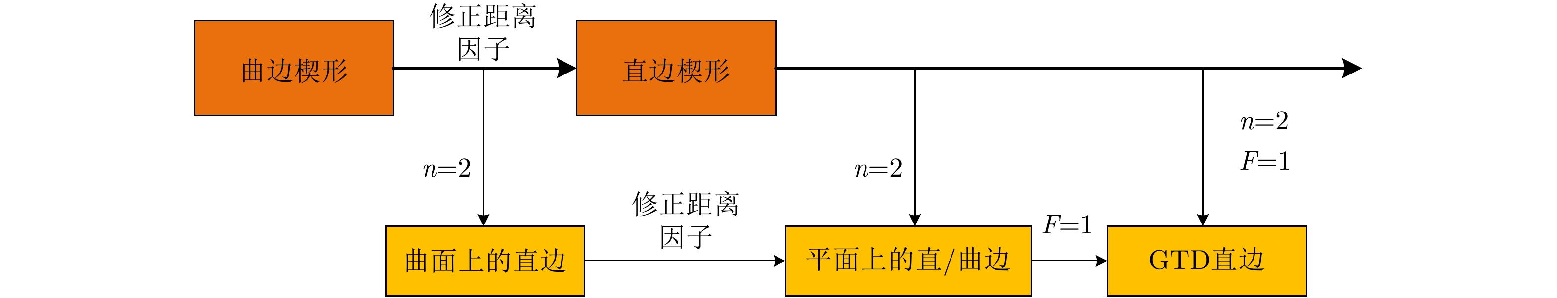
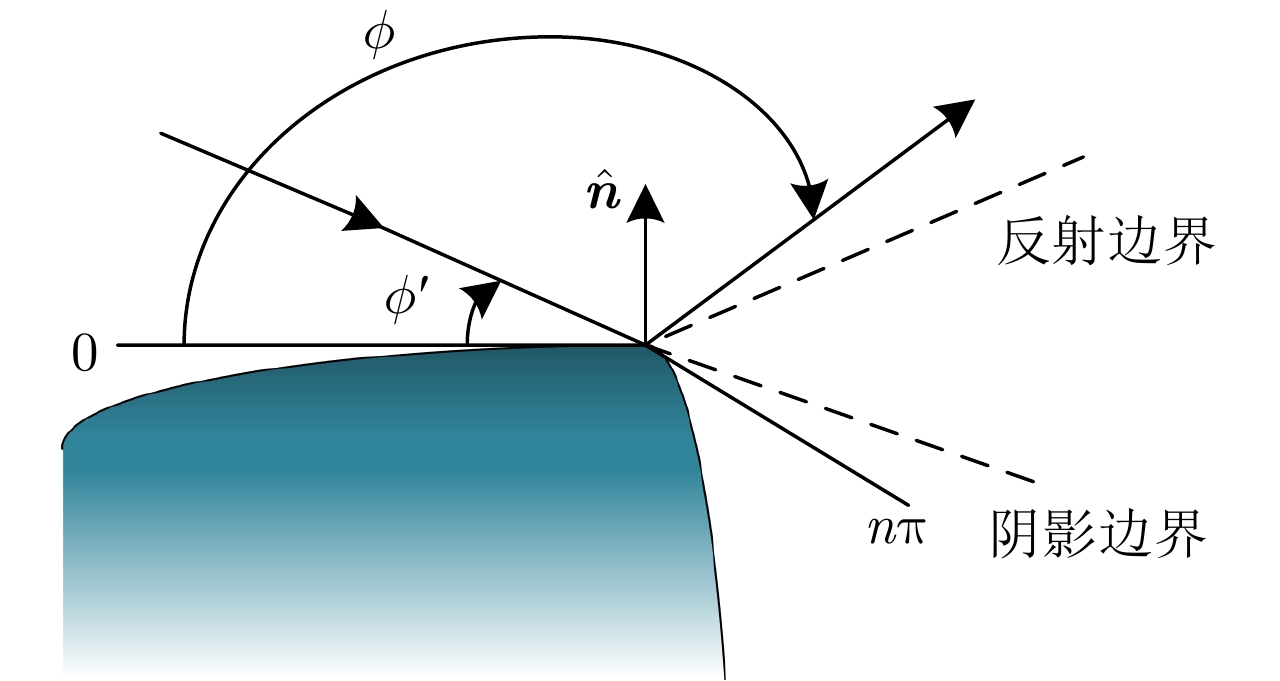
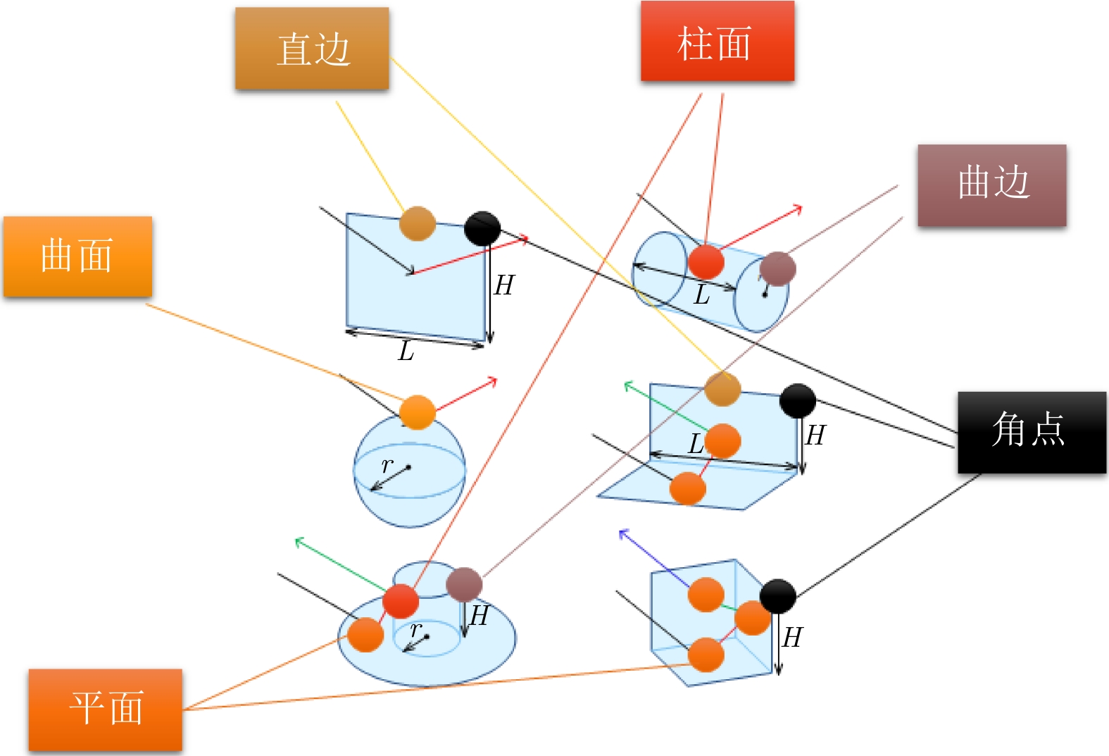
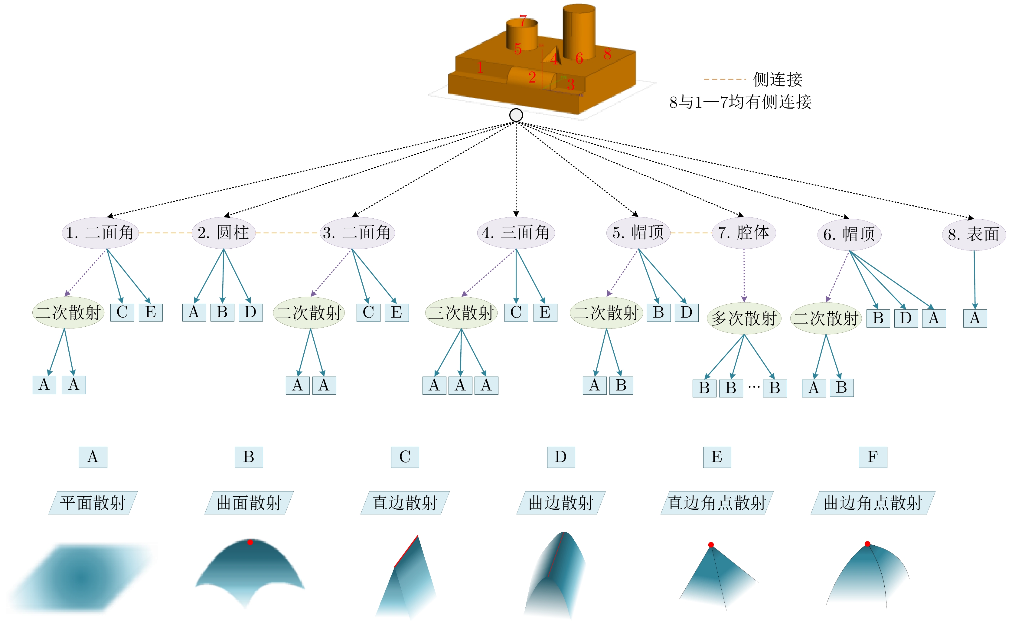
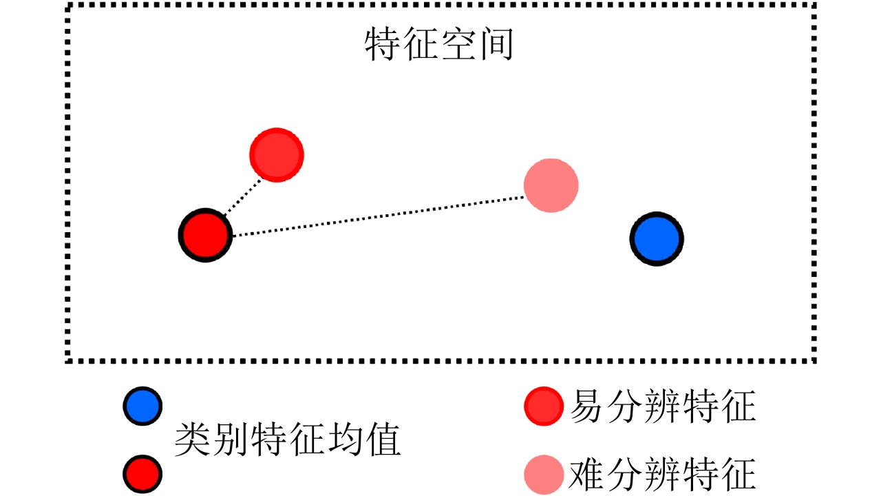
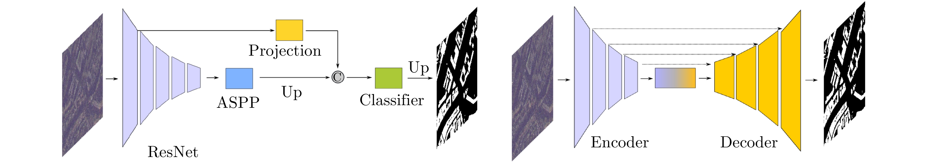
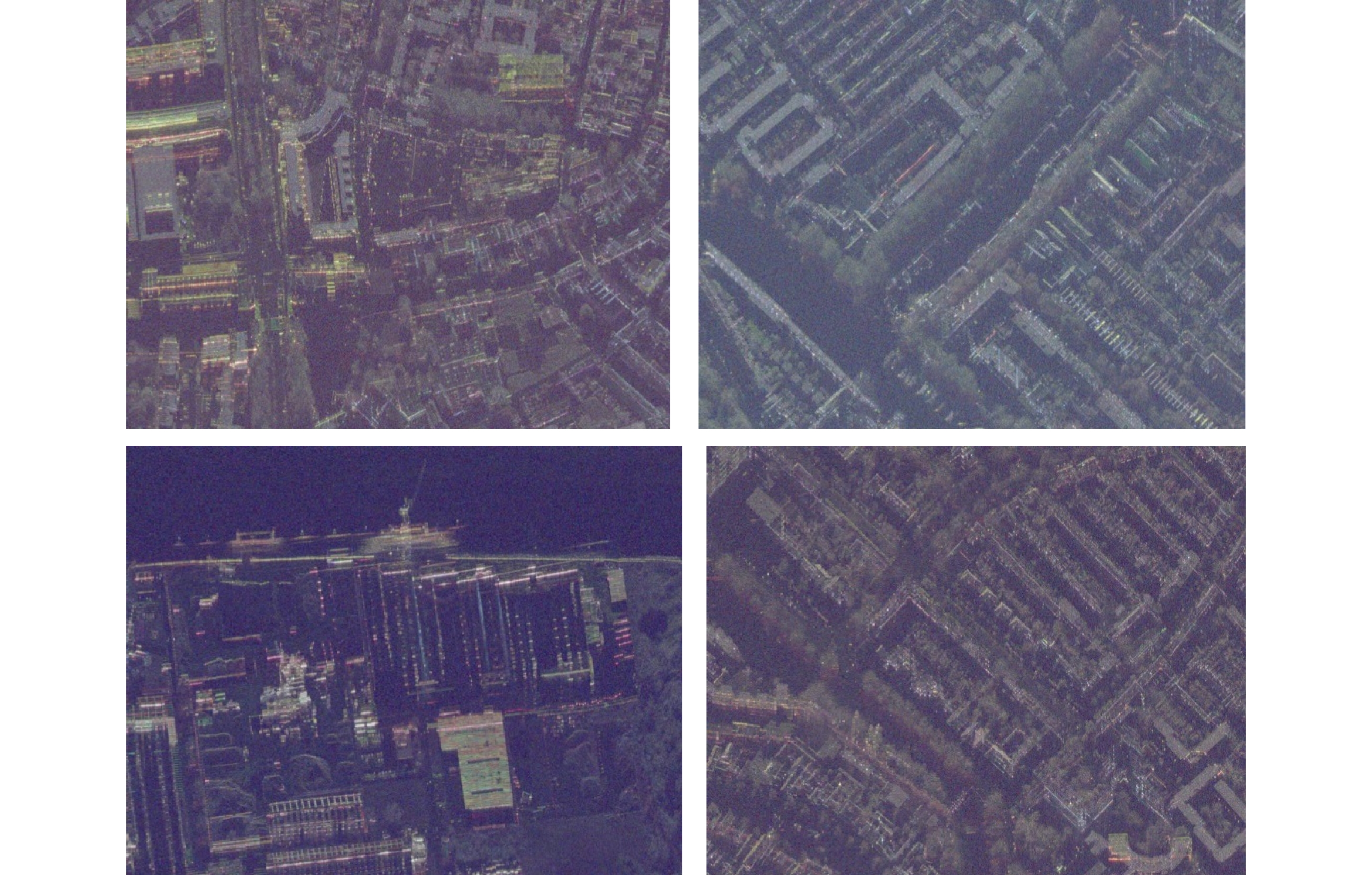
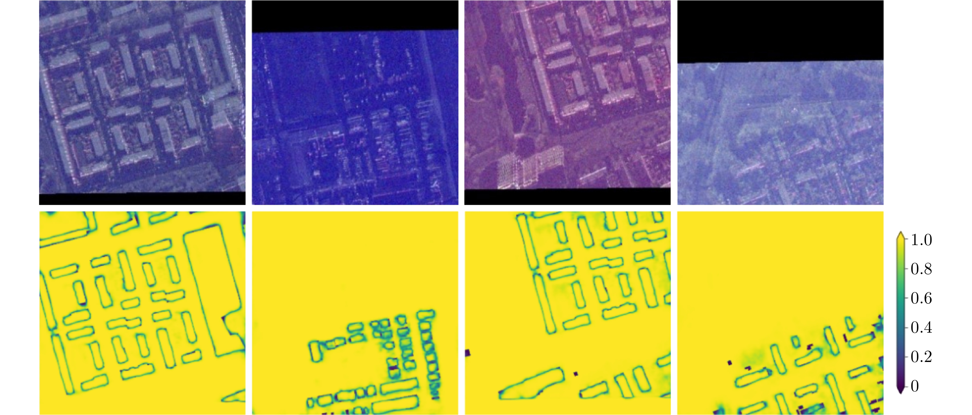
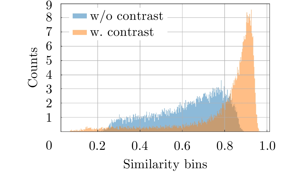
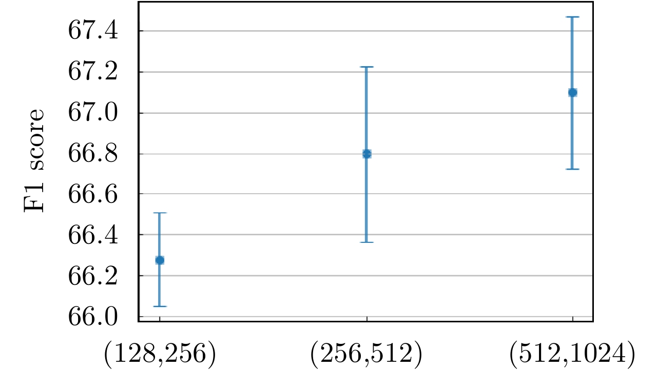
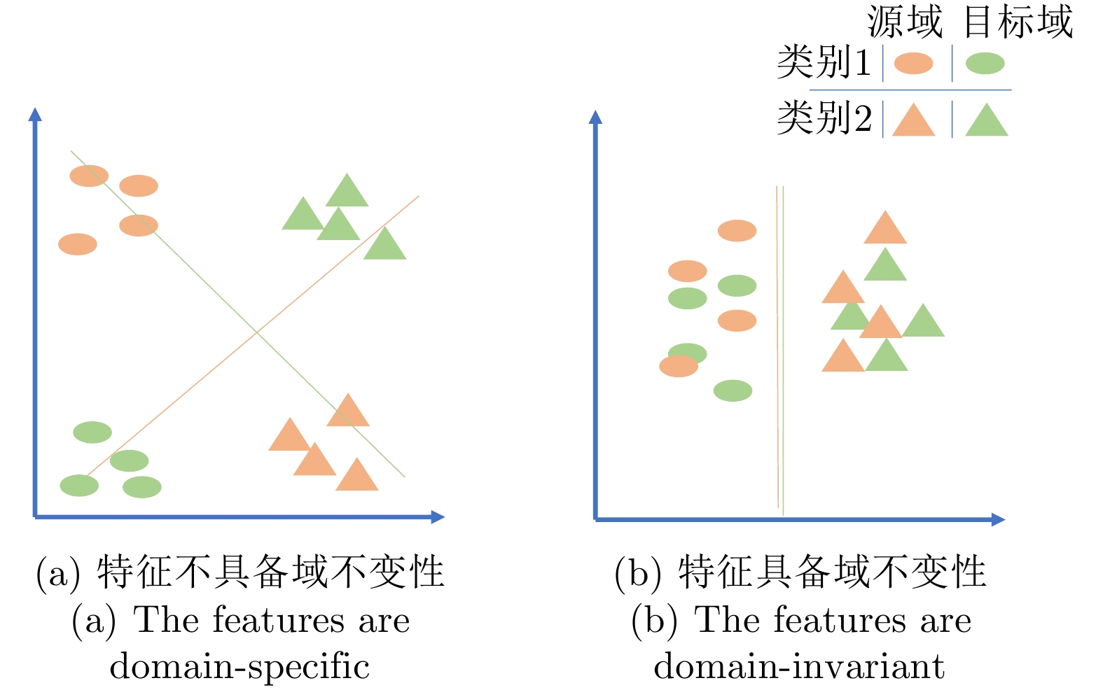
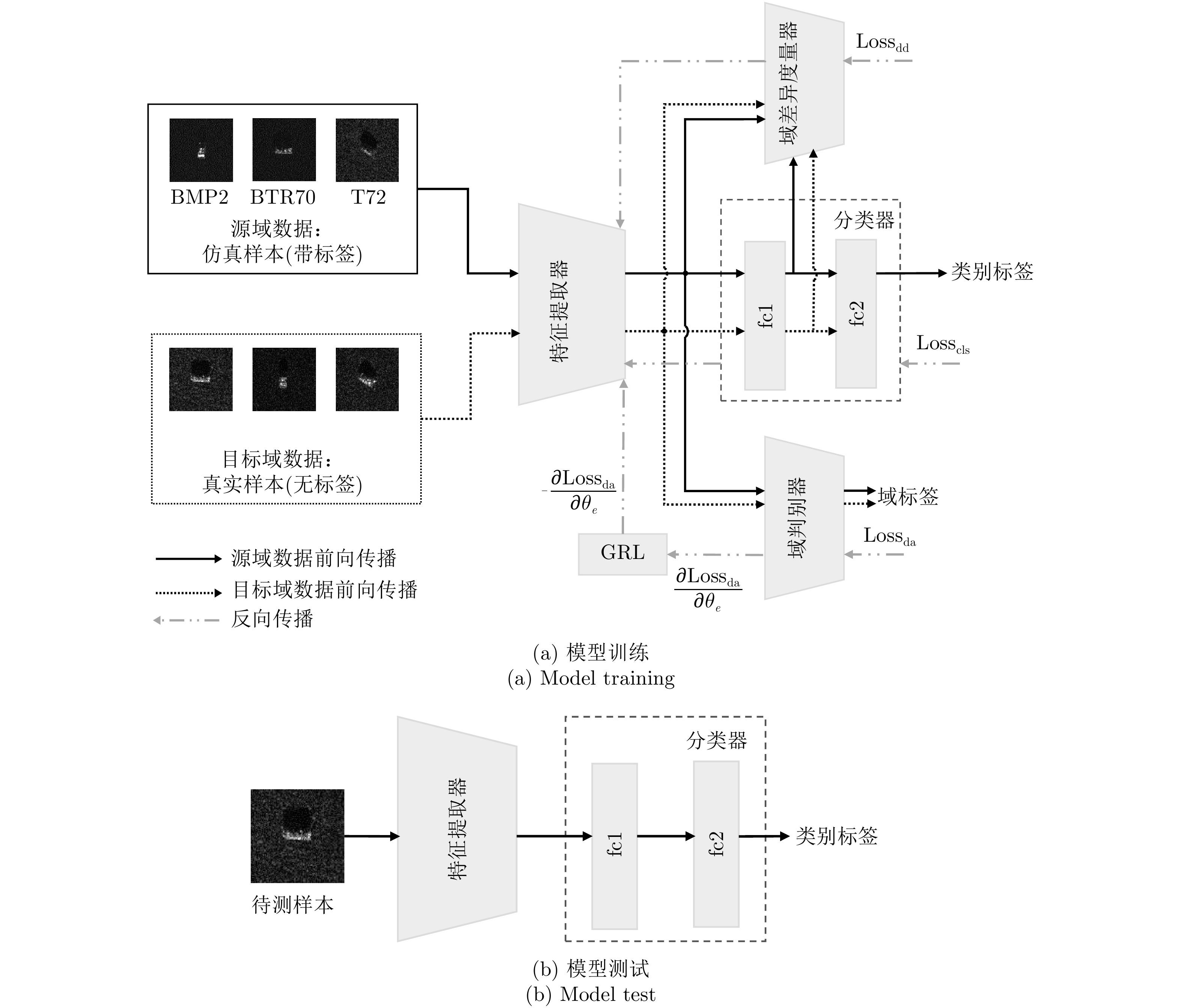
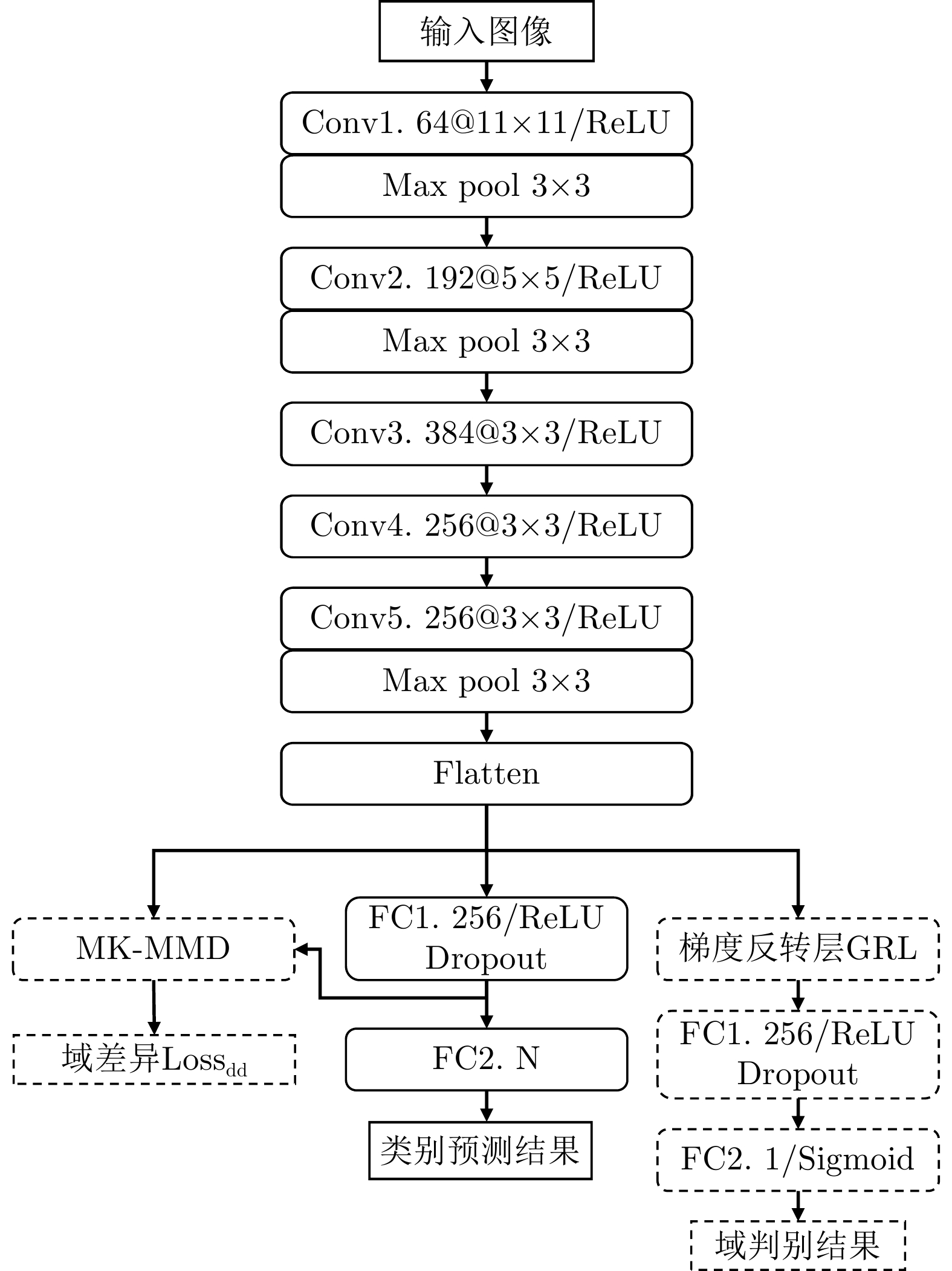
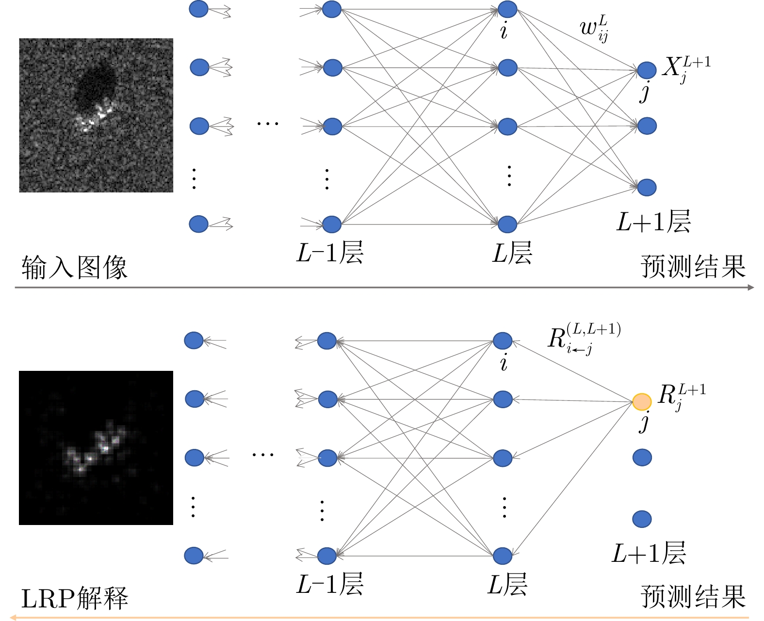
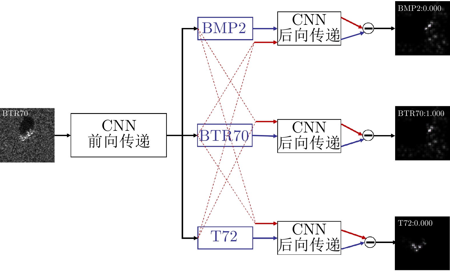
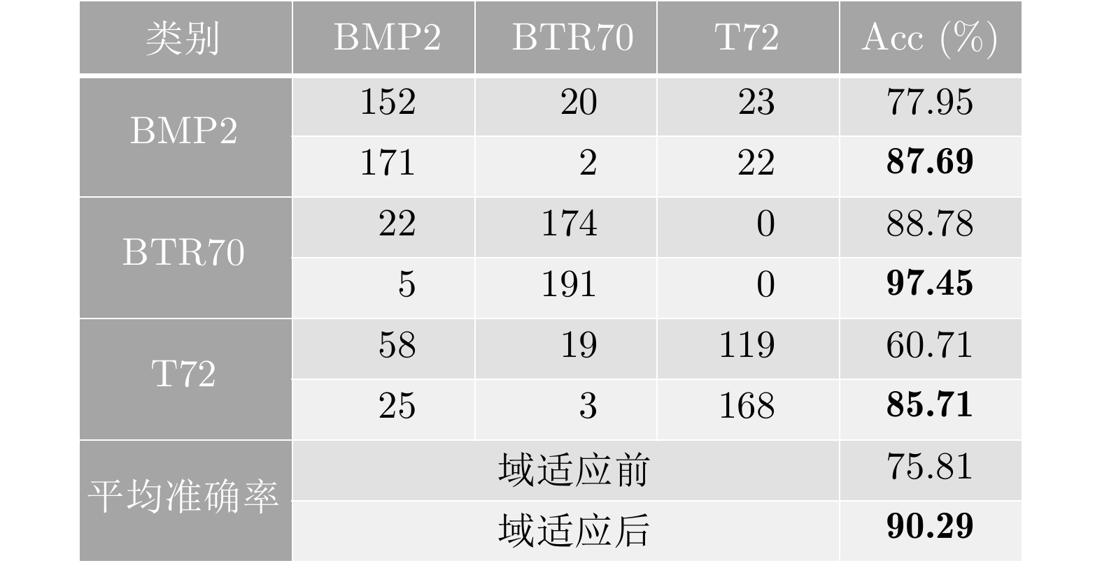
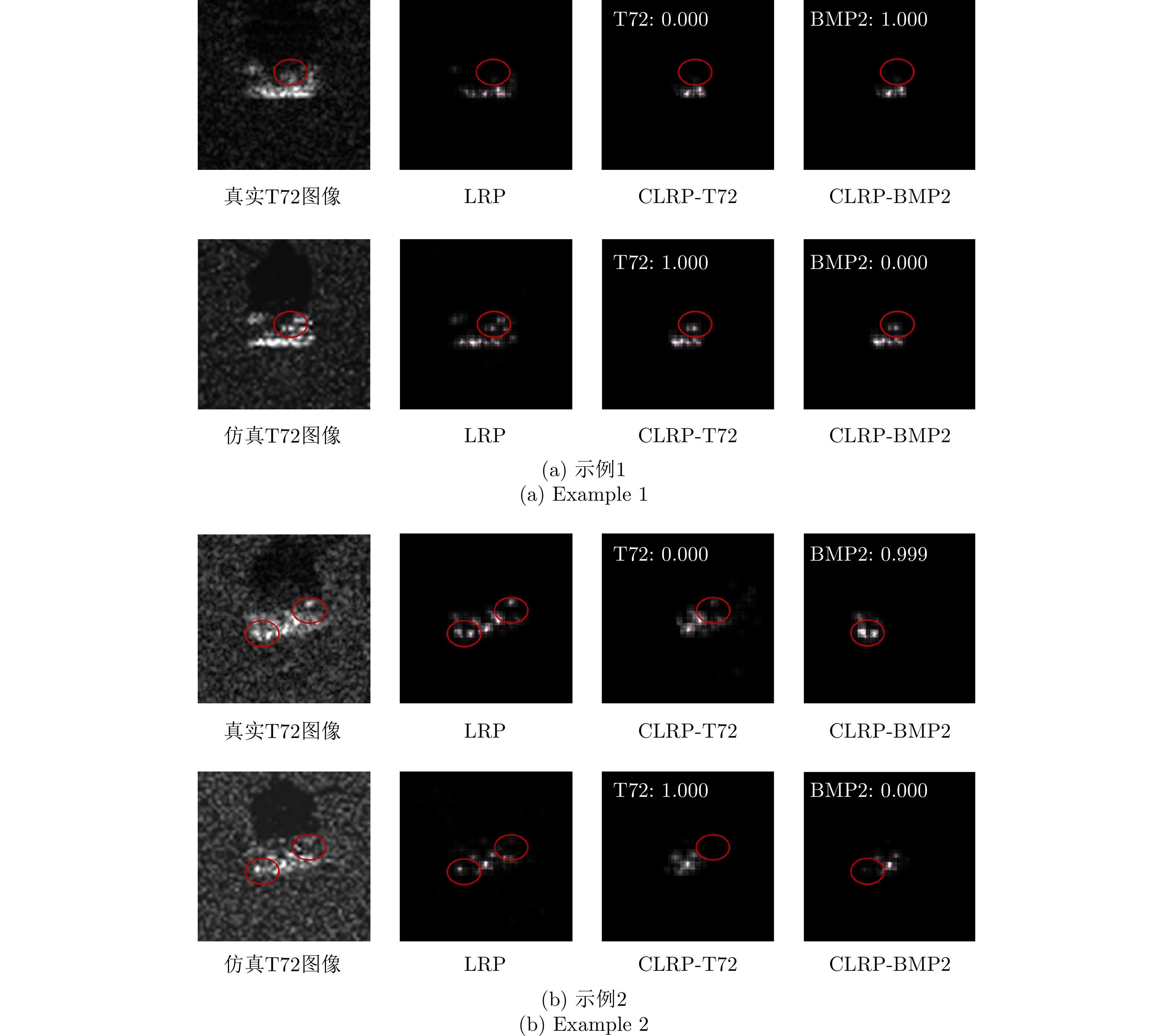
Deep learning technologies have been developed rapidly in Synthetic Aperture Radar (SAR) image interpretation. The current data-driven methods neglect the latent physical characteristics of SAR; thus, the predictions are highly dependent on training data and even violate physical laws. Deep integration of the theory-driven and data-driven approaches for SAR image interpretation is of vital importance. Additionally, the data-driven methods specialize in automatically discovering patterns from a large amount of data that serve as effective complements for physical processes, whereas the integrated interpretable physical models improve the explainability of deep learning algorithms and address the data-hungry problem. This study aimed to develop physically explainable deep learning for SAR image interpretation in signals, scattering mechanisms, semantics, and applications. Strategies for blending the theory-driven and data-driven methods in SAR interpretation are proposed based on physics machine learning to develop novel learnable and explainable paradigms for SAR image interpretation. Further, recent studies on hybrid methods are reviewed, including SAR signal processing, physical characteristics, and semantic image interpretation. Challenges and future perspectives are also discussed on the basis of the research status and related studies in other fields, which can serve as inspiration.
Deep learning technologies have been developed rapidly in Synthetic Aperture Radar (SAR) image interpretation. The current data-driven methods neglect the latent physical characteristics of SAR; thus, the predictions are highly dependent on training data and even violate physical laws. Deep integration of the theory-driven and data-driven approaches for SAR image interpretation is of vital importance. Additionally, the data-driven methods specialize in automatically discovering patterns from a large amount of data that serve as effective complements for physical processes, whereas the integrated interpretable physical models improve the explainability of deep learning algorithms and address the data-hungry problem. This study aimed to develop physically explainable deep learning for SAR image interpretation in signals, scattering mechanisms, semantics, and applications. Strategies for blending the theory-driven and data-driven methods in SAR interpretation are proposed based on physics machine learning to develop novel learnable and explainable paradigms for SAR image interpretation. Further, recent studies on hybrid methods are reviewed, including SAR signal processing, physical characteristics, and semantic image interpretation. Challenges and future perspectives are also discussed on the basis of the research status and related studies in other fields, which can serve as inspiration.


 微信 | 公众平台

