
 Submit Manuscript
 Peer Review
 Editor Work
2020 Vol. 9, No. 2
 Previous Issue
 Abstract
 3313KB
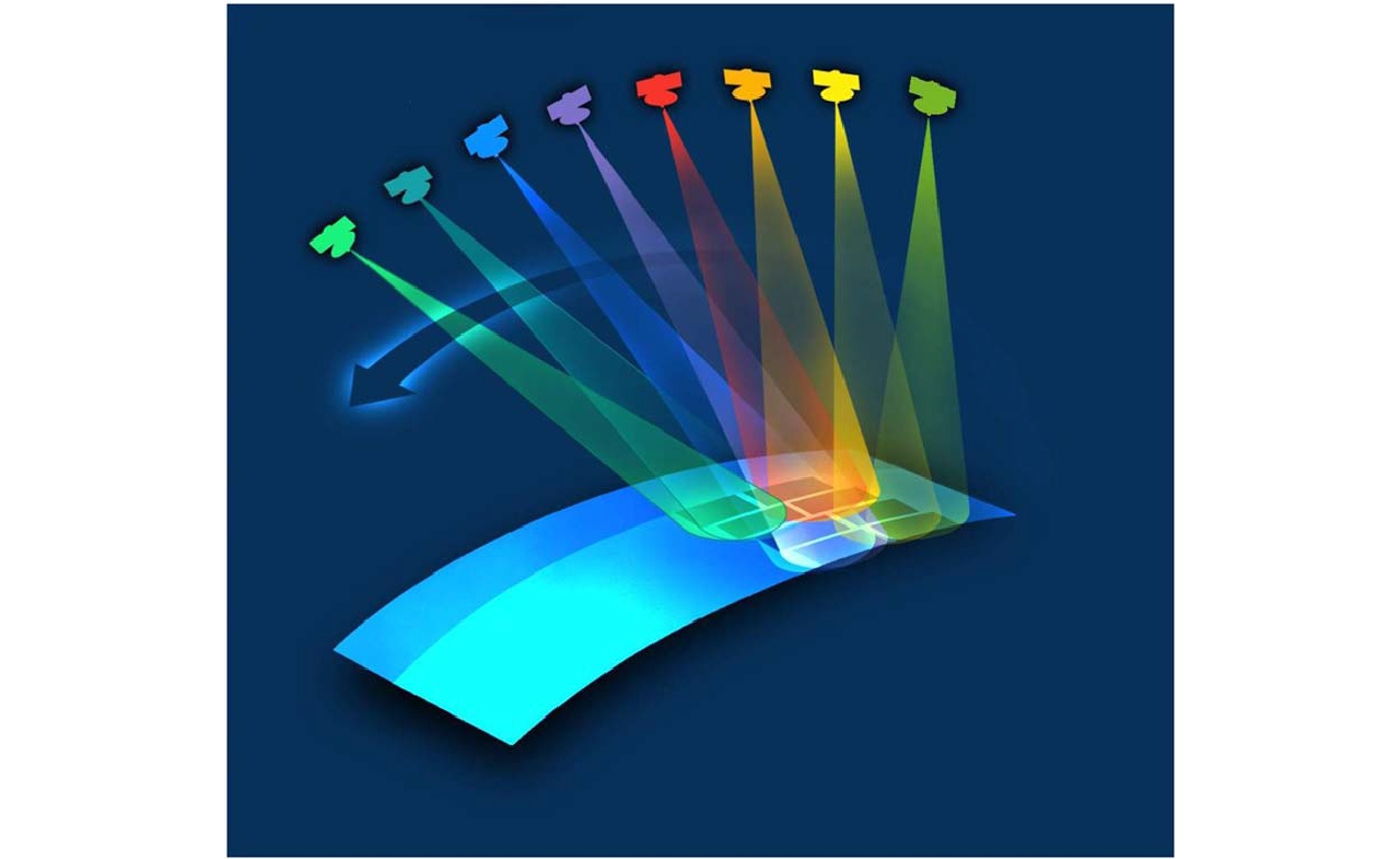


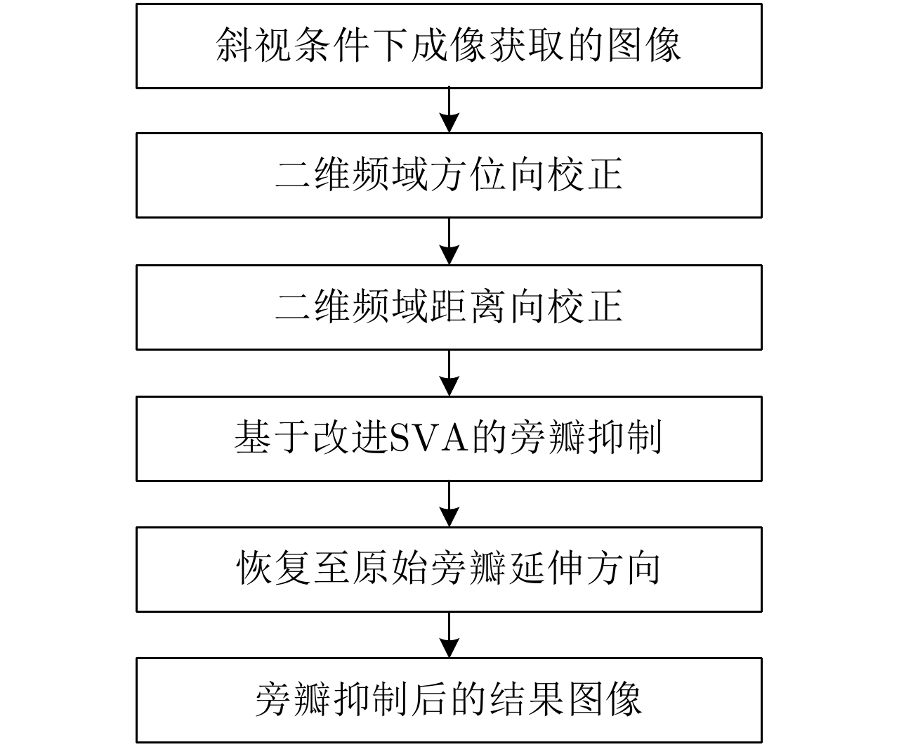
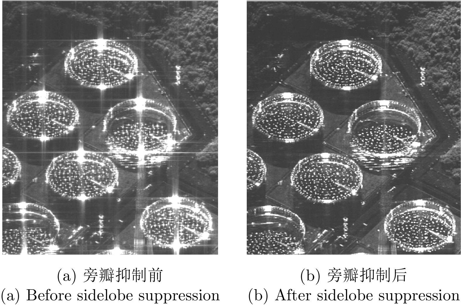
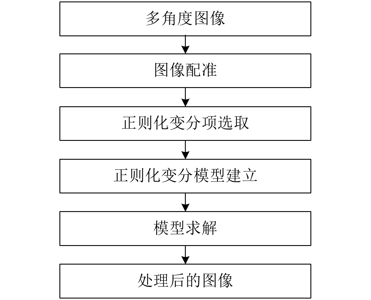
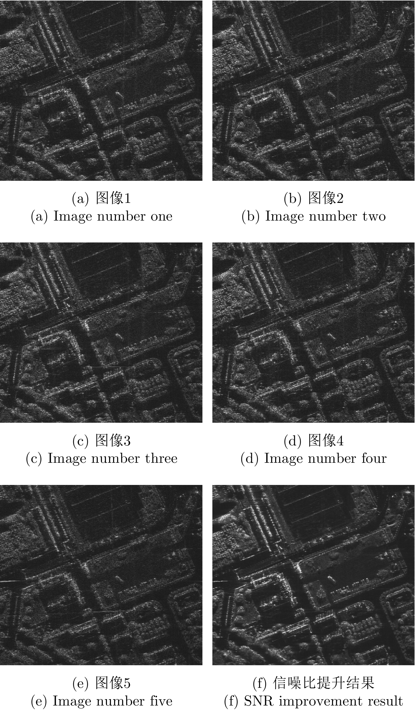


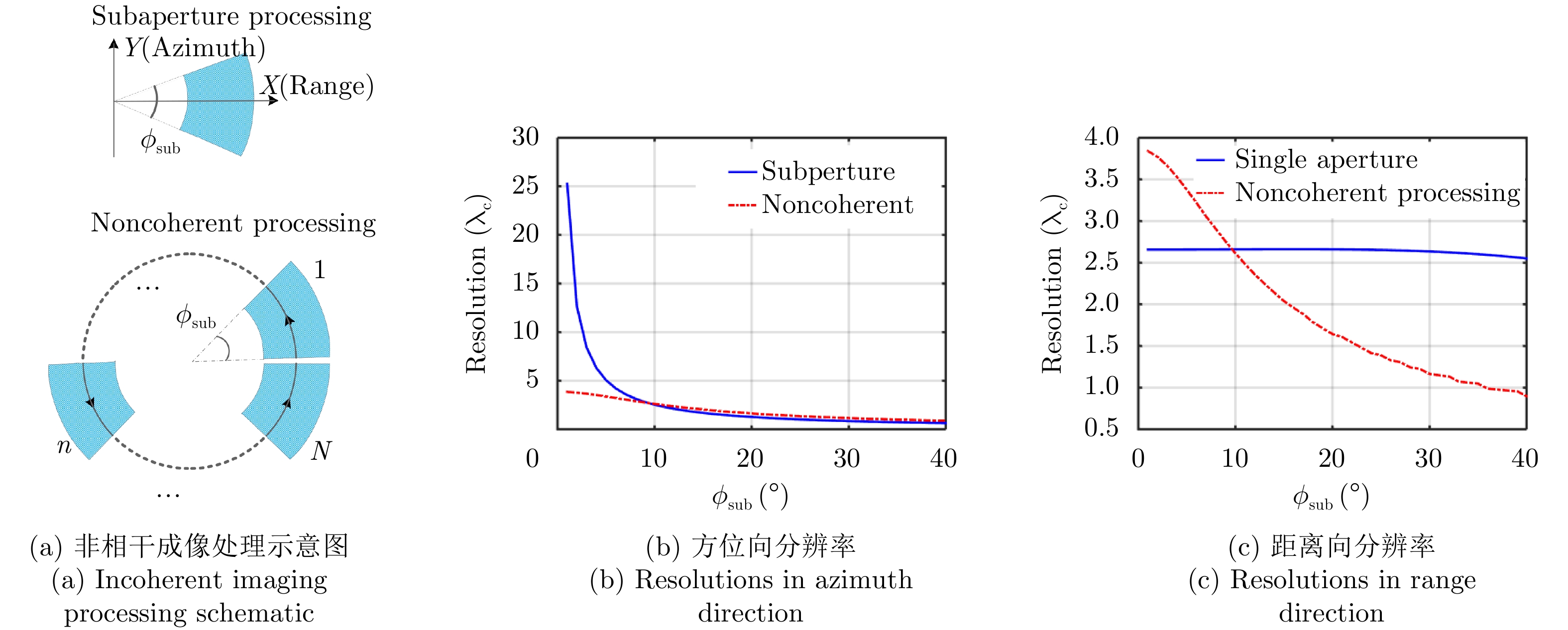
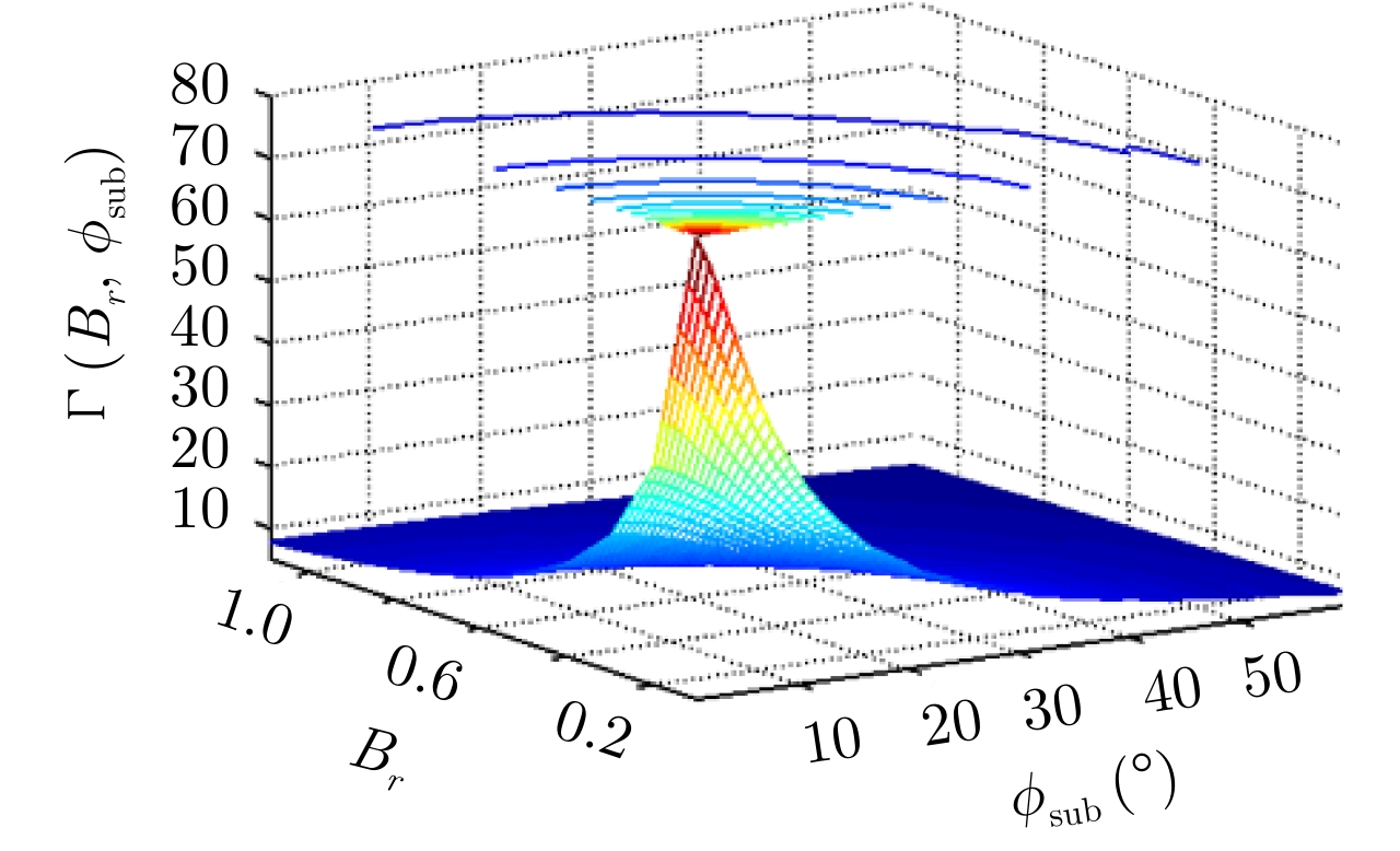
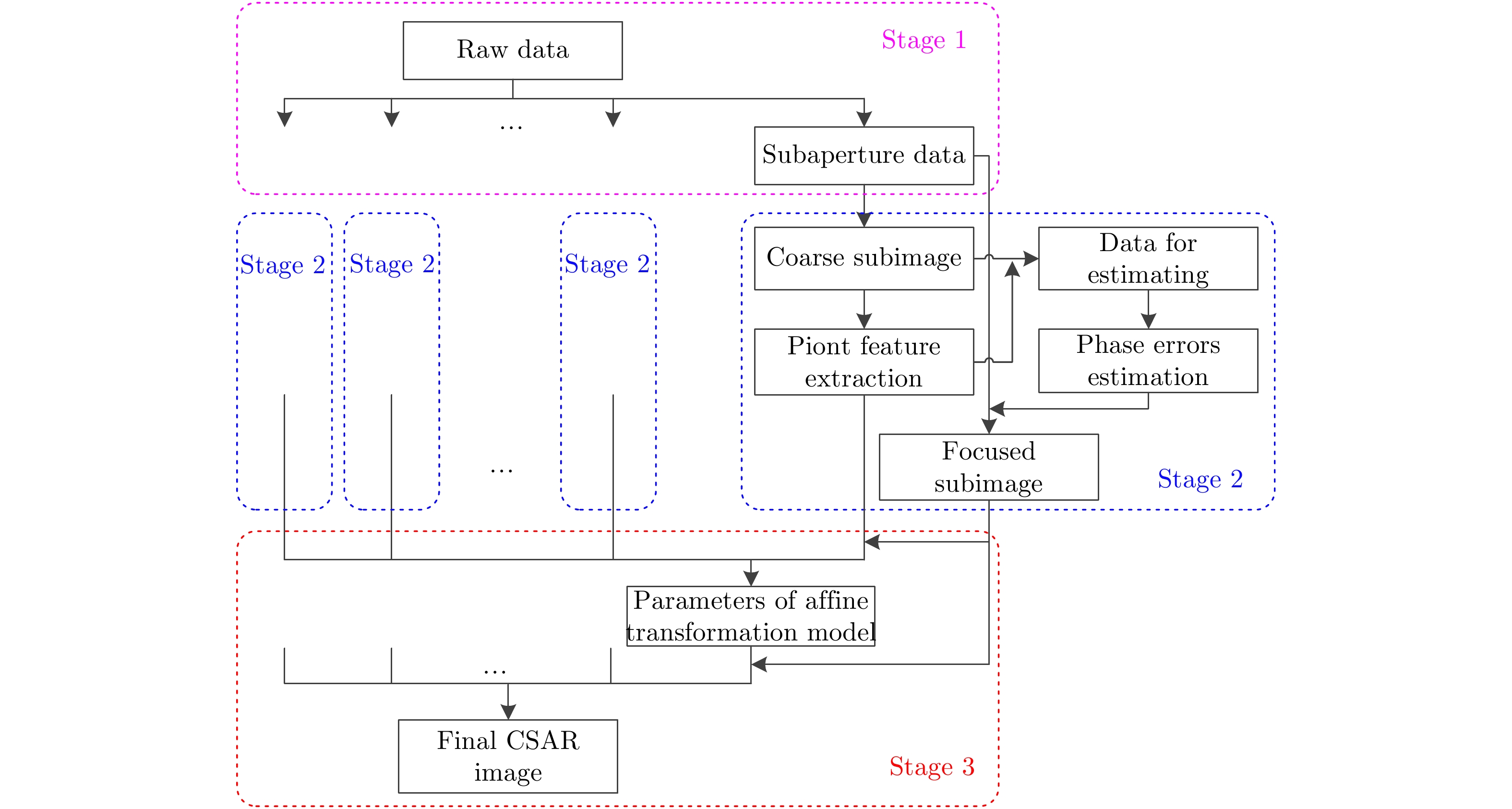
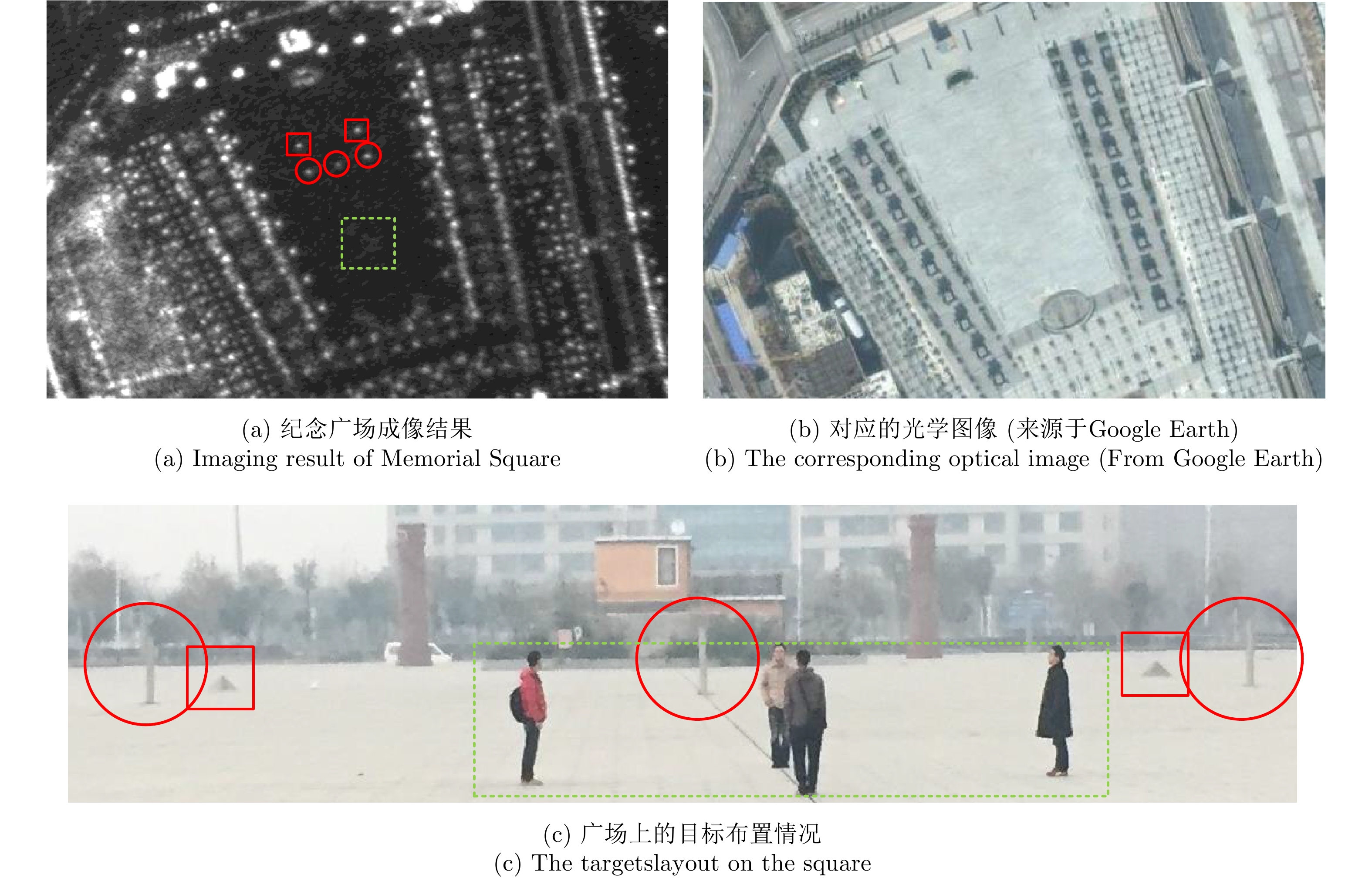
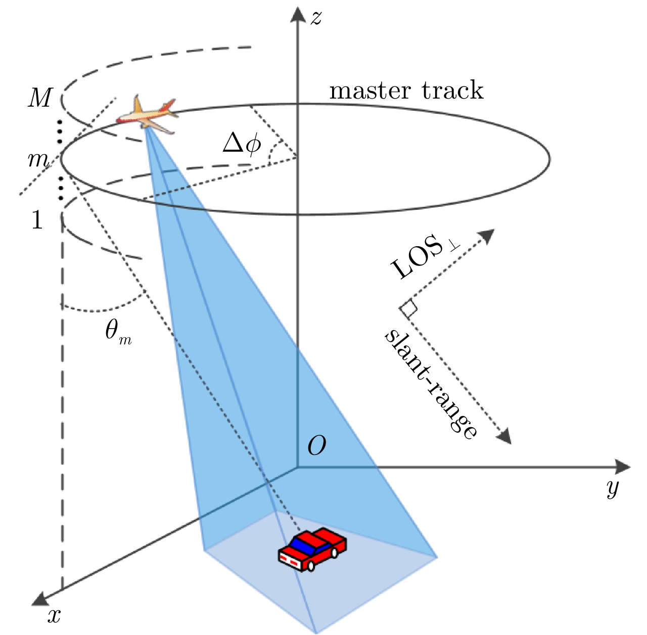
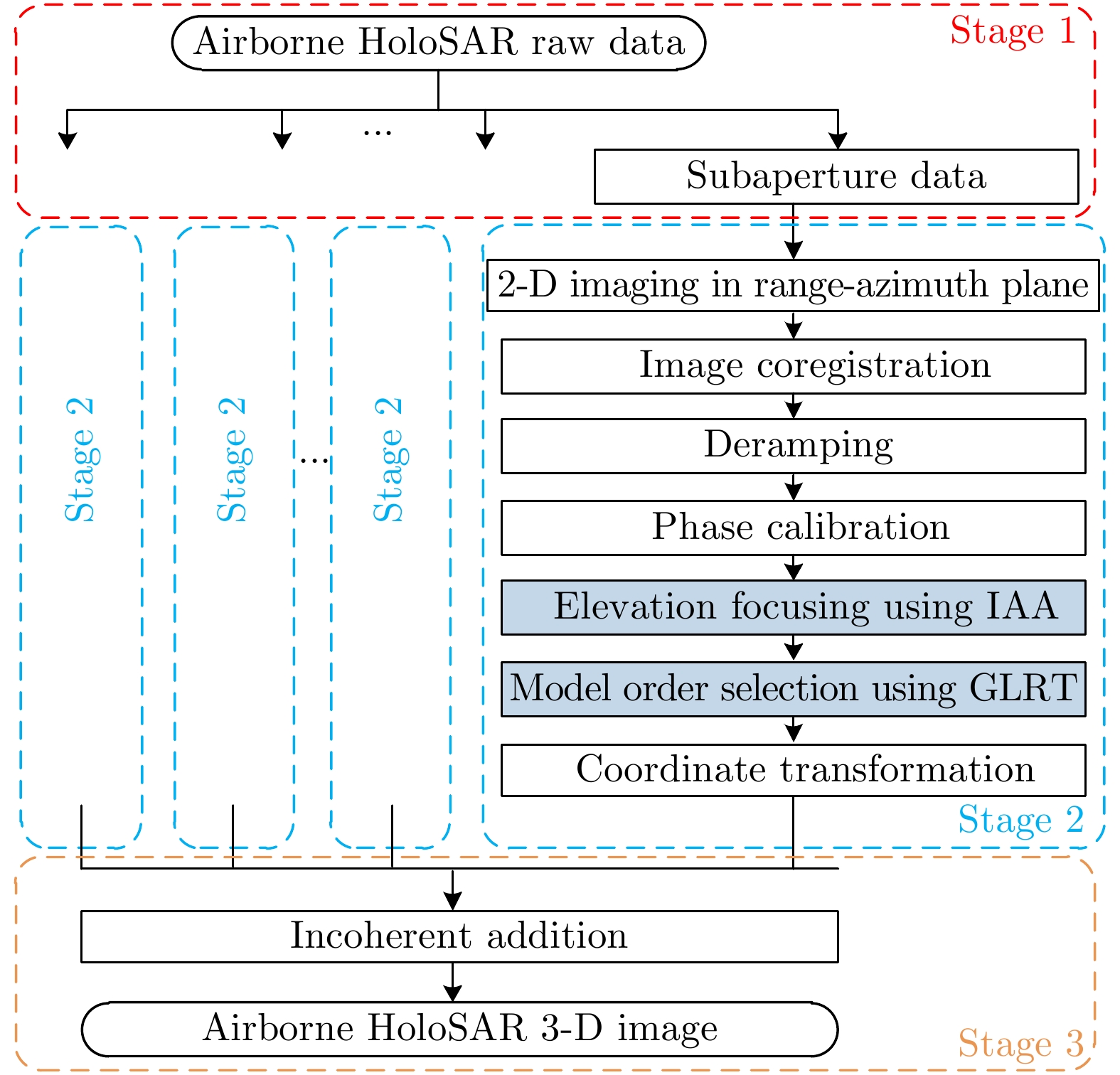
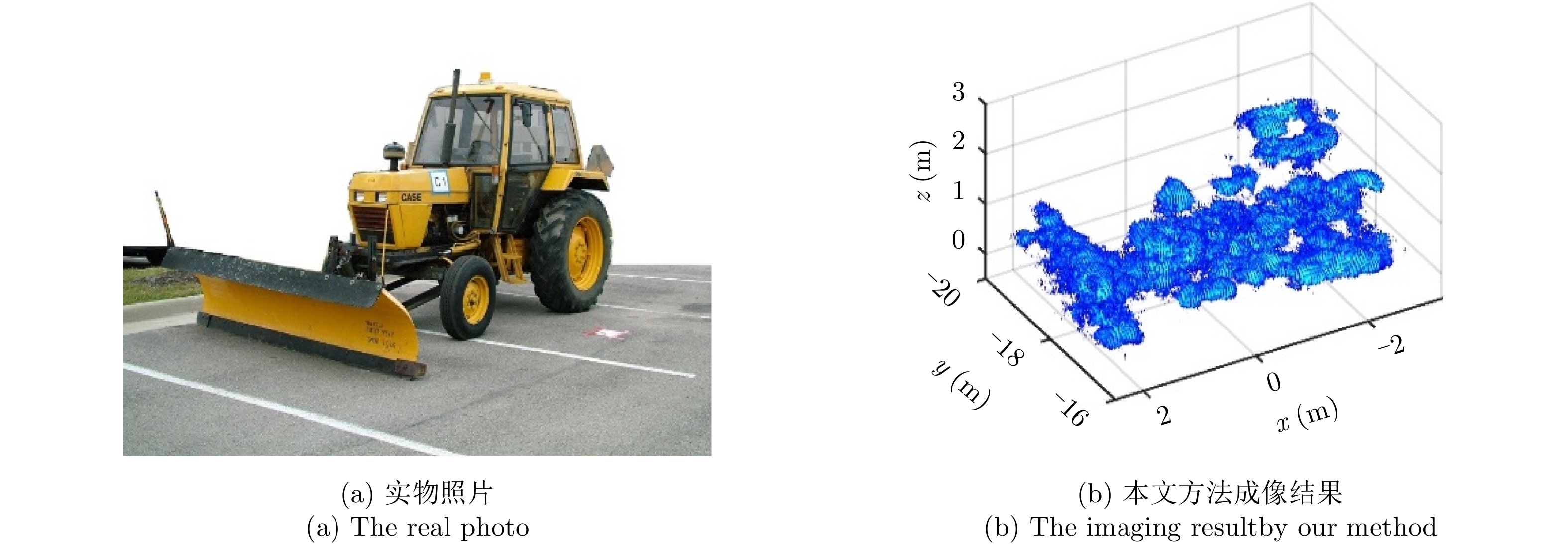
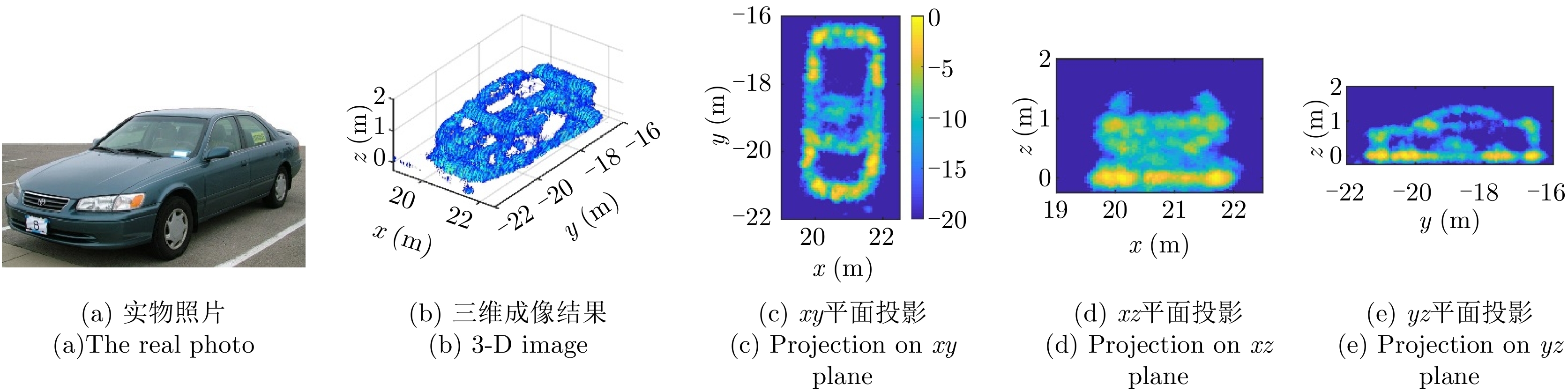
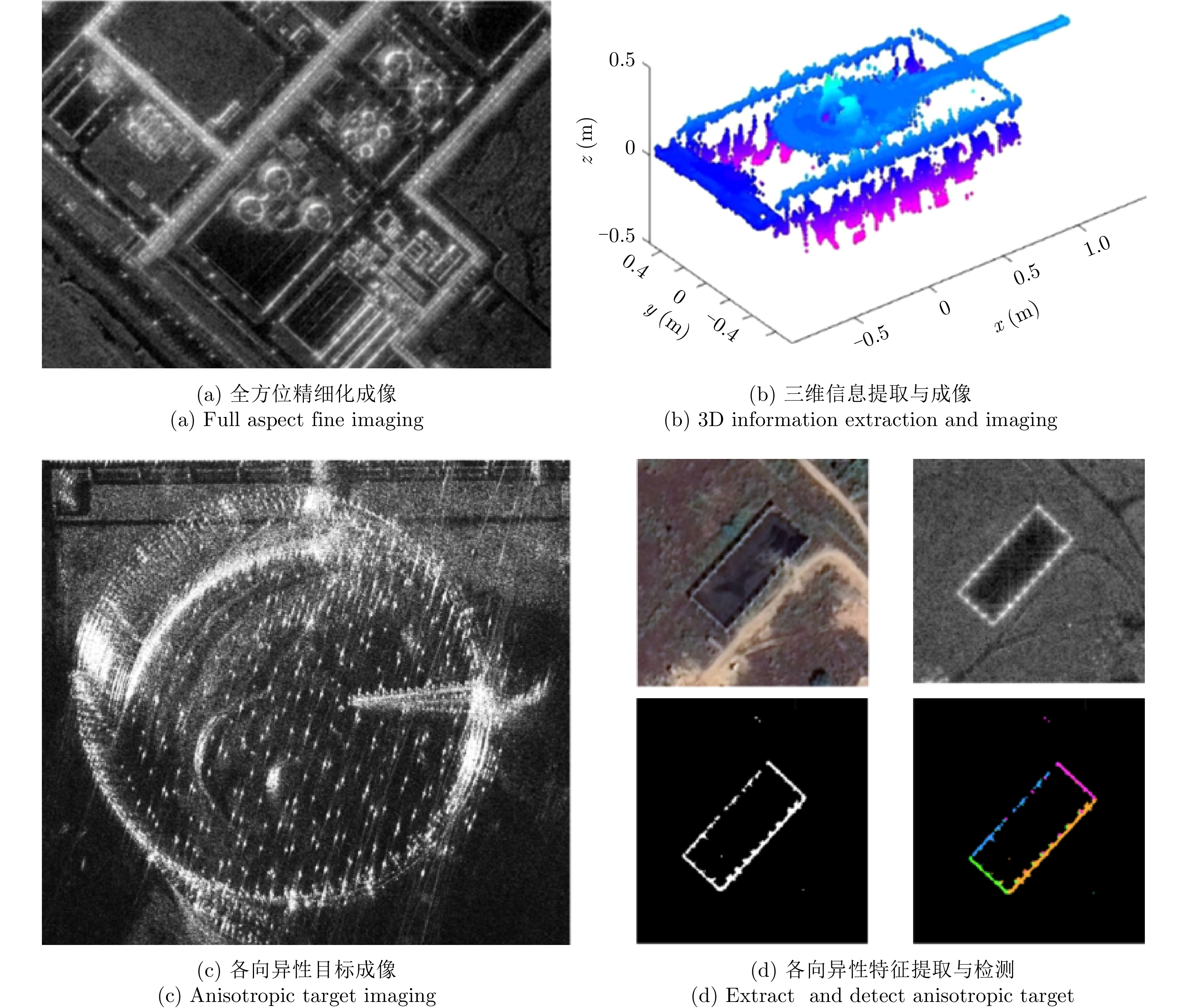
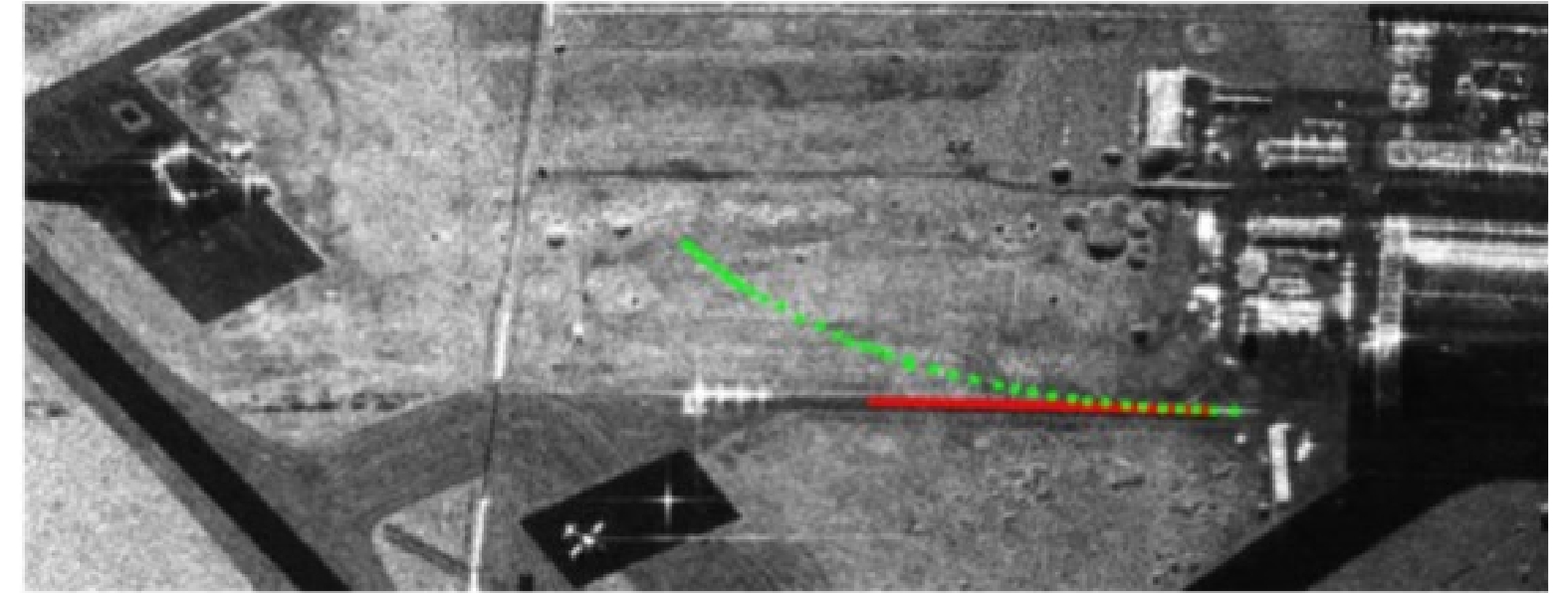
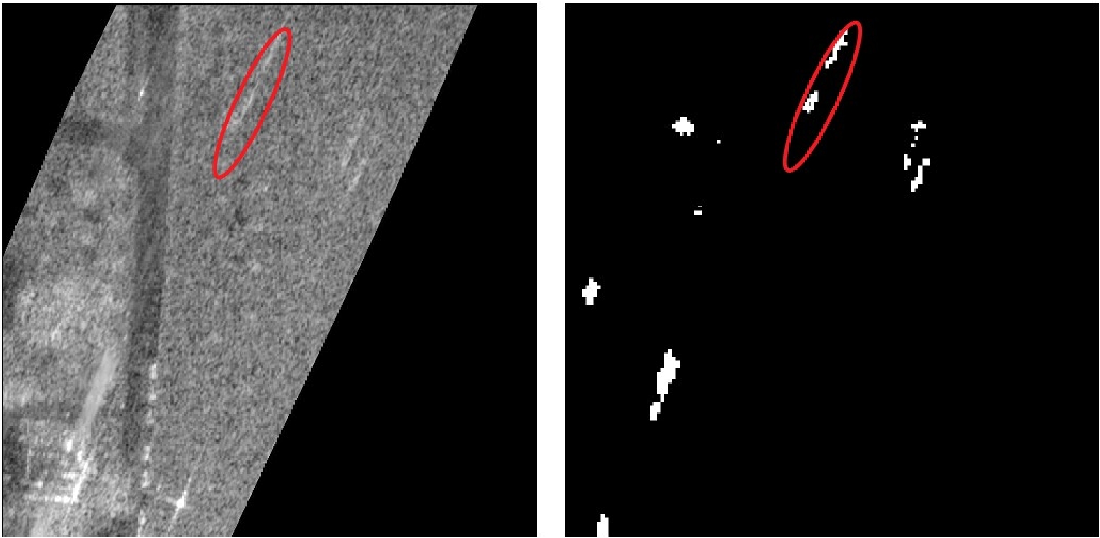
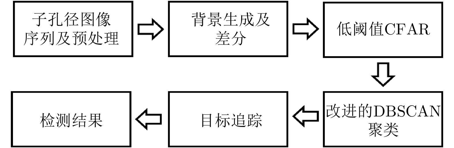
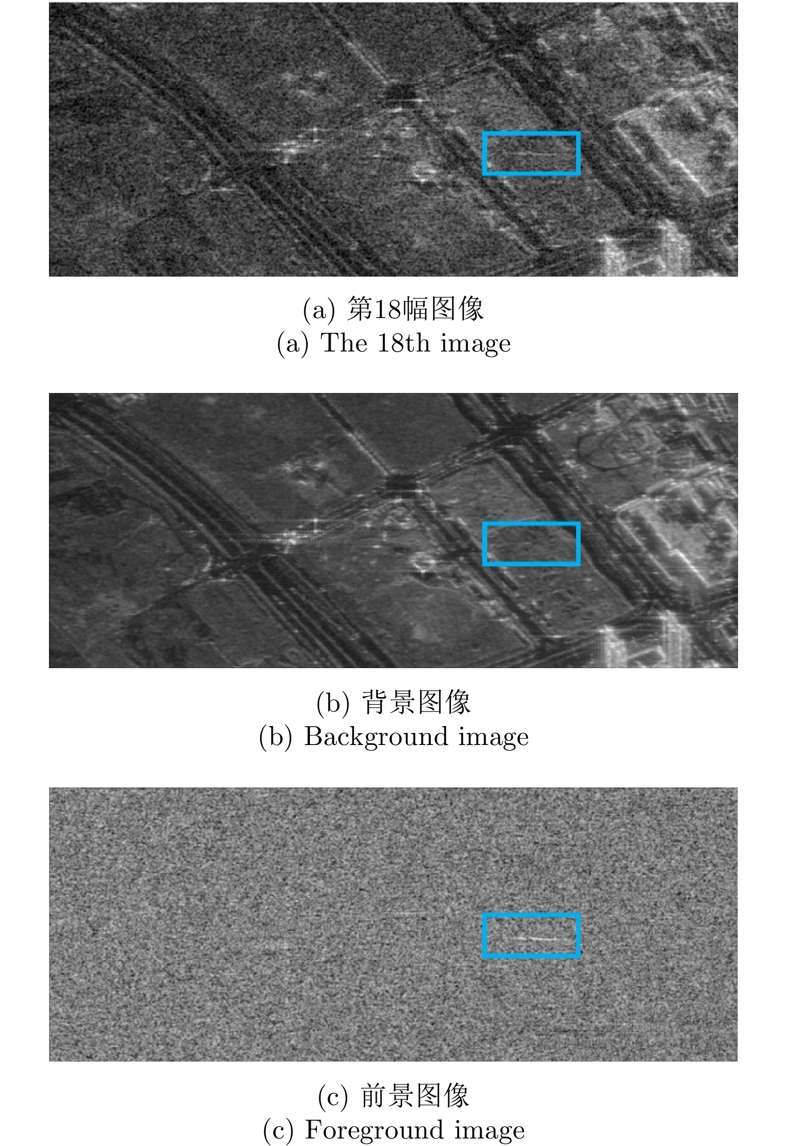
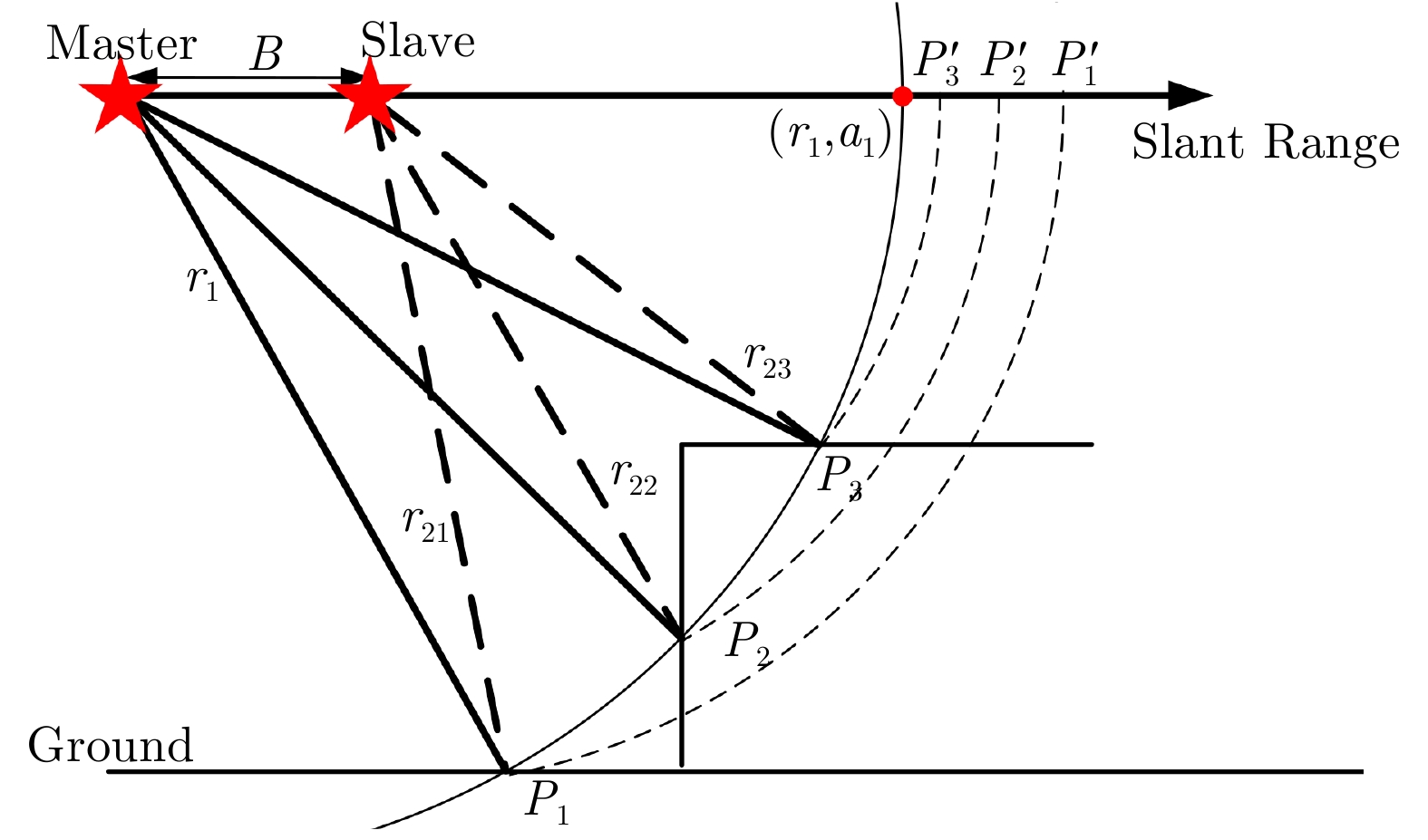
Circular Synthetic Aperture Radar (CSAR) is a novel imaging mode, which has the advantages of all-directional observation, high spatial resolution, and three-dimensional imaging. With the development of airborne CSAR imaging techniques, it has become one of the effective methods for key point area observation. This paper introduces works on airborne CSAR imaging techniques performed by our research team in recent years, including airborne CSAR imaging mode, spatial resolution evaluation, two-dimensional CSAR imaging, three-dimensional target image reconstruction based on a single CSAR, and three-dimensional holographic SAR imaging. In this paper, experimental results based on raw data acquired using airborne CSAR systems with P and X bands are presented. The obtained research results prove the effectivity and practicability of the airborne CSAR imaging mode. The content of this paper is based on a keynote speech presented by the author at the Fifth Young Scientists Forum of Journal of Radars on August 15, 2019.
Circular Synthetic Aperture Radar (CSAR) is a novel imaging mode, which has the advantages of all-directional observation, high spatial resolution, and three-dimensional imaging. With the development of airborne CSAR imaging techniques, it has become one of the effective methods for key point area observation. This paper introduces works on airborne CSAR imaging techniques performed by our research team in recent years, including airborne CSAR imaging mode, spatial resolution evaluation, two-dimensional CSAR imaging, three-dimensional target image reconstruction based on a single CSAR, and three-dimensional holographic SAR imaging. In this paper, experimental results based on raw data acquired using airborne CSAR systems with P and X bands are presented. The obtained research results prove the effectivity and practicability of the airborne CSAR imaging mode. The content of this paper is based on a keynote speech presented by the author at the Fifth Young Scientists Forum of Journal of Radars on August 15, 2019.


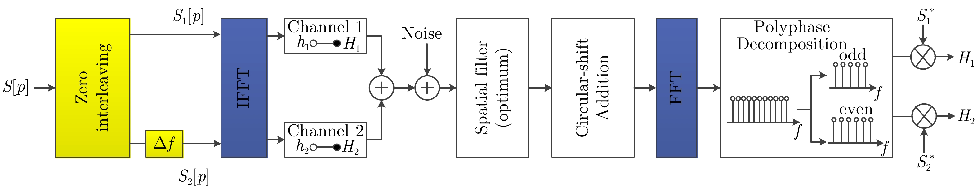

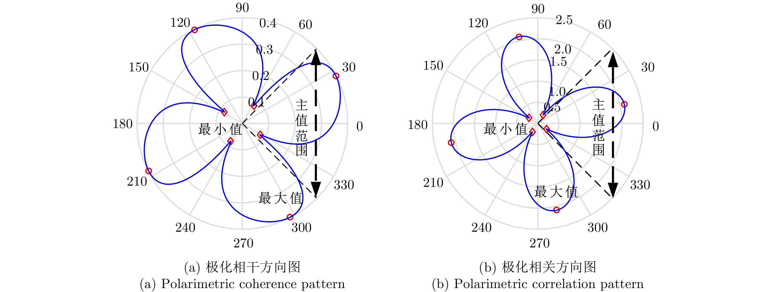
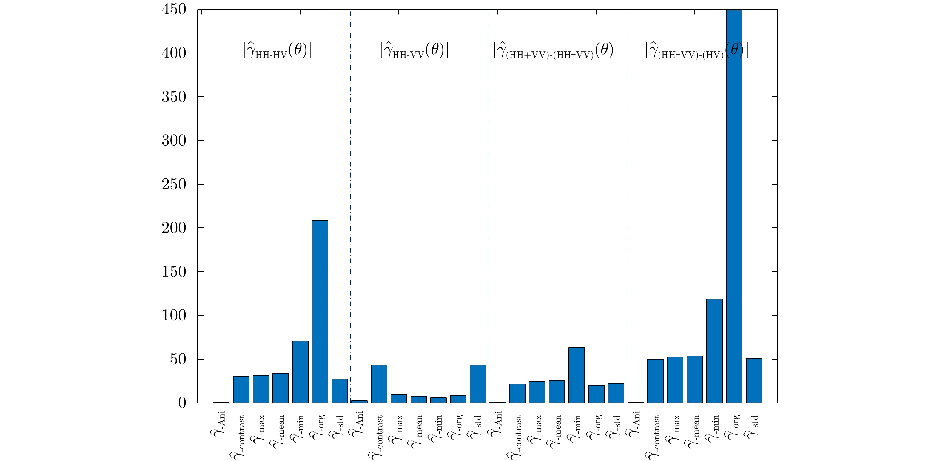
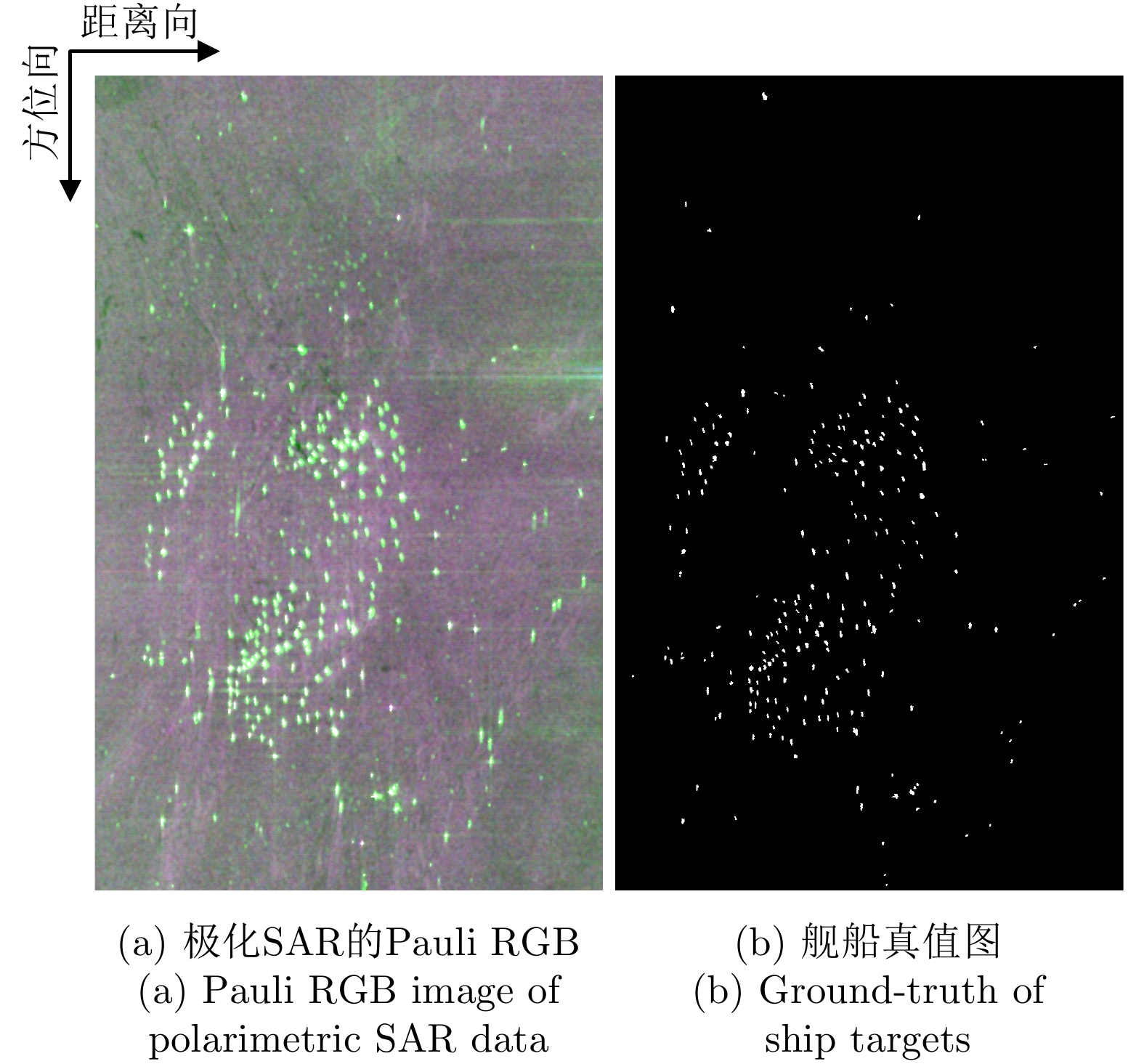
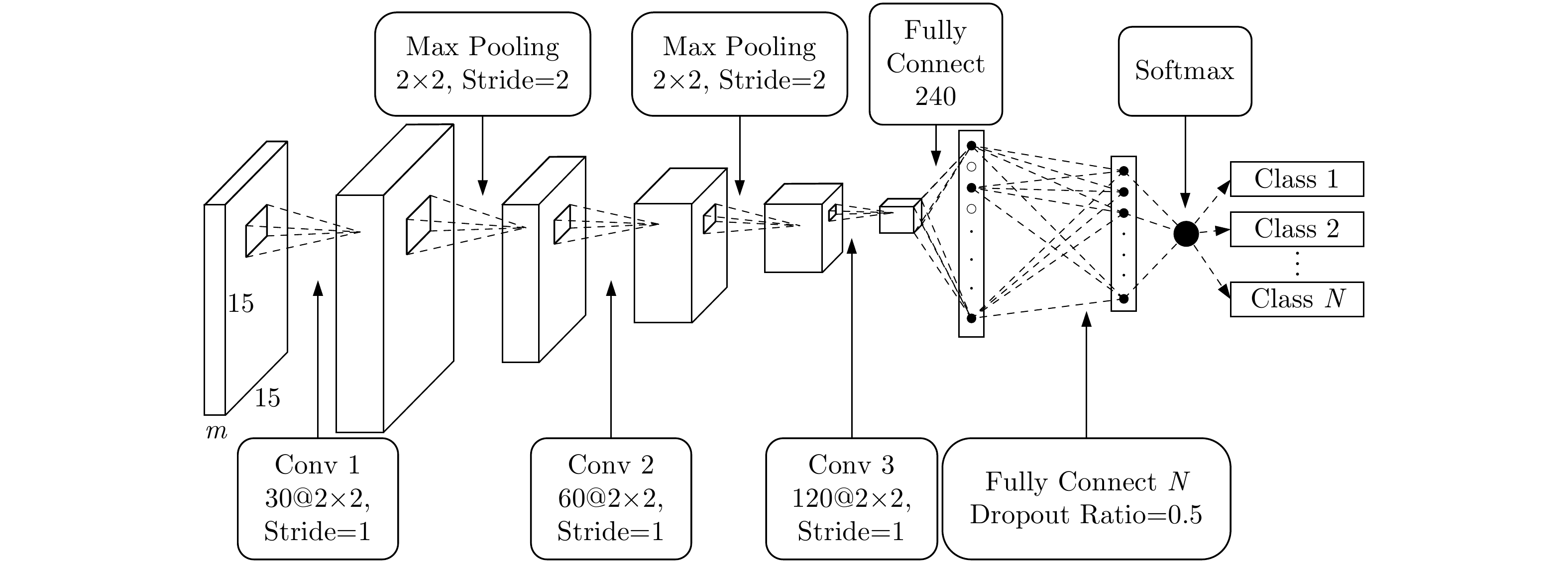
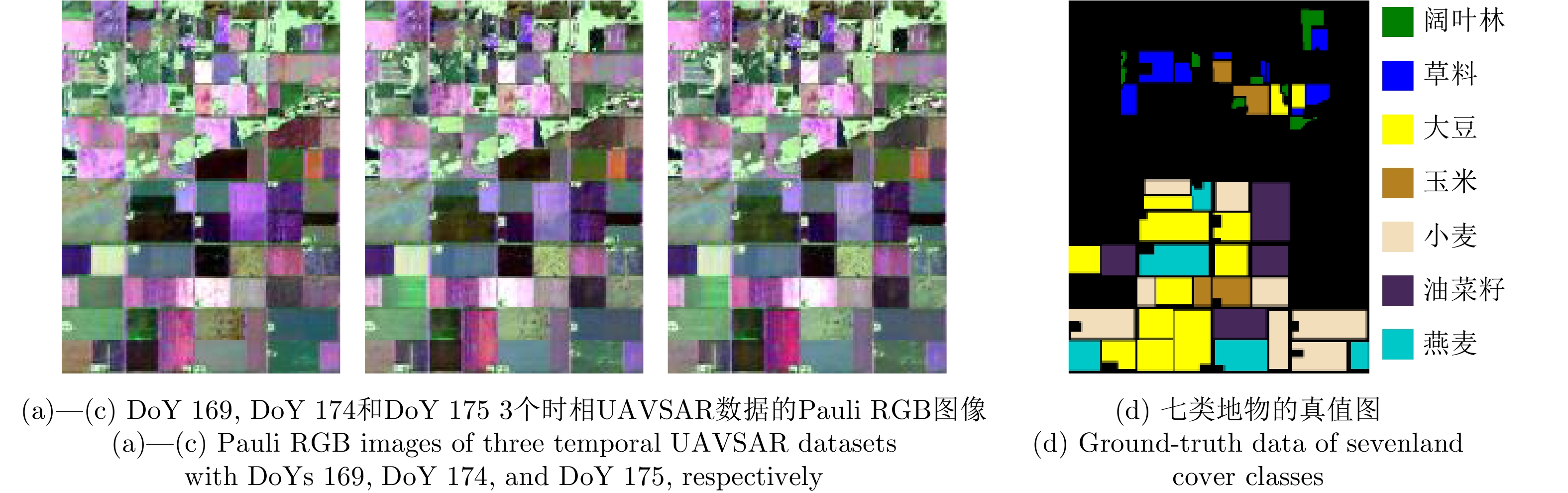
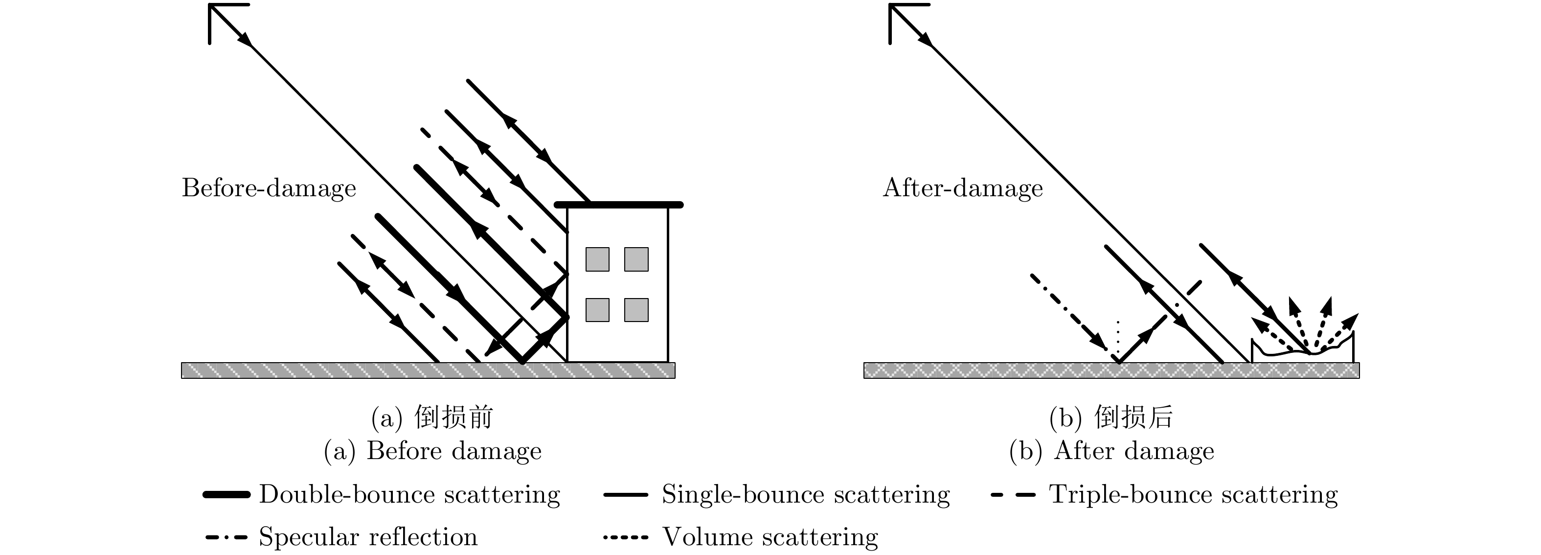
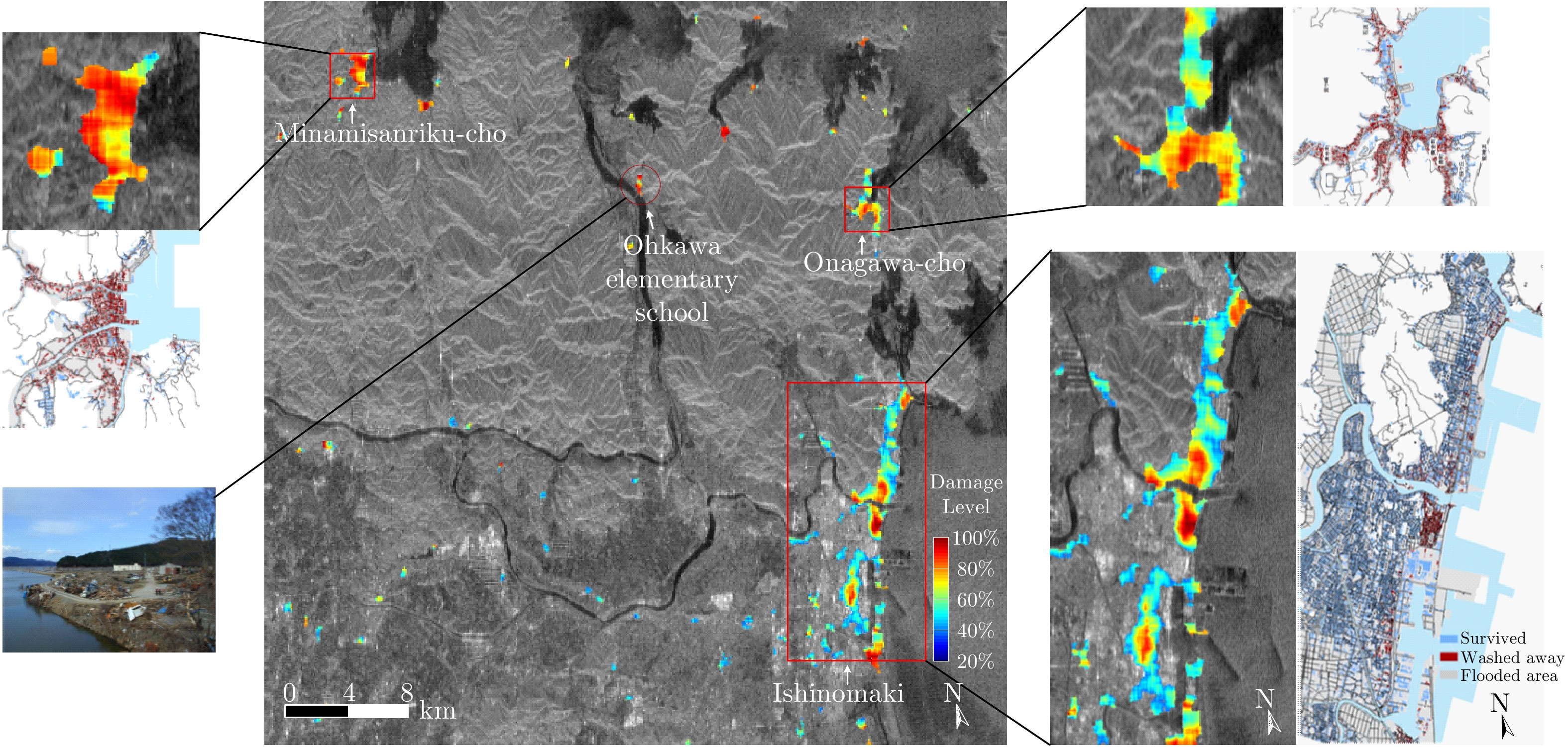
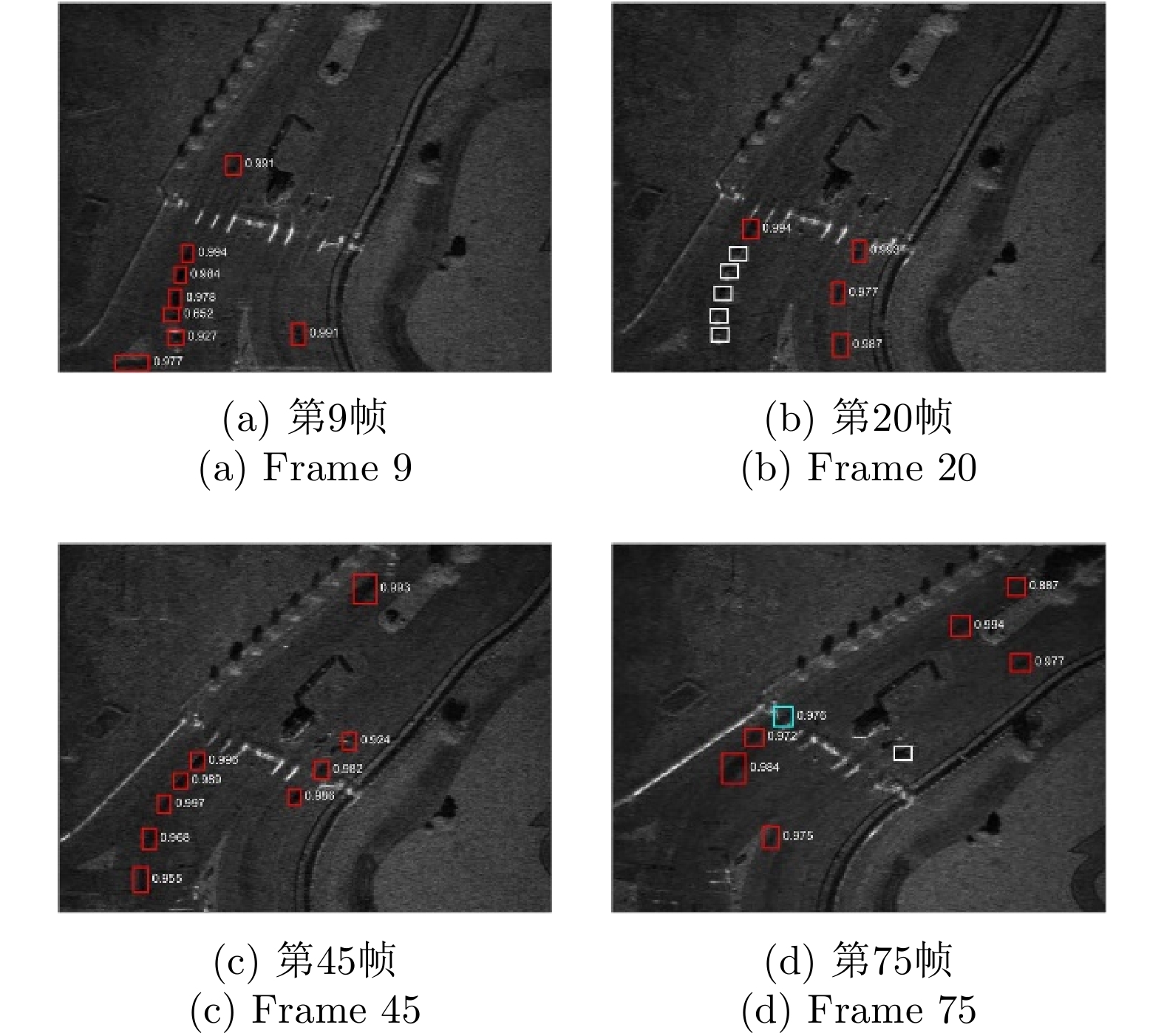
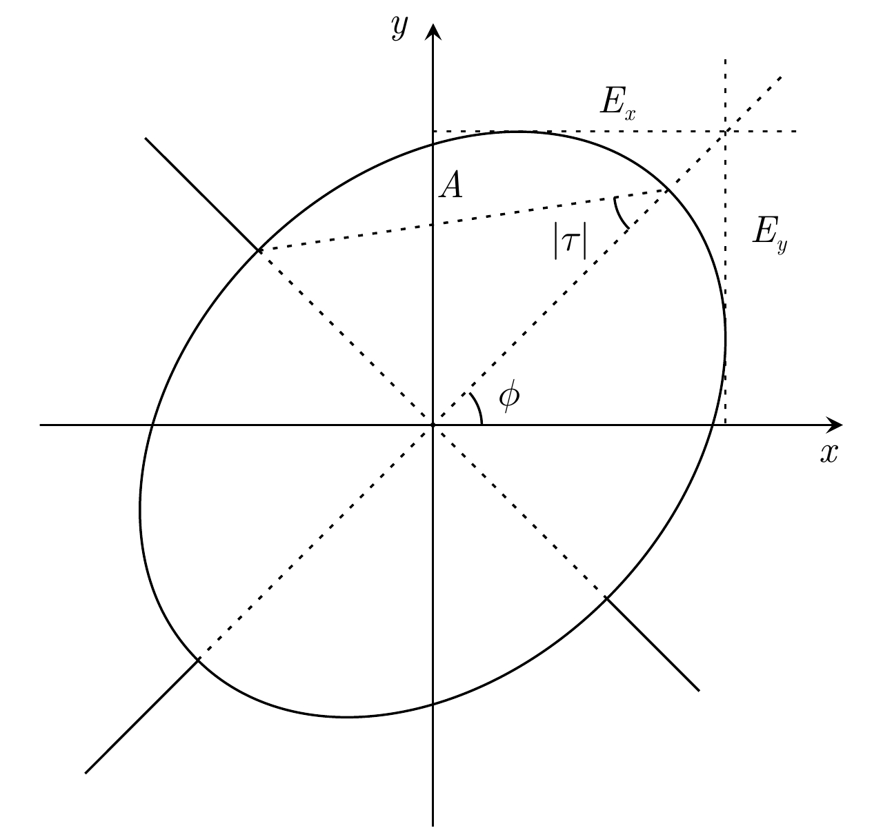
Polarimetric Synthetic Aperture Radar (SAR), which can acquire fully polarimetric information, is widely used in civilian and military fields, such as earth observation, damage assessment, and reconnaissance. Major Chinese universities, the Chinese Academy of Sciences, the industrial sector, and user units have conducted research in this field and obtained numerous remarkable achievements. This work reviews the recent progress of research in the field of polarimetric SAR imaging interpretation and recognition. For target scattering interpretation, theories of polarimetric target decomposition and polarimetric rotation domain interpretation are introduced. For polarimetric SAR application, the technologies of ship detection, land cover classification, and building damage assessment, which are based on the interpretation tools, are summarized in combination with the authors’ own research. Finally, the future development perspectives of polarimetric SAR interpretation and recognition are briefly discussed.
Polarimetric Synthetic Aperture Radar (SAR), which can acquire fully polarimetric information, is widely used in civilian and military fields, such as earth observation, damage assessment, and reconnaissance. Major Chinese universities, the Chinese Academy of Sciences, the industrial sector, and user units have conducted research in this field and obtained numerous remarkable achievements. This work reviews the recent progress of research in the field of polarimetric SAR imaging interpretation and recognition. For target scattering interpretation, theories of polarimetric target decomposition and polarimetric rotation domain interpretation are introduced. For polarimetric SAR application, the technologies of ship detection, land cover classification, and building damage assessment, which are based on the interpretation tools, are summarized in combination with the authors’ own research. Finally, the future development perspectives of polarimetric SAR interpretation and recognition are briefly discussed.


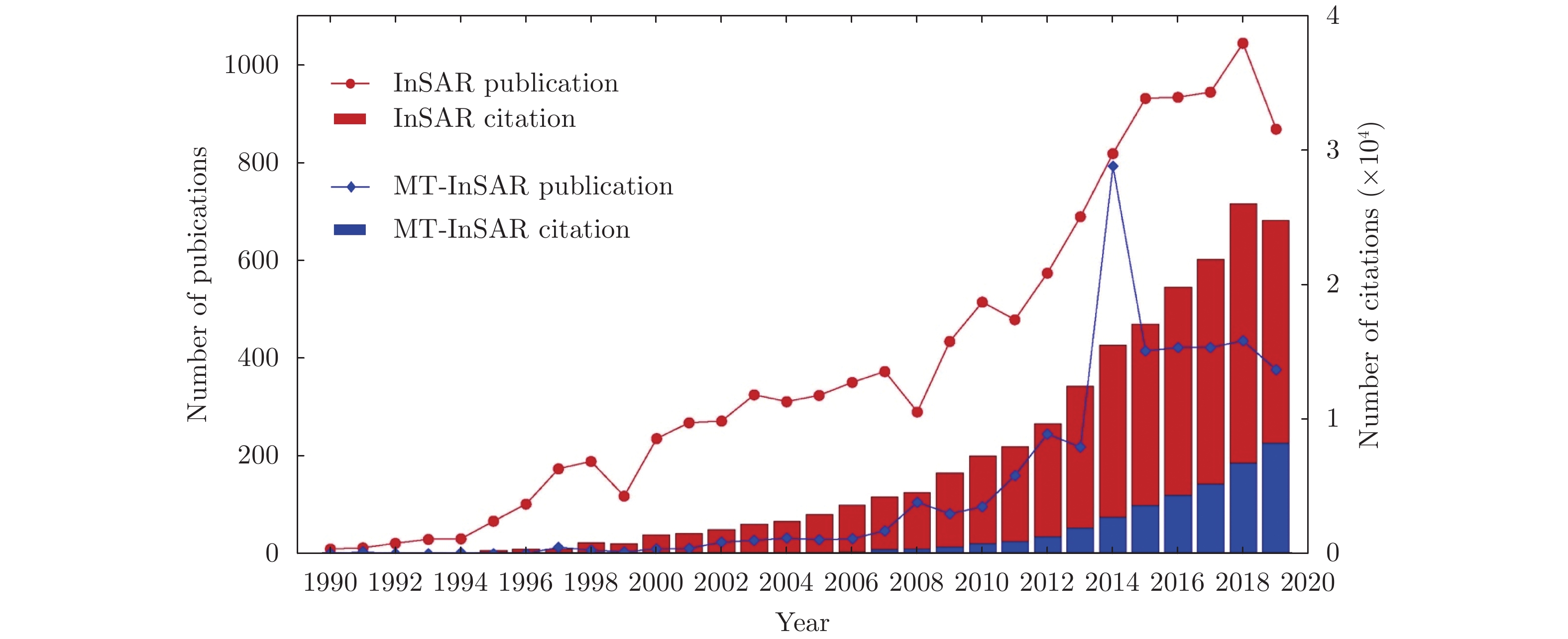
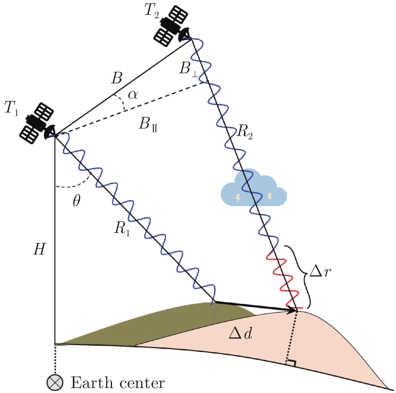
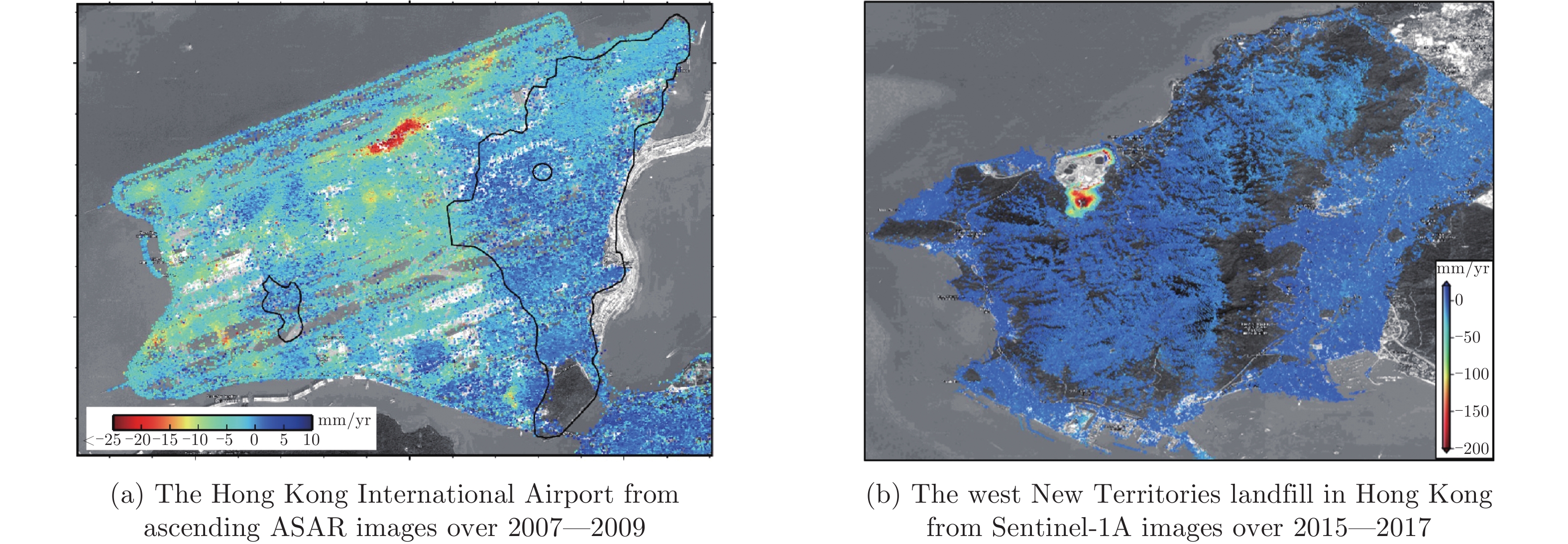
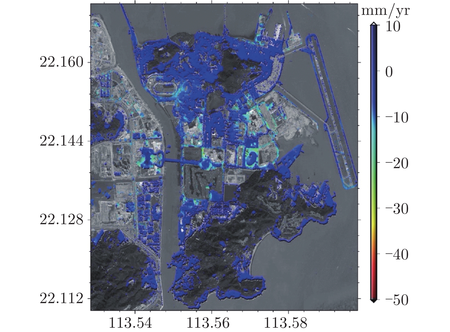
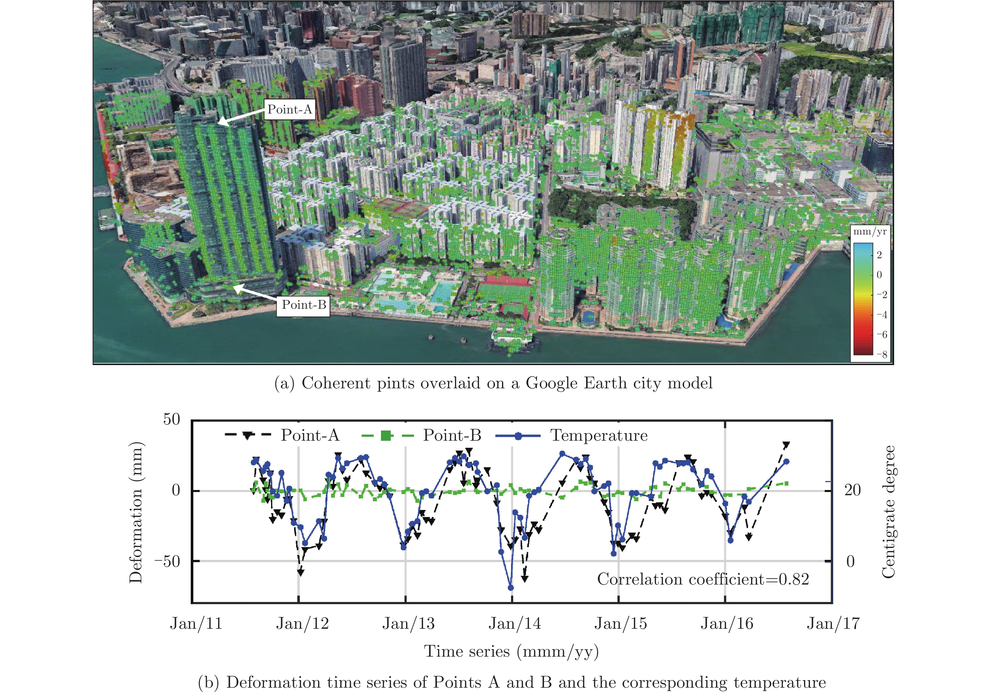
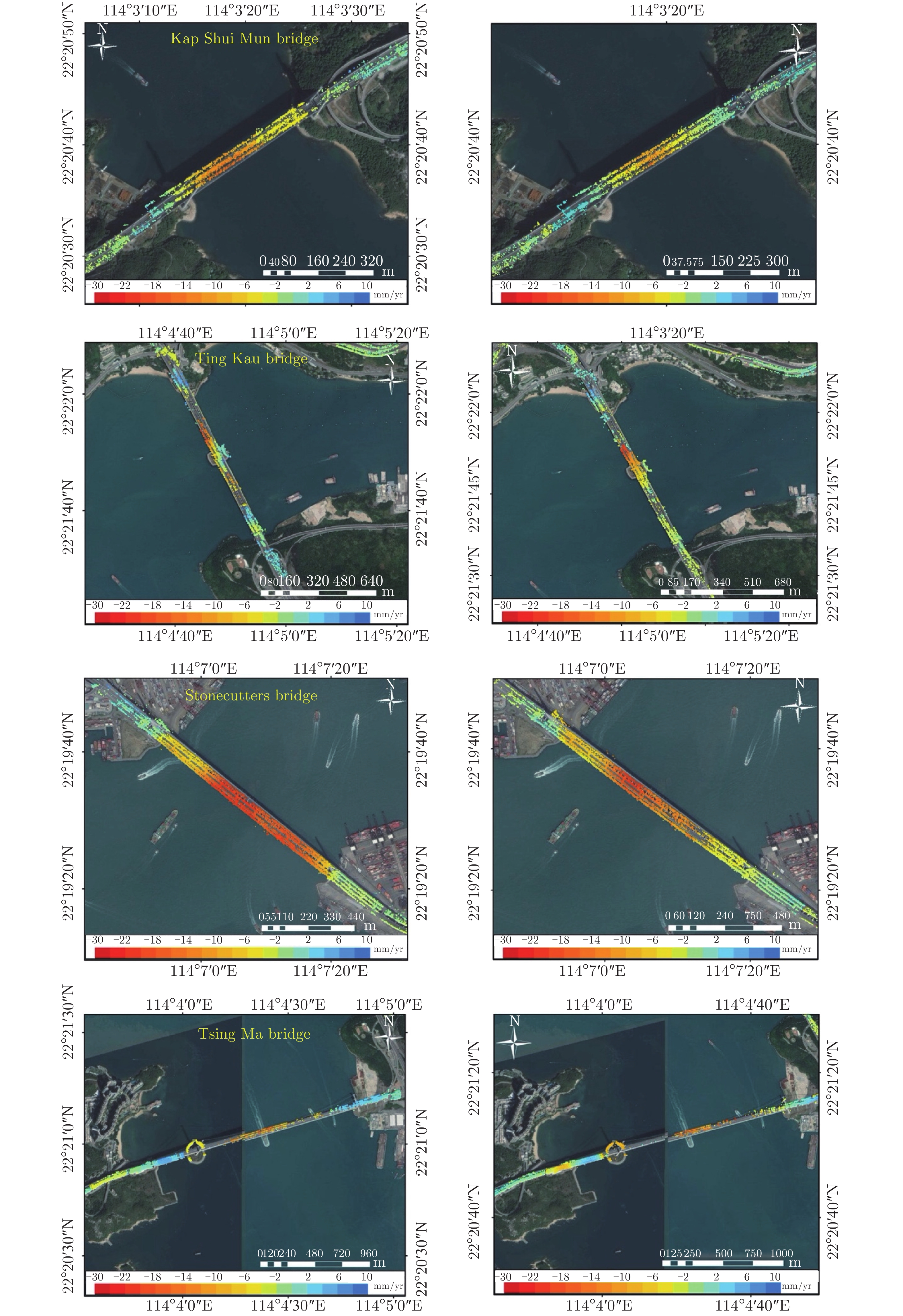
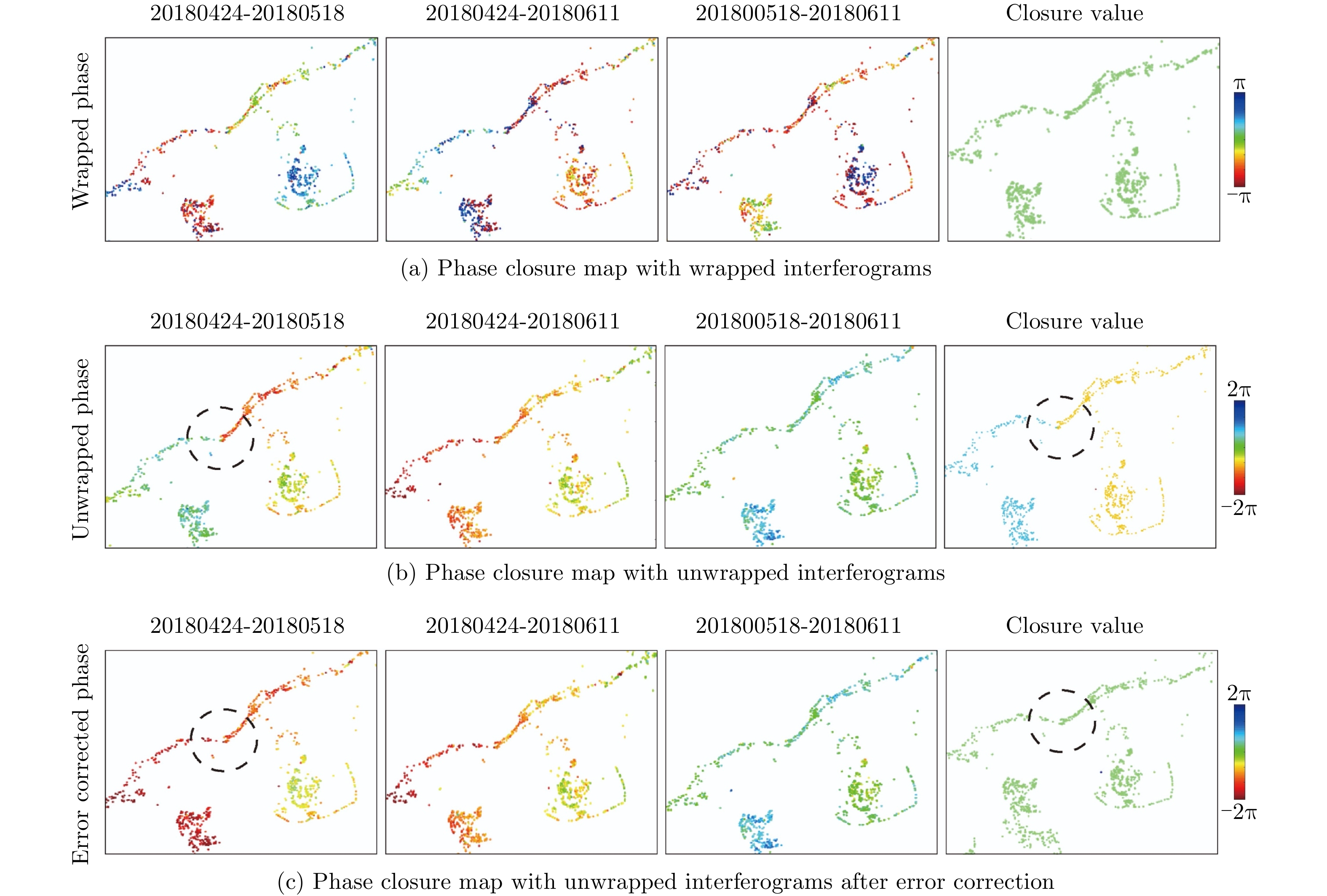
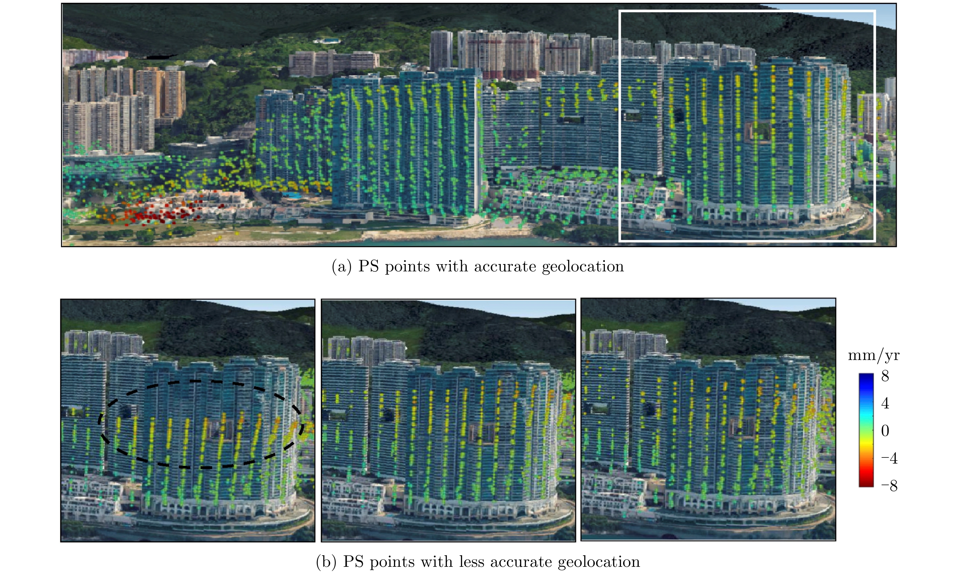
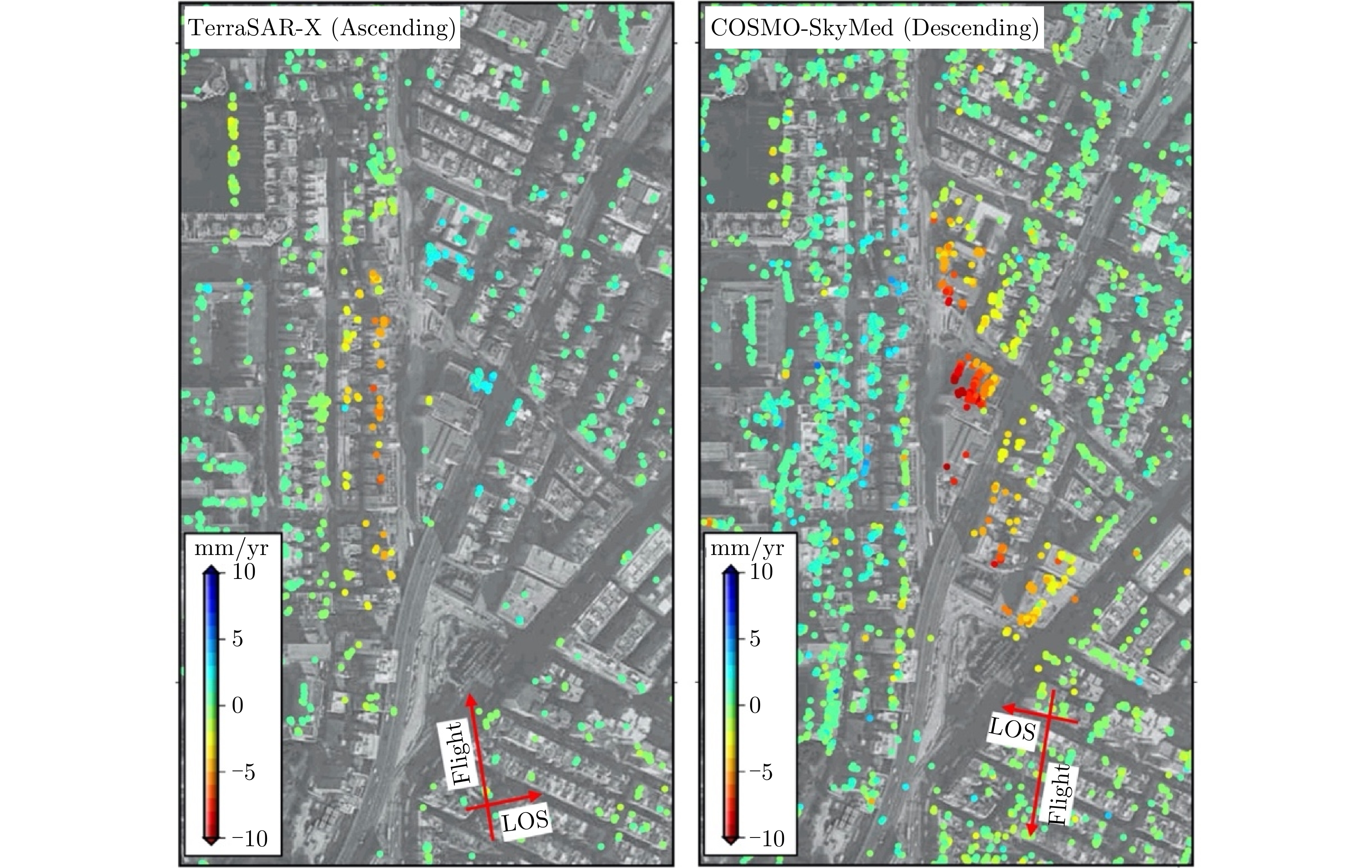
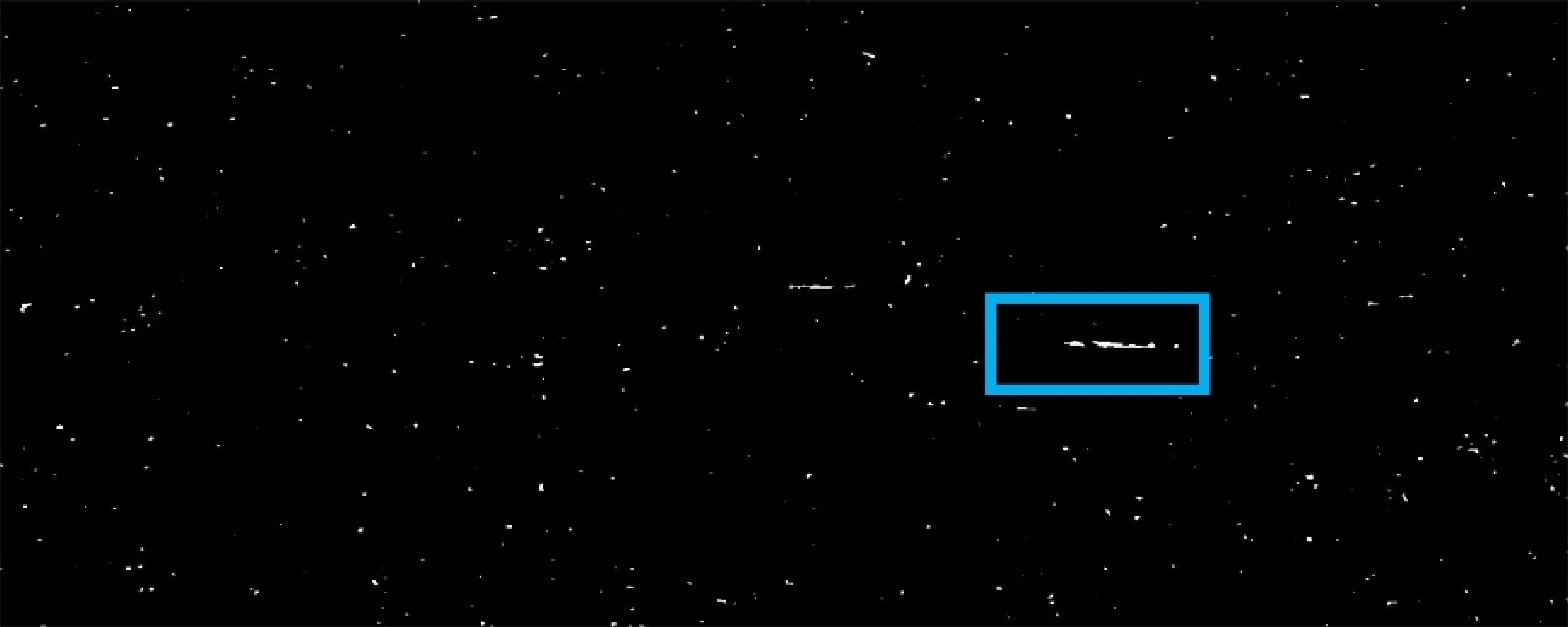
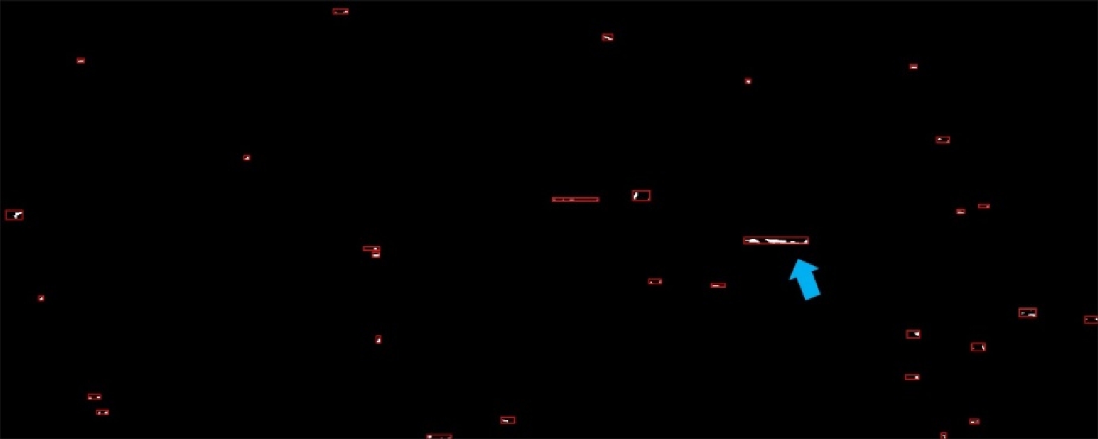
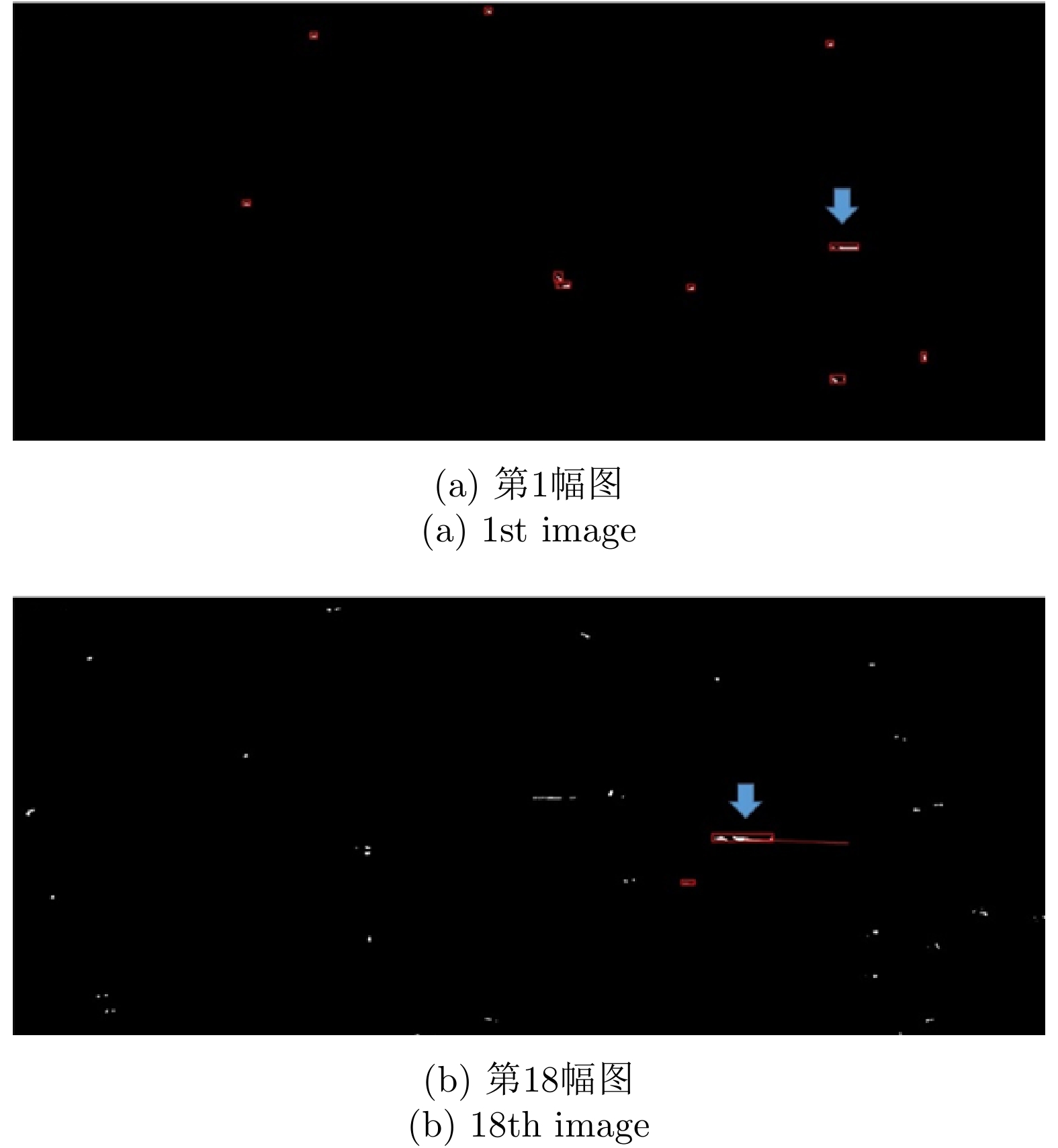
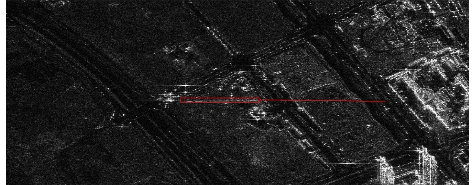
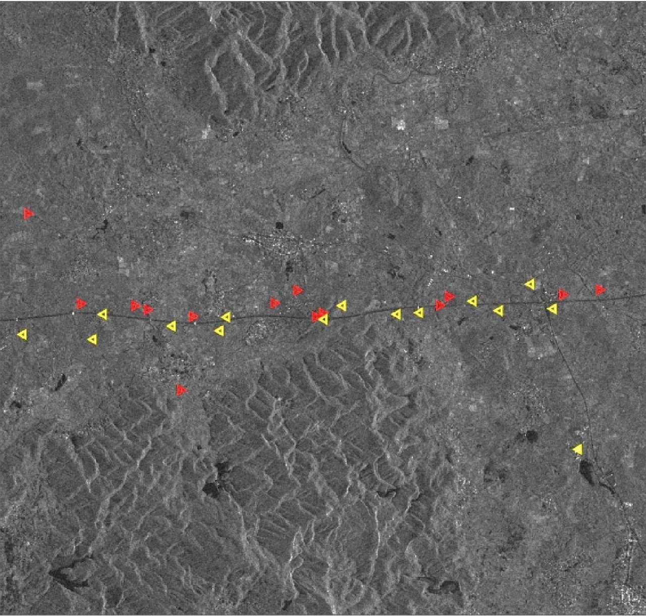
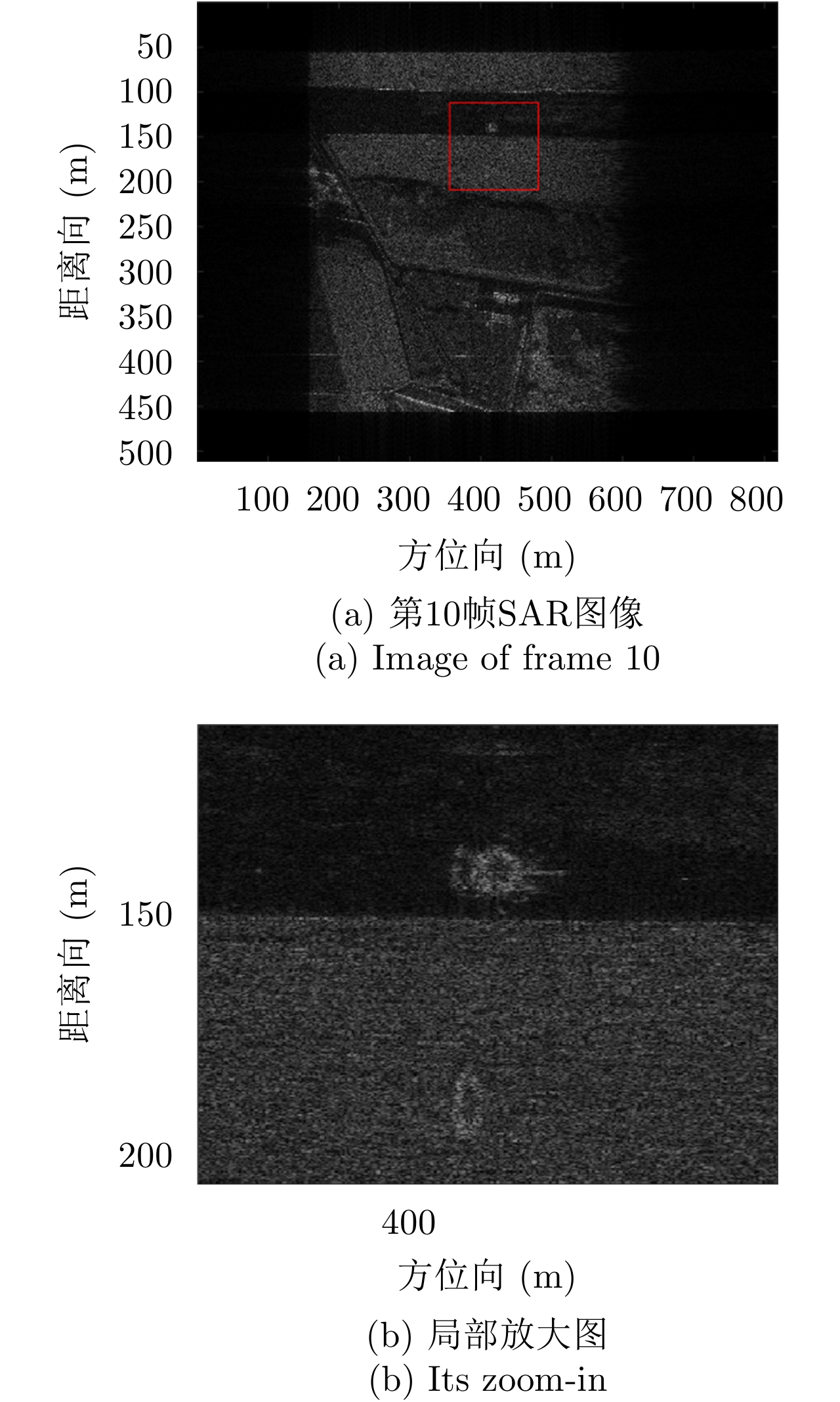
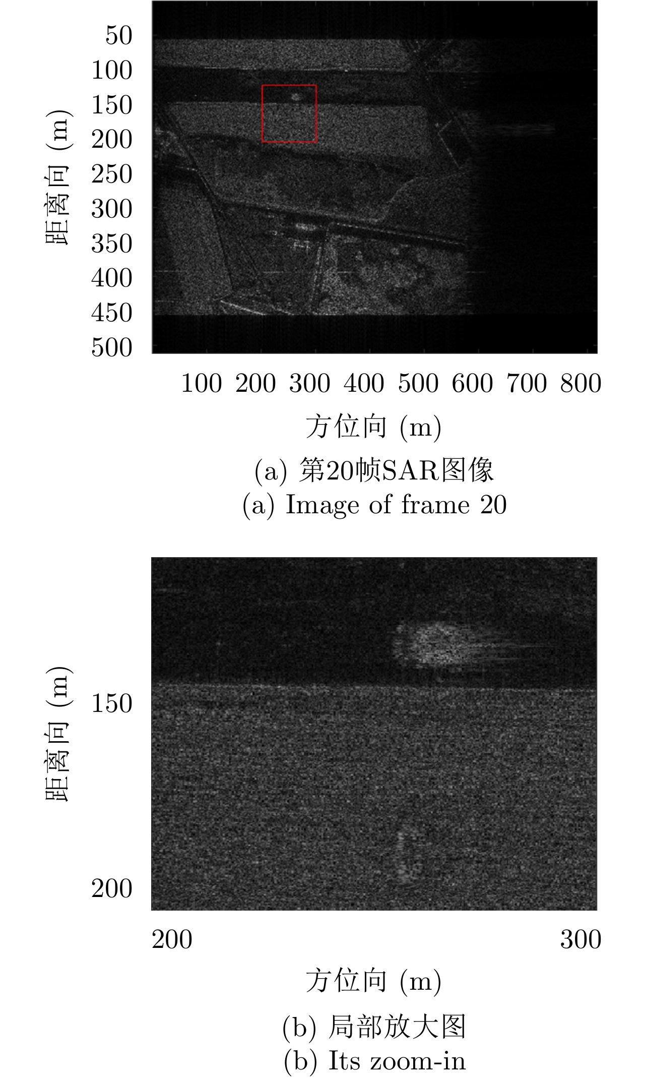
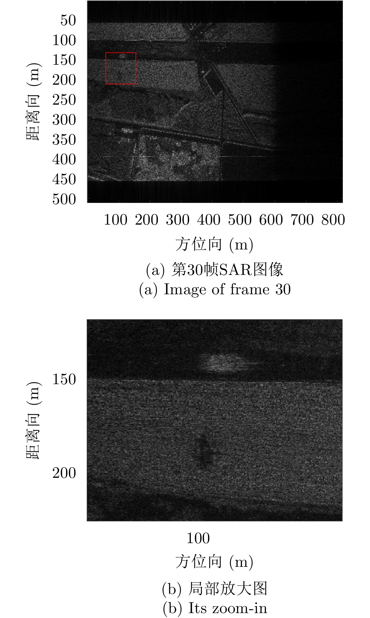
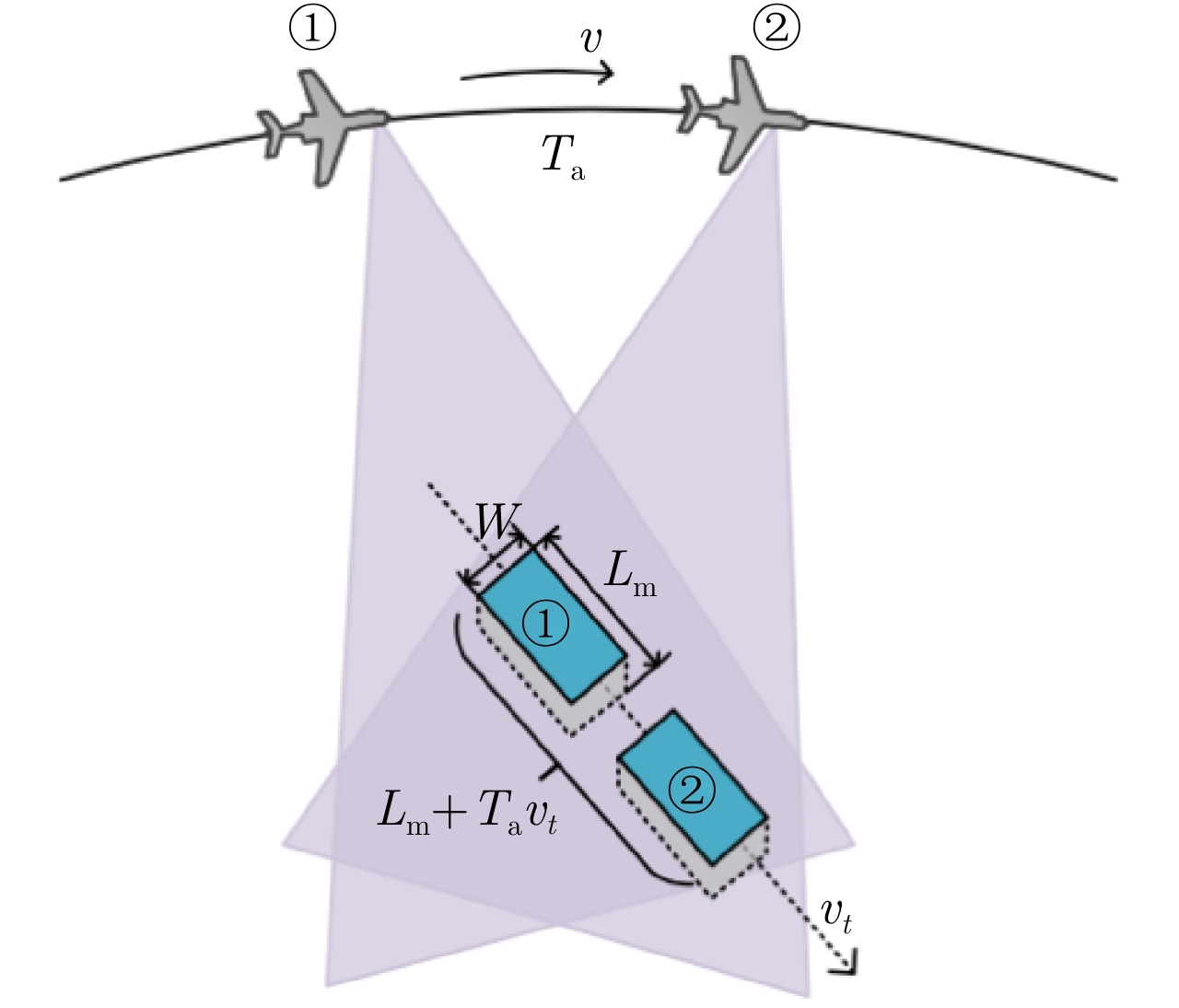
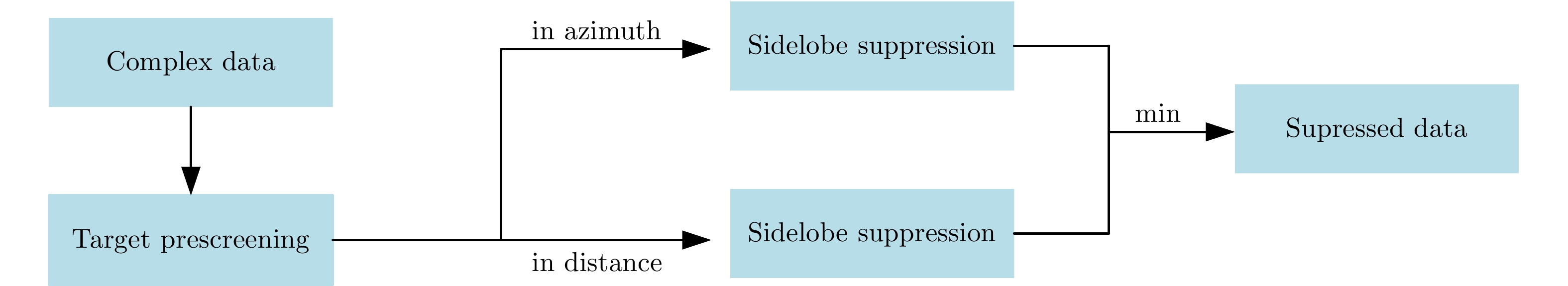
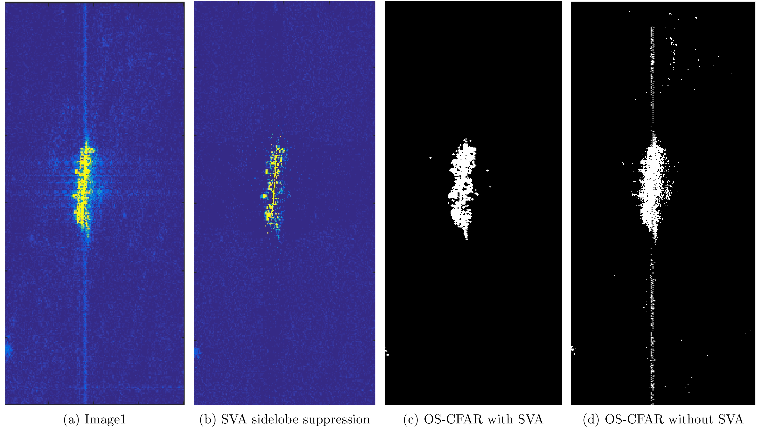
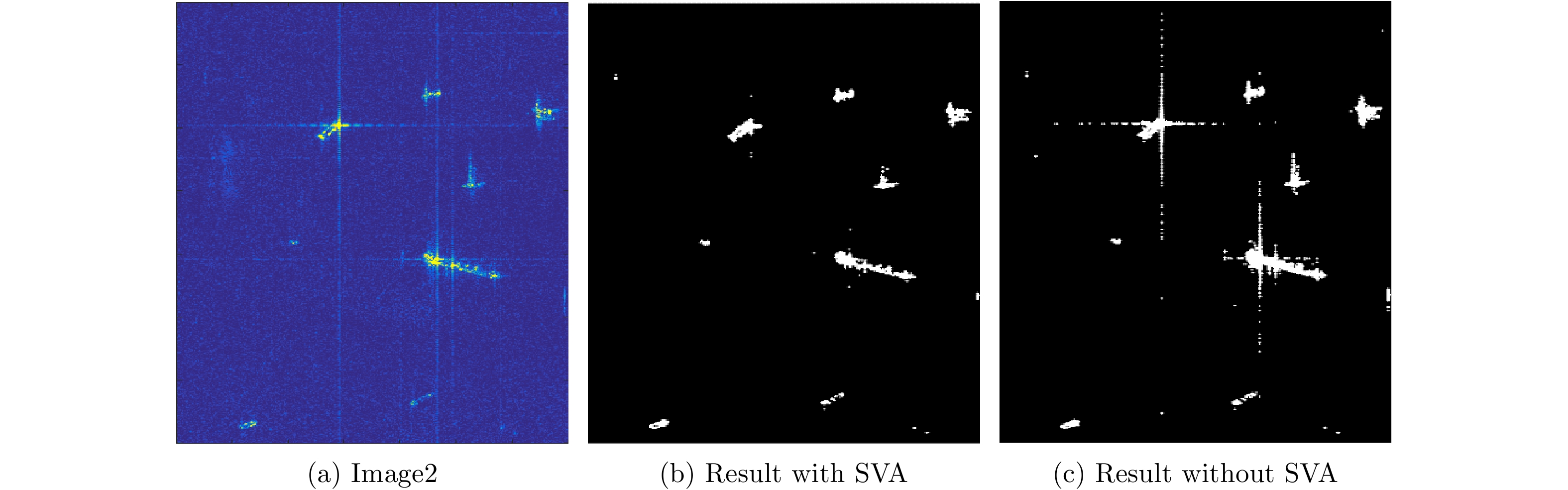
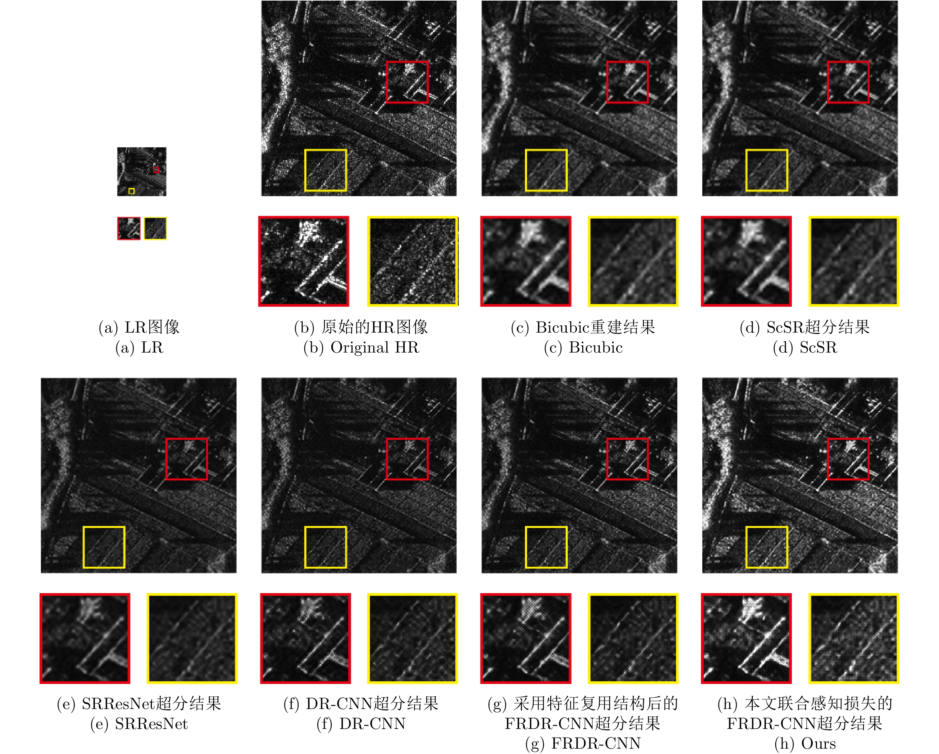
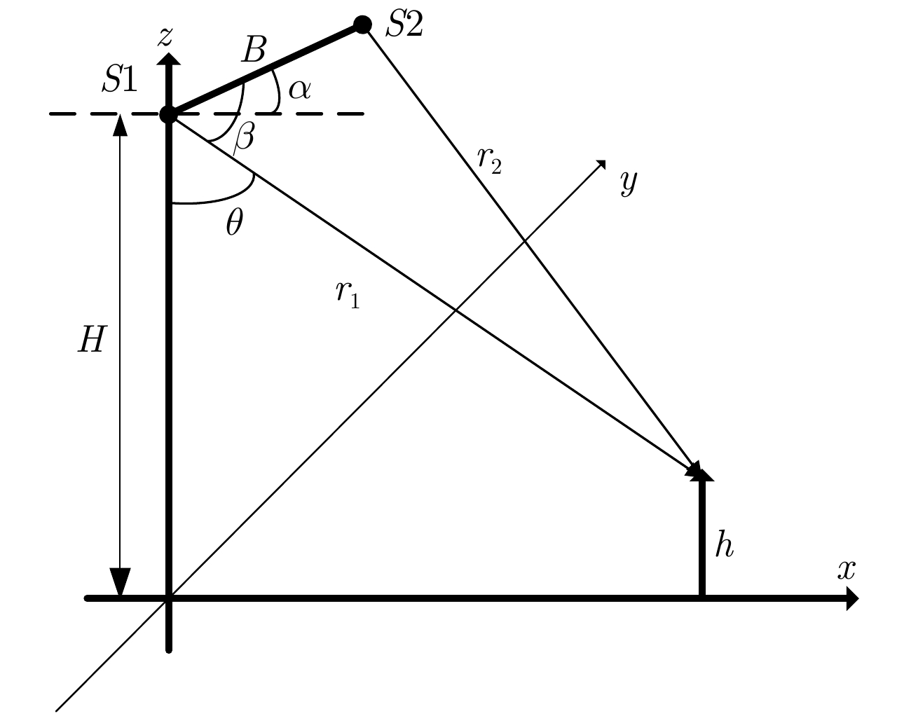
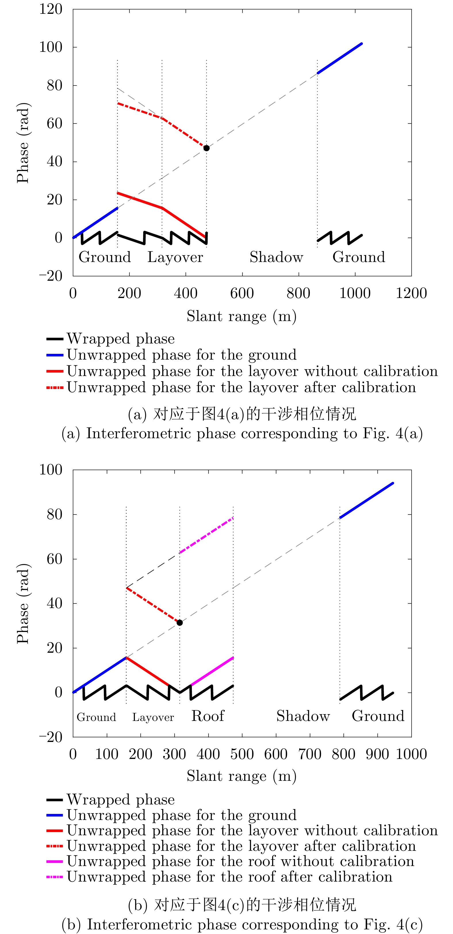
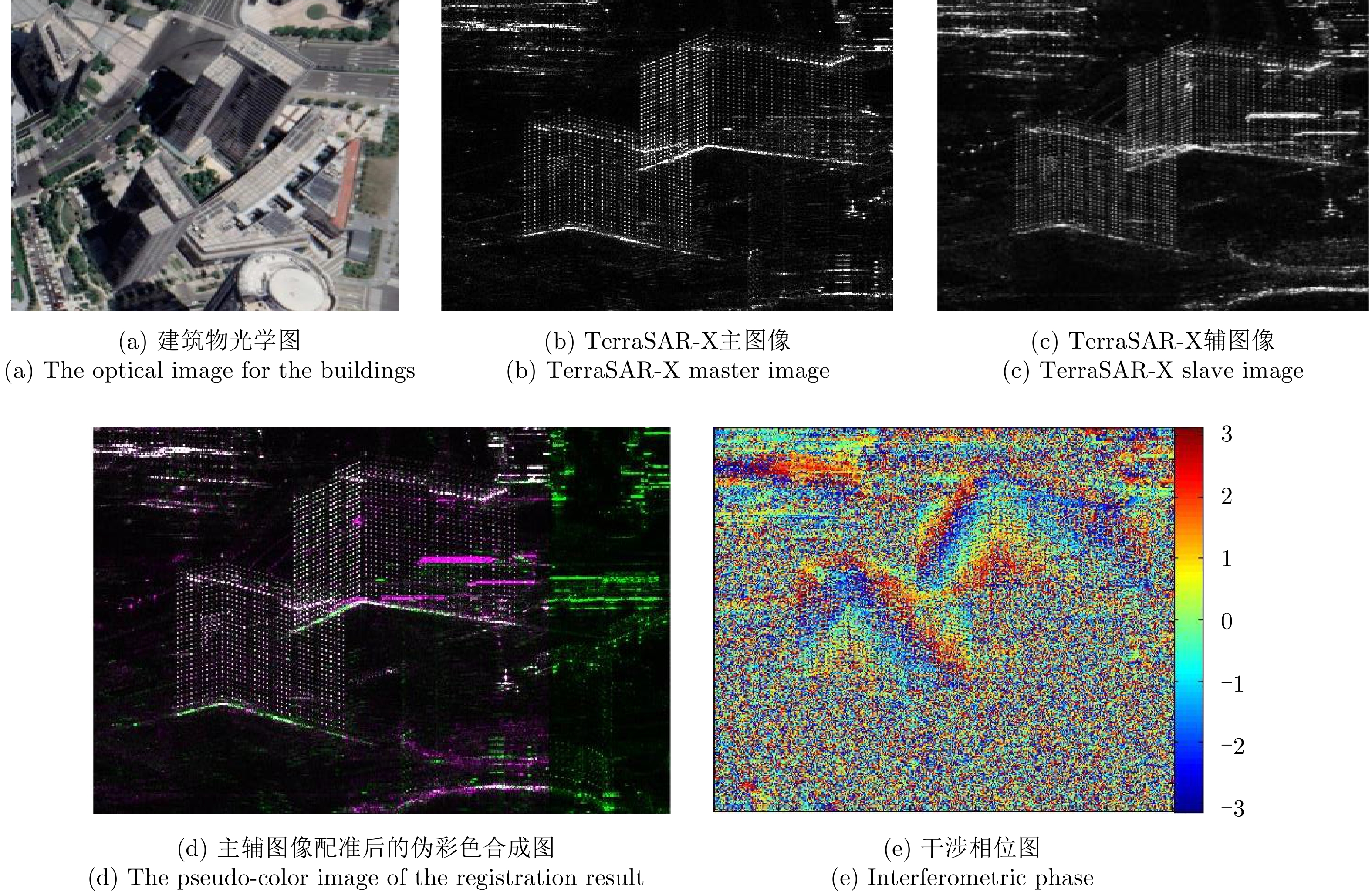
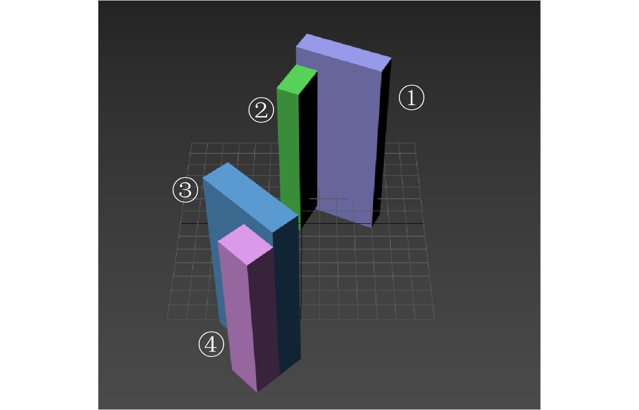
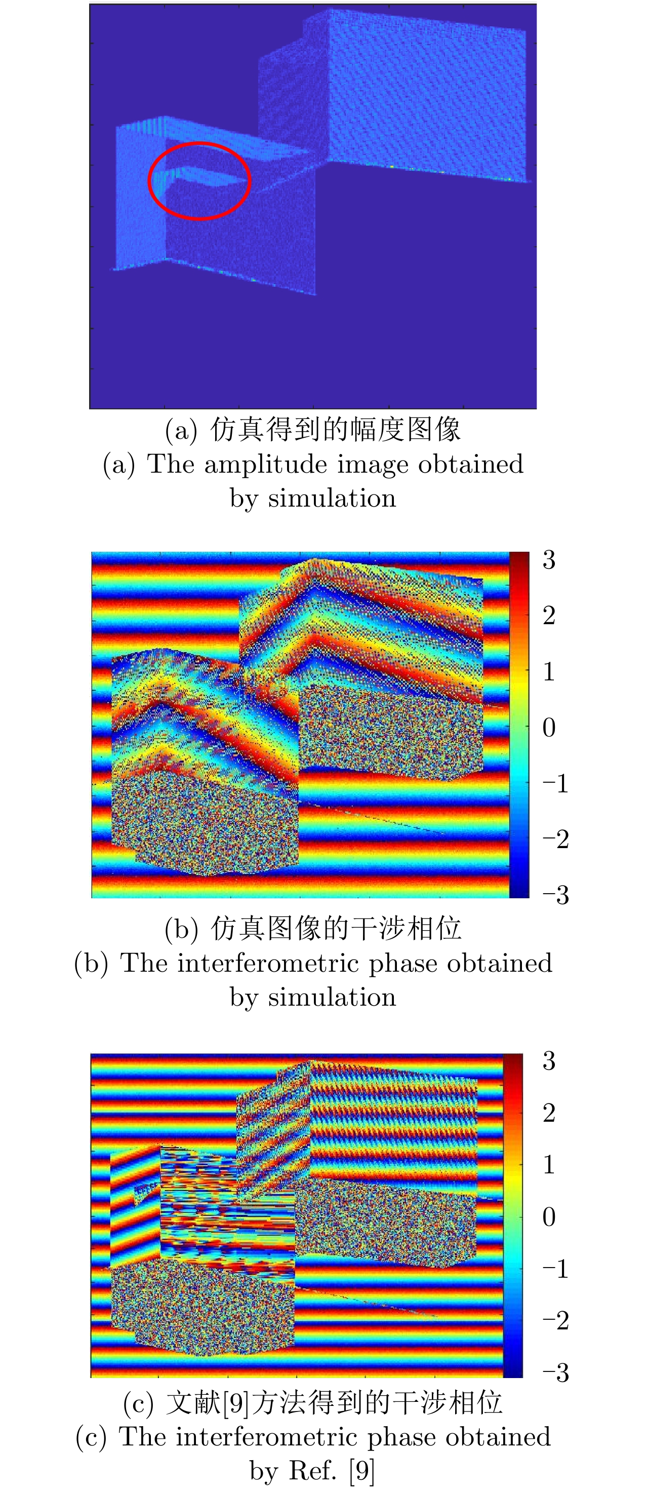
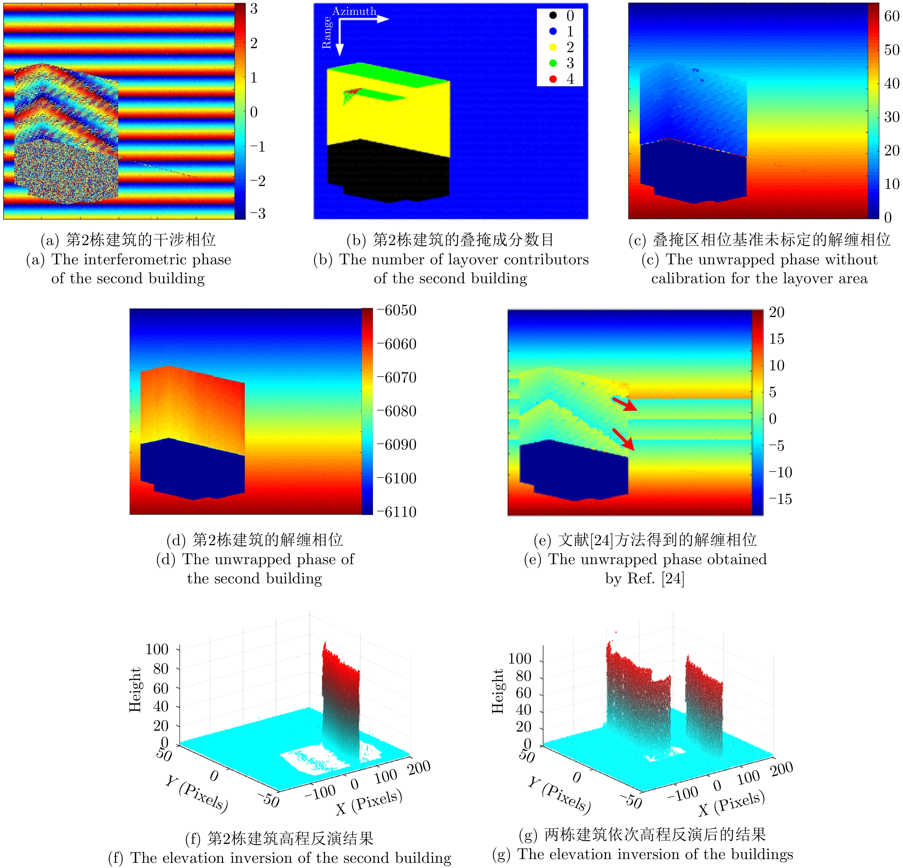
Multi-temporal Interferometric Synthetic Aperture Radar (MT-InSAR) is one of the most powerful Earth observation techniques, especially useful for measuring highly detailed ground deformation over large ground areas. Much research has been carried out to apply MT-InSAR to monitor ground and infrastructure deformation in urban areas related to land reclamation, underground construction and groundwater extraction. This paper reviews the progress in the research and identifies challenges in applying the technology, including the inconsistency in coherent point identification when different approaches are used, the reliability issue in parameter estimation, difficulty in accurate geolocation of measured points, the one-dimensional line-of-sight nature of InSAR measurements, the inability of making complete measurements over an area due to geometric distortions, especially the shadowing effects, the challenges in processing large SAR datasets, the decrease of the number of coherent points with the increase of the length of SAR time series, and the difficulty in quality control of MT-InSAR results.
Multi-temporal Interferometric Synthetic Aperture Radar (MT-InSAR) is one of the most powerful Earth observation techniques, especially useful for measuring highly detailed ground deformation over large ground areas. Much research has been carried out to apply MT-InSAR to monitor ground and infrastructure deformation in urban areas related to land reclamation, underground construction and groundwater extraction. This paper reviews the progress in the research and identifies challenges in applying the technology, including the inconsistency in coherent point identification when different approaches are used, the reliability issue in parameter estimation, difficulty in accurate geolocation of measured points, the one-dimensional line-of-sight nature of InSAR measurements, the inability of making complete measurements over an area due to geometric distortions, especially the shadowing effects, the challenges in processing large SAR datasets, the decrease of the number of coherent points with the increase of the length of SAR time series, and the difficulty in quality control of MT-InSAR results.


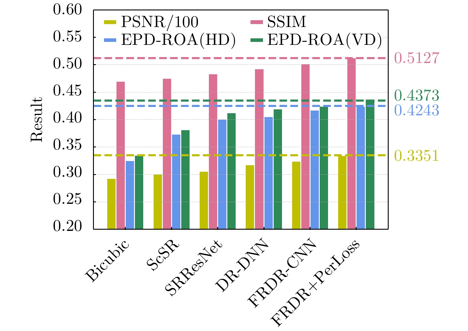


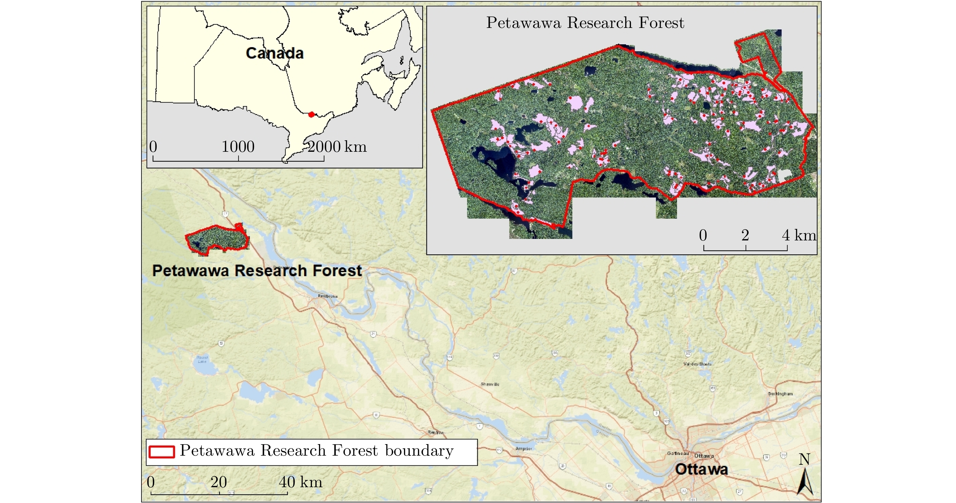
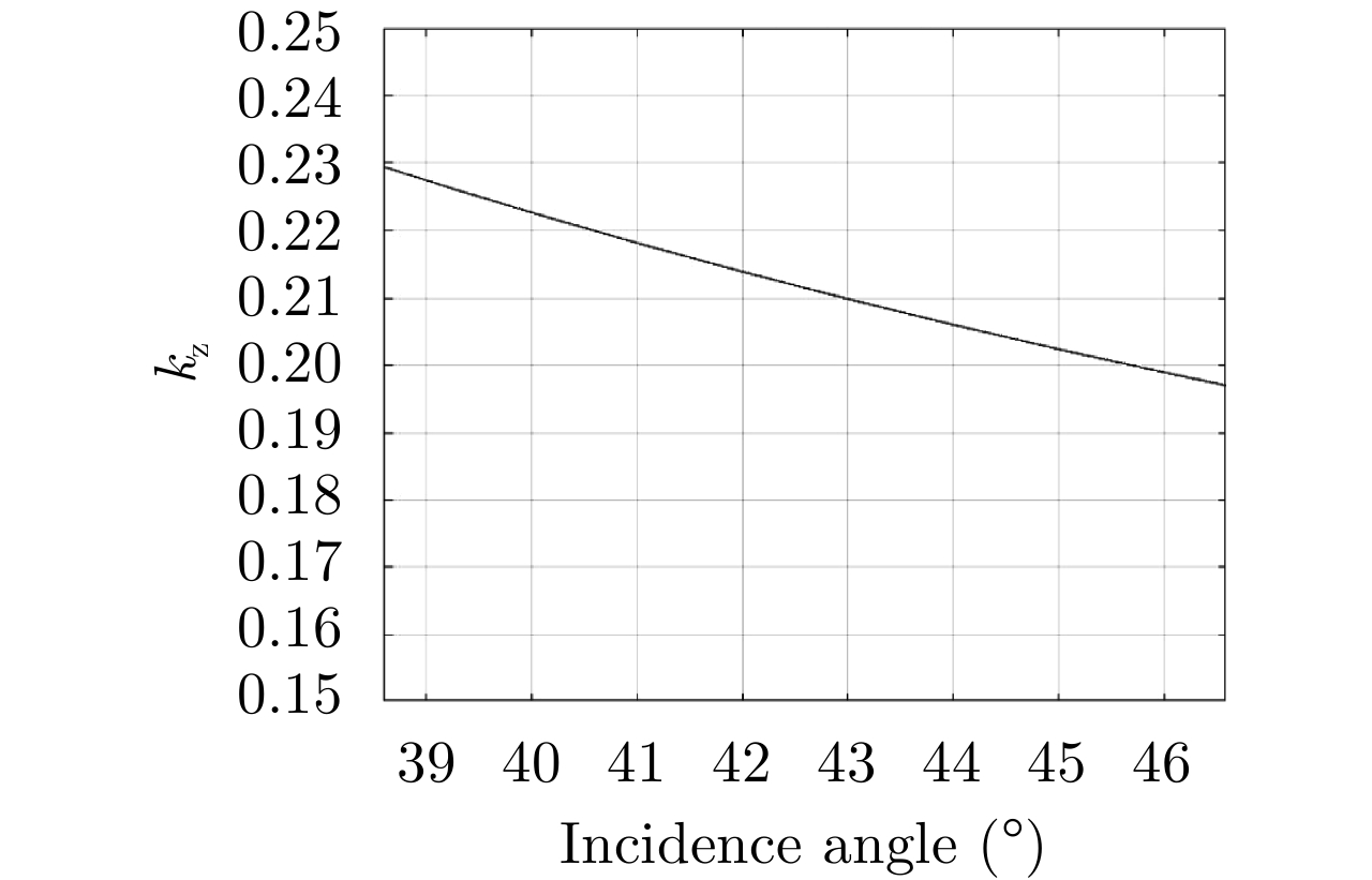
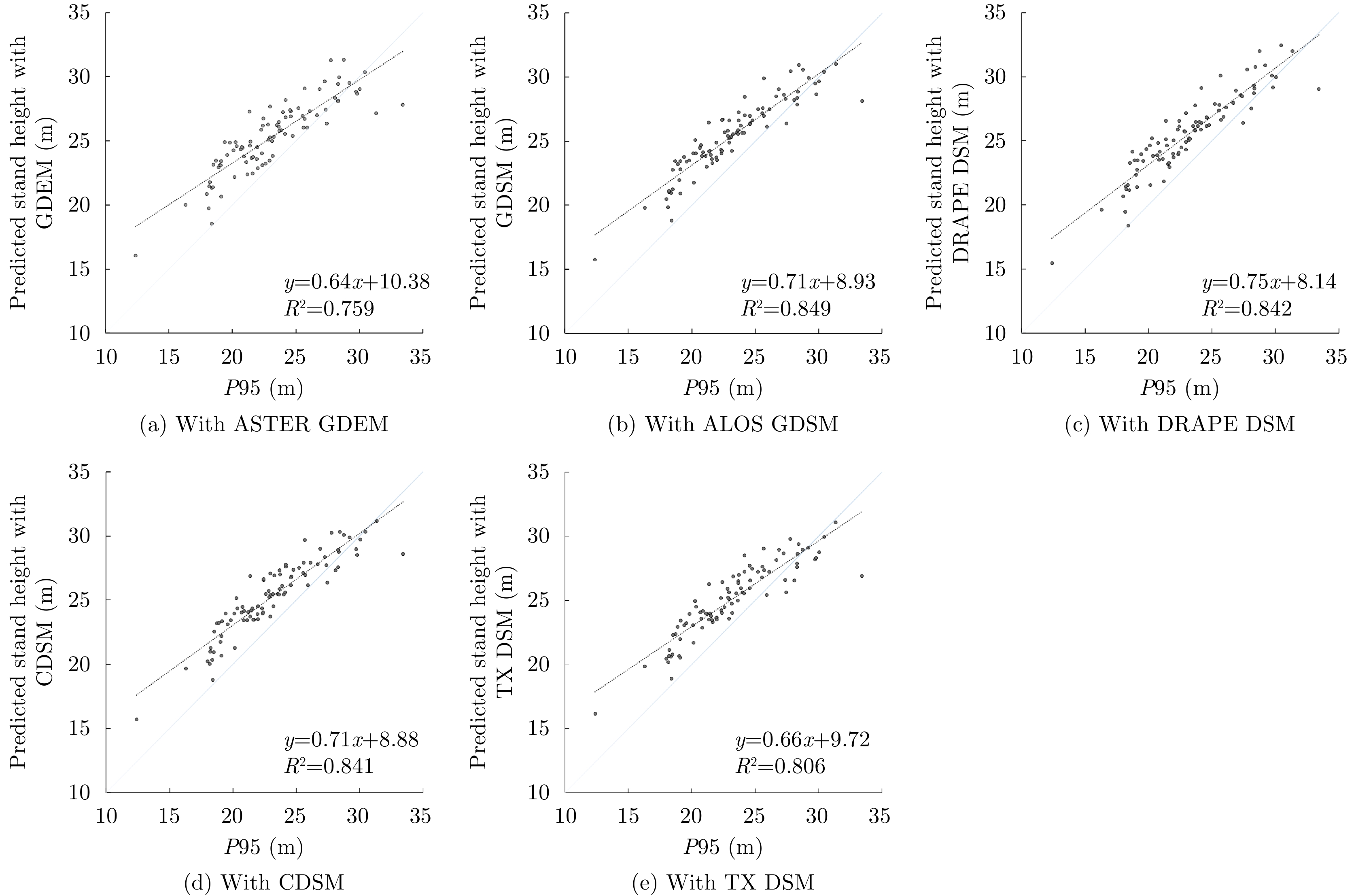
In our previous studies, we demonstrated the usefulness of TanDEM-X interferometric bistatic mode with single polarization to obtain forest heights for the purposes of large area mapping. A key feature of our approach has been the use of a simplified Random Volume Over Ground (RVOG) model that locally estimates forest height. The model takes TanDEM-X interferometric coherence amplitude as an input and uses an external Digital Surface Model (DSM) to account for local slope variations due to terrain topography in order to achieve accurate forest height estimation. The selection of DSM for use as a local slope reference is essential, as an inaccurate DSM will result in less accurate terrain-correction and forest height estimation. In this paper, we assessed TanDEM-X height estimates associated with scale variations in different DSMs used in the model over a remote sensing supersite in Petawawa, Canada. The DSMs used for assessments and comparisons included ASTER GDEM, ALOS GDSM, airborne DRAPE DSM, Canadian DSM and TanDEM-X DSM. Airborne Laser Scanning (ALS) data were used as reference for terrain slope and forest height comparisons. The results showed that, with the exception of the ASTER GDEM, all DSMs were sufficiently accurate for the simplified RVOG model to provide a satisfactory estimate of stand-level forest height. When compared to the ALS 95th height percentile, the modeled forest heights had R2 values greater than 80% and Root-Mean-Square Errors (RMSE) less than 2 m. For a close similarity in slope estimation with the ALS reference, coverage across Canada and open data access, the 0.75 arc-second (20 m) resolution Canadian DSM was selected as a preferred choice for the simplified RVOG model to provide TanDEM-X height estimation in Canada.
In our previous studies, we demonstrated the usefulness of TanDEM-X interferometric bistatic mode with single polarization to obtain forest heights for the purposes of large area mapping. A key feature of our approach has been the use of a simplified Random Volume Over Ground (RVOG) model that locally estimates forest height. The model takes TanDEM-X interferometric coherence amplitude as an input and uses an external Digital Surface Model (DSM) to account for local slope variations due to terrain topography in order to achieve accurate forest height estimation. The selection of DSM for use as a local slope reference is essential, as an inaccurate DSM will result in less accurate terrain-correction and forest height estimation. In this paper, we assessed TanDEM-X height estimates associated with scale variations in different DSMs used in the model over a remote sensing supersite in Petawawa, Canada. The DSMs used for assessments and comparisons included ASTER GDEM, ALOS GDSM, airborne DRAPE DSM, Canadian DSM and TanDEM-X DSM. Airborne Laser Scanning (ALS) data were used as reference for terrain slope and forest height comparisons. The results showed that, with the exception of the ASTER GDEM, all DSMs were sufficiently accurate for the simplified RVOG model to provide a satisfactory estimate of stand-level forest height. When compared to the ALS 95th height percentile, the modeled forest heights had R2 values greater than 80% and Root-Mean-Square Errors (RMSE) less than 2 m. For a close similarity in slope estimation with the ALS reference, coverage across Canada and open data access, the 0.75 arc-second (20 m) resolution Canadian DSM was selected as a preferred choice for the simplified RVOG model to provide TanDEM-X height estimation in Canada.


 微信 | 公众平台

