
 Submit Manuscript
 Peer Review
 Editor Work
2020 Vol. 9, No. 1
 Previous Issue
2020, 9(1): 1-33.
 Abstract
 6396KB
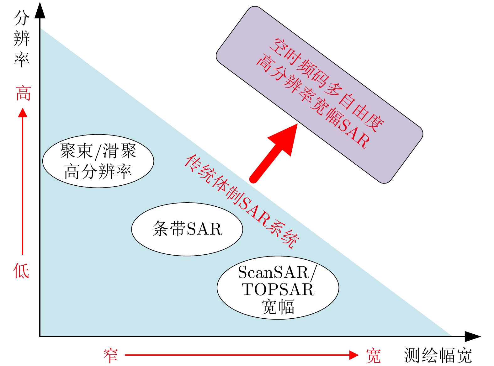
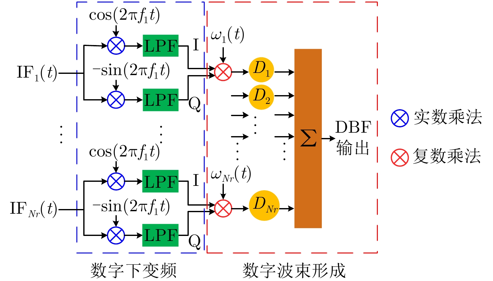
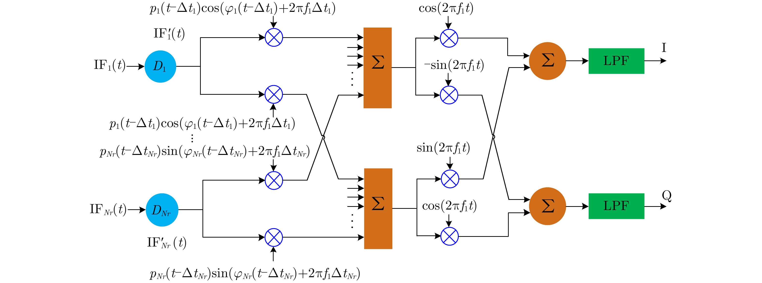
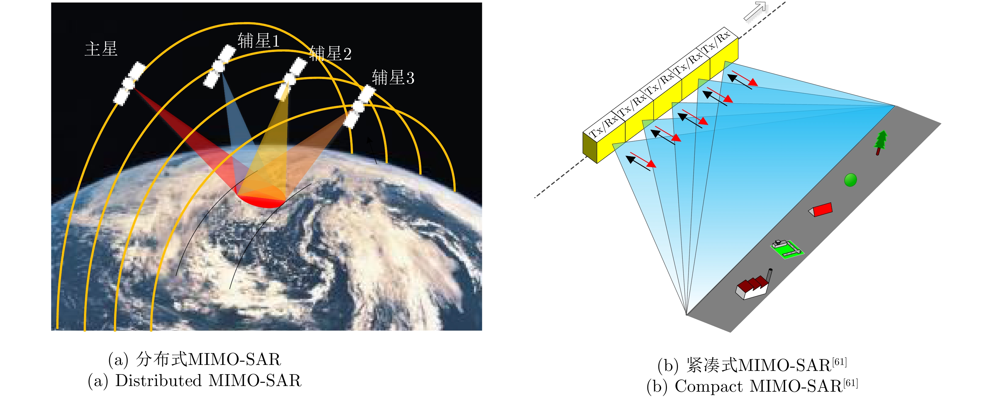
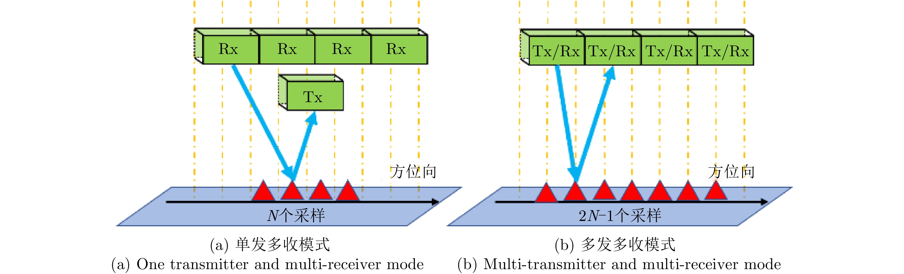
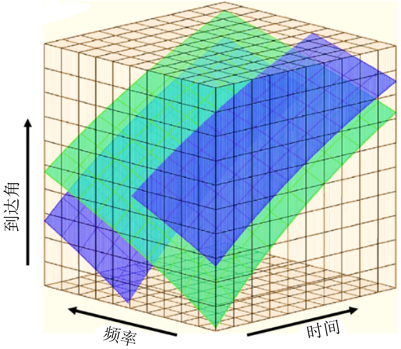
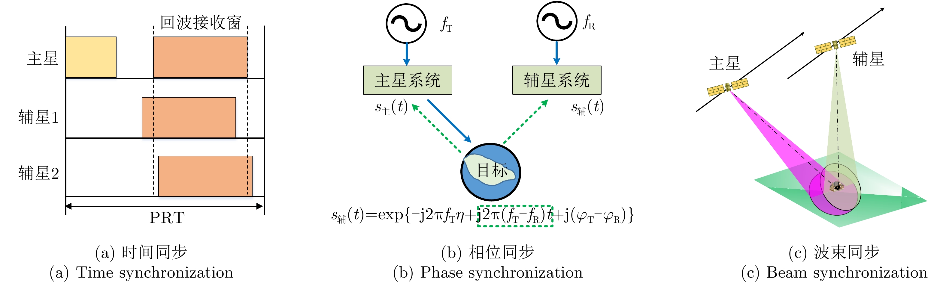
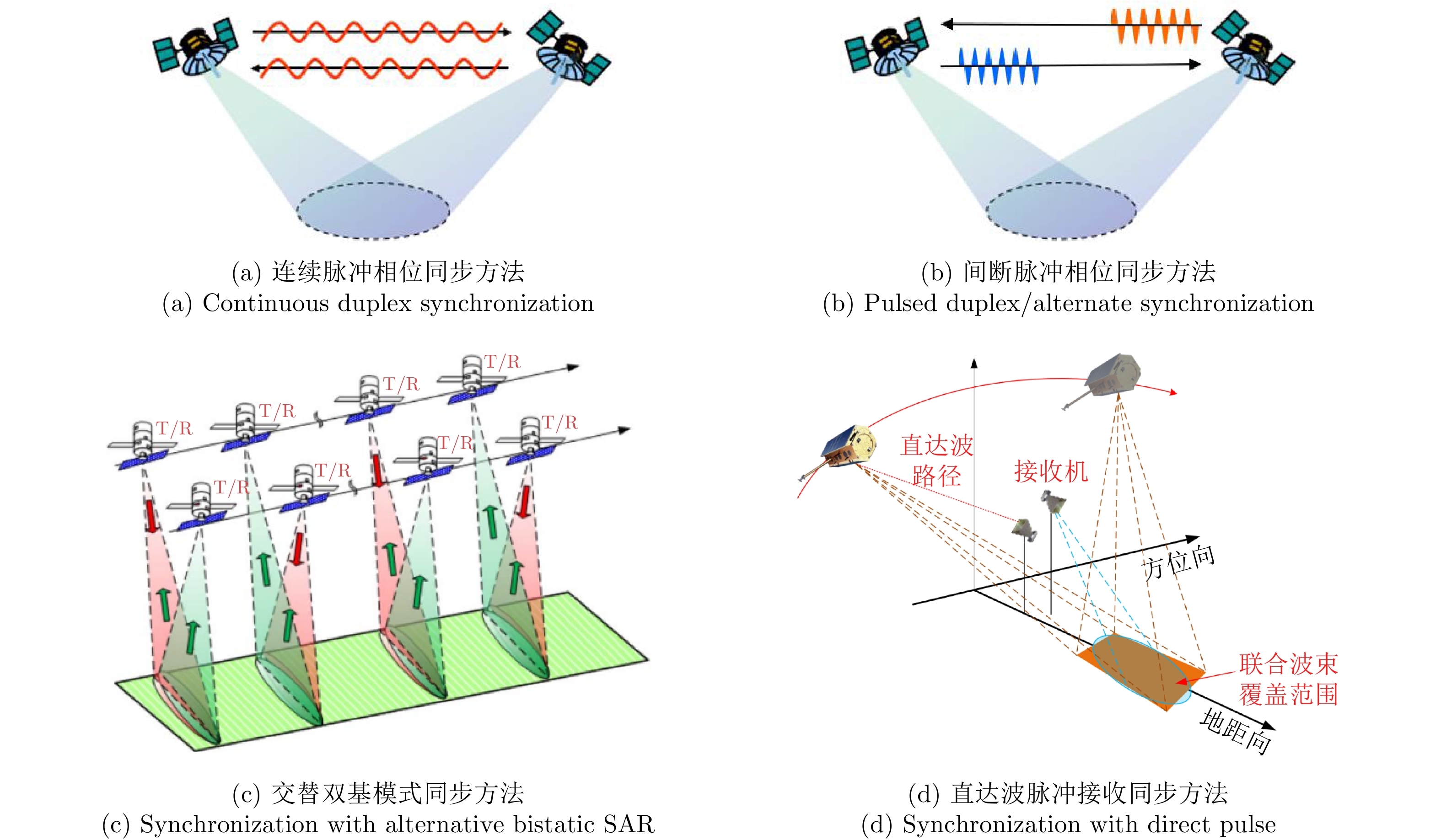
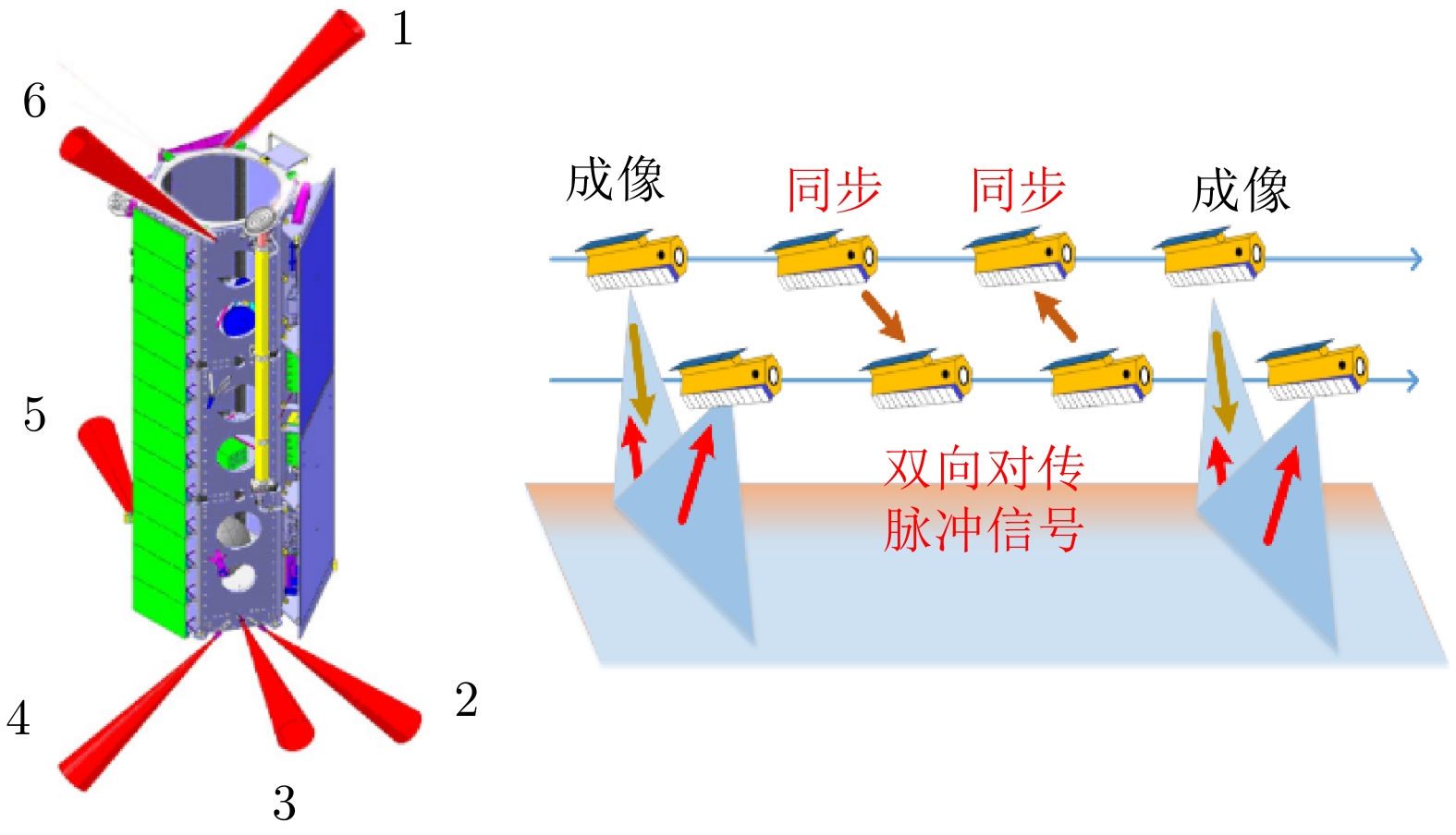
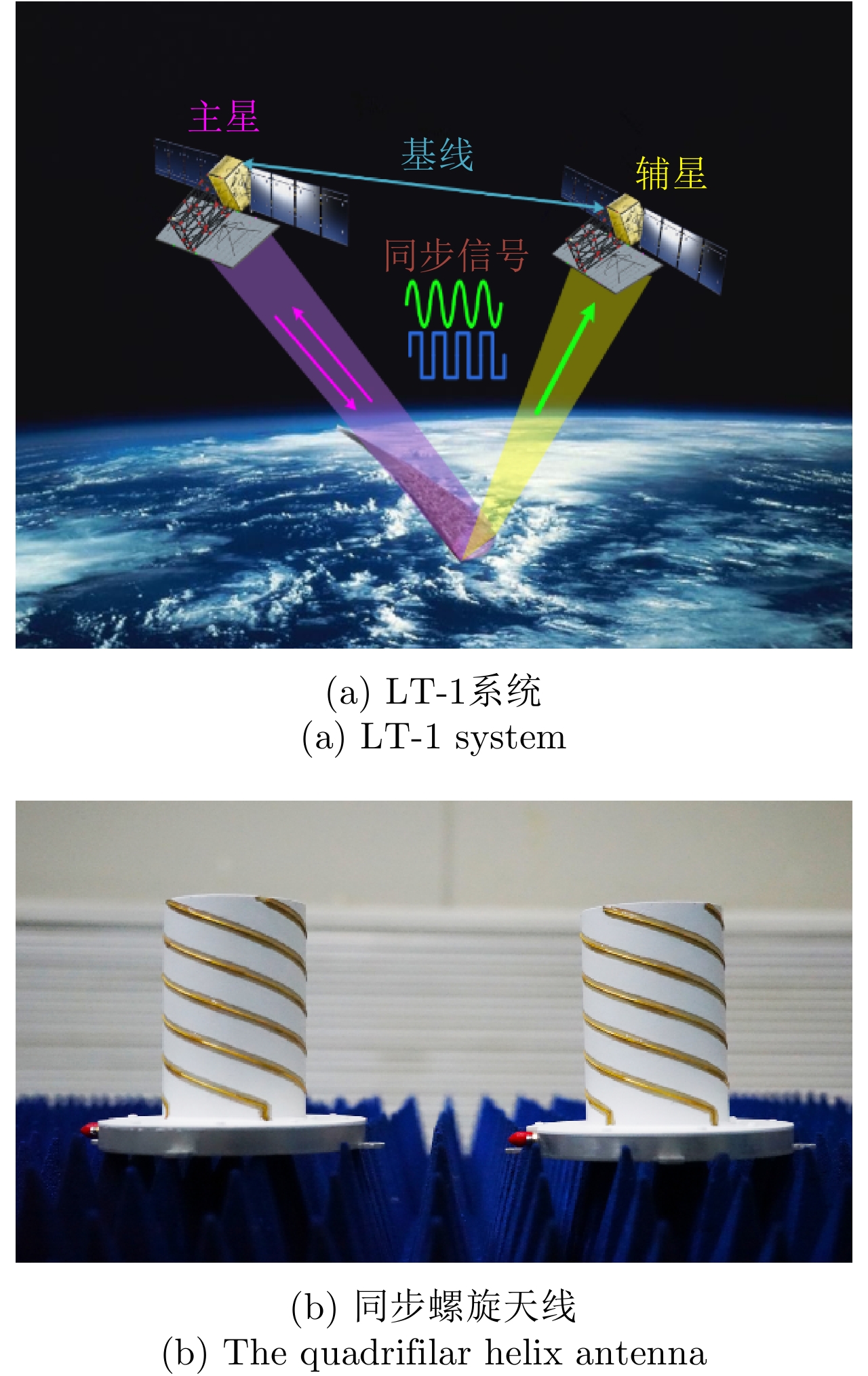
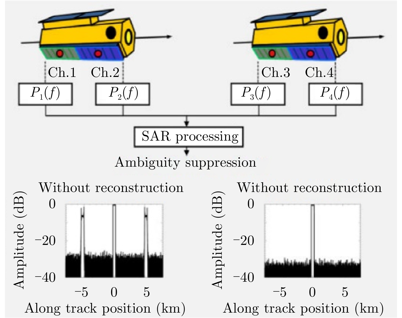
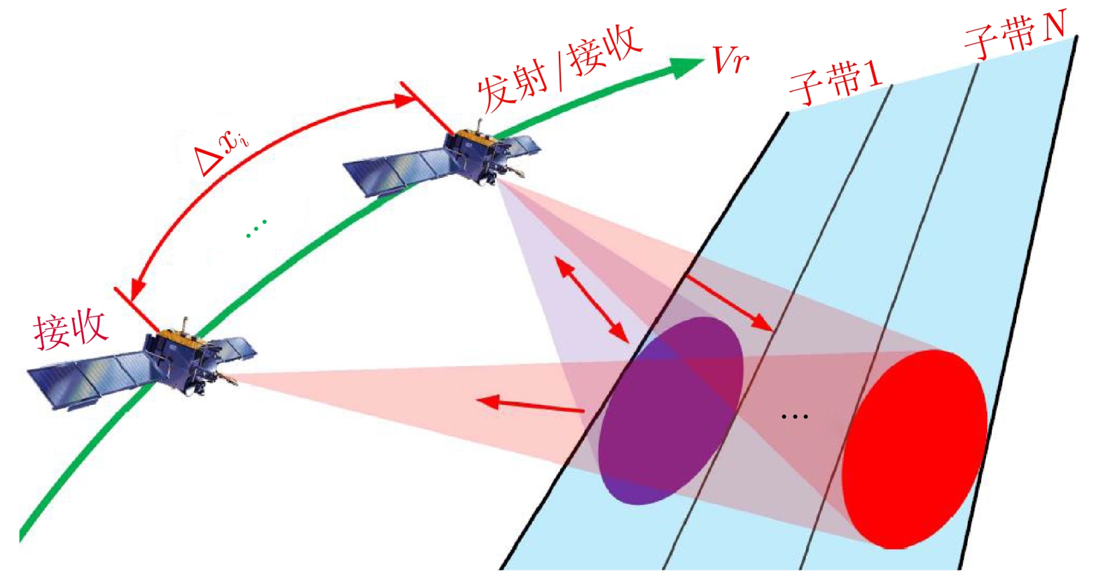
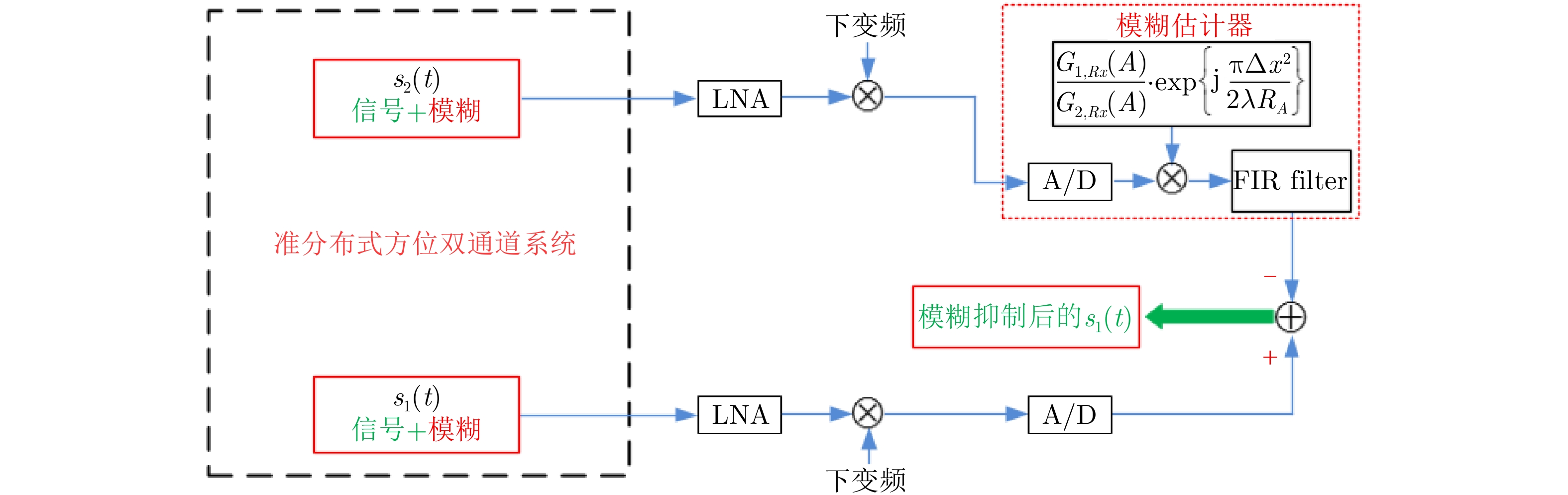
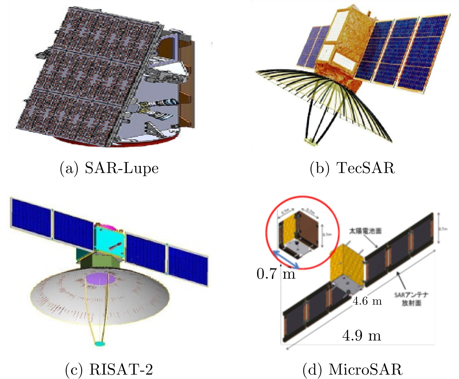
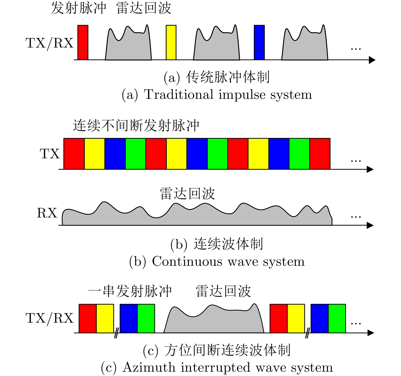
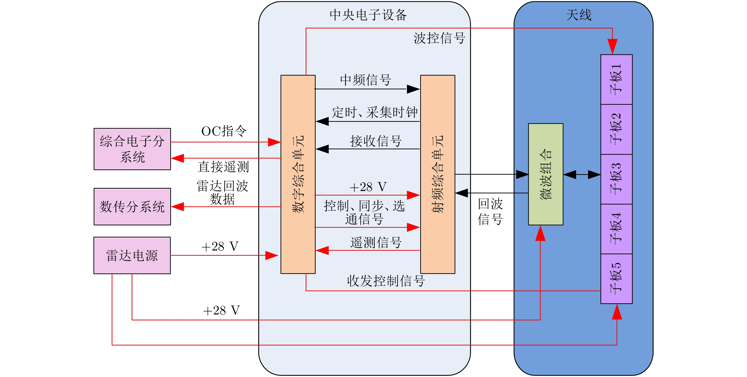
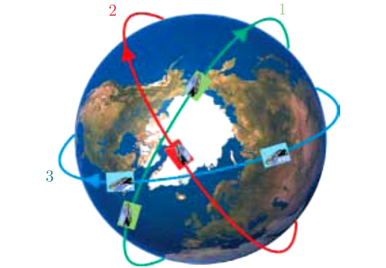
Spaceborne Synthetic Aperture Radar (SAR), which can be mounted on space vehicles to collect information of the entire planet with all-day and all-weather imaging capacity, has been an indispensable device for earth observation. Currently, the technology of our spaceborne SAR has achieved a considerable technological improvement, including the resolution change from meter to submeter, the imaging mode from stripmap to azimuth beam steering like the sliding spotlight, the practical application of the multichannel approach and the conversion of single polarization into full polarization. With the development of SAR techniques, forthcoming SAR will make breakthroughs in SAR architectures, concepts, technologies and modes, for example, high-resolution wide-swath imaging, multistatic SAR, payload miniaturization and intelligence. All of these will extend the observation dimensions and obtain multidimensional data. This study focuses on the forthcoming development of spaceborne SAR.
Spaceborne Synthetic Aperture Radar (SAR), which can be mounted on space vehicles to collect information of the entire planet with all-day and all-weather imaging capacity, has been an indispensable device for earth observation. Currently, the technology of our spaceborne SAR has achieved a considerable technological improvement, including the resolution change from meter to submeter, the imaging mode from stripmap to azimuth beam steering like the sliding spotlight, the practical application of the multichannel approach and the conversion of single polarization into full polarization. With the development of SAR techniques, forthcoming SAR will make breakthroughs in SAR architectures, concepts, technologies and modes, for example, high-resolution wide-swath imaging, multistatic SAR, payload miniaturization and intelligence. All of these will extend the observation dimensions and obtain multidimensional data. This study focuses on the forthcoming development of spaceborne SAR.


2020, 9(1): 34-54.
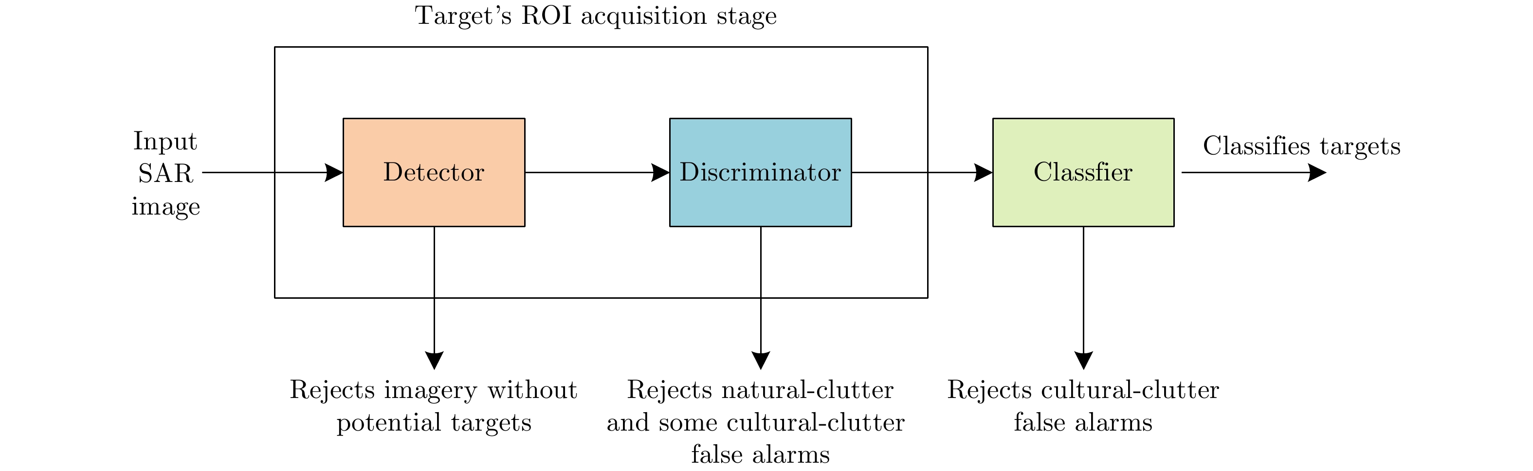
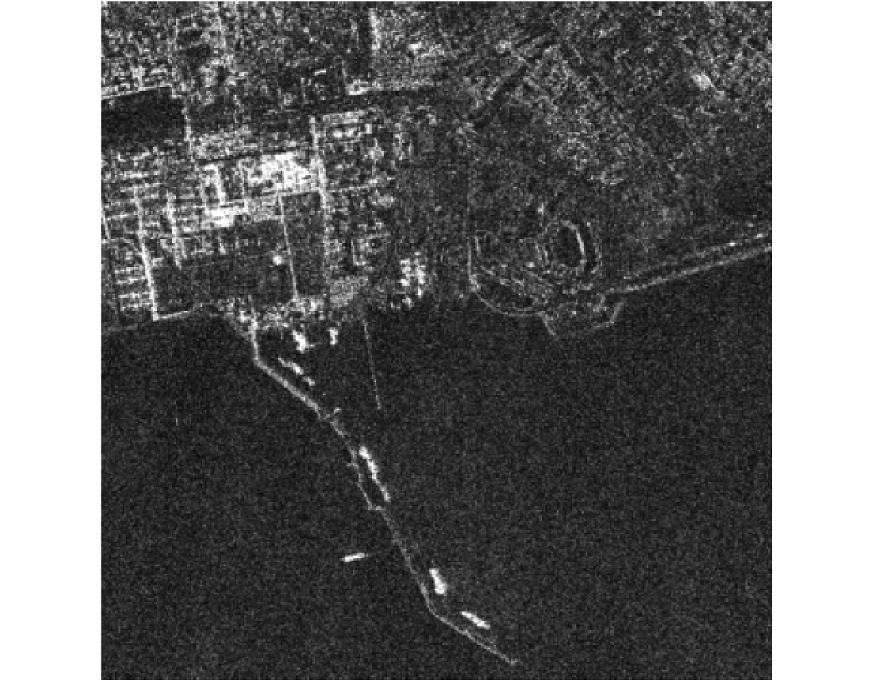
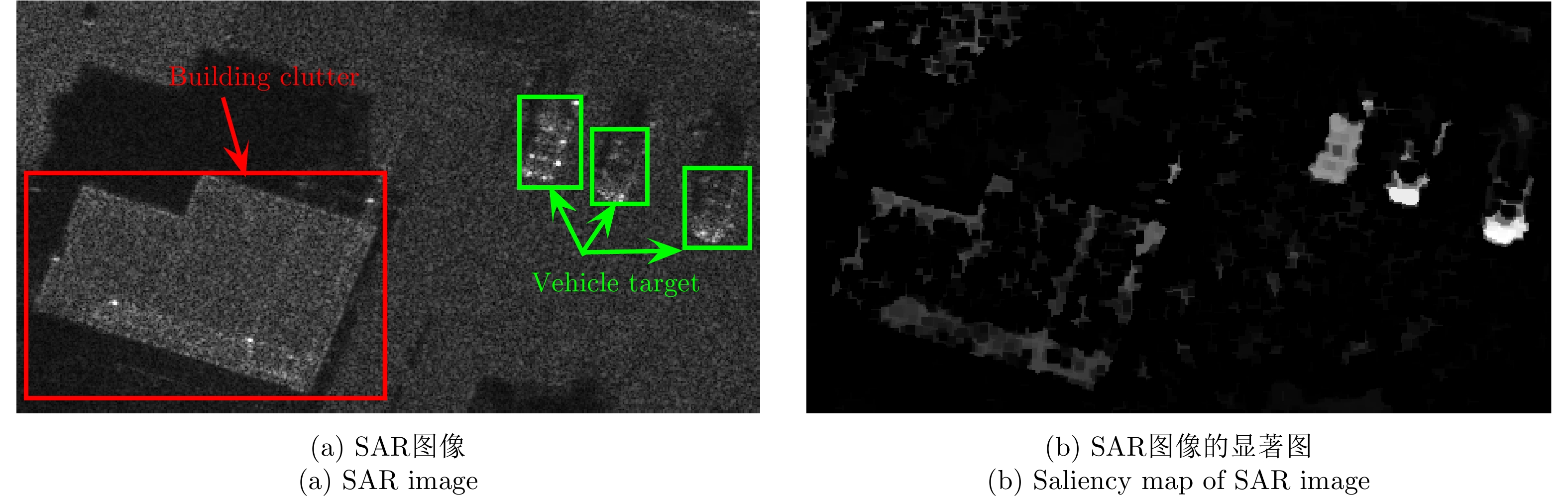
As an active microwave imaging sensor, Synthetic Aperture Radar (SAR) has become one of the main means of Earth observation owing to its unique technical advantages of all-day, all-weather operation and long working distance. As such, it plays a very important role in military and civilian fields. With the development of SAR remote-sensing technology, high-resolution, high-quality SAR images are produced continuously. However, manual detection and recognition of targets of interest is time-consuming and laborious, so the development of Automatic Target Recognition (ATR) technology is a matter of urgency. The typical SAR ATR system primarily comprises three stages: detection, discrimination, and classification/recognition. The detection and discrimination stages are the basis of the SAR ATR system, and research on SAR applications in the radar field has been conducted by researchers around the world. For single-channel SAR images, target detection and discrimination from simple scenes yield good results. However, in complex scenes, the clutter scattering intensity is relatively high, the clutter background is heterogenous, the target scattering intensity is relatively weak, and the target distribution is dense. These factors continue to make accurate SAR target detection and discrimination difficult. In this paper, we summarize the recent research progress on single-channel SAR target detection and discrimination methods for complex scenes, analyze the characteristics and problems associated with various methods, and consider the future development trend of single-channel SAR target detection and discrimination methods for complex scenes.
As an active microwave imaging sensor, Synthetic Aperture Radar (SAR) has become one of the main means of Earth observation owing to its unique technical advantages of all-day, all-weather operation and long working distance. As such, it plays a very important role in military and civilian fields. With the development of SAR remote-sensing technology, high-resolution, high-quality SAR images are produced continuously. However, manual detection and recognition of targets of interest is time-consuming and laborious, so the development of Automatic Target Recognition (ATR) technology is a matter of urgency. The typical SAR ATR system primarily comprises three stages: detection, discrimination, and classification/recognition. The detection and discrimination stages are the basis of the SAR ATR system, and research on SAR applications in the radar field has been conducted by researchers around the world. For single-channel SAR images, target detection and discrimination from simple scenes yield good results. However, in complex scenes, the clutter scattering intensity is relatively high, the clutter background is heterogenous, the target scattering intensity is relatively weak, and the target distribution is dense. These factors continue to make accurate SAR target detection and discrimination difficult. In this paper, we summarize the recent research progress on single-channel SAR target detection and discrimination methods for complex scenes, analyze the characteristics and problems associated with various methods, and consider the future development trend of single-channel SAR target detection and discrimination methods for complex scenes.


2020, 9(1): 55-72.
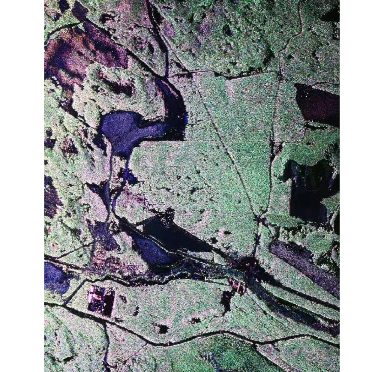
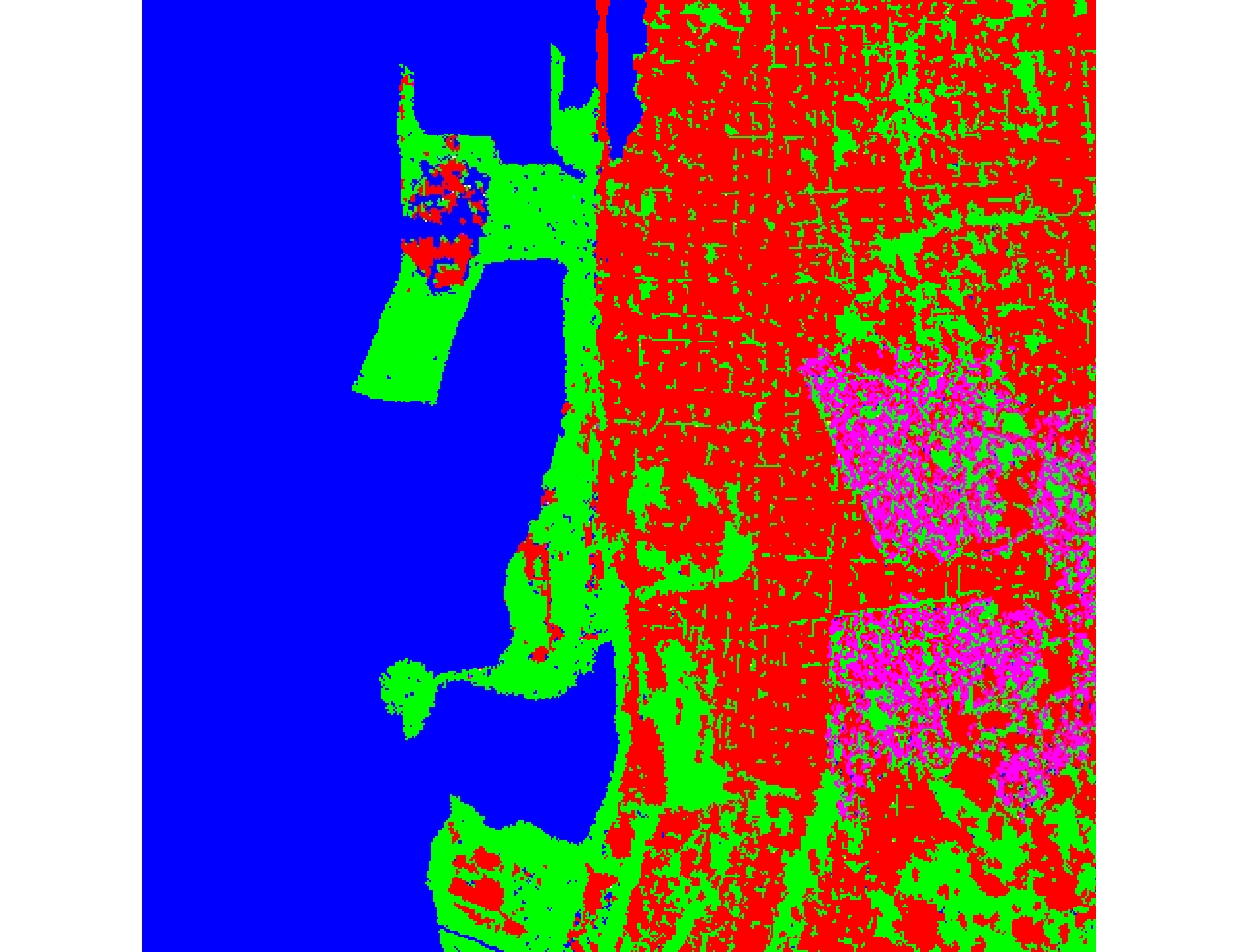
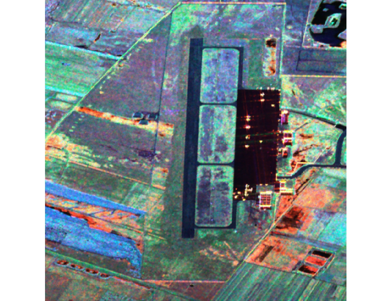
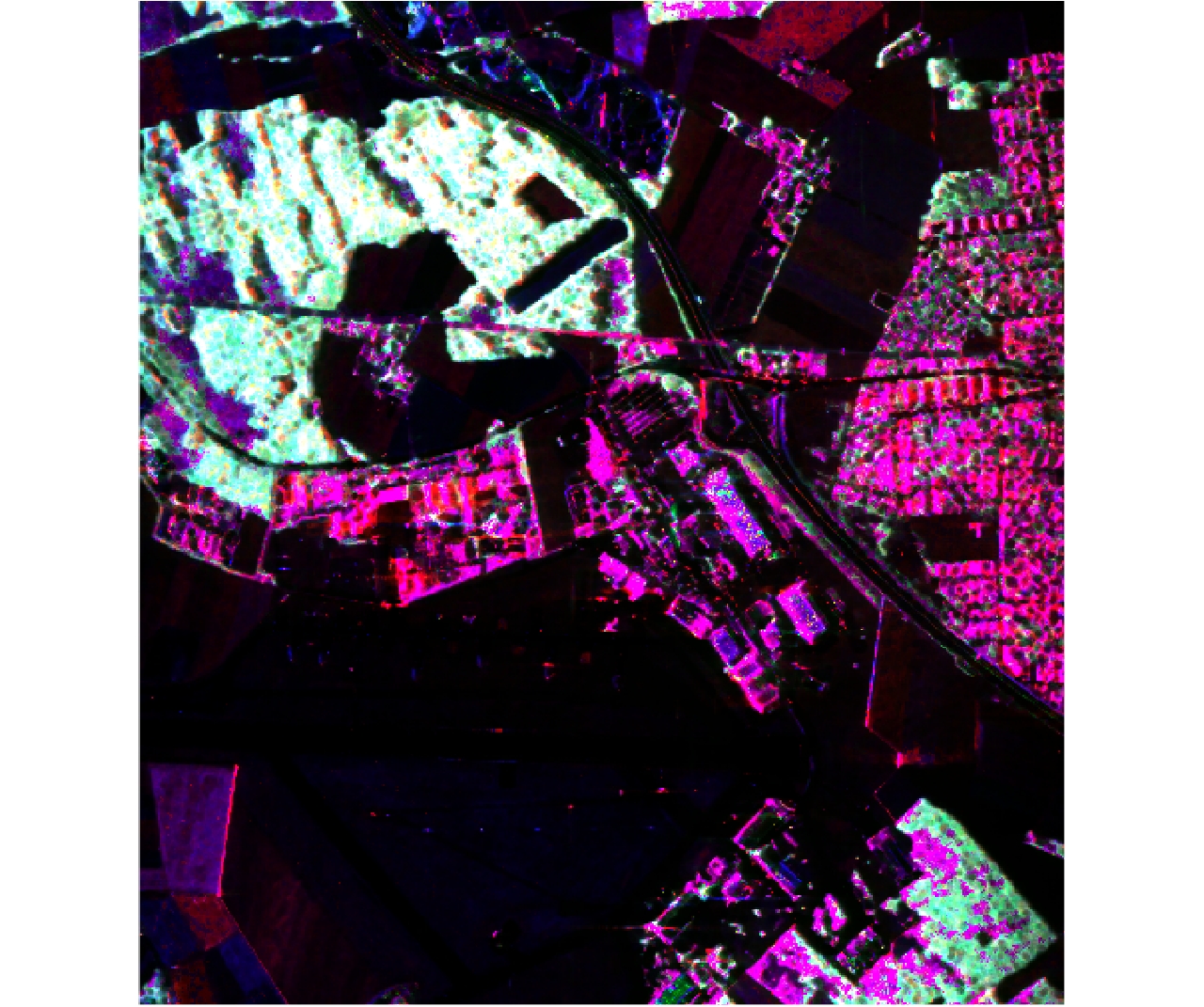
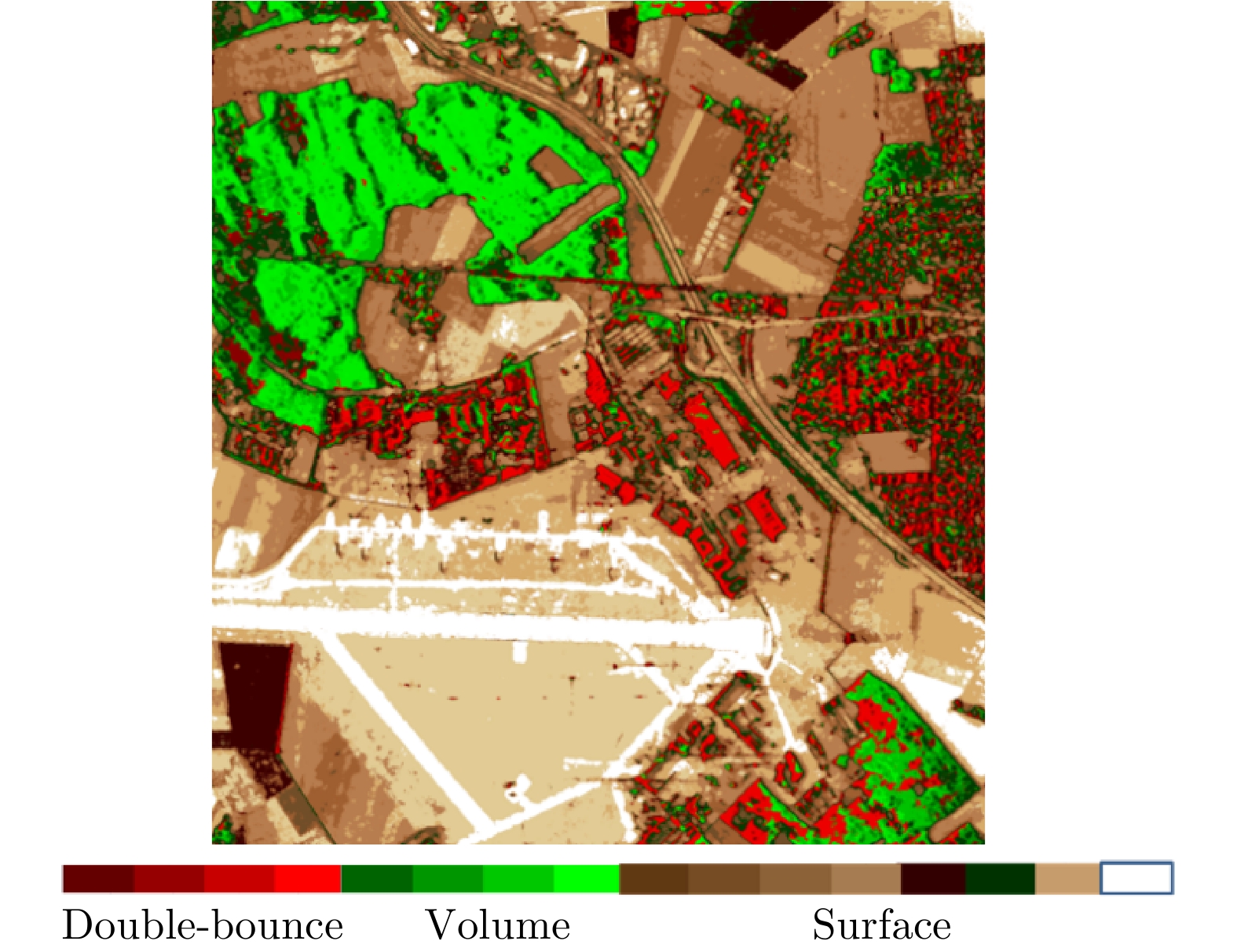
Polarimetric information enriches the content of a Synthetic Aperture Radar (SAR) and has been widely used in agriculture, environment, ocean, forest, military, and other fields. However, it also faces limitations regarding its low resolution and small width, which lead to high application cost. As a novel polarimetric SAR system that can simultaneously obtain relatively rich scatter information and large swath, Compact Polarimetric SAR (CP SAR) has attracted extensive attention from researchers in the past decade. With the successful launch of India’s RISAT-1 satellite, new progresses have been made in the application fields on CP SAR. In this paper, the classical data processing methods of CP SAR are briefly introduced and the main research results of the application of CP SAR in the agriculture and maritime fields over the past 10 years are summarized. Finally, the prospects on its development are given.
Polarimetric information enriches the content of a Synthetic Aperture Radar (SAR) and has been widely used in agriculture, environment, ocean, forest, military, and other fields. However, it also faces limitations regarding its low resolution and small width, which lead to high application cost. As a novel polarimetric SAR system that can simultaneously obtain relatively rich scatter information and large swath, Compact Polarimetric SAR (CP SAR) has attracted extensive attention from researchers in the past decade. With the successful launch of India’s RISAT-1 satellite, new progresses have been made in the application fields on CP SAR. In this paper, the classical data processing methods of CP SAR are briefly introduced and the main research results of the application of CP SAR in the agriculture and maritime fields over the past 10 years are summarized. Finally, the prospects on its development are given.
2020, 9(1): 73-85.
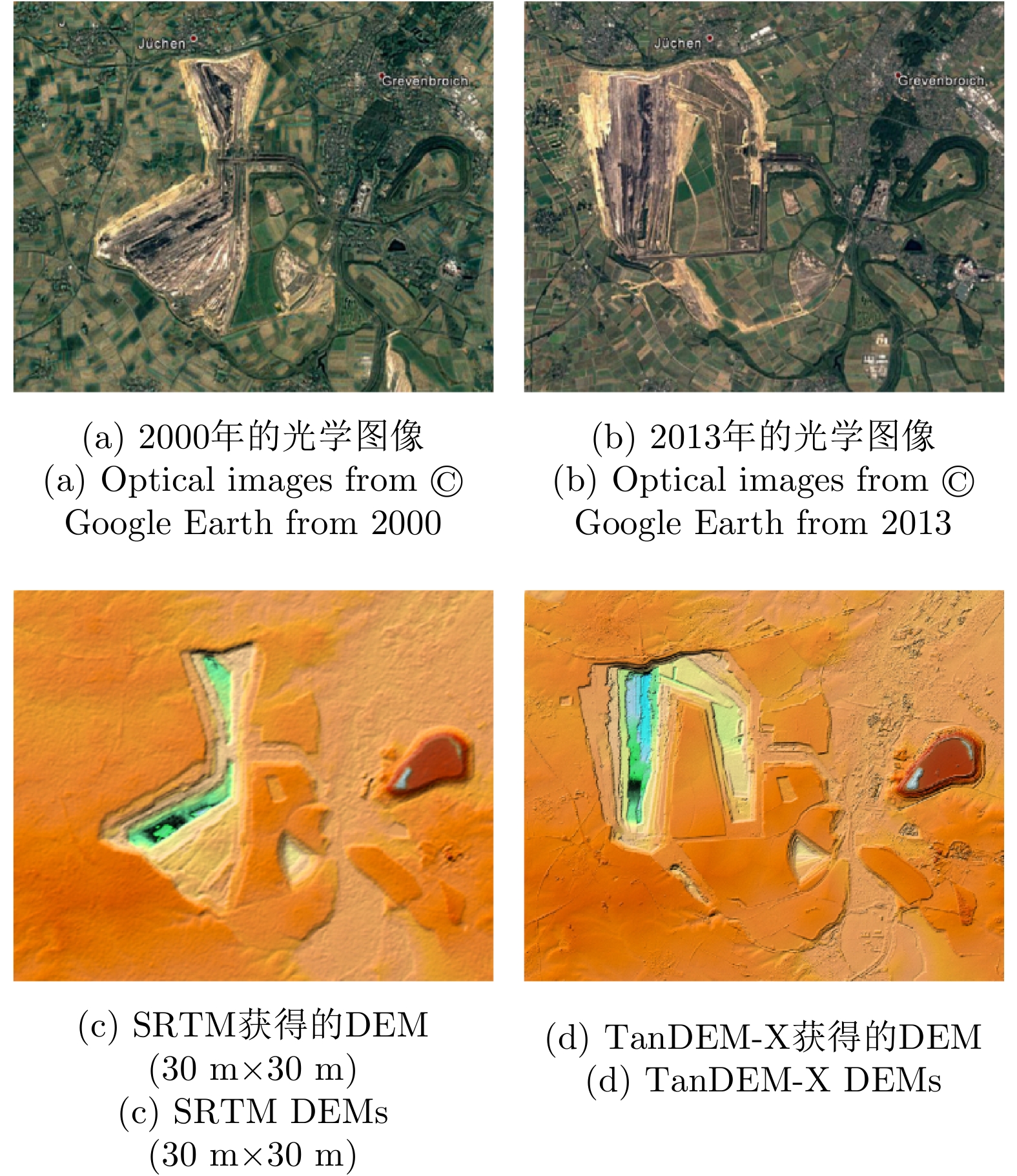
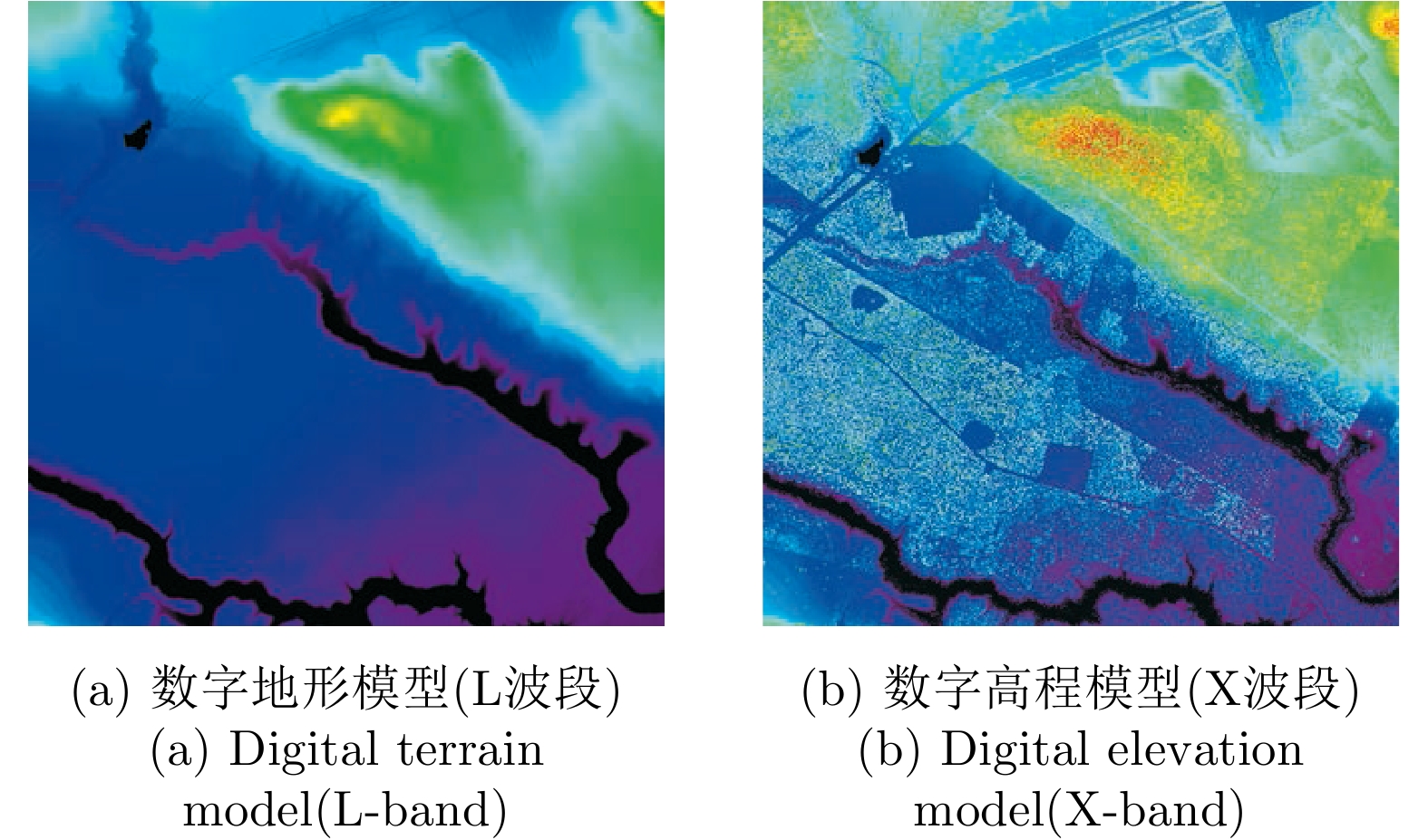
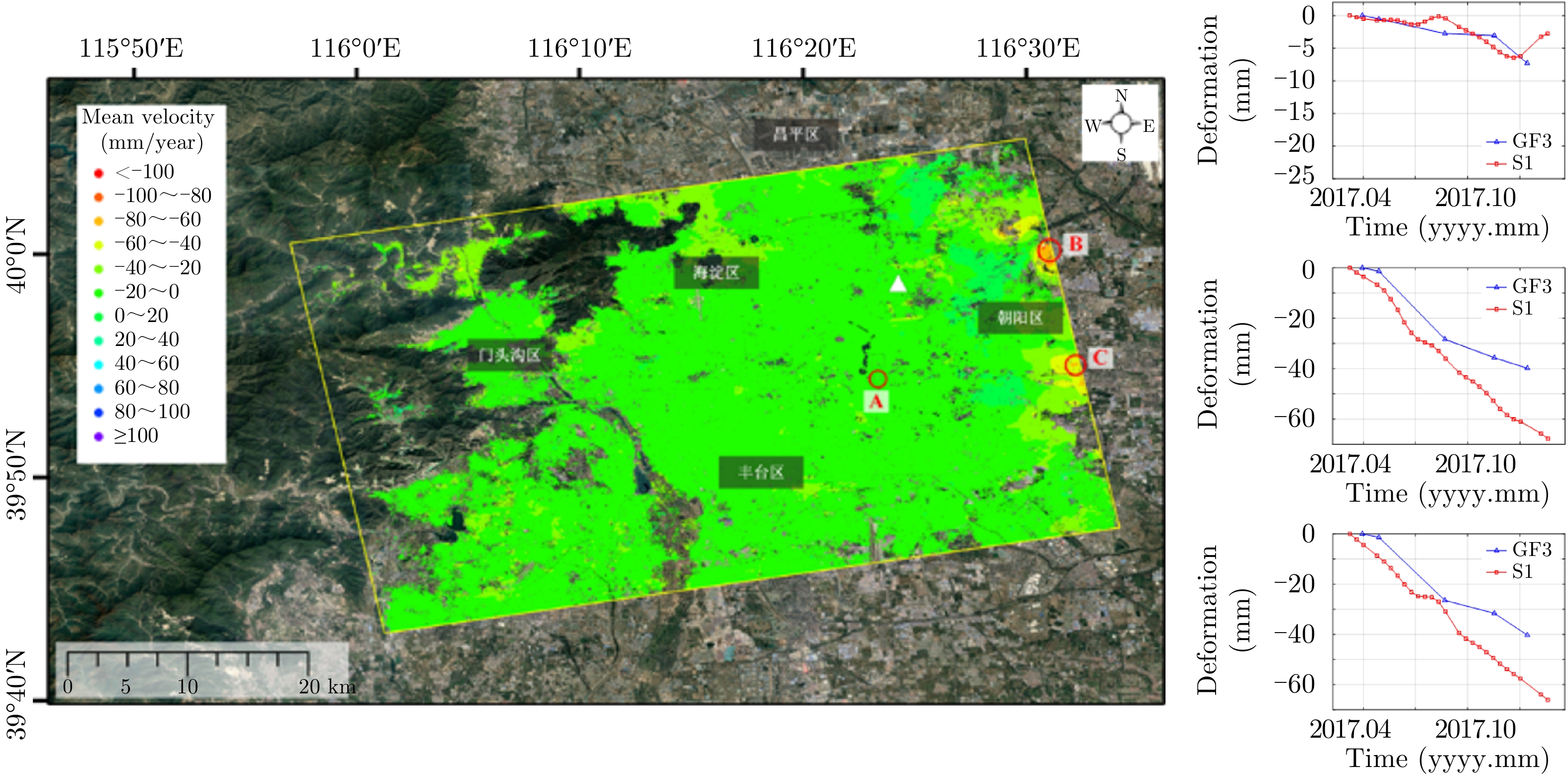
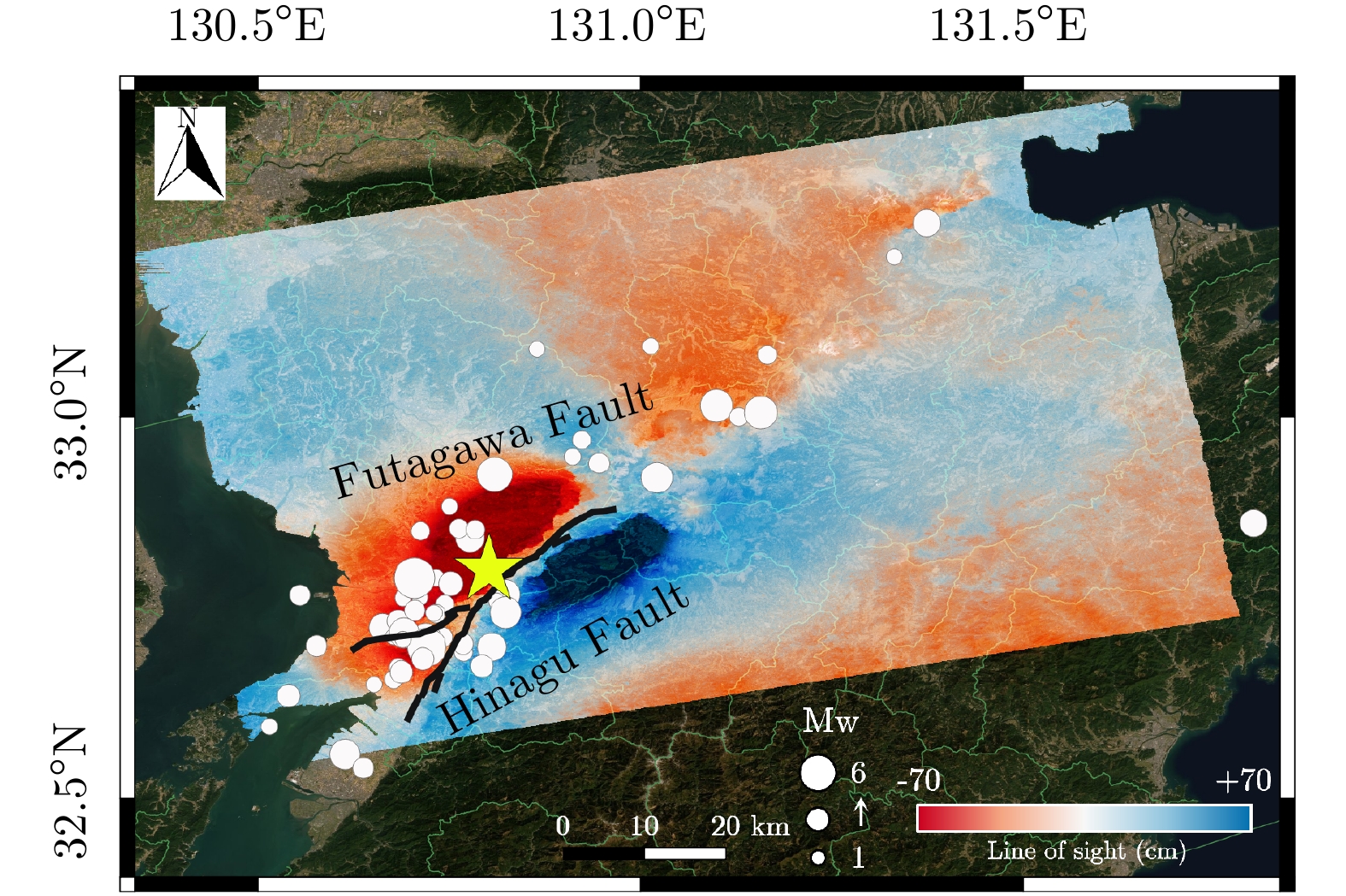
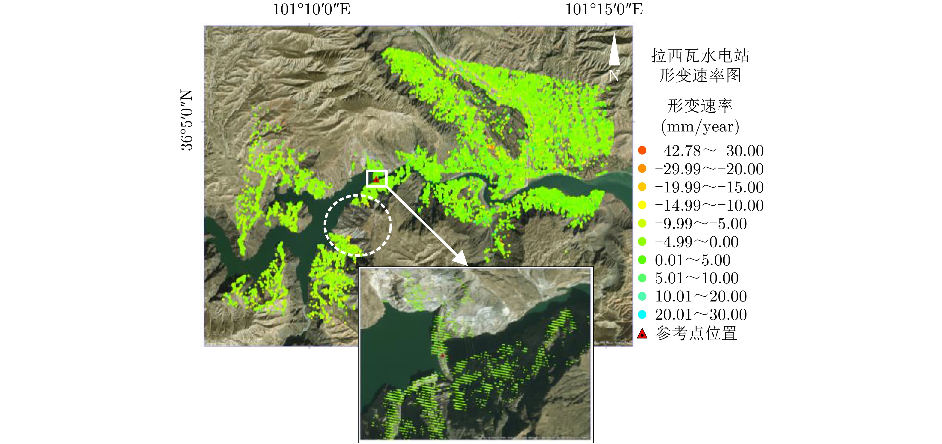
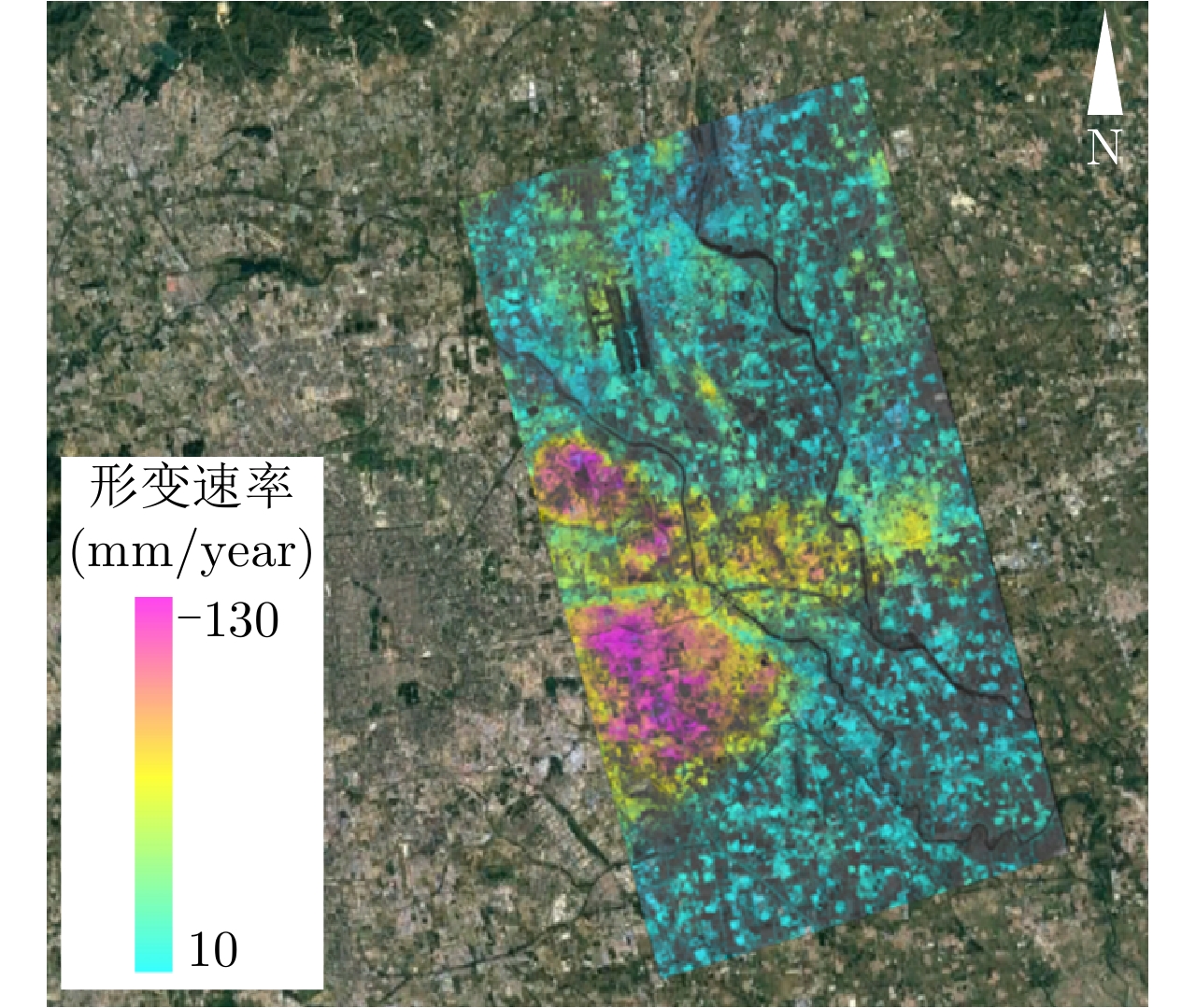
In recent years, spaceborne Interferometric Synthetic Aperture Radar (InSAR) technology has shown increasing application potential in the field of geohazard monitoring. In this article, we first introduce the principle of InSAR technology, then systematically review the development of InSAR technology and analyze the technical characteristics and applicable scope of methods such as differential InSAR and time-series InSAR. We then discuss the application status and development trend of InSAR technology in geohazard monitoring with respect to earthquakes, landslides, hydropower projects, and ground subsidence. Finally, to guide future work in the dynamic monitoring and prevention of geohazards, we summarize the key issues and scientific problems faced by the application of InSAR to geohazard monitoring, which include atmospheric correction, complex-area deformation data acquisition, and the acquisition of multidimensional deformation data. Judging from the current applications of geological hazard monitoring, this technology is now at the point of extensive application. With the development of future spaceborne SAR satellite systems and the driving force of industry application, InSAR technology will develop into a sophisticated high-precision ground observation technology that will have a huge impact on geological hazard monitoring.
In recent years, spaceborne Interferometric Synthetic Aperture Radar (InSAR) technology has shown increasing application potential in the field of geohazard monitoring. In this article, we first introduce the principle of InSAR technology, then systematically review the development of InSAR technology and analyze the technical characteristics and applicable scope of methods such as differential InSAR and time-series InSAR. We then discuss the application status and development trend of InSAR technology in geohazard monitoring with respect to earthquakes, landslides, hydropower projects, and ground subsidence. Finally, to guide future work in the dynamic monitoring and prevention of geohazards, we summarize the key issues and scientific problems faced by the application of InSAR to geohazard monitoring, which include atmospheric correction, complex-area deformation data acquisition, and the acquisition of multidimensional deformation data. Judging from the current applications of geological hazard monitoring, this technology is now at the point of extensive application. With the development of future spaceborne SAR satellite systems and the driving force of industry application, InSAR technology will develop into a sophisticated high-precision ground observation technology that will have a huge impact on geological hazard monitoring.


2020, 9(1): 86-106.
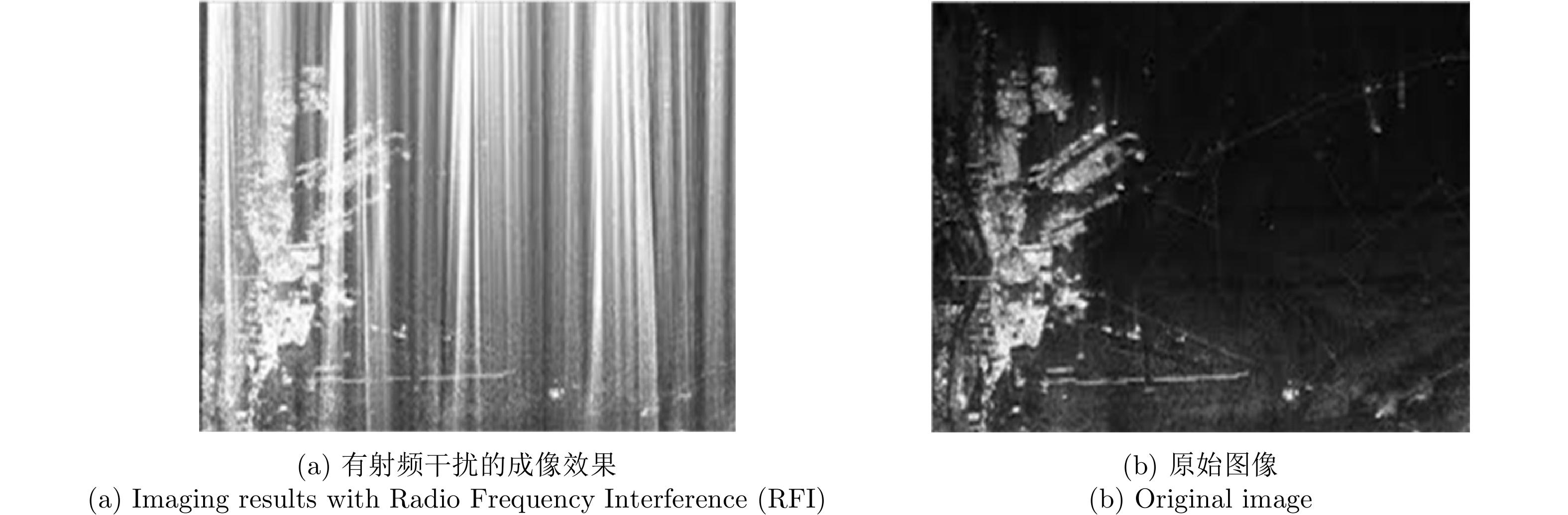
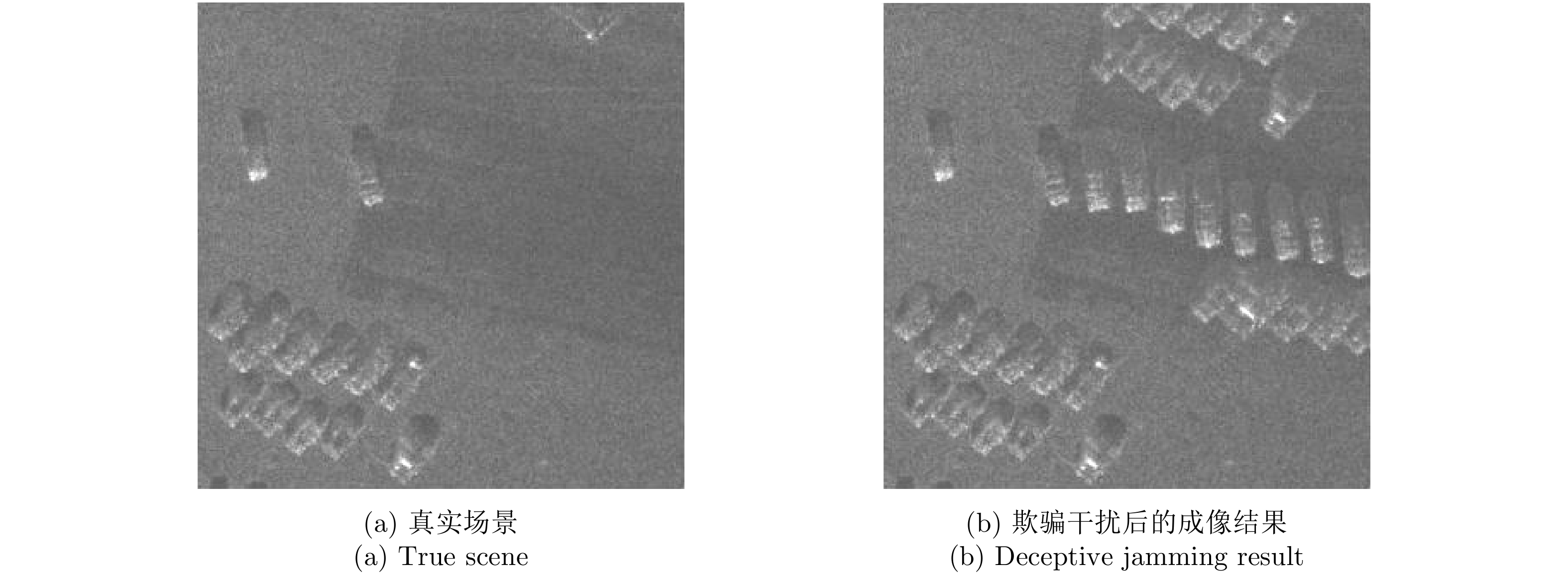
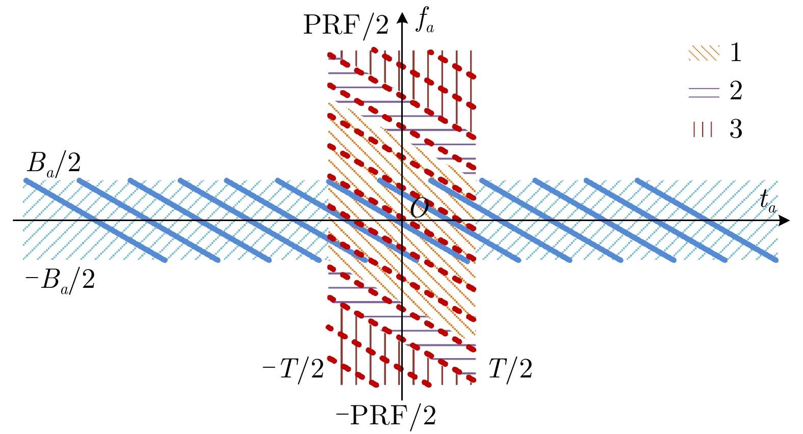
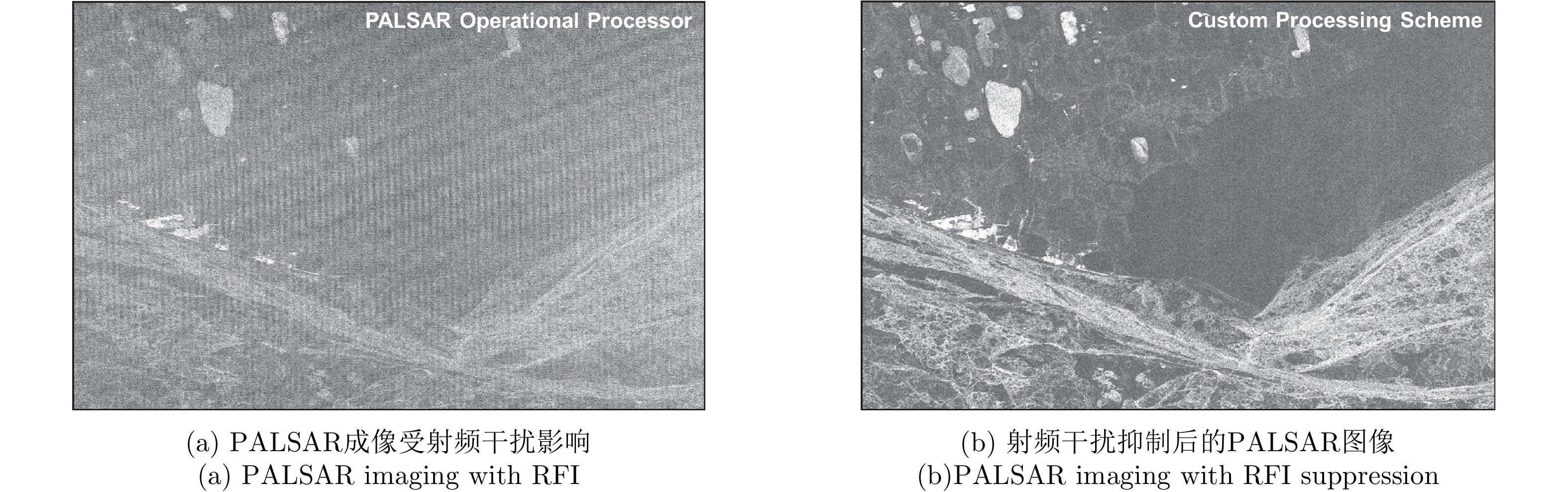
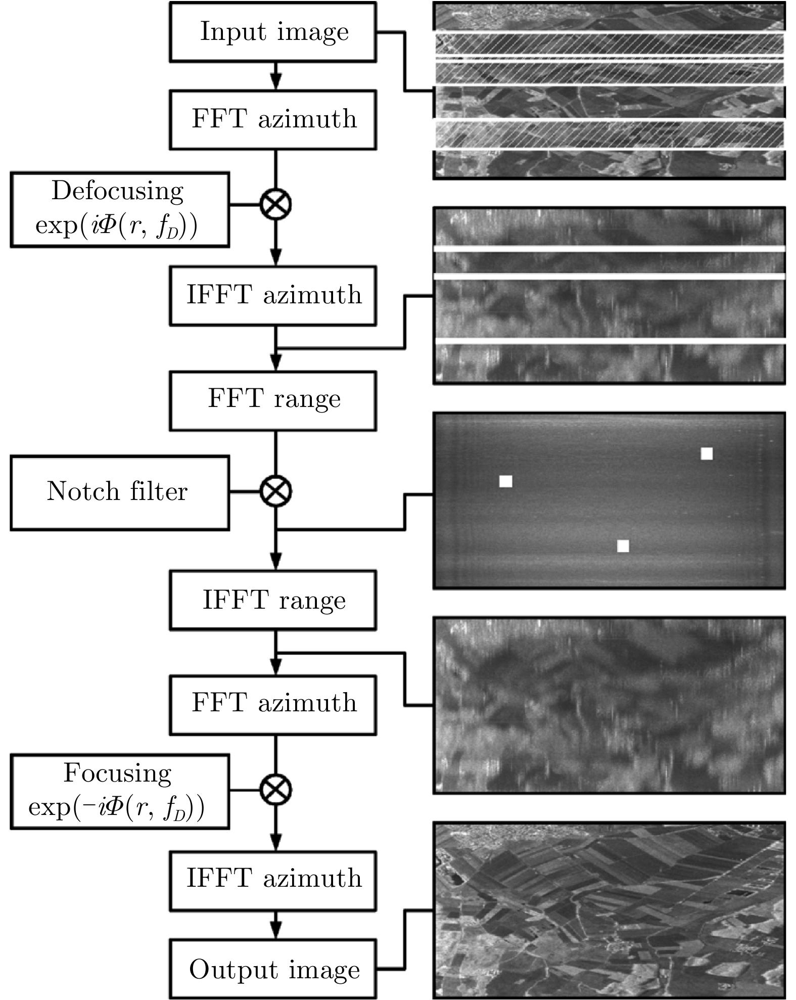
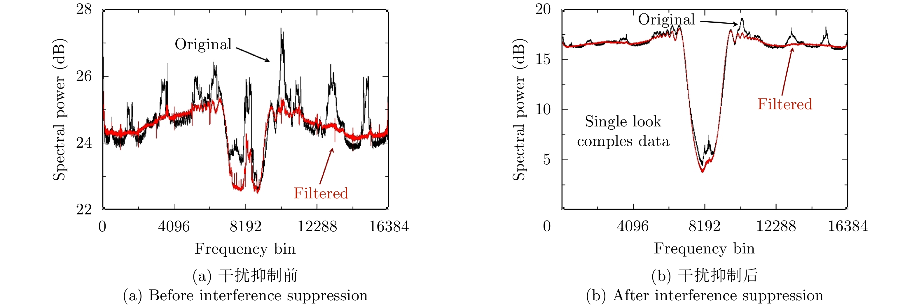
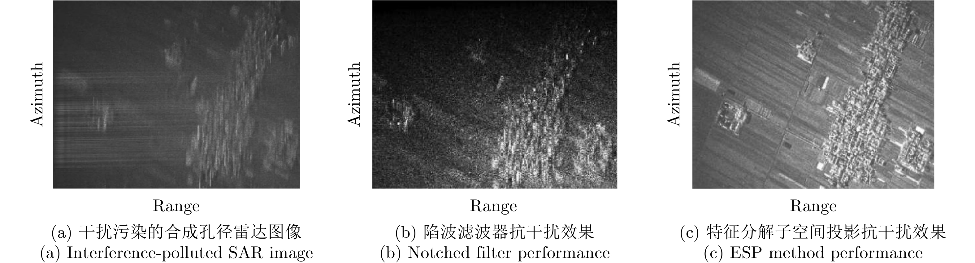
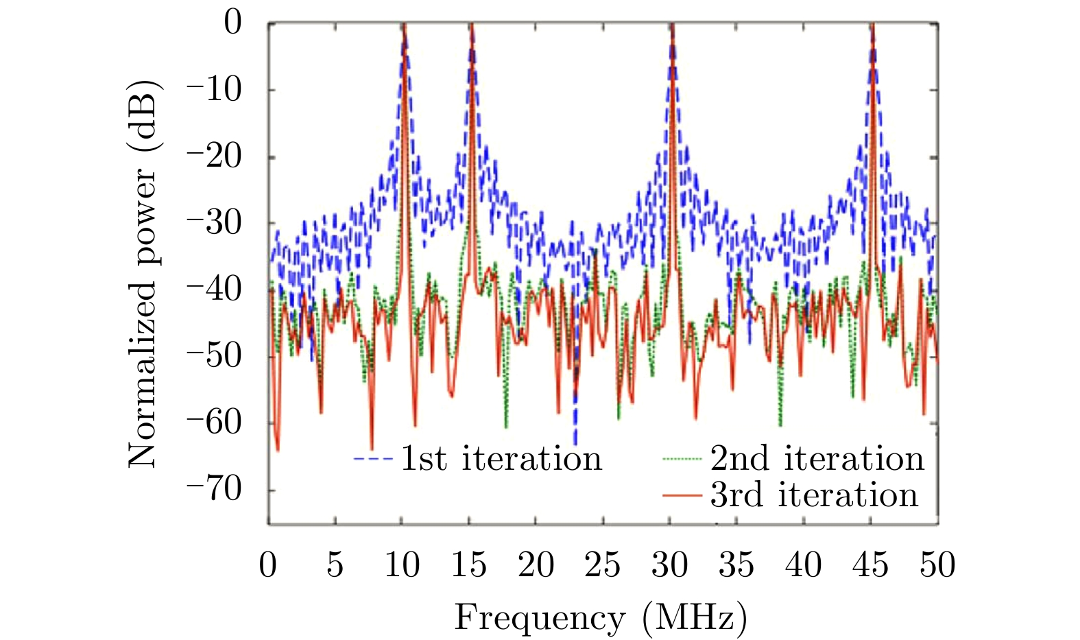
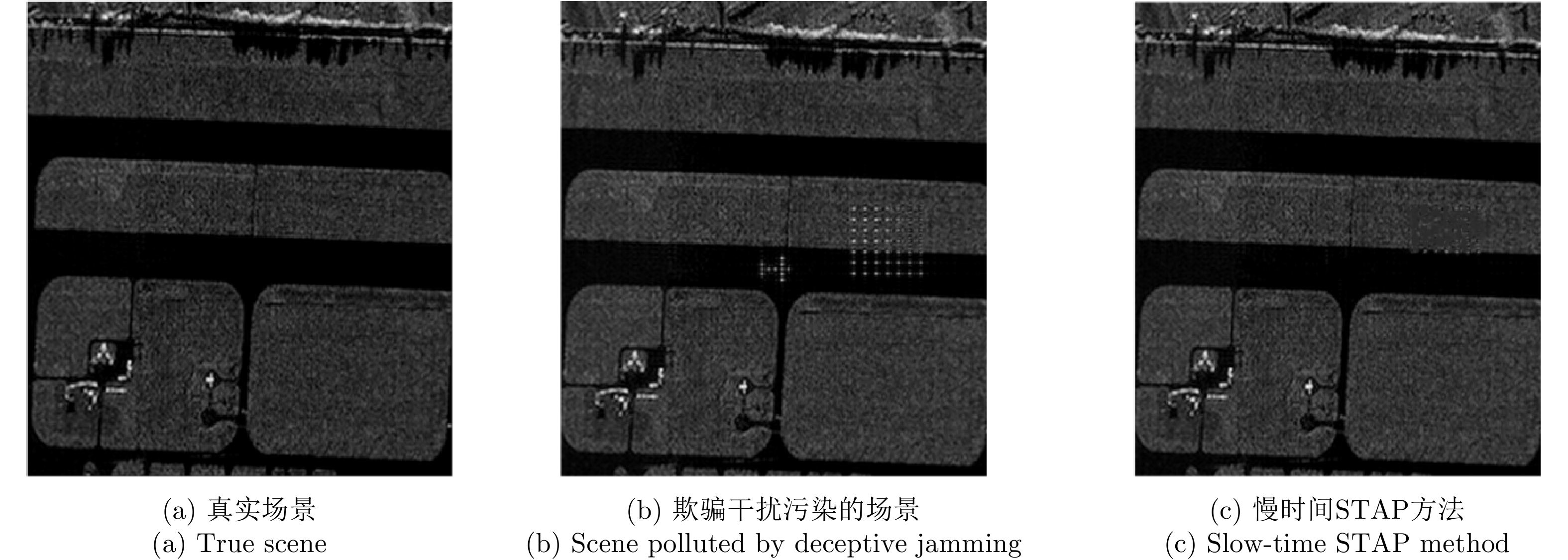
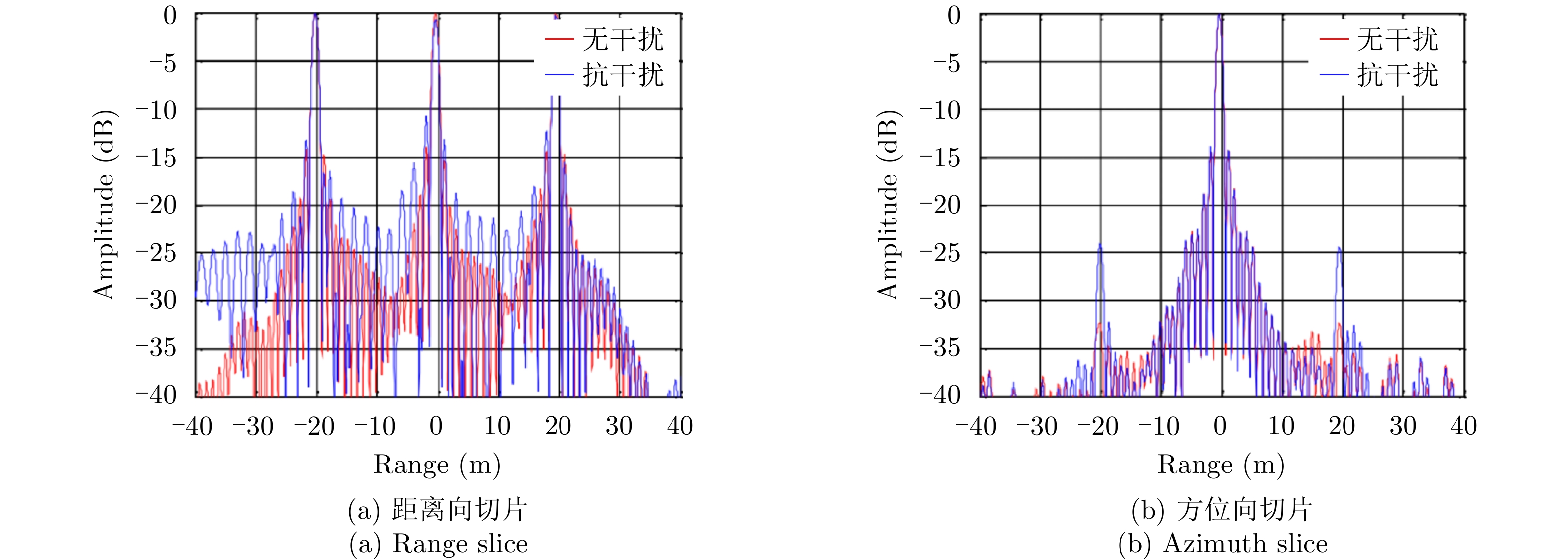
Synthetic Aperture Radar (SAR) has attracted much attention in the recent decades owing to its all-weather and high-resolution working mode. As an active radar system, the high-resolution imaging process of SAR systems is affected by different types of strong, complex, and variable electromagnetic interferences that can severely affect the final high-resolution SAR imaging results. Thus, developing ways to effectively suppress complex electromagnetic interferences is a major challenge and focus of SAR detection. In this paper, we summarize the key elements and main concepts underlying interference suppression in high-resolution SAR imaging, including different interference patterns, interference sources, interference scattering mechanisms, radar antenna configurations, and target characteristics. We then consider the essential task of interference suppression algorithms. Recent papers that detail the representative SAR algorithms used to mitigate suppressed and deceptive jamming are introduced and summarized to provide references for future research.
Synthetic Aperture Radar (SAR) has attracted much attention in the recent decades owing to its all-weather and high-resolution working mode. As an active radar system, the high-resolution imaging process of SAR systems is affected by different types of strong, complex, and variable electromagnetic interferences that can severely affect the final high-resolution SAR imaging results. Thus, developing ways to effectively suppress complex electromagnetic interferences is a major challenge and focus of SAR detection. In this paper, we summarize the key elements and main concepts underlying interference suppression in high-resolution SAR imaging, including different interference patterns, interference sources, interference scattering mechanisms, radar antenna configurations, and target characteristics. We then consider the essential task of interference suppression algorithms. Recent papers that detail the representative SAR algorithms used to mitigate suppressed and deceptive jamming are introduced and summarized to provide references for future research.


2020, 9(1): 107-122.
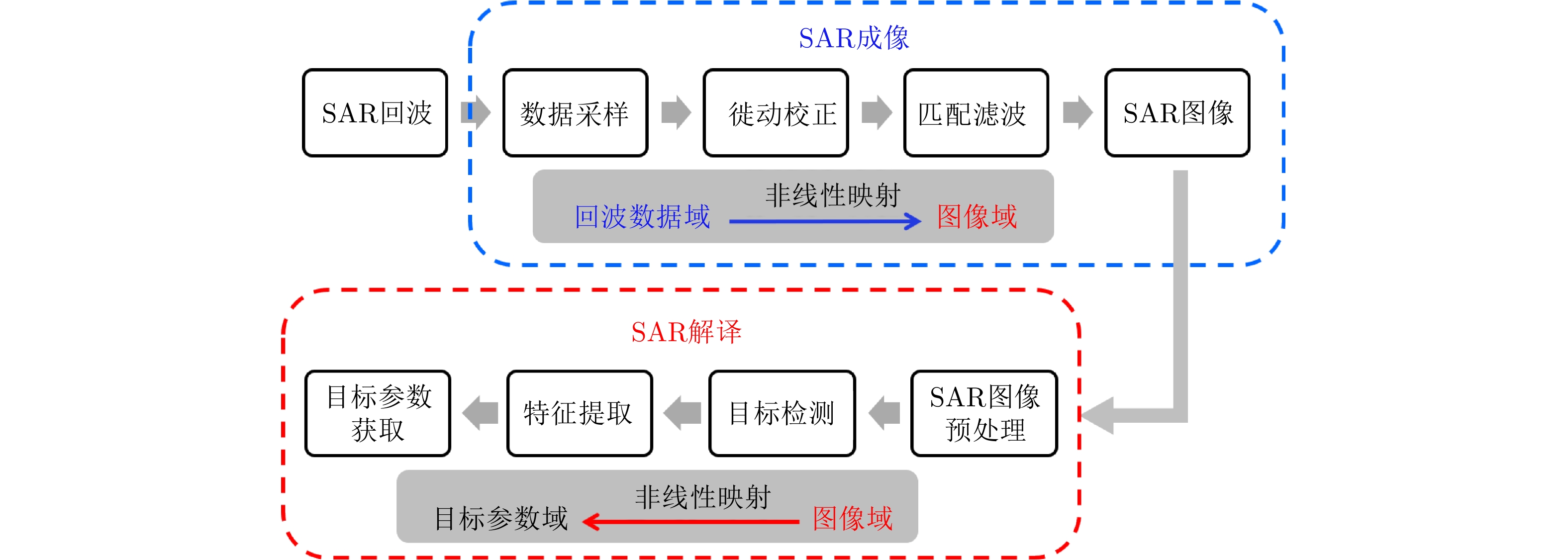
One of the most important research fields in Synthetic Aperture Radar (SAR) technology is to improve the accuracies of the number, location, classification, and other parameters of targets of interest. SAR information processing can be mainly divided into two tasks: imaging and interpretation. At present, research efforts on these two tasks are relatively independent. Many algorithms have been developed for SAR imaging and interpretation, and they have become increasingly complex. However, SAR interpretation has not been made simpler by improvements in the imaging resolution. The low recognition rate of key targets, in particular, has yet to be adequately resolved. In this paper, we use a “data driven + intelligence learning” method to improve the information processing ability of airborne SAR based on SAR imaging & interpretation integration. First, we analyze the feasibility and main problems of SAR imaging & interpretation integration using a “data driven + intelligence learning” method. Based on the results, we propose a SAR learning-imaging method based on “data driven + intelligence learning” with the goal of producing an imaging network. The proposed learning-imaging framework, parameter selection method, network training method, and preliminary simulation results are presented, and the key technical problems to be solved are identified and analyzed.
One of the most important research fields in Synthetic Aperture Radar (SAR) technology is to improve the accuracies of the number, location, classification, and other parameters of targets of interest. SAR information processing can be mainly divided into two tasks: imaging and interpretation. At present, research efforts on these two tasks are relatively independent. Many algorithms have been developed for SAR imaging and interpretation, and they have become increasingly complex. However, SAR interpretation has not been made simpler by improvements in the imaging resolution. The low recognition rate of key targets, in particular, has yet to be adequately resolved. In this paper, we use a “data driven + intelligence learning” method to improve the information processing ability of airborne SAR based on SAR imaging & interpretation integration. First, we analyze the feasibility and main problems of SAR imaging & interpretation integration using a “data driven + intelligence learning” method. Based on the results, we propose a SAR learning-imaging method based on “data driven + intelligence learning” with the goal of producing an imaging network. The proposed learning-imaging framework, parameter selection method, network training method, and preliminary simulation results are presented, and the key technical problems to be solved are identified and analyzed.


2020, 9(1): 123-130.
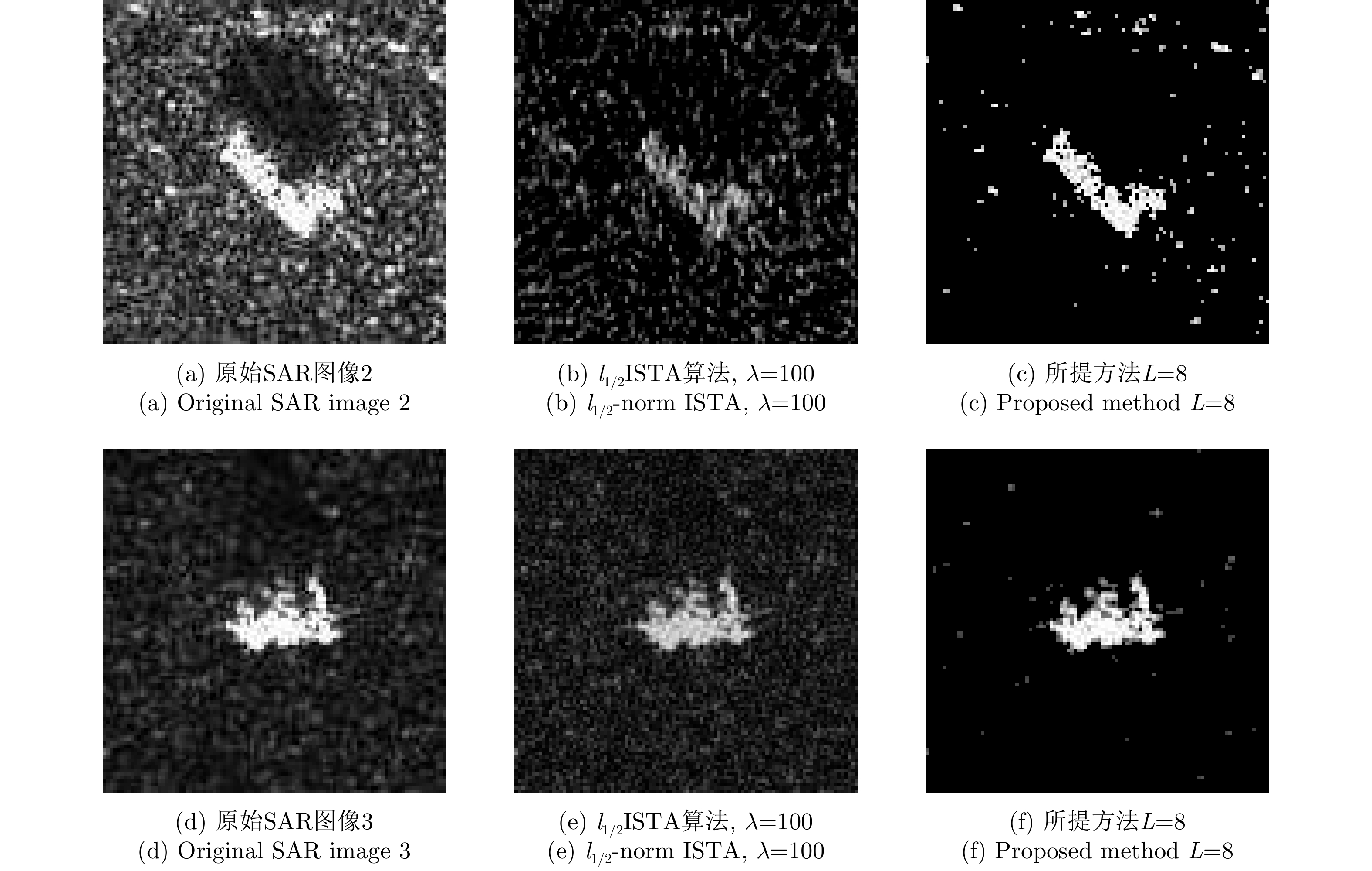
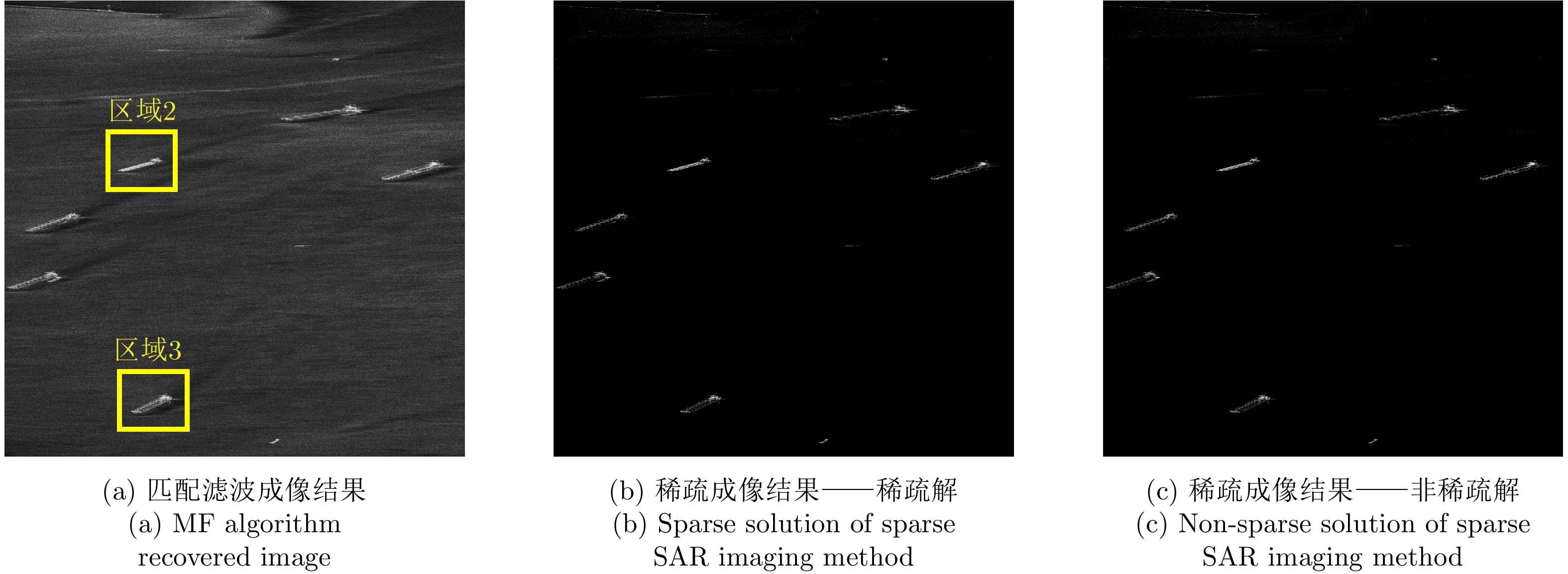
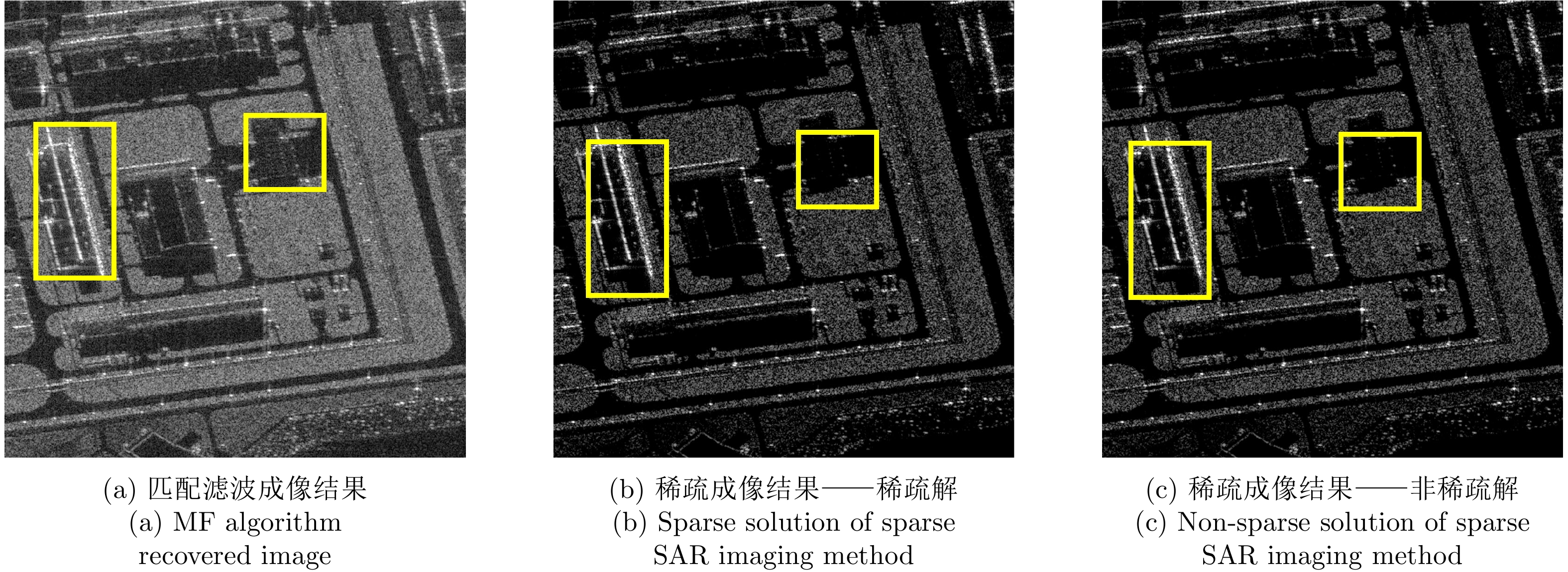
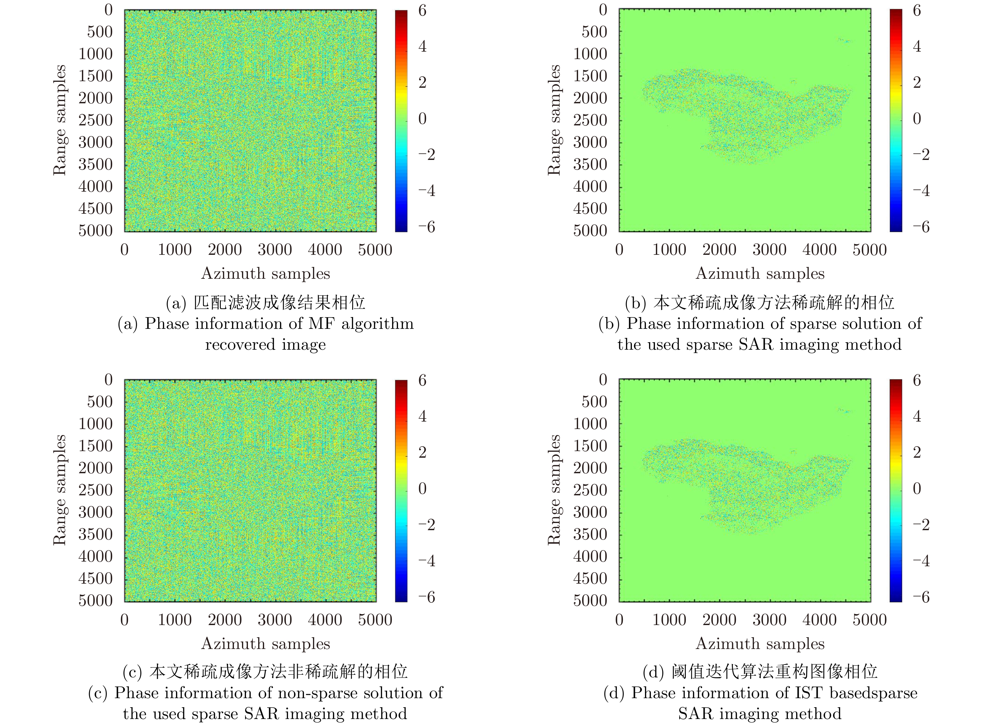
Sparse signal processing-based Synthetic Aperture Radar (SAR) imaging, also known as sparse SAR imaging, is the main research direction of sparse microwave imaging theory. Compared with a conventional SAR system, sparse SAR imaging radar has significant potential to improve imaging performance. However, because it requires heavy computations, the application of sparse SAR imaging in large-scene recovery has become difficult, which restricts its further applications. Additionally, complex SAR images, rather than raw data, are usually used for data archiving due to a number of reasons such as data copyright and system confidentiality. Therefore, it is worthwhile to study how sparse imaging can be achieved using only Matched Filtering (MF) recovered complex images with less computational cost. GaoFen-3 is China’s first 1-m resolution multi-polarization C-band satellite. It has a high-resolution, wide swath imaging ability and hence plays an important role in disaster monitoring and ocean surveillance applications. In this paper, we introduce a complex image-based sparse SAR imaging method to process GaoFen-3 complex image data and improve image performance. Experimental results show that the sparse imaging results have lower sidelobes, higher signal-to-clutter and noise ratio, and better target distinguishing ability compared with inputted images. Additionally, sparse imaging can effectively preserve the statistical distribution and phase information of images that makes the recovered GaoFen-3 sparse image-based applications such as interferometric synthetic aperture radar and constant false alarm ratio detection possible.
Sparse signal processing-based Synthetic Aperture Radar (SAR) imaging, also known as sparse SAR imaging, is the main research direction of sparse microwave imaging theory. Compared with a conventional SAR system, sparse SAR imaging radar has significant potential to improve imaging performance. However, because it requires heavy computations, the application of sparse SAR imaging in large-scene recovery has become difficult, which restricts its further applications. Additionally, complex SAR images, rather than raw data, are usually used for data archiving due to a number of reasons such as data copyright and system confidentiality. Therefore, it is worthwhile to study how sparse imaging can be achieved using only Matched Filtering (MF) recovered complex images with less computational cost. GaoFen-3 is China’s first 1-m resolution multi-polarization C-band satellite. It has a high-resolution, wide swath imaging ability and hence plays an important role in disaster monitoring and ocean surveillance applications. In this paper, we introduce a complex image-based sparse SAR imaging method to process GaoFen-3 complex image data and improve image performance. Experimental results show that the sparse imaging results have lower sidelobes, higher signal-to-clutter and noise ratio, and better target distinguishing ability compared with inputted images. Additionally, sparse imaging can effectively preserve the statistical distribution and phase information of images that makes the recovered GaoFen-3 sparse image-based applications such as interferometric synthetic aperture radar and constant false alarm ratio detection possible.


2020, 9(1): 131-142.
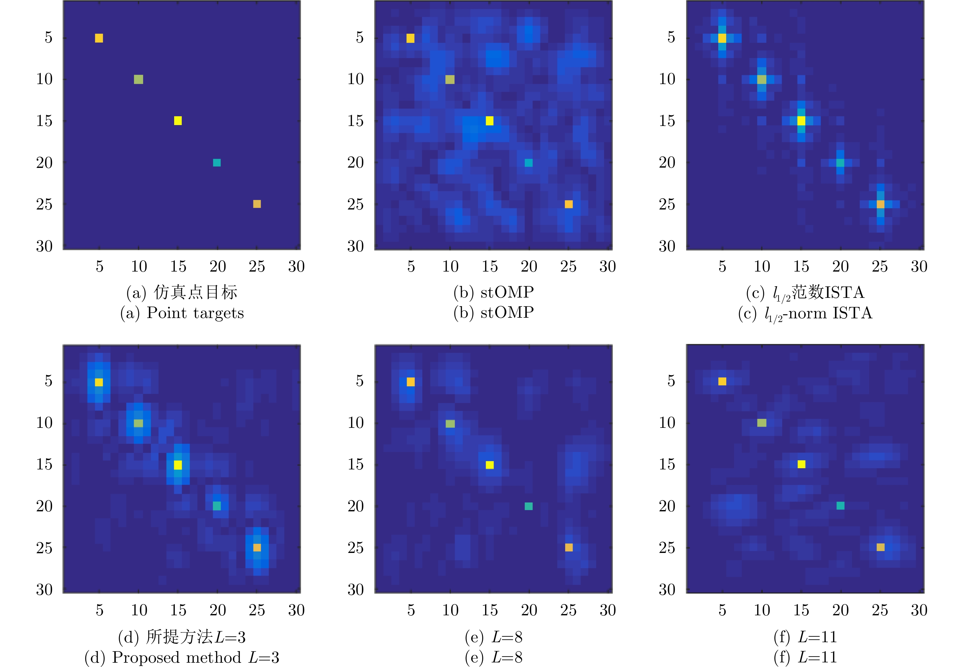
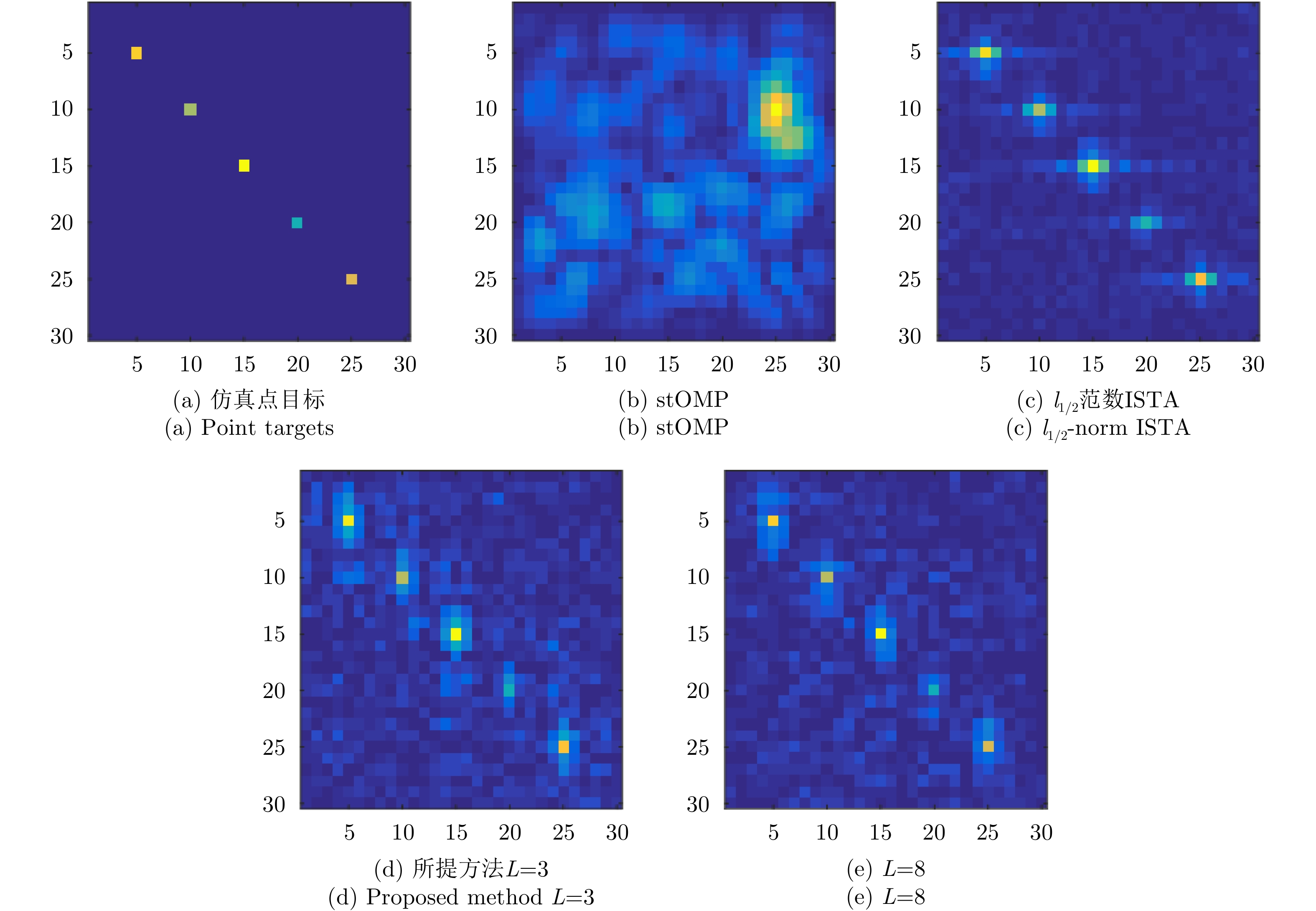
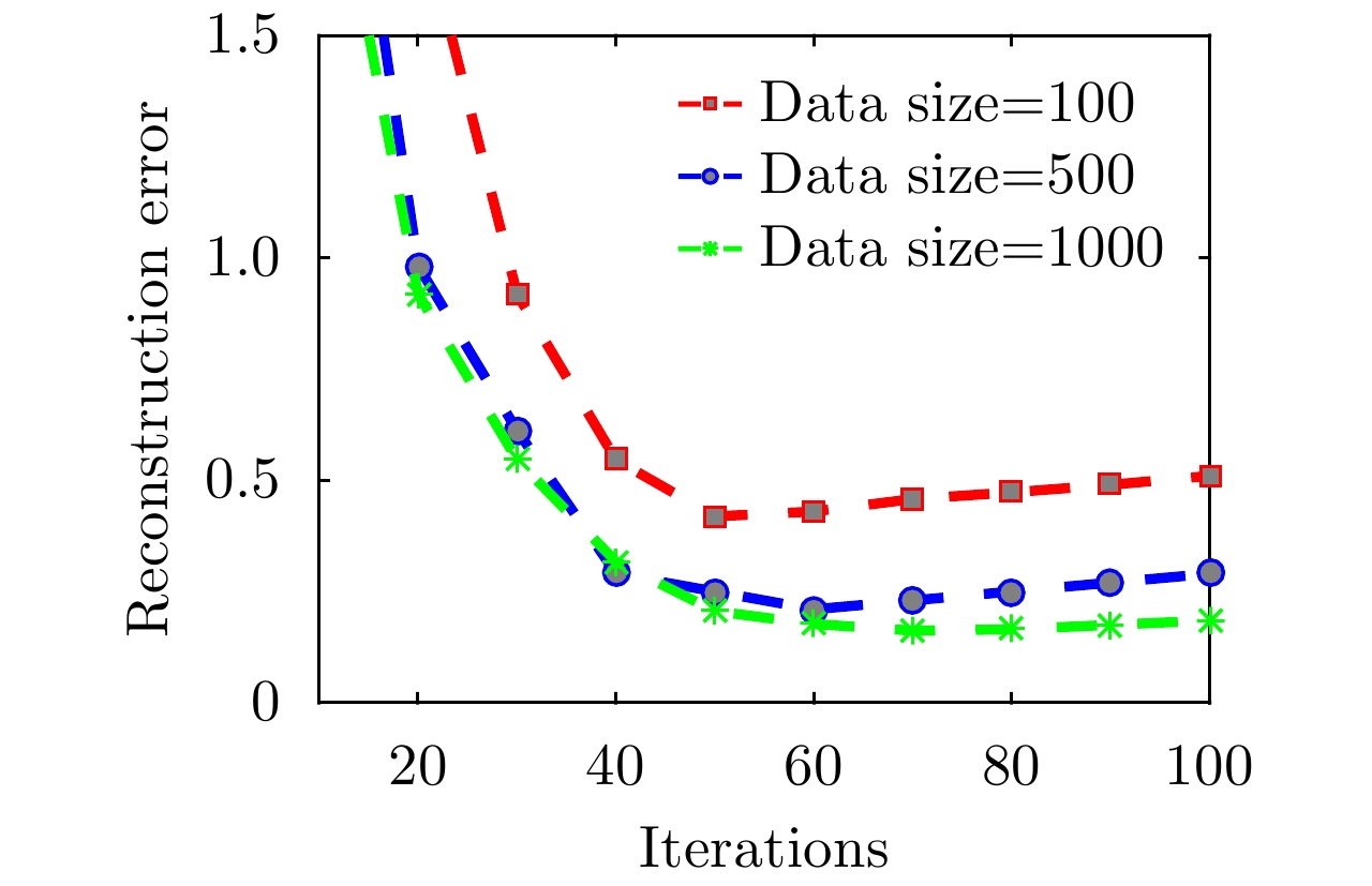
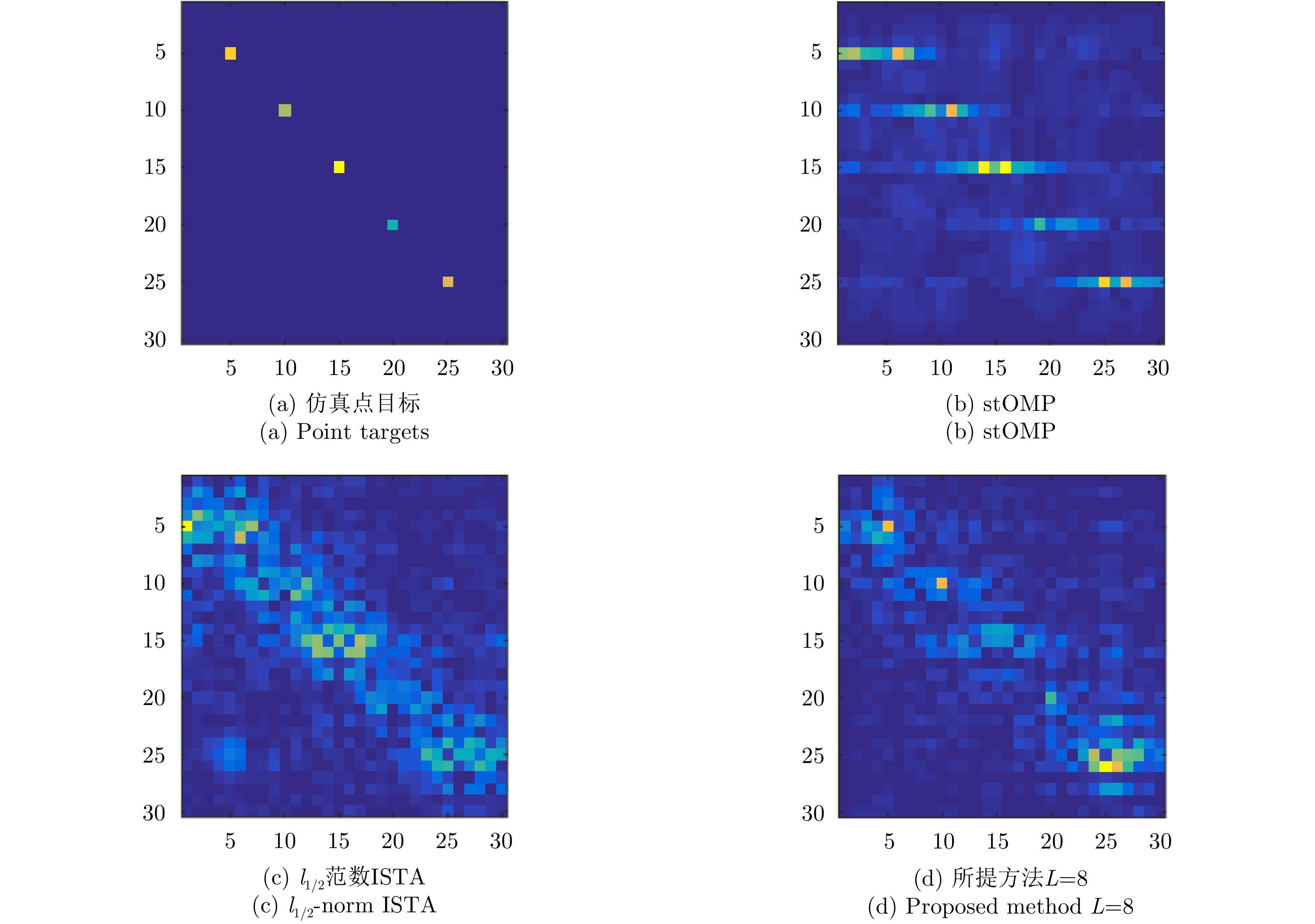
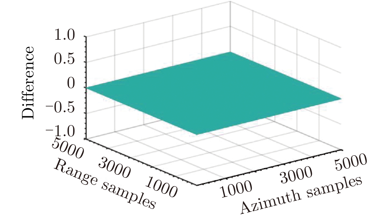
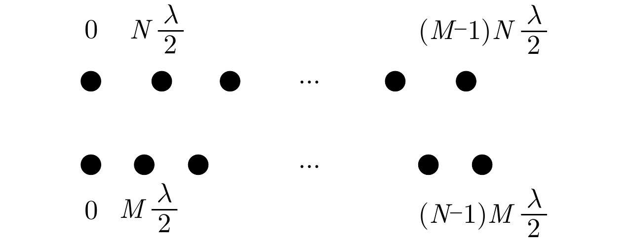
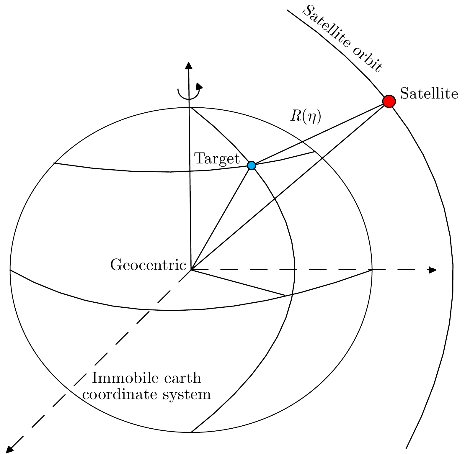
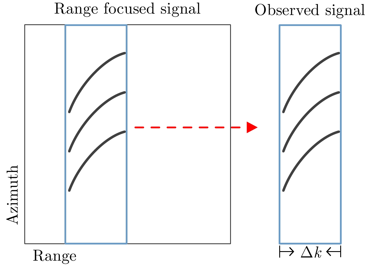
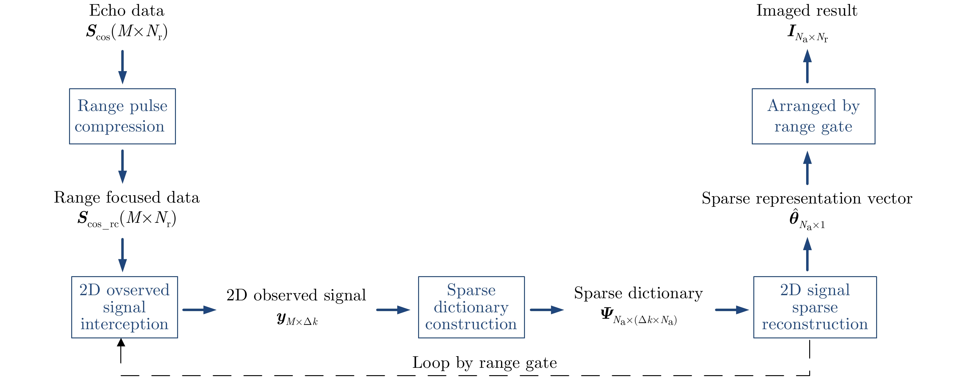
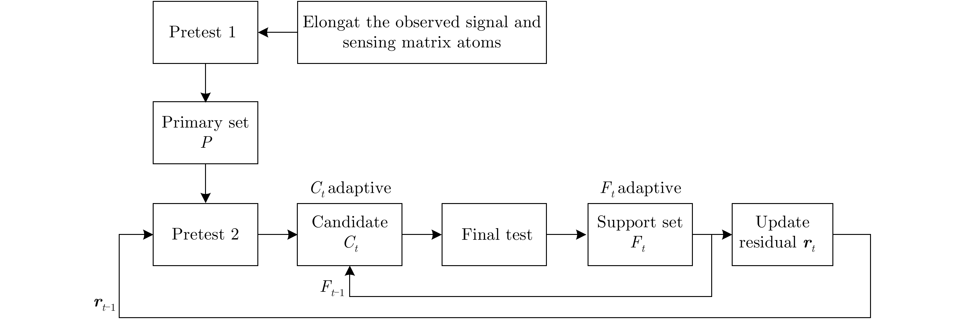
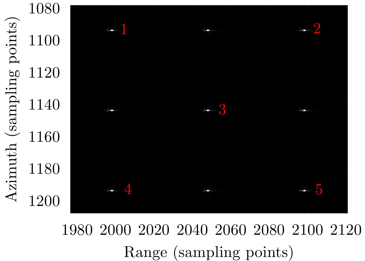
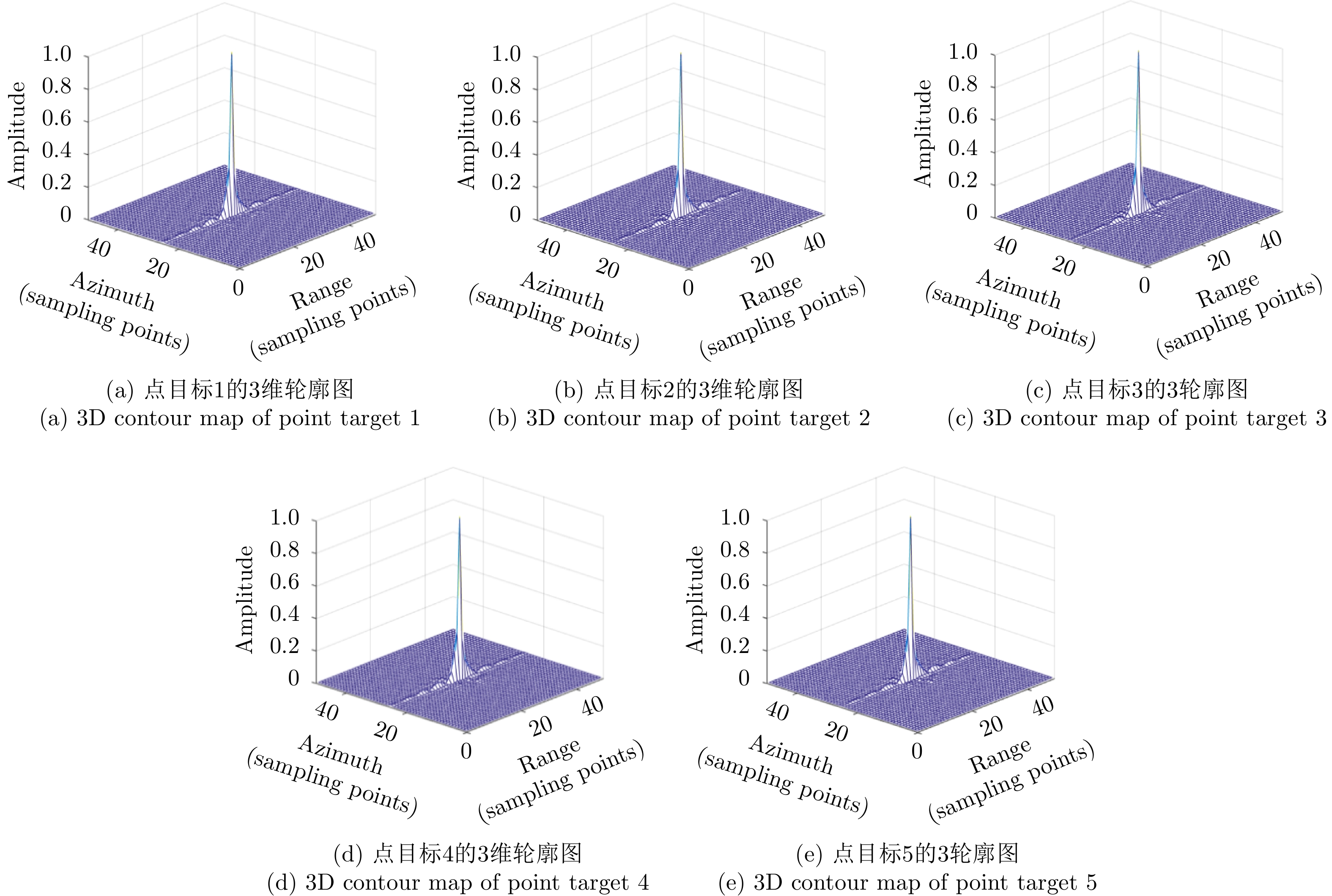
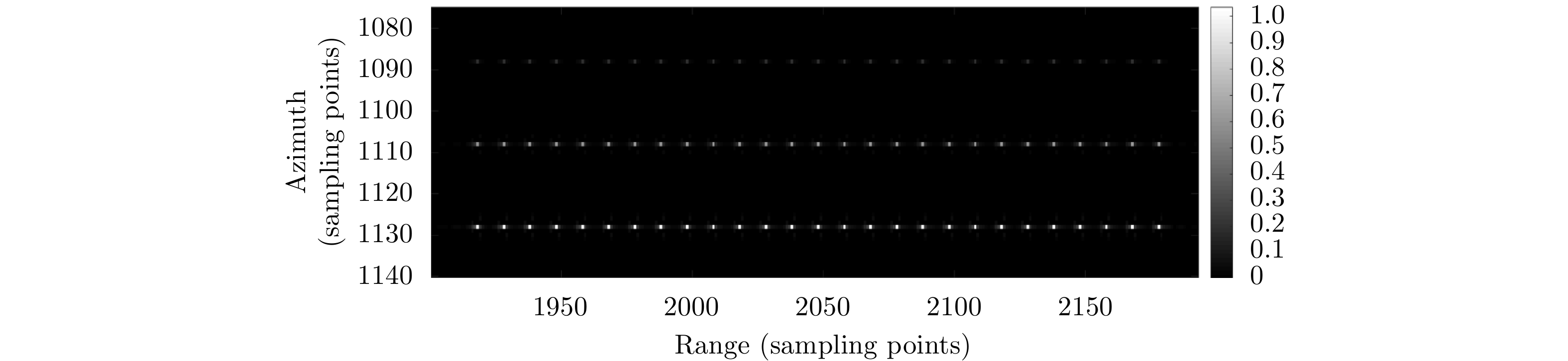
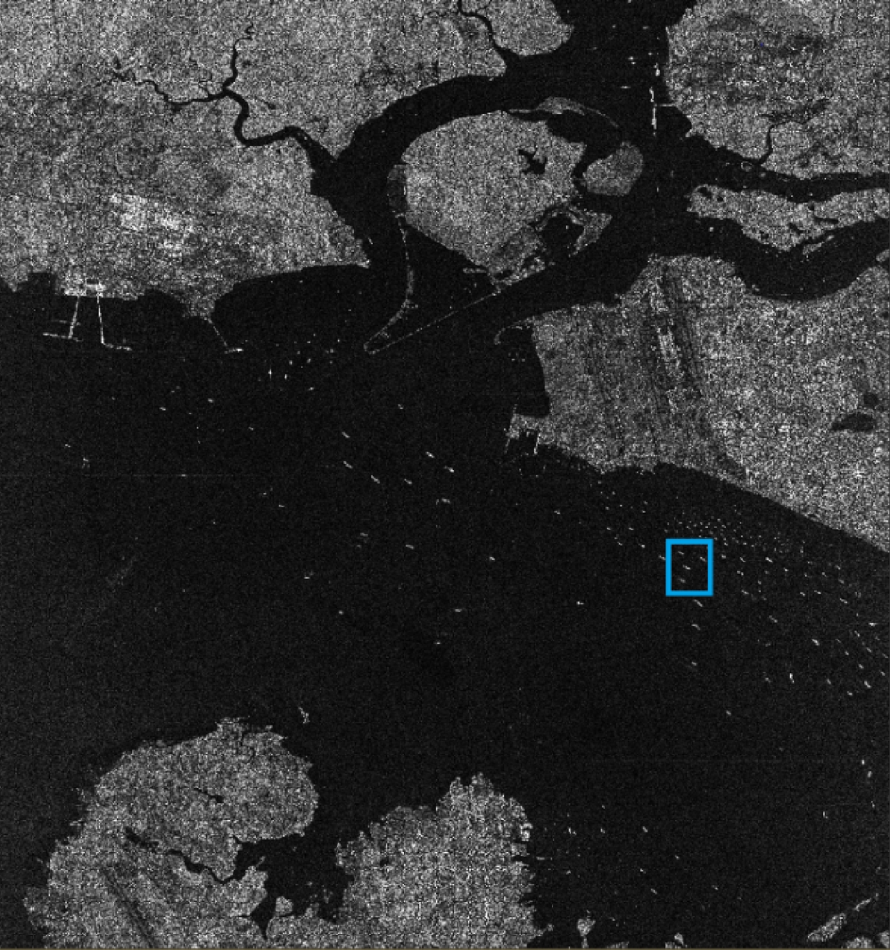
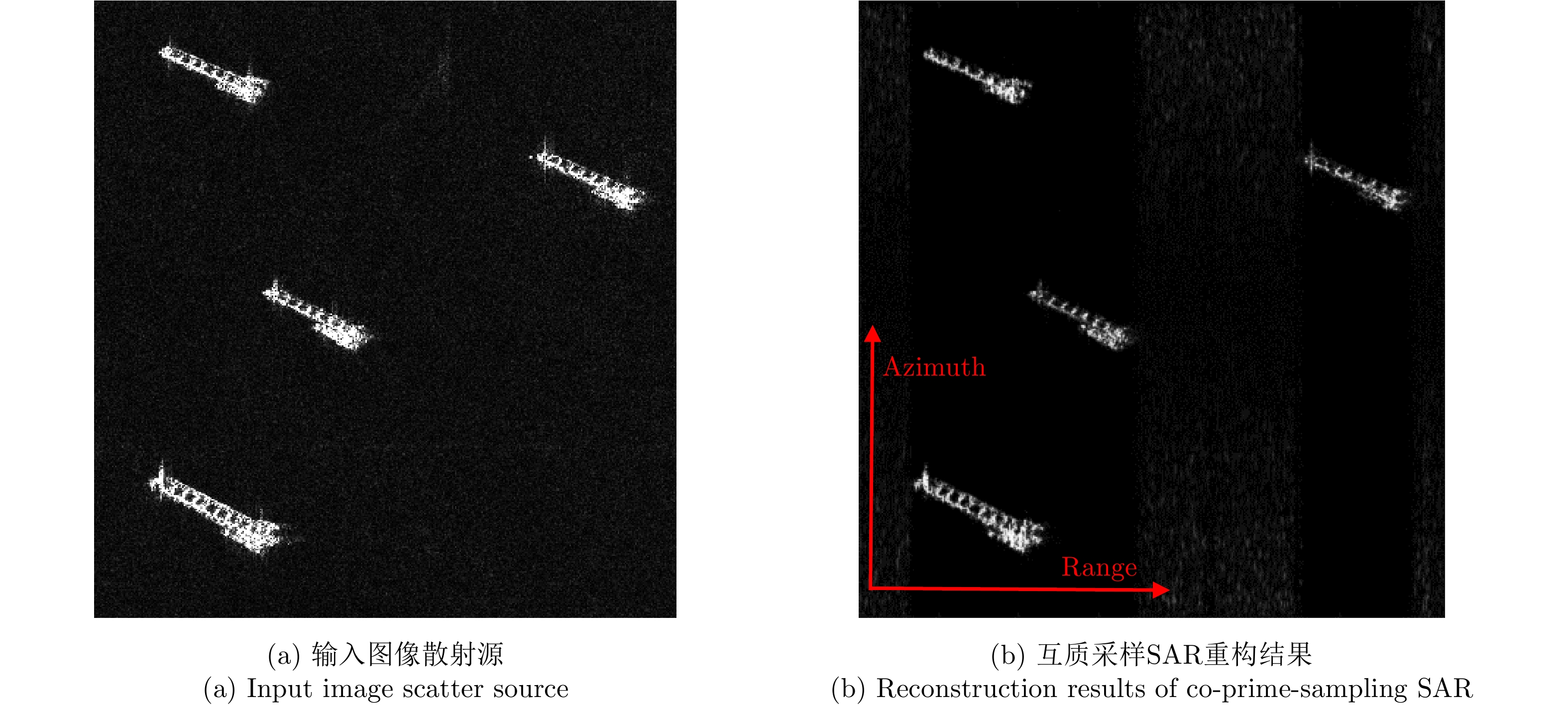
Co-prime-sampling space-borne Synthetic Aperture Radar (SAR) replaces the traditional uniform sampling by performing co-prime sampling in azimuth, which effectively alleviates the conflict between spatial resolution and effective swath width, while also improving the ground detection performance of the SAR system. However, co-prime-sampling in azimuth causes the echo signal to exhibit azimuthal under sampling and non-uniform sampling characteristics, which means the traditional SAR image-processing method can not effectively image co-prime-sampled SAR. In this paper, an imaging method based on Two-Dimensional (2D) sparse-signal reconstruction is proposed for co-prime-sampling space-borne SAR. Using this method, after range-pulse compression, the 2D observed signal is intercepted and a corresponding sparse dictionary consisting of 2D atoms is constructed according to the Doppler parameters of each range gate. Then, azimuth-focus processing is completed by the improved 2D-signal sparsity adaptive matching pursuit algorithm. The proposed method not only compensates for the 2D coupling between the range and azimuth, but also eliminates the influence of space-varying imaging parameters on sparse reconstruction to achieve accurate reconstruction of the entire scene. The simulation results of the point targets and distribution targets verify that the proposed method can effectively reconstruct sparse scenes at a rate much lower than the Nyquist sampling rate.
Co-prime-sampling space-borne Synthetic Aperture Radar (SAR) replaces the traditional uniform sampling by performing co-prime sampling in azimuth, which effectively alleviates the conflict between spatial resolution and effective swath width, while also improving the ground detection performance of the SAR system. However, co-prime-sampling in azimuth causes the echo signal to exhibit azimuthal under sampling and non-uniform sampling characteristics, which means the traditional SAR image-processing method can not effectively image co-prime-sampled SAR. In this paper, an imaging method based on Two-Dimensional (2D) sparse-signal reconstruction is proposed for co-prime-sampling space-borne SAR. Using this method, after range-pulse compression, the 2D observed signal is intercepted and a corresponding sparse dictionary consisting of 2D atoms is constructed according to the Doppler parameters of each range gate. Then, azimuth-focus processing is completed by the improved 2D-signal sparsity adaptive matching pursuit algorithm. The proposed method not only compensates for the 2D coupling between the range and azimuth, but also eliminates the influence of space-varying imaging parameters on sparse reconstruction to achieve accurate reconstruction of the entire scene. The simulation results of the point targets and distribution targets verify that the proposed method can effectively reconstruct sparse scenes at a rate much lower than the Nyquist sampling rate.


2020, 9(1): 143-153.
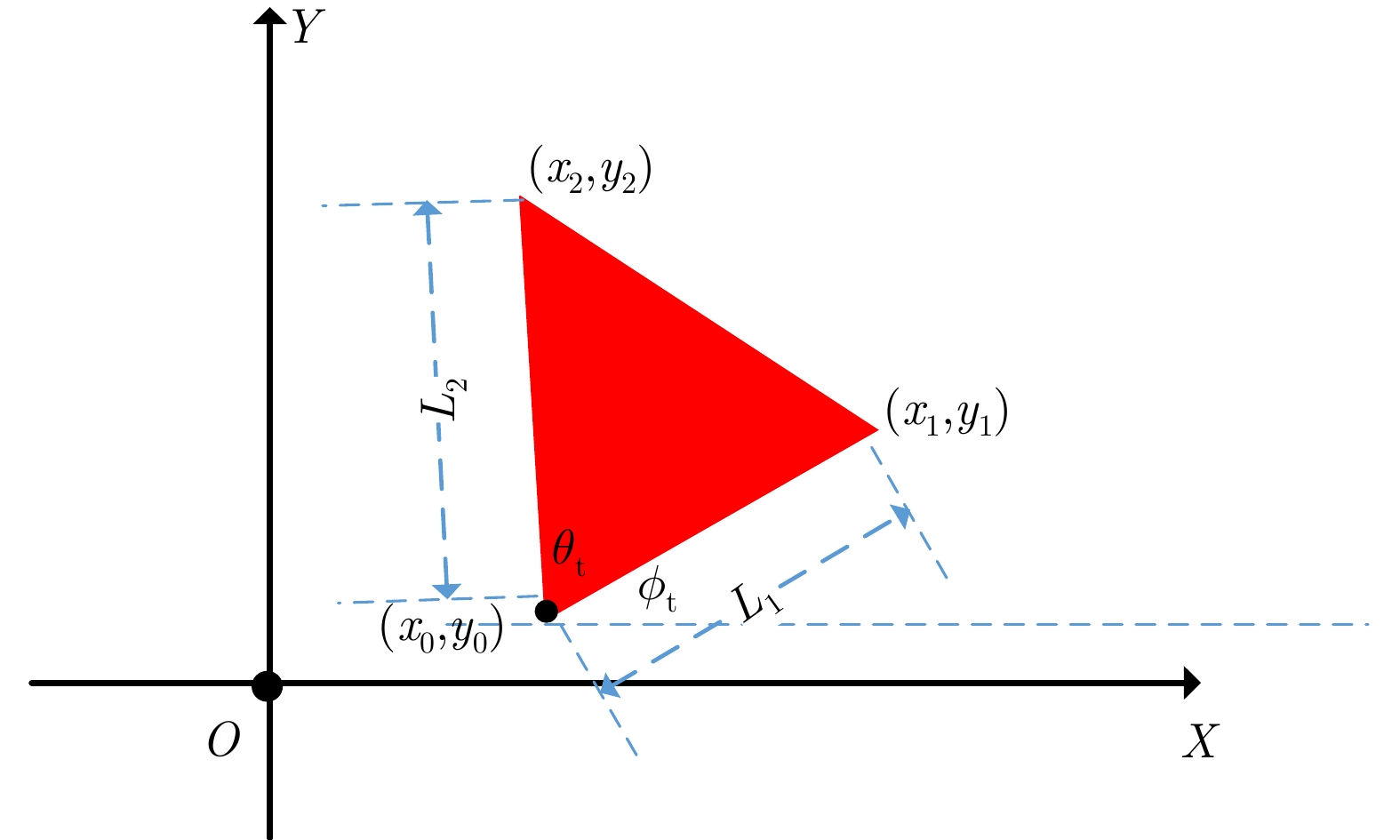
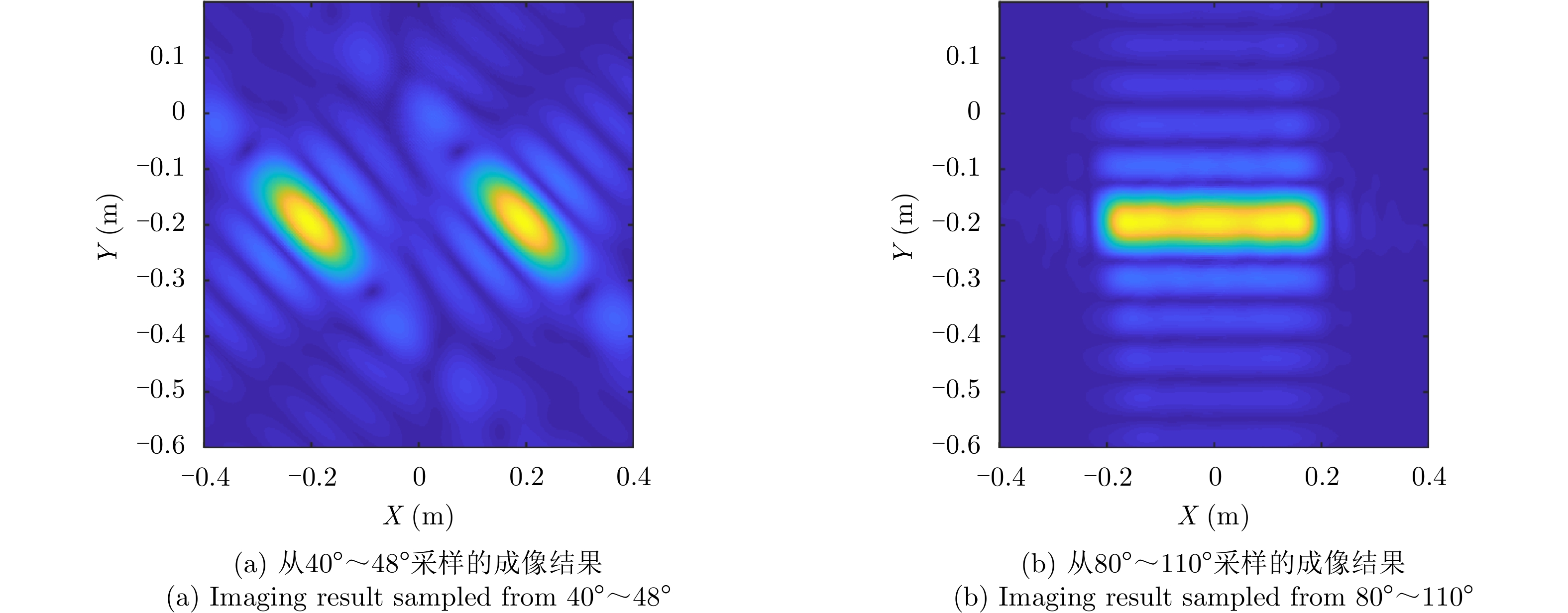
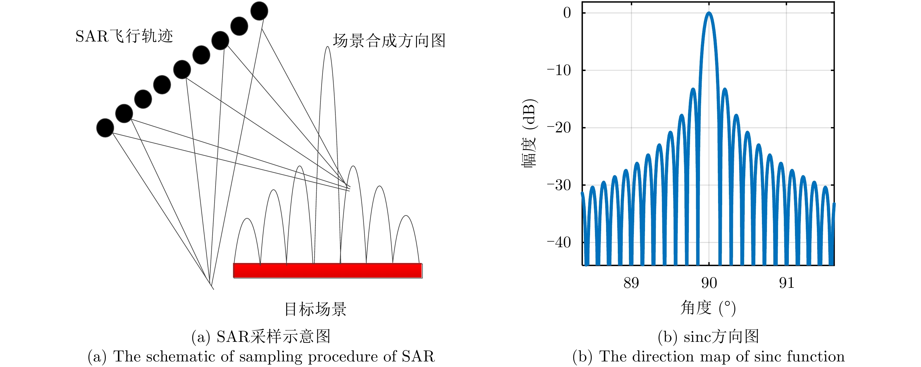
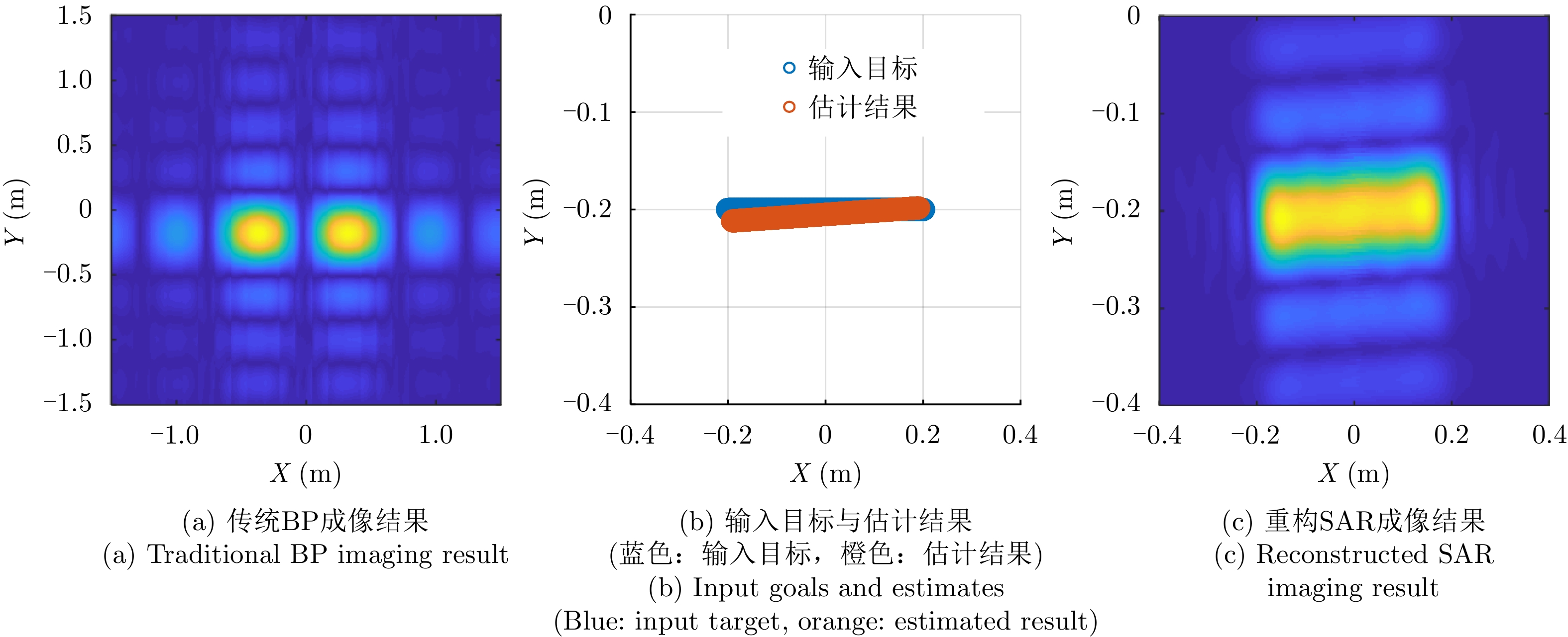
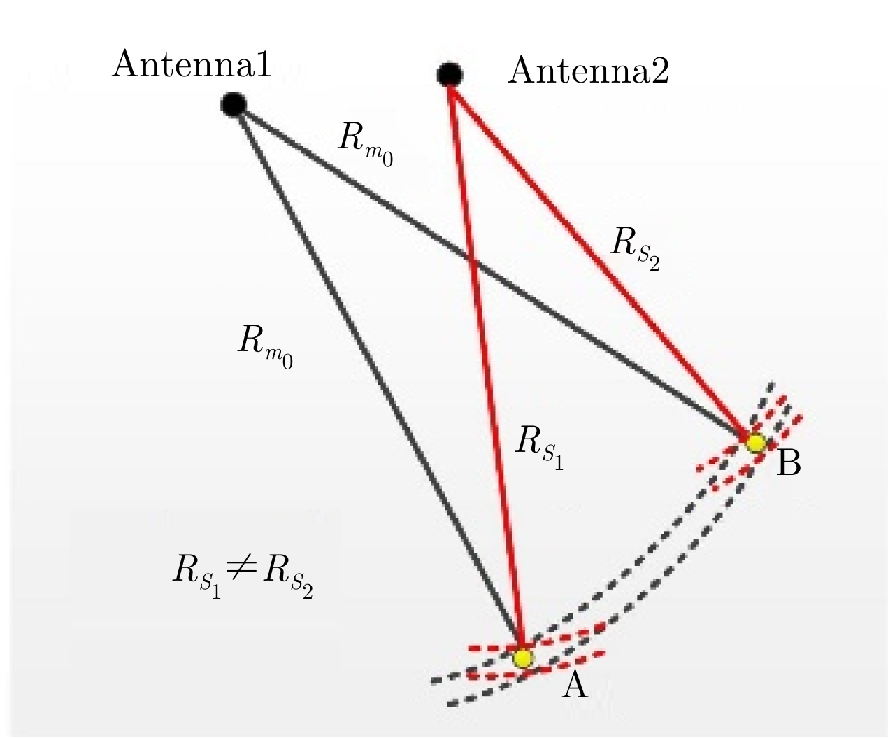
In the Synthetic Aperture Radar (SAR) remote sensing imagery of complicated scenes (especially urban scenes), there are a large number of lines and surfaces, such as roads in urban areas and the surfaces of buildings. These microwave-signal-scattering features have strong directivity. Traditional SAR acquires the scattering information of a scene from a single observation, and traditional imaging algorithms are based on the point target model, which makes the main features of the lines and surfaces in traditional SAR images appear as a series of strong scattering points rather than line-scattering and surface-scattering features. This outcome ultimately causes the target to be discontinuous in the SAR image, thus making the SAR image difficult to interpret. Therefore, in this study, we conducted an in-depth and meticulous investigation of the SAR imaging mechanism for lines and surfaces by establishing a parametric echo model of typical lines and triangular surfaces. Based on the proposed parametric model, we performed parametric imaging of these lines and surfaces. Based on our results, we propose a parametric imaging method, in which the typical lines and surfaces are classified and determined based on Bayesian theory and the proposed parametric model. Then, an SAR image can be obtained that effectively characterizes the scattering features of the line and surface targets by visual imaging, which effectively facilitates SAR image interpretation. The results of our numerical simulation experiments verify the validity of the proposed method.
In the Synthetic Aperture Radar (SAR) remote sensing imagery of complicated scenes (especially urban scenes), there are a large number of lines and surfaces, such as roads in urban areas and the surfaces of buildings. These microwave-signal-scattering features have strong directivity. Traditional SAR acquires the scattering information of a scene from a single observation, and traditional imaging algorithms are based on the point target model, which makes the main features of the lines and surfaces in traditional SAR images appear as a series of strong scattering points rather than line-scattering and surface-scattering features. This outcome ultimately causes the target to be discontinuous in the SAR image, thus making the SAR image difficult to interpret. Therefore, in this study, we conducted an in-depth and meticulous investigation of the SAR imaging mechanism for lines and surfaces by establishing a parametric echo model of typical lines and triangular surfaces. Based on the proposed parametric model, we performed parametric imaging of these lines and surfaces. Based on our results, we propose a parametric imaging method, in which the typical lines and surfaces are classified and determined based on Bayesian theory and the proposed parametric model. Then, an SAR image can be obtained that effectively characterizes the scattering features of the line and surface targets by visual imaging, which effectively facilitates SAR image interpretation. The results of our numerical simulation experiments verify the validity of the proposed method.


2020, 9(1): 154-165.
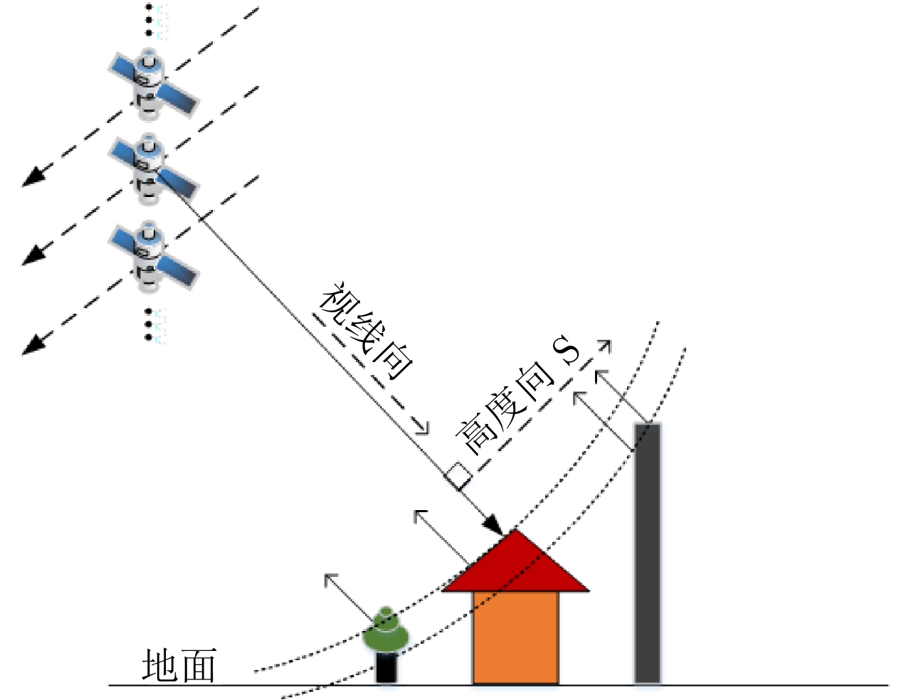
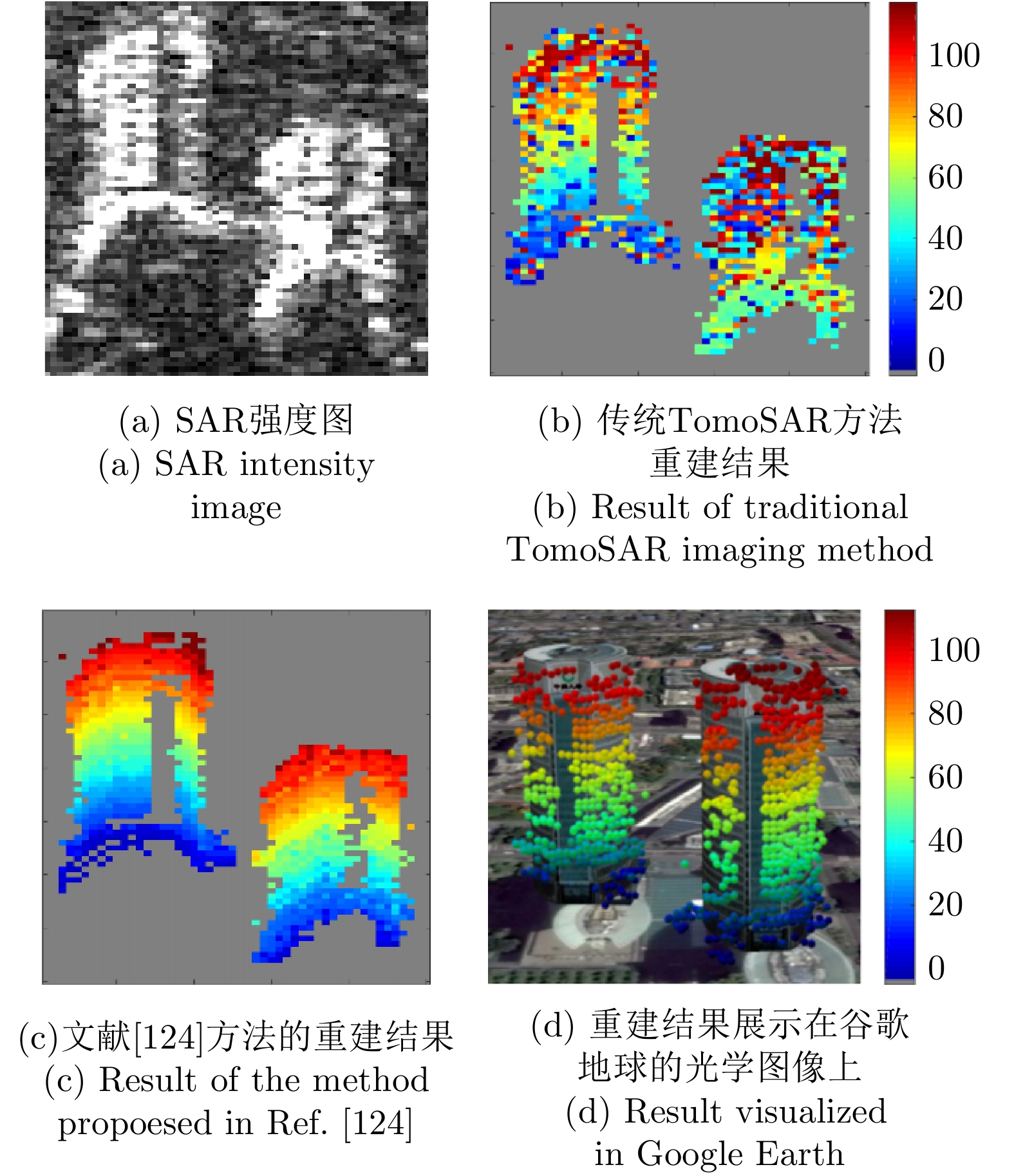
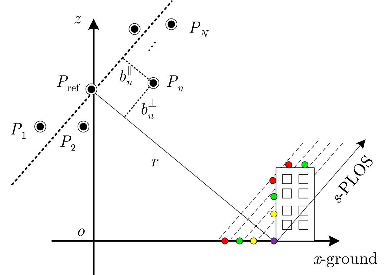
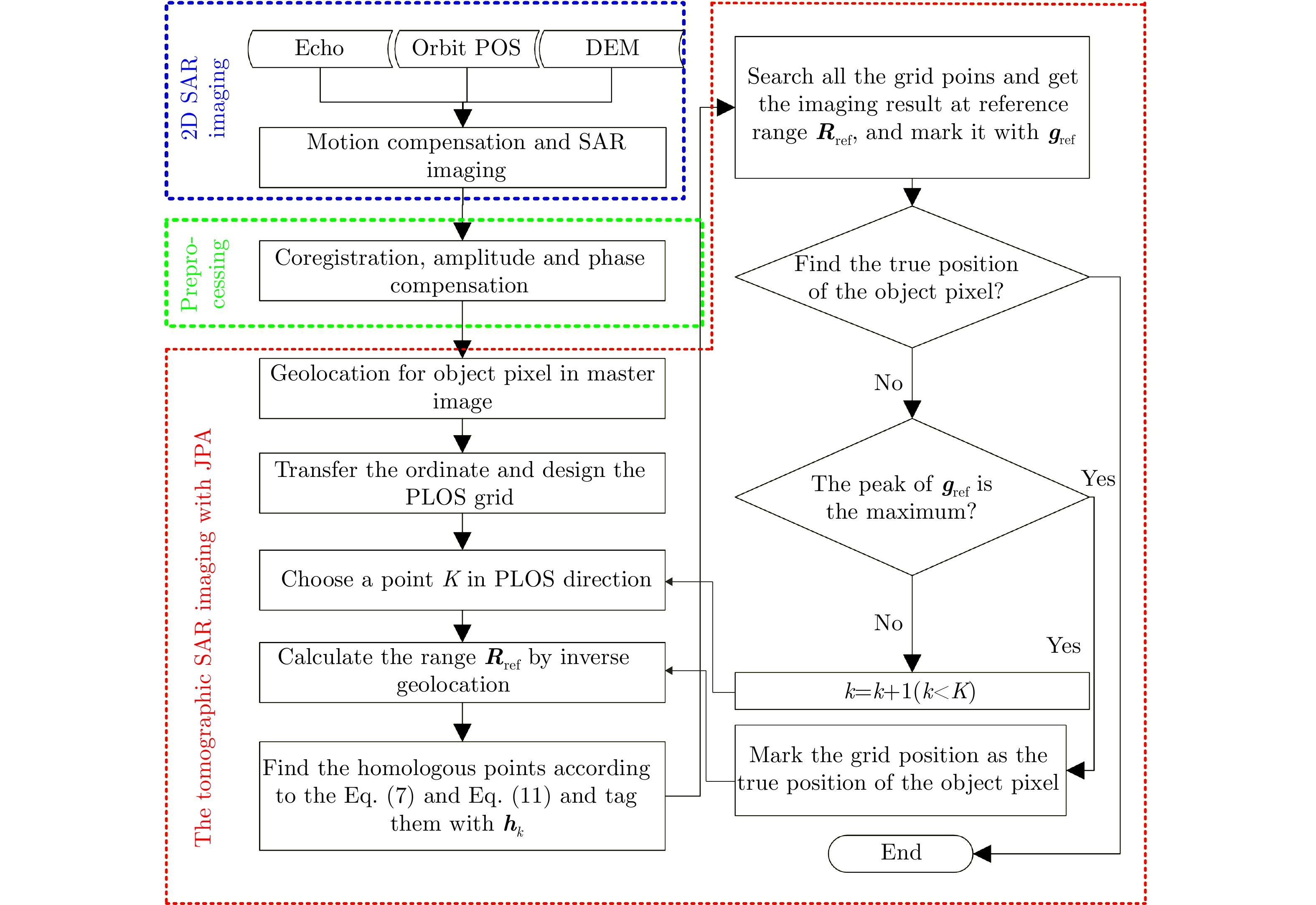
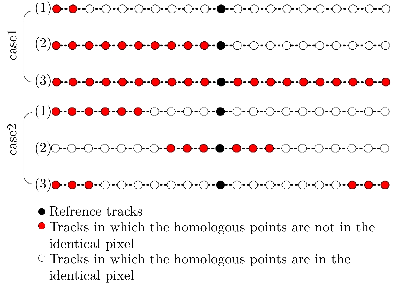
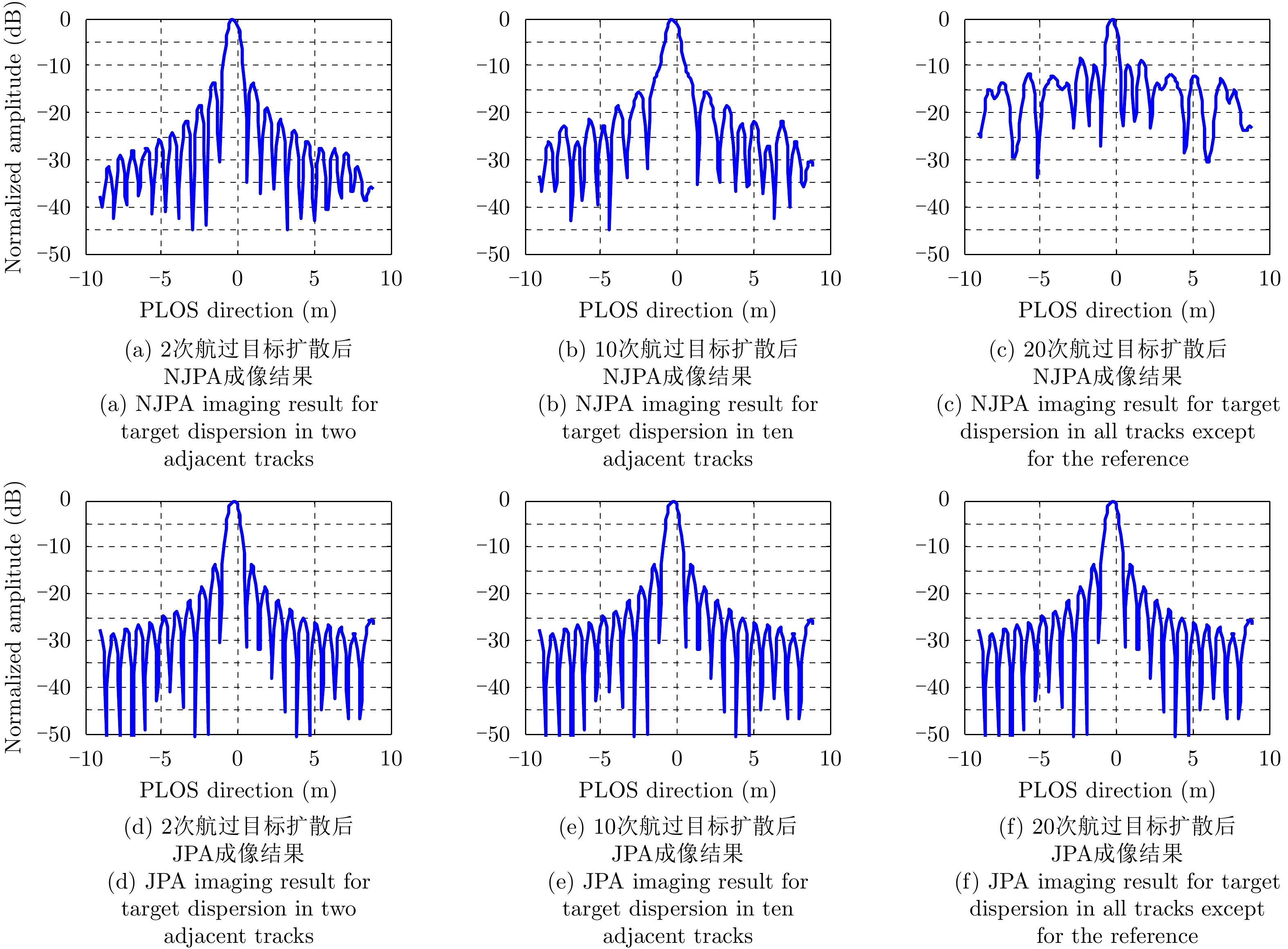
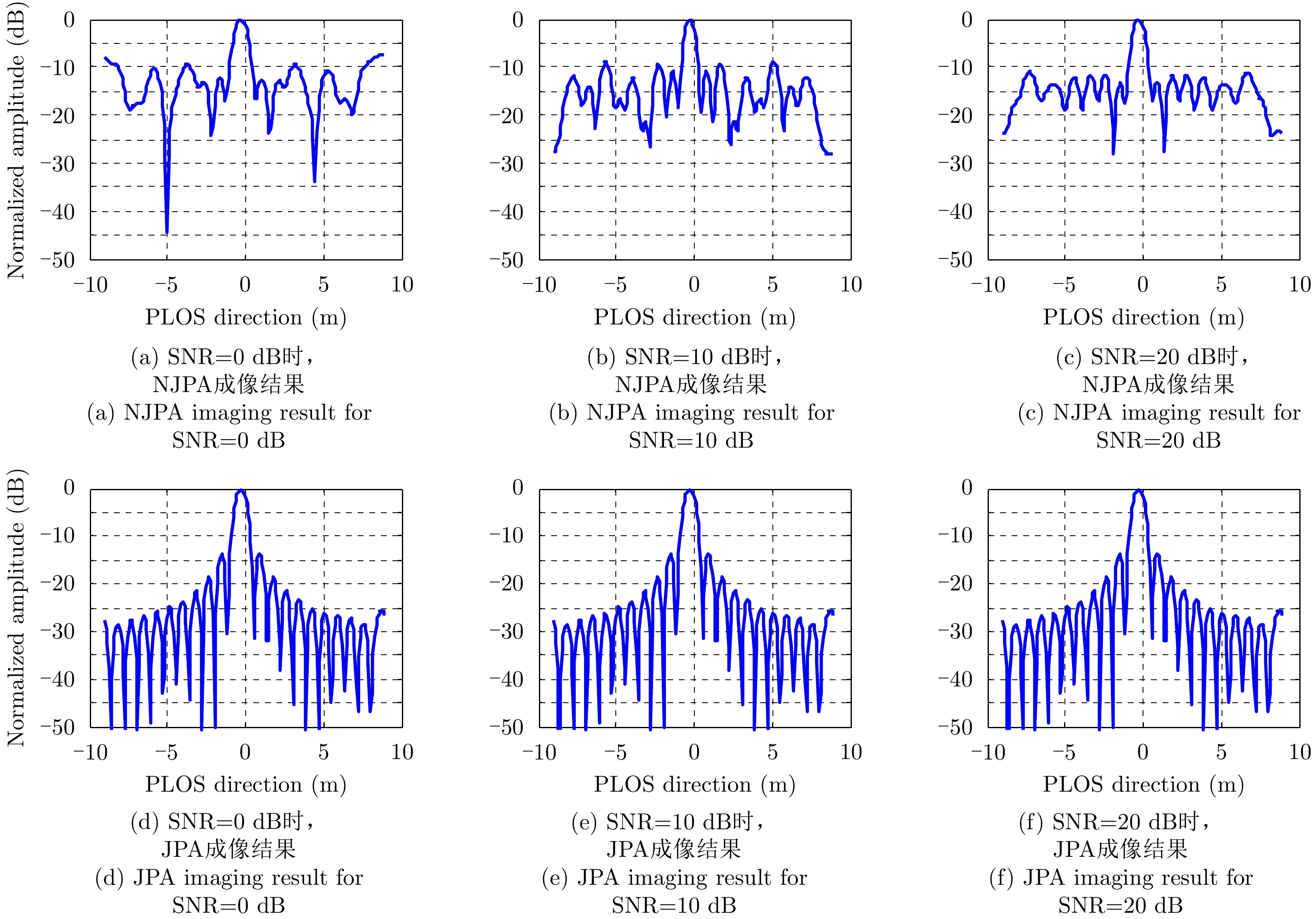
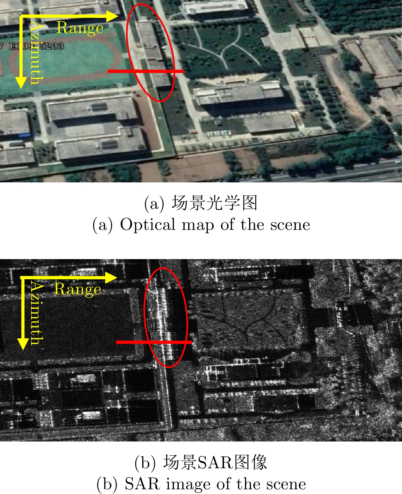
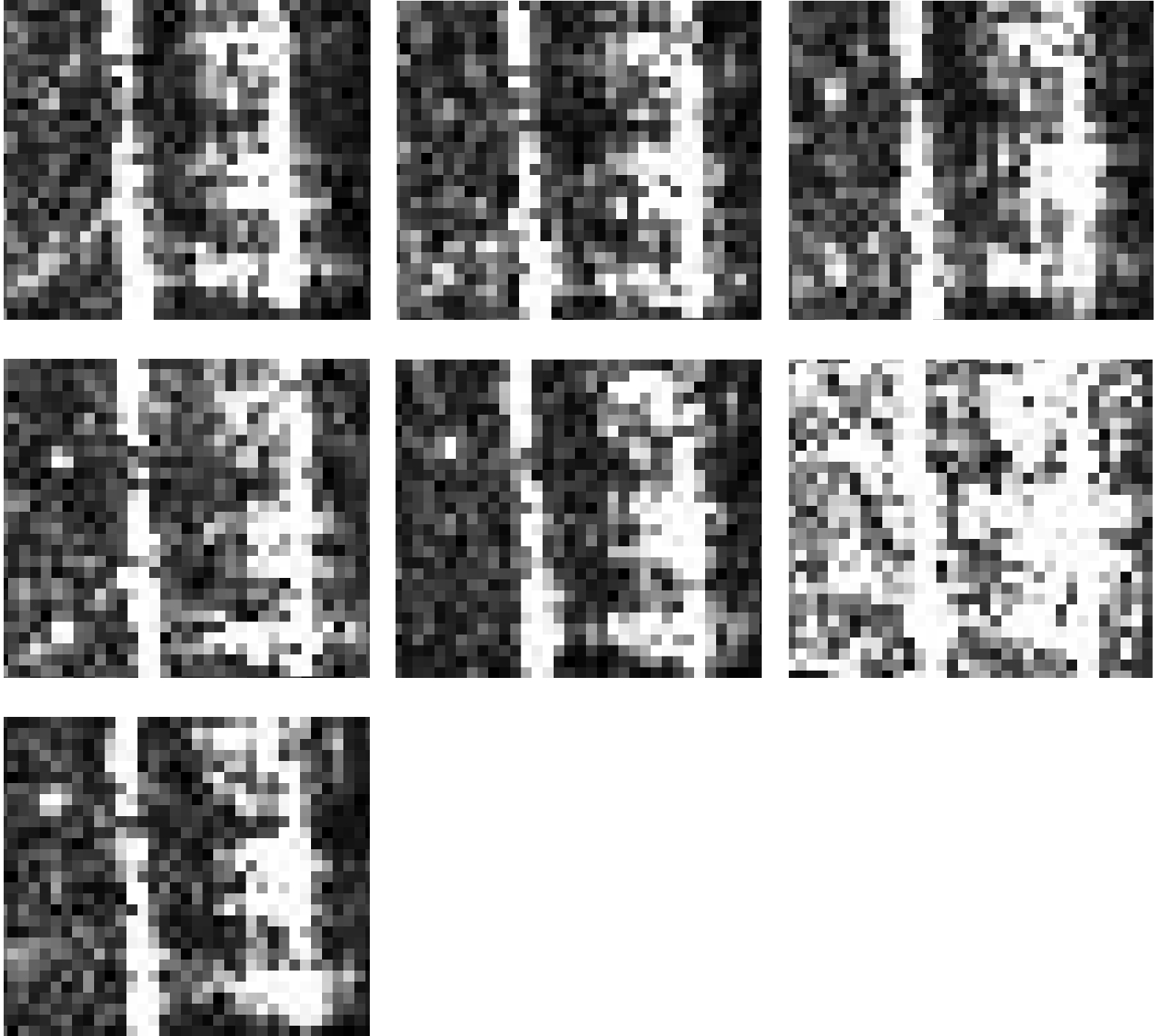
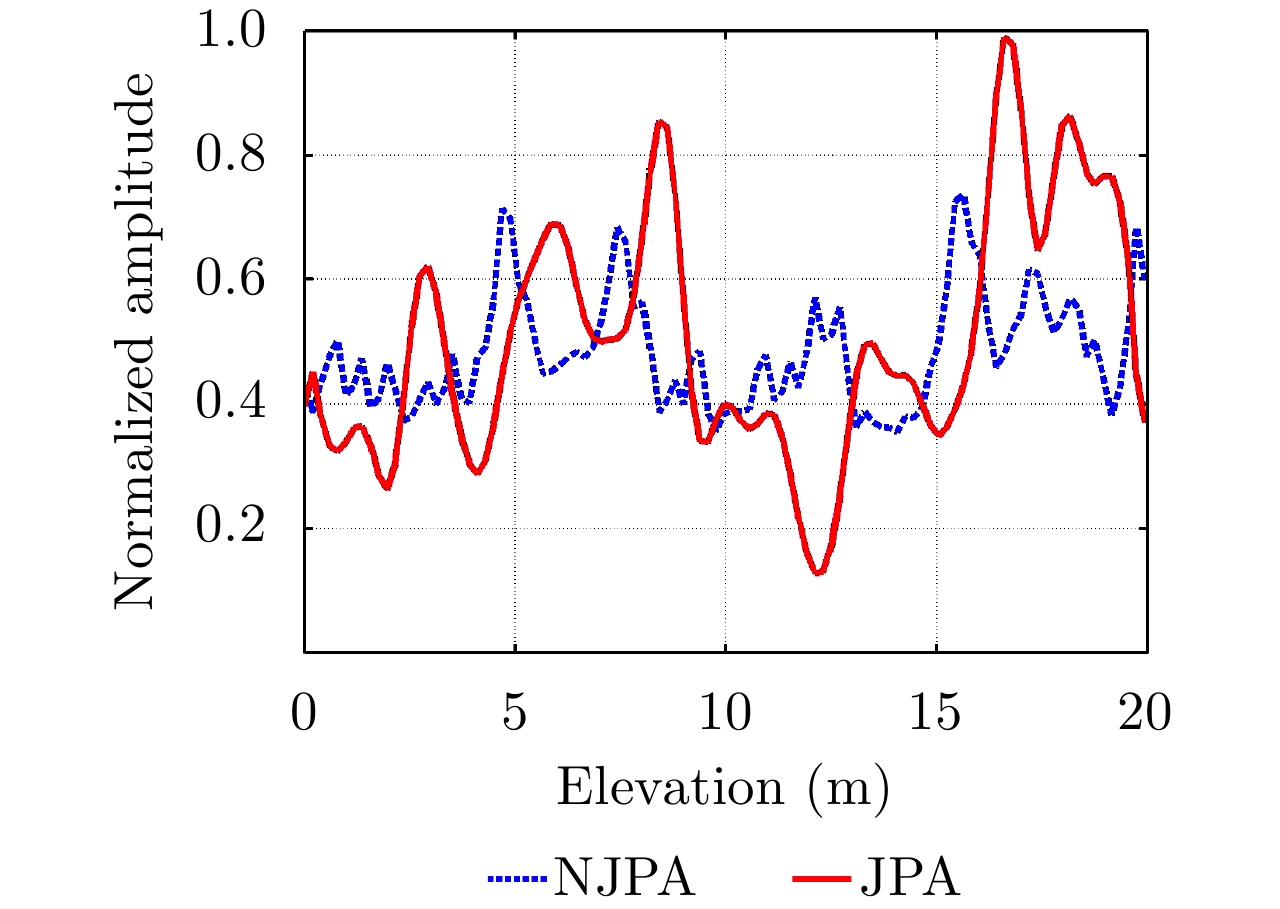
An indispensable step in the imaging of Tomographic Synthetic Aperture Radar (TomoSAR) in spectral analysis or Compressive Sensing (CS) technology is estimating the perpendicular baselines in the Perpendicular Line Of Sight (PLOS) in deramping operations. To avoid this procedure, we introduce a Beam Forming (BF) method in the spatial domain that scans for TomoSAR focusing in the PLOS direction. Because of the sophisticated structure of buildings in urban areas, multipass high-resolution SAR images suffer from discrepancies in the look and incidence angles as well as speckle noise. As a result, it is challenging to precisely coregister all the homologous points in the identical pixels of multipass SAR images. To identify the most relevant pixels with respect to both amplitude and phase when BF imaging is implemented, we propose an inconsistency criterion for specific pixels using the joint phase and amplitude of pixels in a window. By minimizing the inconsistency criterion, homologous points with high accuracy can be identified by focusing on TomoSAR imaging. We used simulation and real data from a multipass X-band airborne TomoSAR system in China to test the effectiveness of the proposed method. Experimental results show that the peak of the reflectivity profile via conventional tomographic imaging is about 15.63 m, whereas that by the proposed method is 16.88 m, which is very close to the actual height of the 18 m building. The results demonstrate the feasibility of improving the focusing power of scatterers in the PLOS direction and extracting the three-dimensional outliers of buildings.
An indispensable step in the imaging of Tomographic Synthetic Aperture Radar (TomoSAR) in spectral analysis or Compressive Sensing (CS) technology is estimating the perpendicular baselines in the Perpendicular Line Of Sight (PLOS) in deramping operations. To avoid this procedure, we introduce a Beam Forming (BF) method in the spatial domain that scans for TomoSAR focusing in the PLOS direction. Because of the sophisticated structure of buildings in urban areas, multipass high-resolution SAR images suffer from discrepancies in the look and incidence angles as well as speckle noise. As a result, it is challenging to precisely coregister all the homologous points in the identical pixels of multipass SAR images. To identify the most relevant pixels with respect to both amplitude and phase when BF imaging is implemented, we propose an inconsistency criterion for specific pixels using the joint phase and amplitude of pixels in a window. By minimizing the inconsistency criterion, homologous points with high accuracy can be identified by focusing on TomoSAR imaging. We used simulation and real data from a multipass X-band airborne TomoSAR system in China to test the effectiveness of the proposed method. Experimental results show that the peak of the reflectivity profile via conventional tomographic imaging is about 15.63 m, whereas that by the proposed method is 16.88 m, which is very close to the actual height of the 18 m building. The results demonstrate the feasibility of improving the focusing power of scatterers in the PLOS direction and extracting the three-dimensional outliers of buildings.


2020, 9(1): 166-173.
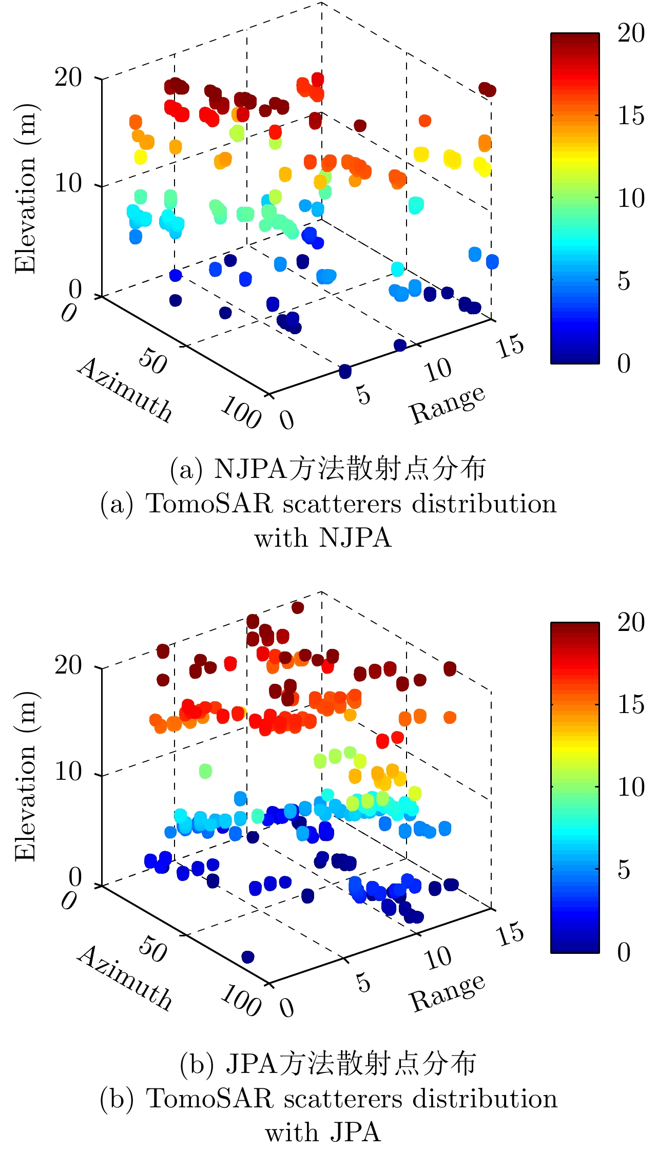
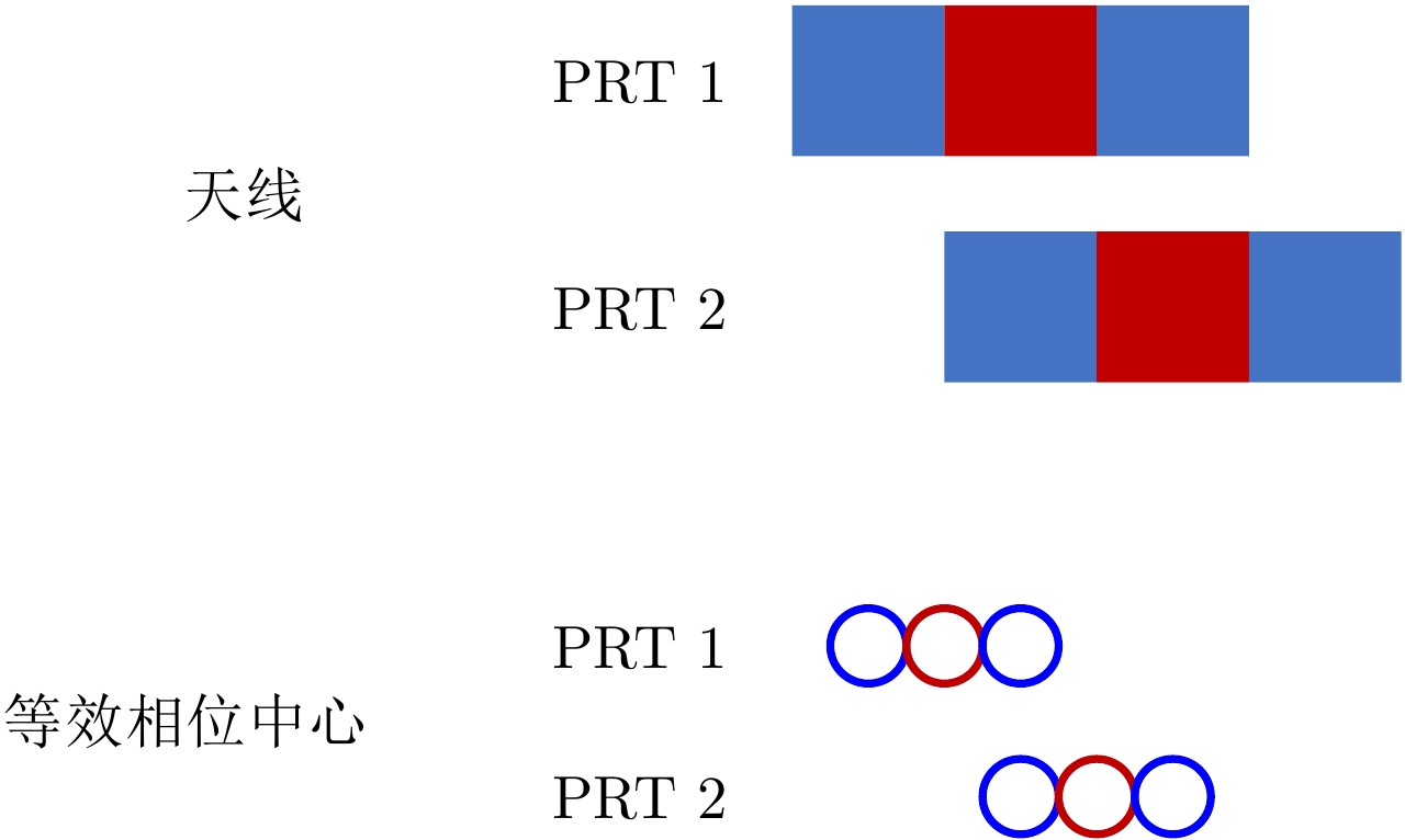
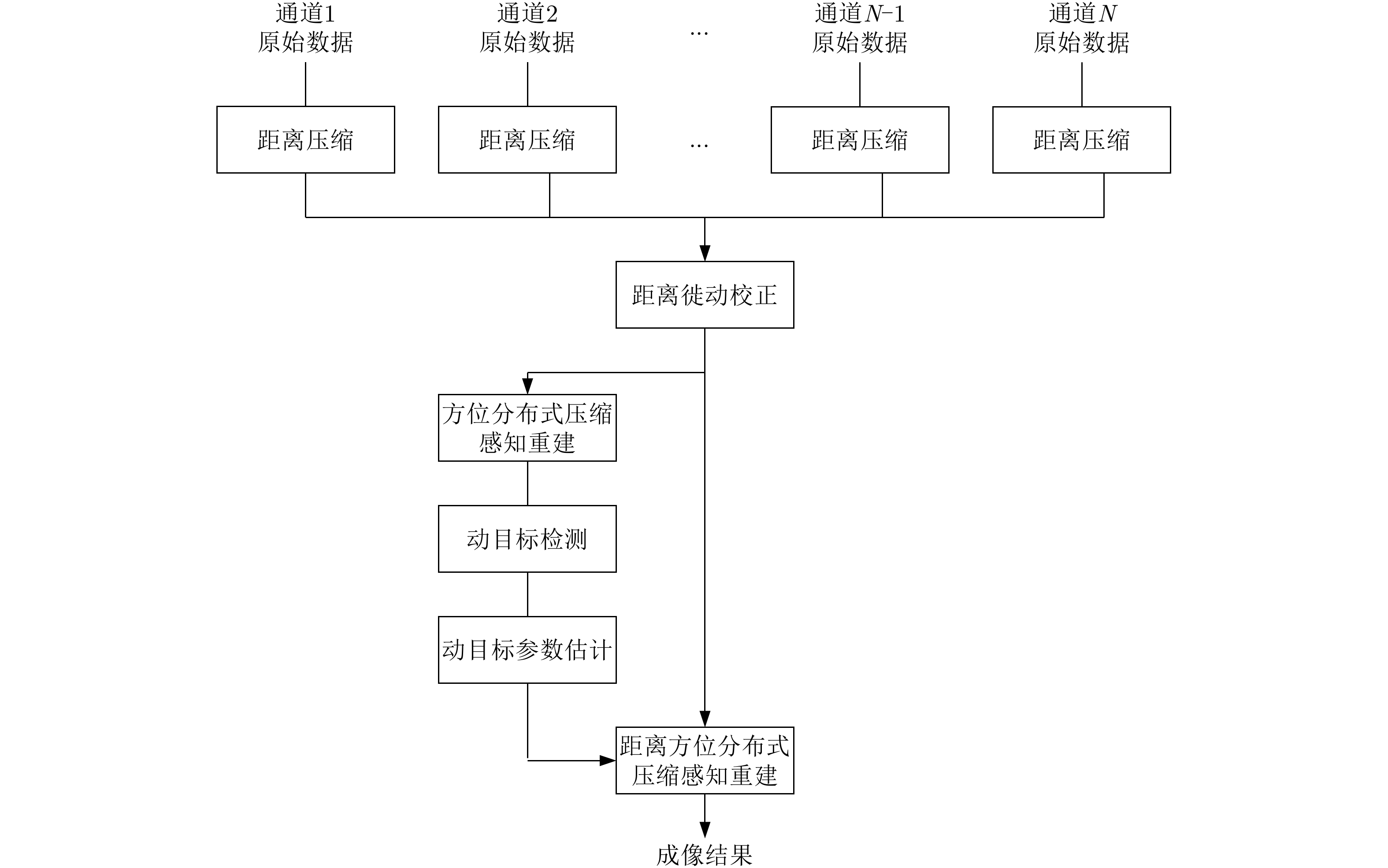
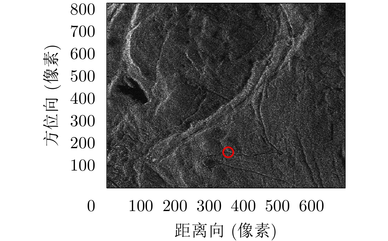
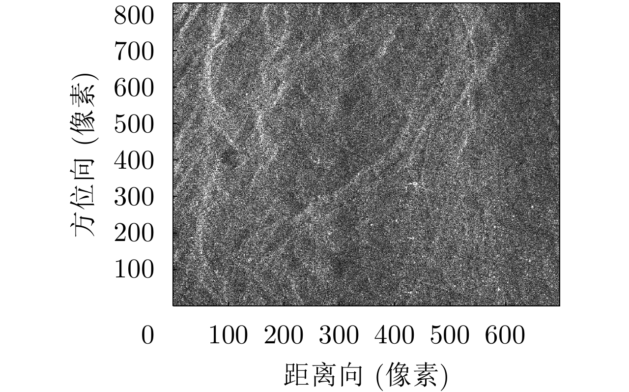
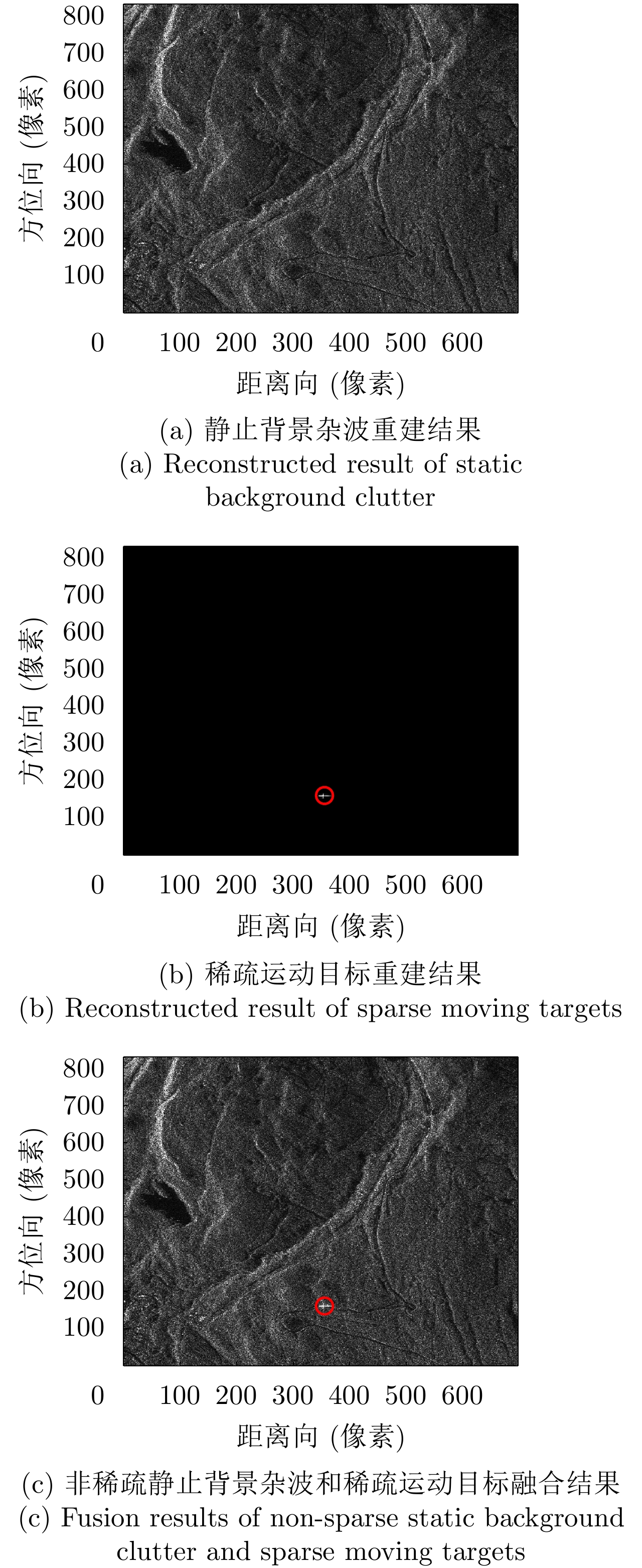
High-resolution wide-swath SAR moving target imaging is of great significance for target tracking. To achieve target tracking, conversional space-based multichannel SAR technology requires a large number of channels. However, this leads to high system complexity. Moreover, paired false target echoes exist in the azimuth. To address such problems, a high-resolution wide-swath SAR moving target imaging technology based on distributed compressed sensing is proposed in this paper. When the number of channels is large enough, the number of channels is approximately half of that of the conventional high-resolution wide-swath target imaging configuration channel. A distributed compressed sensing observation model is constructed using the sparse property of moving targets and the nonsparse characteristics of the clutter background. Clutter background and sparse moving targets are reconstructed by combining one-dimensional distributed compressed sensing reconstruction in the azimuth and two-dimensional distributed compressed sensing reconstruction in the range-azimuth. Moreover, the paired false target echoes in multichannel SAR moving target are suppressed. The simulation results combined with RADAR-SAT data verify the effectiveness of the proposed technology.
High-resolution wide-swath SAR moving target imaging is of great significance for target tracking. To achieve target tracking, conversional space-based multichannel SAR technology requires a large number of channels. However, this leads to high system complexity. Moreover, paired false target echoes exist in the azimuth. To address such problems, a high-resolution wide-swath SAR moving target imaging technology based on distributed compressed sensing is proposed in this paper. When the number of channels is large enough, the number of channels is approximately half of that of the conventional high-resolution wide-swath target imaging configuration channel. A distributed compressed sensing observation model is constructed using the sparse property of moving targets and the nonsparse characteristics of the clutter background. Clutter background and sparse moving targets are reconstructed by combining one-dimensional distributed compressed sensing reconstruction in the azimuth and two-dimensional distributed compressed sensing reconstruction in the range-azimuth. Moreover, the paired false target echoes in multichannel SAR moving target are suppressed. The simulation results combined with RADAR-SAT data verify the effectiveness of the proposed technology.


2020, 9(1): 174-184.
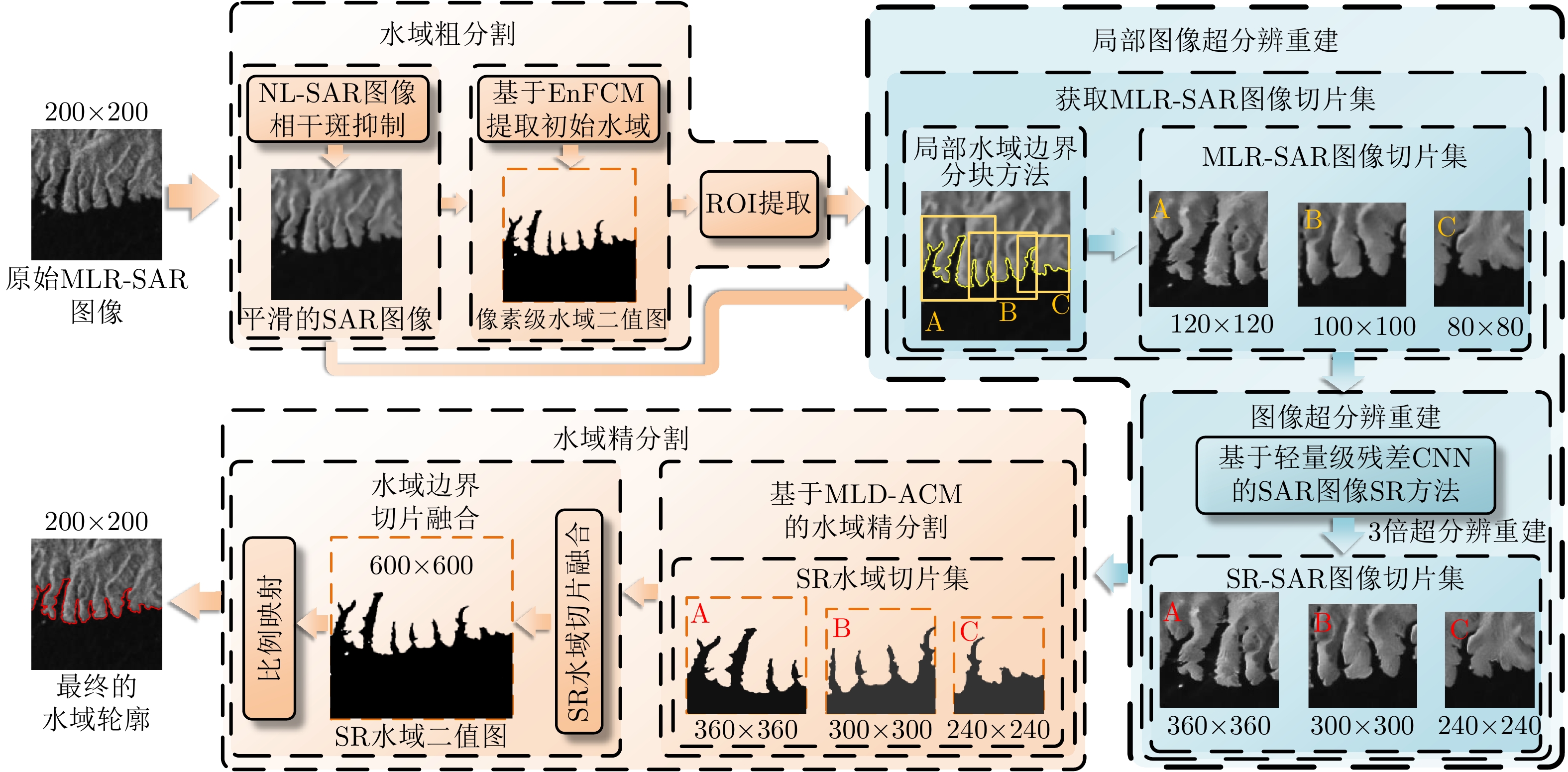
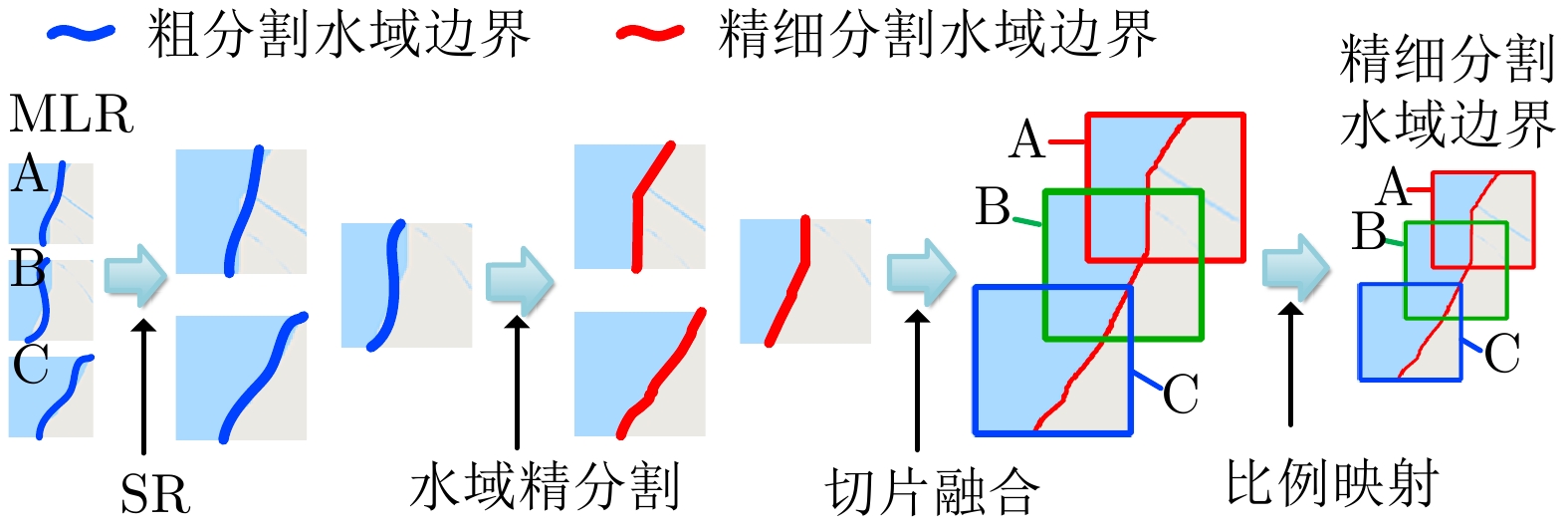
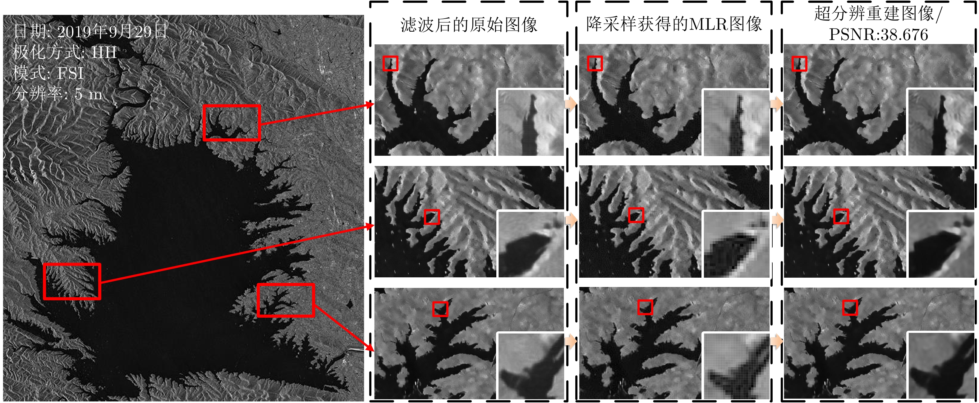
The extraction of water from Synthetic Aperture Radar (SAR) images is of great significance in water resources investigation and monitoring disasters. To deal with the problems of the insufficient accuracy of water boundaries extracted from middle-low resolution SAR images. This paper proposes a high-precision water boundaries extraction method based on a local super-resolution restoration technology that combines the advantages of the super-resolution restoration technology based on the lightweight residual Convolutional Neural Network (CNN) and the traditional SAR images water extraction methods. The proposed method can significantly improve the accuracy of water segmentation results by using SAR images. To verify the effectiveness of the proposed method, as a study area, we selected the Danjiangkou Reservoir, the water source of the middle route of a south-to-north water diversion project. Further, we conducted experiments on the multi-mode SAR dataset and evaluated its accuracy. This dataset included one Standard Strip-map (SS) mode image obtained by the Chinese GaoFen-3 (GF-3) satellite with a resolution of 8 m and one Interferometric Wide-swath (IW) mode SAR image obtained by Sentinel-1 satellite with a resolution of 20 m. The experimental results showed that the water segmentation results from the middle–low resolution SAR images of the proposed method were more precise, and the overall water segmentation performance was superior to that of the traditional methods.
The extraction of water from Synthetic Aperture Radar (SAR) images is of great significance in water resources investigation and monitoring disasters. To deal with the problems of the insufficient accuracy of water boundaries extracted from middle-low resolution SAR images. This paper proposes a high-precision water boundaries extraction method based on a local super-resolution restoration technology that combines the advantages of the super-resolution restoration technology based on the lightweight residual Convolutional Neural Network (CNN) and the traditional SAR images water extraction methods. The proposed method can significantly improve the accuracy of water segmentation results by using SAR images. To verify the effectiveness of the proposed method, as a study area, we selected the Danjiangkou Reservoir, the water source of the middle route of a south-to-north water diversion project. Further, we conducted experiments on the multi-mode SAR dataset and evaluated its accuracy. This dataset included one Standard Strip-map (SS) mode image obtained by the Chinese GaoFen-3 (GF-3) satellite with a resolution of 8 m and one Interferometric Wide-swath (IW) mode SAR image obtained by Sentinel-1 satellite with a resolution of 20 m. The experimental results showed that the water segmentation results from the middle–low resolution SAR images of the proposed method were more precise, and the overall water segmentation performance was superior to that of the traditional methods.


2020, 9(1): 185-194.
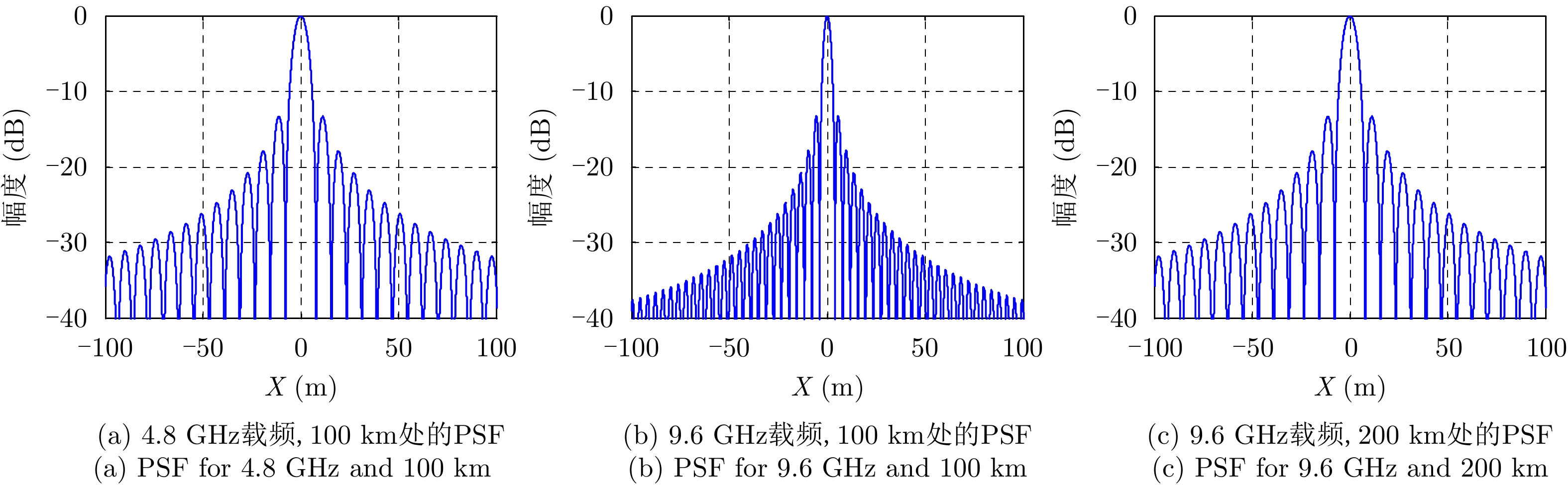
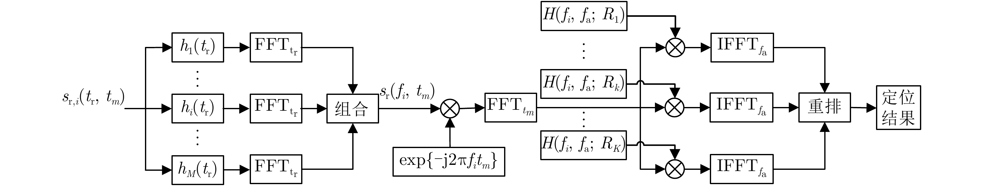
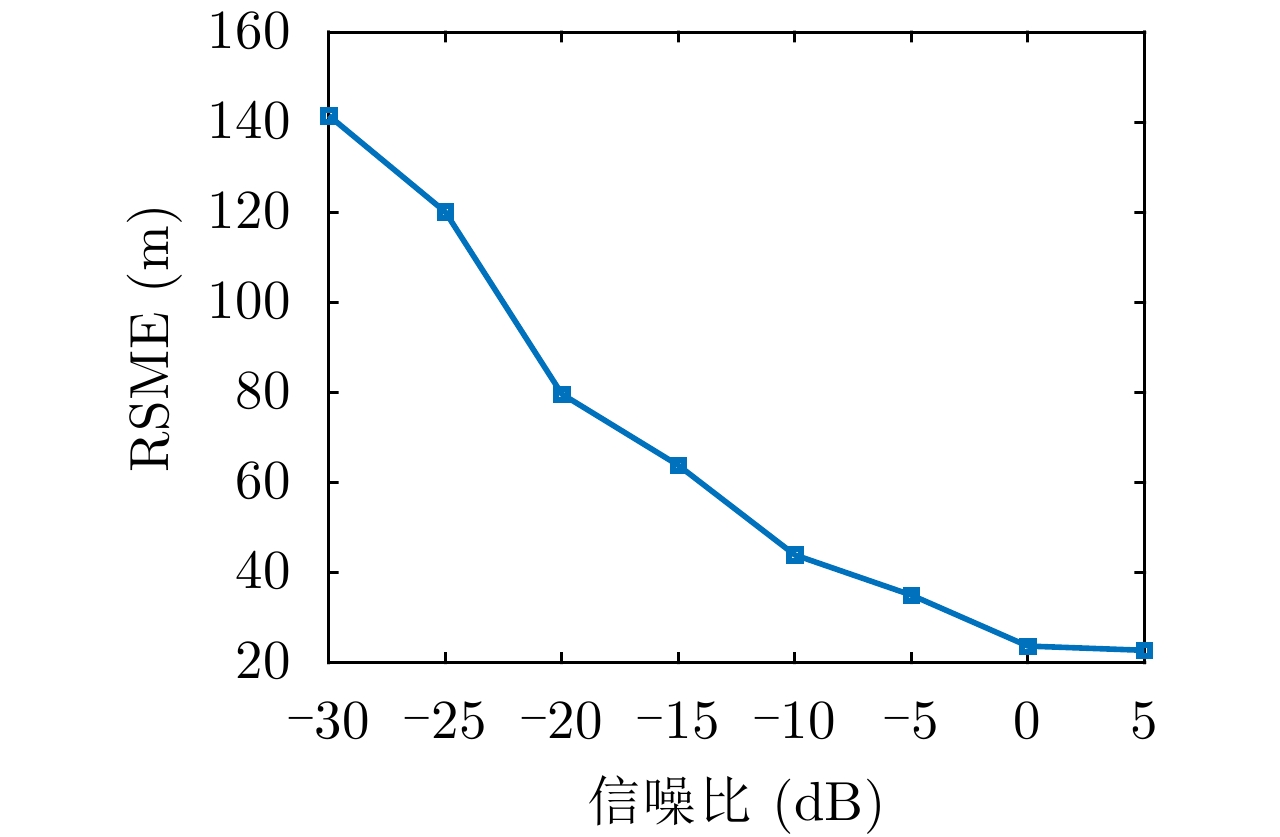
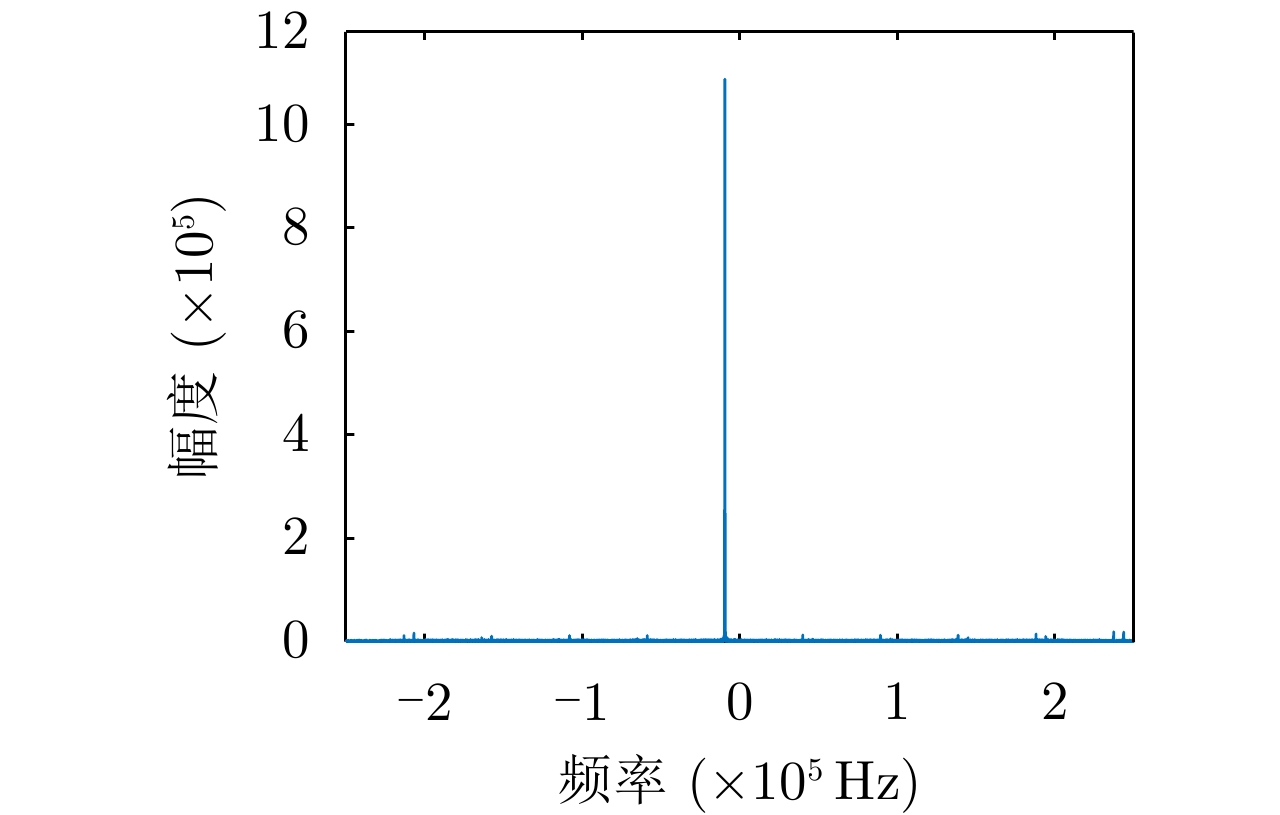
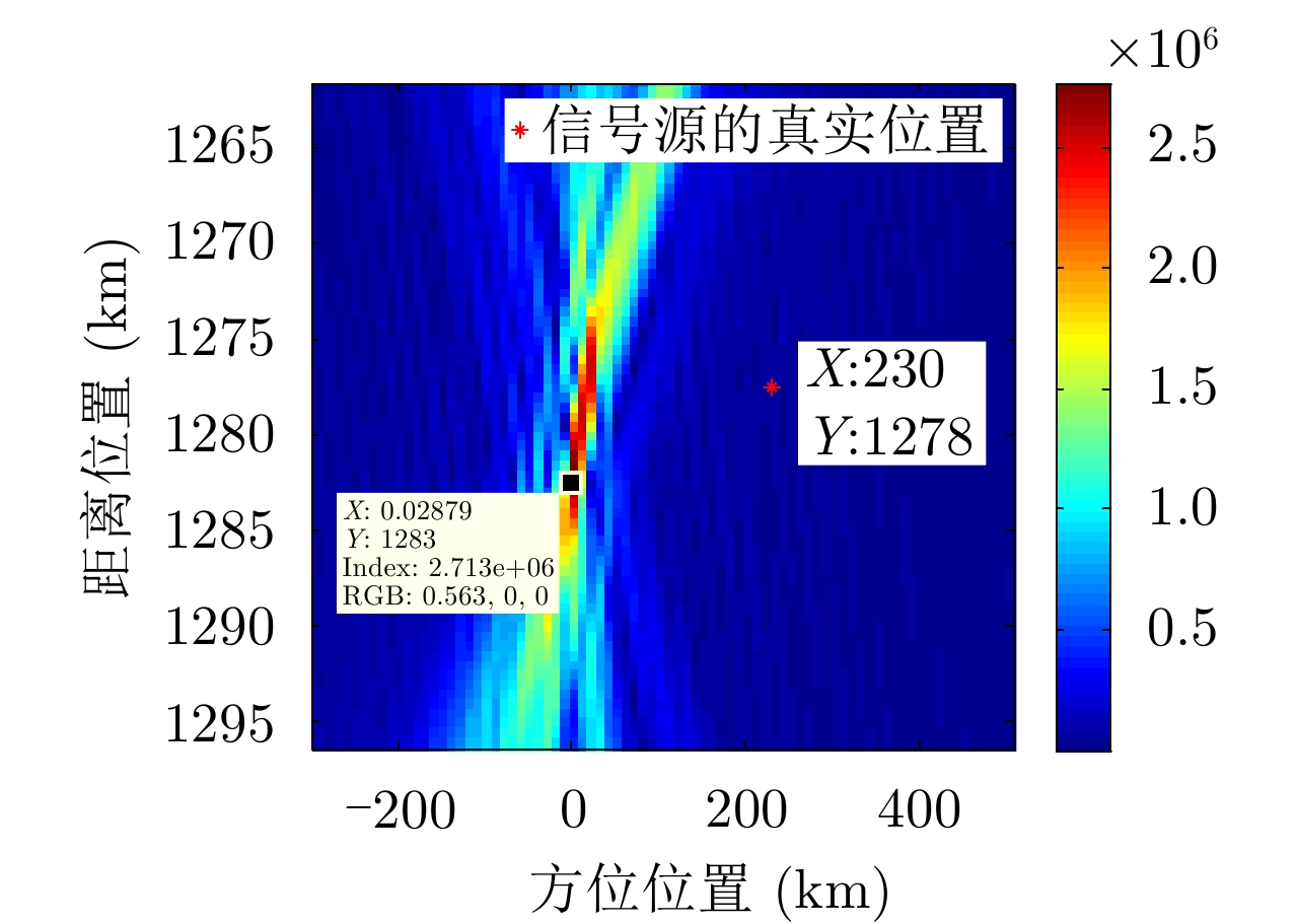
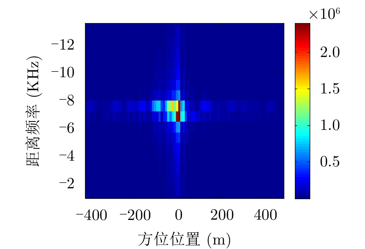
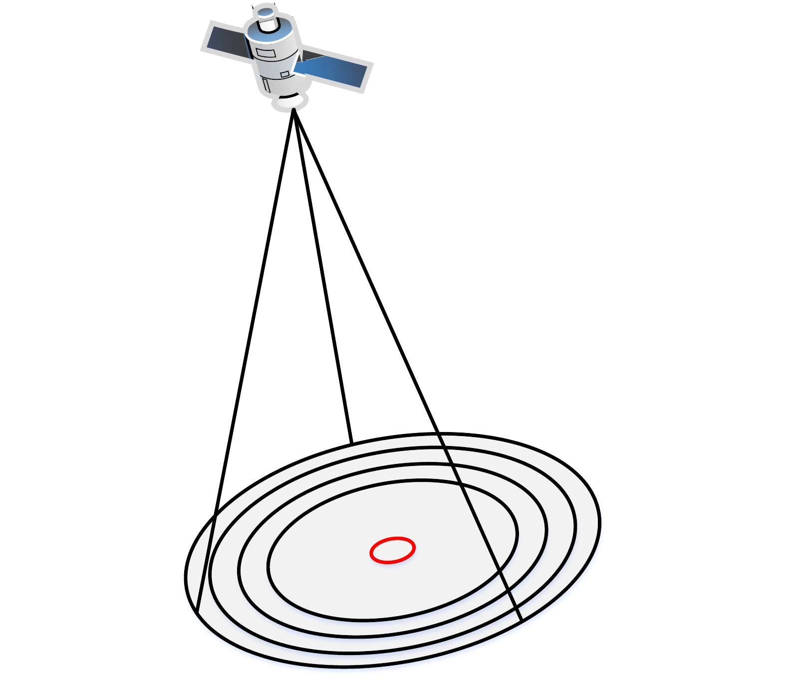
When the direction-of-arrival estimation is made by a single platform, the localization accuracy decreases with increases in the distance from the radiation source, which means the localization accuracy of the azimuth of the radiation source at long distances must be improved. To address this problem, we propose a radiation-source localization algorithm based on a long synthetic aperture. This algorithm introduces the use of synthetic aperture imaging to the passive localization of radiation sources. A long virtual aperture is obtained by movement of the platform, and received data is processed in the form of synthetic aperture radar to obtain high azimuth localization accuracy. For a single-frequency radiation source, the received signal is equivalent to a linear frequency-modulation signal in the azimuth domain, and its chirp rate is inversely proportional to the distance from the radiation source. A range search and azimuth-focusing method are used to perform signal focusing in the range–azimuth domain, and the localization of the radiation source is obtained directly by two-dimensional imaging. Moreover, with respect to the characteristics of wide-beam reconnaissance, we analyzed the range–azimuth coupling relationship of the chirp rate at a low sampling frequency. On this basis, methods for direction-of-arrival estimation and two-dimensional imaging localization are proposed. Our theoretical derivation and experimental data processing results verify the validity of this algorithm.
When the direction-of-arrival estimation is made by a single platform, the localization accuracy decreases with increases in the distance from the radiation source, which means the localization accuracy of the azimuth of the radiation source at long distances must be improved. To address this problem, we propose a radiation-source localization algorithm based on a long synthetic aperture. This algorithm introduces the use of synthetic aperture imaging to the passive localization of radiation sources. A long virtual aperture is obtained by movement of the platform, and received data is processed in the form of synthetic aperture radar to obtain high azimuth localization accuracy. For a single-frequency radiation source, the received signal is equivalent to a linear frequency-modulation signal in the azimuth domain, and its chirp rate is inversely proportional to the distance from the radiation source. A range search and azimuth-focusing method are used to perform signal focusing in the range–azimuth domain, and the localization of the radiation source is obtained directly by two-dimensional imaging. Moreover, with respect to the characteristics of wide-beam reconnaissance, we analyzed the range–azimuth coupling relationship of the chirp rate at a low sampling frequency. On this basis, methods for direction-of-arrival estimation and two-dimensional imaging localization are proposed. Our theoretical derivation and experimental data processing results verify the validity of this algorithm.


2020, 9(1): 195-203.
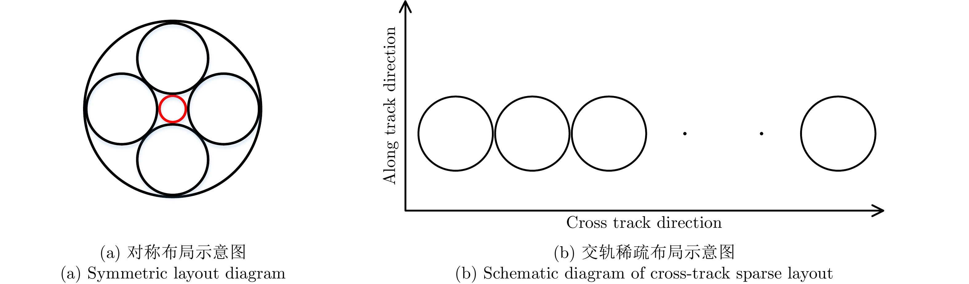
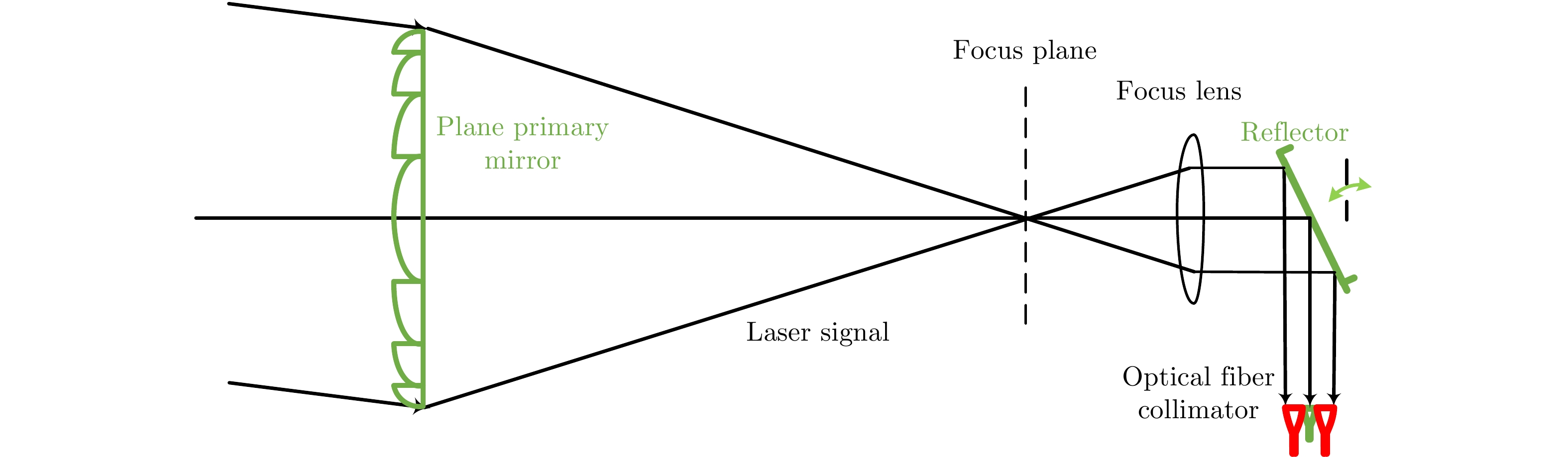
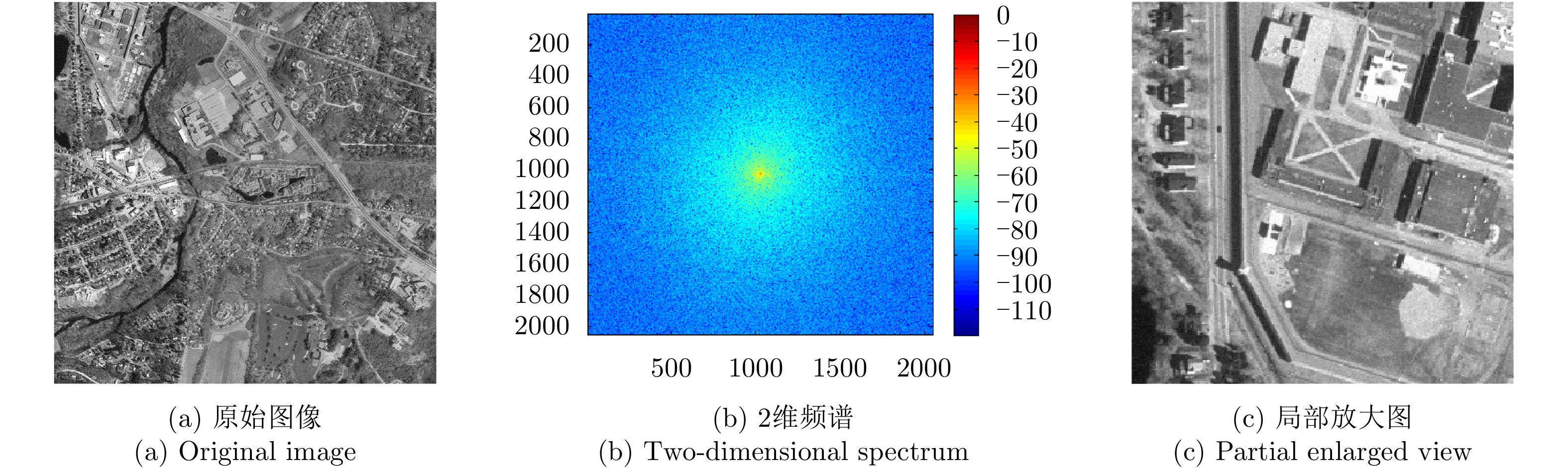
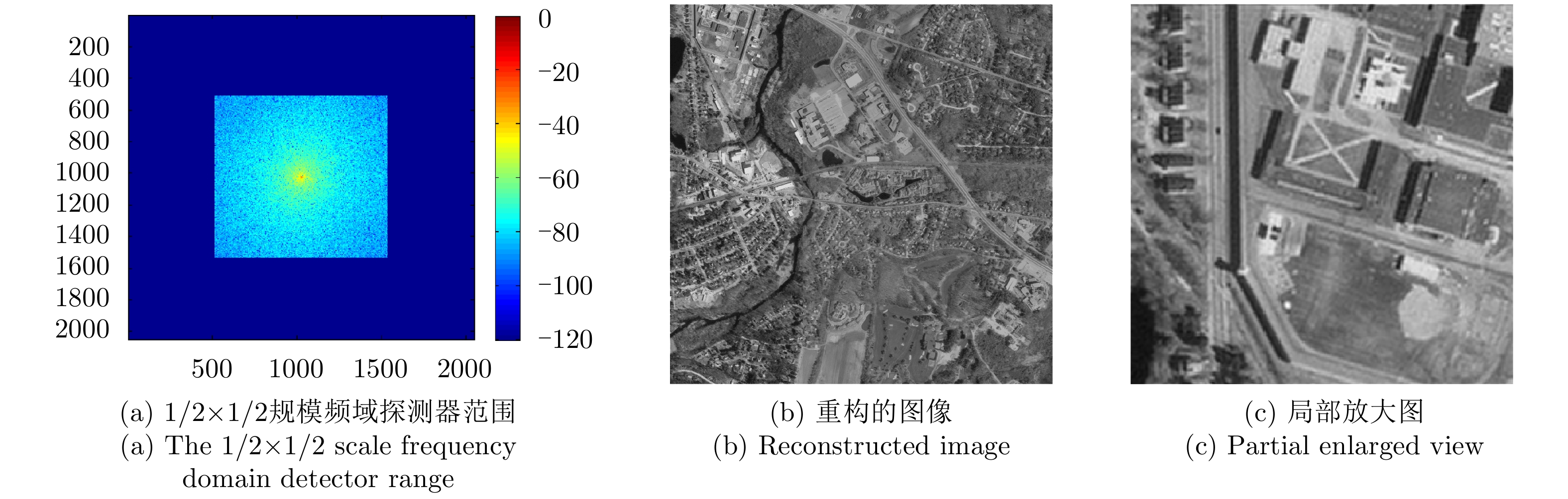
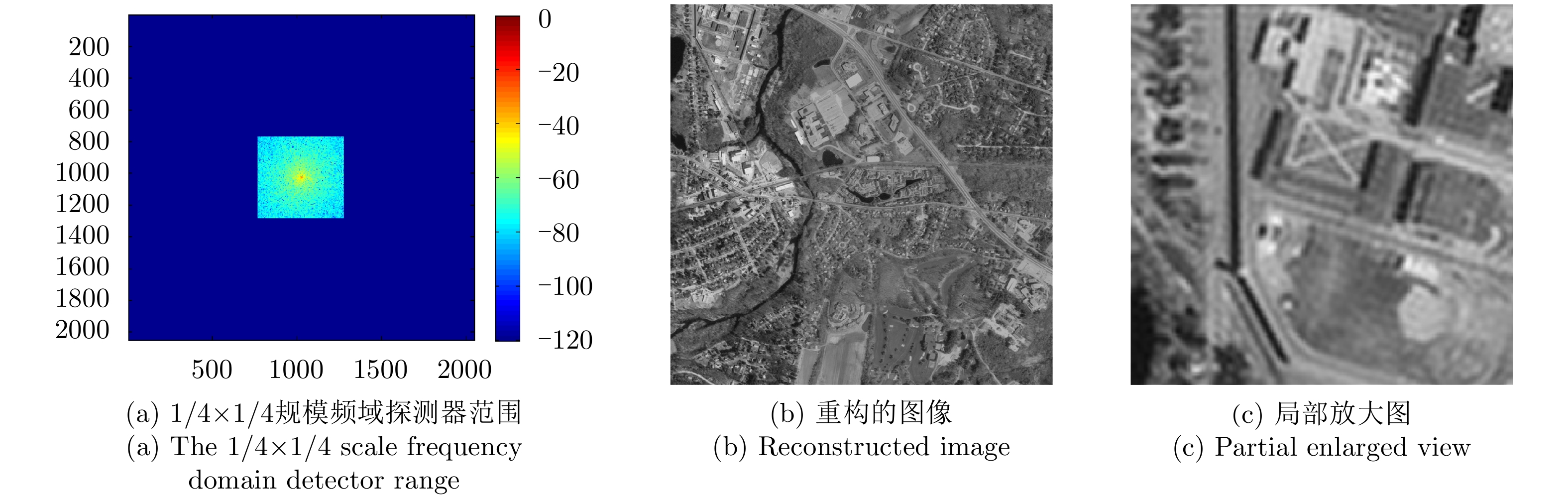
In recent years, the diffractive optical systems have developed rapidly. Diffractive devices such as binary optical device and membrane-based lens are equivalent to fixed phase shifters of microwave antennas. Thus, the mature theories and methods of a microwave phased-array antenna could be used for diffractive devices’ performance analysis. Both laser Synthetic Aperture Radar (SAR) and laser communication feature a single color and long wavelength, and they are specifically suitable for non-imaging diffractive optical systems. A signal wave front control realized by a diffraction device reduces the focal length and the weight of a system. Research on laser SAR and laser communication technology has important theoretical significance and application value for diffractive optical system. In this paper, we provide a phased-array interpretation of a diffractive optical system and introduce research that has been conducted on airborne and spaceborne laser SAR with respect to diffractive optical systems. We propose the concept of shipborne 1 m diffraction aperture laser communication and an interferometric positioning system and analyze its performance. The results indicated that, using a 10 m short baseline, this system can reach 400 million km with a corresponding positioning accuracy of 6 km that is suitable for use during deep space probes. We also discuss the sparse-sampling laser-imaging problem using a laser to illuminate the target, transforming the laser image signal into the frequency domain with Fourier lens, using the small-scale detector to perform sparse sampling in the low-frequency domain, and reconstructing the target image using a computer. Some preliminary simulation results are provided.
In recent years, the diffractive optical systems have developed rapidly. Diffractive devices such as binary optical device and membrane-based lens are equivalent to fixed phase shifters of microwave antennas. Thus, the mature theories and methods of a microwave phased-array antenna could be used for diffractive devices’ performance analysis. Both laser Synthetic Aperture Radar (SAR) and laser communication feature a single color and long wavelength, and they are specifically suitable for non-imaging diffractive optical systems. A signal wave front control realized by a diffraction device reduces the focal length and the weight of a system. Research on laser SAR and laser communication technology has important theoretical significance and application value for diffractive optical system. In this paper, we provide a phased-array interpretation of a diffractive optical system and introduce research that has been conducted on airborne and spaceborne laser SAR with respect to diffractive optical systems. We propose the concept of shipborne 1 m diffraction aperture laser communication and an interferometric positioning system and analyze its performance. The results indicated that, using a 10 m short baseline, this system can reach 400 million km with a corresponding positioning accuracy of 6 km that is suitable for use during deep space probes. We also discuss the sparse-sampling laser-imaging problem using a laser to illuminate the target, transforming the laser image signal into the frequency domain with Fourier lens, using the small-scale detector to perform sparse sampling in the low-frequency domain, and reconstructing the target image using a computer. Some preliminary simulation results are provided.


 微信 | 公众平台

