
 Submit Manuscript
 Peer Review
 Editor Work
2019 Vol. 8, No. 6
 Previous Issue
 Abstract
 2958KB
This paper analyzes the multi-directional evolution of radar ground imaging technology from the aspects of the representation of imaging results, aperture manifolds, signal channels, system morphologies, observation directions, processing methods, realization mechanisms, and target recognition. Attempts are made to analyze and understand the internal and external factors as well as the development law of radar ground imaging technology from a macroscopic perspective over a long time scale, and to predict the direction of future development. Alternative observation perspective and thinking method are proposed with a view to advance the understanding of the times veins and macro trends of radar ground imaging technology, meet practical needs, lead innovation efforts, and promote development and applications.
This paper analyzes the multi-directional evolution of radar ground imaging technology from the aspects of the representation of imaging results, aperture manifolds, signal channels, system morphologies, observation directions, processing methods, realization mechanisms, and target recognition. Attempts are made to analyze and understand the internal and external factors as well as the development law of radar ground imaging technology from a macroscopic perspective over a long time scale, and to predict the direction of future development. Alternative observation perspective and thinking method are proposed with a view to advance the understanding of the times veins and macro trends of radar ground imaging technology, meet practical needs, lead innovation efforts, and promote development and applications.


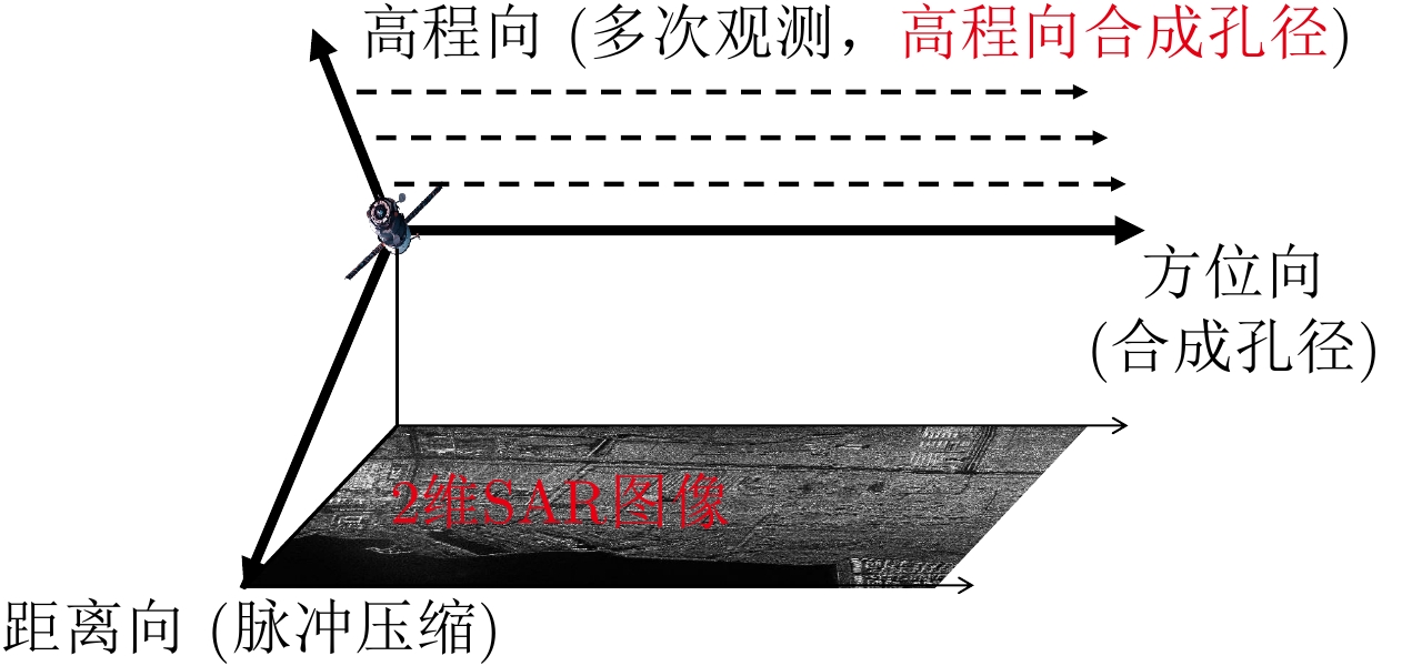
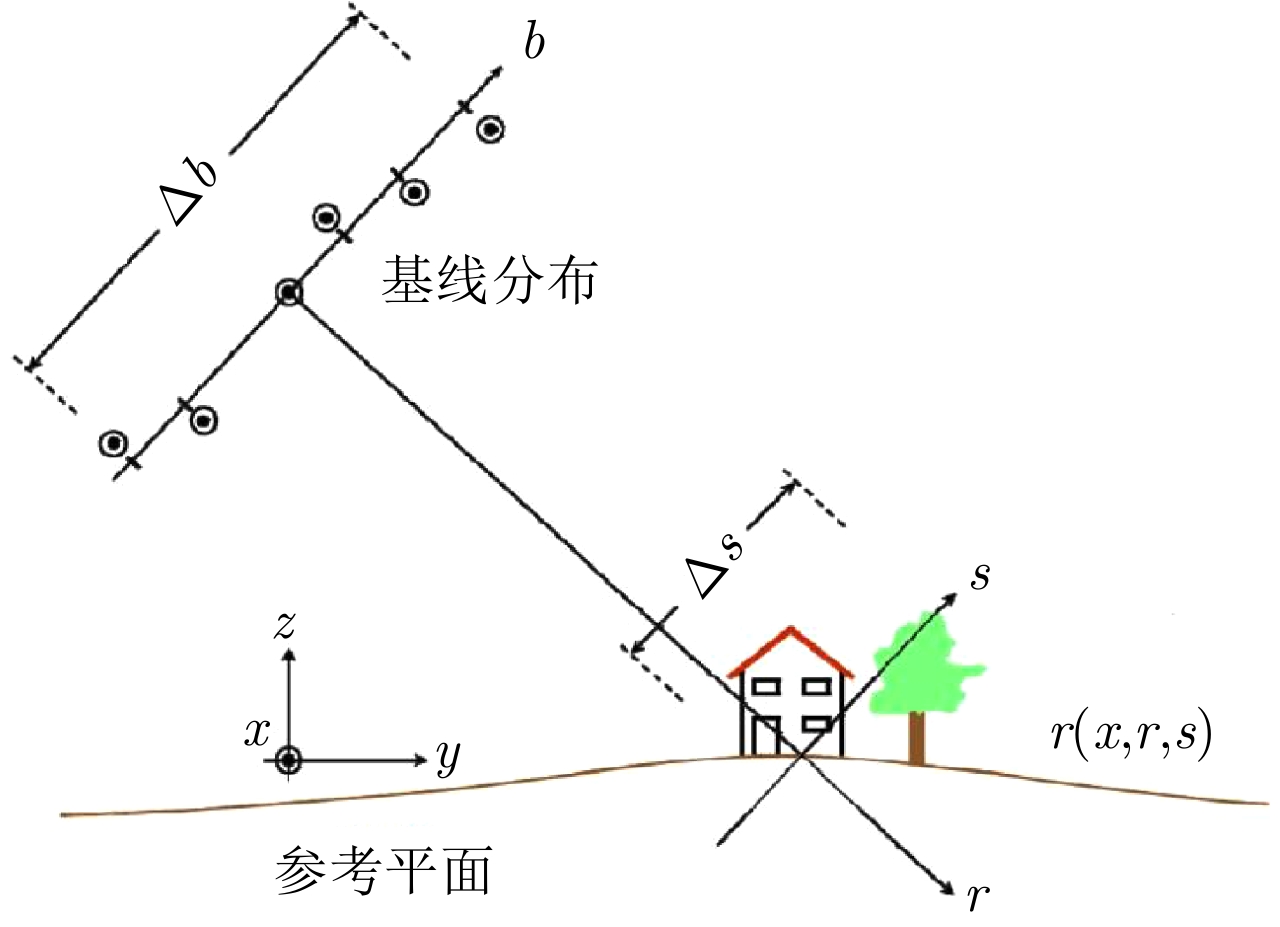
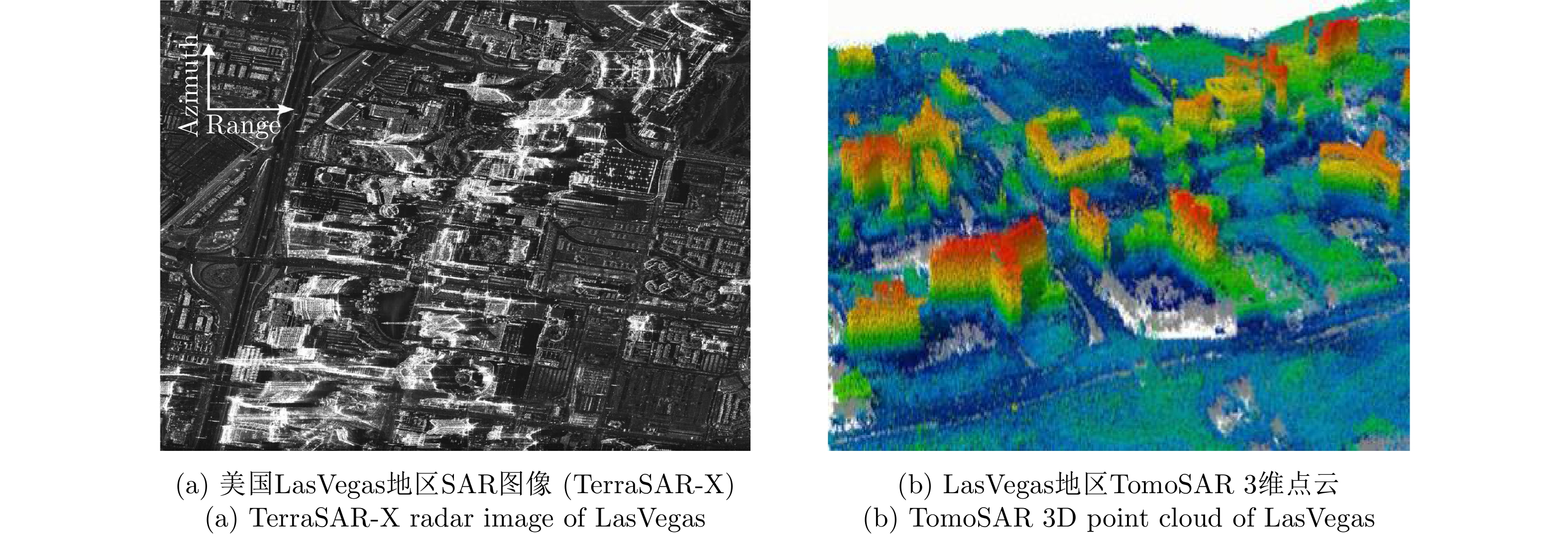
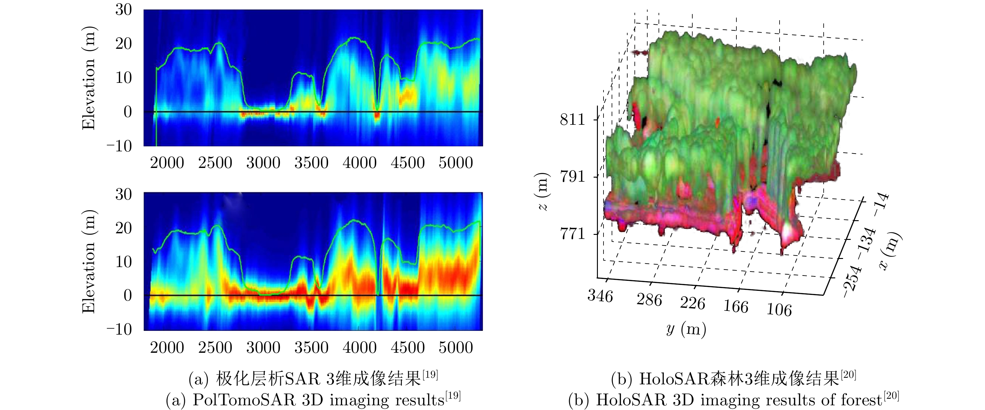
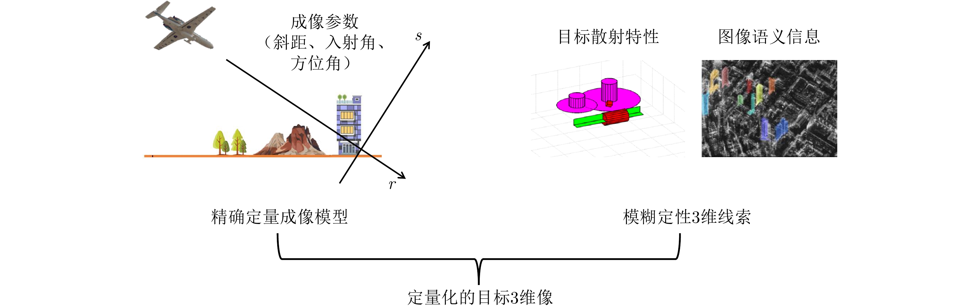
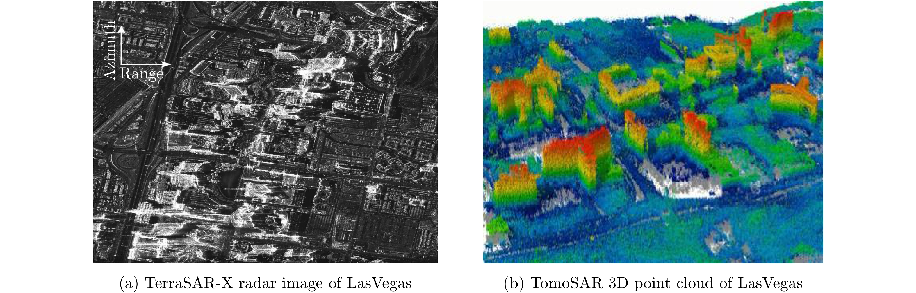
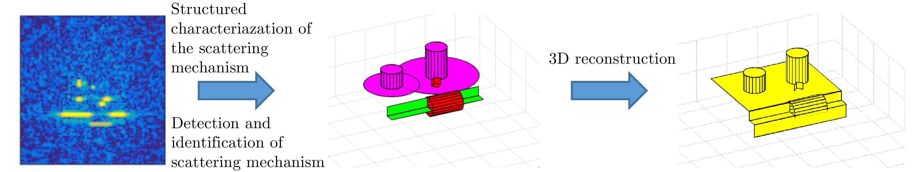
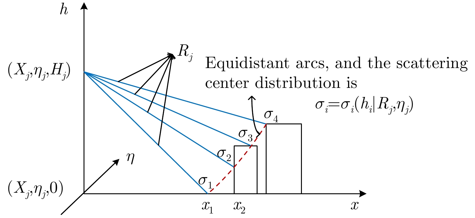
Synthetic Aperture Radar three-dimensional (SAR 3D) imaging technology can eliminate severe overlap in 2D images, and improve target recognition and 3D modeling capabilities, which have become an important trend in SAR development. After decades of development of SAR 3D imaging technology, many types of 3D imaging methods have been proposed. In this study, the history of SAR 3D imaging technology is systematically reviewed and the characteristics of existing SAR 3D imaging technology are analyzed. Given that the 3D information contained in SAR echo and images is not fully used by existing techniques, a new concept of SAR microwave vision 3D imaging has been proposed for the first time. This new concept is integrated with microwave scattering mechanism and image visual semantics to realize three-dimensional reconstruction, which form the theory and method of SAR microwave vision 3D imaging and can achieve high-efficiency and low-cost SAR 3D imaging. This study also analyzes the concept, goal and key scientific problems of SAR microwave vision 3D imaging and provides a preliminary solution, which will contribute in several ways to our understanding of SAR 3D imaging and provide the basis for further research.
Synthetic Aperture Radar three-dimensional (SAR 3D) imaging technology can eliminate severe overlap in 2D images, and improve target recognition and 3D modeling capabilities, which have become an important trend in SAR development. After decades of development of SAR 3D imaging technology, many types of 3D imaging methods have been proposed. In this study, the history of SAR 3D imaging technology is systematically reviewed and the characteristics of existing SAR 3D imaging technology are analyzed. Given that the 3D information contained in SAR echo and images is not fully used by existing techniques, a new concept of SAR microwave vision 3D imaging has been proposed for the first time. This new concept is integrated with microwave scattering mechanism and image visual semantics to realize three-dimensional reconstruction, which form the theory and method of SAR microwave vision 3D imaging and can achieve high-efficiency and low-cost SAR 3D imaging. This study also analyzes the concept, goal and key scientific problems of SAR microwave vision 3D imaging and provides a preliminary solution, which will contribute in several ways to our understanding of SAR 3D imaging and provide the basis for further research.


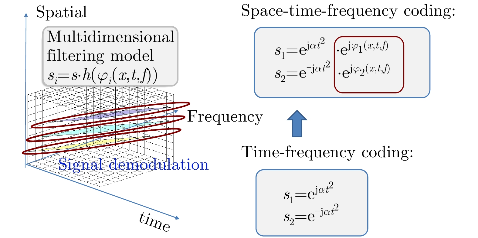
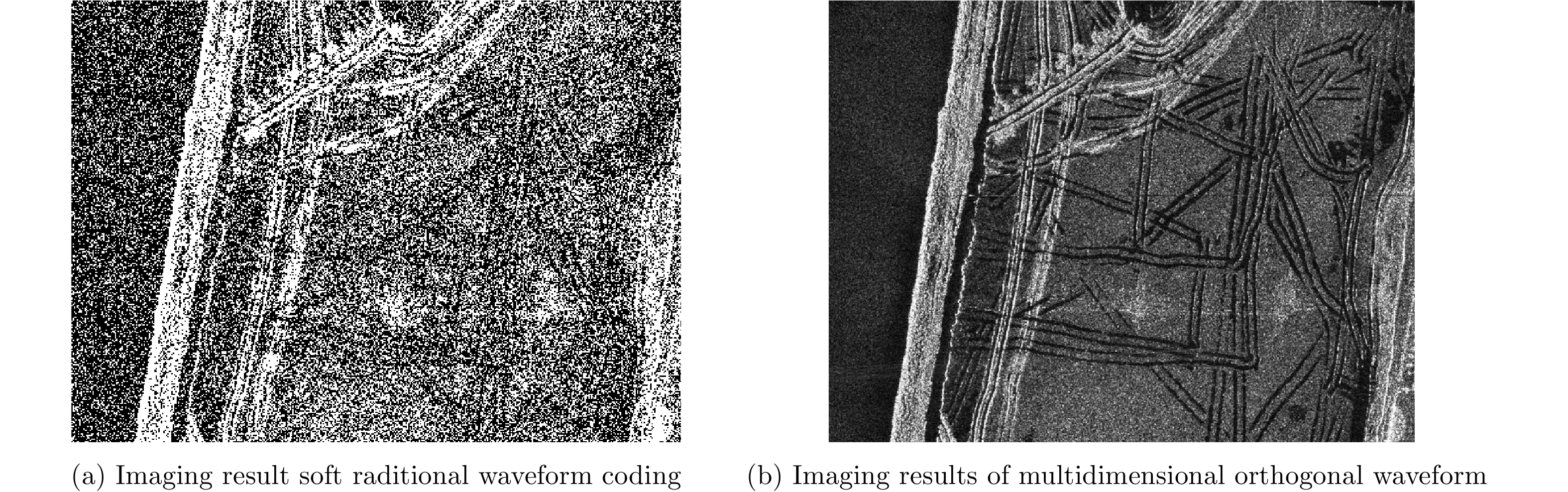


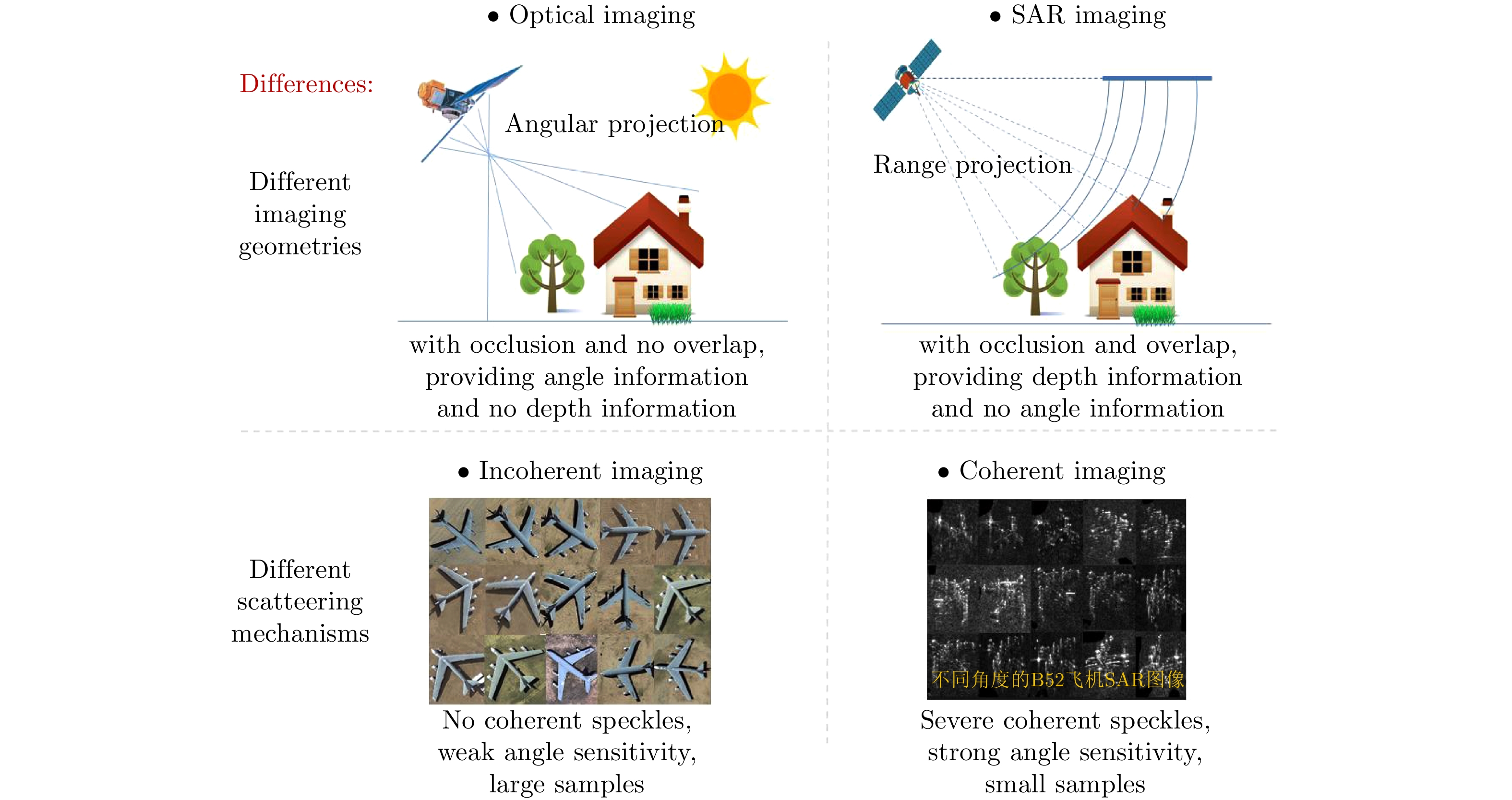

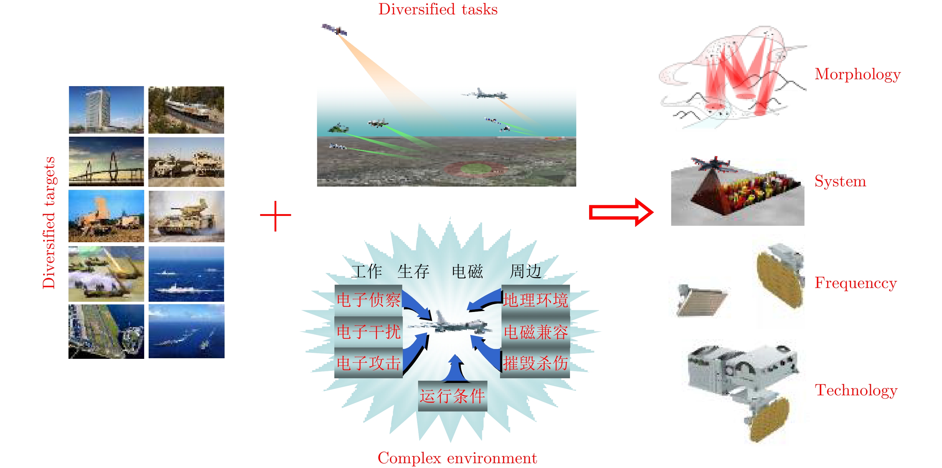
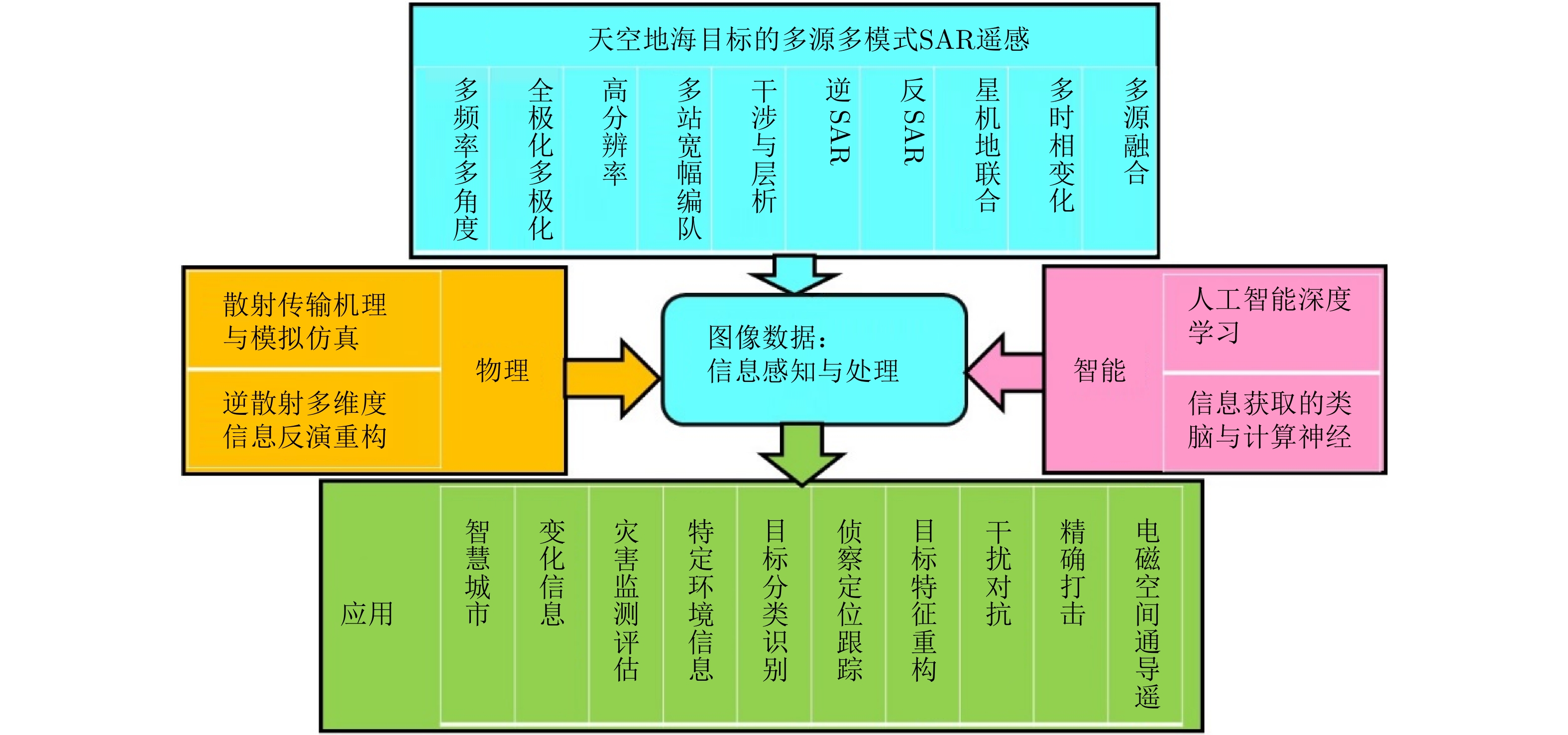
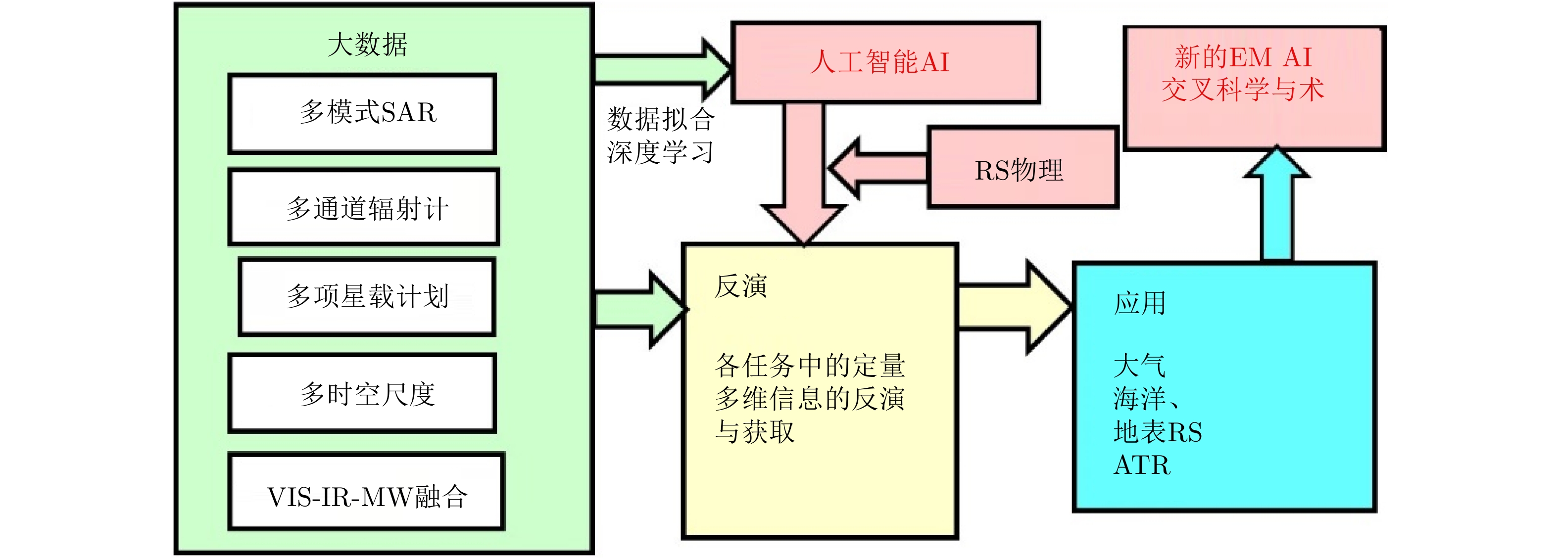
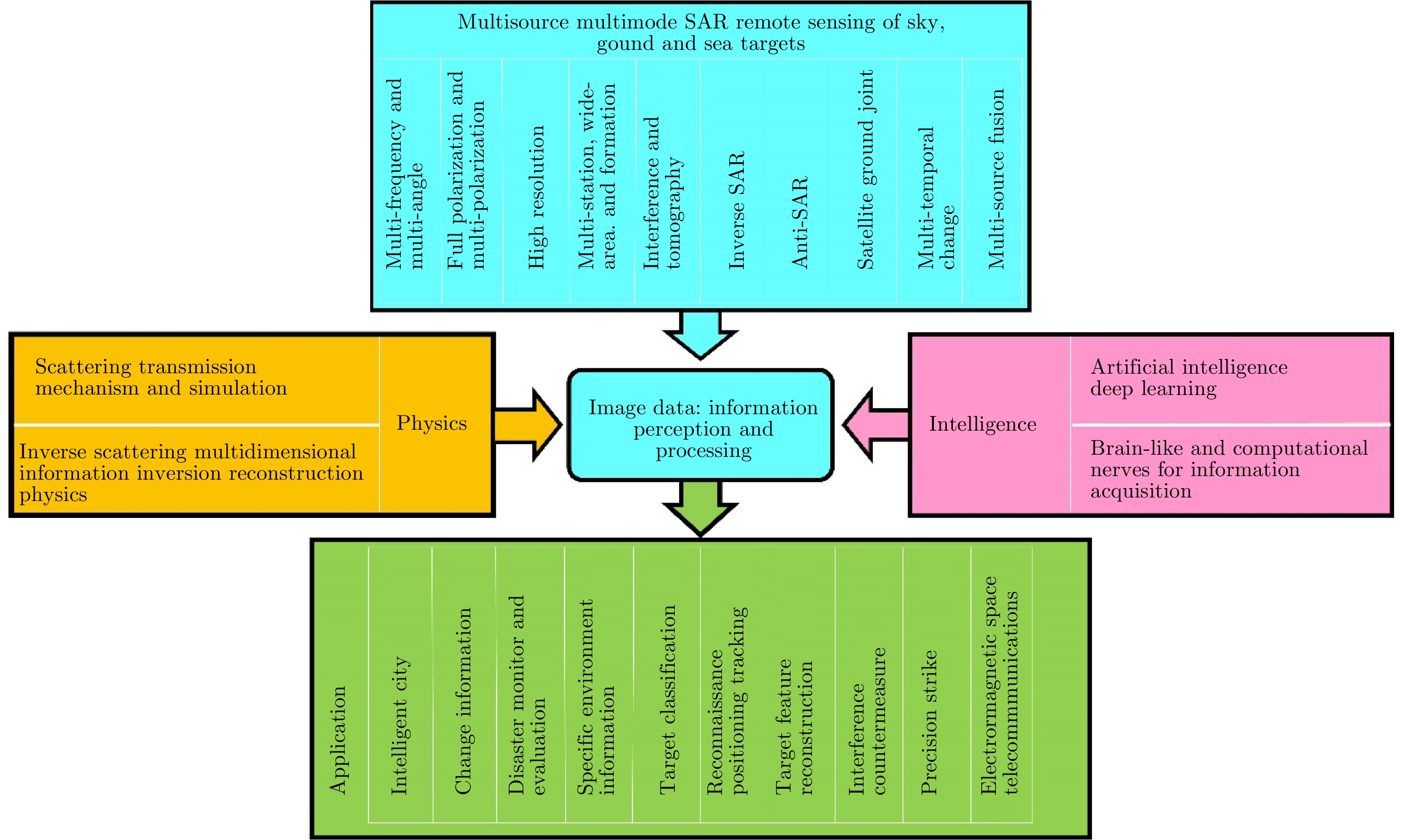
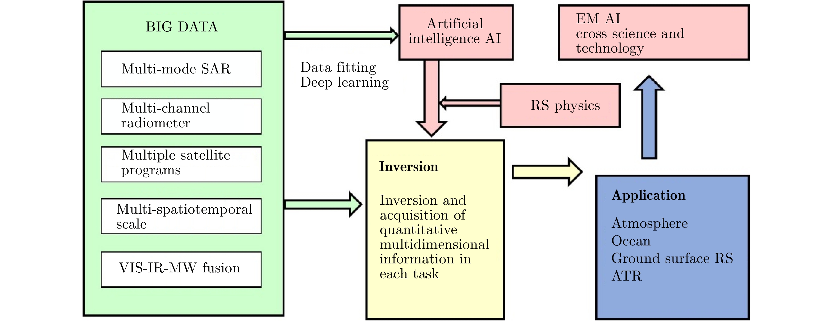
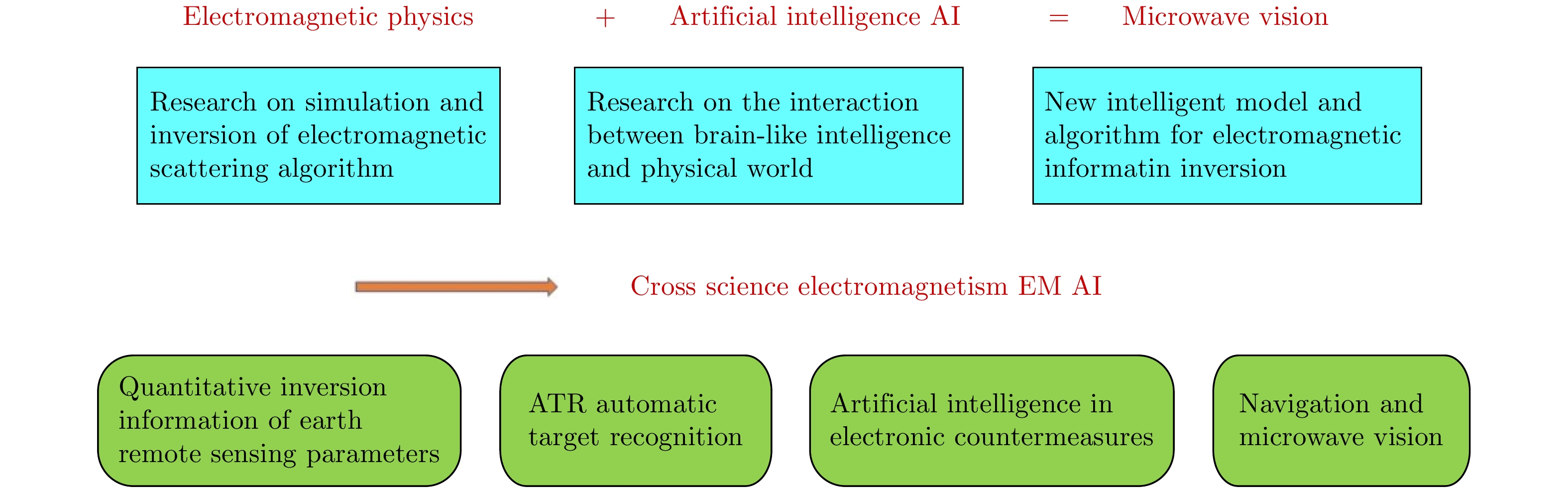
The development of multimode high-resolution Synthetic Aperture Radar (SAR) poses new challenges to information perception and feature abstraction of the space, ground, sea, and environment targets. The intersection of spatial remote sensing big data and artificial intelligence information technology is a new scientific research domain and major application area in Automatic Target Recognition (ATR). We emphasize that research on artificial intelligence information technology needs to be conducted under the physical background of the interaction between electromagnetic waves and targets, i.e., physical intelligence, to develop microwave vision of information perception on the electromagnetic spectrum that cannot be recognized by human eyes. This study is based on a keynote speech presented by author at the Fifth Young Scientists Forum of Journal of Radars on August 15, 2019.
The development of multimode high-resolution Synthetic Aperture Radar (SAR) poses new challenges to information perception and feature abstraction of the space, ground, sea, and environment targets. The intersection of spatial remote sensing big data and artificial intelligence information technology is a new scientific research domain and major application area in Automatic Target Recognition (ATR). We emphasize that research on artificial intelligence information technology needs to be conducted under the physical background of the interaction between electromagnetic waves and targets, i.e., physical intelligence, to develop microwave vision of information perception on the electromagnetic spectrum that cannot be recognized by human eyes. This study is based on a keynote speech presented by author at the Fifth Young Scientists Forum of Journal of Radars on August 15, 2019.


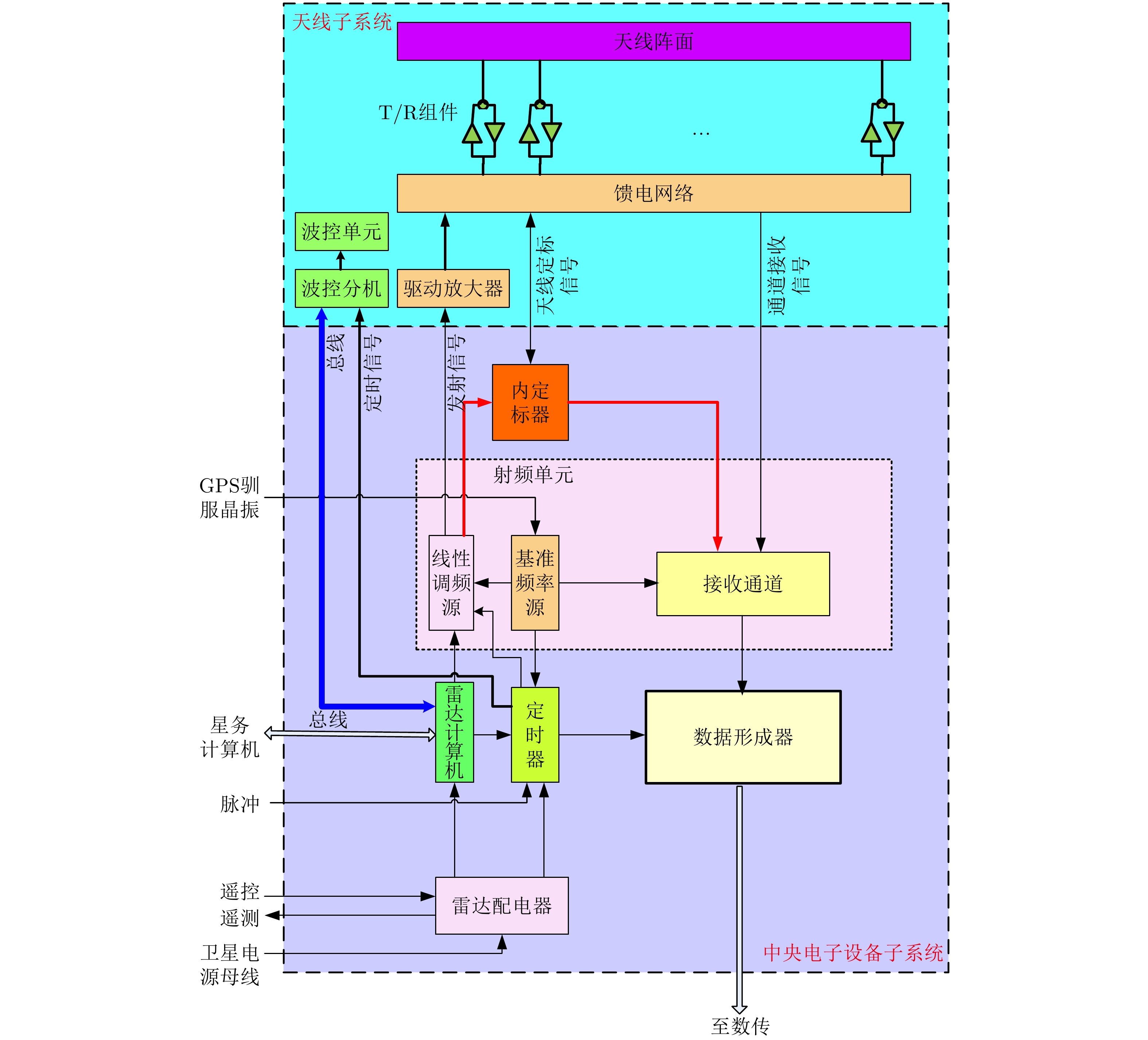
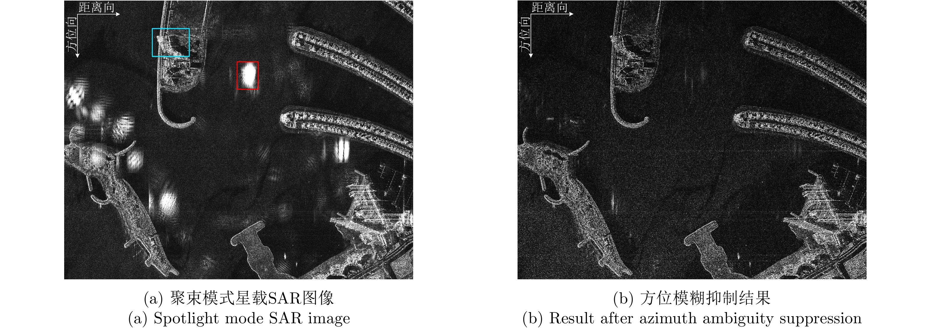
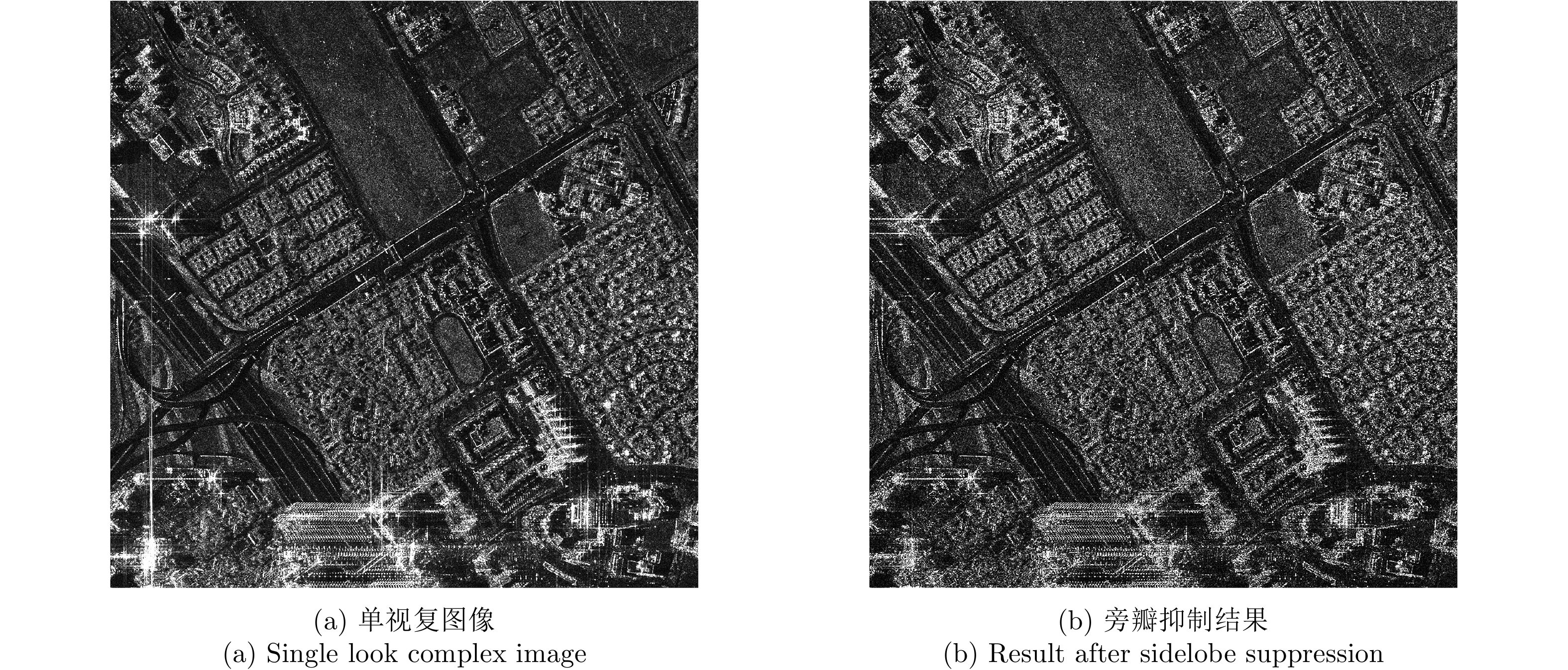
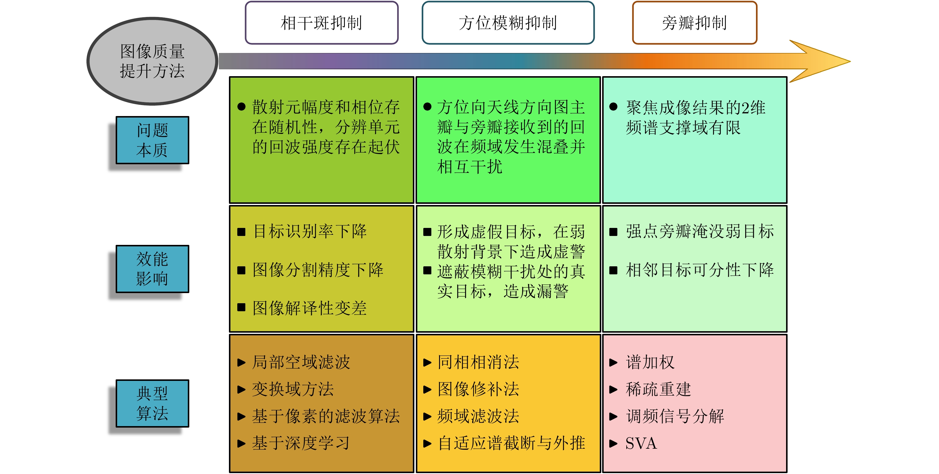
As an important tool for acquiring remote sensing information, Synthetic Aperture Radar (SAR) has various modes, including high-resolution wide-swath, multi-angle information acquisition, high temporal observation, and three-dimensional topographic mapping. For any spaceborne SAR system, obtaining high-quality images is a prerequisite for improving the performance of SAR applications. In this paper, we analyze the factors affecting spaceborne SAR imaging and image quality with respect to orbit, platform, payload, and signal processing. We describe high-precision data acquisition techniques, including amplitude-phase compensation, the dynamic adjustment of the central electronic equipment, and antenna pattern estimation. We then present imaging compensation methods based on the improved motion model and tropospheric delay correction, which can achieve resolutions better than 0.3 m. Lastly, we summarize and compare SAR image processing techniques such as speckle noise suppression, azimuth ambiguity suppression, and sidelobe suppression, whereby the equivalent number of looks can be increased to more than 25 and the azimuth ambiguity and sidelobes can both be suppressed by 20 dB.
As an important tool for acquiring remote sensing information, Synthetic Aperture Radar (SAR) has various modes, including high-resolution wide-swath, multi-angle information acquisition, high temporal observation, and three-dimensional topographic mapping. For any spaceborne SAR system, obtaining high-quality images is a prerequisite for improving the performance of SAR applications. In this paper, we analyze the factors affecting spaceborne SAR imaging and image quality with respect to orbit, platform, payload, and signal processing. We describe high-precision data acquisition techniques, including amplitude-phase compensation, the dynamic adjustment of the central electronic equipment, and antenna pattern estimation. We then present imaging compensation methods based on the improved motion model and tropospheric delay correction, which can achieve resolutions better than 0.3 m. Lastly, we summarize and compare SAR image processing techniques such as speckle noise suppression, azimuth ambiguity suppression, and sidelobe suppression, whereby the equivalent number of looks can be increased to more than 25 and the azimuth ambiguity and sidelobes can both be suppressed by 20 dB.


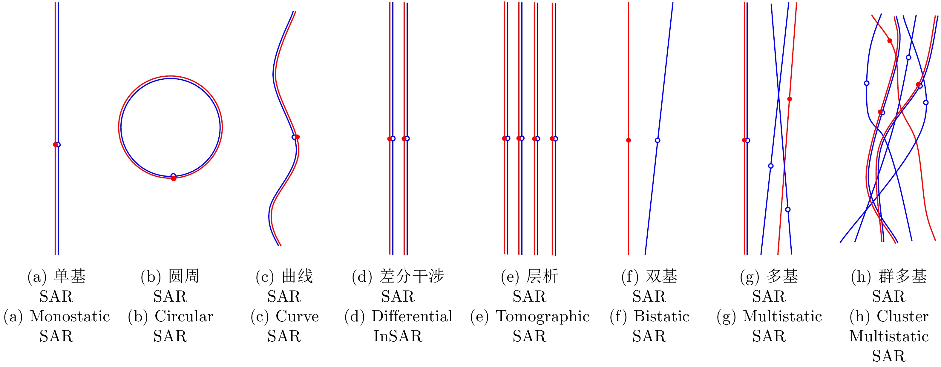
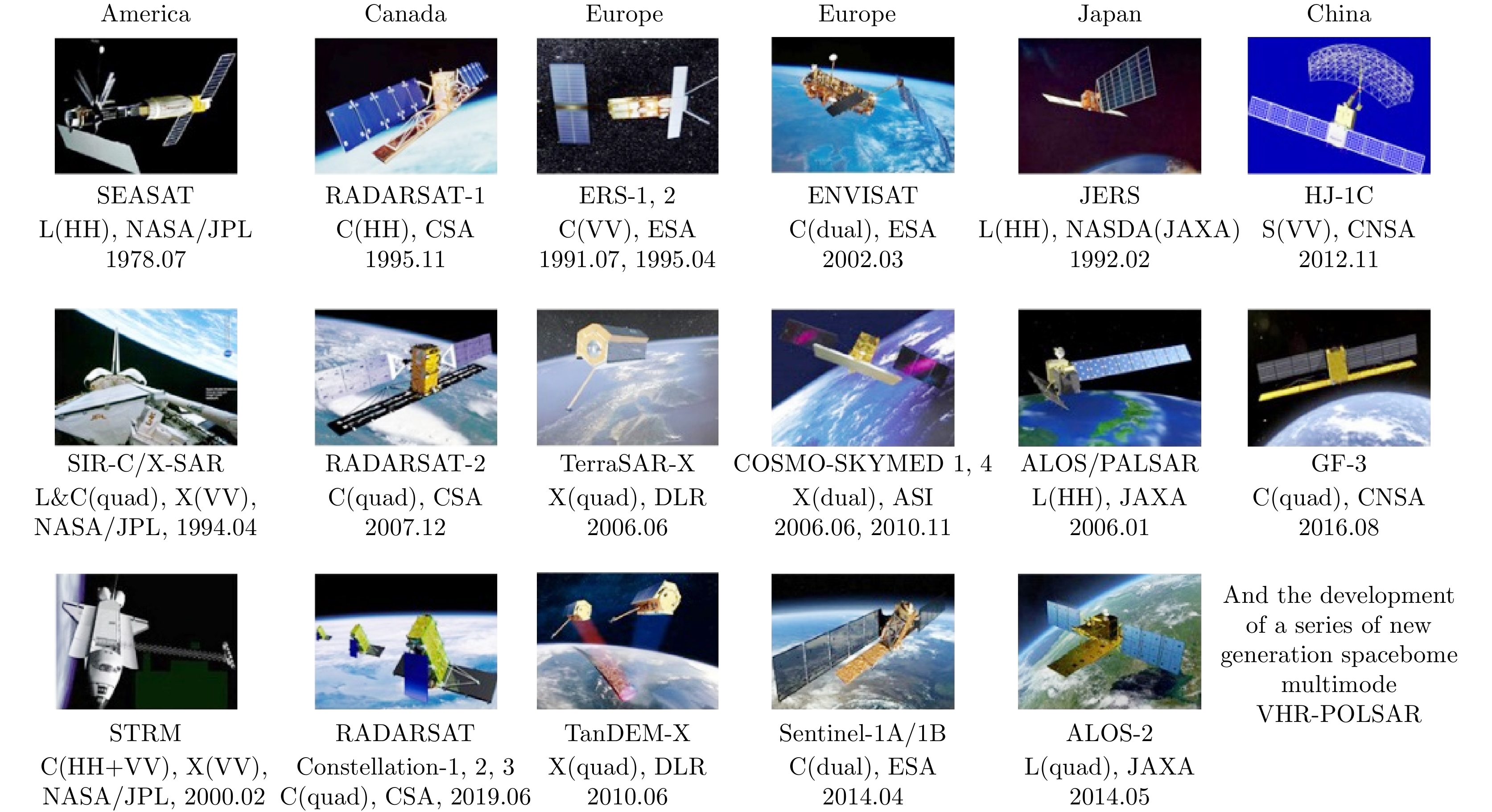
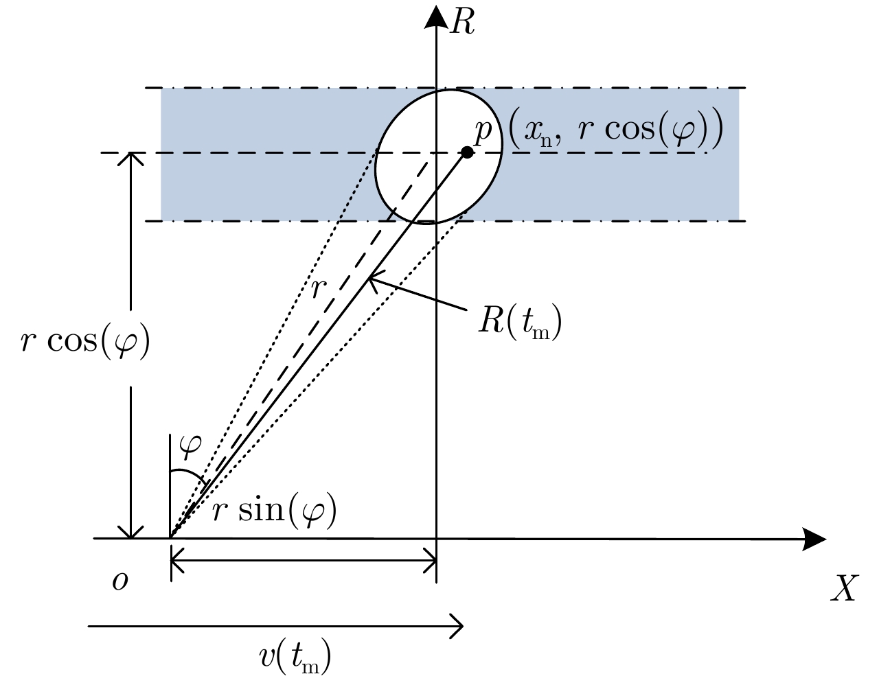
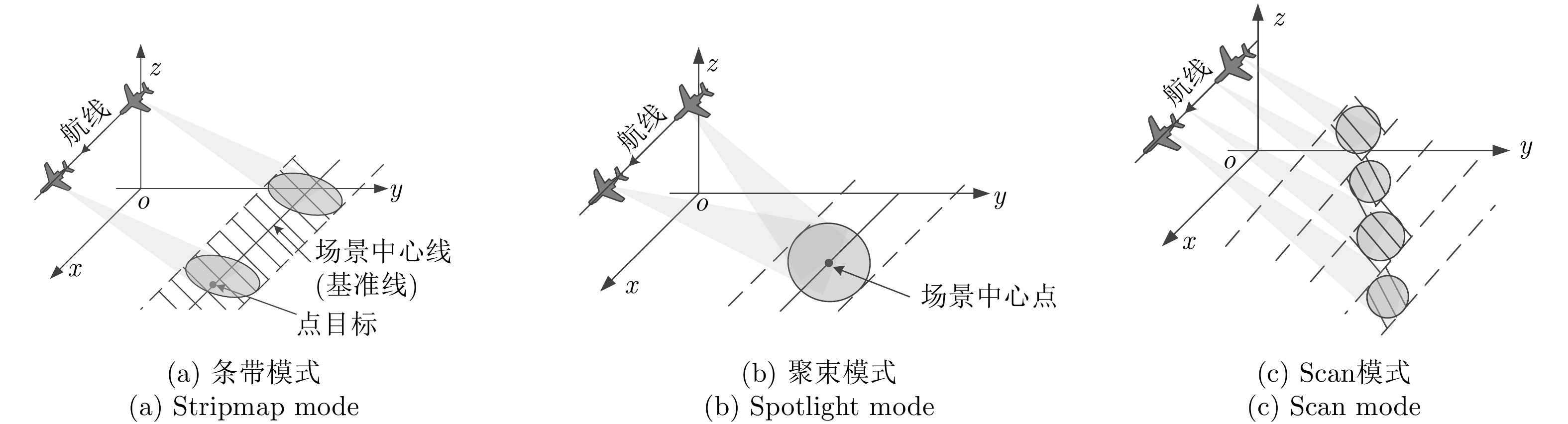
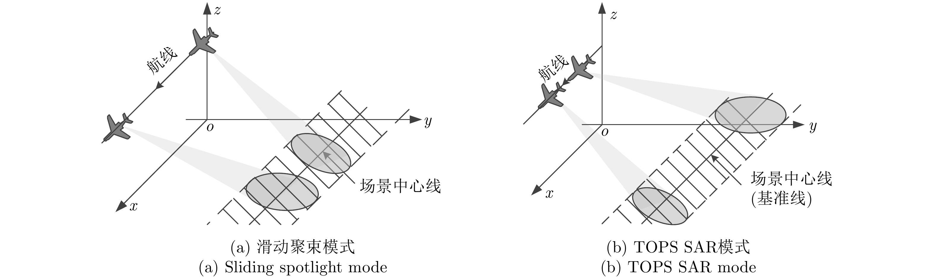
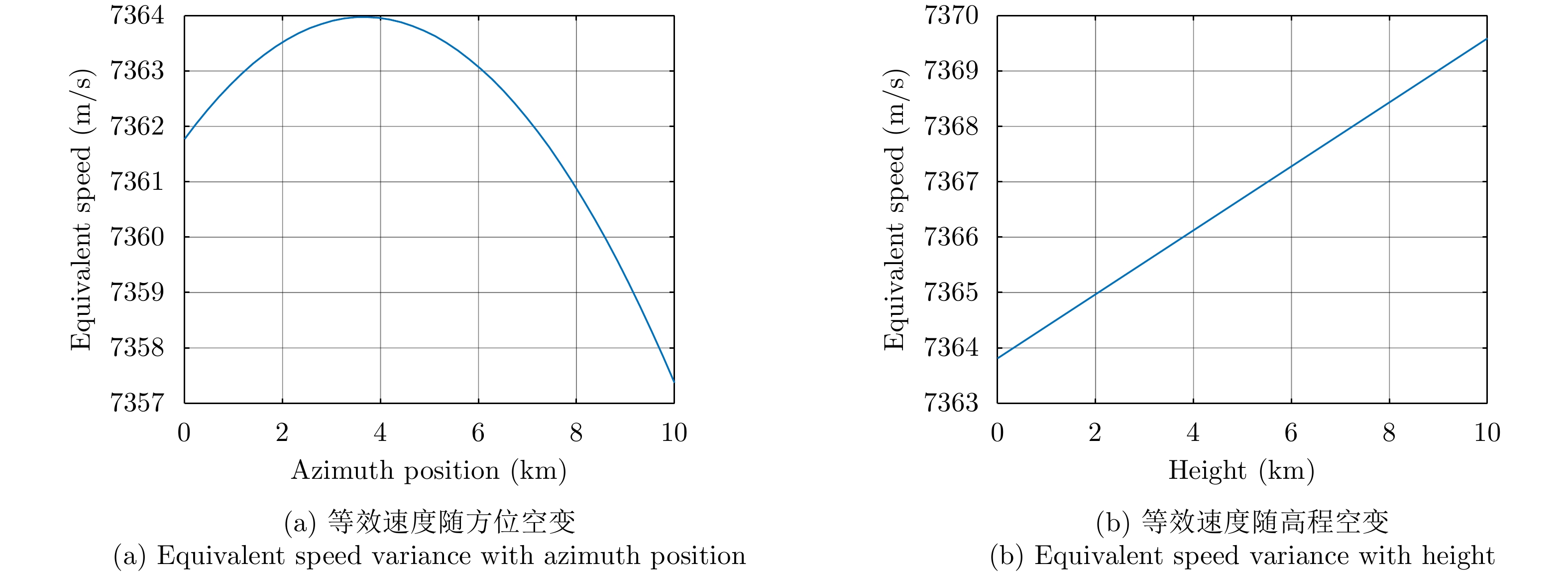
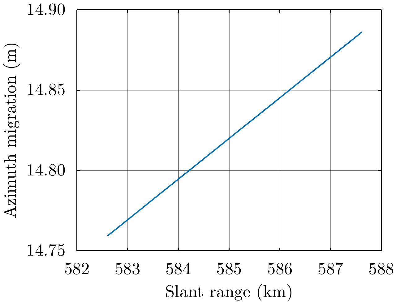
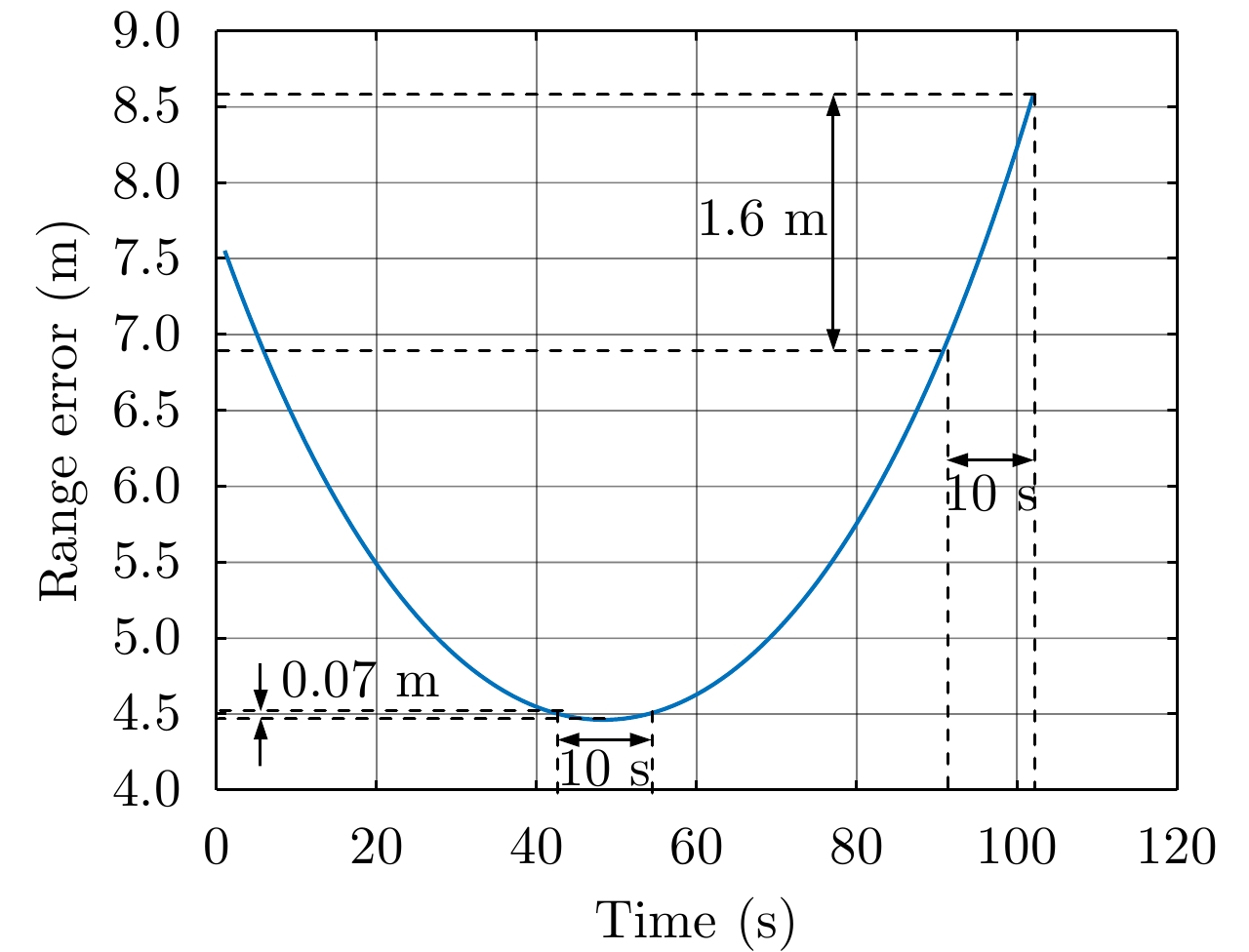
The multi-platform-borne Synthetic Aperture Radar (SAR) has become one of the most explored research directions in the domain of SAR. This study discusses the imaging algorithms in multi-platform-borne SARs such as airborne SAR, missile-borne SAR, and spaceborne SAR. First, the establishment of the radar echo model is briefly introduced, including two main points: slant range-model and imaging mode. Subsequently, the imaging algorithms of the aforementioned multi-platform-borne SARs developed and used in recent years are summarized. In addition, the inherent characteristics and challenges are described. Finally, the future development trends of the research are discussed.
The multi-platform-borne Synthetic Aperture Radar (SAR) has become one of the most explored research directions in the domain of SAR. This study discusses the imaging algorithms in multi-platform-borne SARs such as airborne SAR, missile-borne SAR, and spaceborne SAR. First, the establishment of the radar echo model is briefly introduced, including two main points: slant range-model and imaging mode. Subsequently, the imaging algorithms of the aforementioned multi-platform-borne SARs developed and used in recent years are summarized. In addition, the inherent characteristics and challenges are described. Finally, the future development trends of the research are discussed.


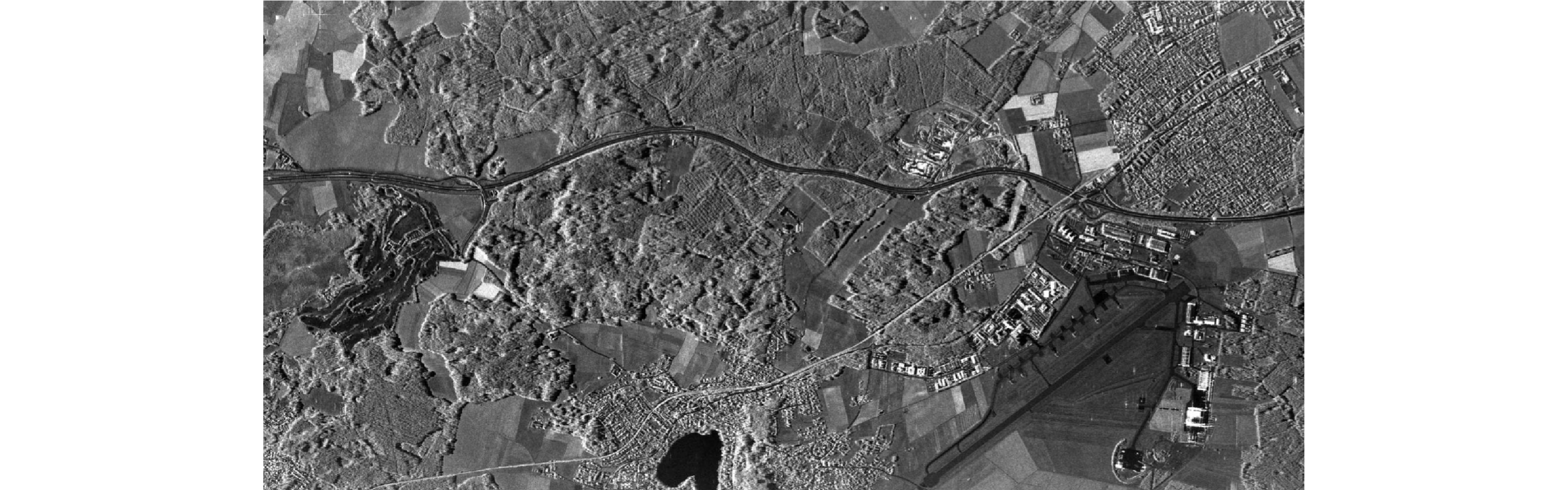
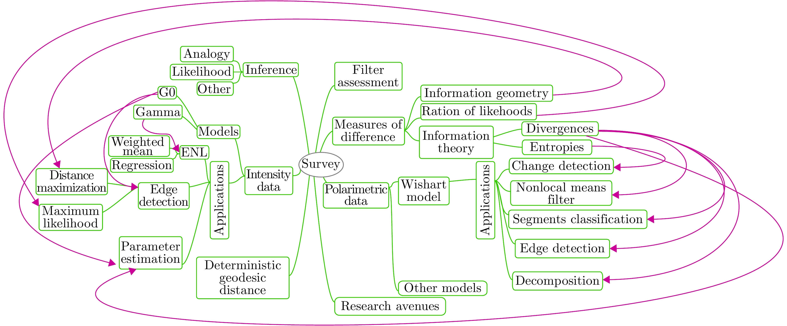
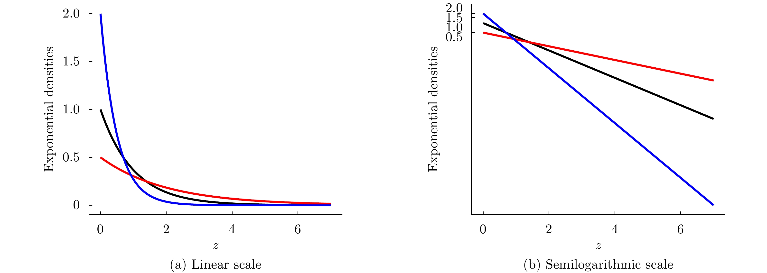
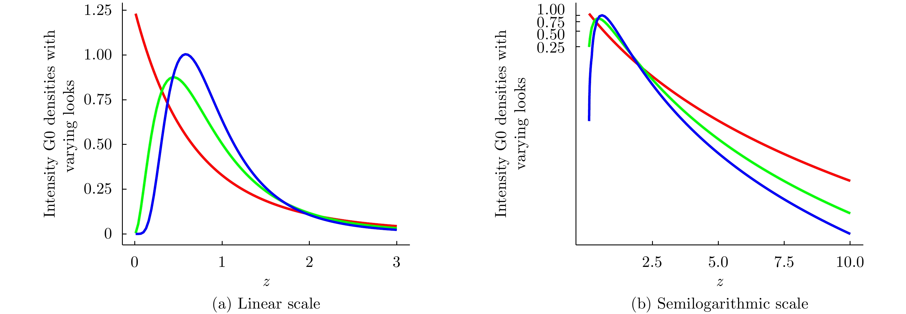
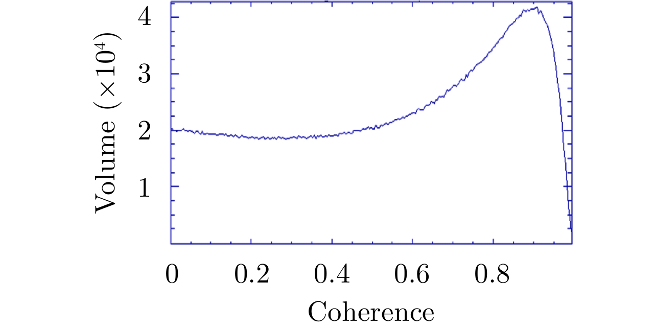
“Contrast” is an generic denomination for “difference”. Measures of contrast are a powerful tool in image processing and analysis, e.g., in denoising, edge detection, segmentation, classification, parameter estimation, change detection, and feature selection. We present a survey on techniques that aim at measuring the contrast between (i) samples of SAR imagery, and (ii) samples and models, with emphasis on those that employ the statistical properties of the data.
“Contrast” is an generic denomination for “difference”. Measures of contrast are a powerful tool in image processing and analysis, e.g., in denoising, edge detection, segmentation, classification, parameter estimation, change detection, and feature selection. We present a survey on techniques that aim at measuring the contrast between (i) samples of SAR imagery, and (ii) samples and models, with emphasis on those that employ the statistical properties of the data.


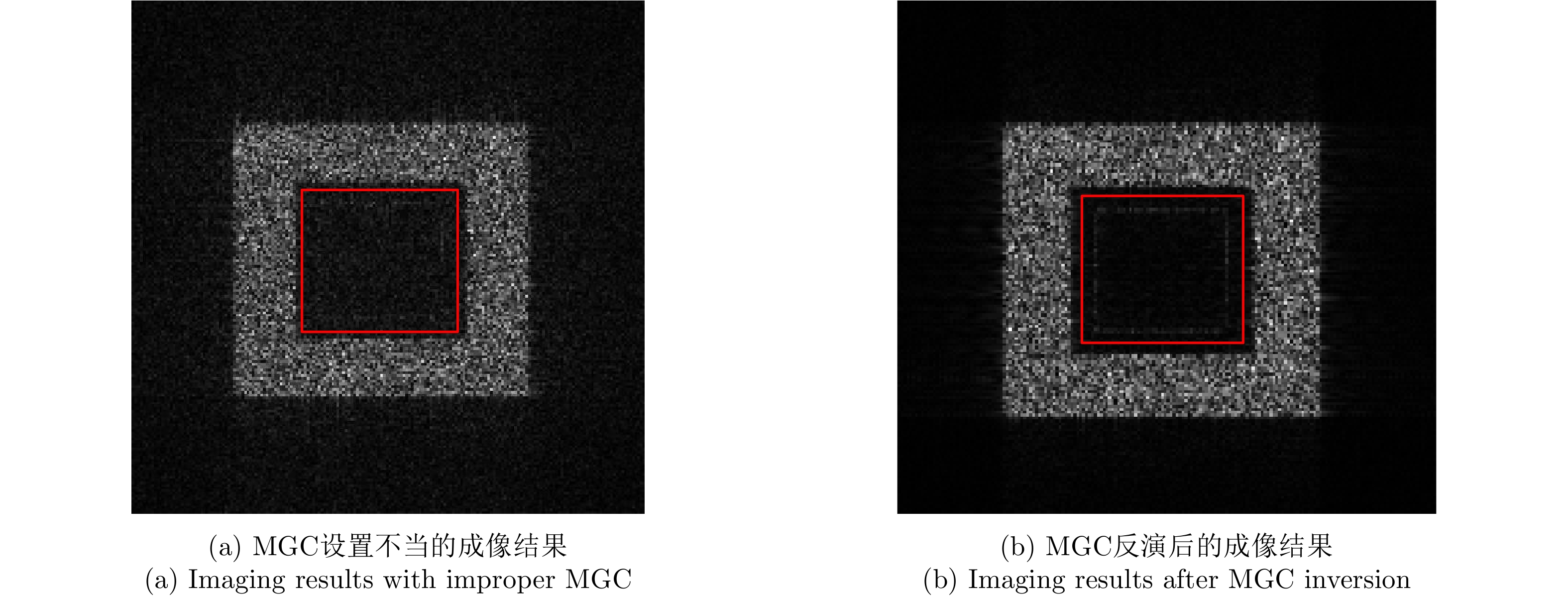
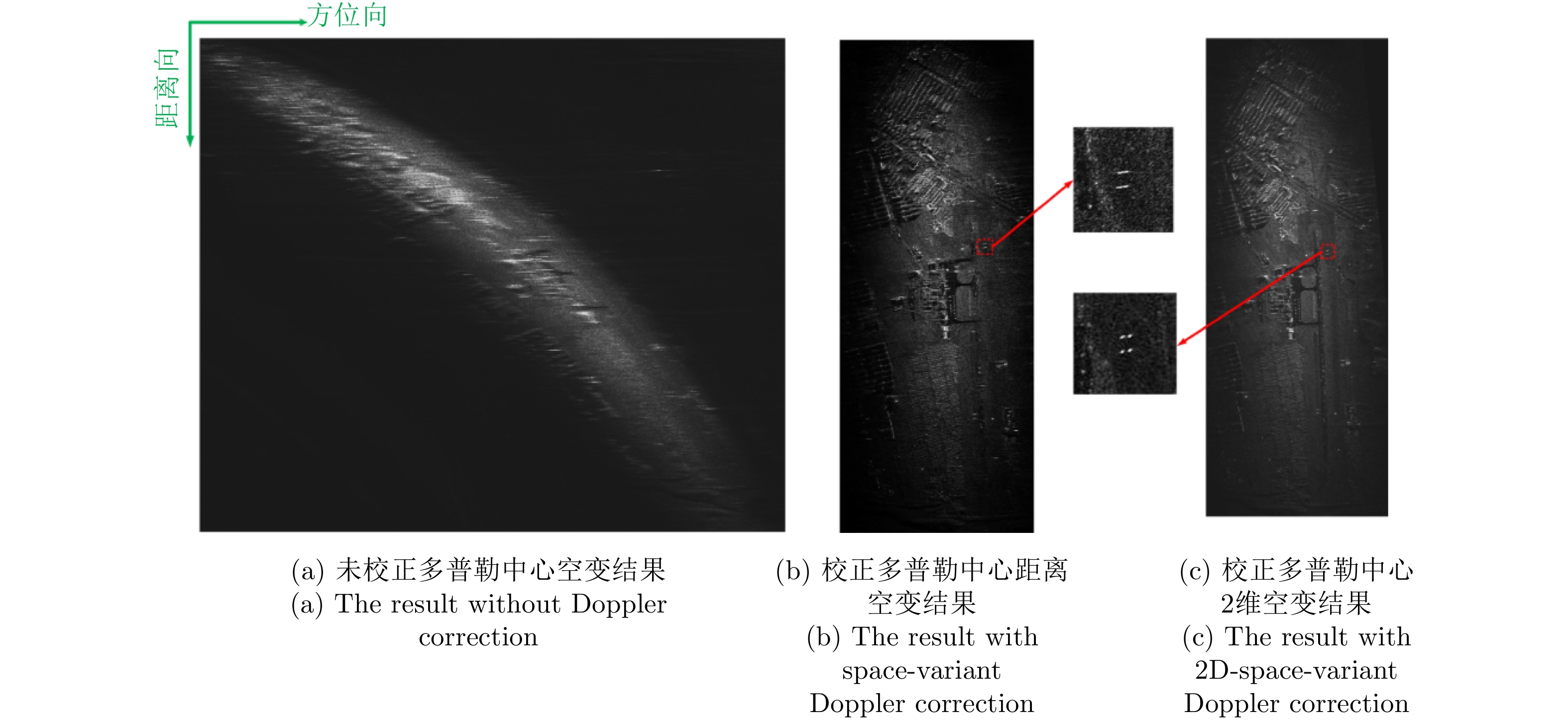
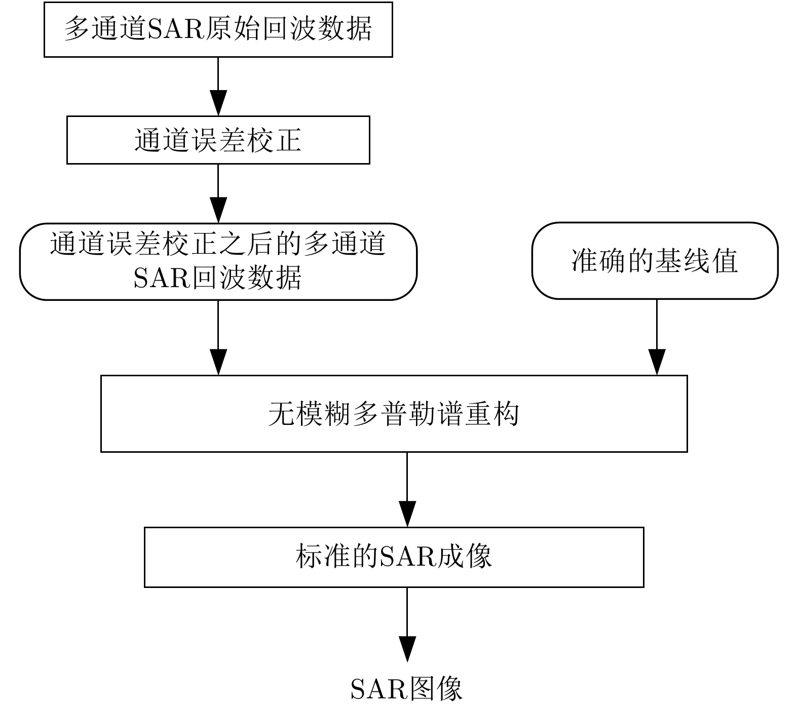
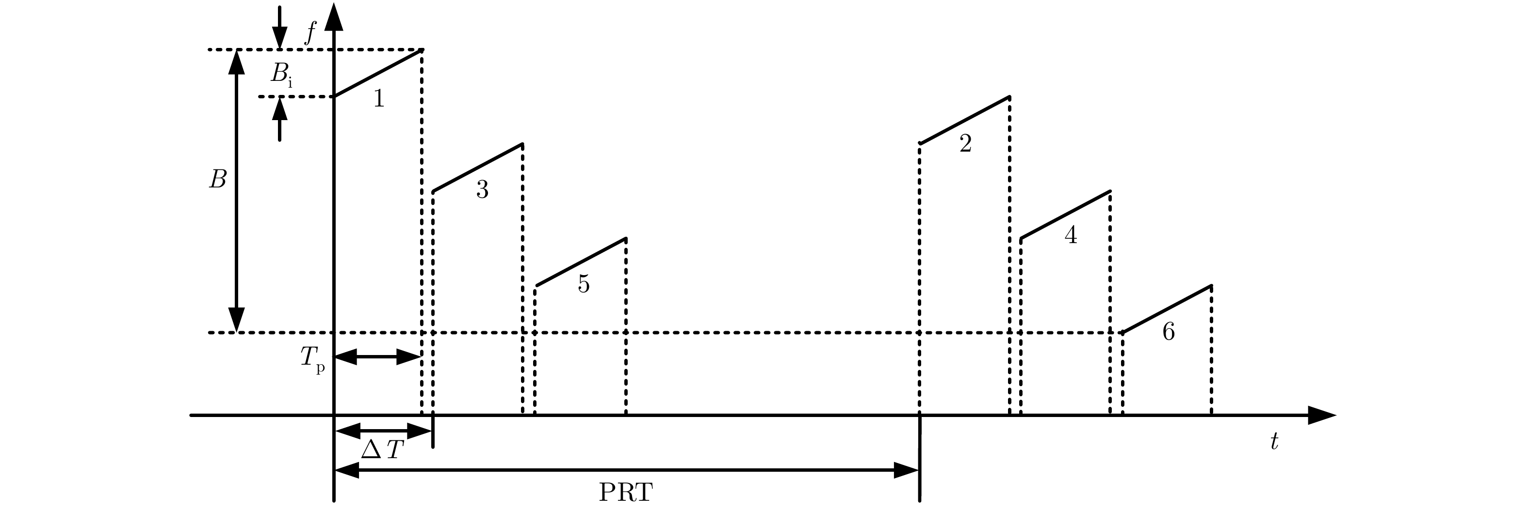
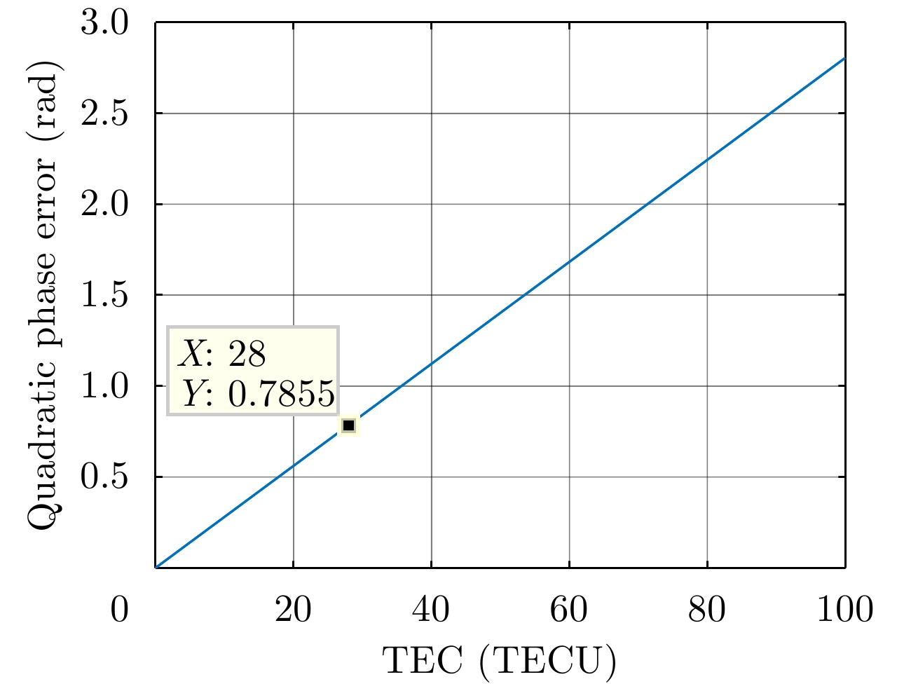
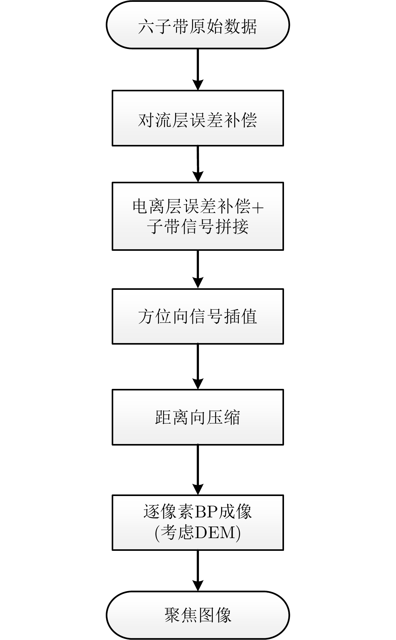
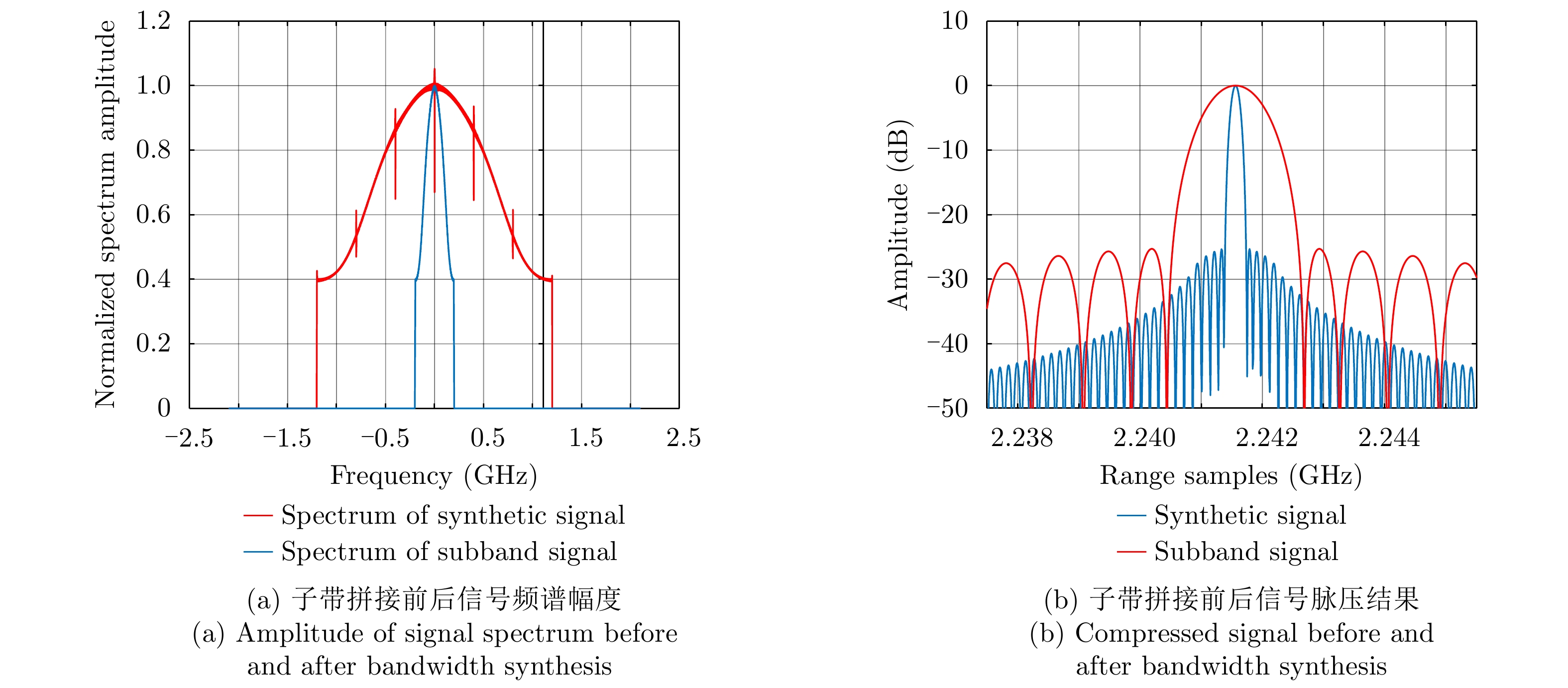
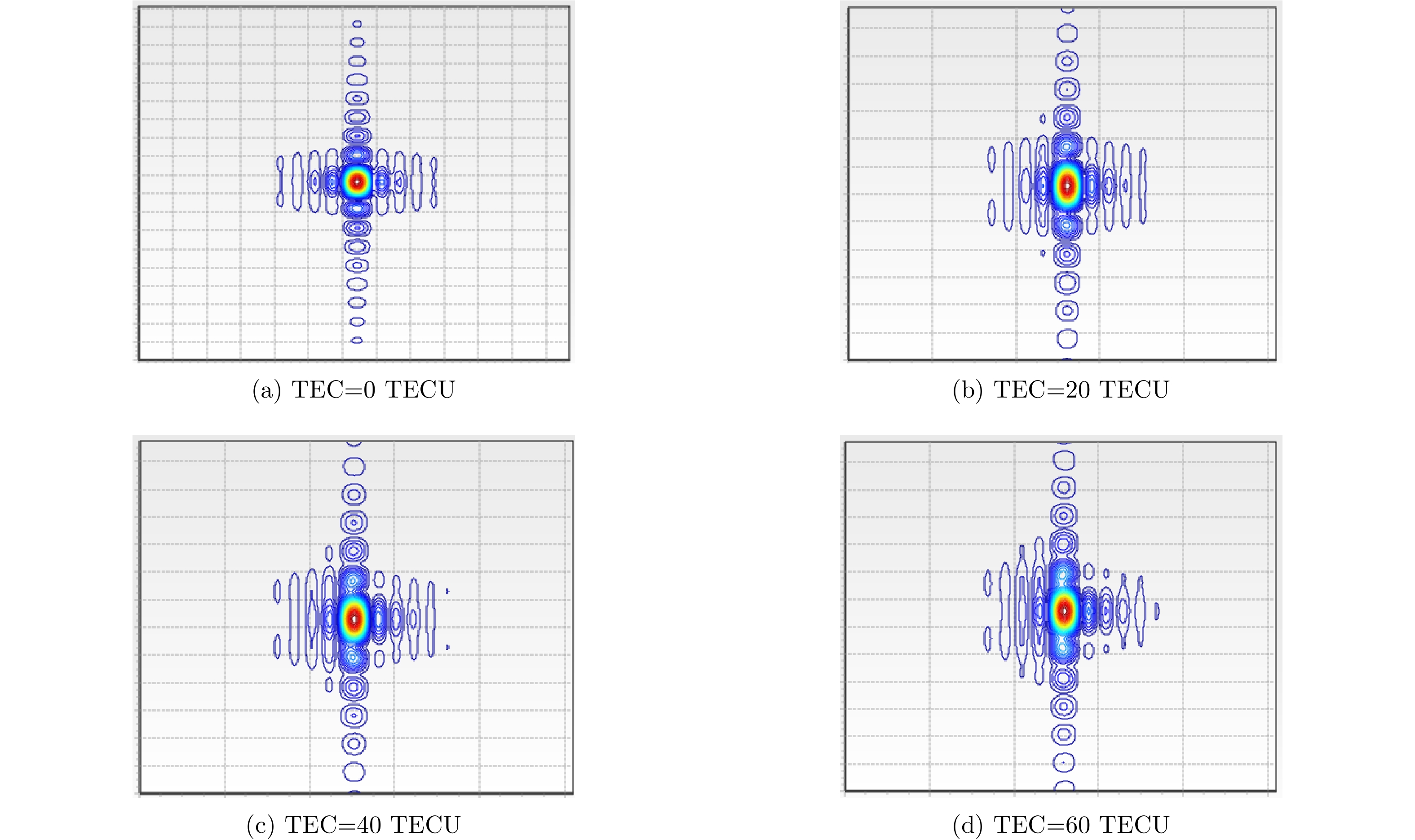
Spaceborne Synthetic Aperture Radar (SAR) is a type of microwave imaging radar with 2D high resolution. This technological device achieves range high resolution by transmitting wideband signals and azimuth high resolution through the synthetic aperture approach. With the increasing demand for high-resolution imaging, the resolution of spaceborne SAR has moved toward the decimeter level. On the one hand, limited by the present hardware technology, achieving wideband signal transmission through stepped-frequency technology is necessary. In this case, we need to study high-precision bandwidth synthesis technology. The influence of slant range error and amplitude and phase error between sub-bands should be considered. On the other hand, due to limited beamwidth, the system needs to work in sliding spot mode to achieve a long synthetic aperture. In this case, we need to study the problem of imaging parameter variance caused by curved orbit, “Stop–go” error, and the influence of ionospheric and tropospheric transmission errors on imaging. To solve these problems, this paper introduces the principle of stepped-frequency signal design and bandwidth synthesis technology in detail. A time-domain algorithm and non-ideal factor compensation method are proposed for spaceborne high-resolution stepped-frequency SAR imaging. Finally, simulation verification and performance analysis of the imaging algorithm are conducted.
Spaceborne Synthetic Aperture Radar (SAR) is a type of microwave imaging radar with 2D high resolution. This technological device achieves range high resolution by transmitting wideband signals and azimuth high resolution through the synthetic aperture approach. With the increasing demand for high-resolution imaging, the resolution of spaceborne SAR has moved toward the decimeter level. On the one hand, limited by the present hardware technology, achieving wideband signal transmission through stepped-frequency technology is necessary. In this case, we need to study high-precision bandwidth synthesis technology. The influence of slant range error and amplitude and phase error between sub-bands should be considered. On the other hand, due to limited beamwidth, the system needs to work in sliding spot mode to achieve a long synthetic aperture. In this case, we need to study the problem of imaging parameter variance caused by curved orbit, “Stop–go” error, and the influence of ionospheric and tropospheric transmission errors on imaging. To solve these problems, this paper introduces the principle of stepped-frequency signal design and bandwidth synthesis technology in detail. A time-domain algorithm and non-ideal factor compensation method are proposed for spaceborne high-resolution stepped-frequency SAR imaging. Finally, simulation verification and performance analysis of the imaging algorithm are conducted.


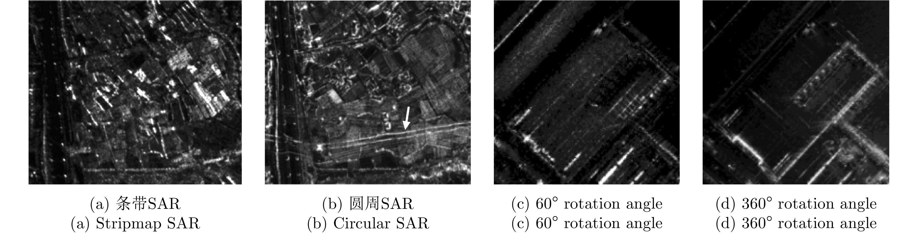
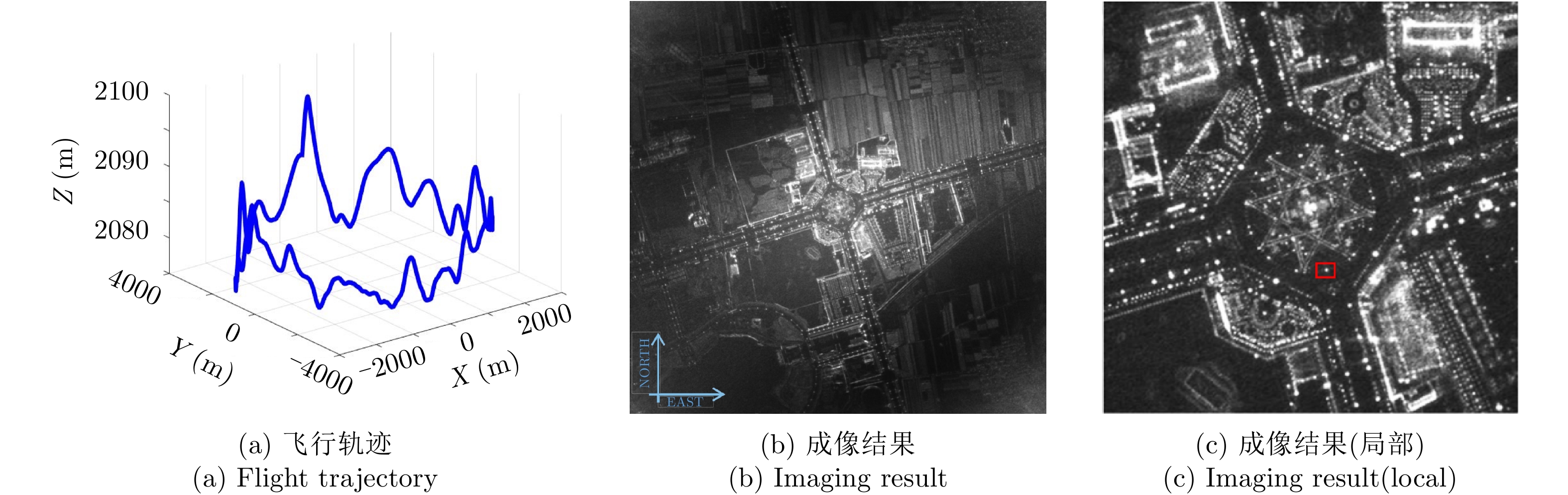
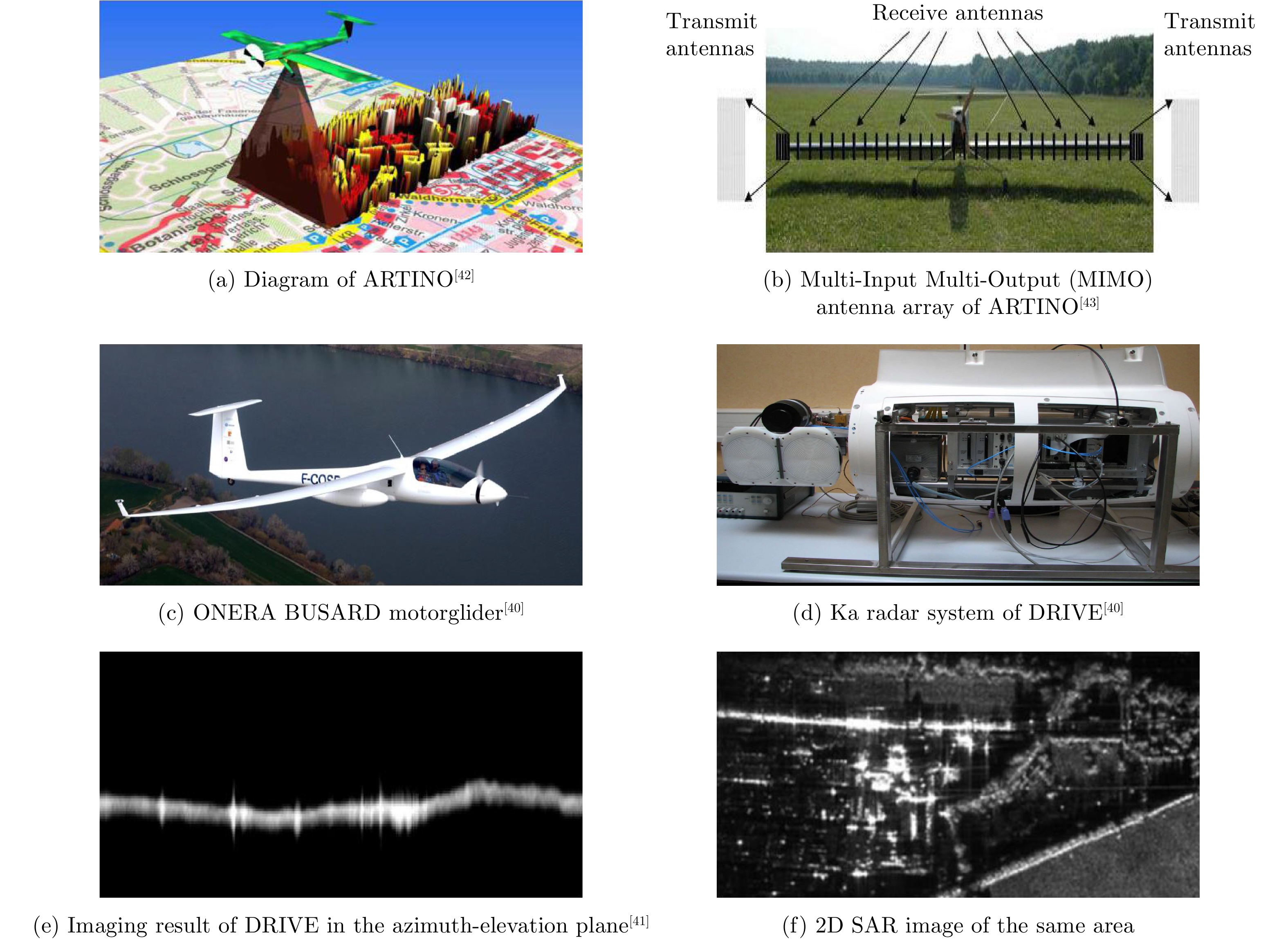
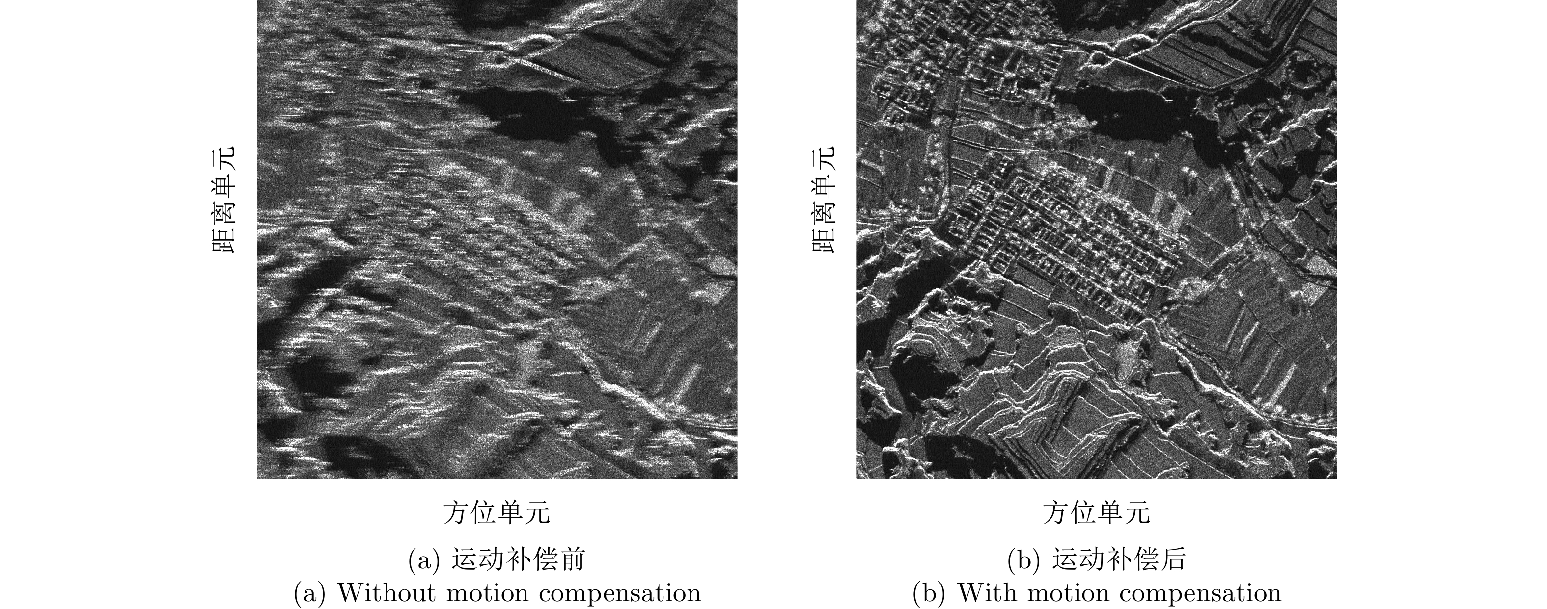
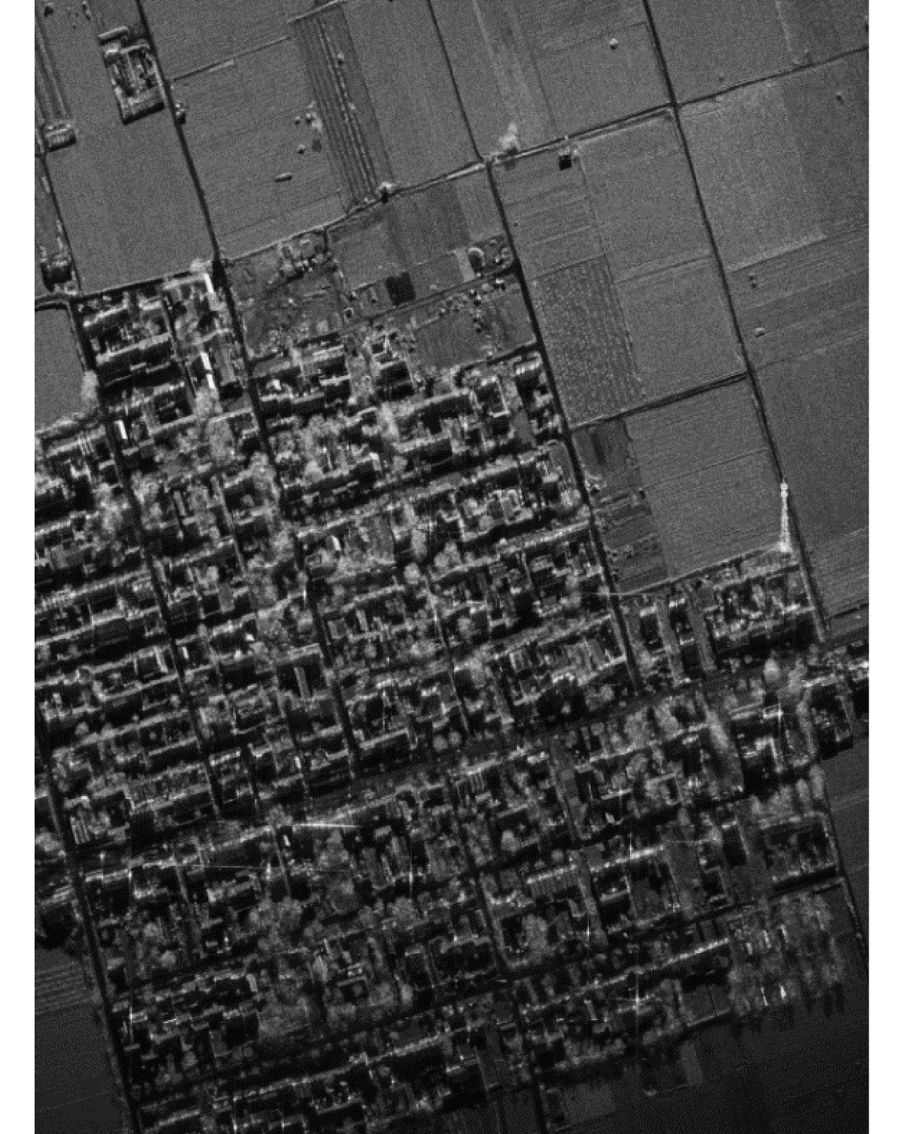
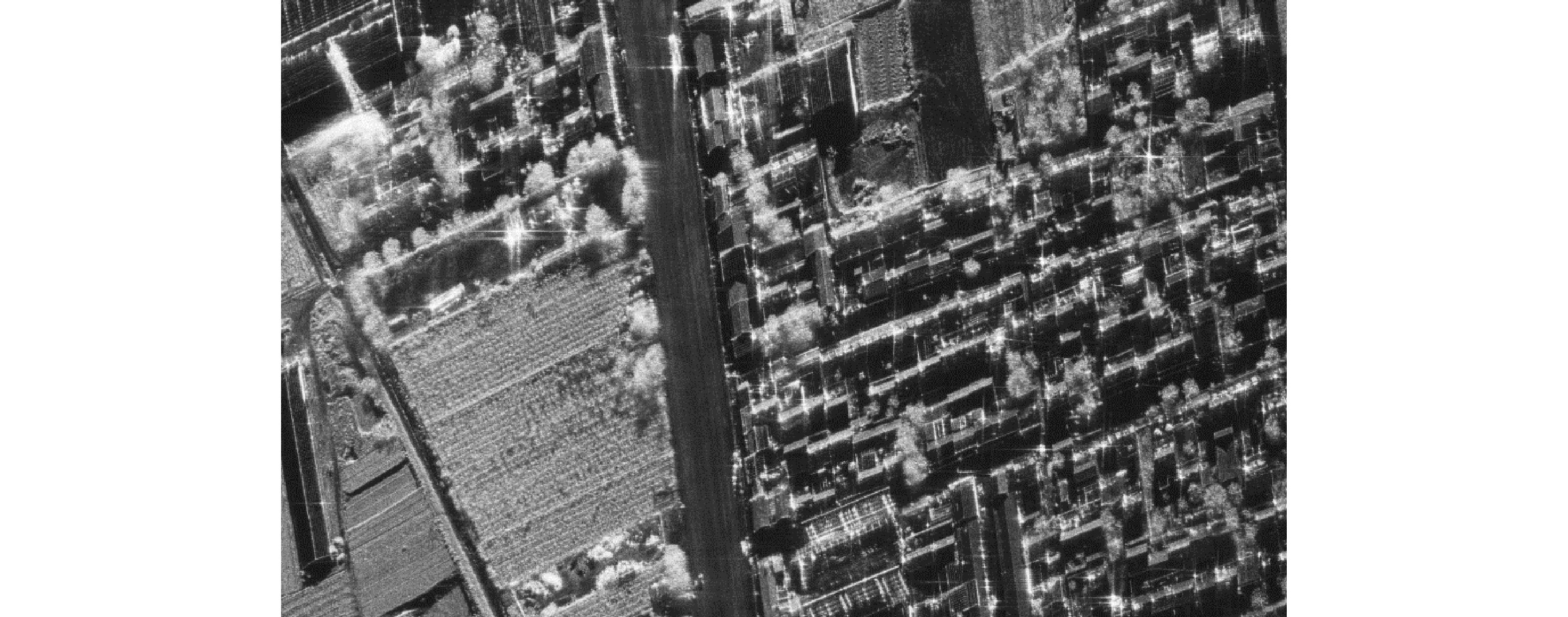
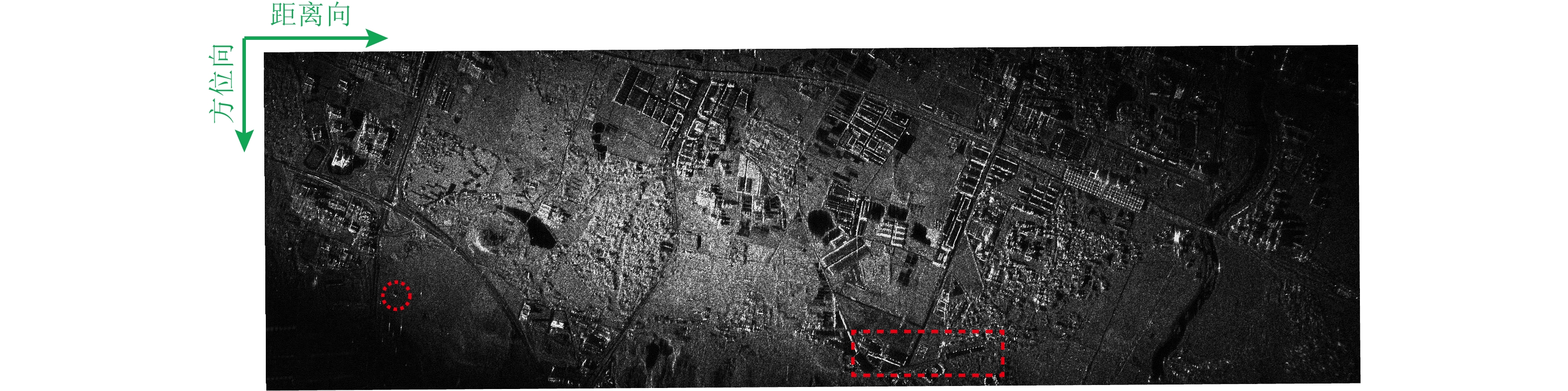
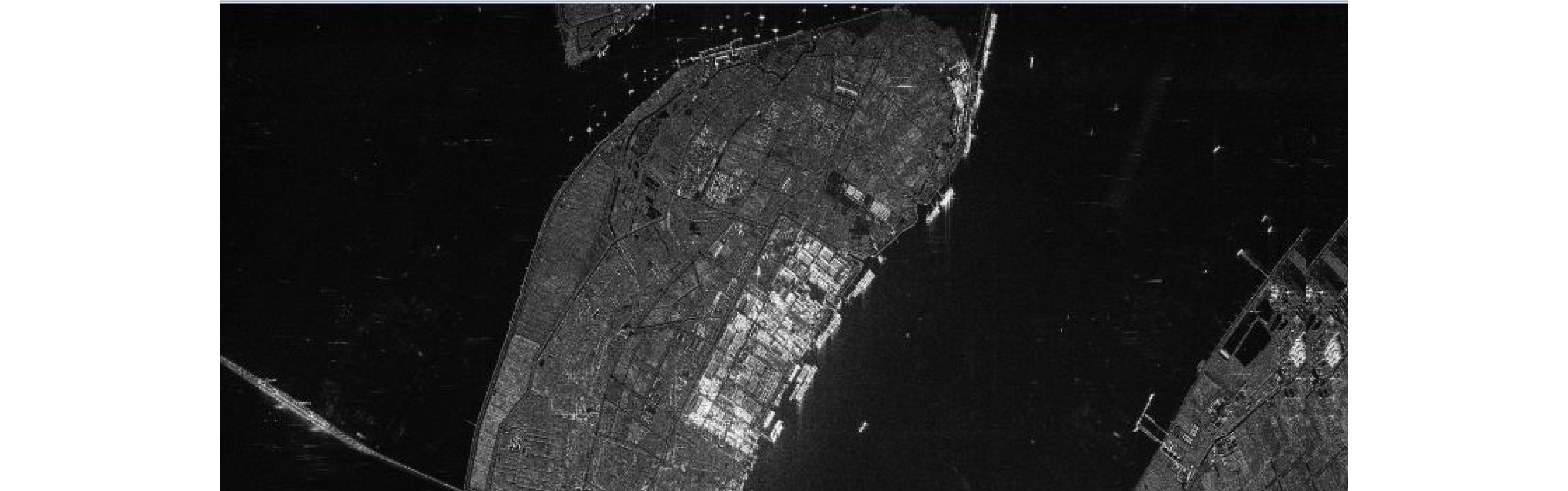
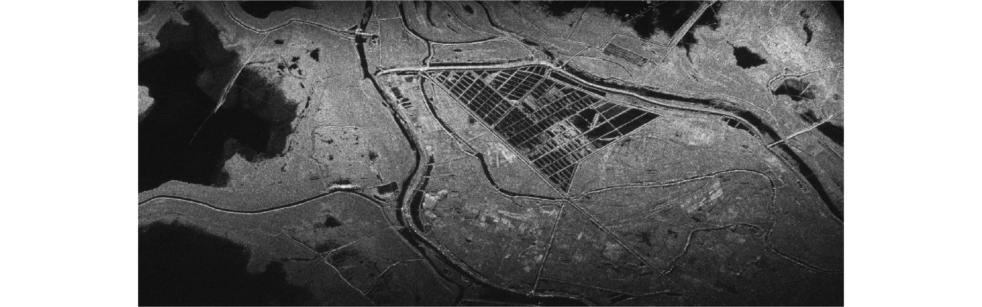
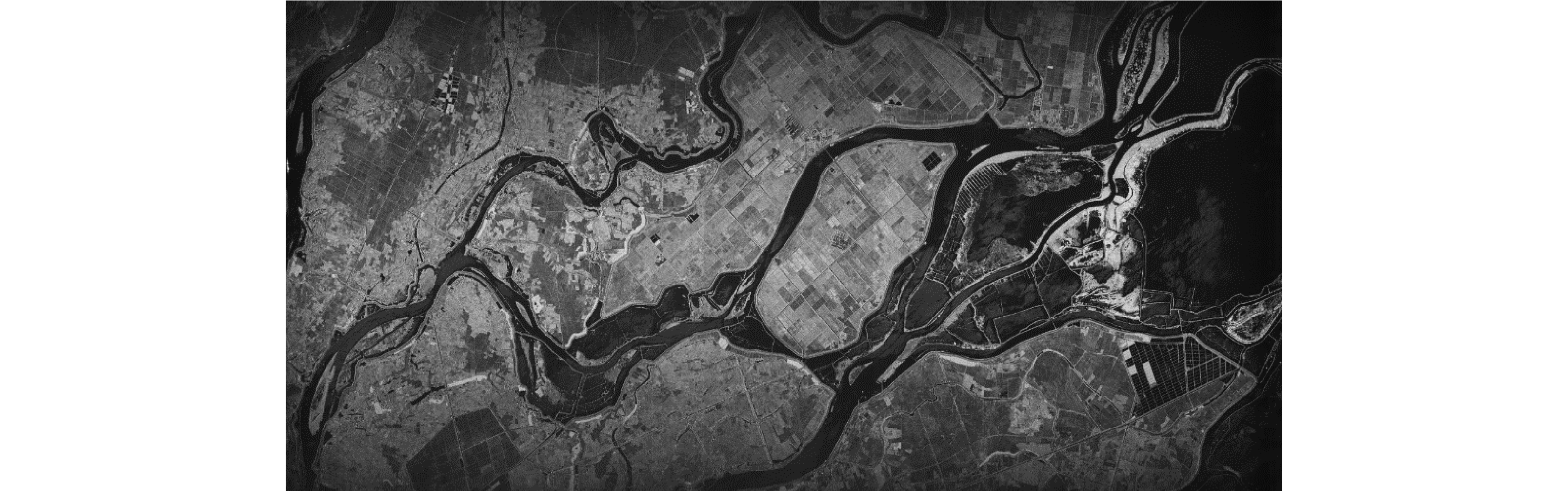
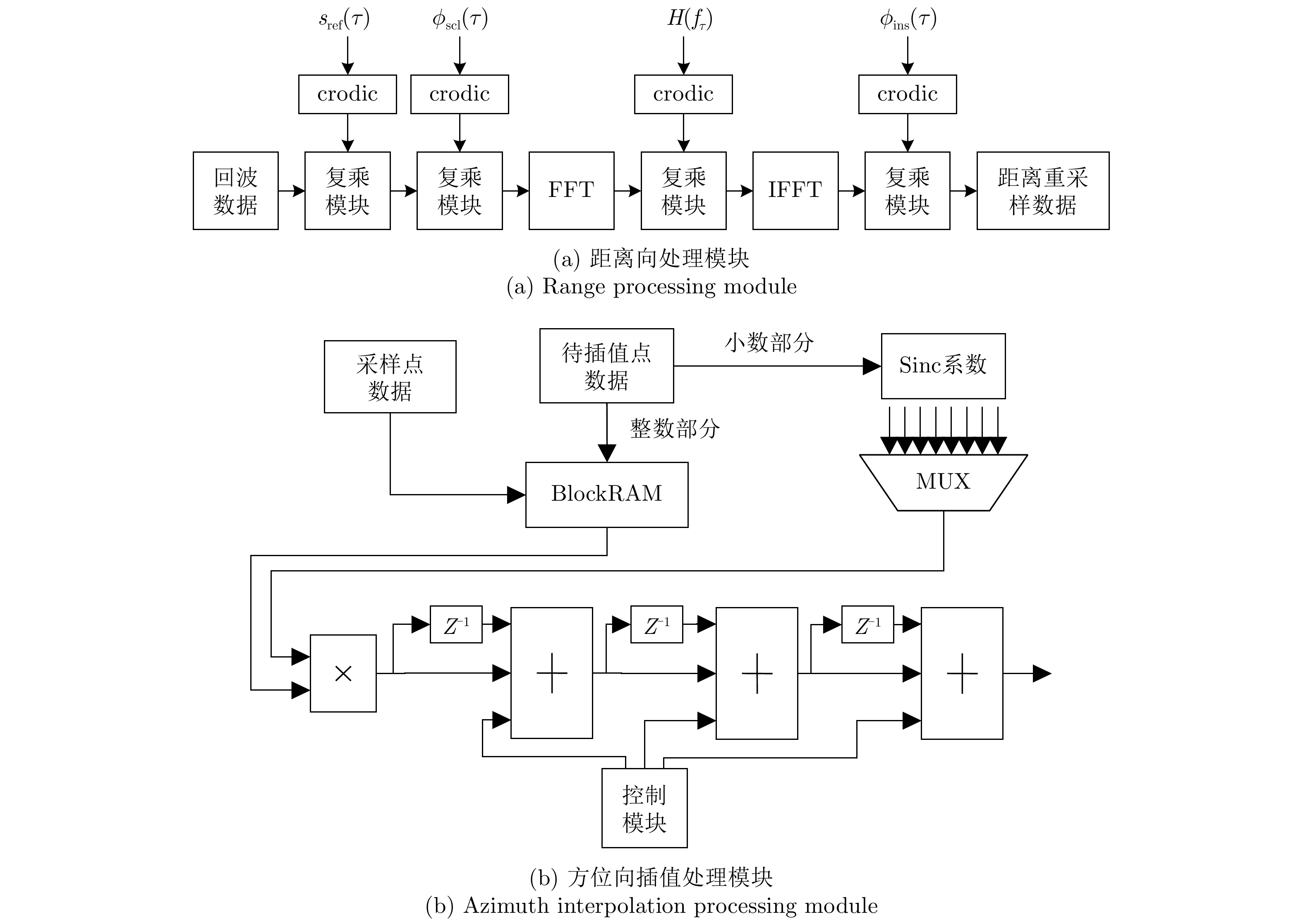
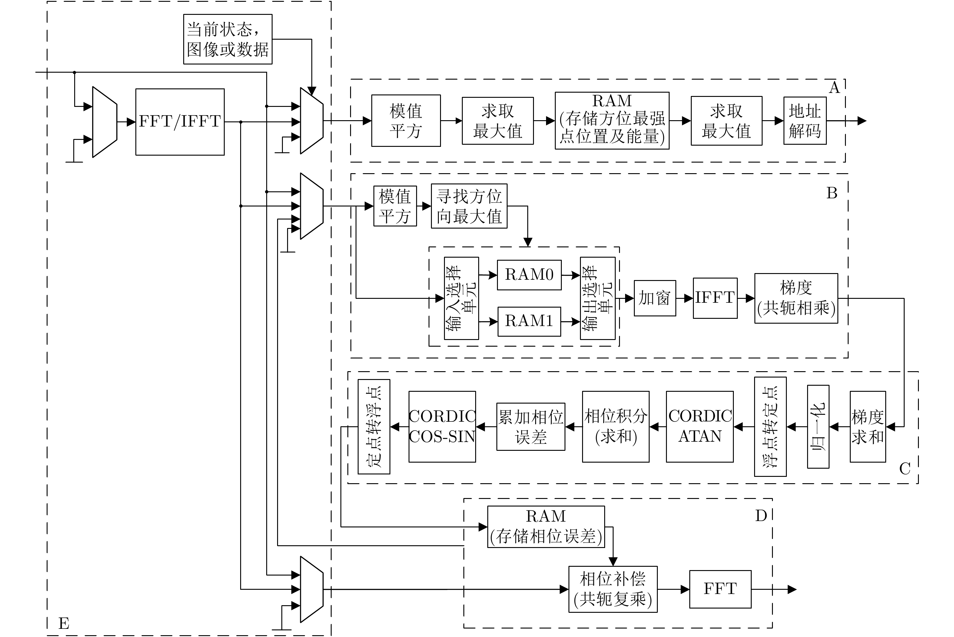
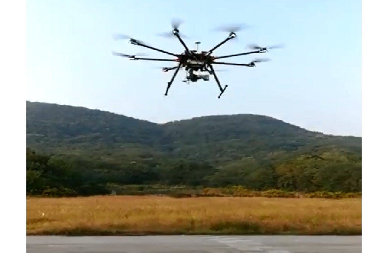
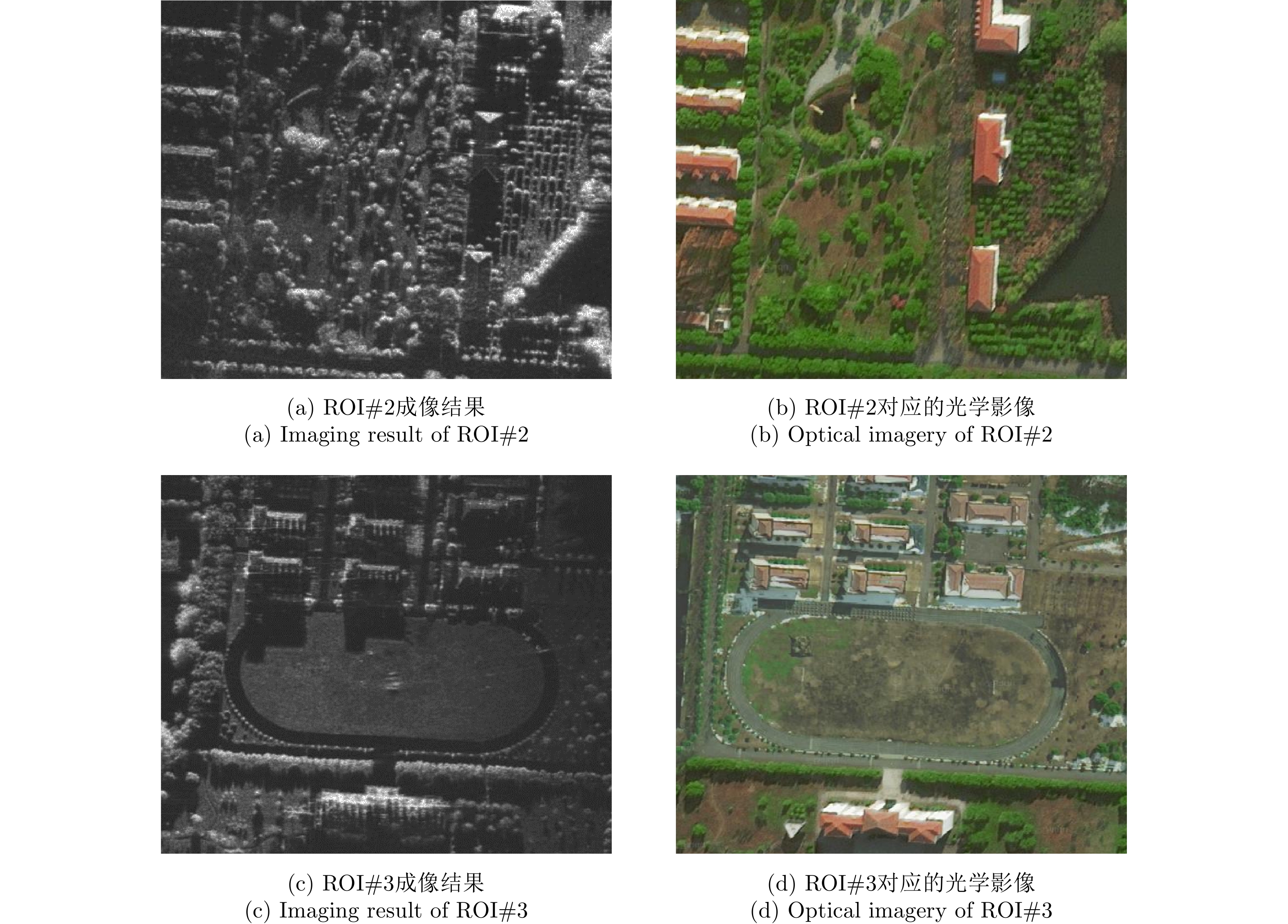
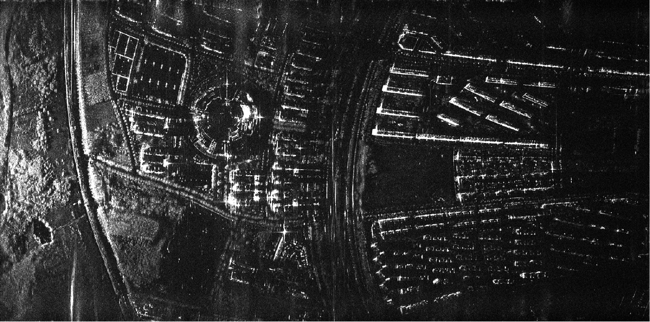
Miniature Synthetic Aperture Radar (MiniSAR) has been making breakthroughs to effectively overcome the limitations of time and space, and has exhibited superiority with respect to light weight and low-power consumption as well as high flexibility to achieve high-resolution imaging for the Region Of Interest (ROI). However, imaging signal processing for MiniSAR systems still face several technical challenges such as high-resolution imaging of ground targets under complicated trajectories, refocusing of non-cooperative moving targets, and efficient and real-time processing of echo data. In this paper, a series of imaging signal processing and associated hardware designs using Field-Programmable Gate Array (FPGA) architecture have been proposed to realize MiniSAR ultra-high-resolution imaging and real-time processing. Additionally, experimental results utilizing considerable spotlight and stripmap MiniSAR data have been presented to demonstrate the effectiveness and reliability of the proposed technology.
Miniature Synthetic Aperture Radar (MiniSAR) has been making breakthroughs to effectively overcome the limitations of time and space, and has exhibited superiority with respect to light weight and low-power consumption as well as high flexibility to achieve high-resolution imaging for the Region Of Interest (ROI). However, imaging signal processing for MiniSAR systems still face several technical challenges such as high-resolution imaging of ground targets under complicated trajectories, refocusing of non-cooperative moving targets, and efficient and real-time processing of echo data. In this paper, a series of imaging signal processing and associated hardware designs using Field-Programmable Gate Array (FPGA) architecture have been proposed to realize MiniSAR ultra-high-resolution imaging and real-time processing. Additionally, experimental results utilizing considerable spotlight and stripmap MiniSAR data have been presented to demonstrate the effectiveness and reliability of the proposed technology.


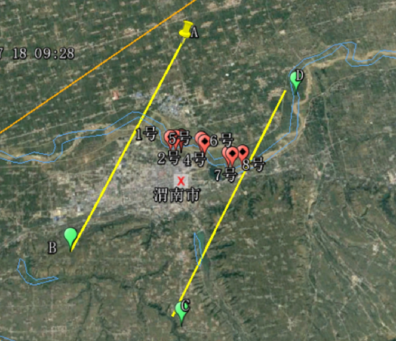
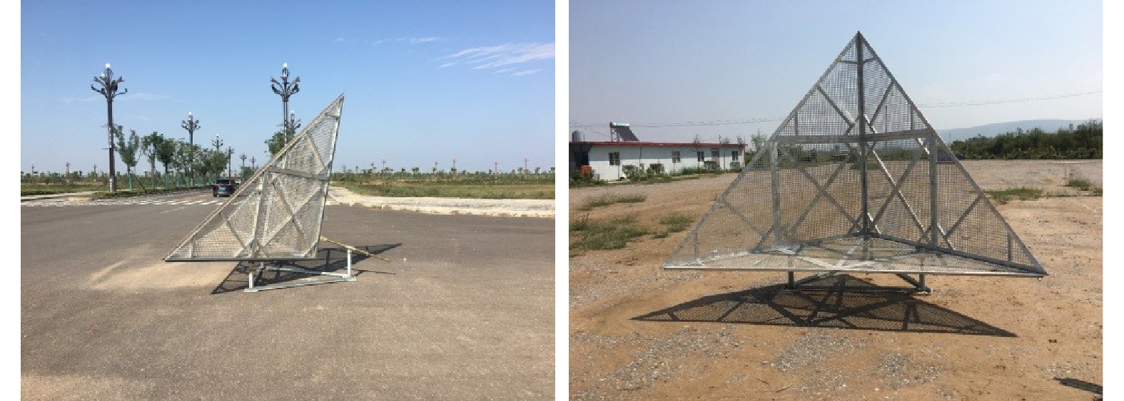
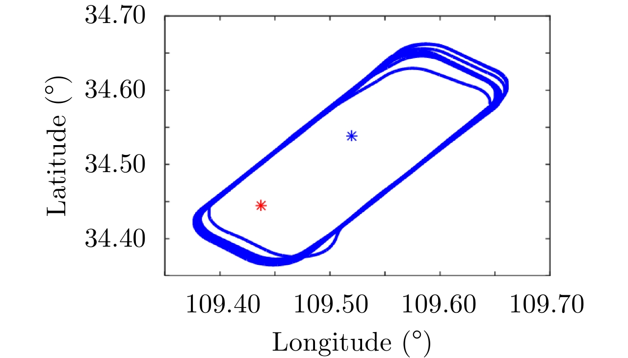
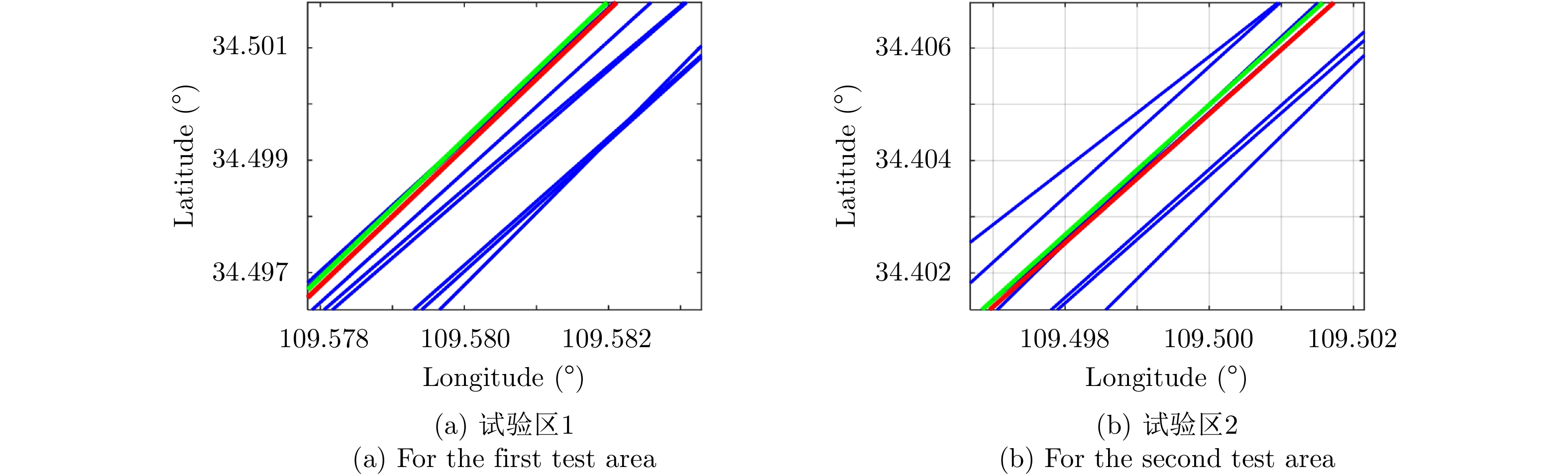
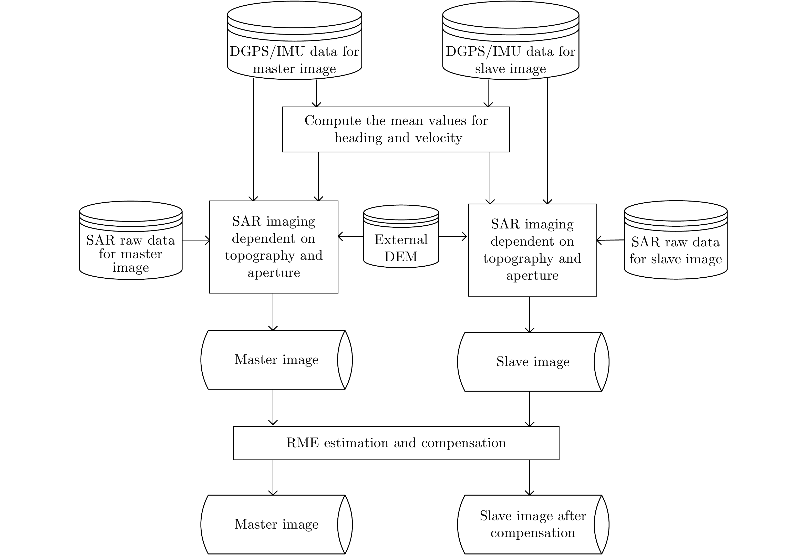
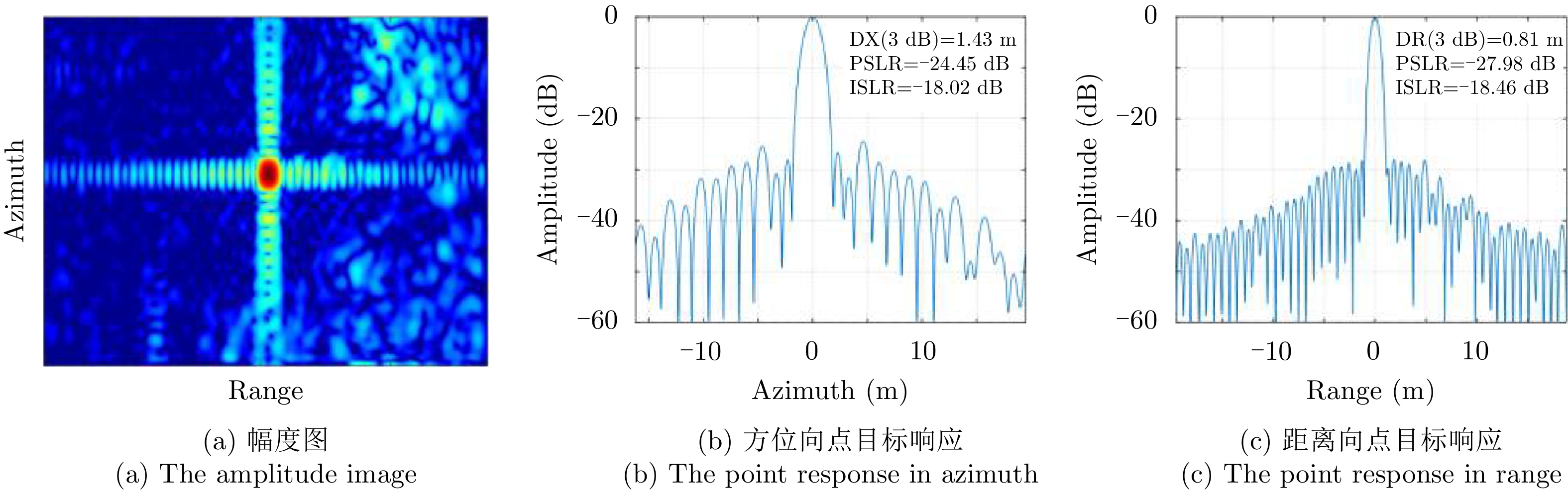
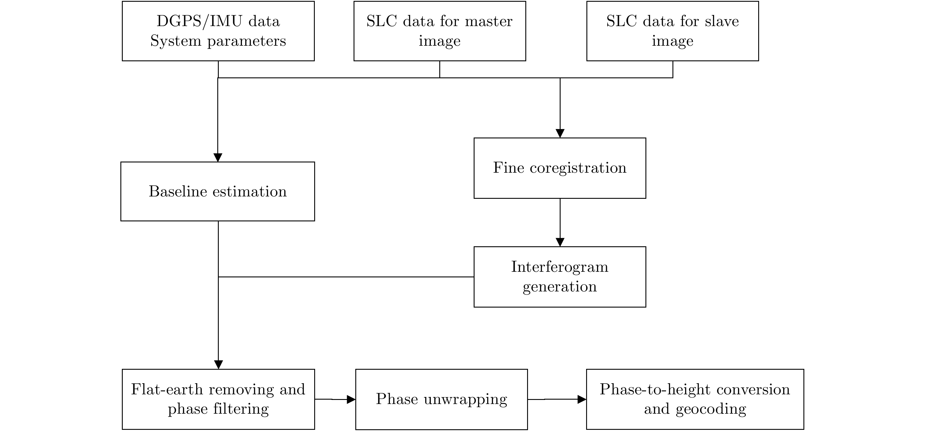
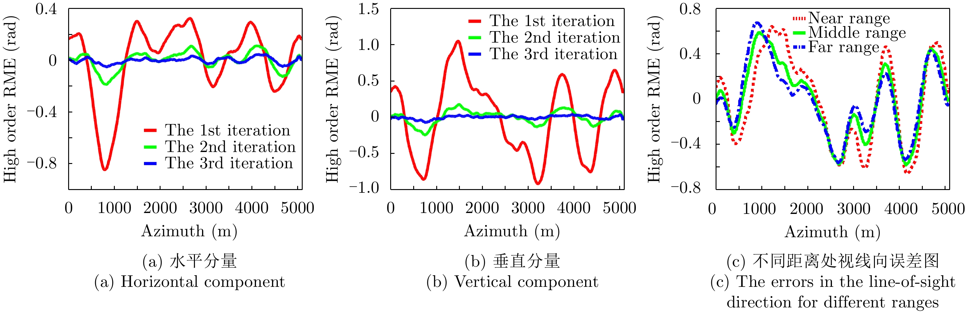
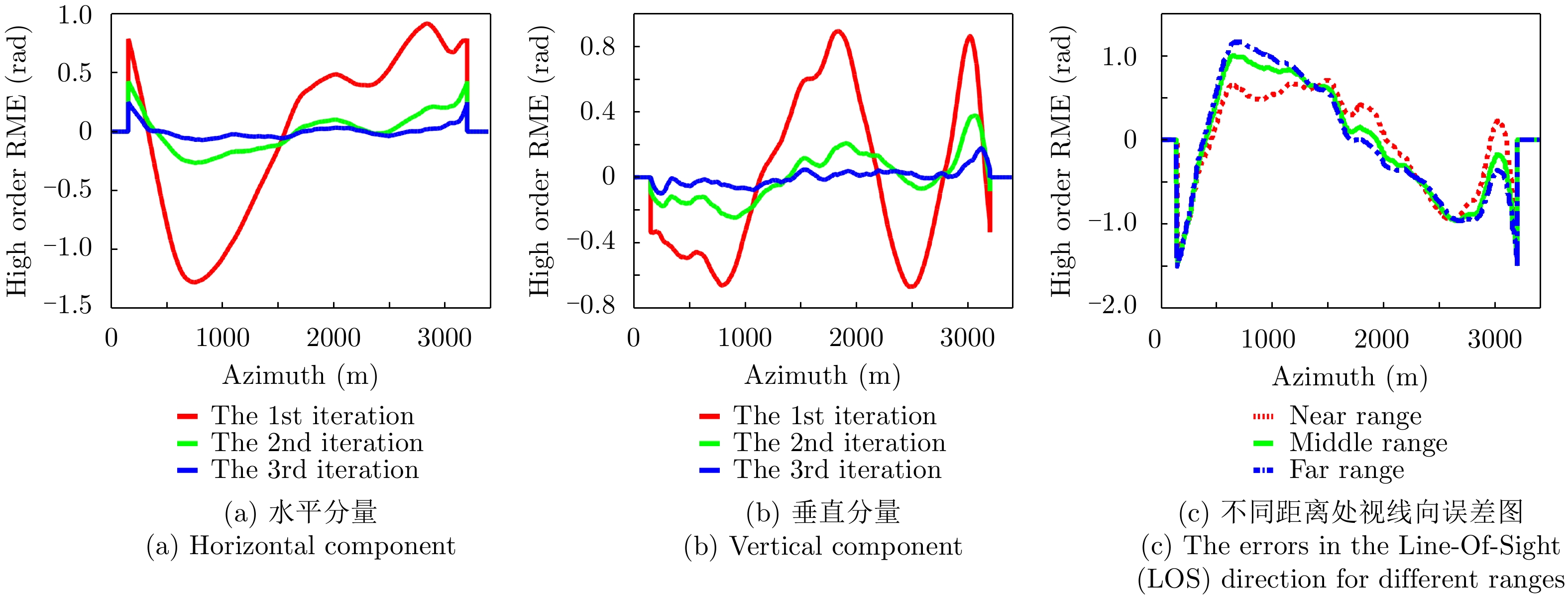
This paper describes the L-band airborne Synthetic Aperture Radar (SAR) system and an experimental study of repeat-pass SAR interferometry. The discussions mainly focus on the internal calibration method, the imaging method based on Differential Global Positioning System/Inertial Measurement Unit (DGPS/IMU) data, Residual Motion Error (RME) estimation and compensation, and the Digital Elevation Model (DEM) inversion method with Interferometric SAR (InSAR). Two typical test areas were chosen from the acquired SAR data for detailed analyses. The DEMs in these two areas were inversed with repeat-pass InSAR, and comparisons with the measured ground points show errors in these two areas with a standard deviation 3.40 m and 2.85 m, respectively. This demonstrates the good performance of this L-band repeat-pass interferometric SAR system. These results have important significance for the design of airborne repeat-pass InSAR systems and typical terrain mapping. When the flight tracks are under good control, this L-band SAR system is applicable in the fields of differential InSAR, polarimetric InSAR, and tomographic SAR.
This paper describes the L-band airborne Synthetic Aperture Radar (SAR) system and an experimental study of repeat-pass SAR interferometry. The discussions mainly focus on the internal calibration method, the imaging method based on Differential Global Positioning System/Inertial Measurement Unit (DGPS/IMU) data, Residual Motion Error (RME) estimation and compensation, and the Digital Elevation Model (DEM) inversion method with Interferometric SAR (InSAR). Two typical test areas were chosen from the acquired SAR data for detailed analyses. The DEMs in these two areas were inversed with repeat-pass InSAR, and comparisons with the measured ground points show errors in these two areas with a standard deviation 3.40 m and 2.85 m, respectively. This demonstrates the good performance of this L-band repeat-pass interferometric SAR system. These results have important significance for the design of airborne repeat-pass InSAR systems and typical terrain mapping. When the flight tracks are under good control, this L-band SAR system is applicable in the fields of differential InSAR, polarimetric InSAR, and tomographic SAR.


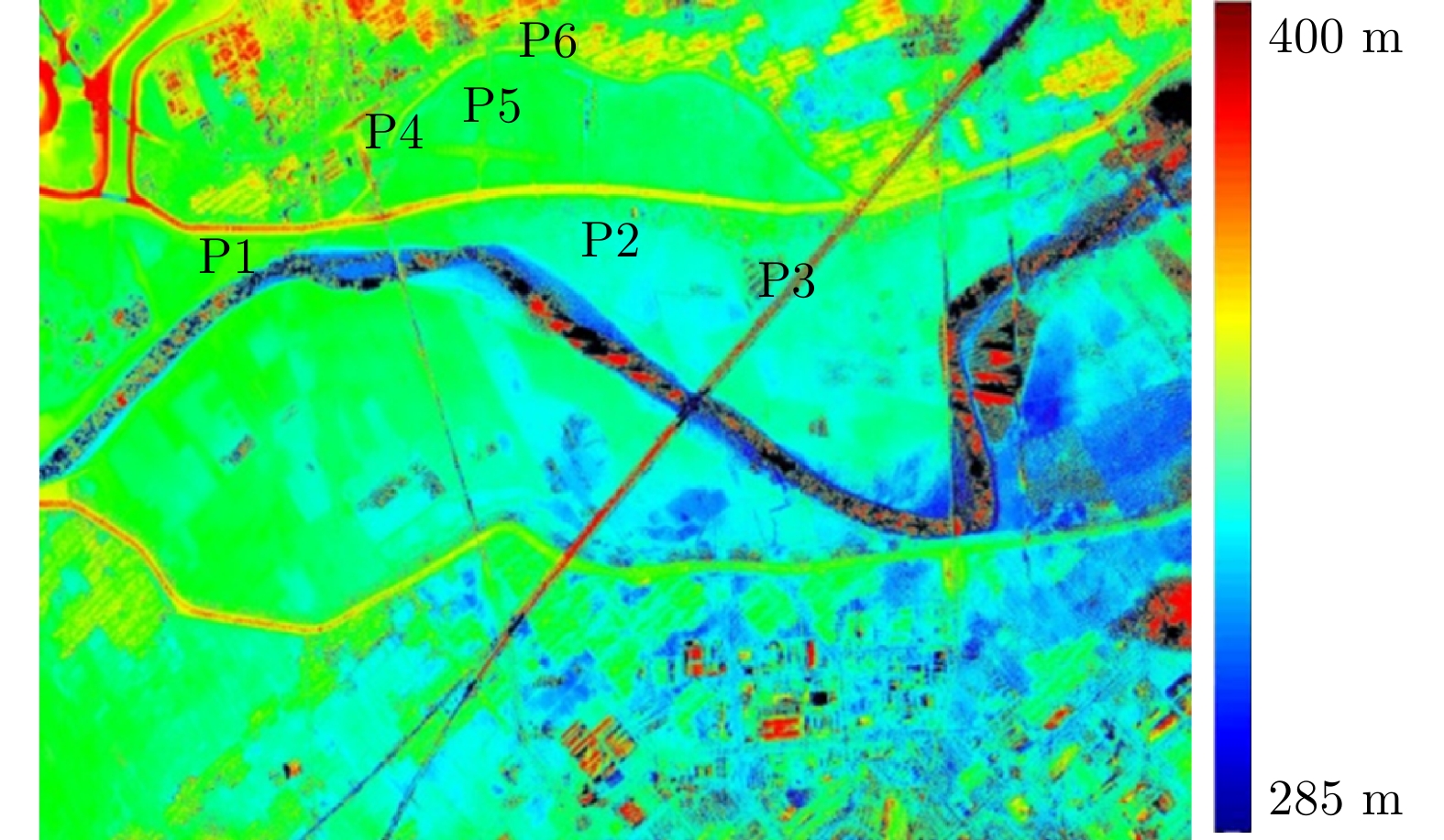
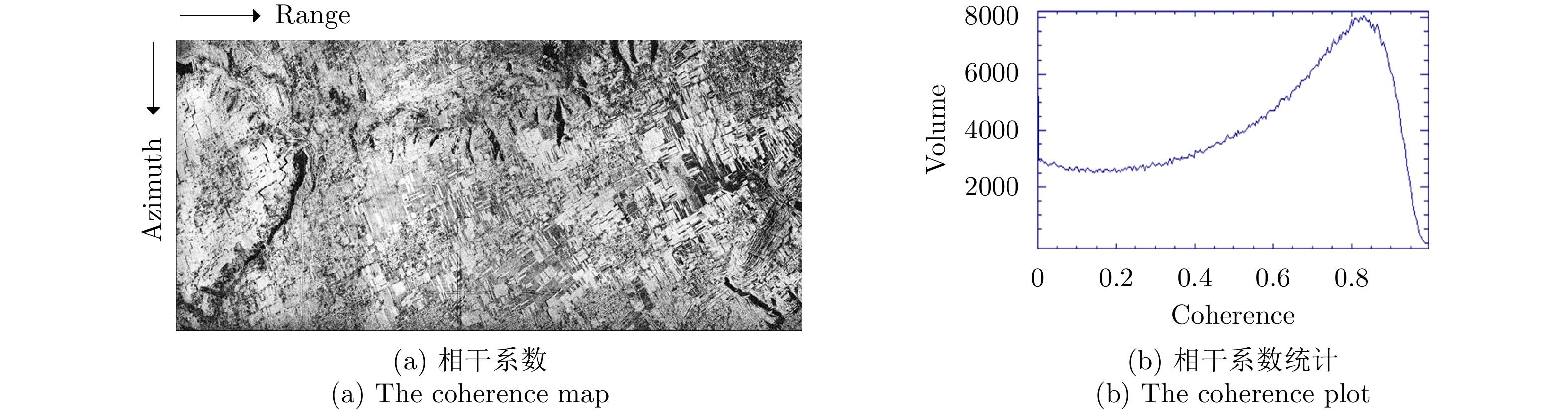

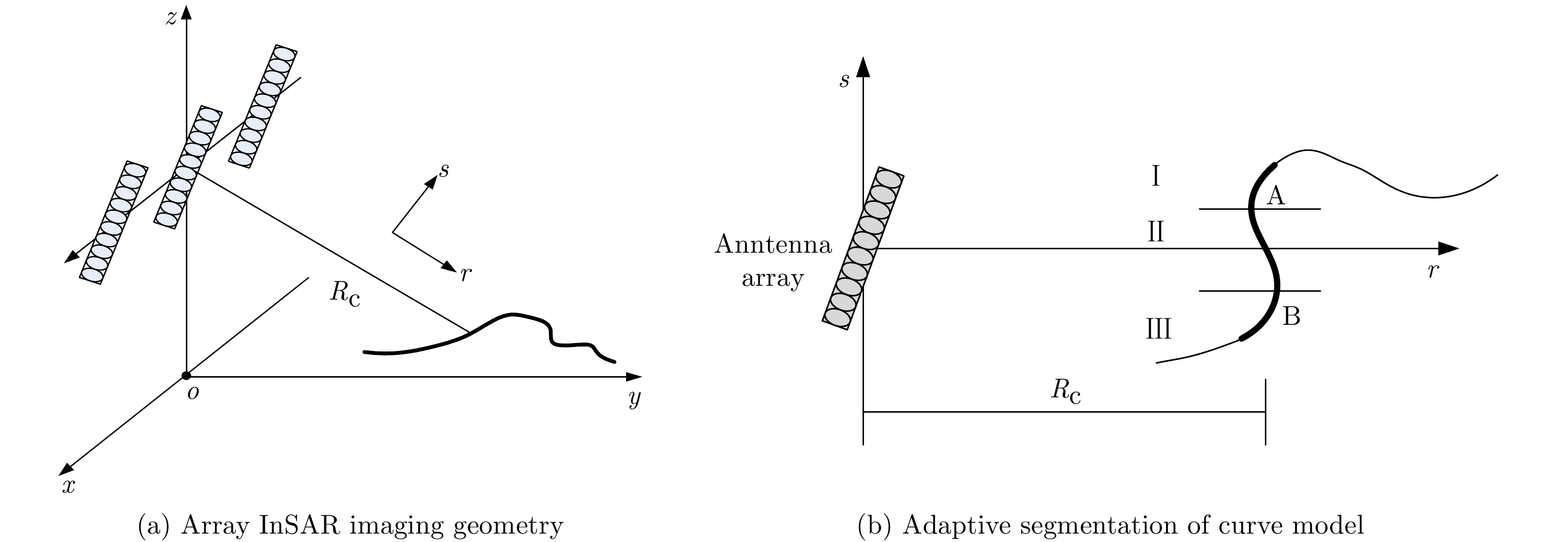
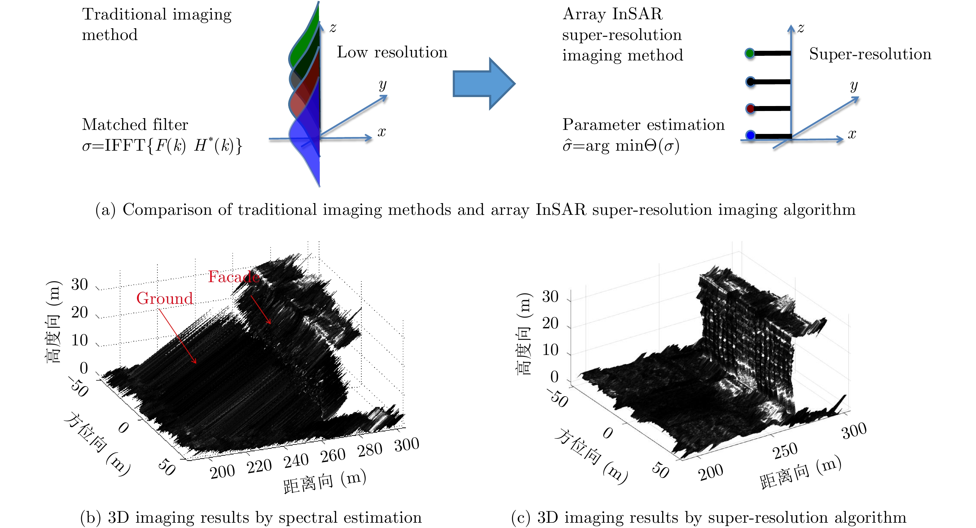
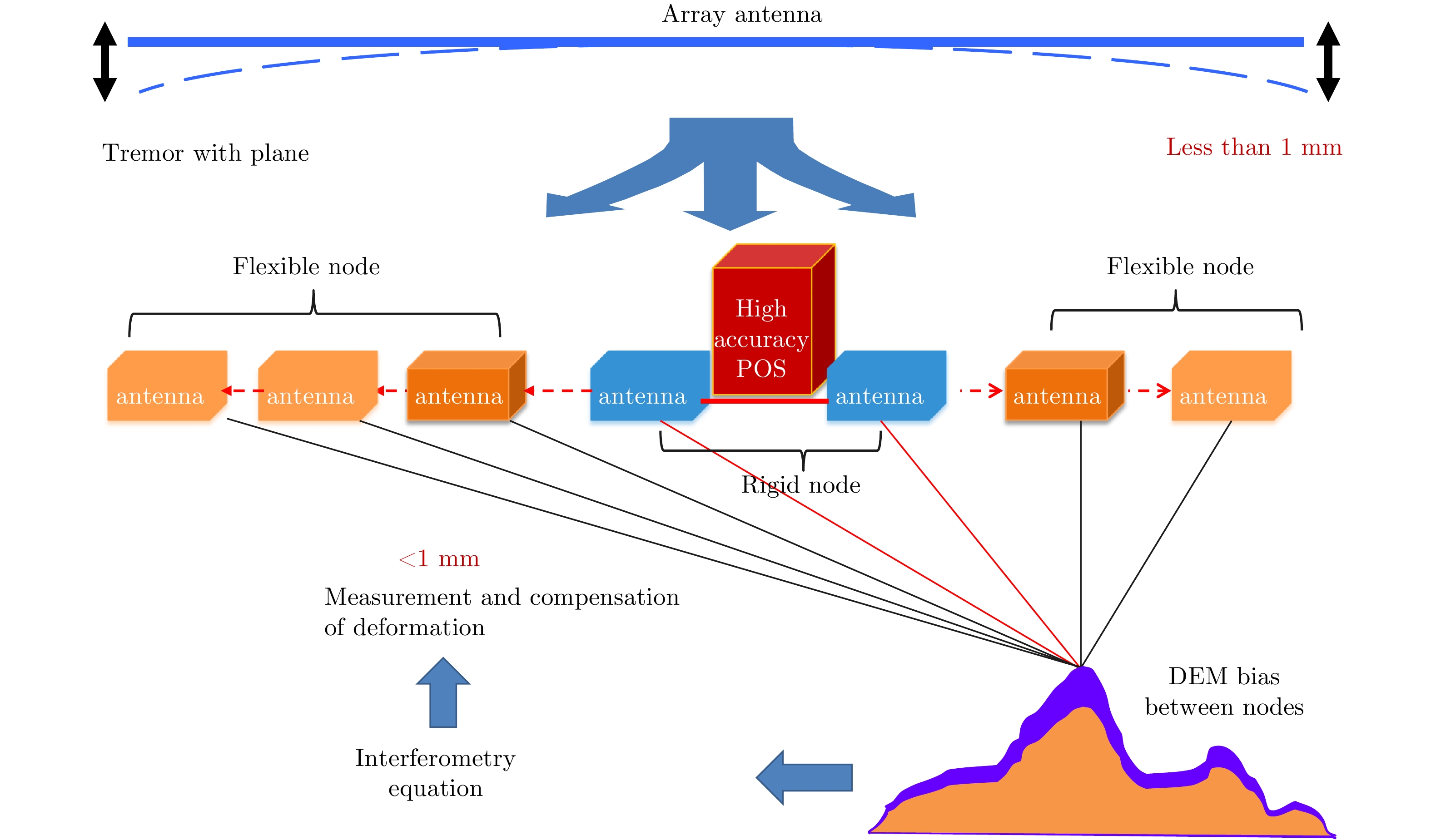
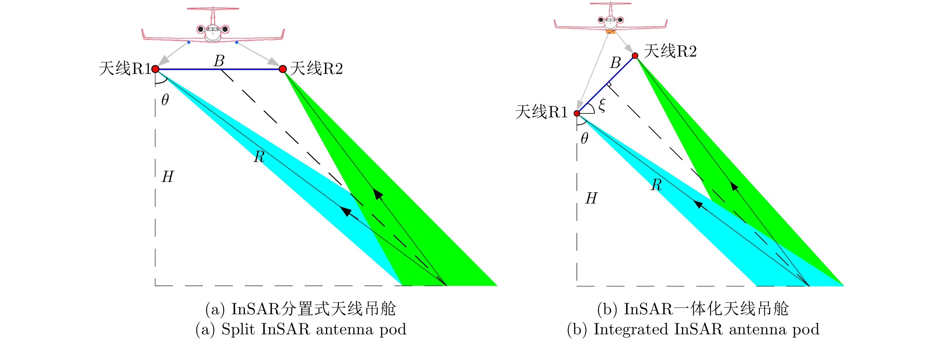
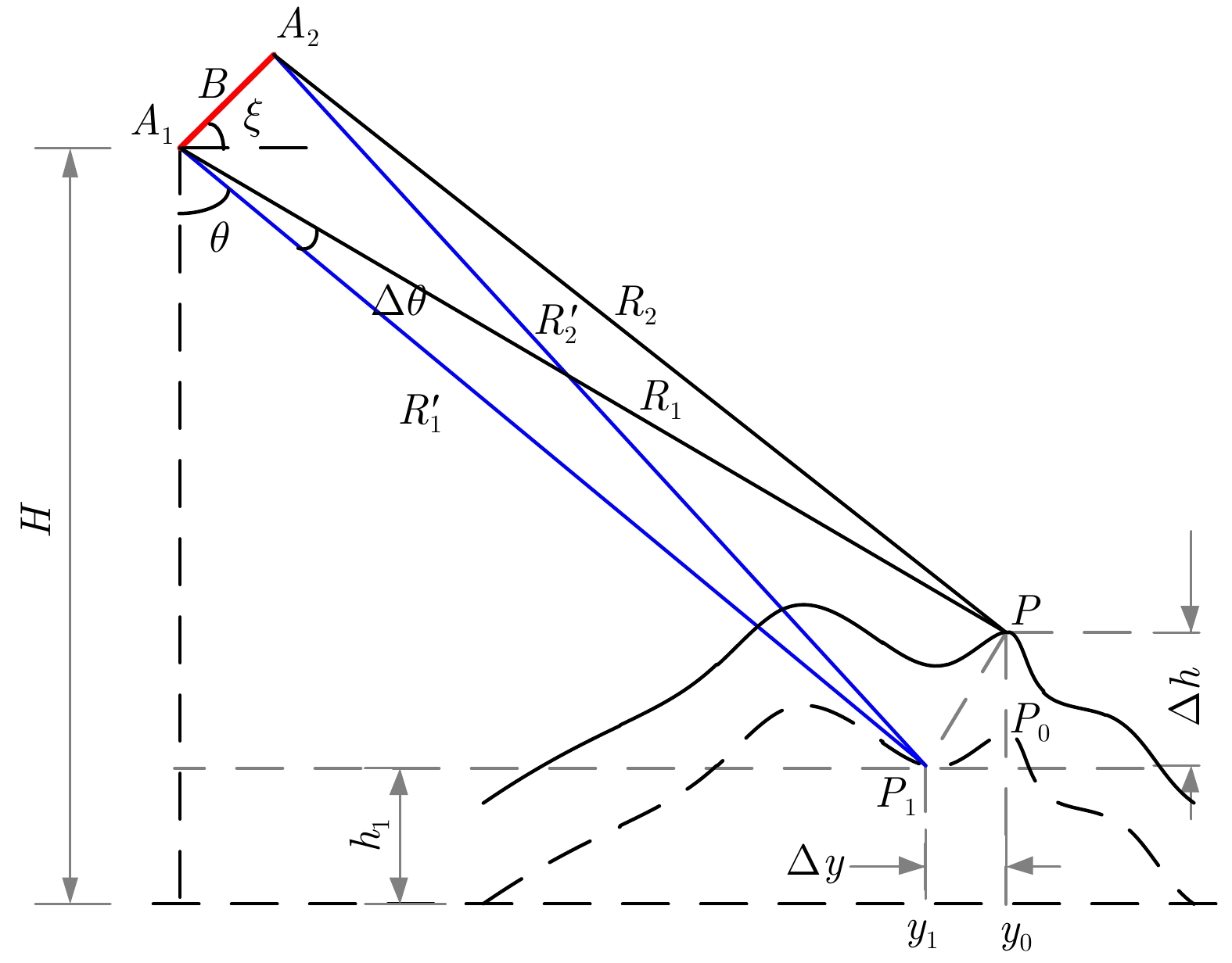
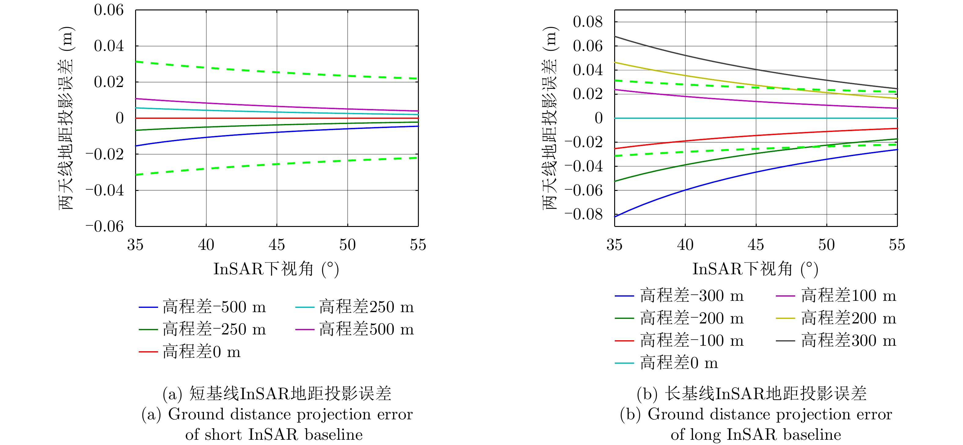
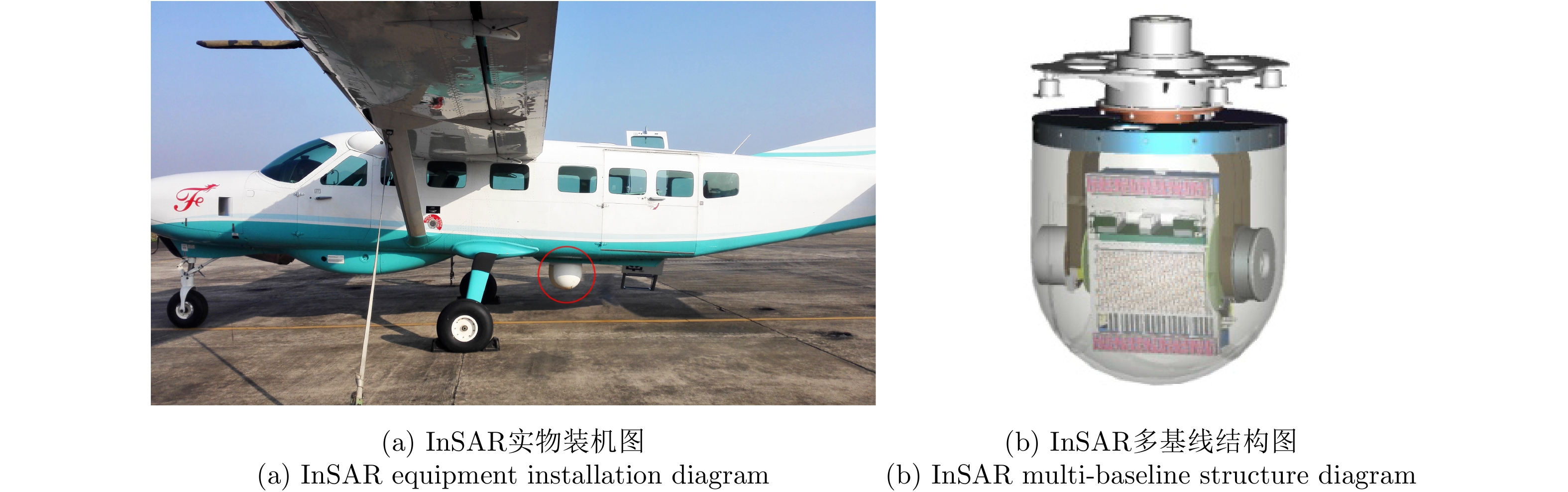
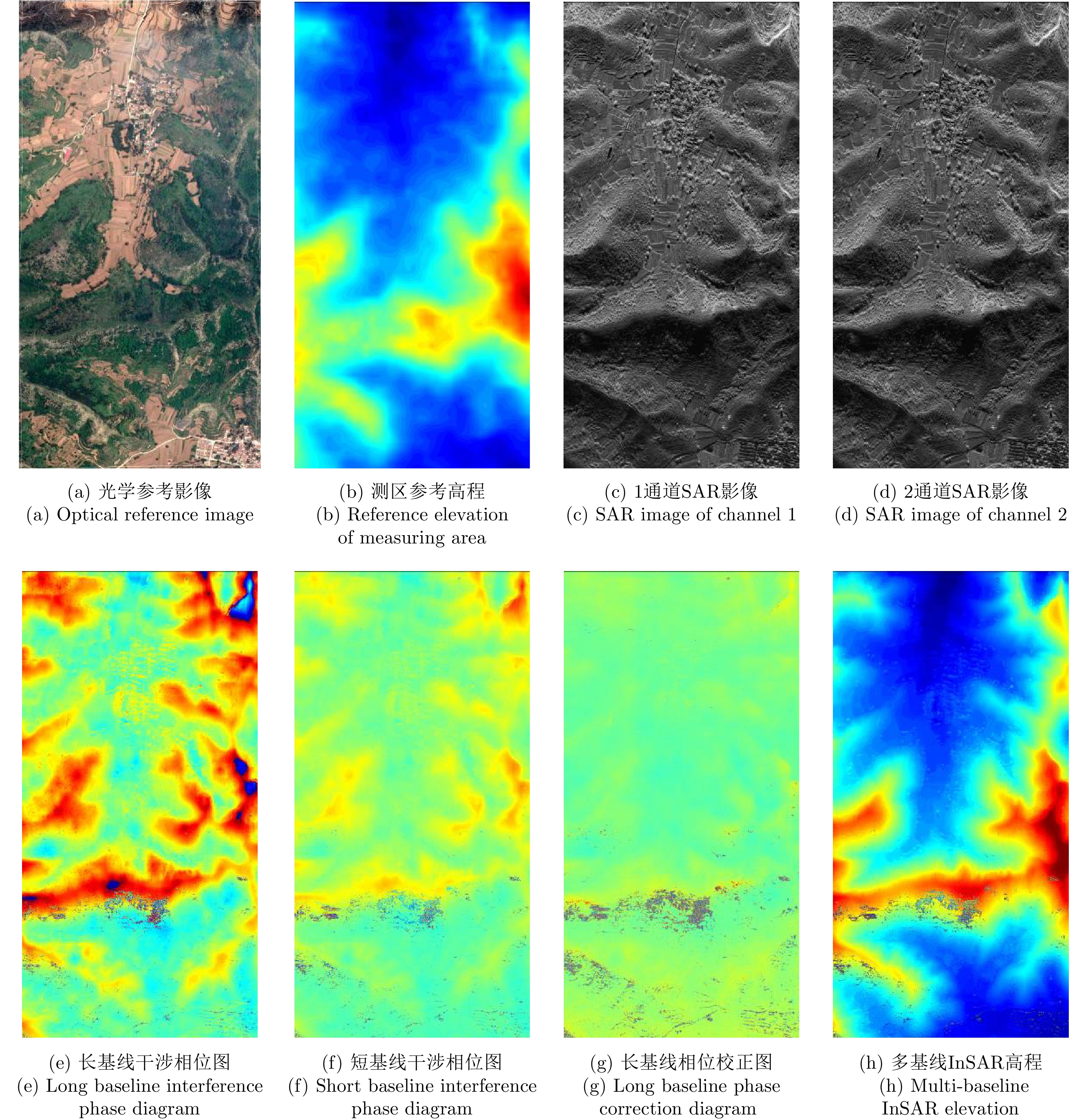
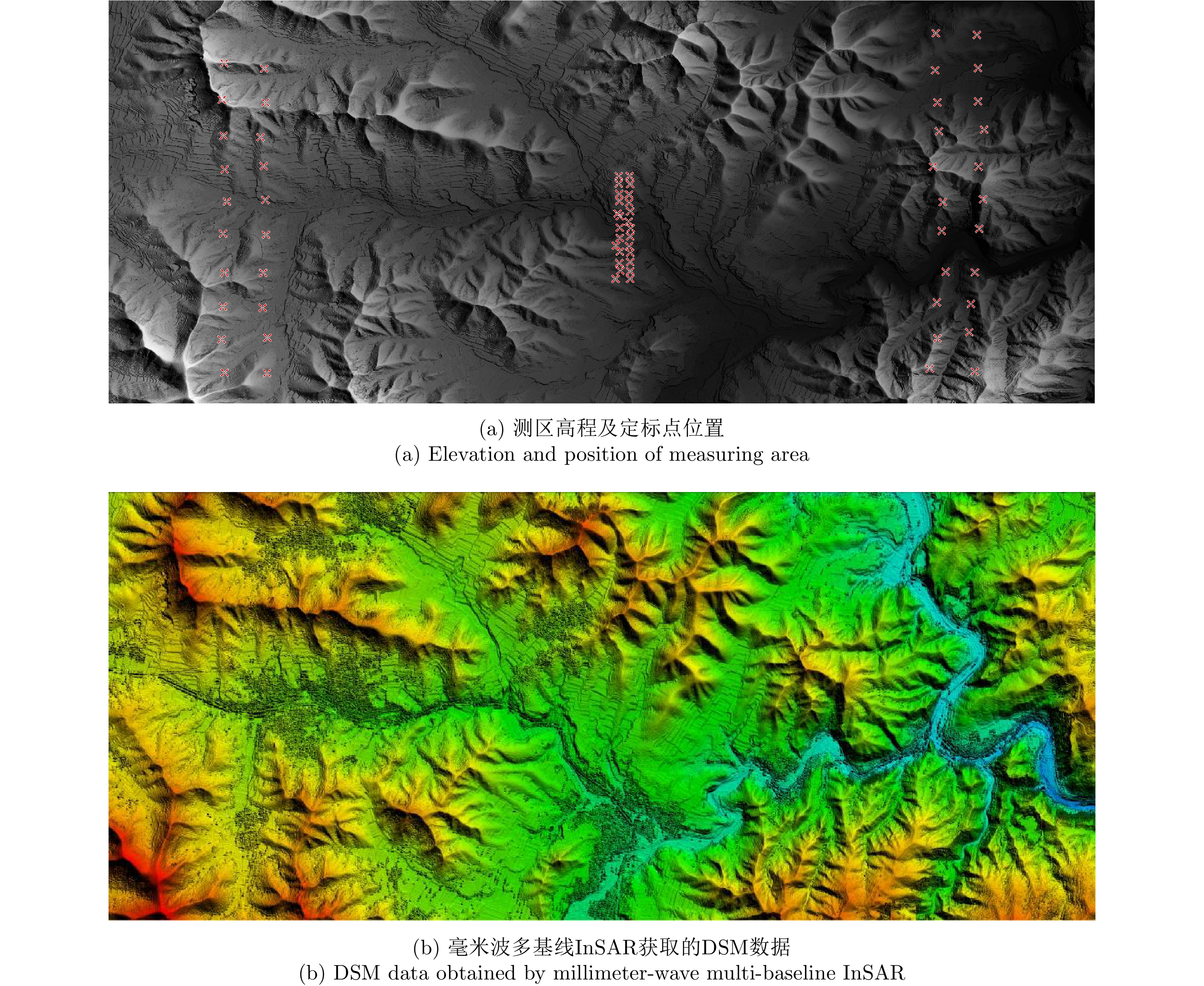
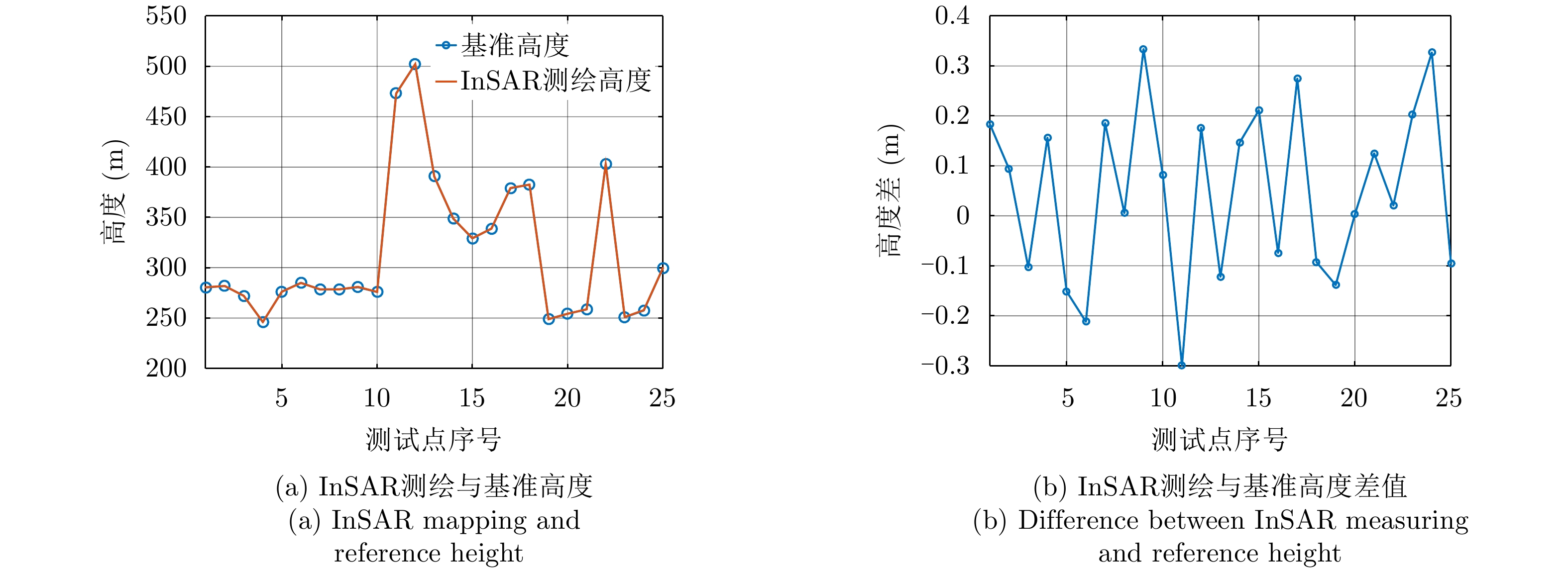
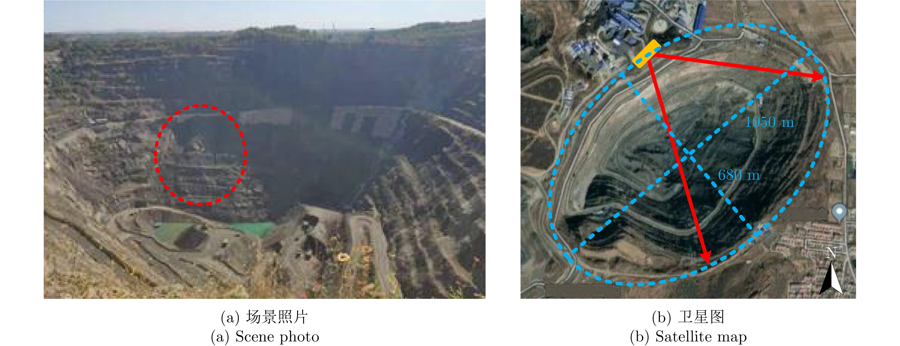
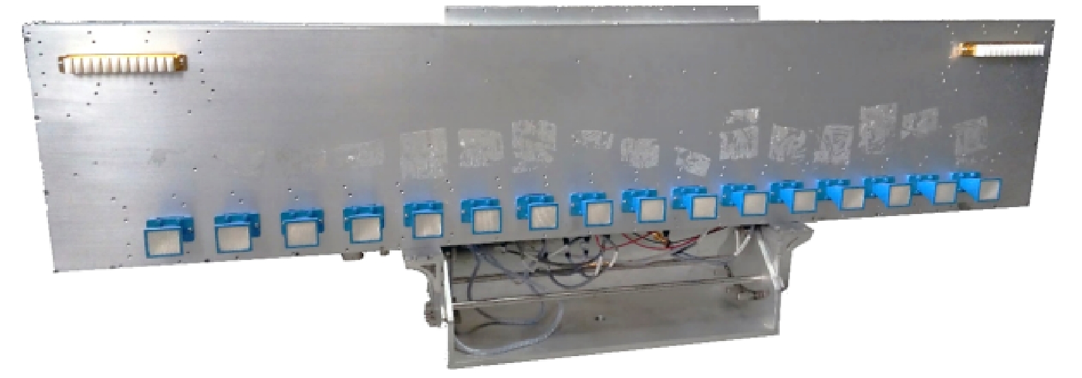
The characteristics of airborne millimeter-wave Interferometric Synthetic Aperture Radar (InSAR) include unrestricted light, large surveying width, and high mapping precision. In recent years, with the continuous development and improvement of the technology of airborne millimeter-wave InSAR, it has gradually become a widely used mapping method. The core of the system design of a high-precision millimeter-wave InSAR system designed for small aircraft platforms comprises InSAR baseline configuration, multi-baseline configuration, the external Digital Elevation Model (DEM), and InSAR processing flow. In this study, interferometric elevation measurements influenced by different baseline parameters of an airborne millimeter-wave InSAR system are analyzed. A design scheme of the millimeter-wave multi-baseline InSAR system based on integrated antenna pod is provided. Then, a time-domain imaging algorithm-based millimeter-wave multi-baseline InSAR elevation measurement process is proposed. Finally, real measured data experiments are used to illustrate the feasibility and effectiveness of the proposed millimeter-wave multi-baseline InSAR system and the interference data processing method for large-scale mapping missions.
The characteristics of airborne millimeter-wave Interferometric Synthetic Aperture Radar (InSAR) include unrestricted light, large surveying width, and high mapping precision. In recent years, with the continuous development and improvement of the technology of airborne millimeter-wave InSAR, it has gradually become a widely used mapping method. The core of the system design of a high-precision millimeter-wave InSAR system designed for small aircraft platforms comprises InSAR baseline configuration, multi-baseline configuration, the external Digital Elevation Model (DEM), and InSAR processing flow. In this study, interferometric elevation measurements influenced by different baseline parameters of an airborne millimeter-wave InSAR system are analyzed. A design scheme of the millimeter-wave multi-baseline InSAR system based on integrated antenna pod is provided. Then, a time-domain imaging algorithm-based millimeter-wave multi-baseline InSAR elevation measurement process is proposed. Finally, real measured data experiments are used to illustrate the feasibility and effectiveness of the proposed millimeter-wave multi-baseline InSAR system and the interference data processing method for large-scale mapping missions.

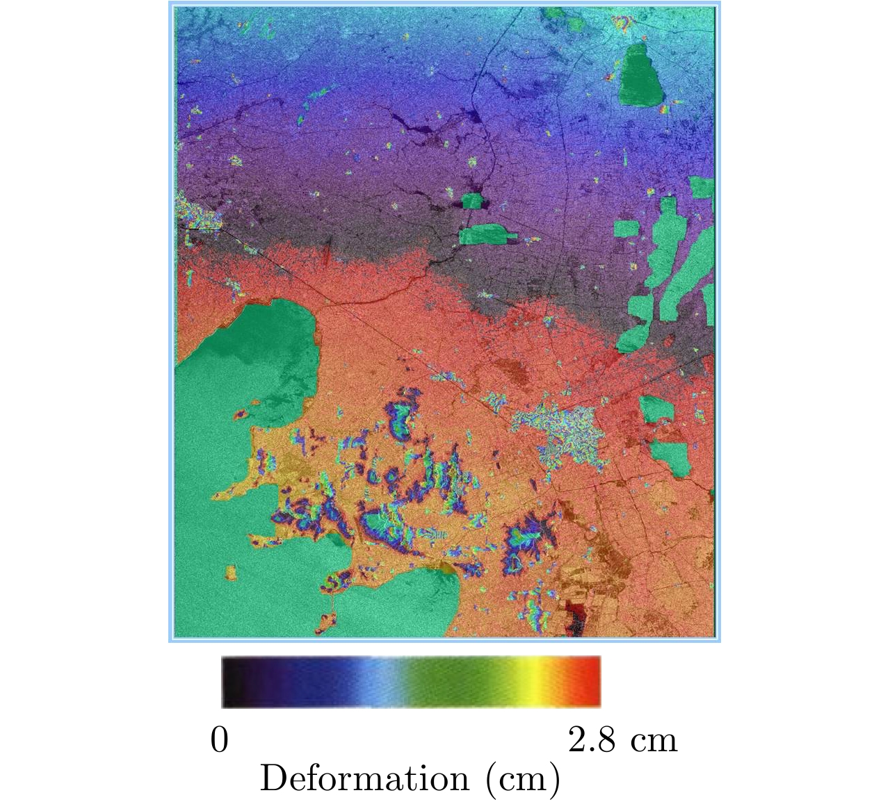
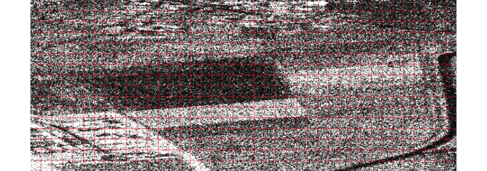
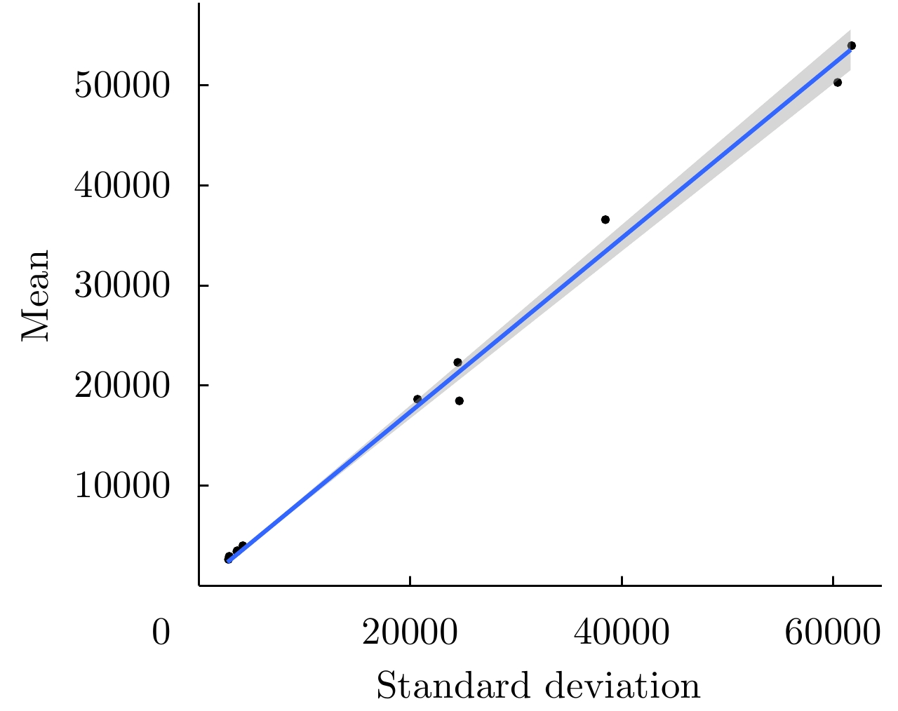
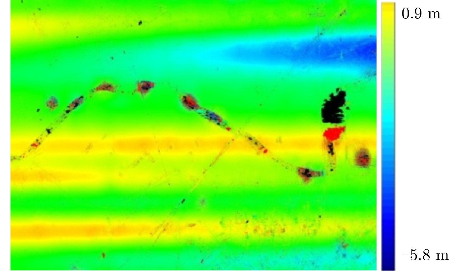
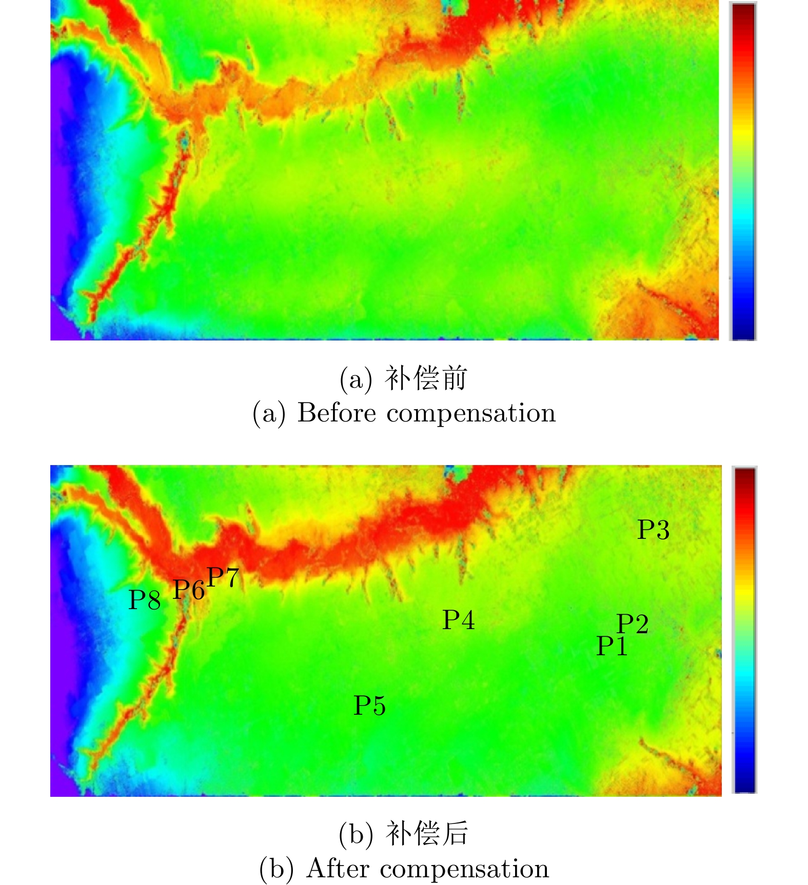
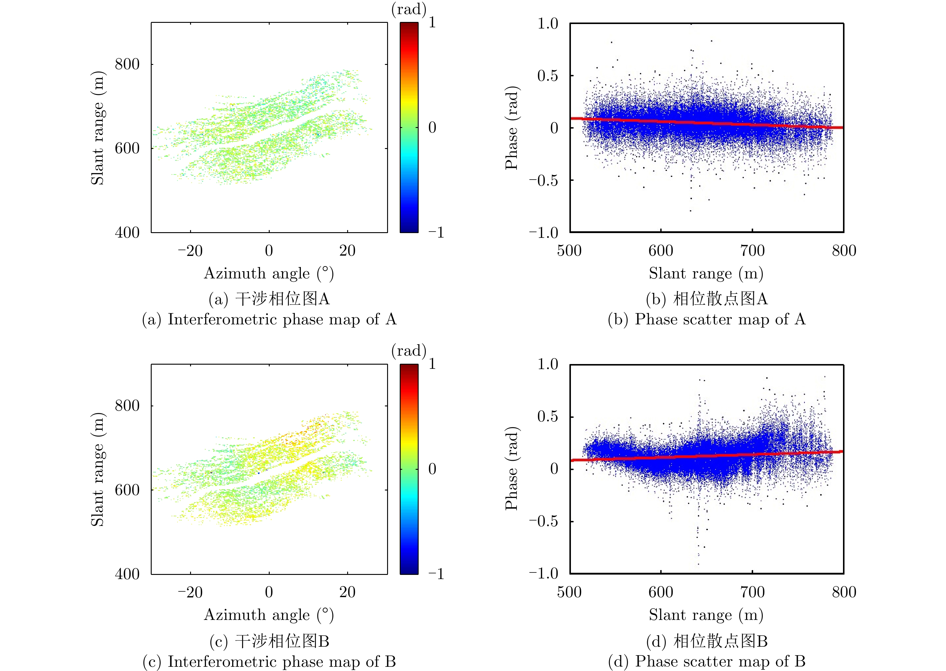
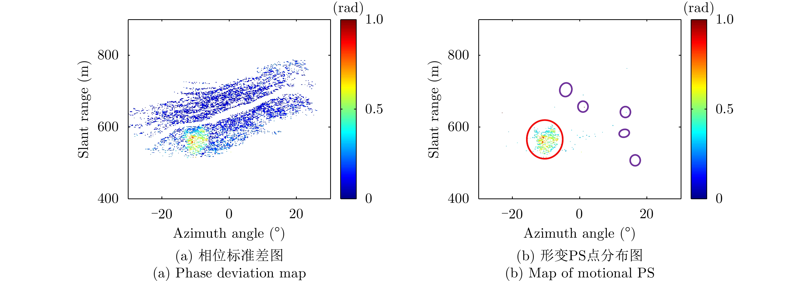
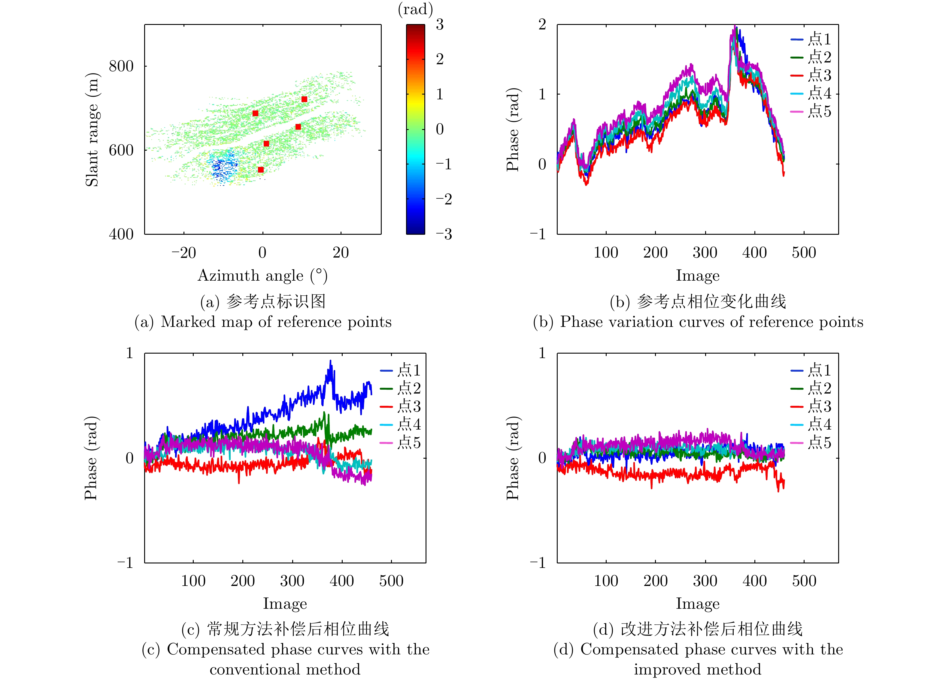
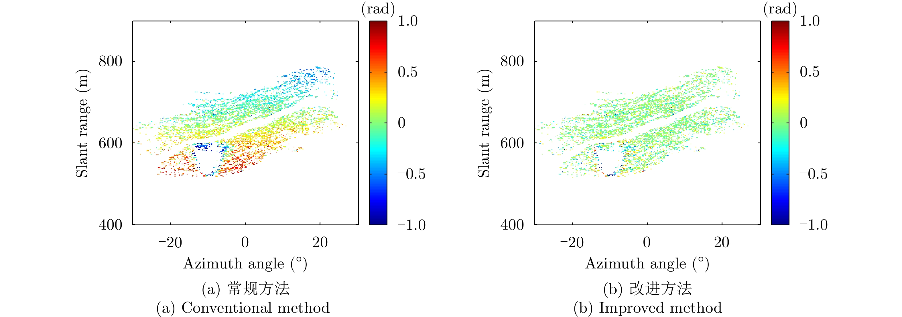
When the Permanent Scatterer (PS) technique is utilized to compensate the Atmospheric Phase (AP) for Ground-Based Interferometric Synthetic Aperture Radar (GB-InSAR) images, a proper parametric model should be built to describe the AP. However, for some interferograms, the AP may nonlinearly vary with the PS range, and this cannot be effectively compensated via the conventional method. This paper proposes an improved method to compensate the nonlinear AP. Here, the conventional method is first used to compensate all the phase interferograms. By calculating the standard deviation of the phase sequence of every PS and setting a proper threshold, a large number of stable PSs are selected. Then these stable PSs are divided into a certain number of sub-regions, and some control points are determined. With the inverse distance weighting interpolation, the APs of all the PSs are estimated and compensated. To verify the effectiveness of the proposed method, 460 radar images are processed, and the results are made compared with those of the conventional method. The nonlinear AP could be better compensated with the proposed method to avoid misunderstanding of the motional area. Several reference PSs are selected to make quantitative comparisons, and measurement error up to 1 rad could be reduced.
When the Permanent Scatterer (PS) technique is utilized to compensate the Atmospheric Phase (AP) for Ground-Based Interferometric Synthetic Aperture Radar (GB-InSAR) images, a proper parametric model should be built to describe the AP. However, for some interferograms, the AP may nonlinearly vary with the PS range, and this cannot be effectively compensated via the conventional method. This paper proposes an improved method to compensate the nonlinear AP. Here, the conventional method is first used to compensate all the phase interferograms. By calculating the standard deviation of the phase sequence of every PS and setting a proper threshold, a large number of stable PSs are selected. Then these stable PSs are divided into a certain number of sub-regions, and some control points are determined. With the inverse distance weighting interpolation, the APs of all the PSs are estimated and compensated. To verify the effectiveness of the proposed method, 460 radar images are processed, and the results are made compared with those of the conventional method. The nonlinear AP could be better compensated with the proposed method to avoid misunderstanding of the motional area. Several reference PSs are selected to make quantitative comparisons, and measurement error up to 1 rad could be reduced.


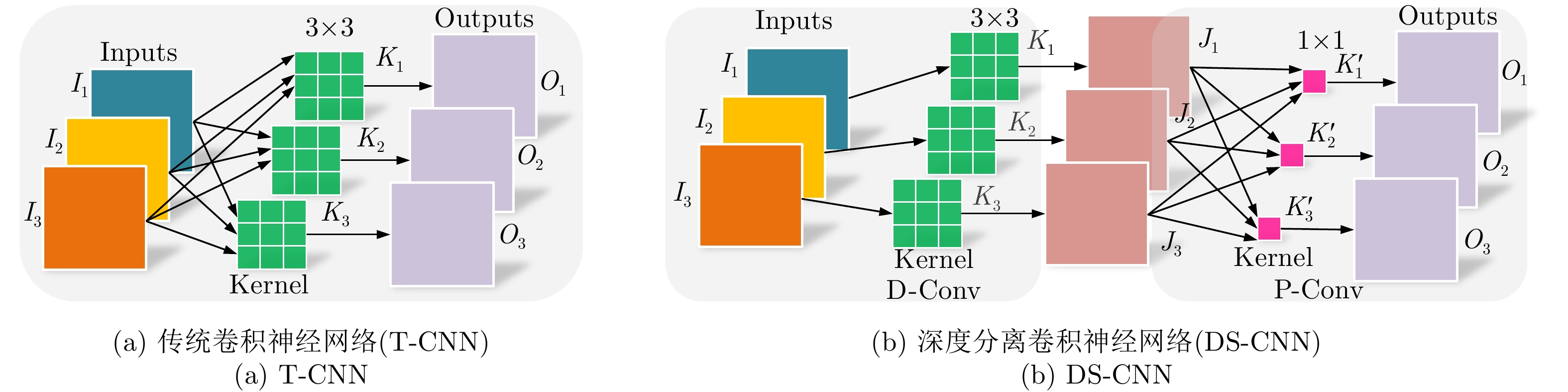
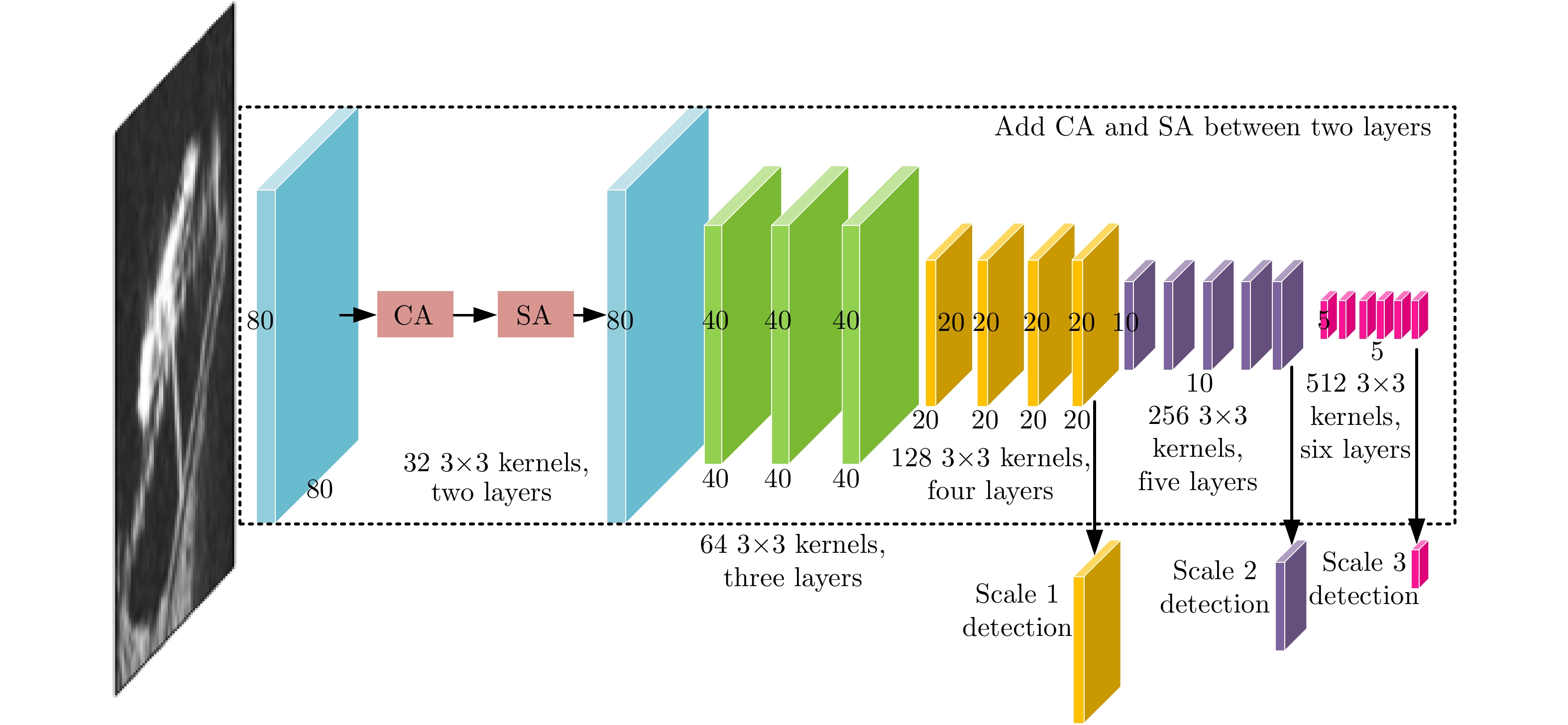
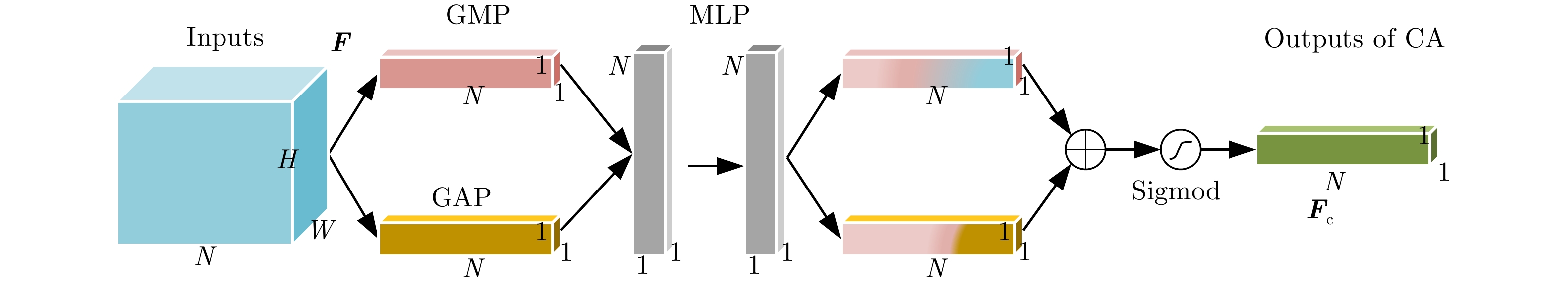
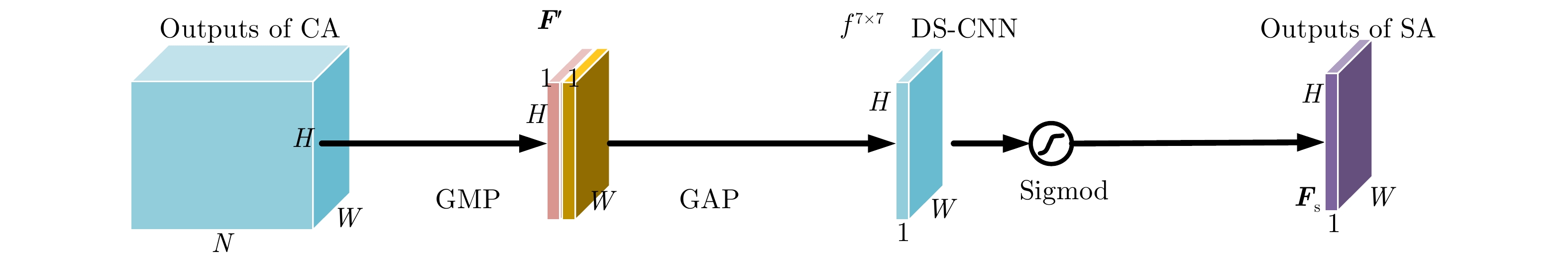
With the development of artificial intelligence, Synthetic-Aperture Radar (SAR) ship detection using deep learning technology can effectively avoid traditionally complex feature design and thereby greatly improve detection accuracy. However, most existing detection models often improve detection accuracy at the expense of detection speed that limits some real-time applications of SAR such as emergency military deployment, rapid maritime rescue, and real-time marine environmental monitoring. To solve this problem, a high-speed and high-accuracy SAR ship detection method called SARShipNet-20 based on a Depthwise Separable Convolution Neural Network (DS-CNN) has been proposed in this paper, that replaces the Traditional Convolution Neural Network (T-CNN) and combines Channel Attention (CA) and Spatial Attention (SA). As a result, high-speed and high-accuracy SAR ship detection can be simultaneously achieved. This method has certain practical significance in the field of real-time SAR application, and its lightweight model is helpful for future FPGA or DSP hardware transplantation.
With the development of artificial intelligence, Synthetic-Aperture Radar (SAR) ship detection using deep learning technology can effectively avoid traditionally complex feature design and thereby greatly improve detection accuracy. However, most existing detection models often improve detection accuracy at the expense of detection speed that limits some real-time applications of SAR such as emergency military deployment, rapid maritime rescue, and real-time marine environmental monitoring. To solve this problem, a high-speed and high-accuracy SAR ship detection method called SARShipNet-20 based on a Depthwise Separable Convolution Neural Network (DS-CNN) has been proposed in this paper, that replaces the Traditional Convolution Neural Network (T-CNN) and combines Channel Attention (CA) and Spatial Attention (SA). As a result, high-speed and high-accuracy SAR ship detection can be simultaneously achieved. This method has certain practical significance in the field of real-time SAR application, and its lightweight model is helpful for future FPGA or DSP hardware transplantation.
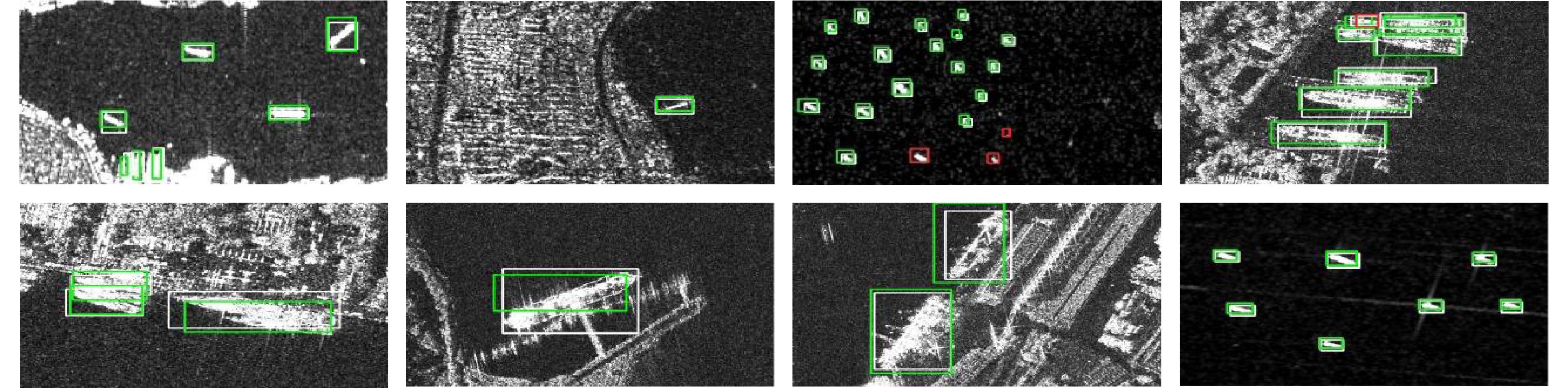

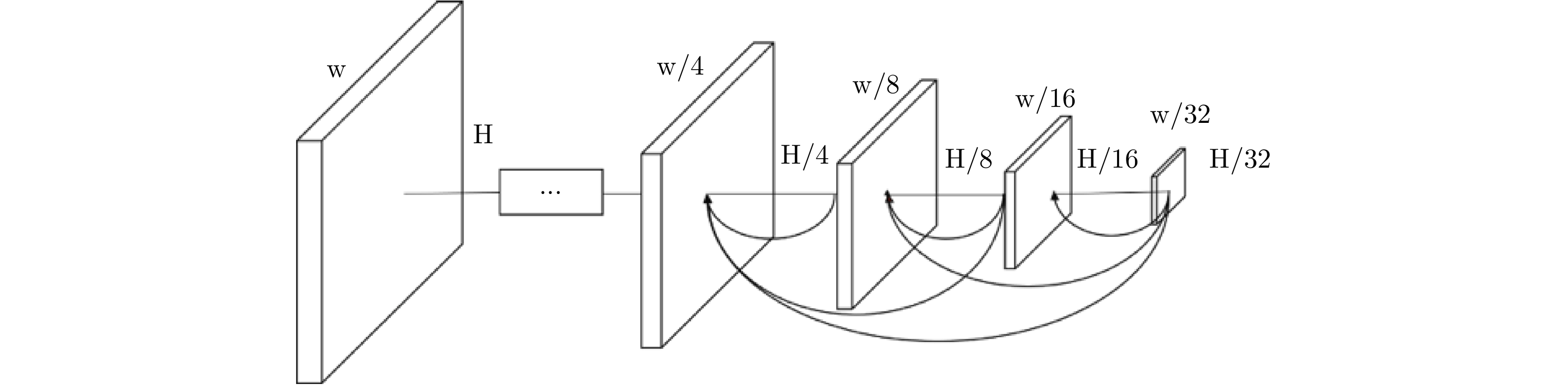
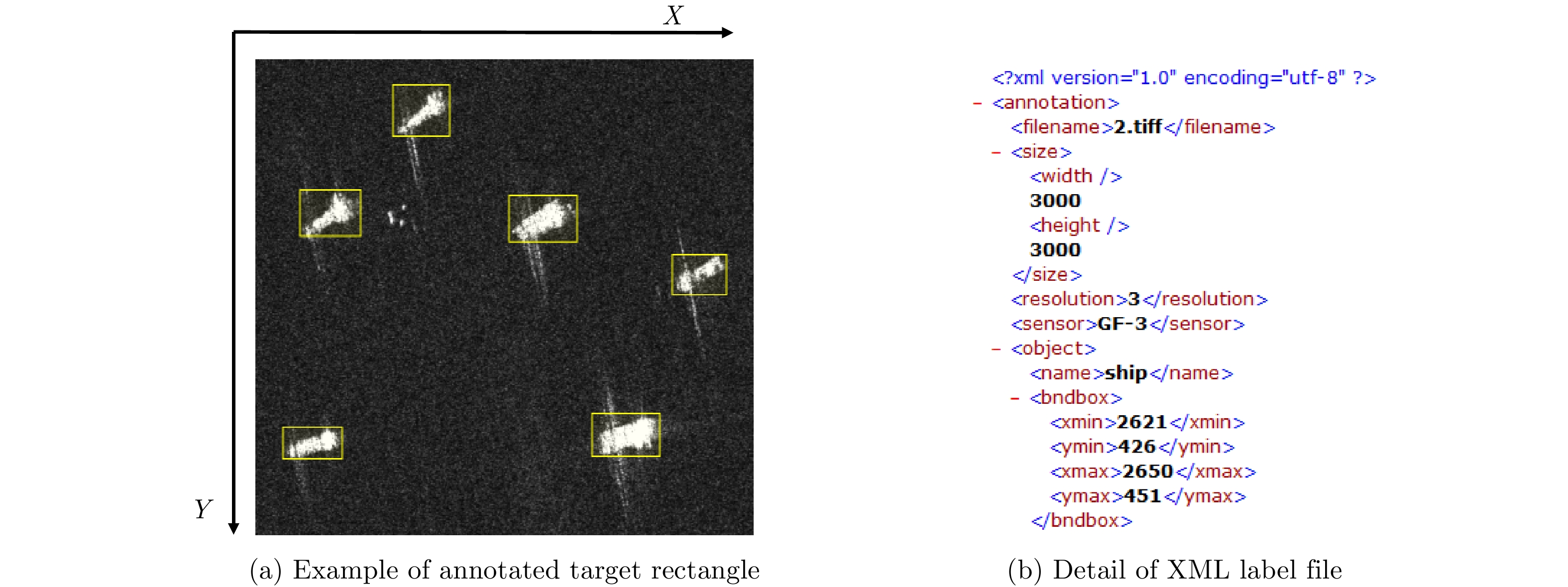
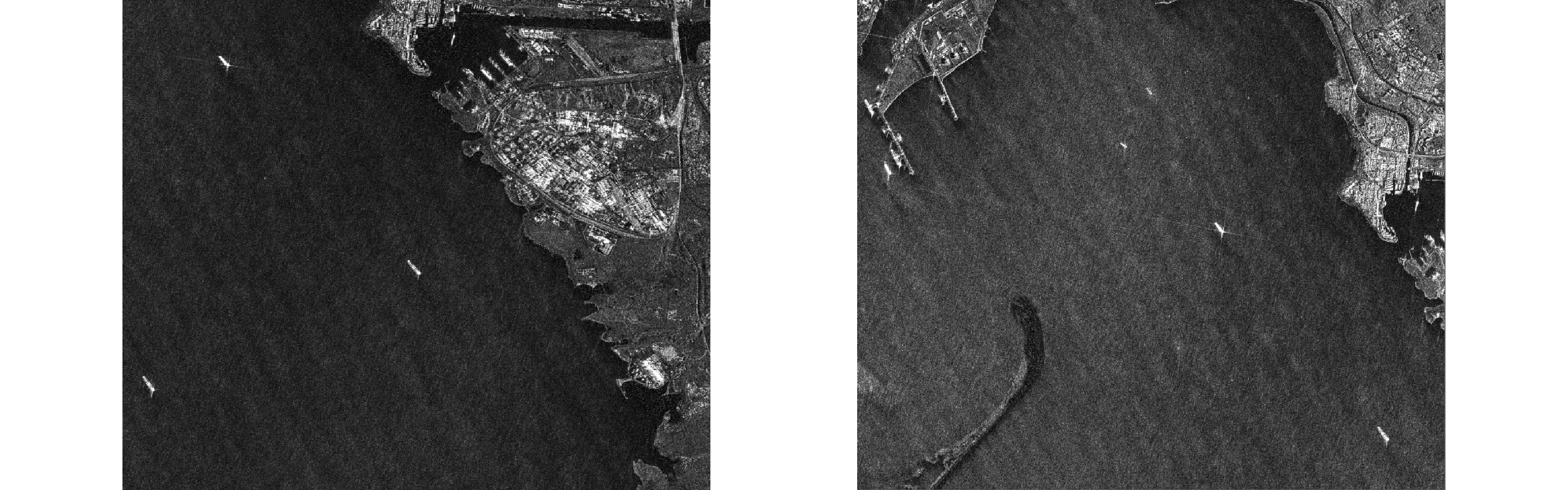
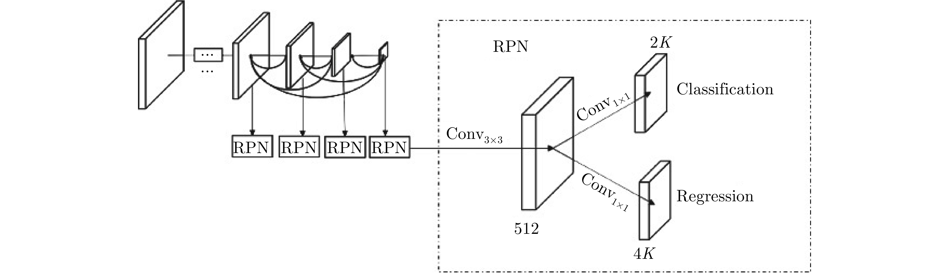
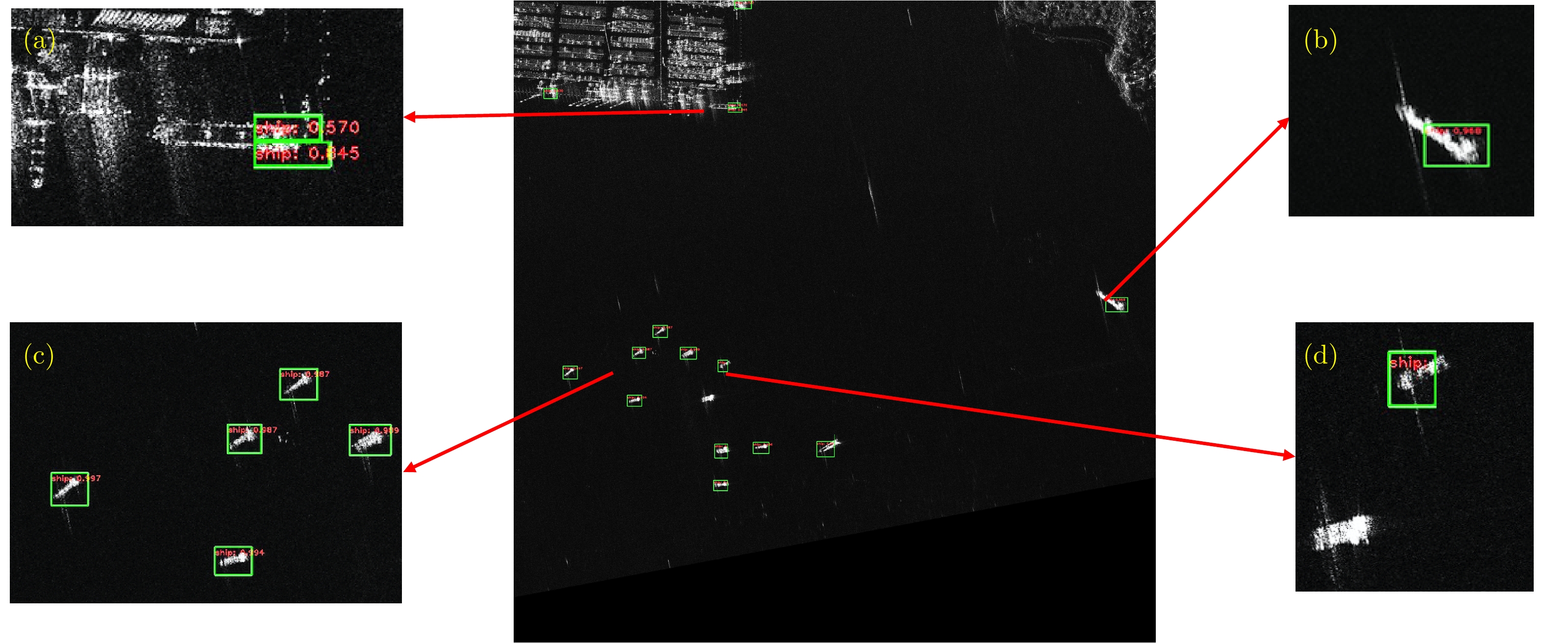
Over the recent years, deep-learning technology has been widely used. However, in research based on Synthetic Aperture Radar (SAR) ship target detection, it is difficult to support the training of a deep-learning network model because of the difficulty in data acquisition and the small scale of the samples. This paper provides a SAR ship detection dataset with a high resolution and large-scale images. This dataset comprises 31 images from Gaofen-3 satellite SAR images, including harbors, islands, reefs, and the sea surface in different conditions. The backgrounds include various scenarios such as the near shore and open sea. We conducted experiments using both traditional detection algorithms and deep-learning algorithms and observed the densely connected end-to-end neural network to achieve the highest average precision of 88.1%. Based on the experiments and performance analysis, corresponding benchmarks are provided as a basis for further research on SAR ship detection using this dataset.
Over the recent years, deep-learning technology has been widely used. However, in research based on Synthetic Aperture Radar (SAR) ship target detection, it is difficult to support the training of a deep-learning network model because of the difficulty in data acquisition and the small scale of the samples. This paper provides a SAR ship detection dataset with a high resolution and large-scale images. This dataset comprises 31 images from Gaofen-3 satellite SAR images, including harbors, islands, reefs, and the sea surface in different conditions. The backgrounds include various scenarios such as the near shore and open sea. We conducted experiments using both traditional detection algorithms and deep-learning algorithms and observed the densely connected end-to-end neural network to achieve the highest average precision of 88.1%. Based on the experiments and performance analysis, corresponding benchmarks are provided as a basis for further research on SAR ship detection using this dataset.


 微信 | 公众平台

