
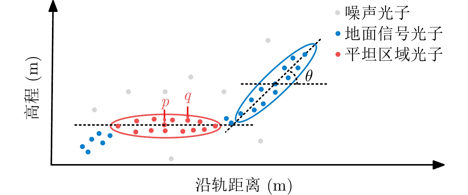
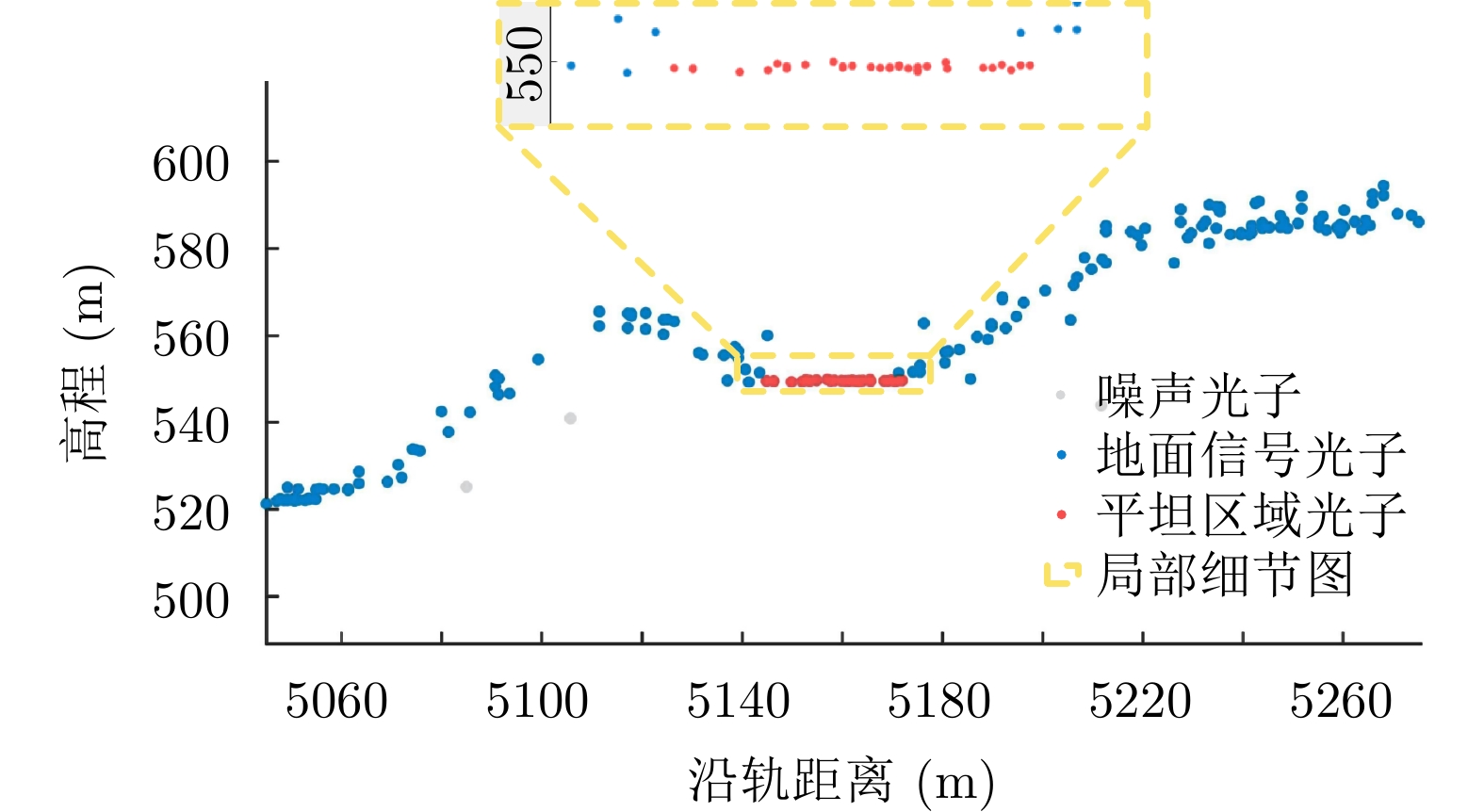
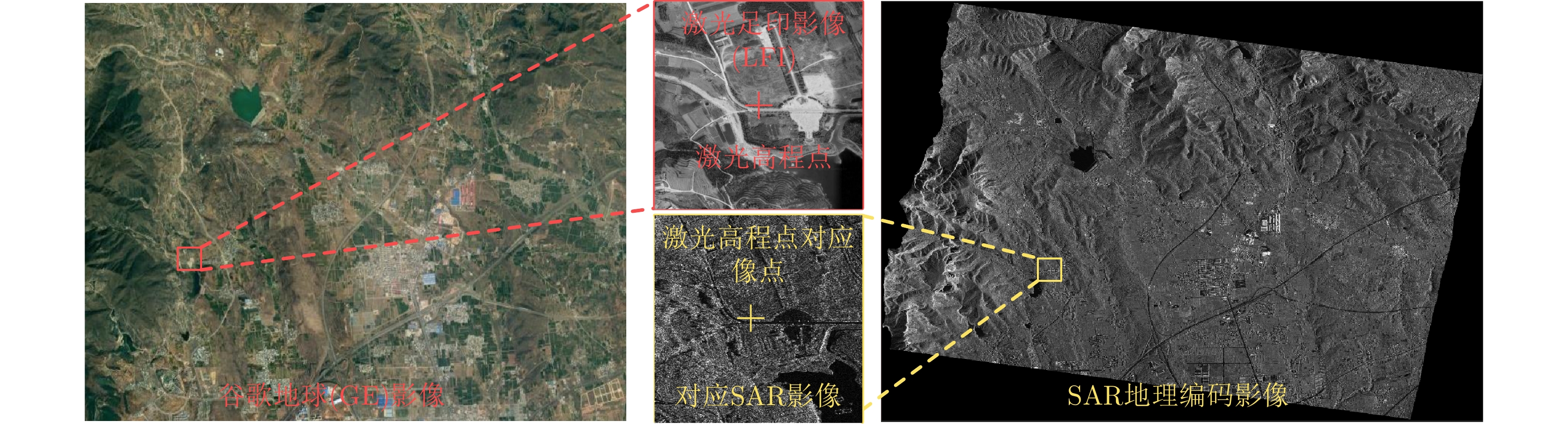
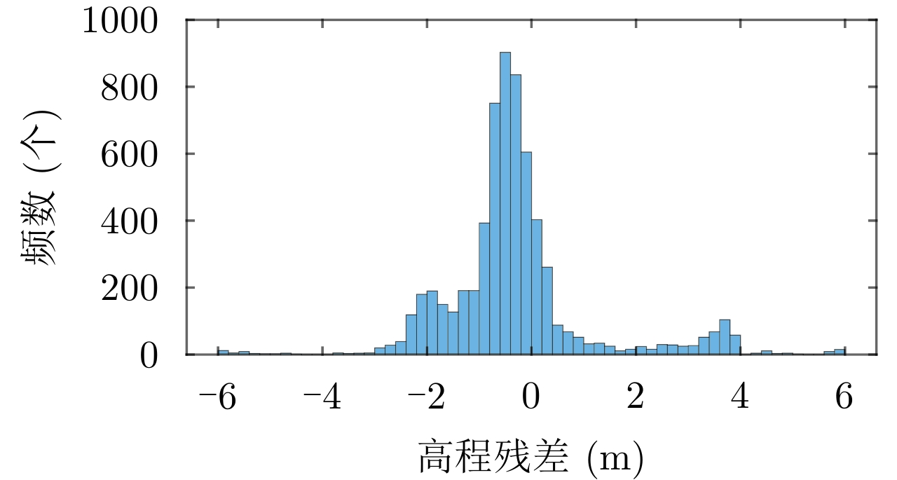
 Submit Manuscript
 Peer Review
 Editor Work
2023 Vol. 12, No. 1
 Previous Issue
 Abstract
 2812KB


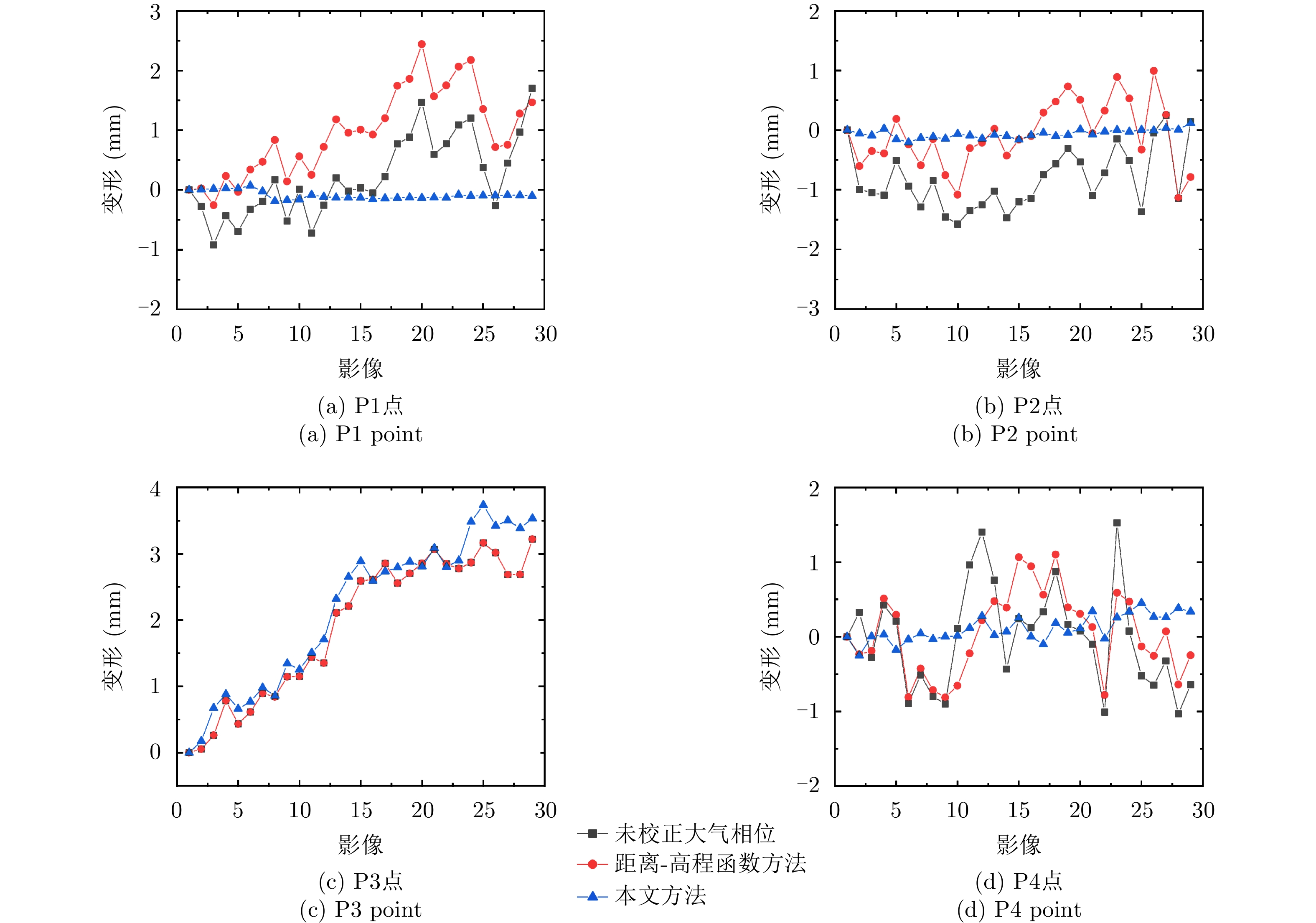


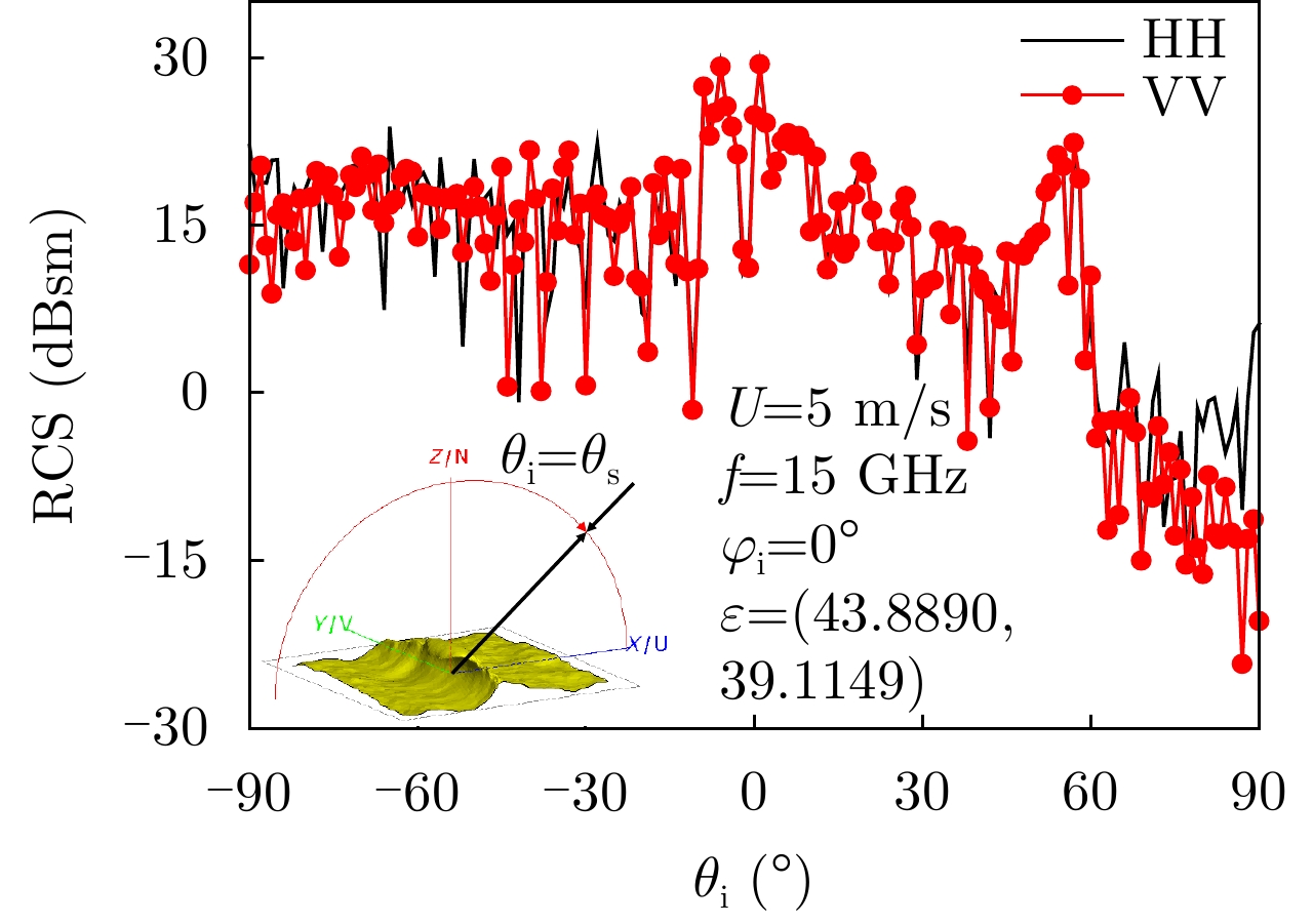


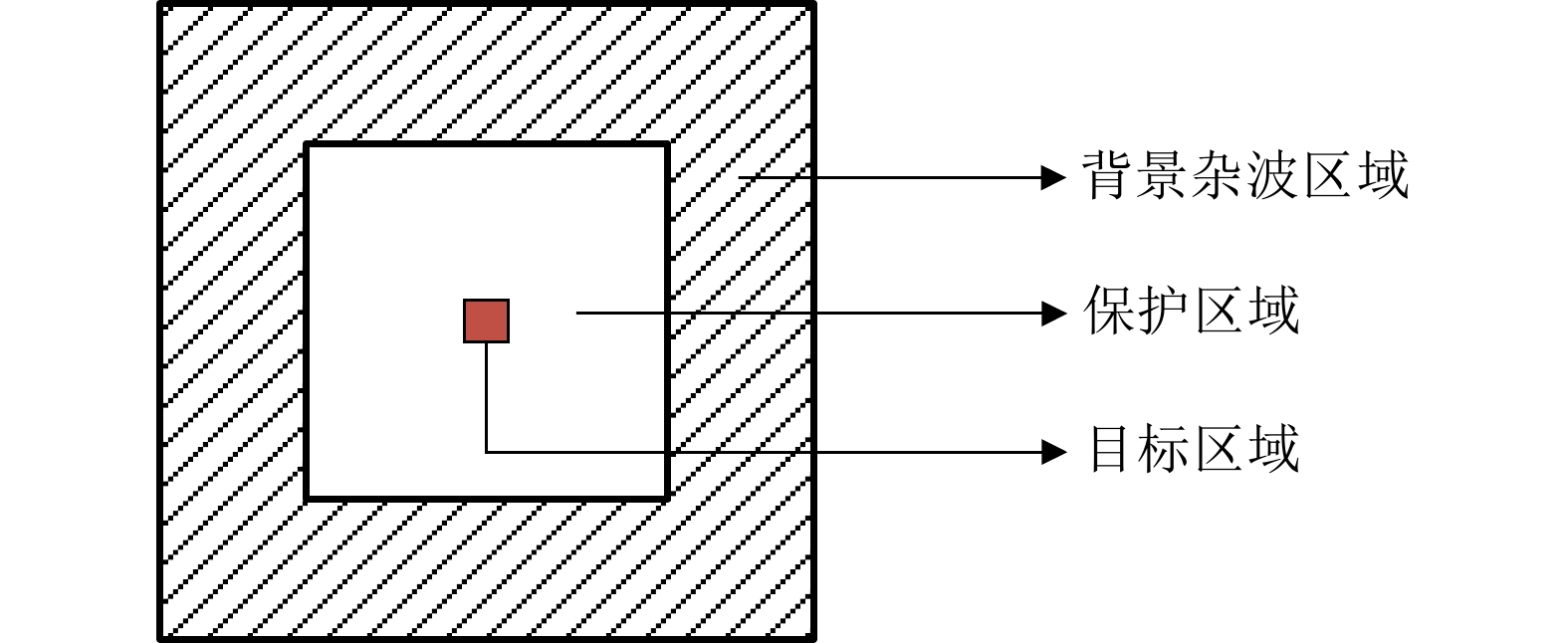
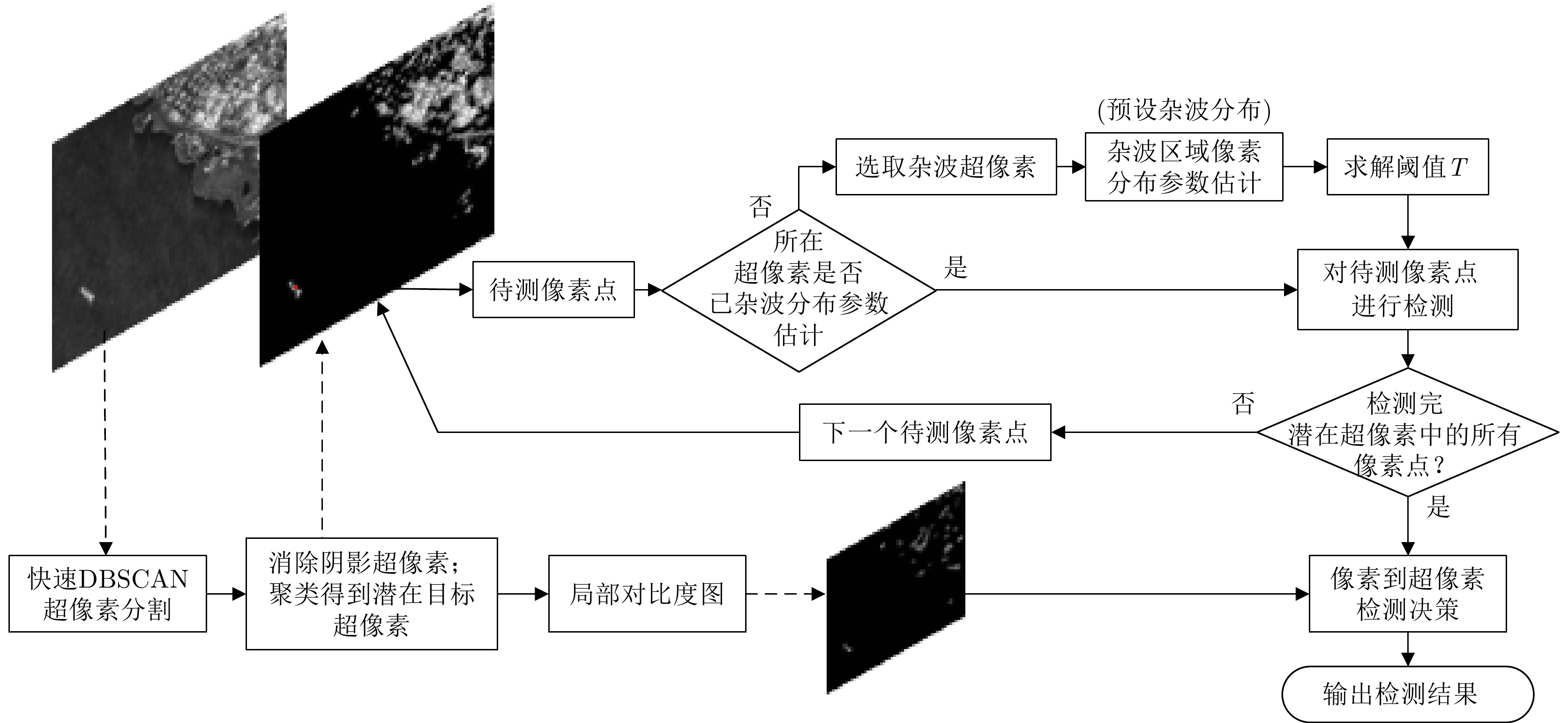
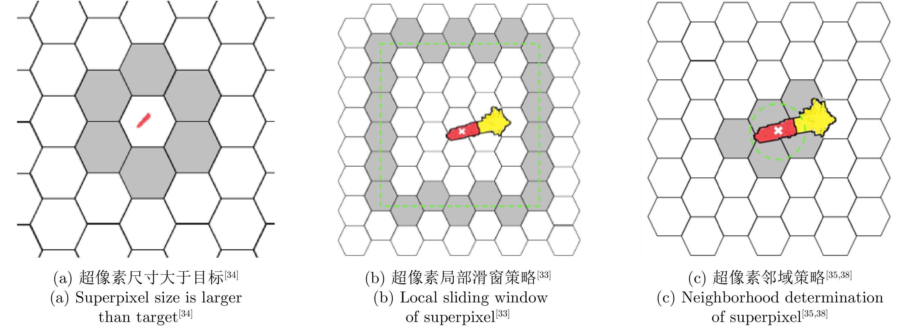
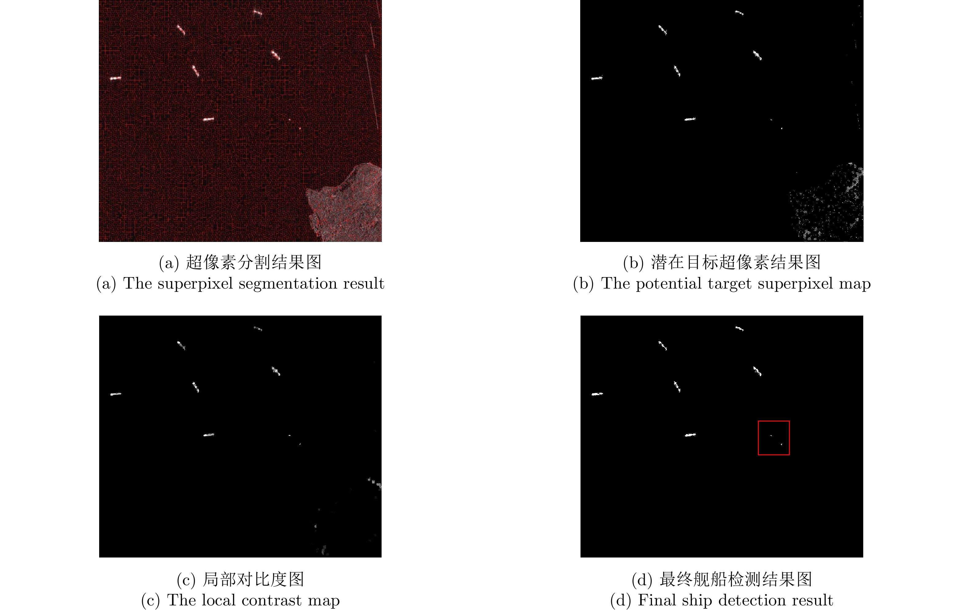
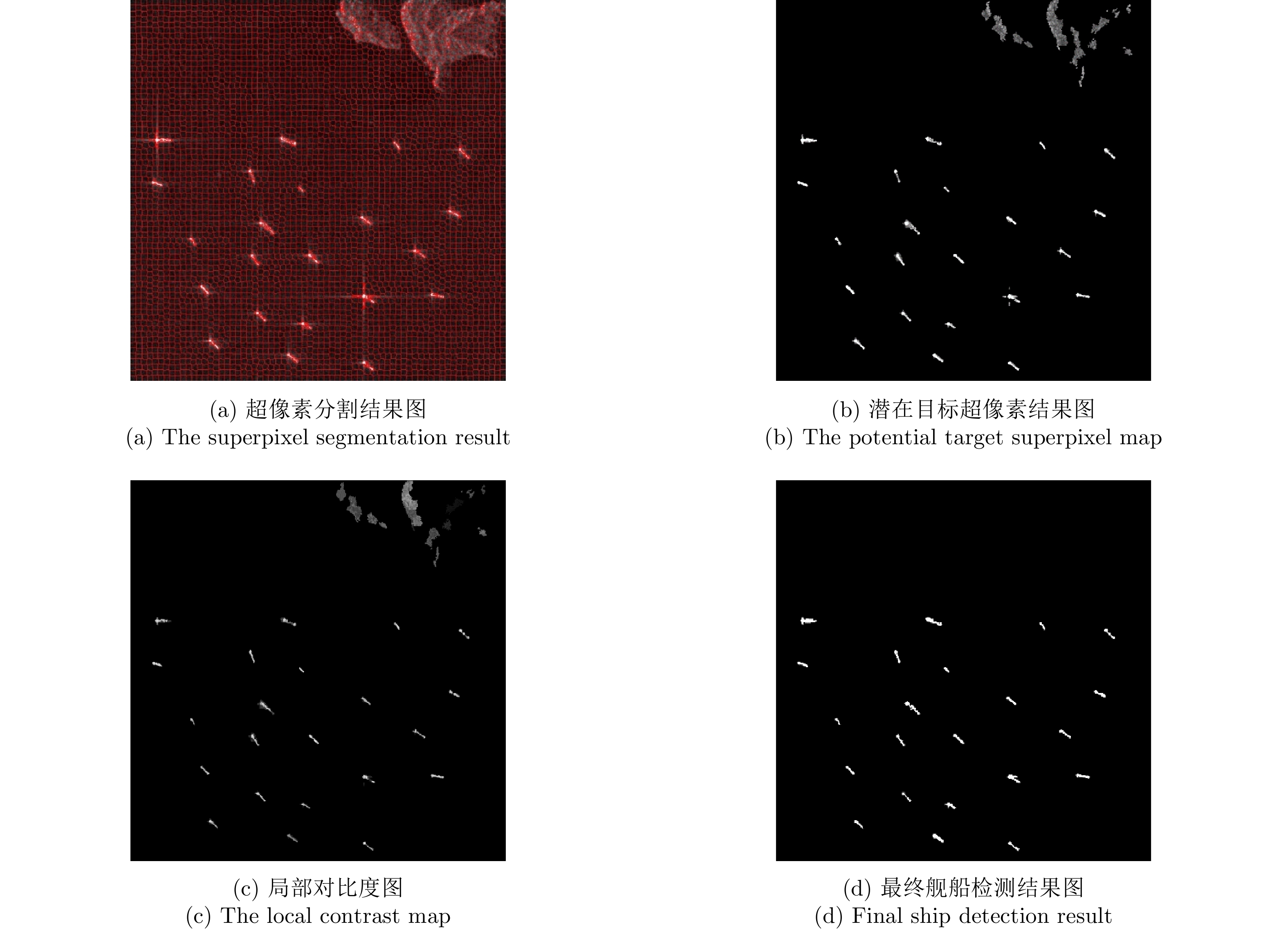
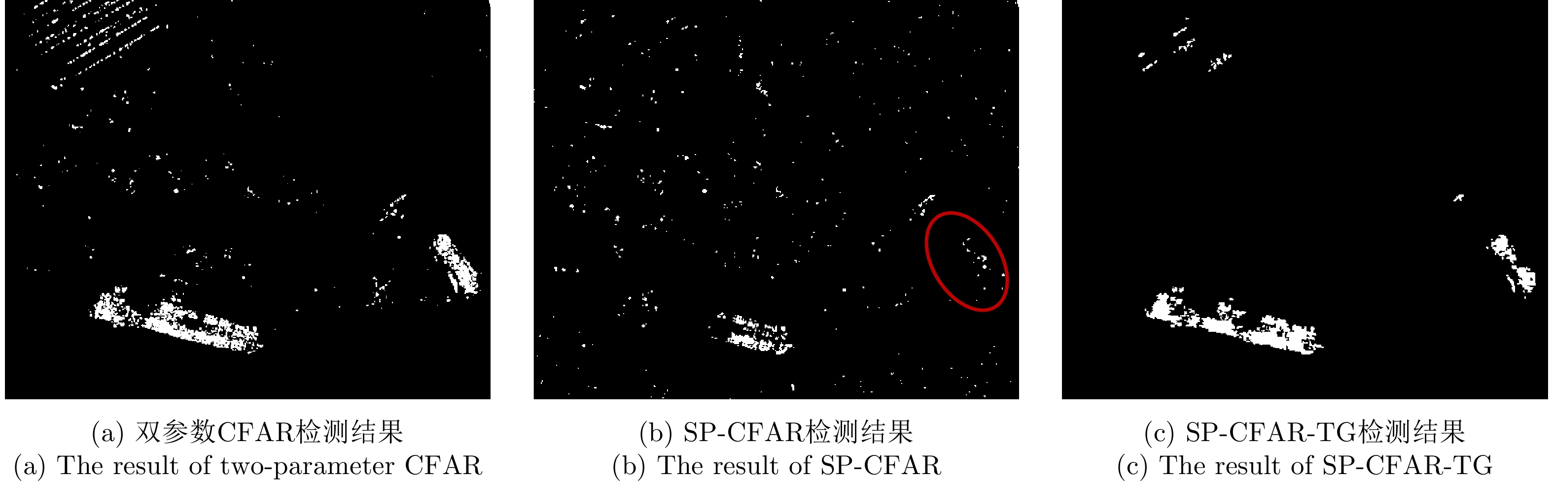
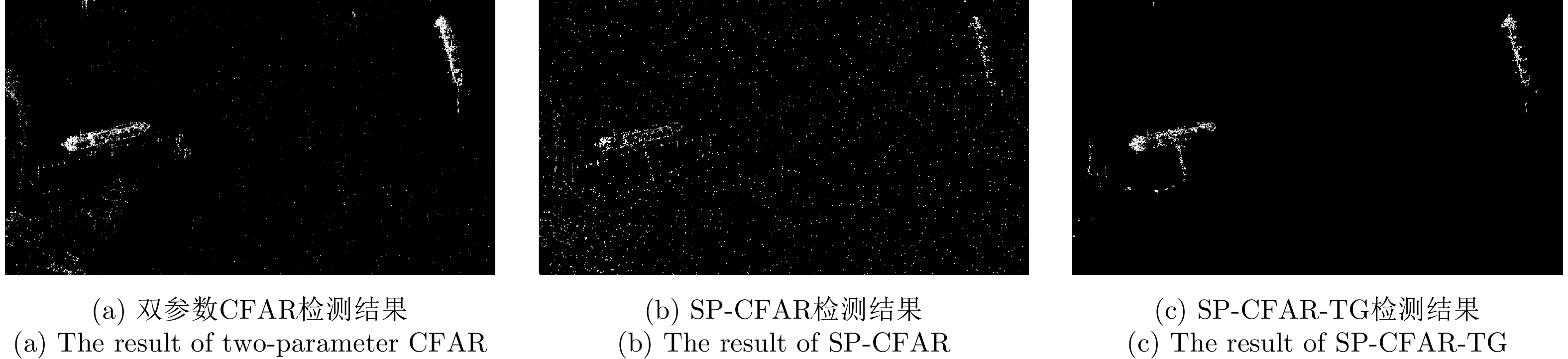
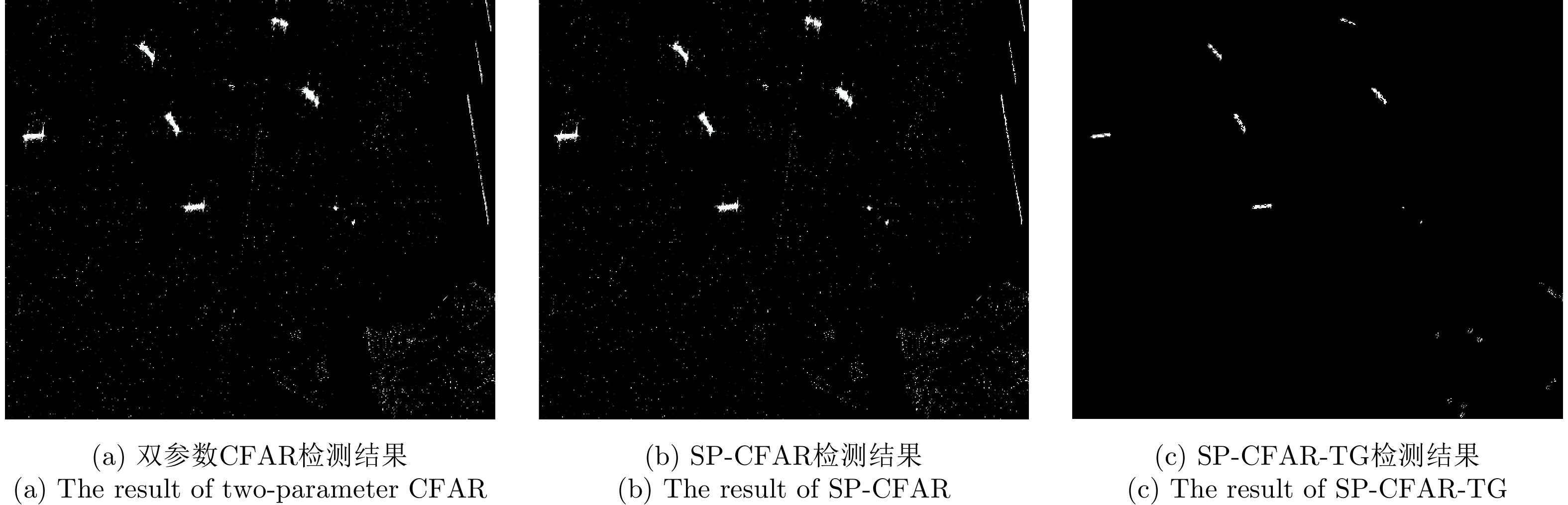
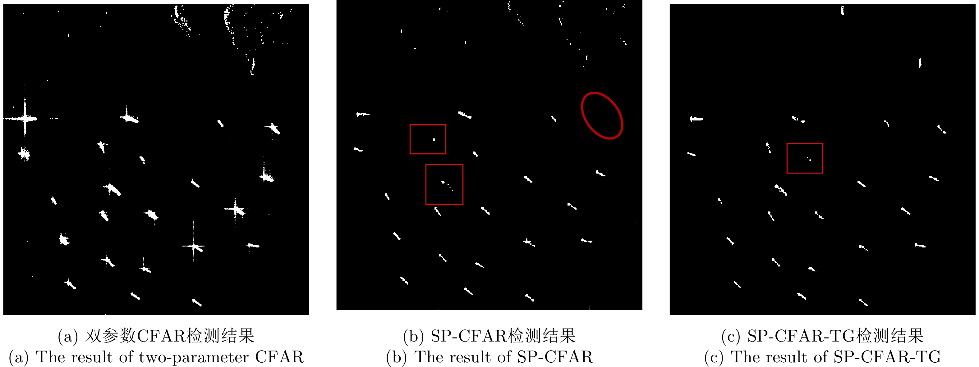
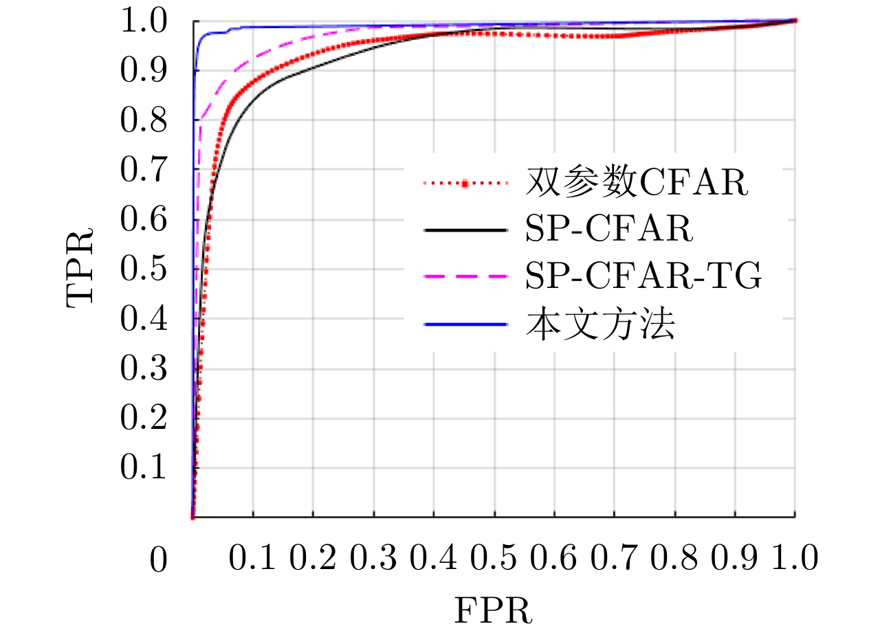
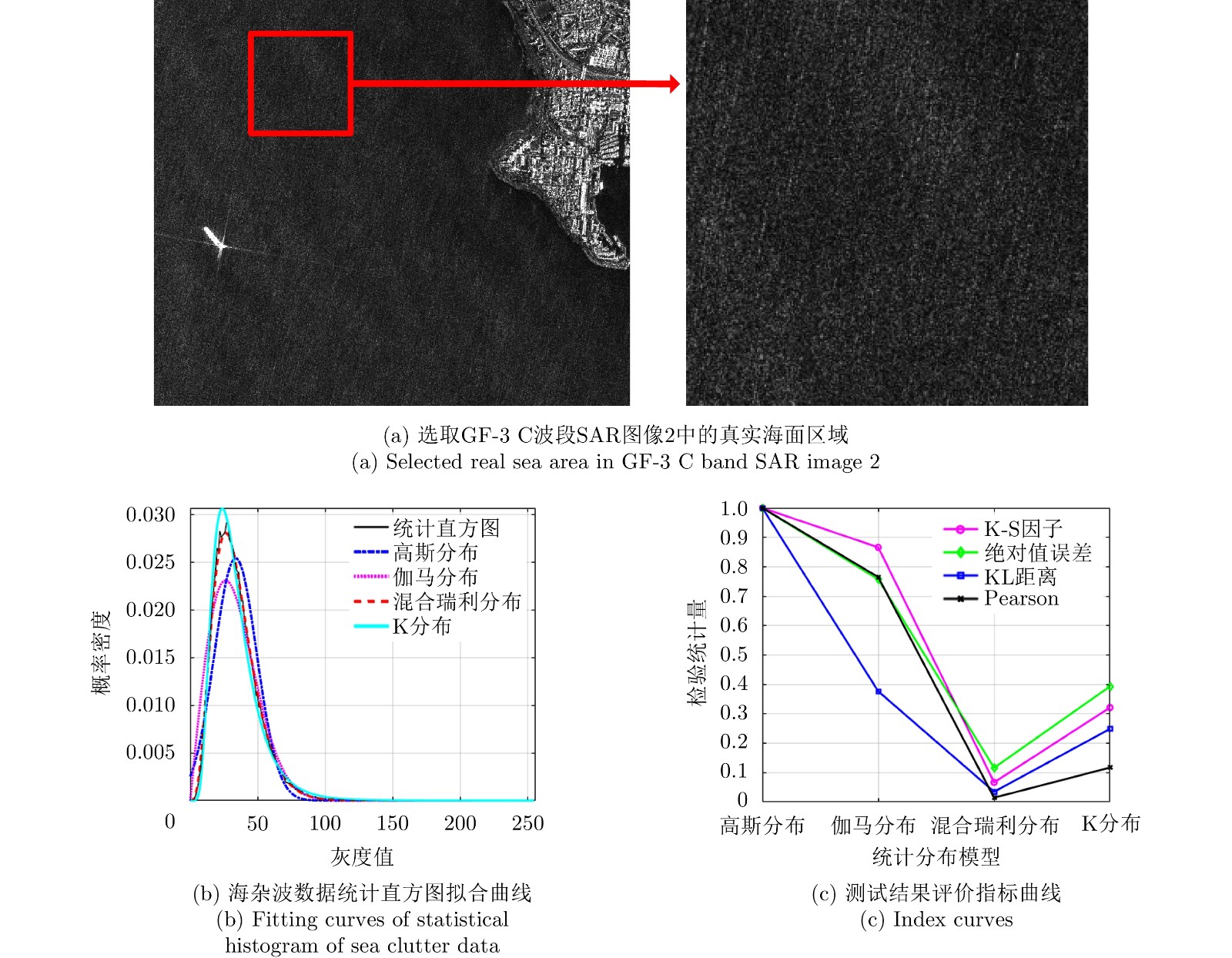
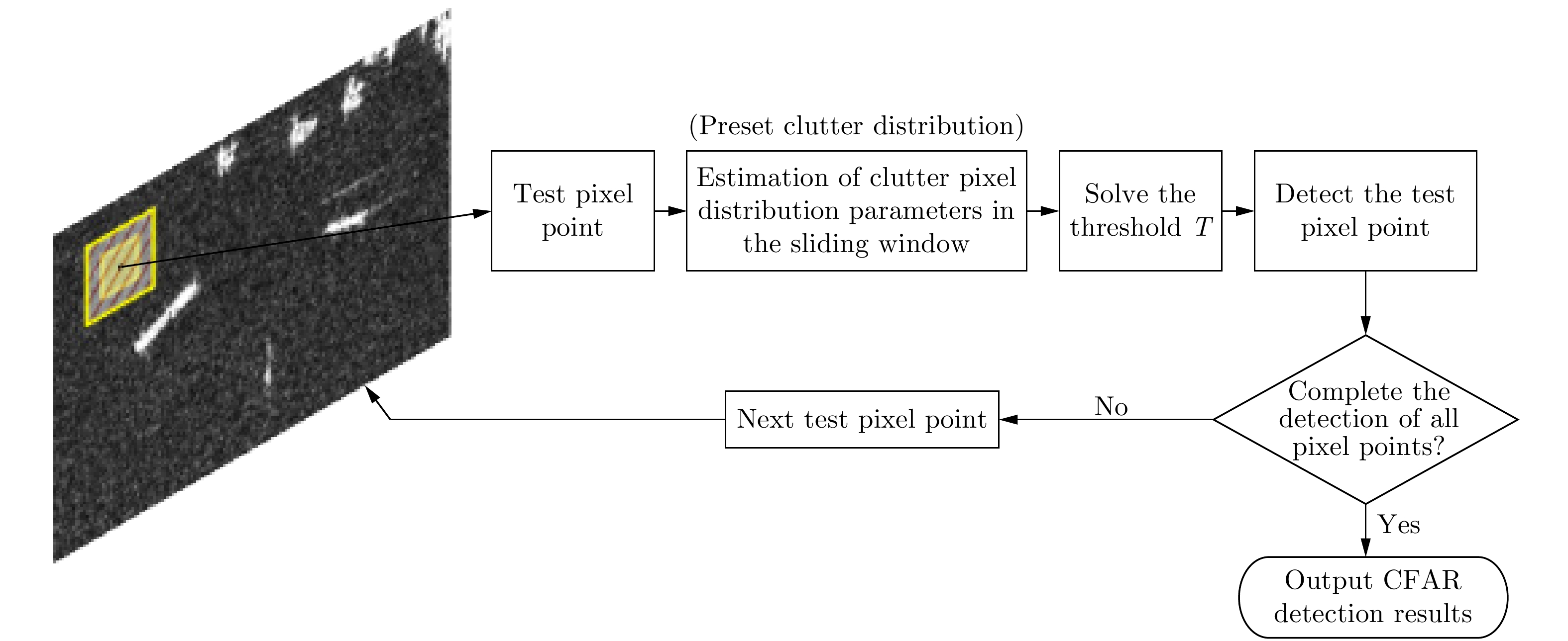
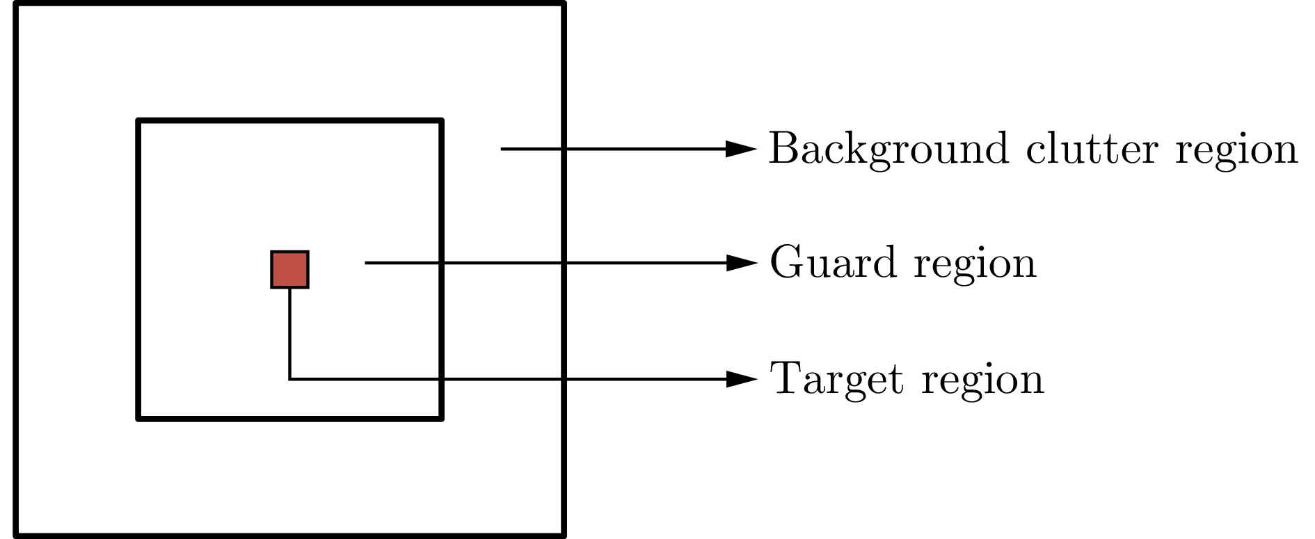
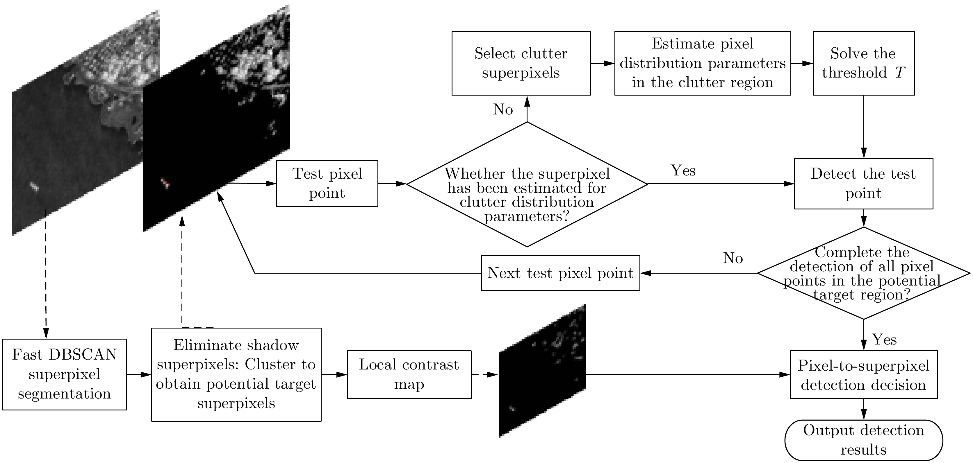
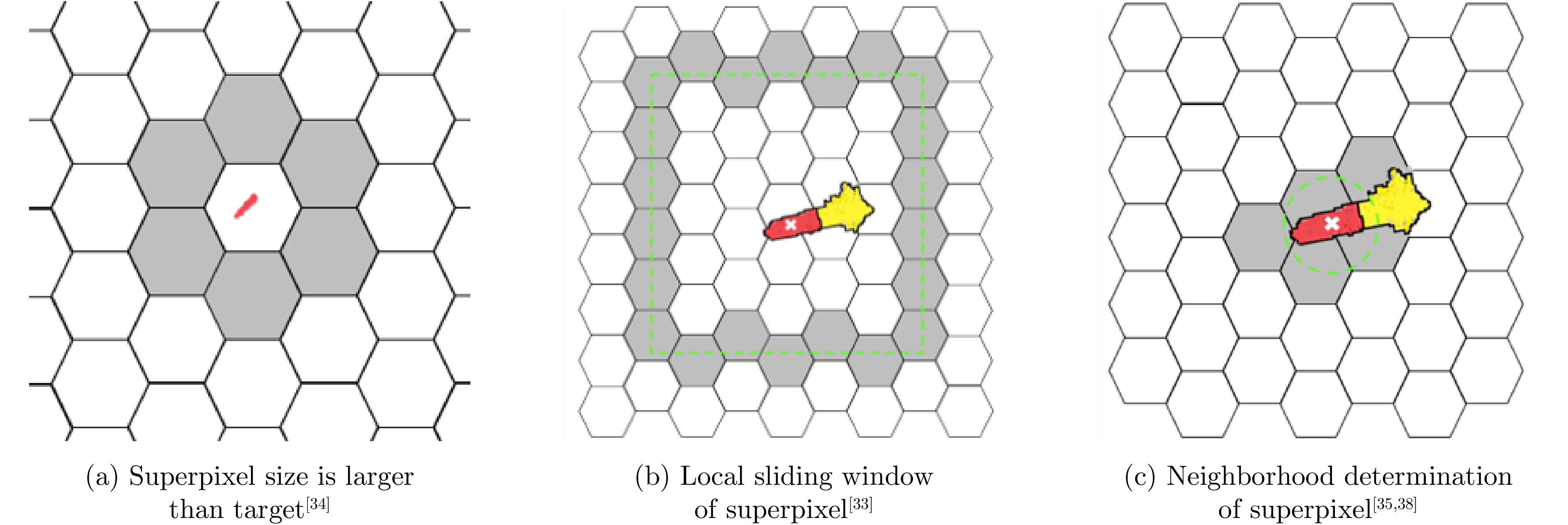
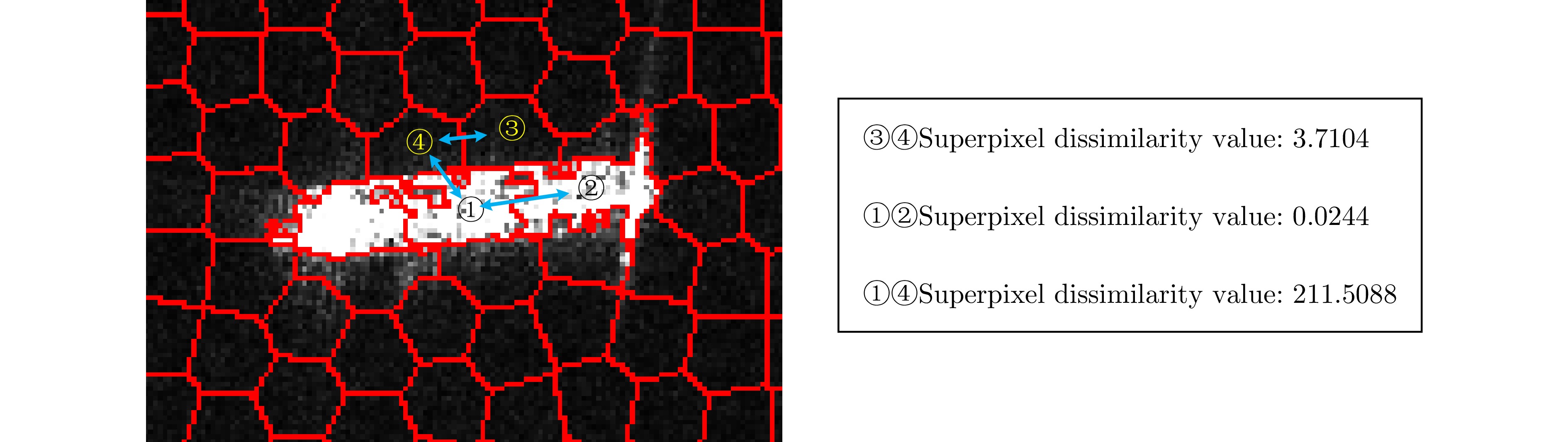
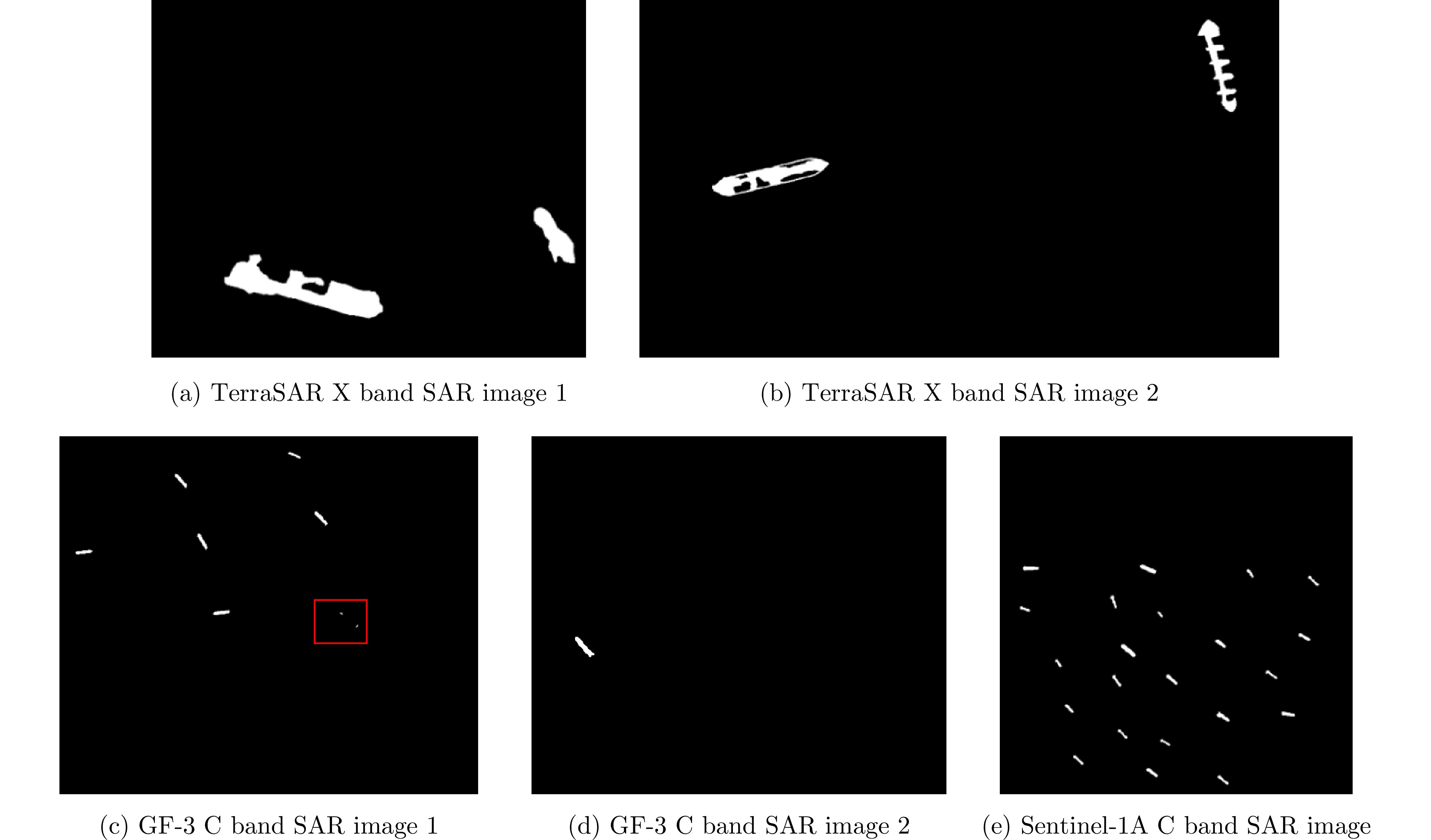
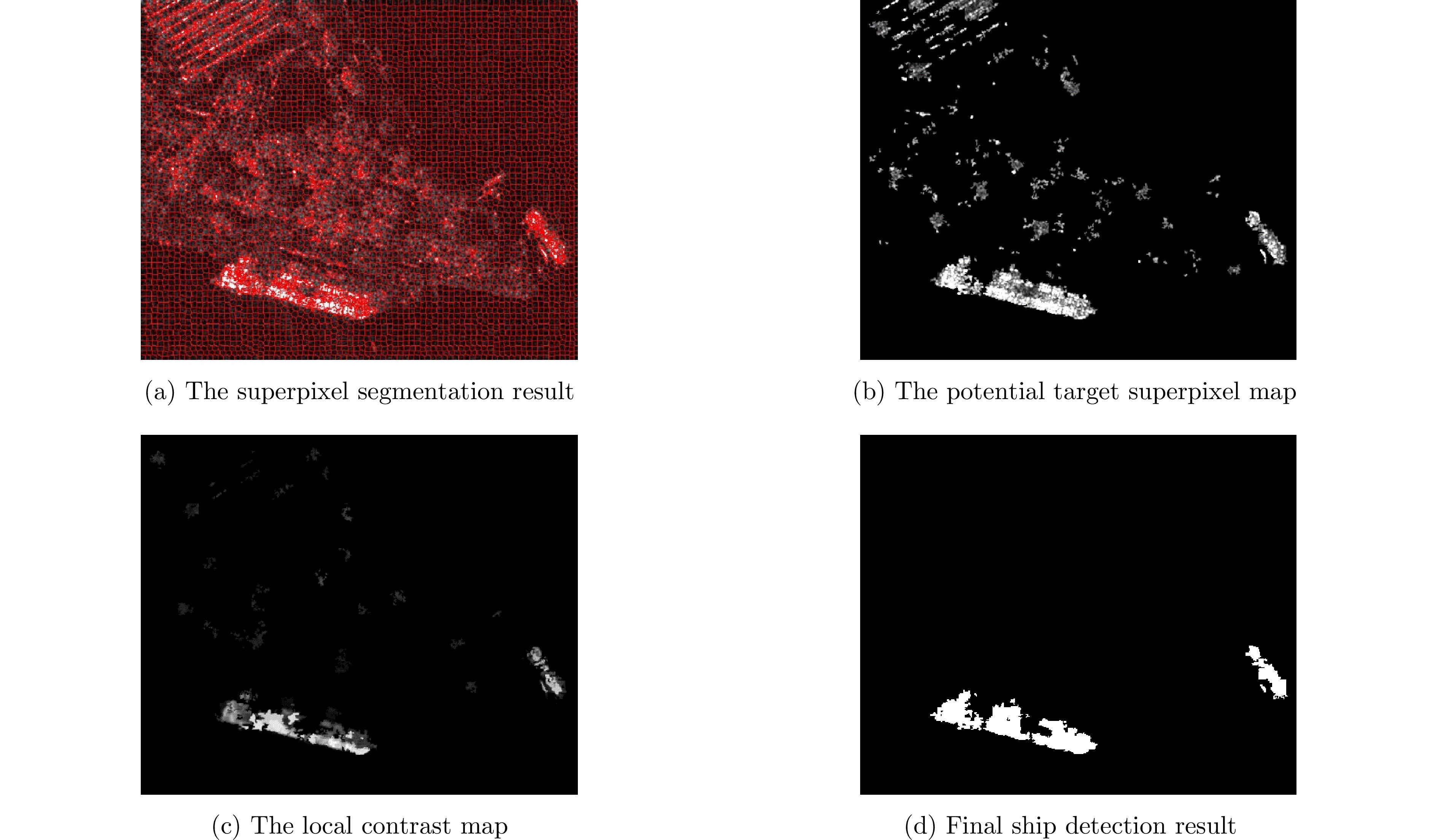
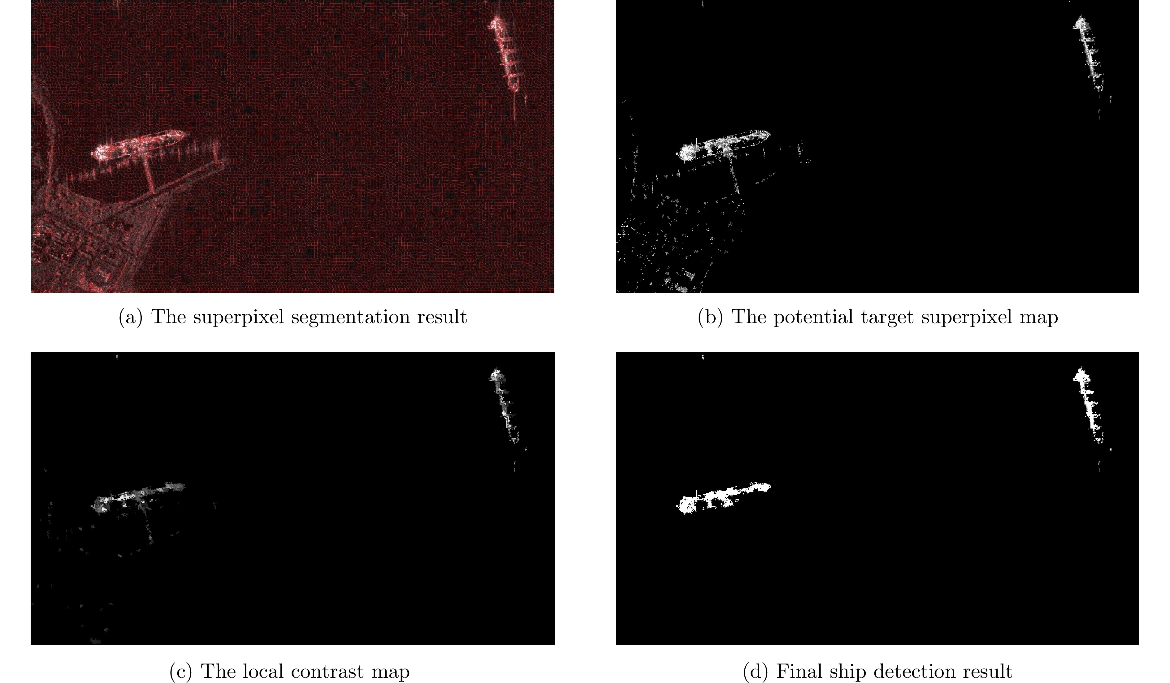
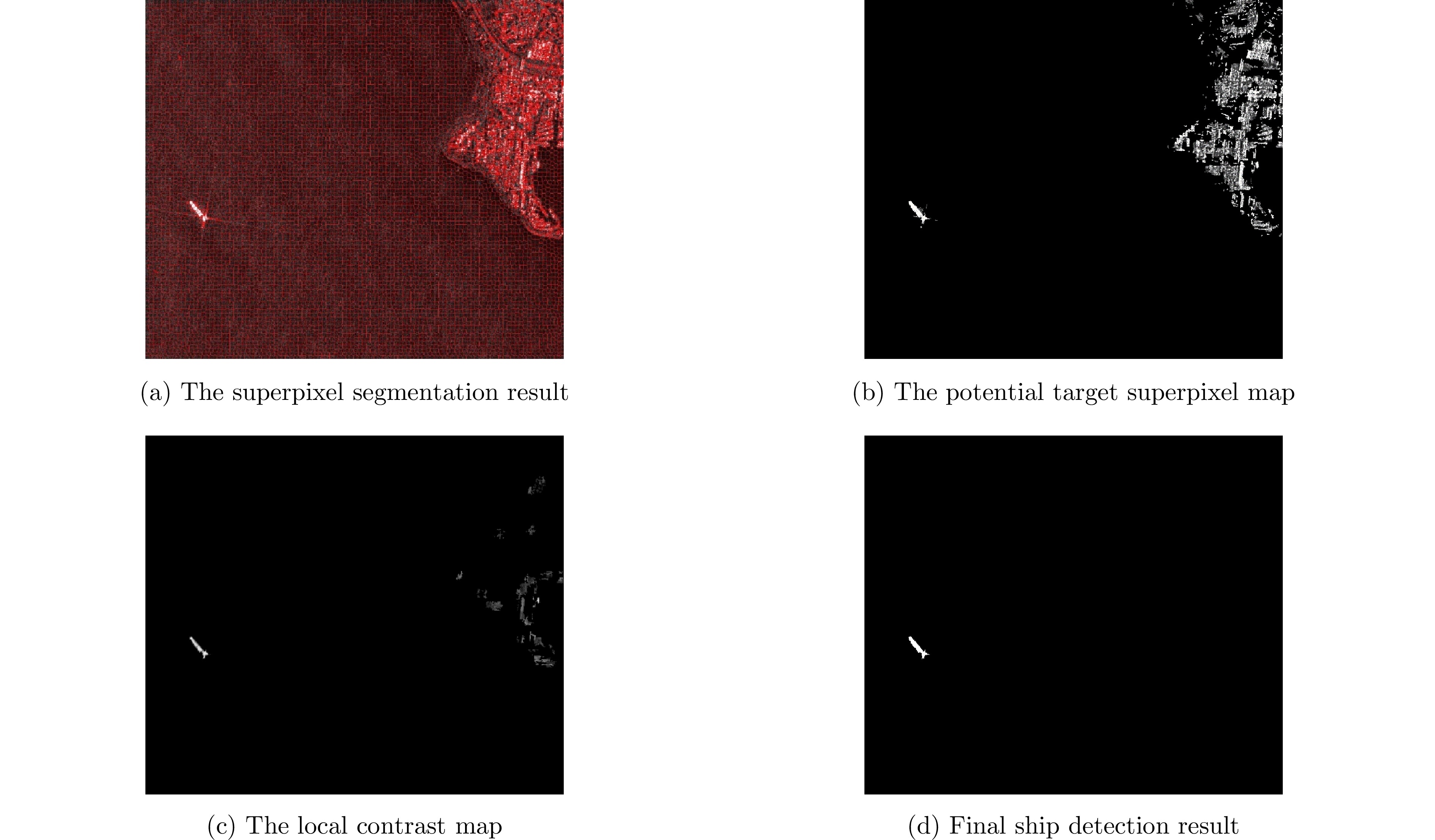
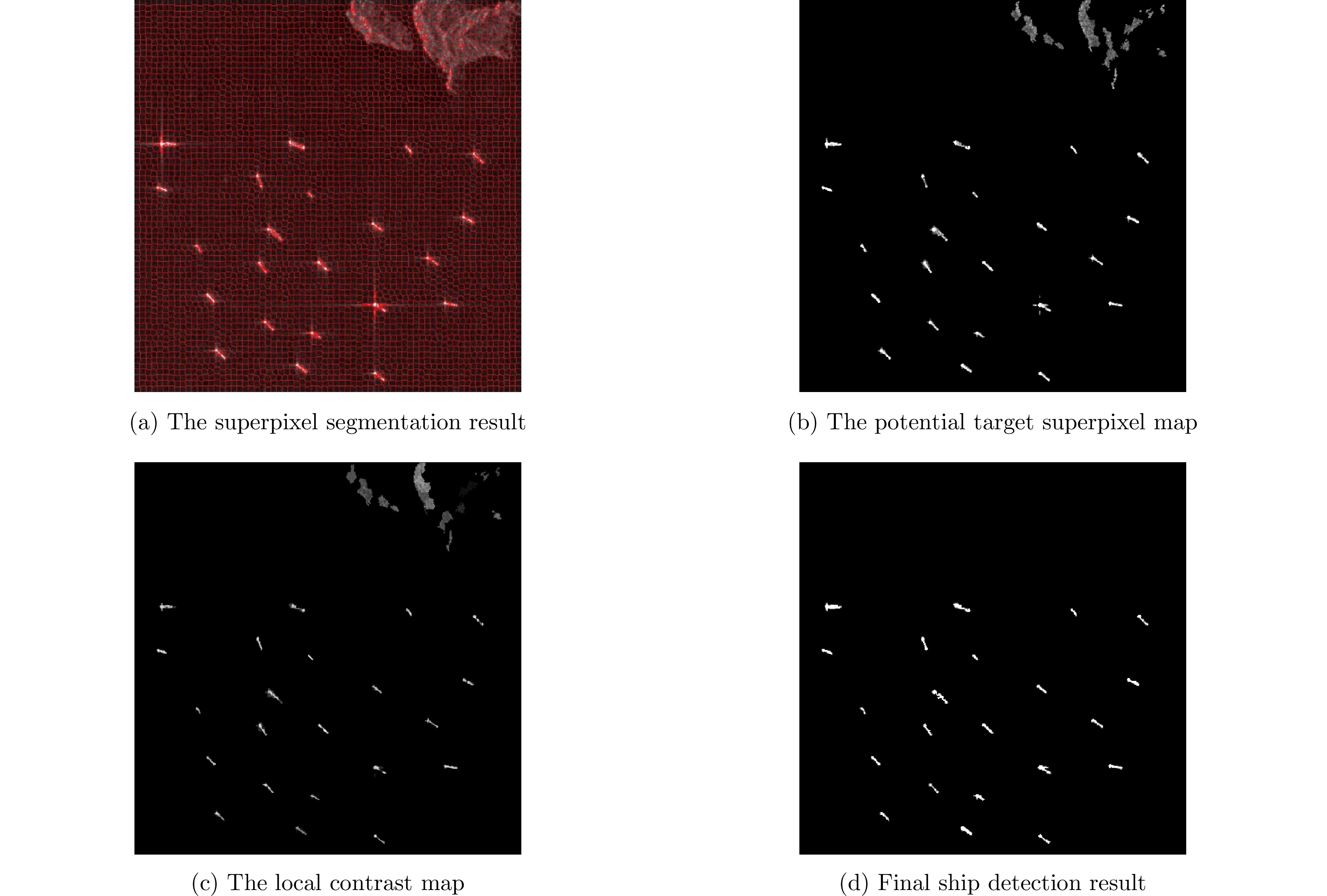
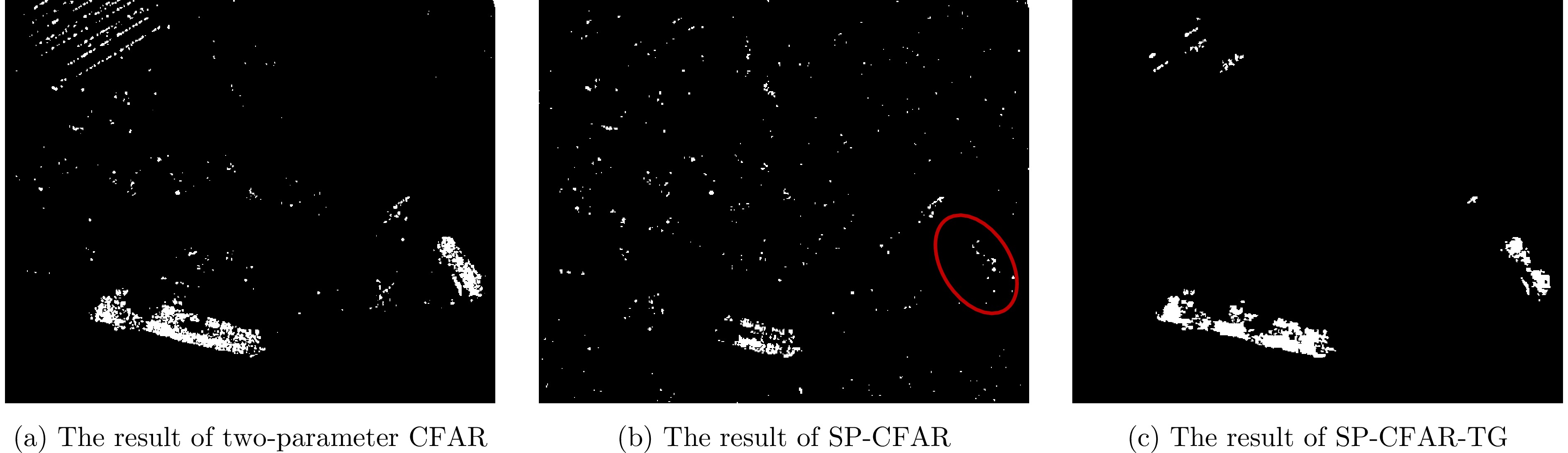
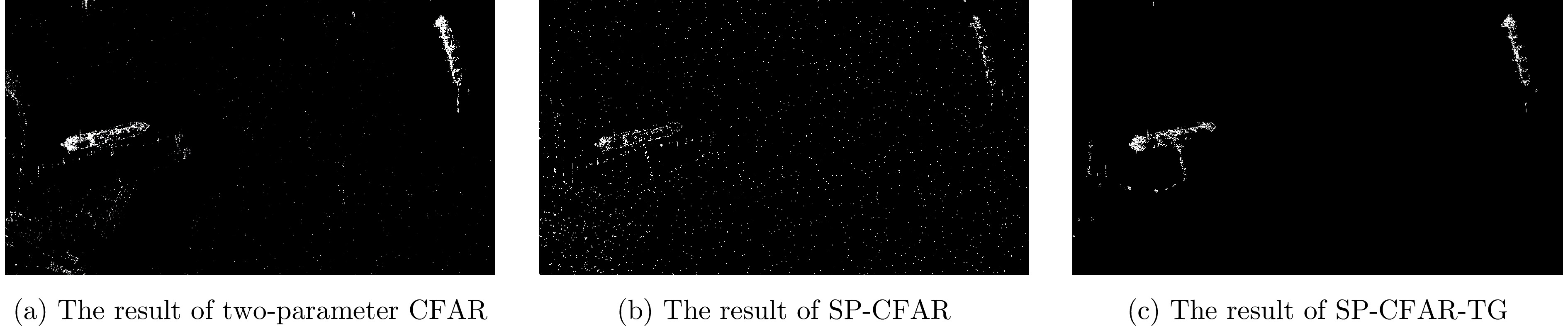
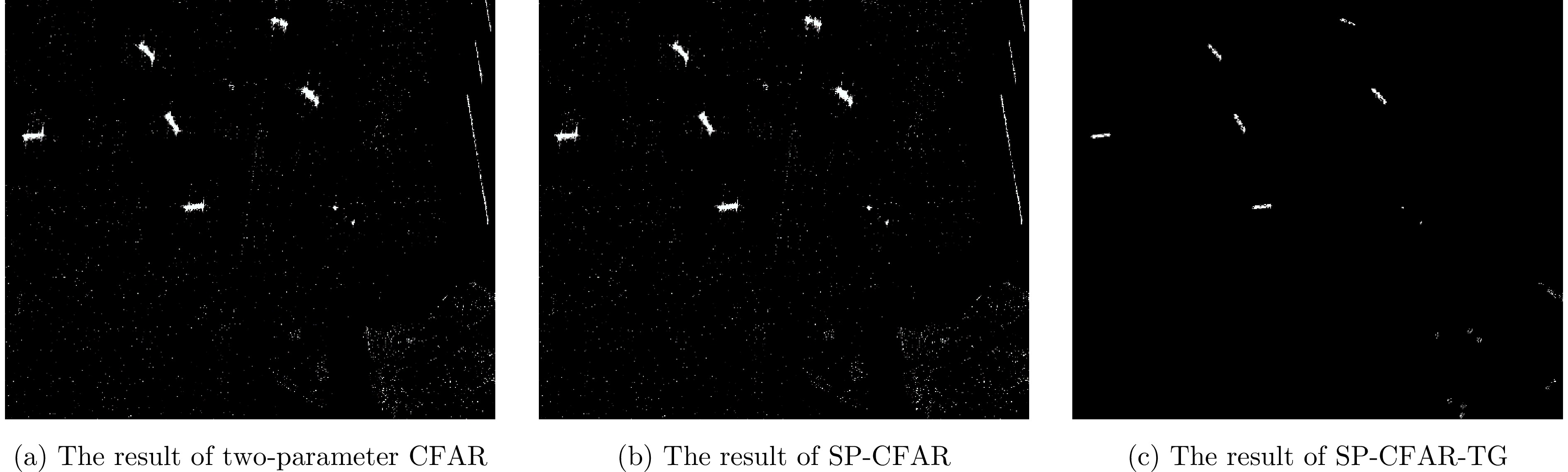
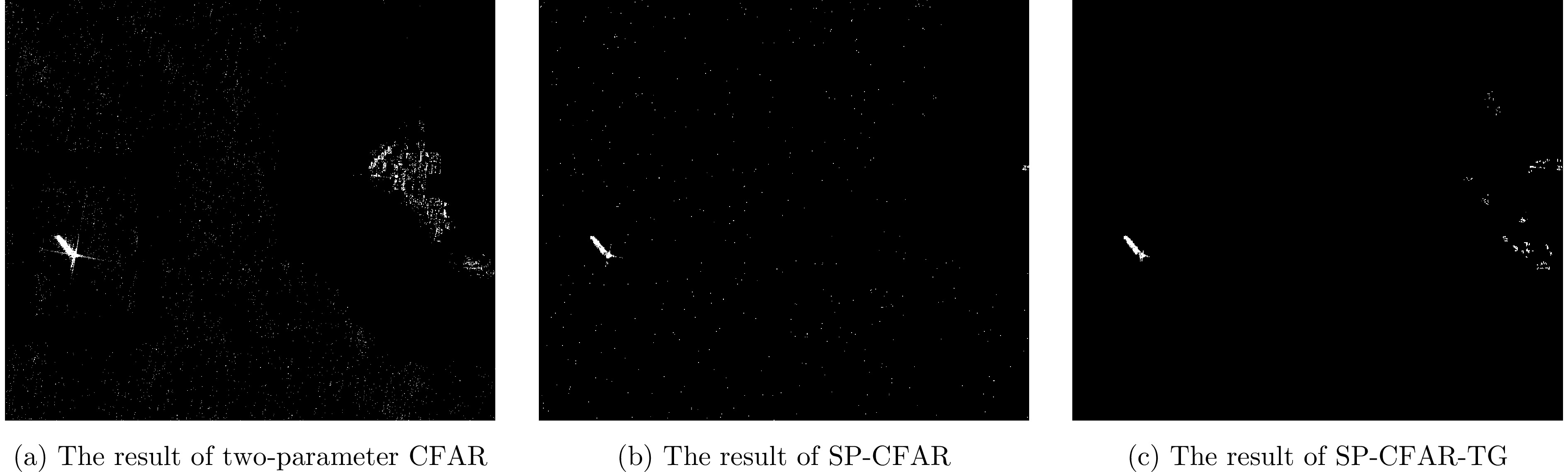
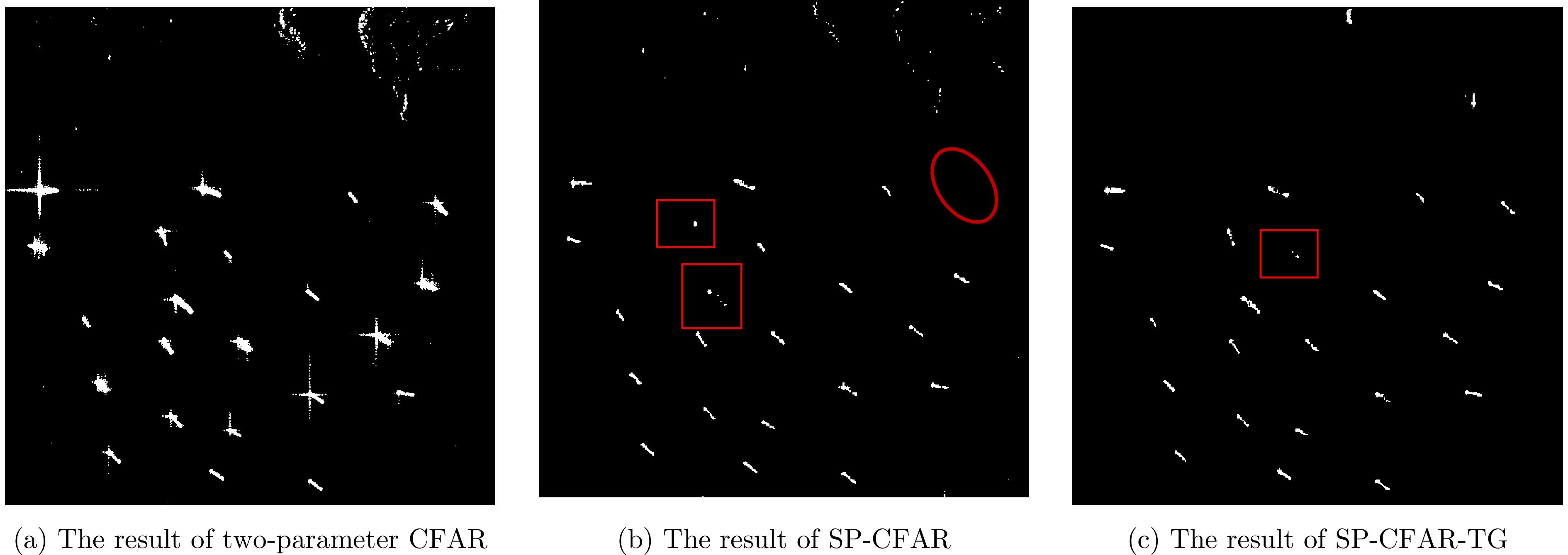
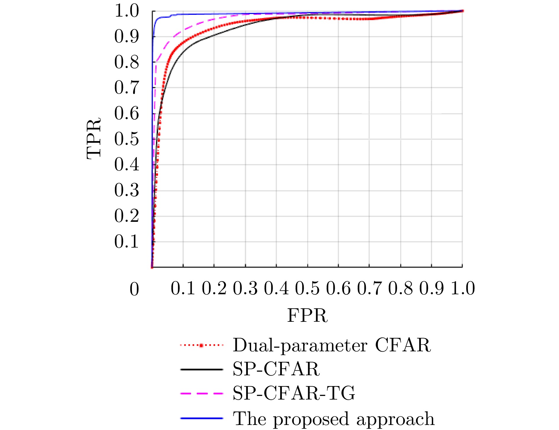
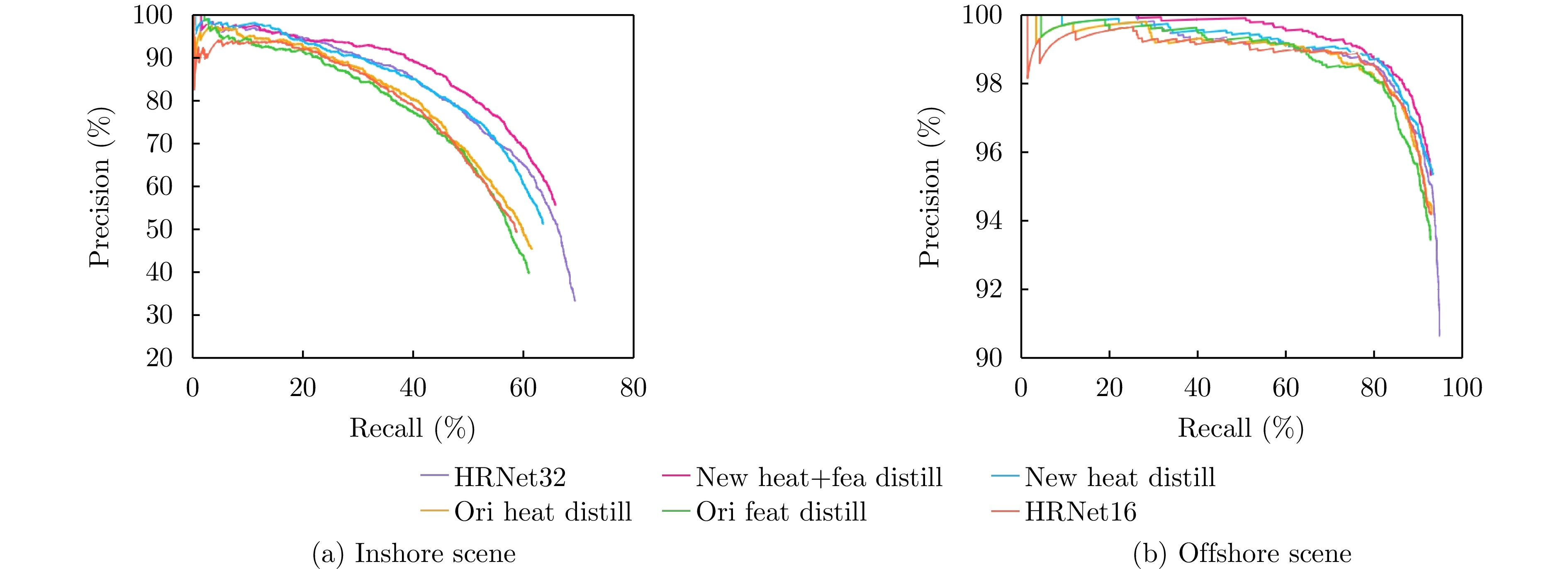
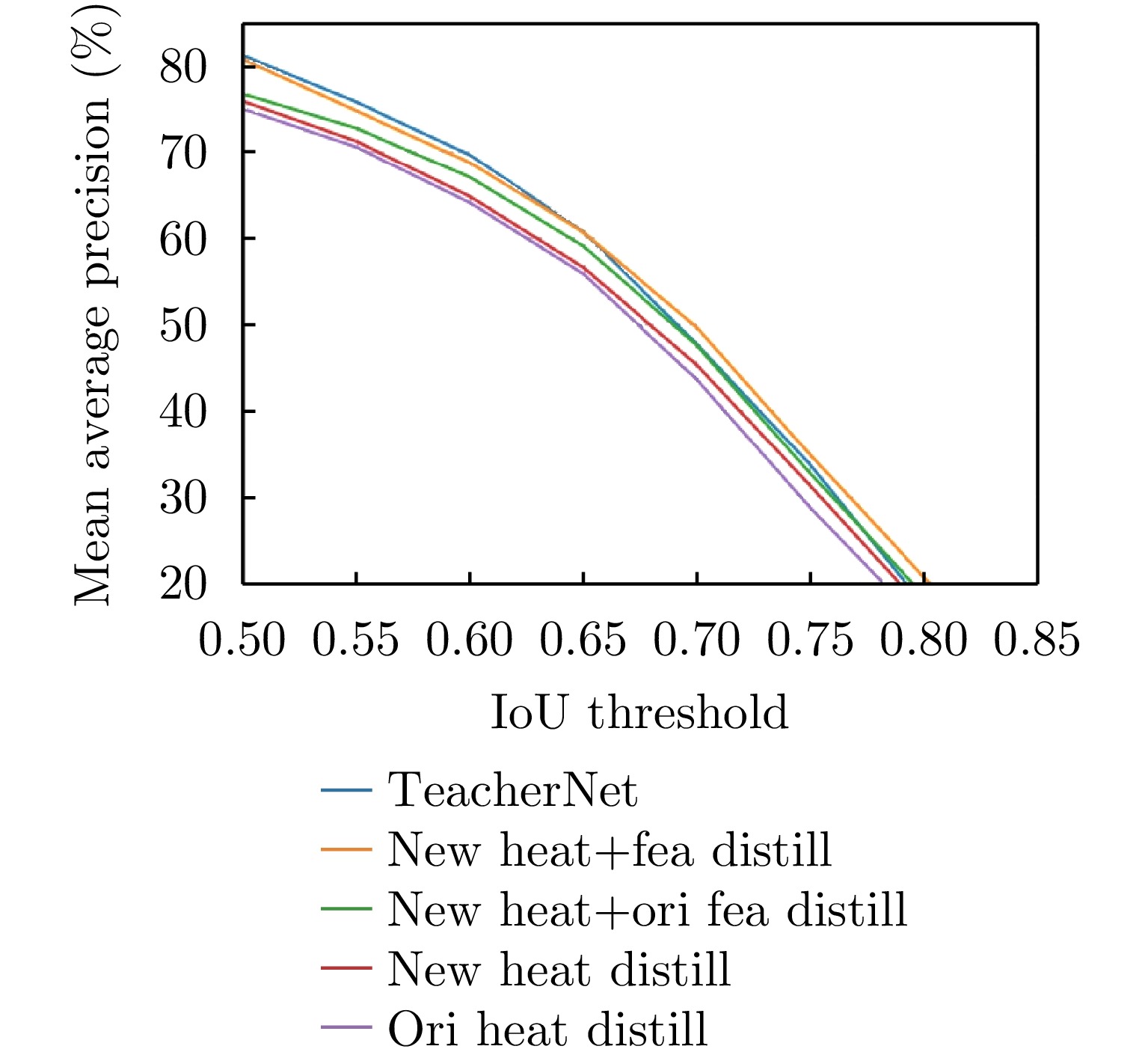
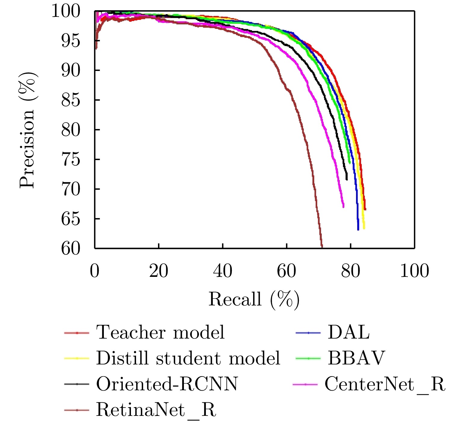
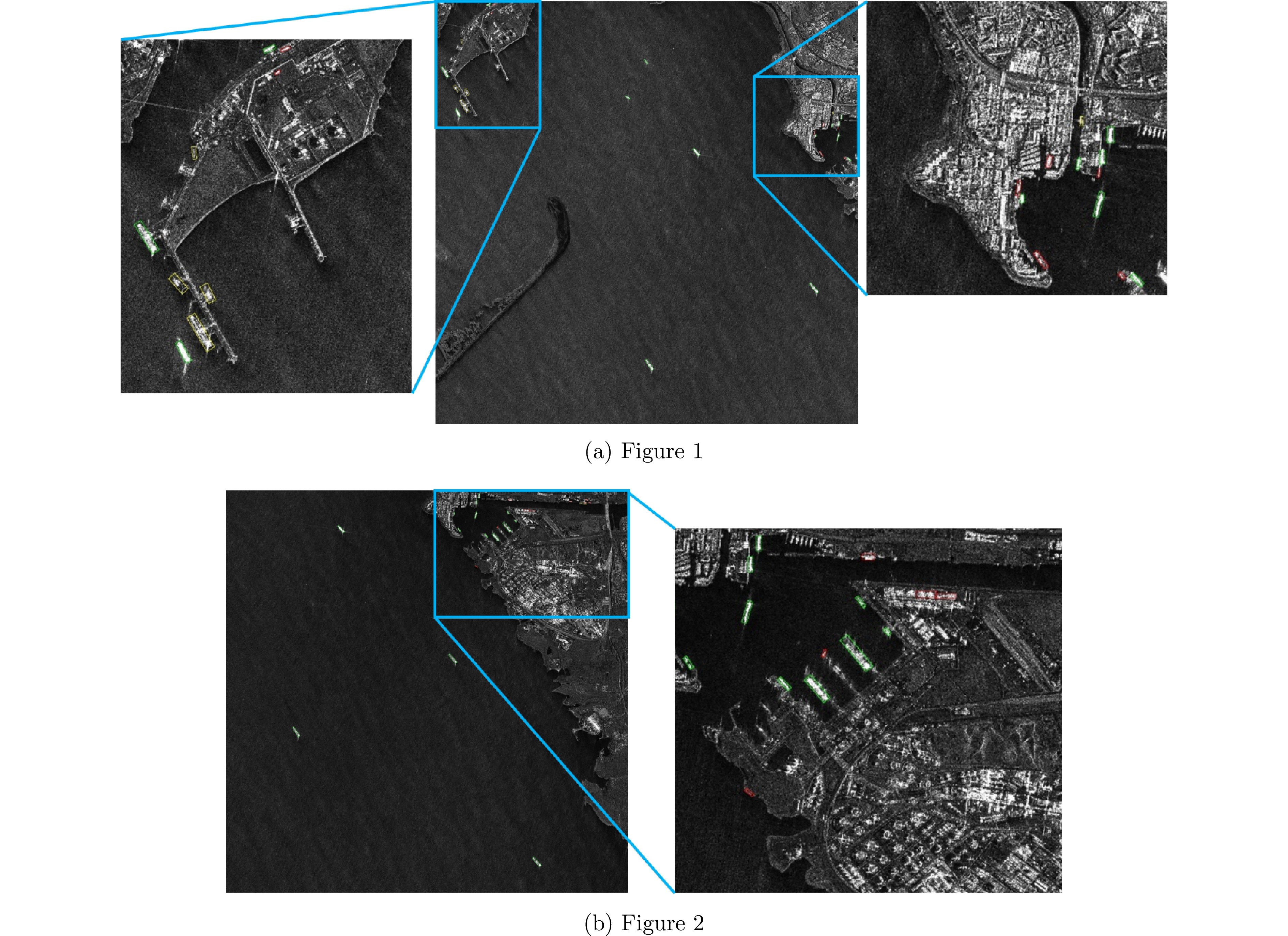
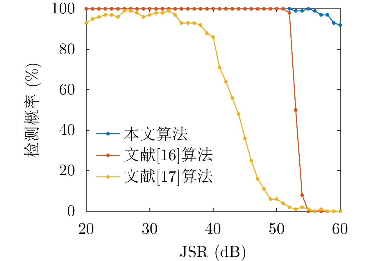
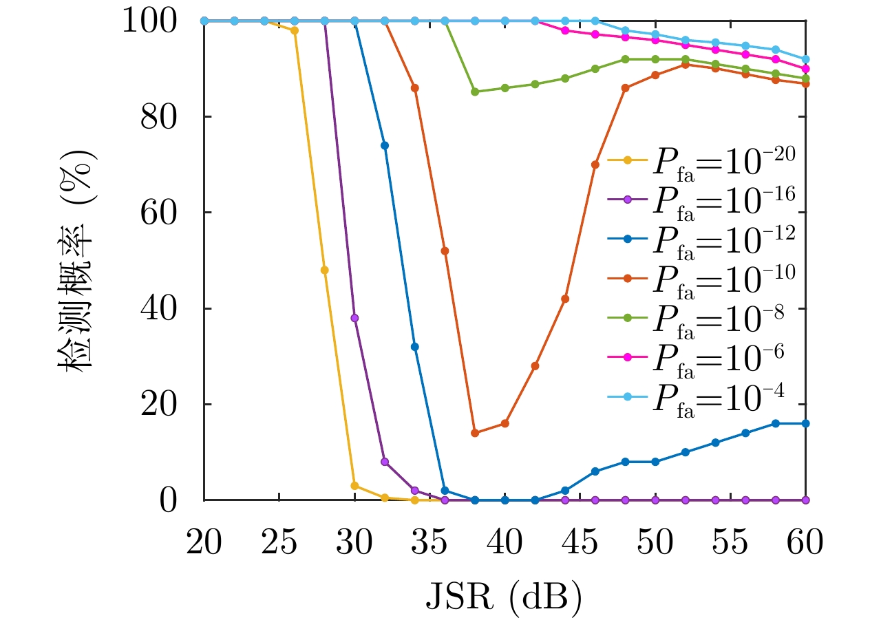
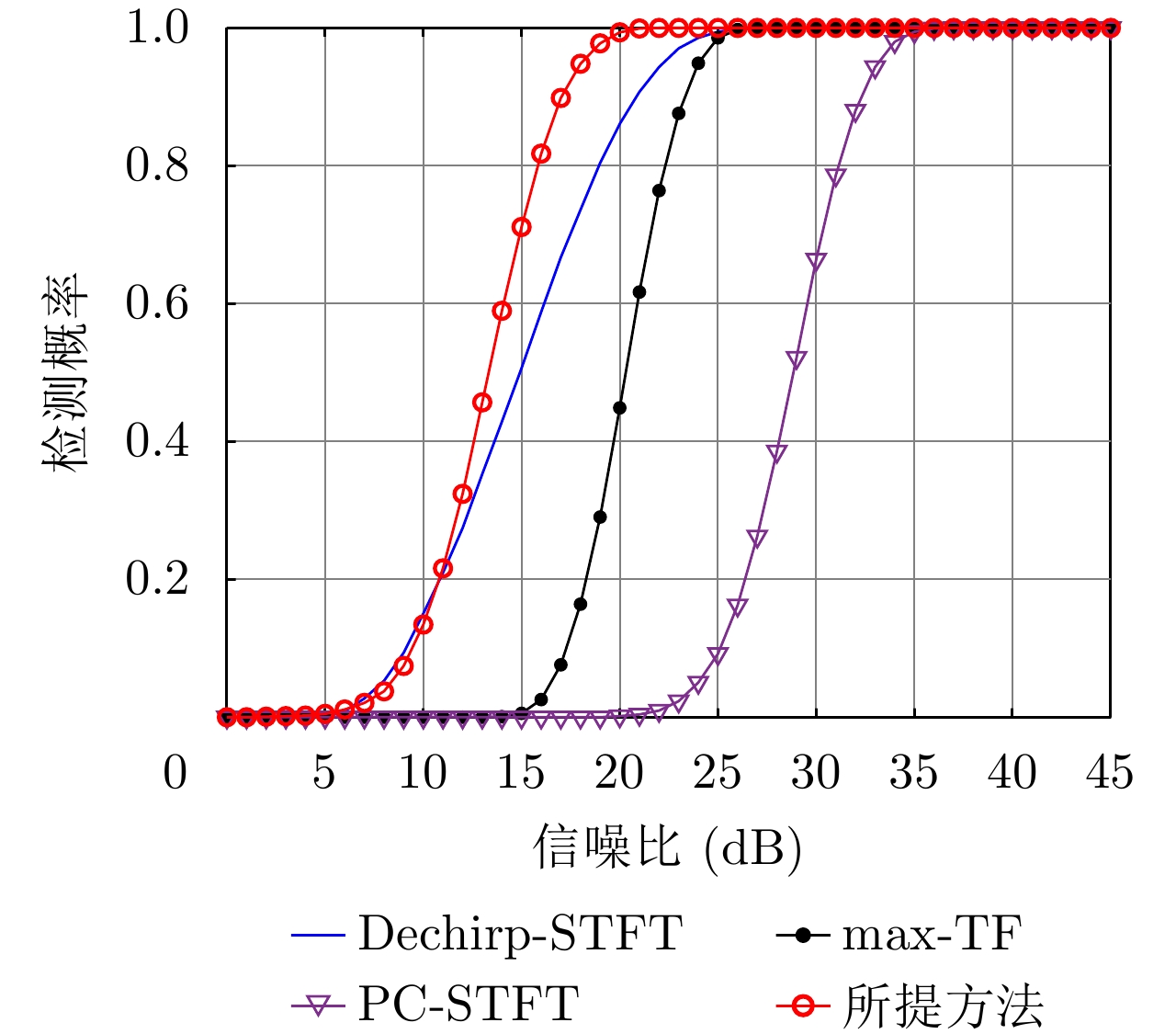
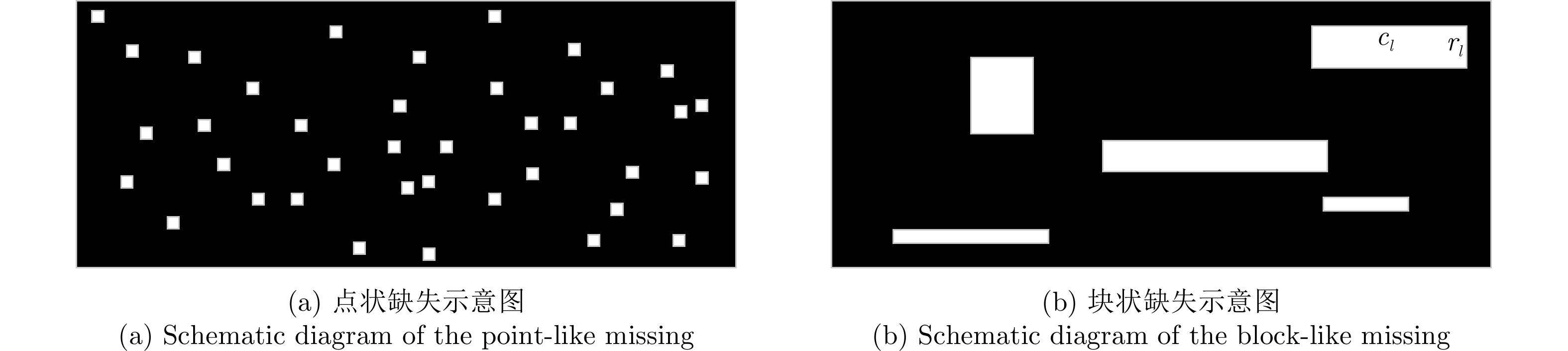
Synthetic Aperture Radar (SAR) image ship target detection has attracted considerable attention. As a state-of-the-art method, the Constant False Alarm Rate (CFAR) detection algorithm is often used in SAR image ship target detection. However, the detection performance of the classical CFAR is easily affected by speckle noise. Moreover, the detection results based on the sliding window are sensitive to the size of the sliding window. Thus, ensuring that there are no target pixels in the cluttered background is difficult, which easily leads to a high computational load. This study proposes a new ship target detection method for SAR images based on fast superpixel-based non-window CFAR to solve these problems. The superpixel generation method of Density Based Spatial Clustering of Applications with Noise is used to generate superpixels for SAR images. Under the assumption that SAR data obey the Rayleigh mixture distribution, we define a superpixel dissimilarity measure. Then, the clutter parameters of each pixel are accurately estimated using superpixels, which can avoid the shortcomings of the traditional CFAR sliding window even in the case of multiple targets. A local contrast based on the Coefficient of Variation (CoV) of the SAR image is proposed to optimize the CFAR detection result, which can eliminate a large number of false alarms from man-made targets in urban areas. The experimental results of five real SAR images show that the proposed method for ship target detection in SAR images with different scenes is robust compared with other state-of-the-art methods.
Synthetic Aperture Radar (SAR) image ship target detection has attracted considerable attention. As a state-of-the-art method, the Constant False Alarm Rate (CFAR) detection algorithm is often used in SAR image ship target detection. However, the detection performance of the classical CFAR is easily affected by speckle noise. Moreover, the detection results based on the sliding window are sensitive to the size of the sliding window. Thus, ensuring that there are no target pixels in the cluttered background is difficult, which easily leads to a high computational load. This study proposes a new ship target detection method for SAR images based on fast superpixel-based non-window CFAR to solve these problems. The superpixel generation method of Density Based Spatial Clustering of Applications with Noise is used to generate superpixels for SAR images. Under the assumption that SAR data obey the Rayleigh mixture distribution, we define a superpixel dissimilarity measure. Then, the clutter parameters of each pixel are accurately estimated using superpixels, which can avoid the shortcomings of the traditional CFAR sliding window even in the case of multiple targets. A local contrast based on the Coefficient of Variation (CoV) of the SAR image is proposed to optimize the CFAR detection result, which can eliminate a large number of false alarms from man-made targets in urban areas. The experimental results of five real SAR images show that the proposed method for ship target detection in SAR images with different scenes is robust compared with other state-of-the-art methods.


 微信 | 公众平台

