
 Submit Manuscript
 Peer Review
 Editor Work
2021 Vol. 10, No. 3
 Previous Issue
 Abstract
 5121KB
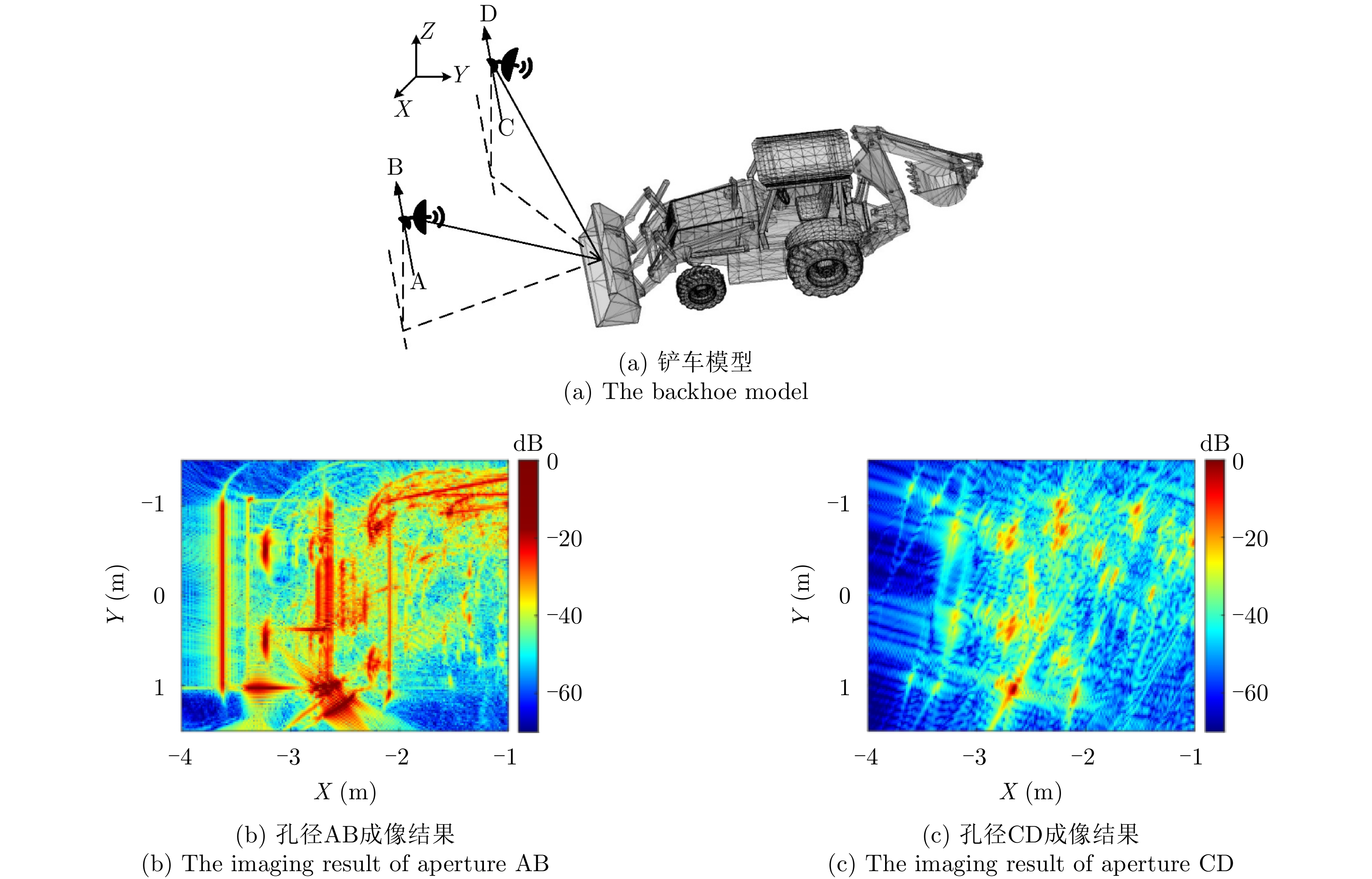
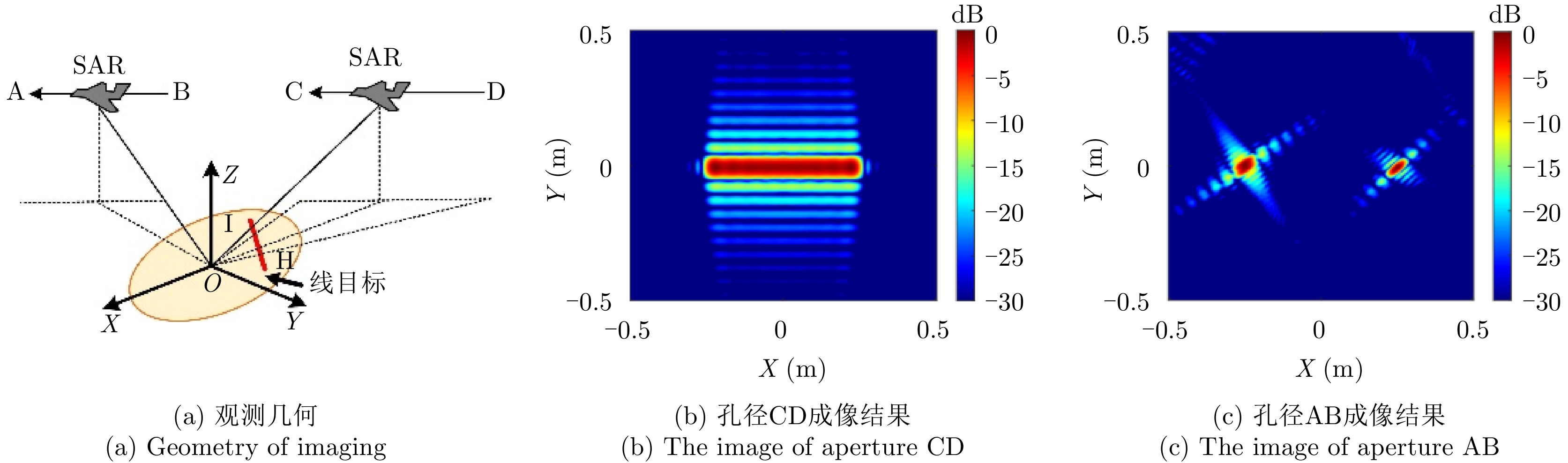
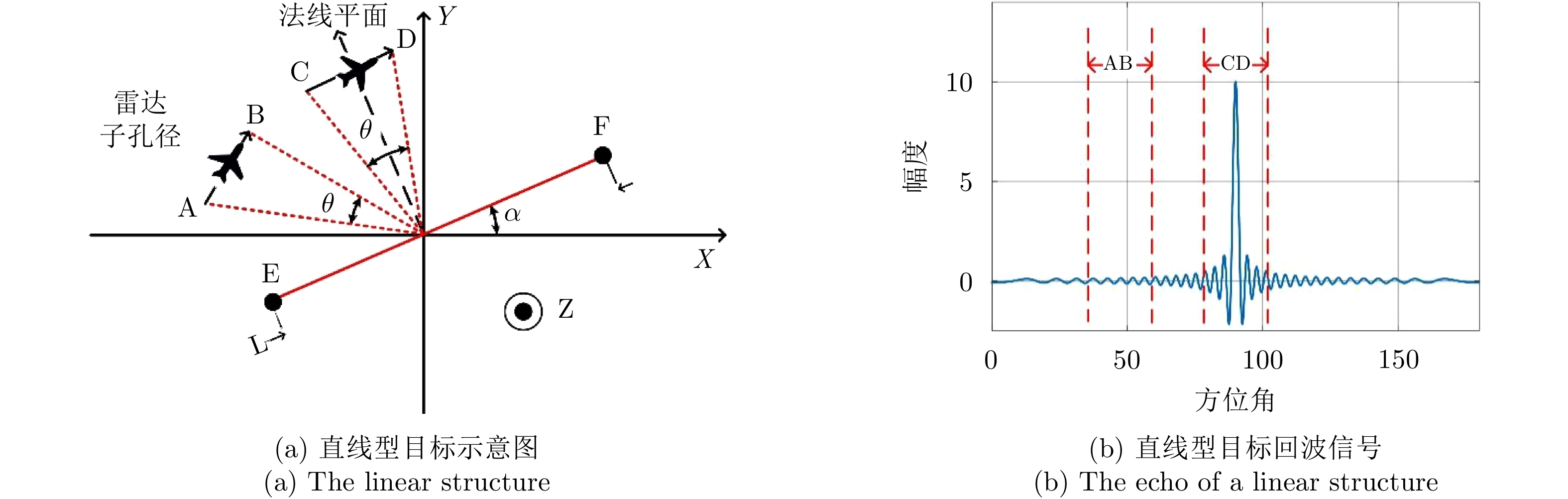
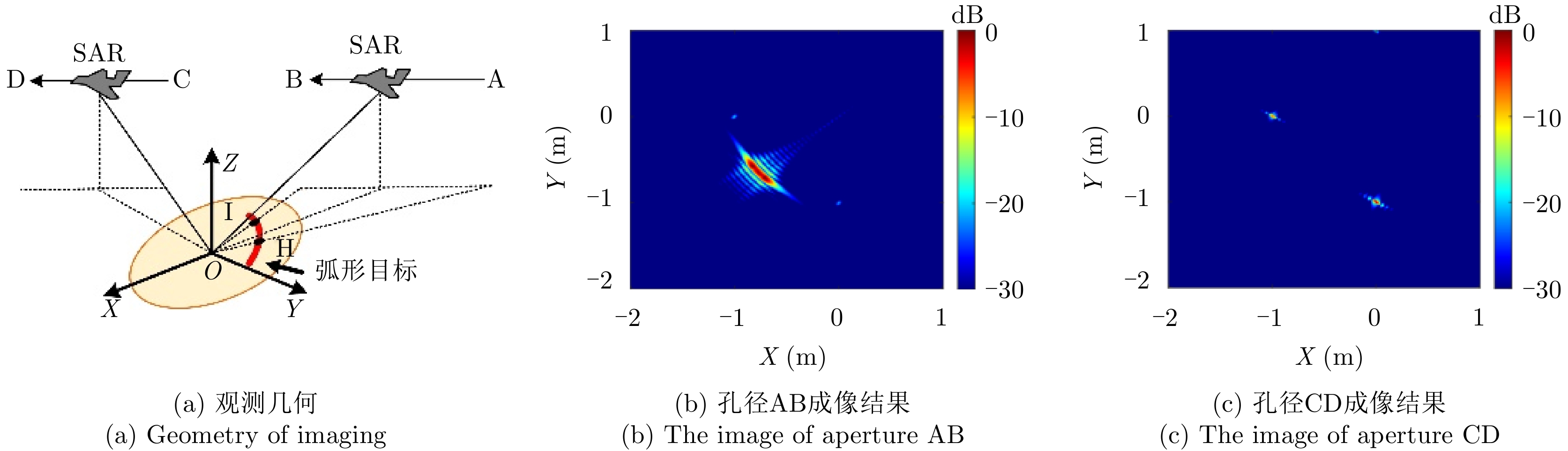
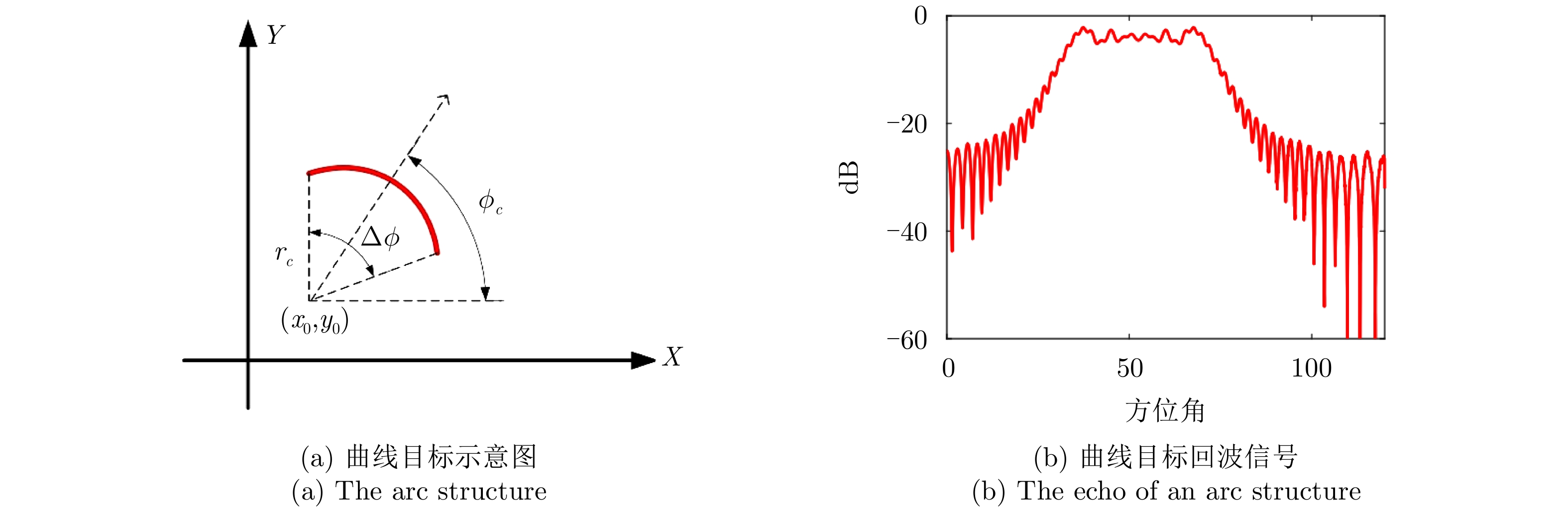
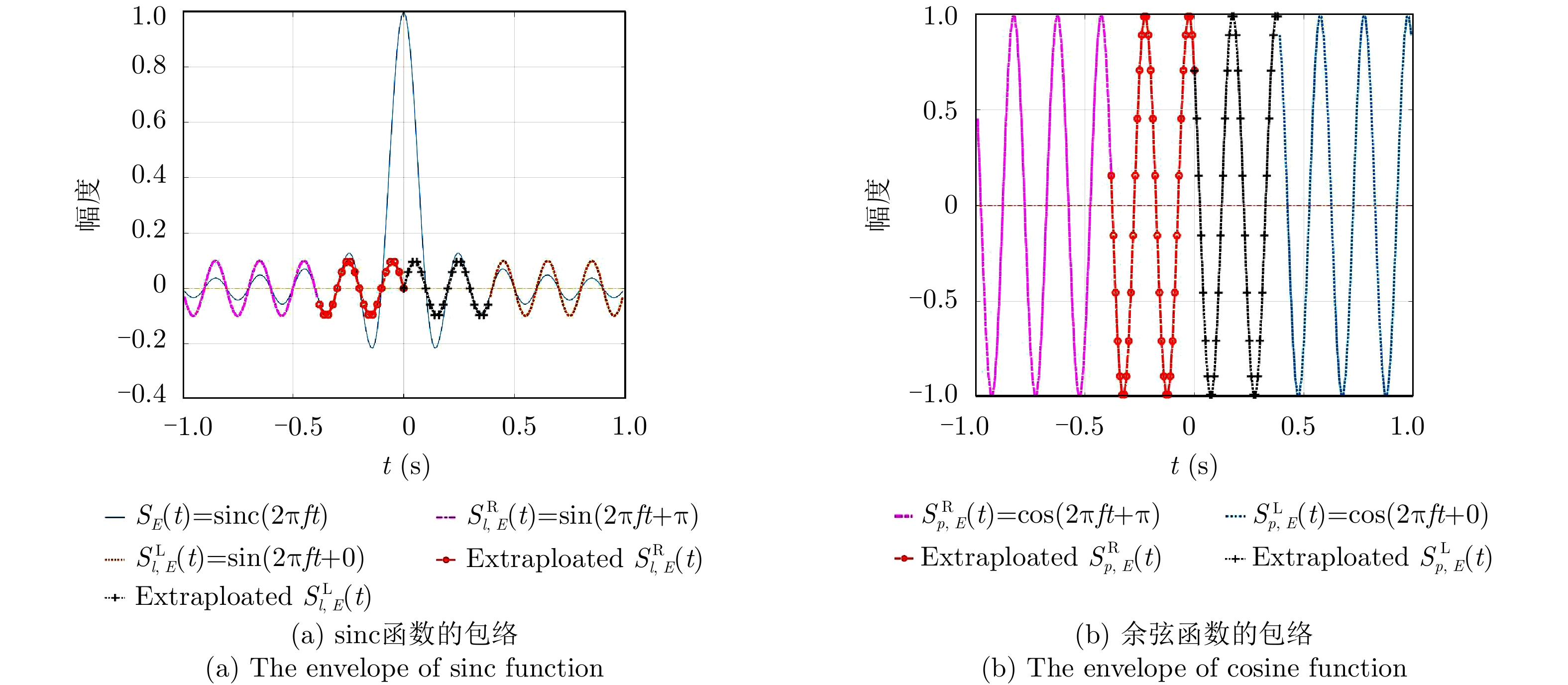
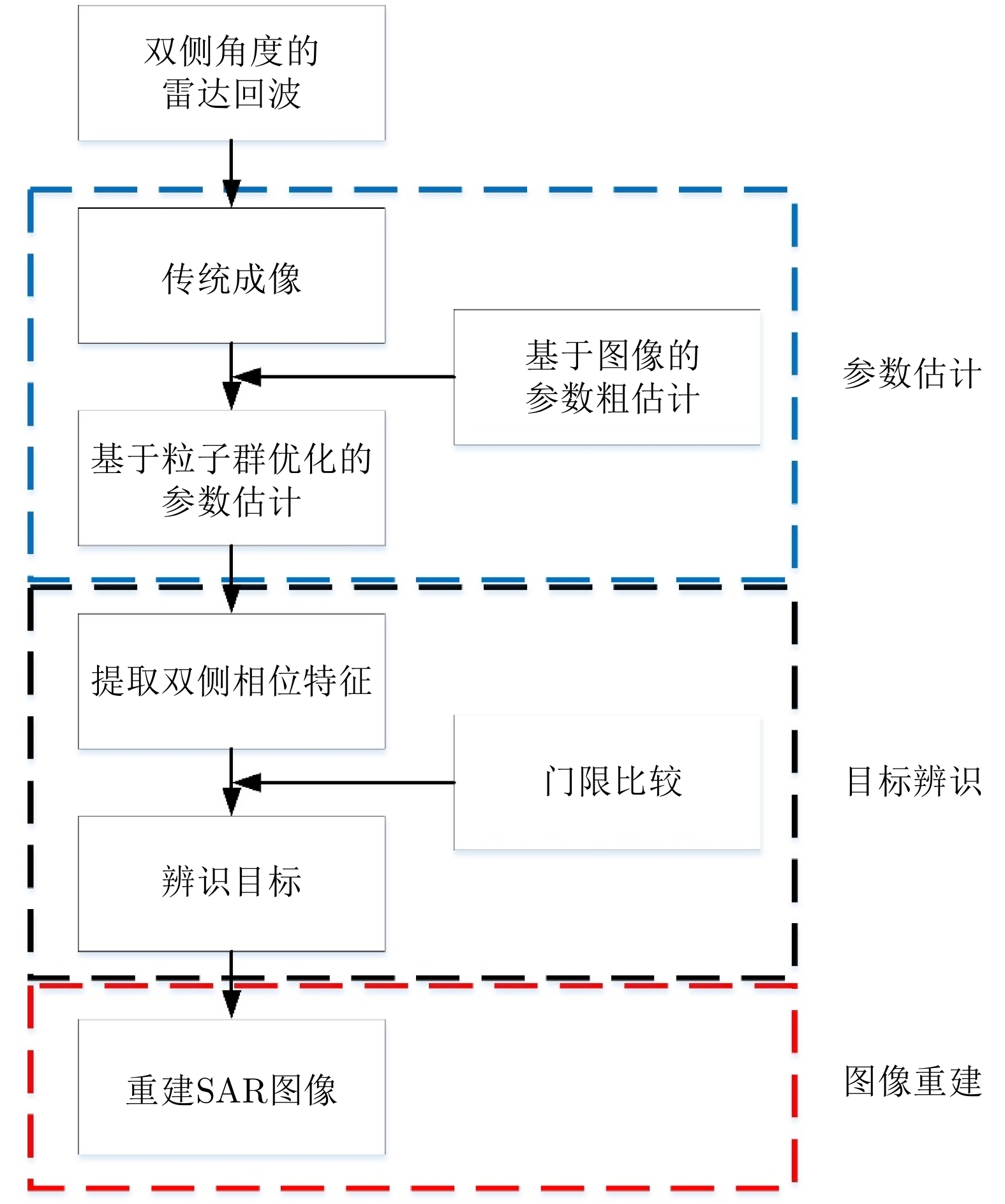
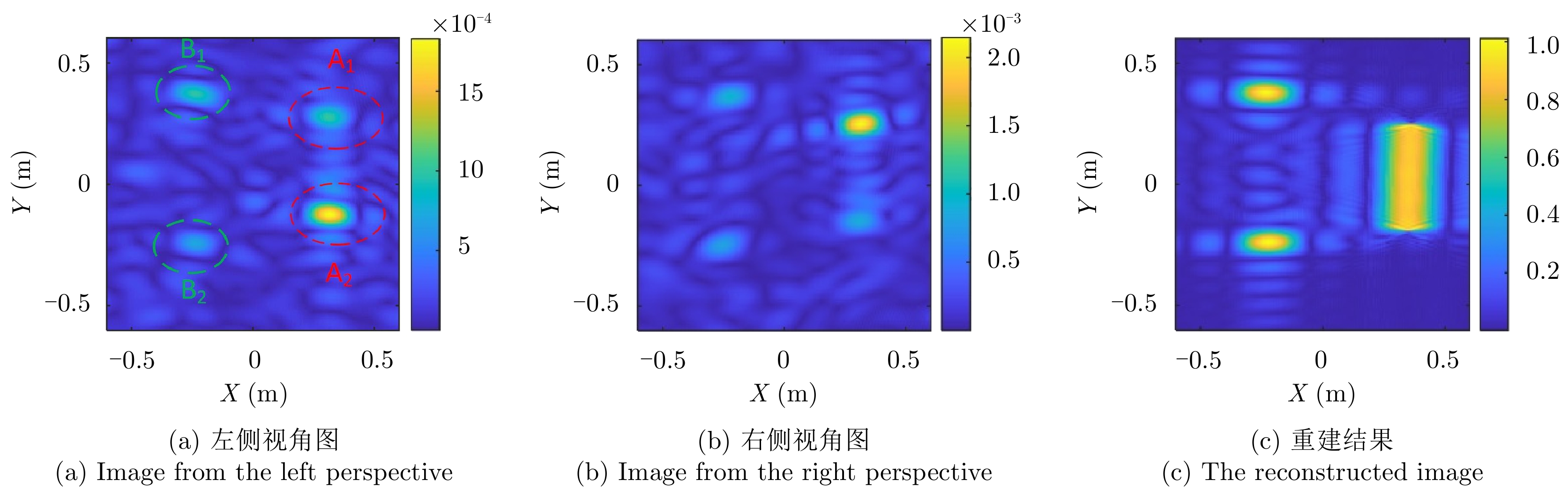
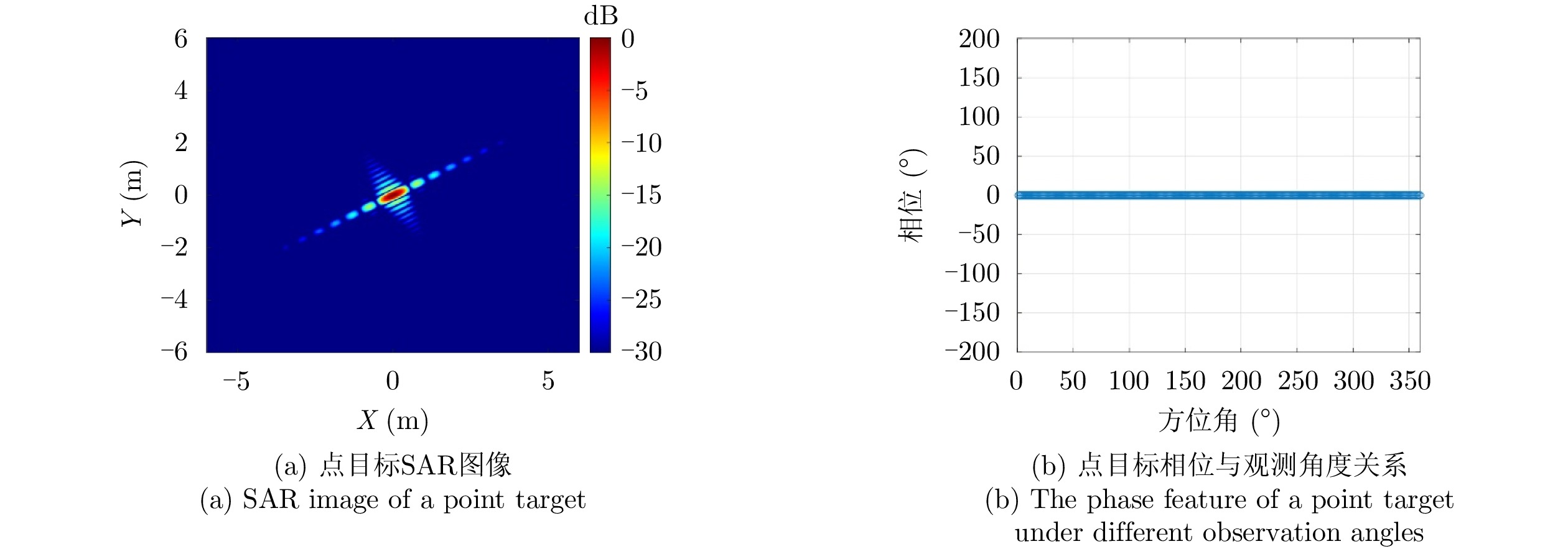
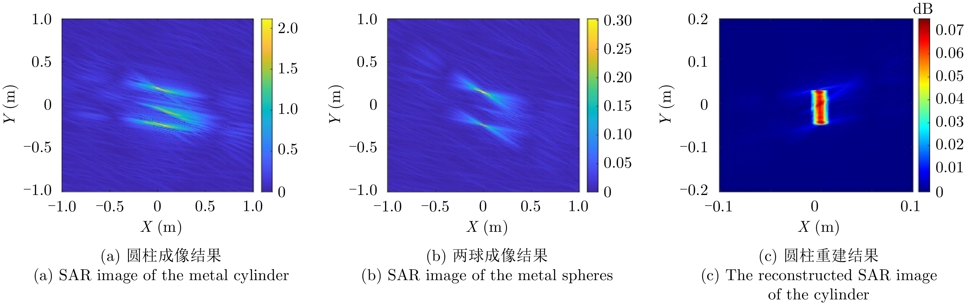
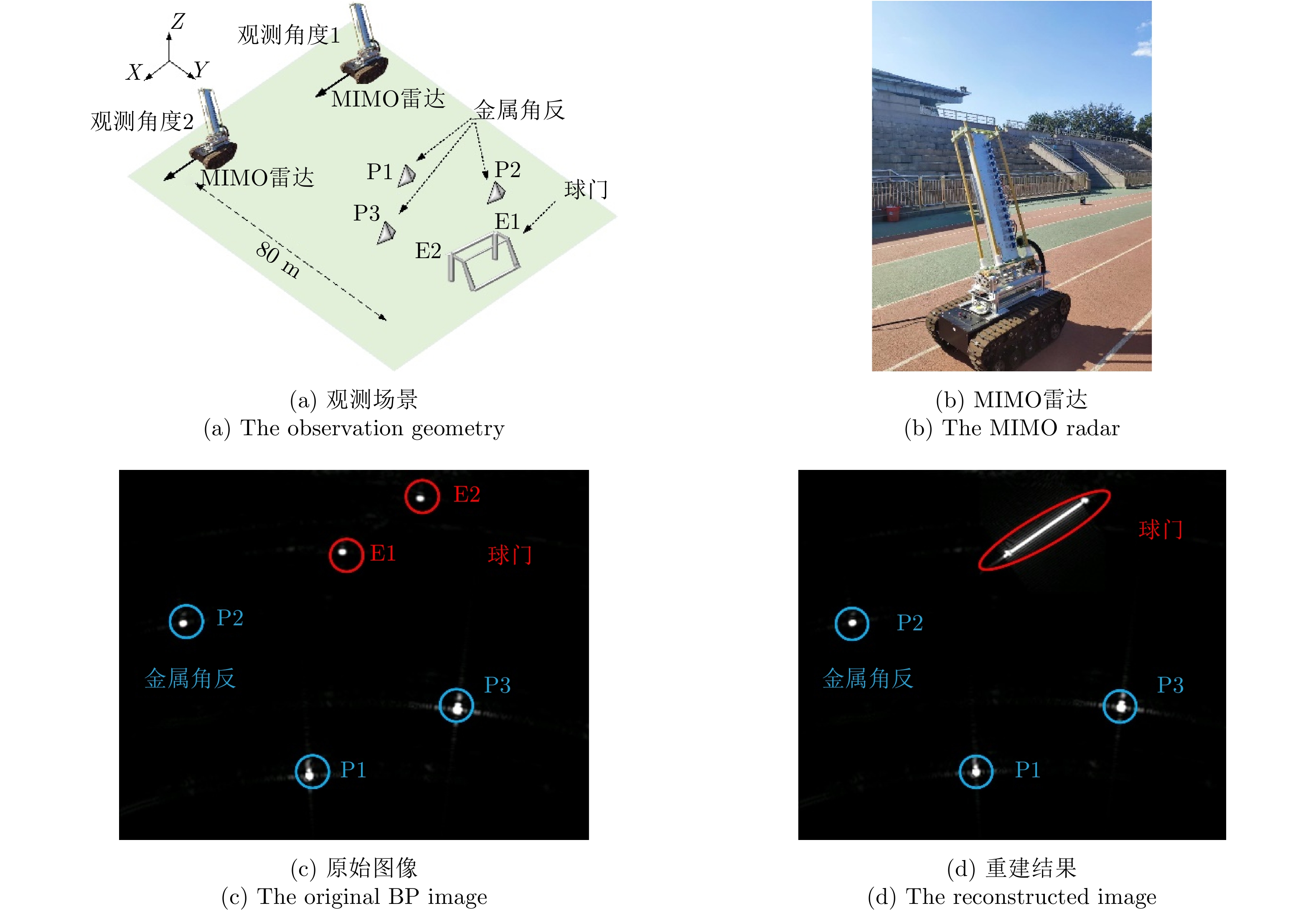
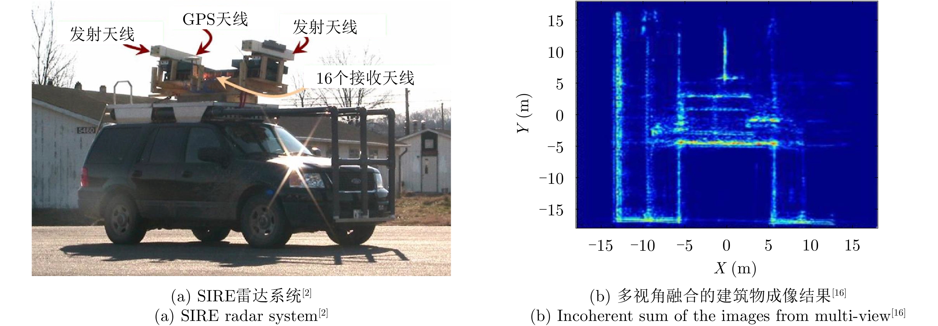
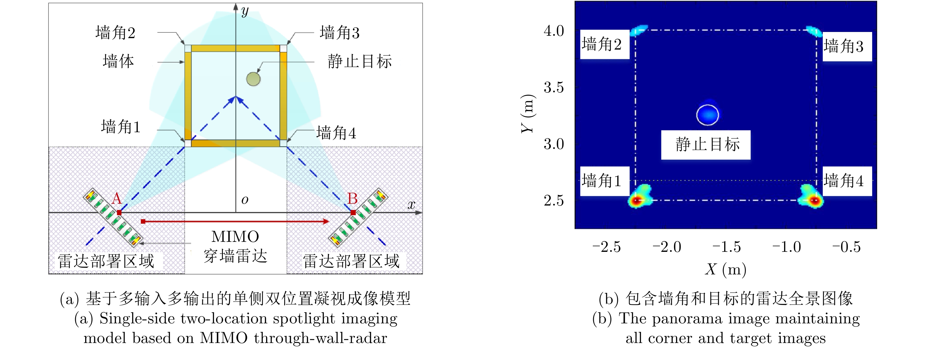
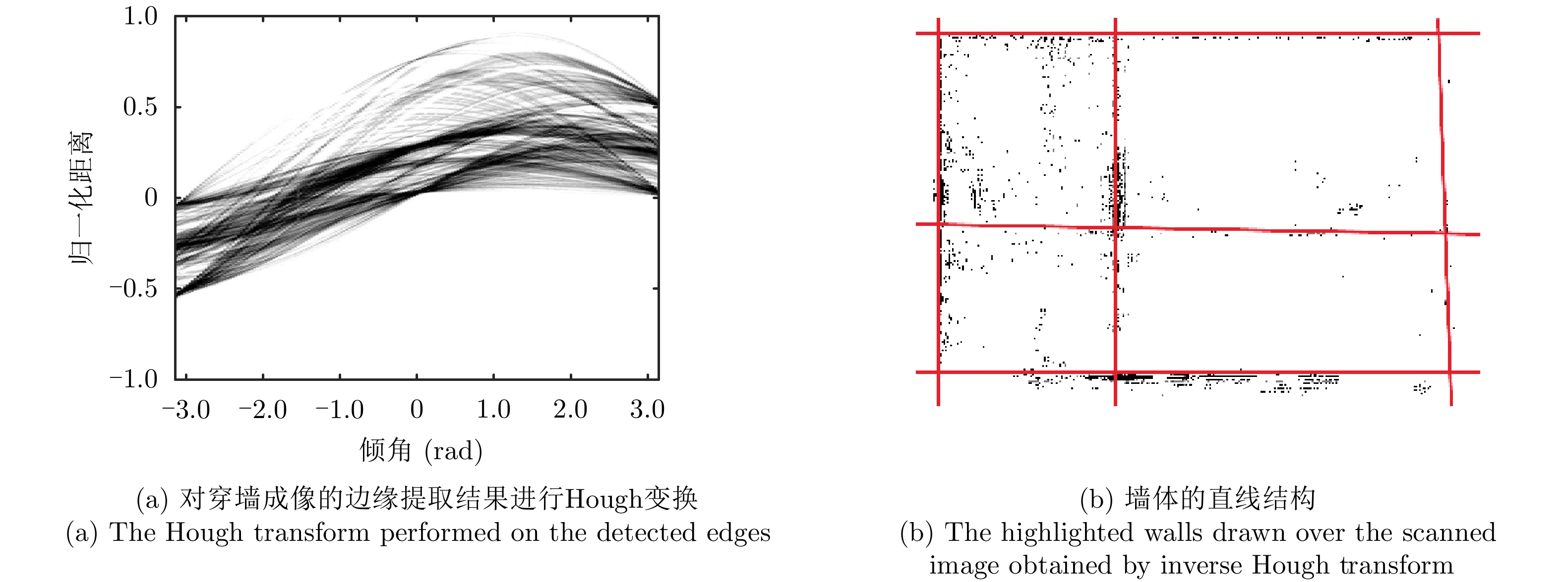
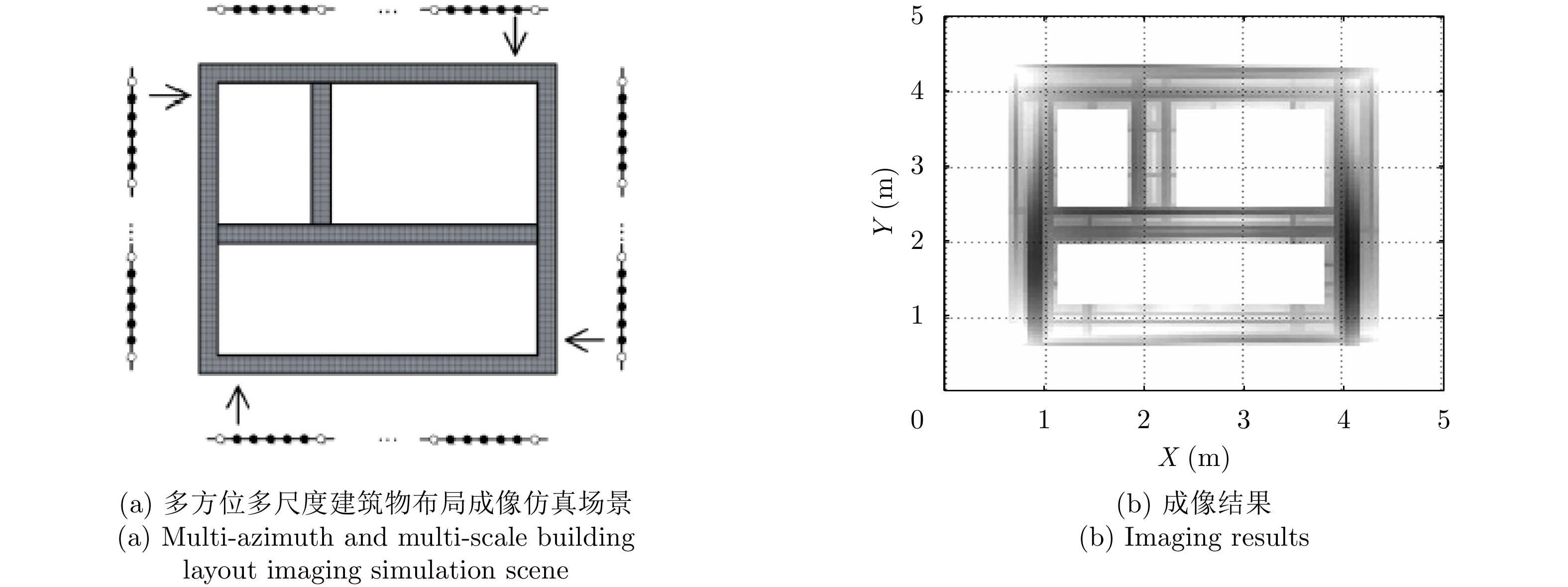
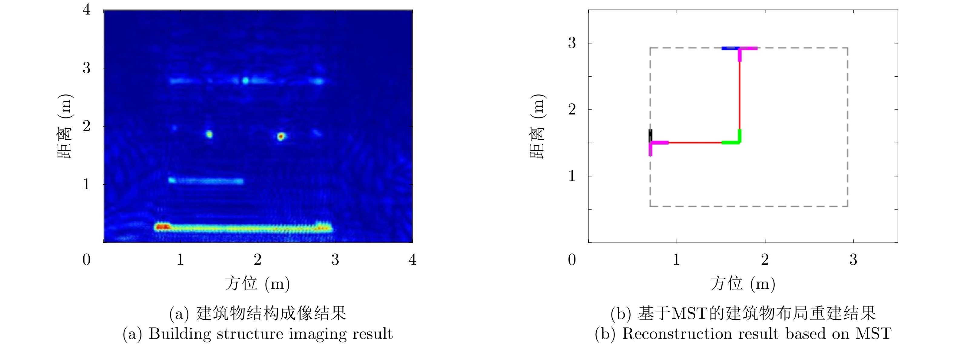
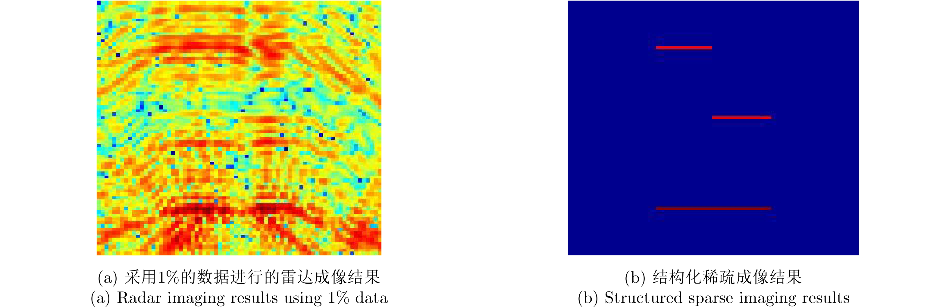
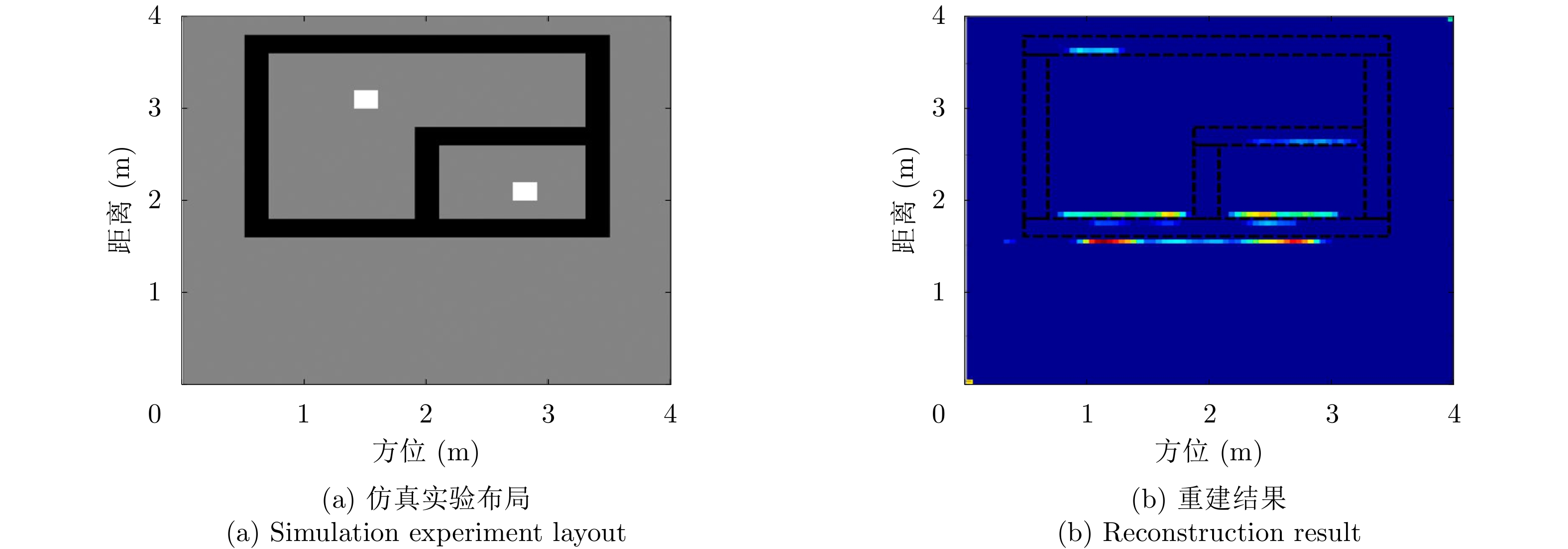
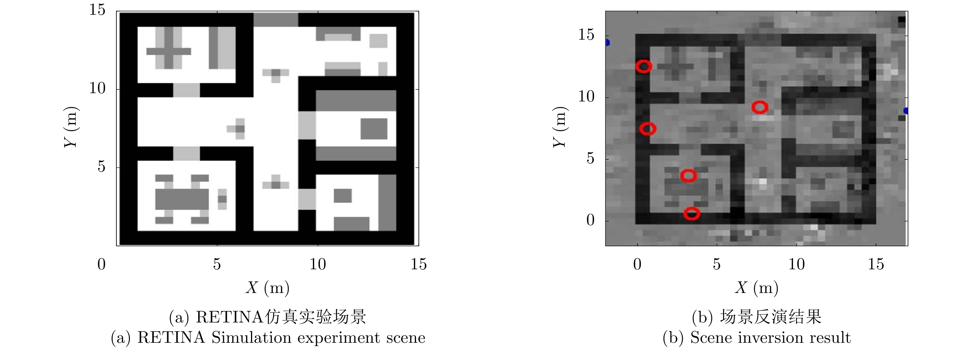
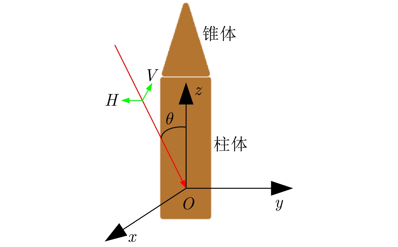
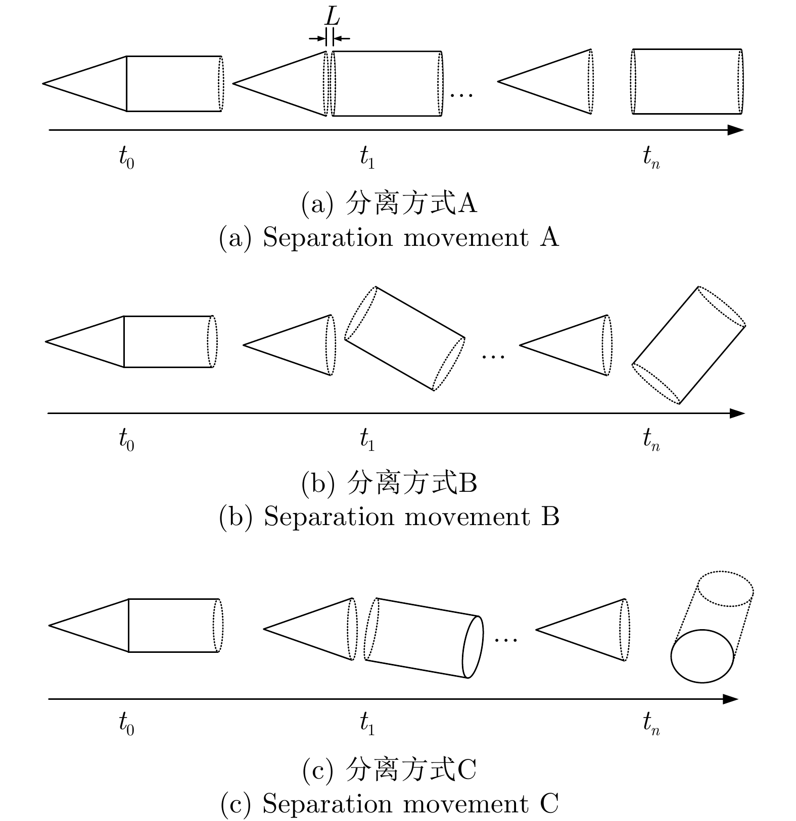
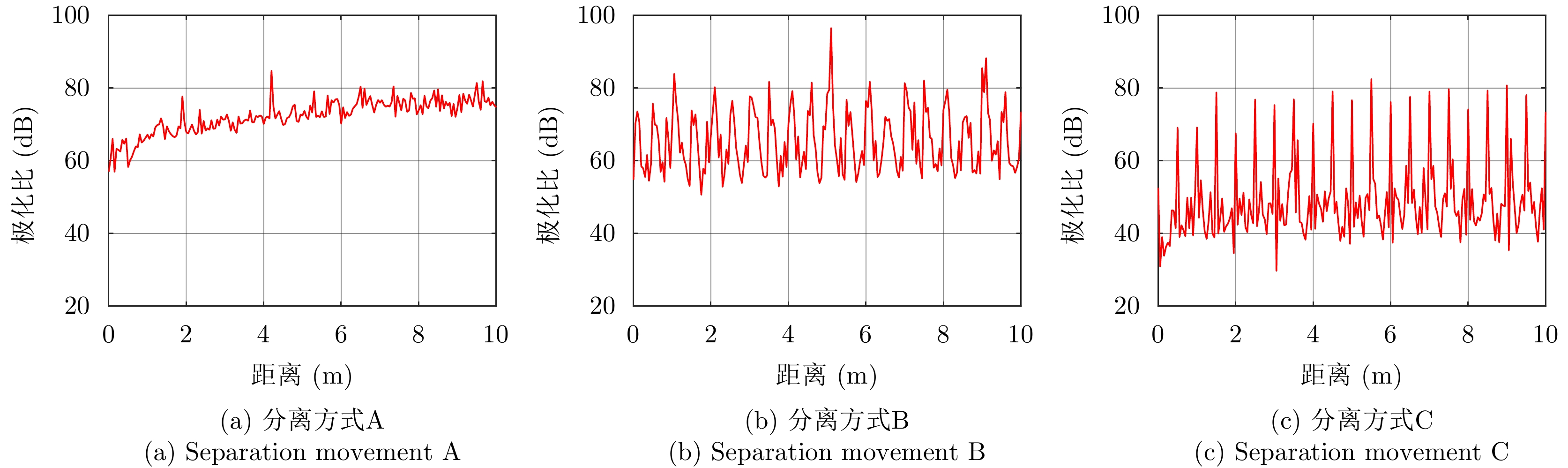
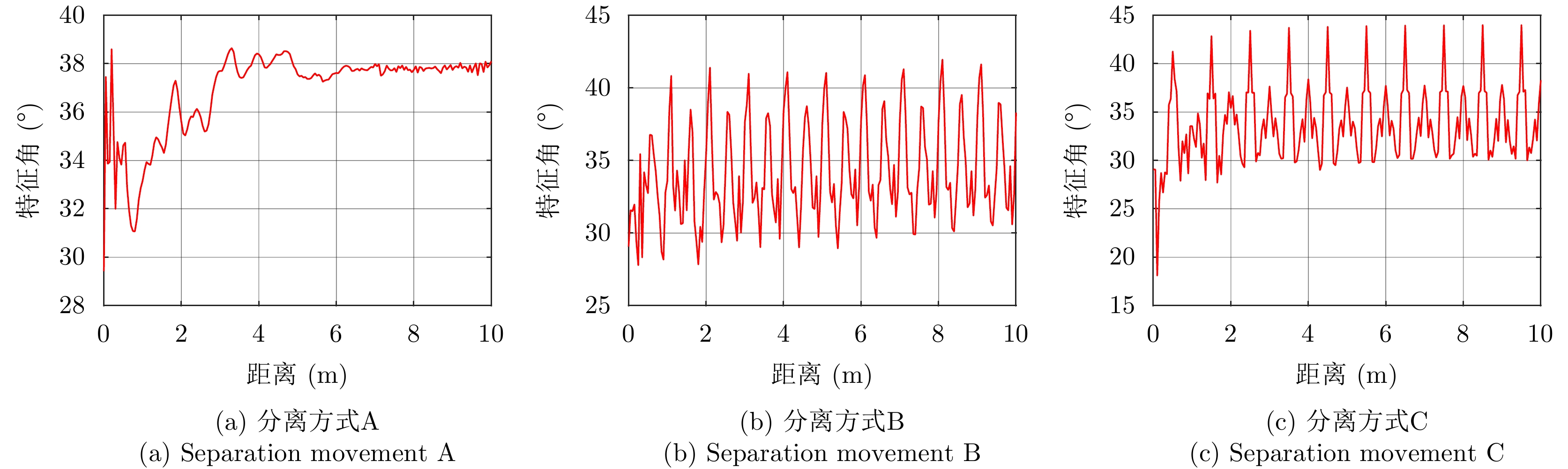
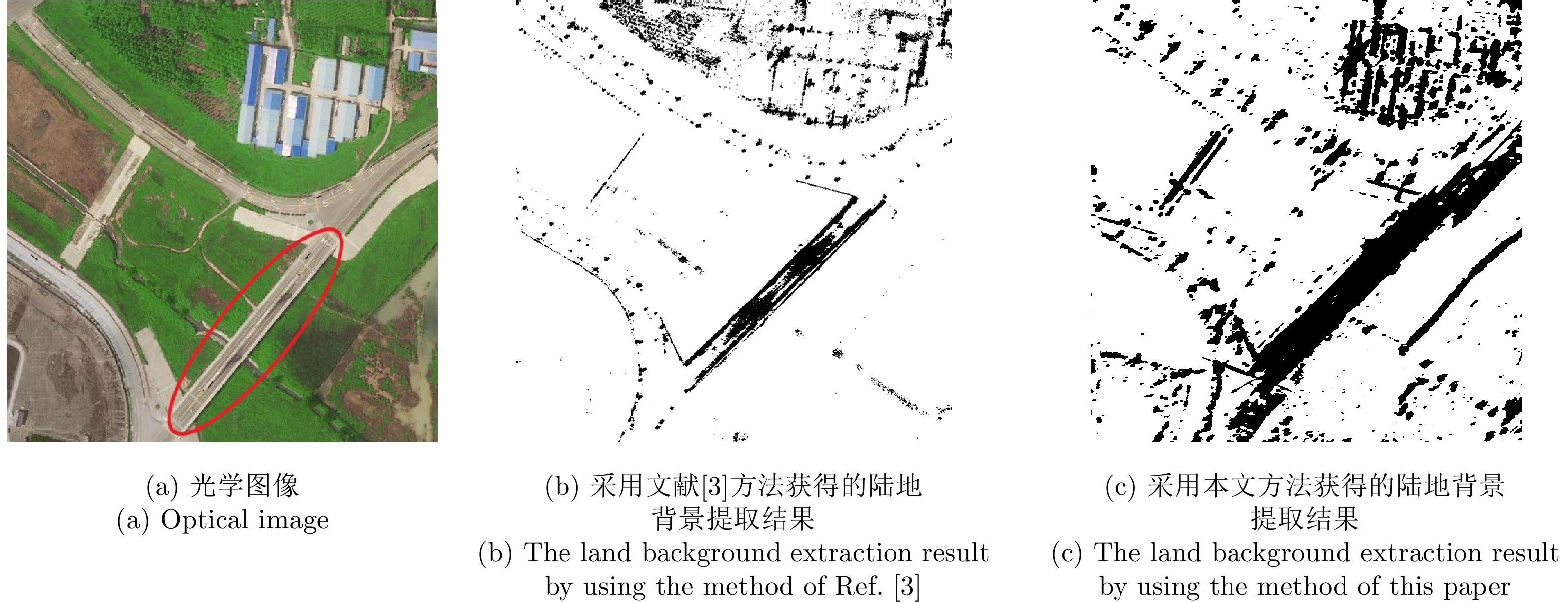
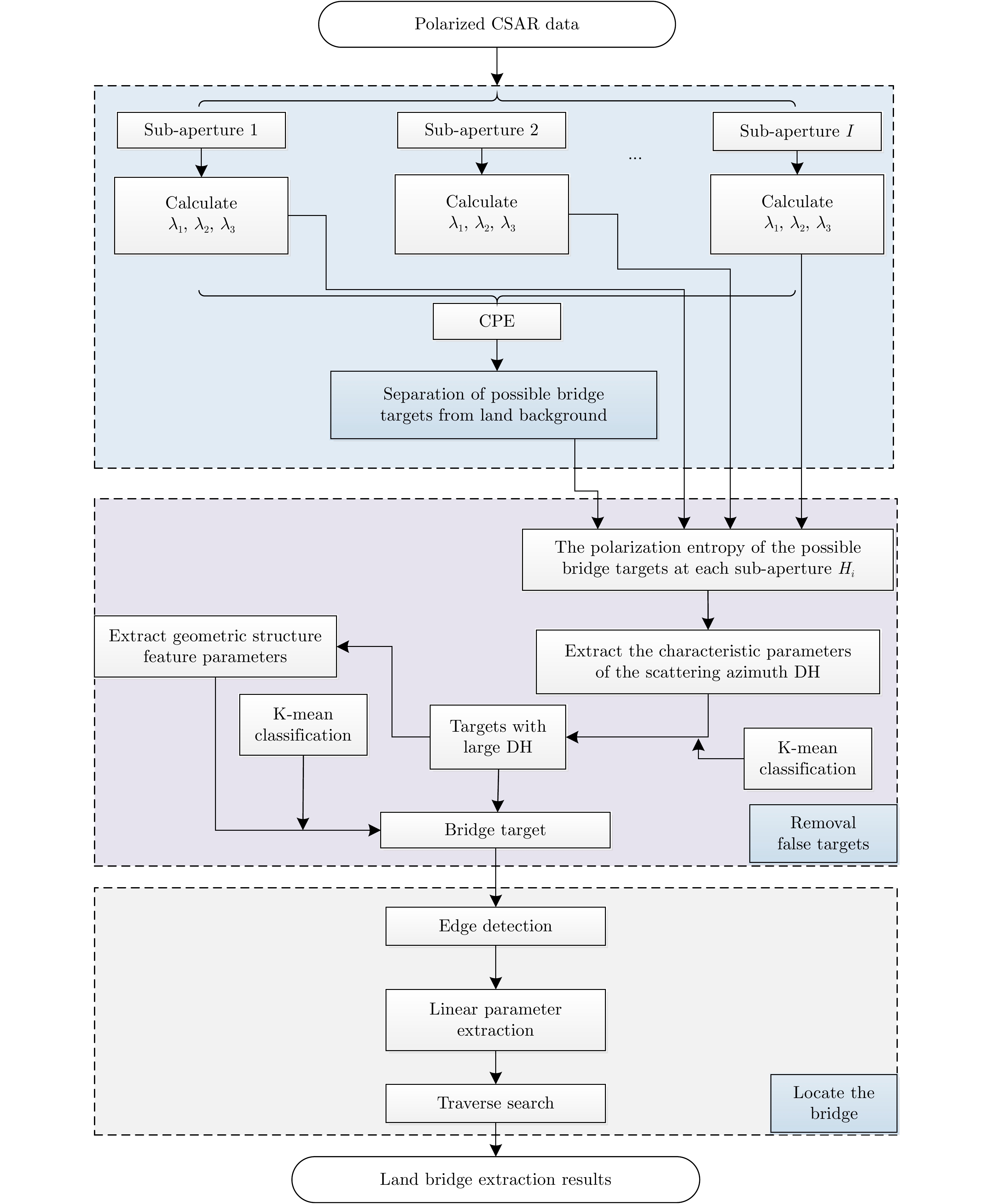
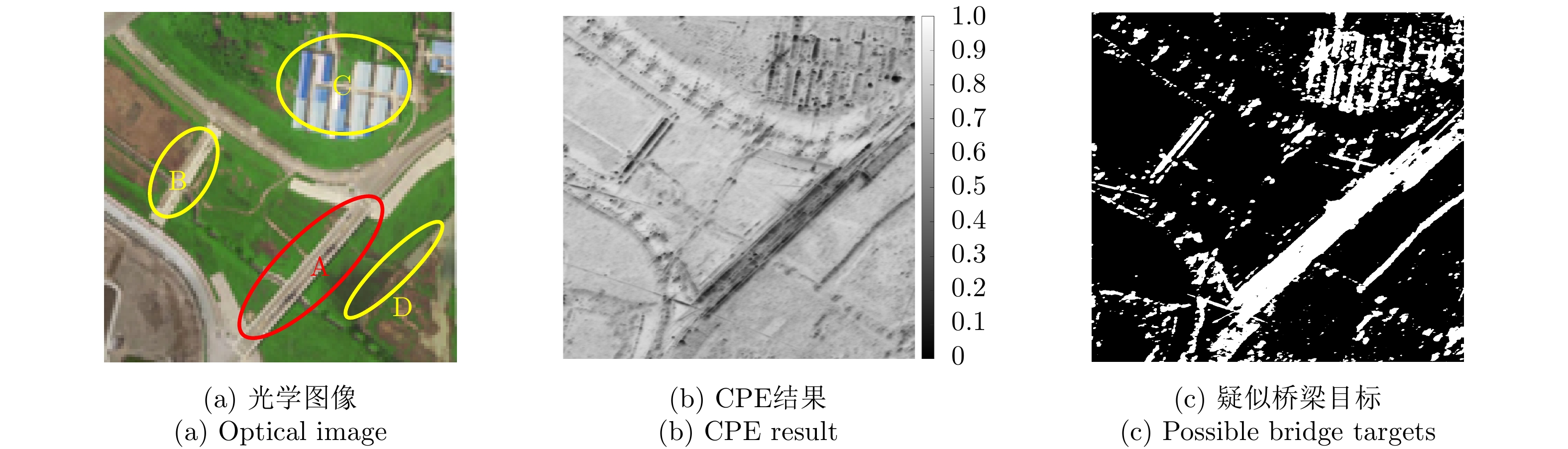
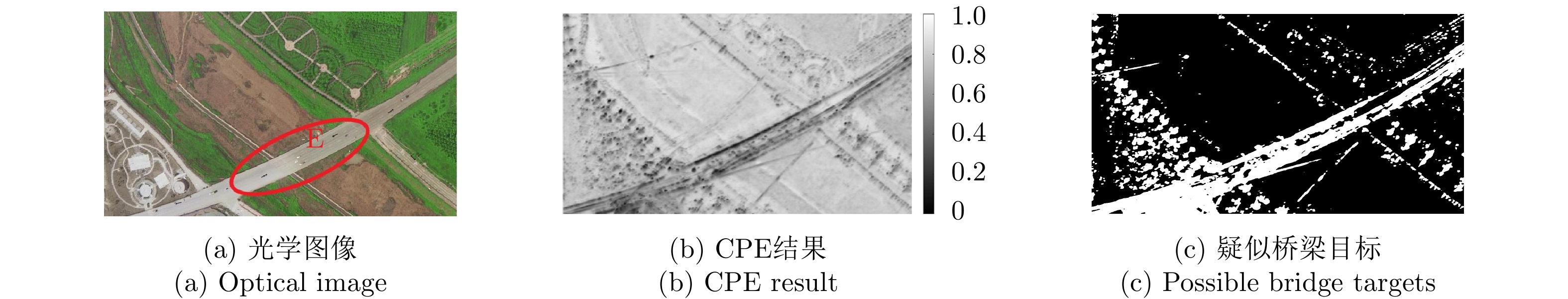
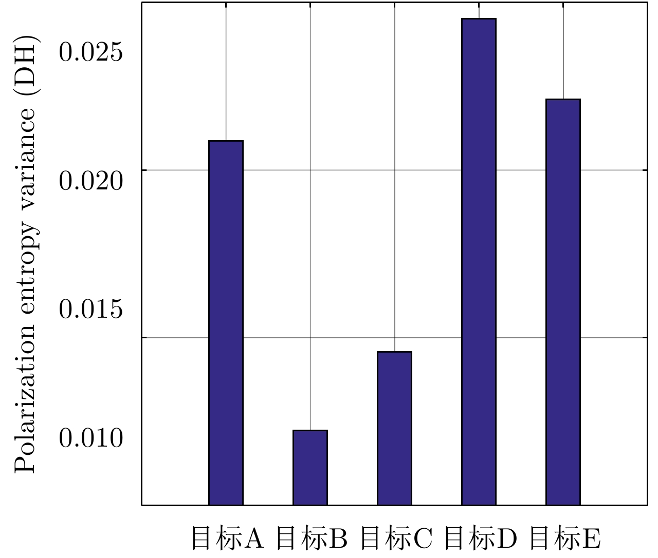
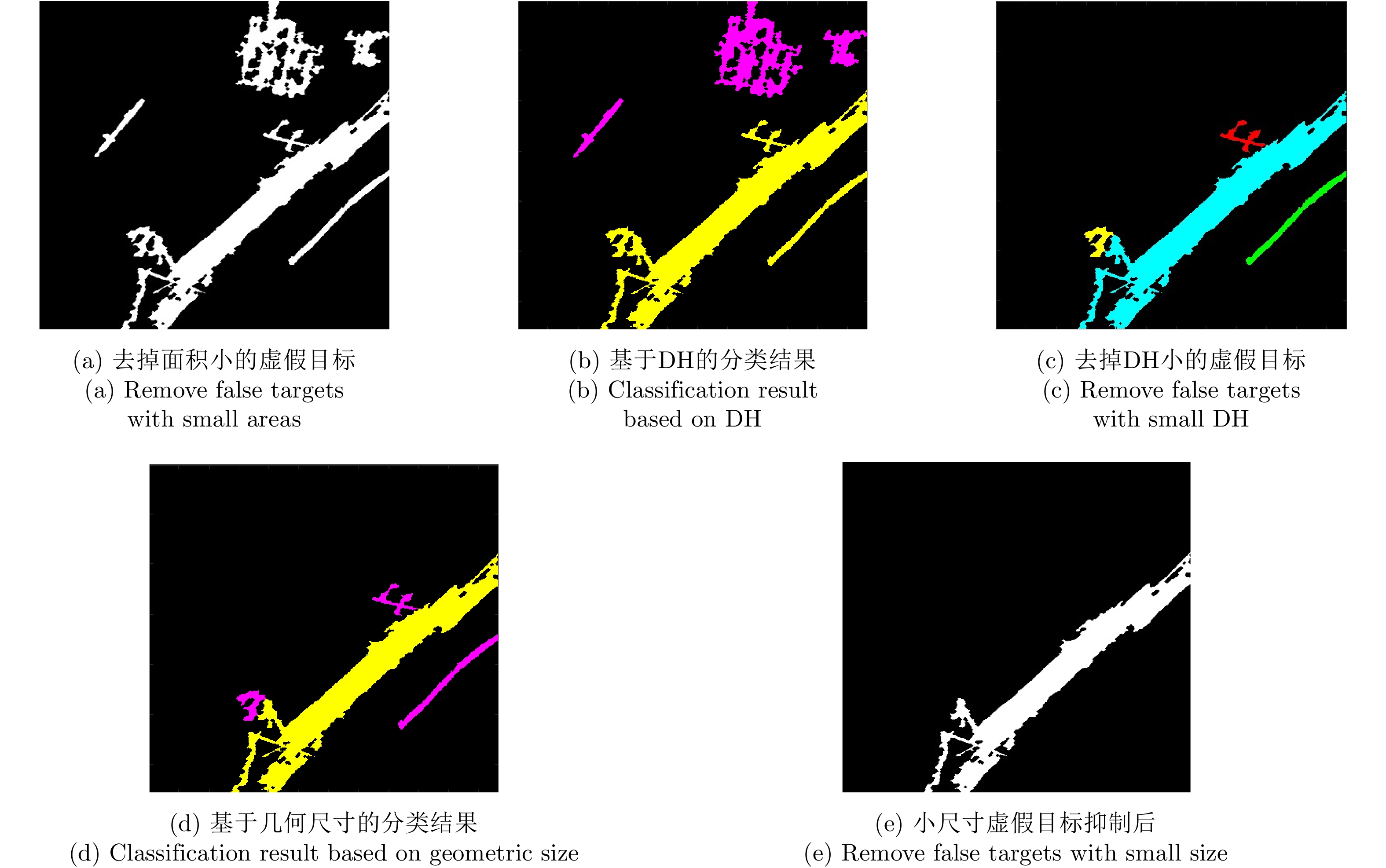
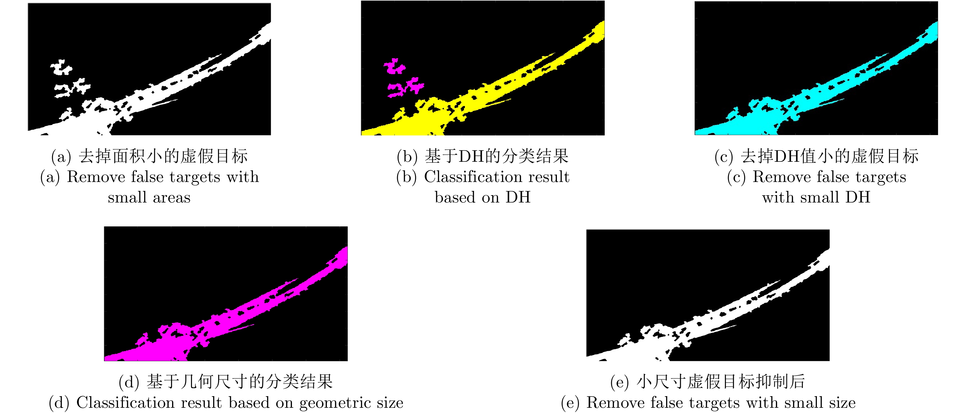
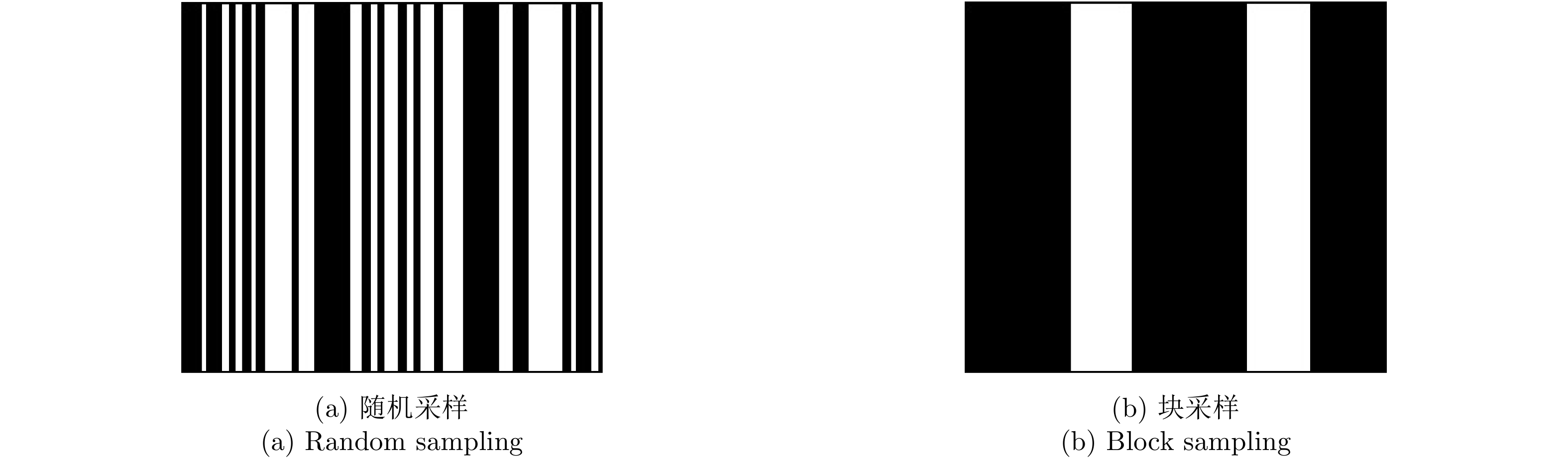
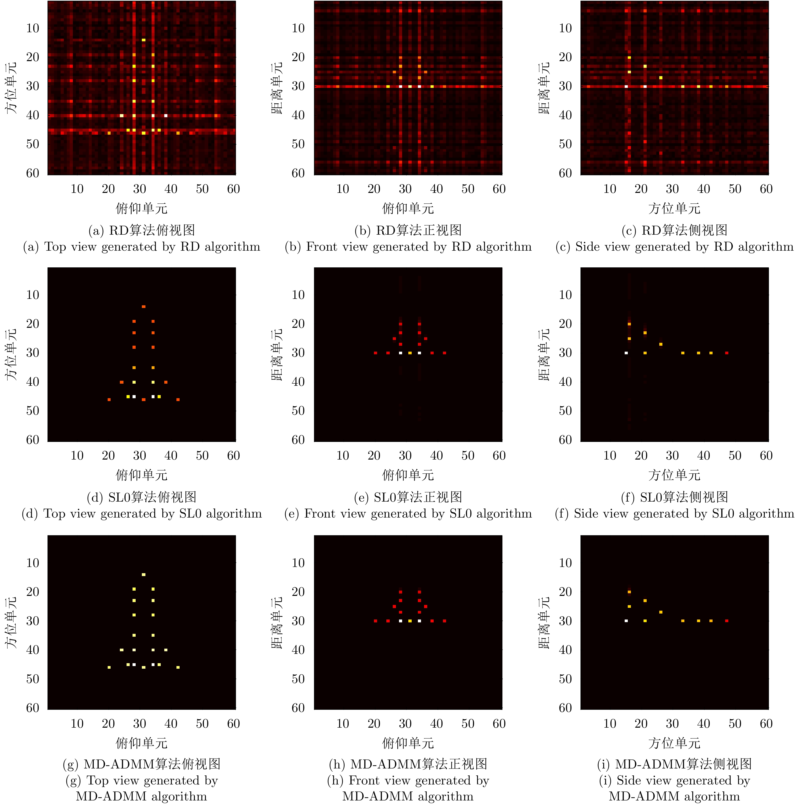
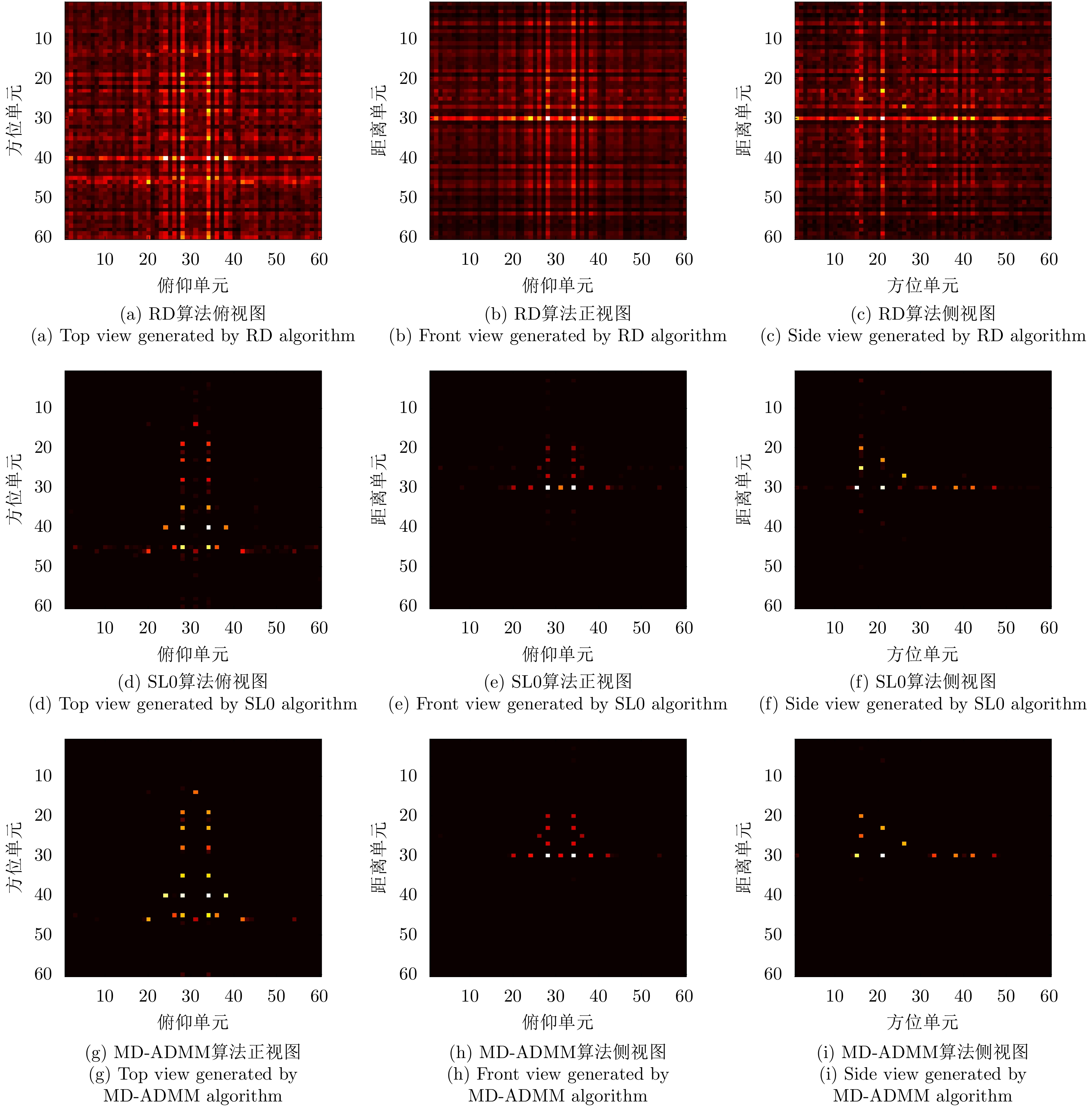
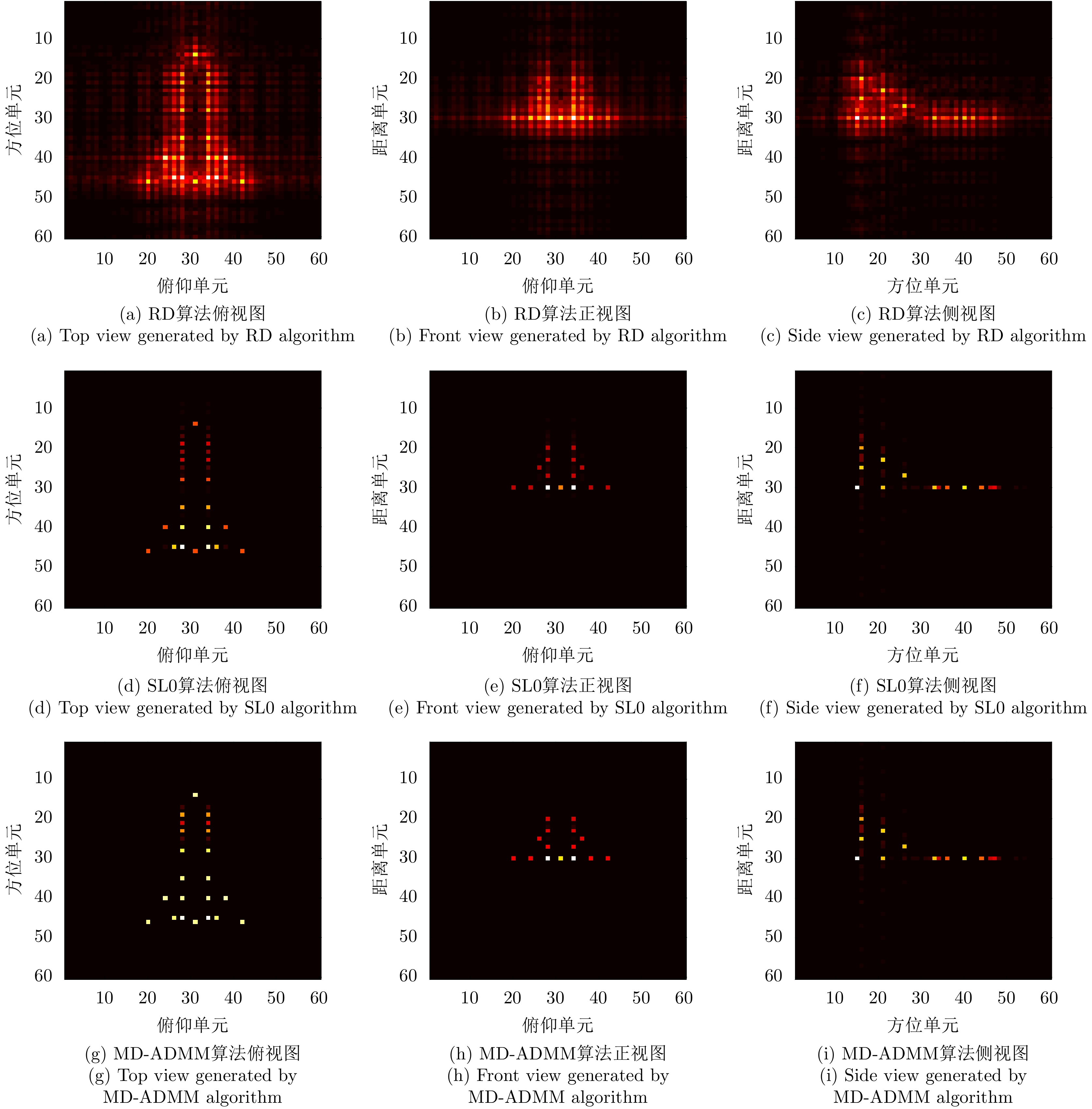
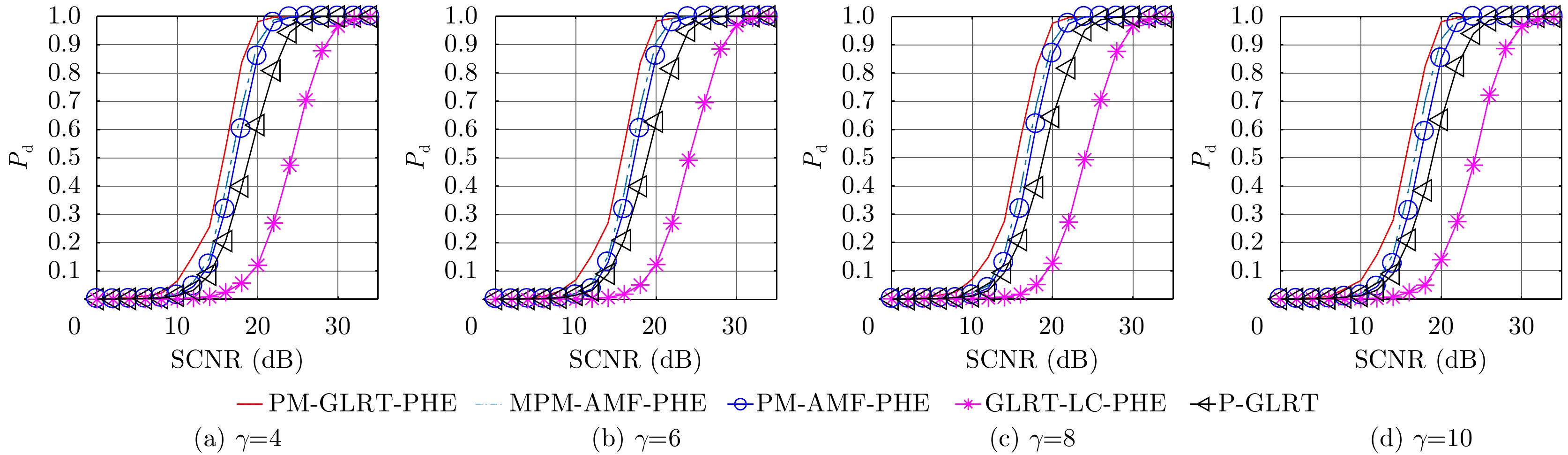
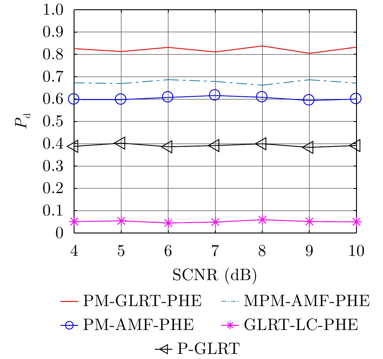
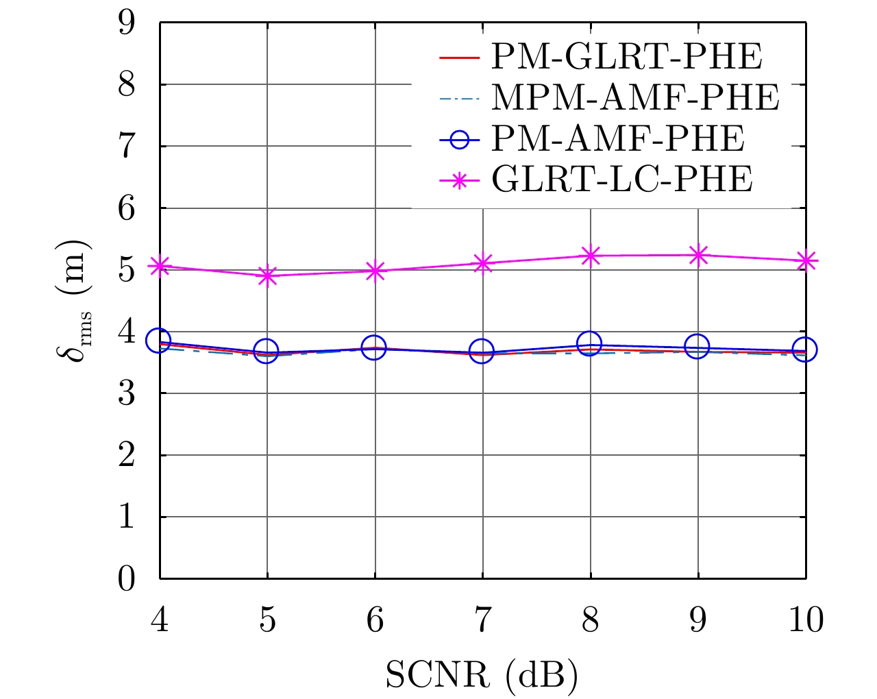
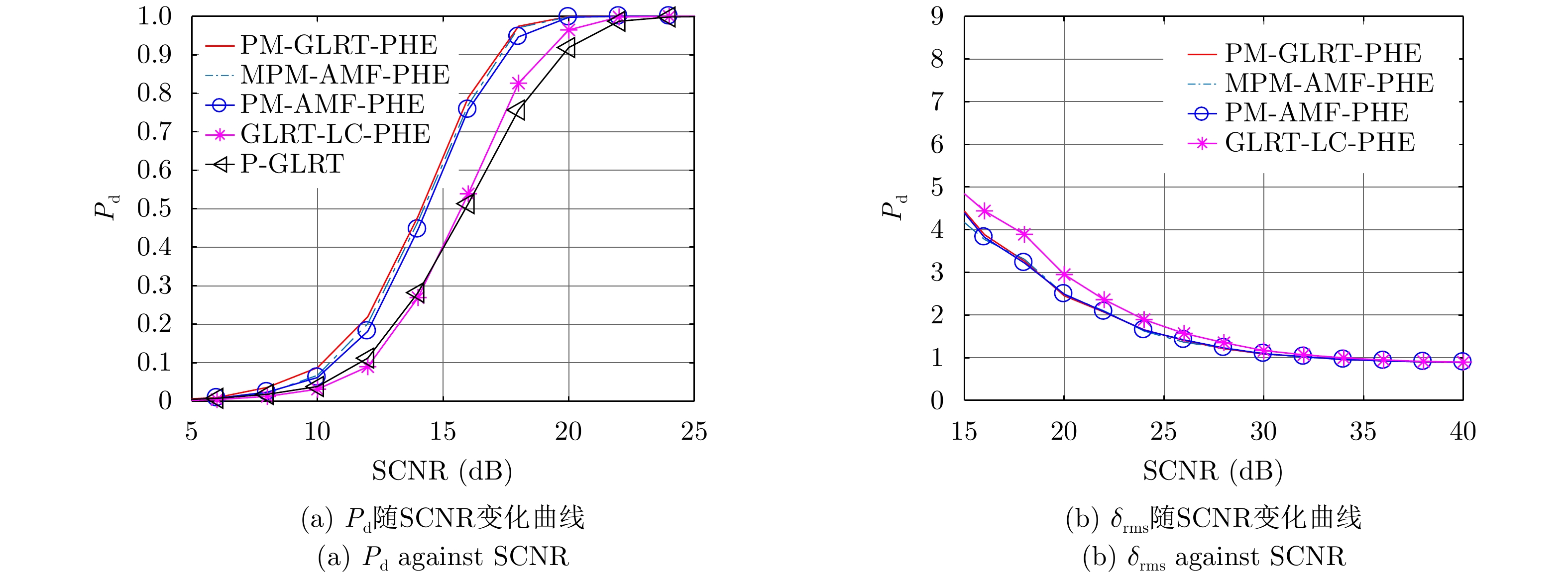
Under the constraints of the point scattering model, traditional Synthetic Aperture Radar (SAR) imaging algorithms can be regarded as a mapping from data space to image space. However, most objects in the real scene are extended targets, which are mismatched with the point scattering model in traditional linear imaging algorithms. The abovementioned reasons lead to the distortion of SAR image representation. A common phenomenon is that the extended targets appear as isolated scattered points, which hinder the application of target recognition on the basis of SAR images. SAR parametric nonlinear imaging techniques are established to solve the abovementioned model mismatch problem. Such methods are characterized by the scattering models that consider point targets and extended targets. Specifically, by using the sensitivity of the phase and amplitude characteristics of the echoes or images to the observation angles, SAR parametric imaging methods can first identify the target type and estimate the scattering parameters, and then reconstruct the target image on the basis of the scattering model. SAR parametric imaging methods can obtain better image quality than traditional linear methods for extended targets. This article mainly introduces the parametric imaging methods of linear extended targets, which correspond to the isolated strong points and continuous edges of objects in the real scene, and discusses the parametric imaging methods on the basis of the echo and image domains and experimental results. Last, the future development trends of SAR parametric imaging methods are discussed.
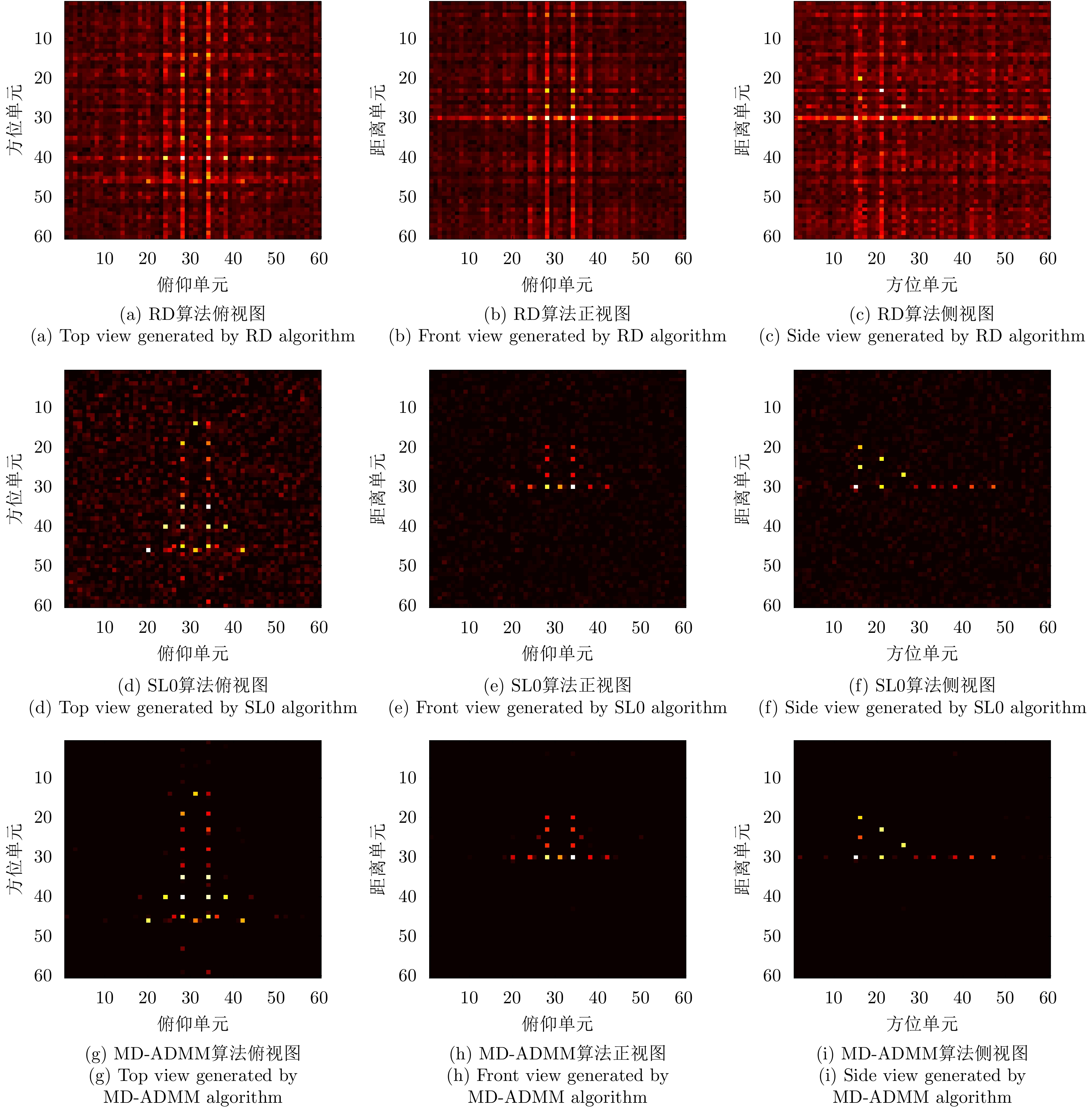
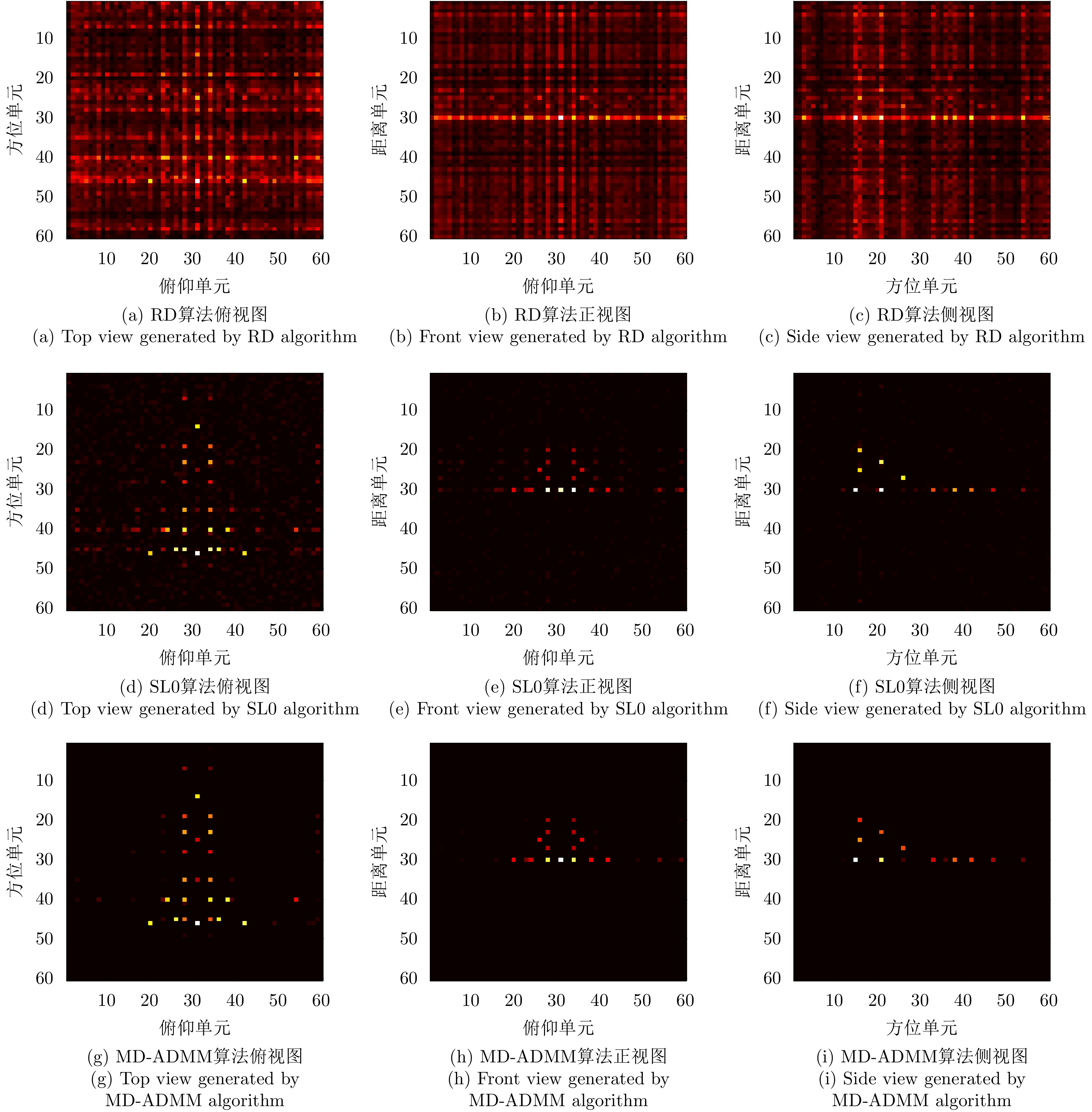
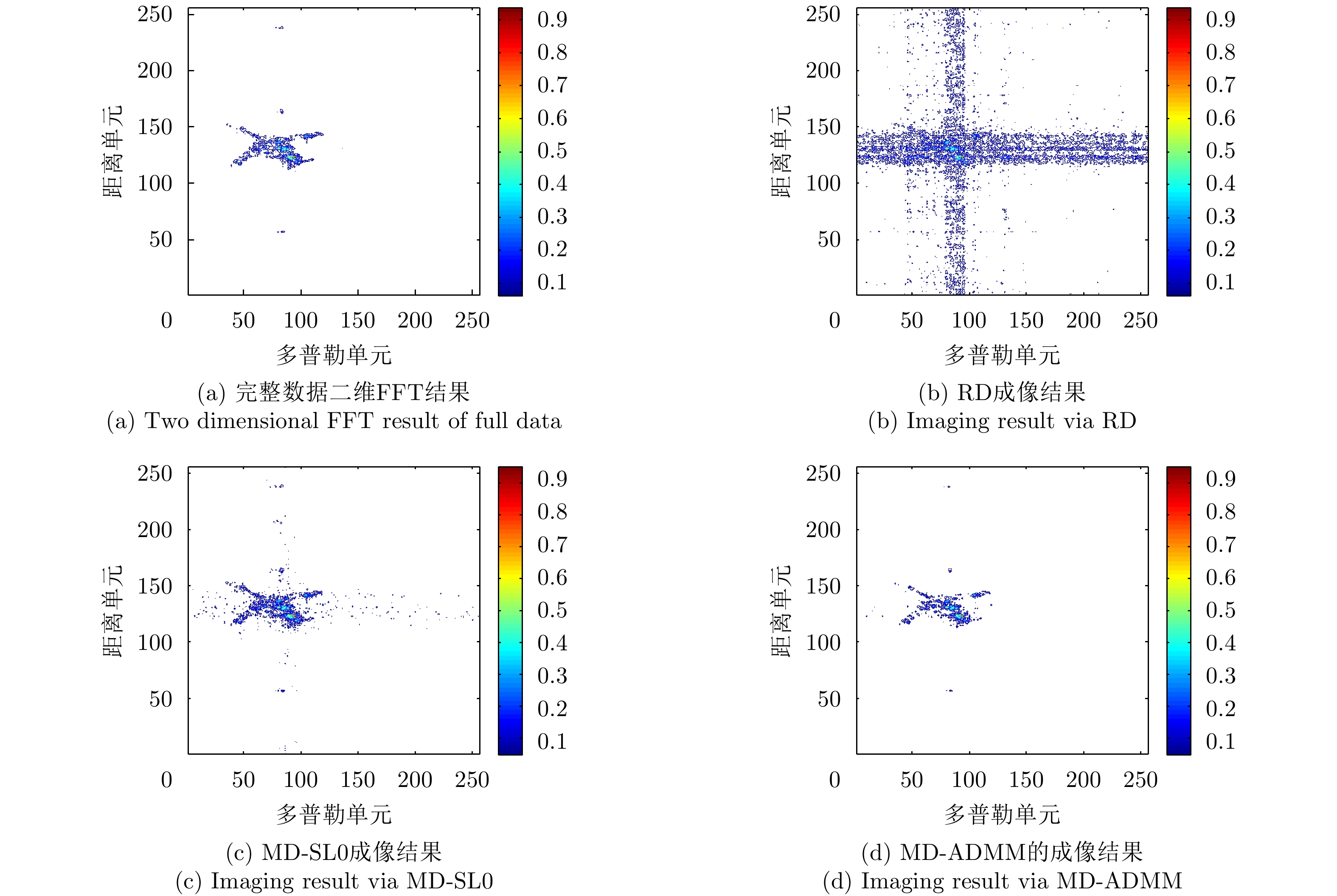
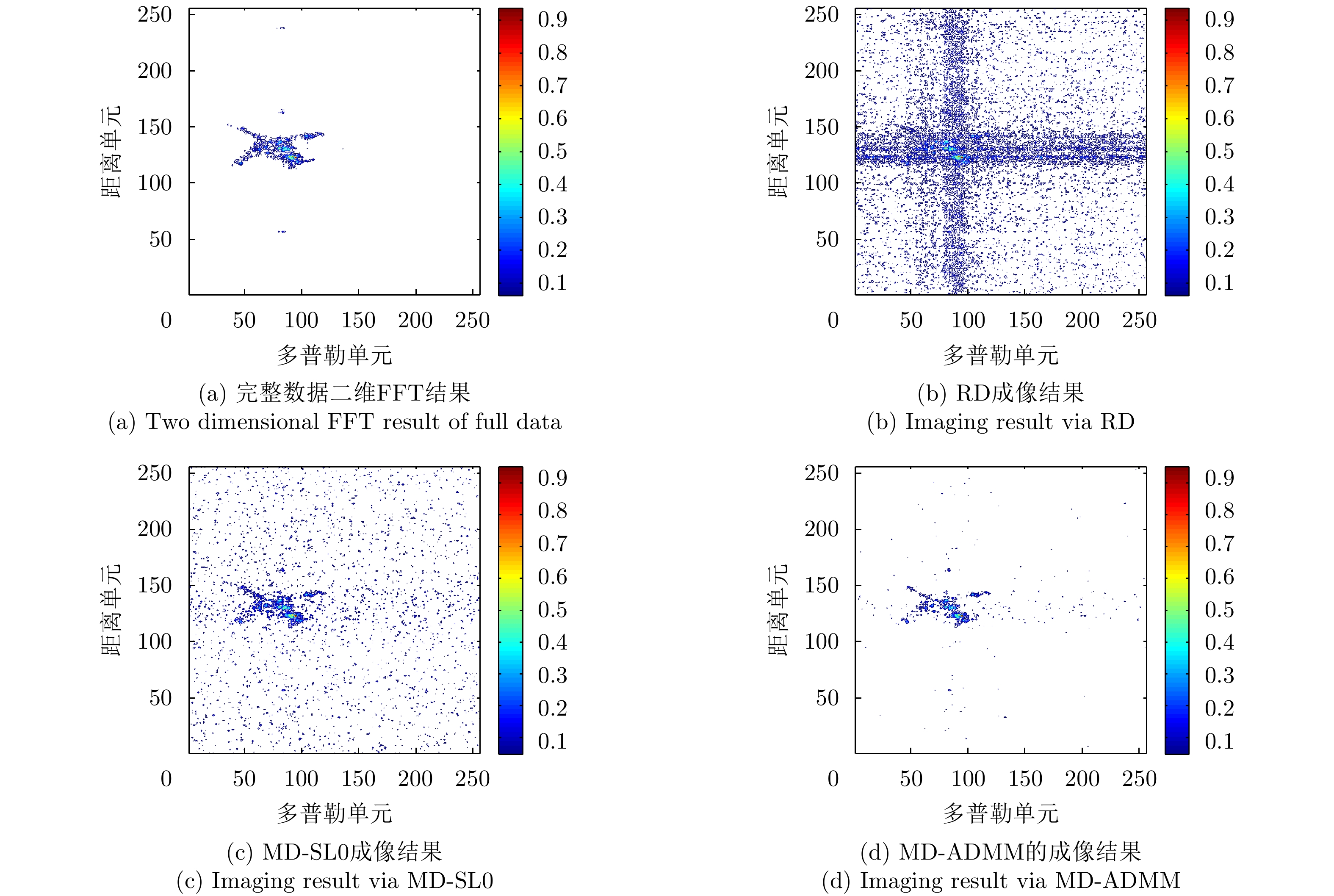
Under the constraints of the point scattering model, traditional Synthetic Aperture Radar (SAR) imaging algorithms can be regarded as a mapping from data space to image space. However, most objects in the real scene are extended targets, which are mismatched with the point scattering model in traditional linear imaging algorithms. The abovementioned reasons lead to the distortion of SAR image representation. A common phenomenon is that the extended targets appear as isolated scattered points, which hinder the application of target recognition on the basis of SAR images. SAR parametric nonlinear imaging techniques are established to solve the abovementioned model mismatch problem. Such methods are characterized by the scattering models that consider point targets and extended targets. Specifically, by using the sensitivity of the phase and amplitude characteristics of the echoes or images to the observation angles, SAR parametric imaging methods can first identify the target type and estimate the scattering parameters, and then reconstruct the target image on the basis of the scattering model. SAR parametric imaging methods can obtain better image quality than traditional linear methods for extended targets. This article mainly introduces the parametric imaging methods of linear extended targets, which correspond to the isolated strong points and continuous edges of objects in the real scene, and discusses the parametric imaging methods on the basis of the echo and image domains and experimental results. Last, the future development trends of SAR parametric imaging methods are discussed.


 微信 | 公众平台

