
 Submit Manuscript
 Peer Review
 Editor Work
2017 Vol. 6, No. 5
 Previous Issue
 Abstract
 1126KB


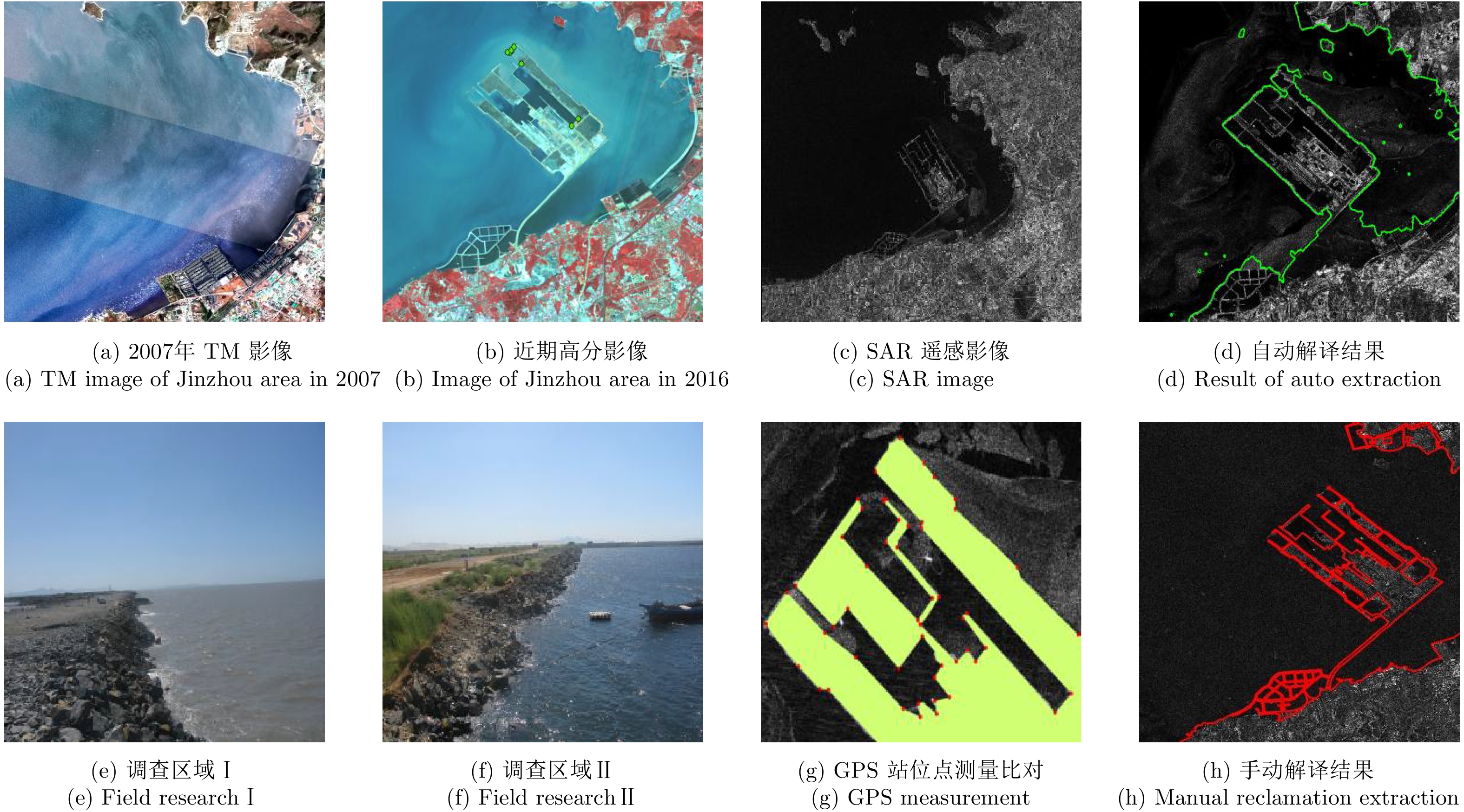


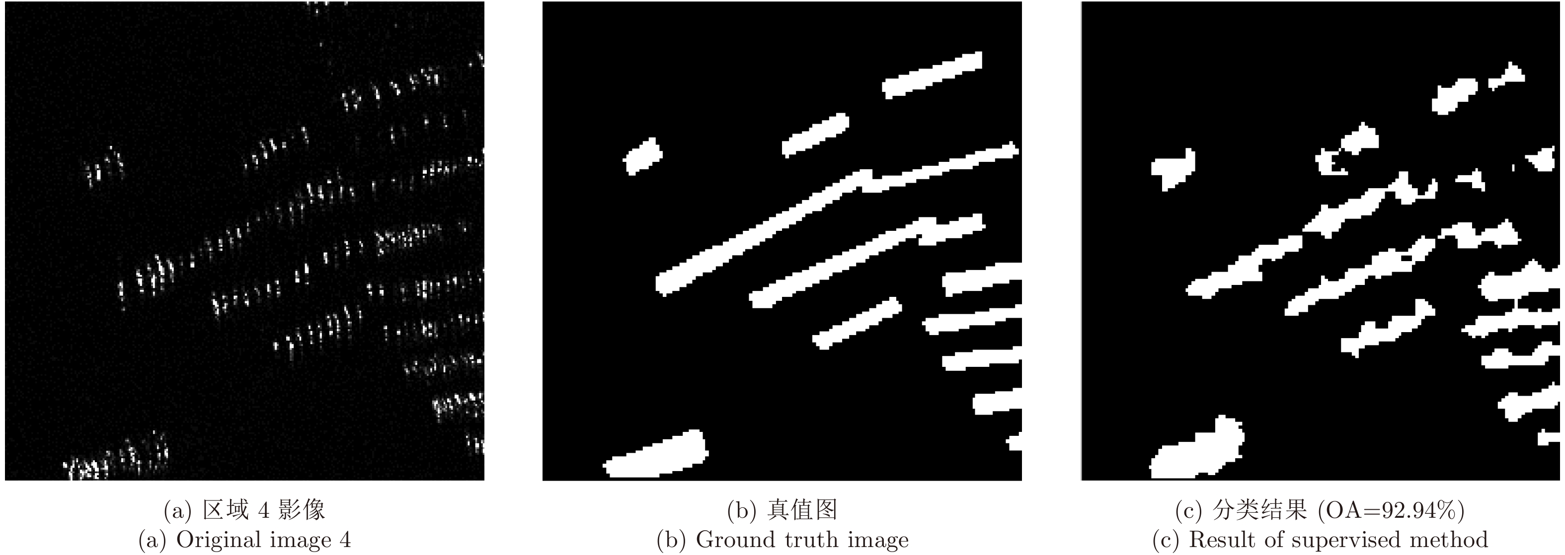
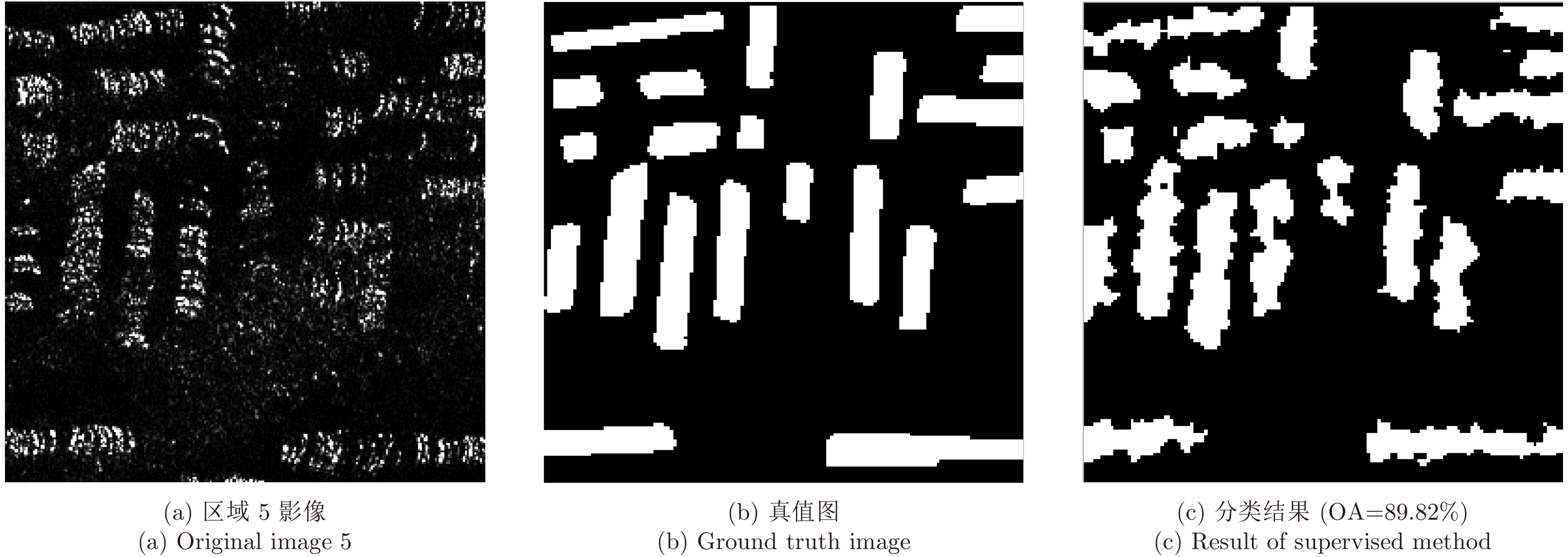
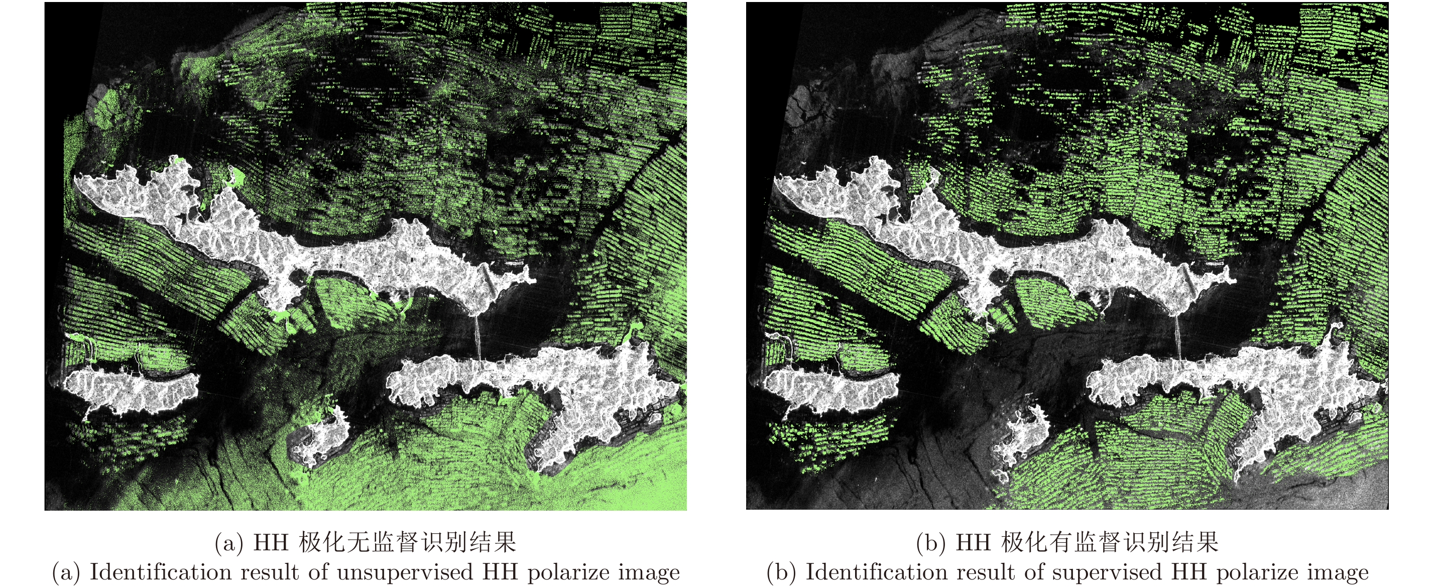
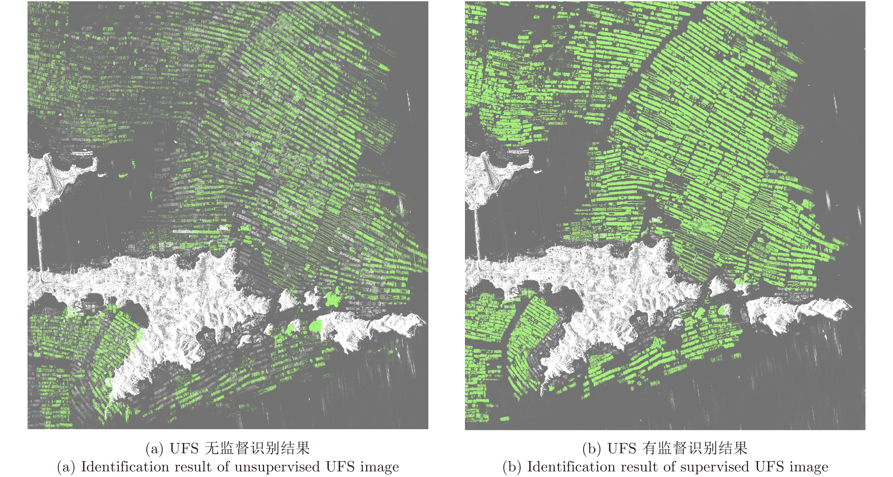


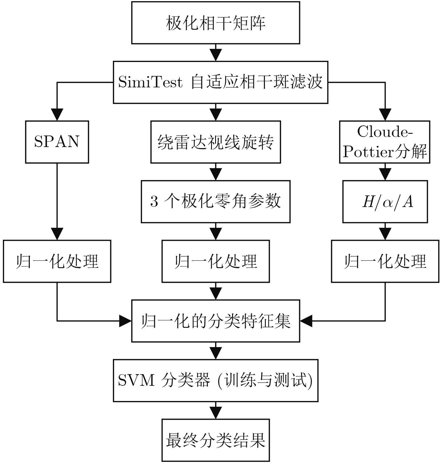


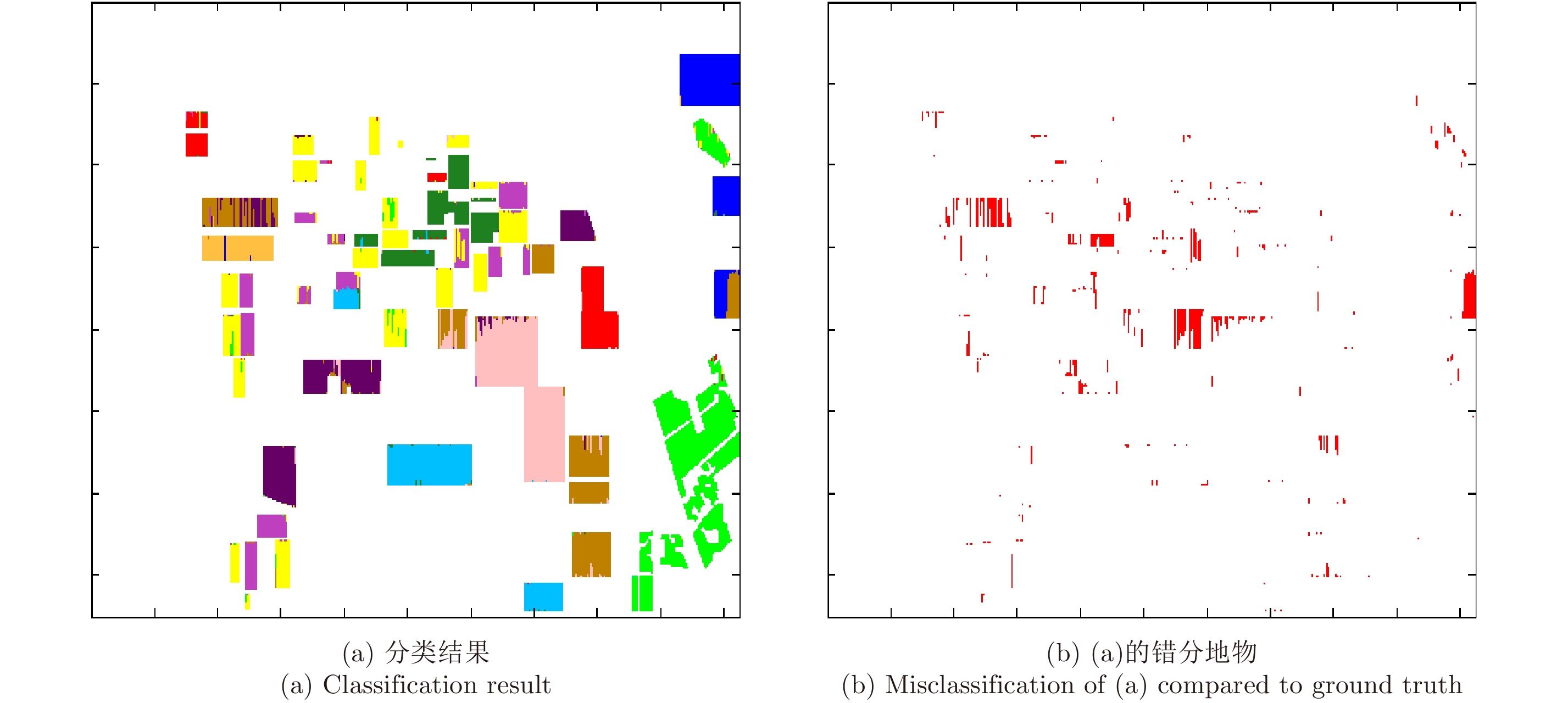
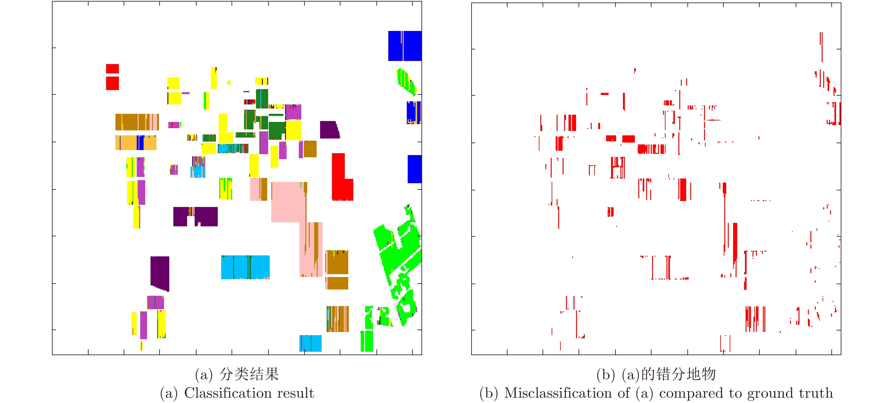

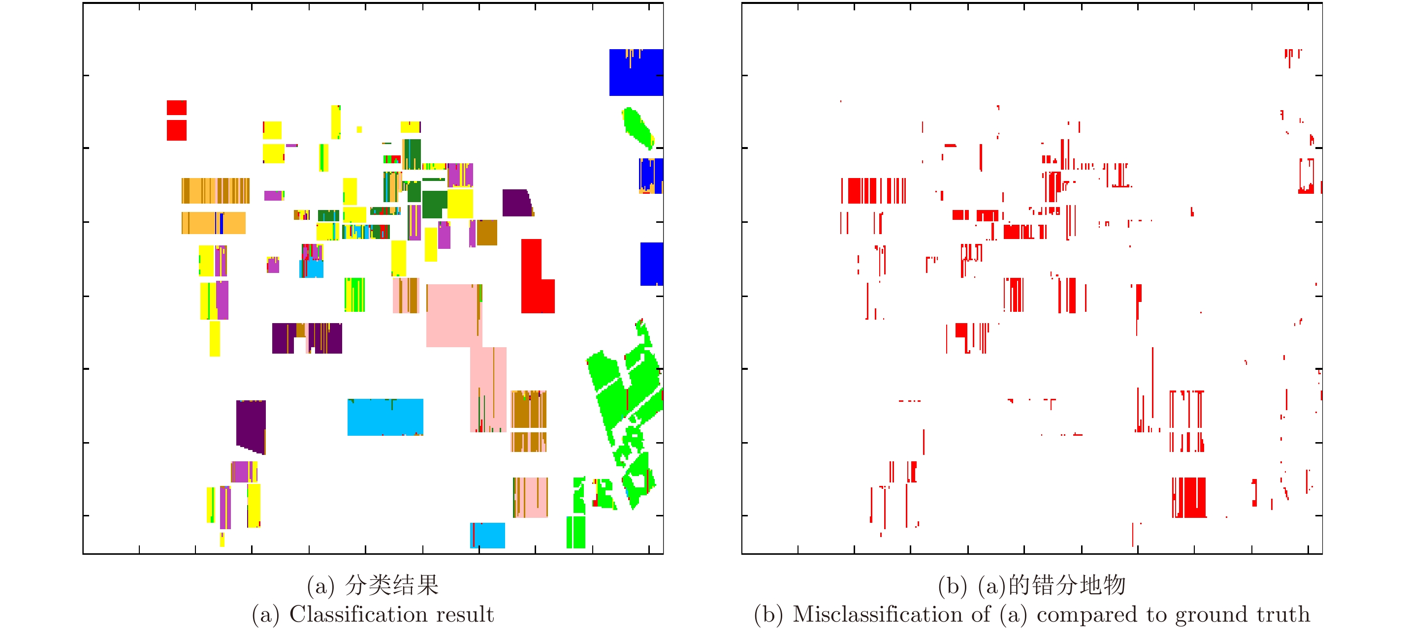


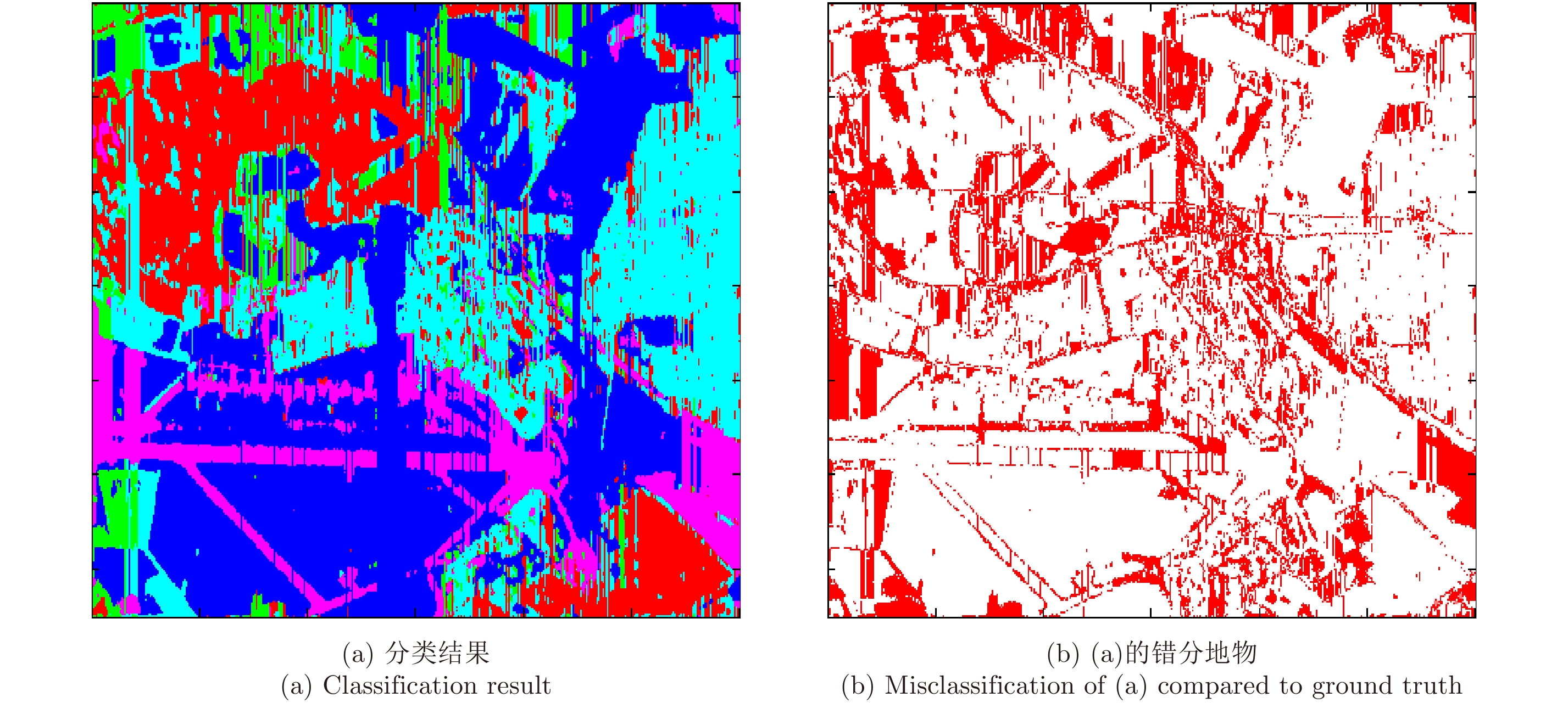


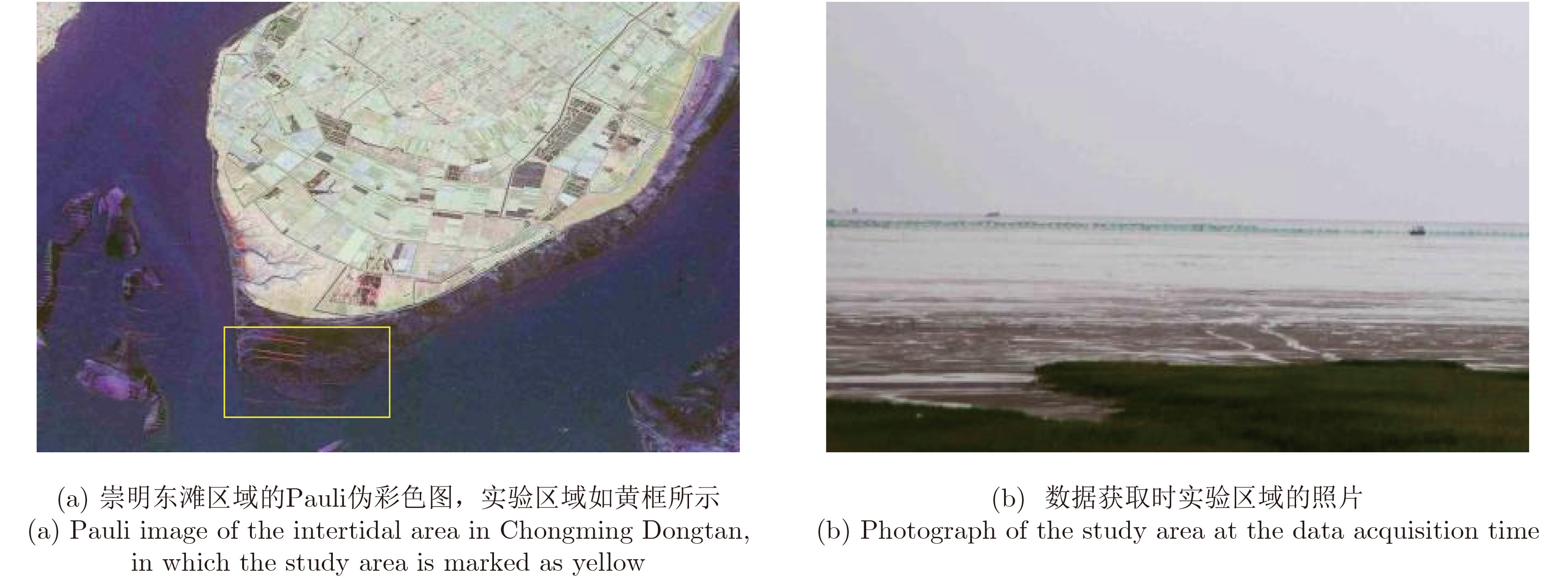

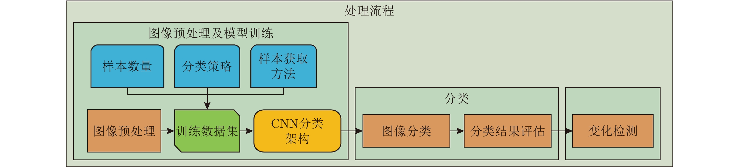
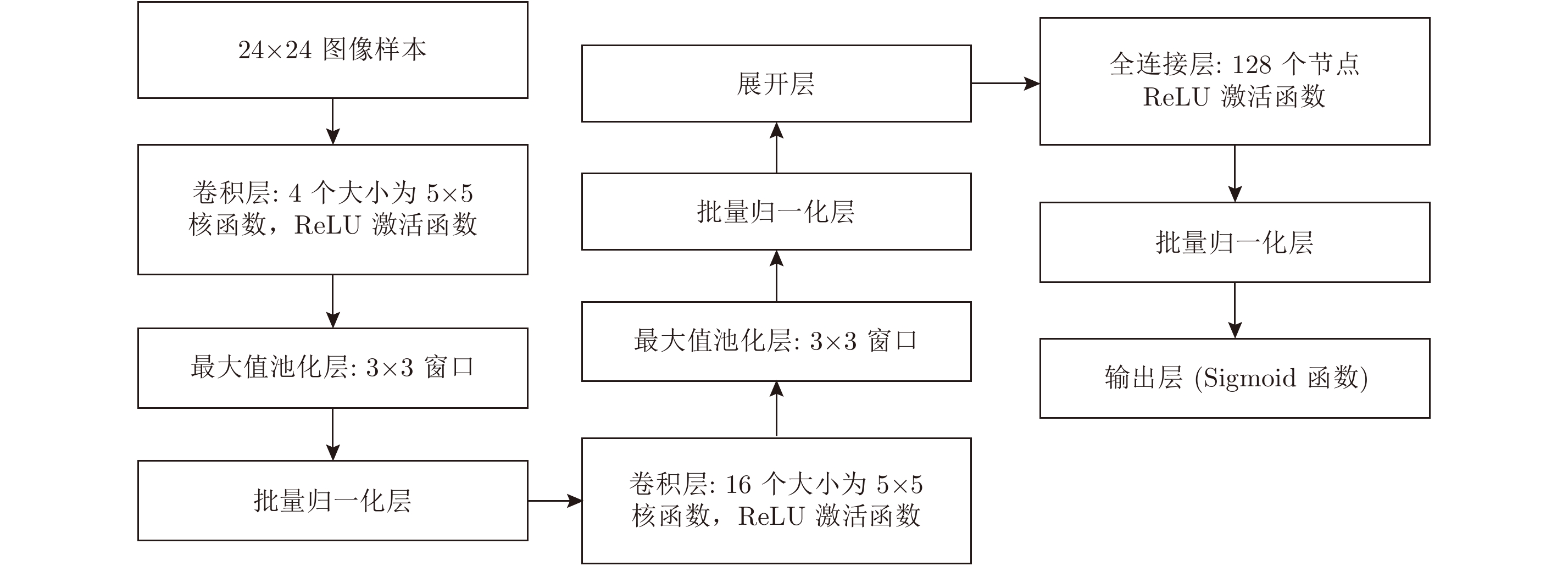
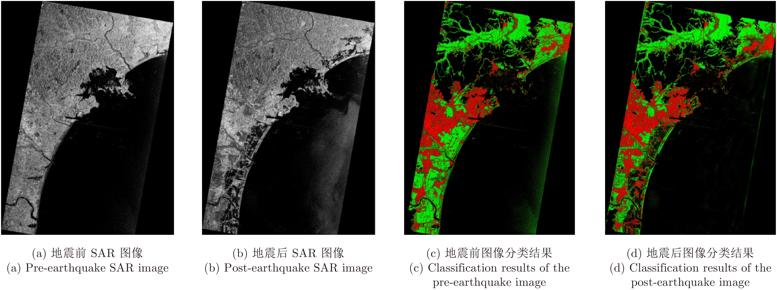
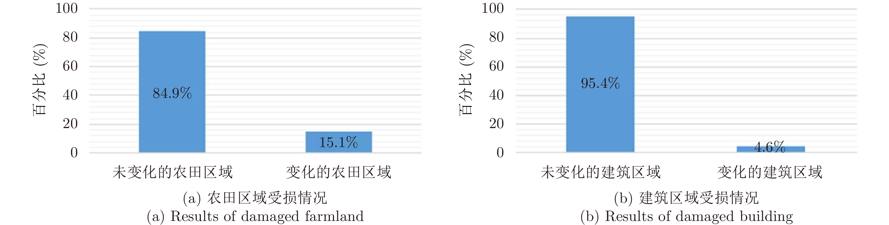
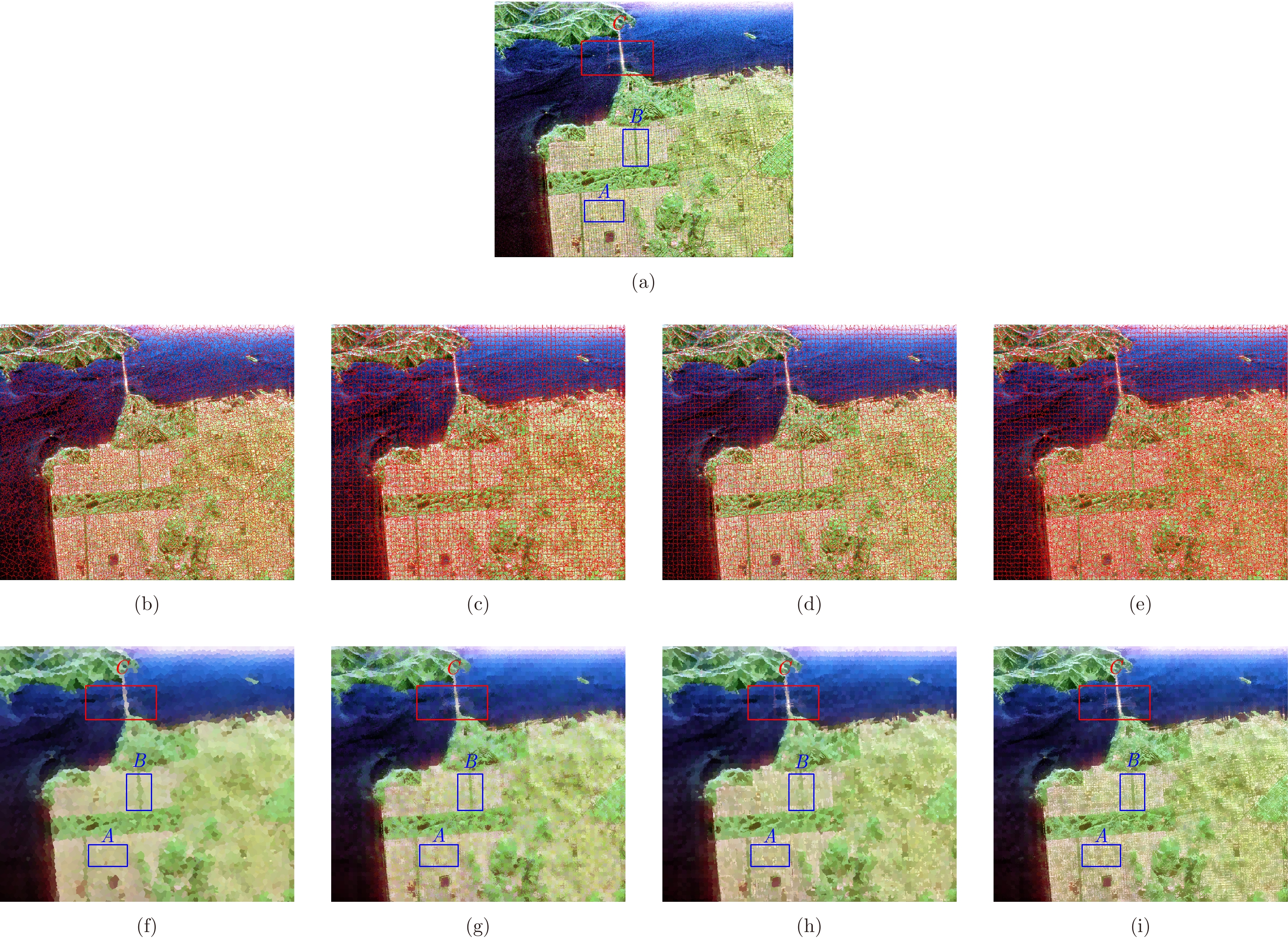
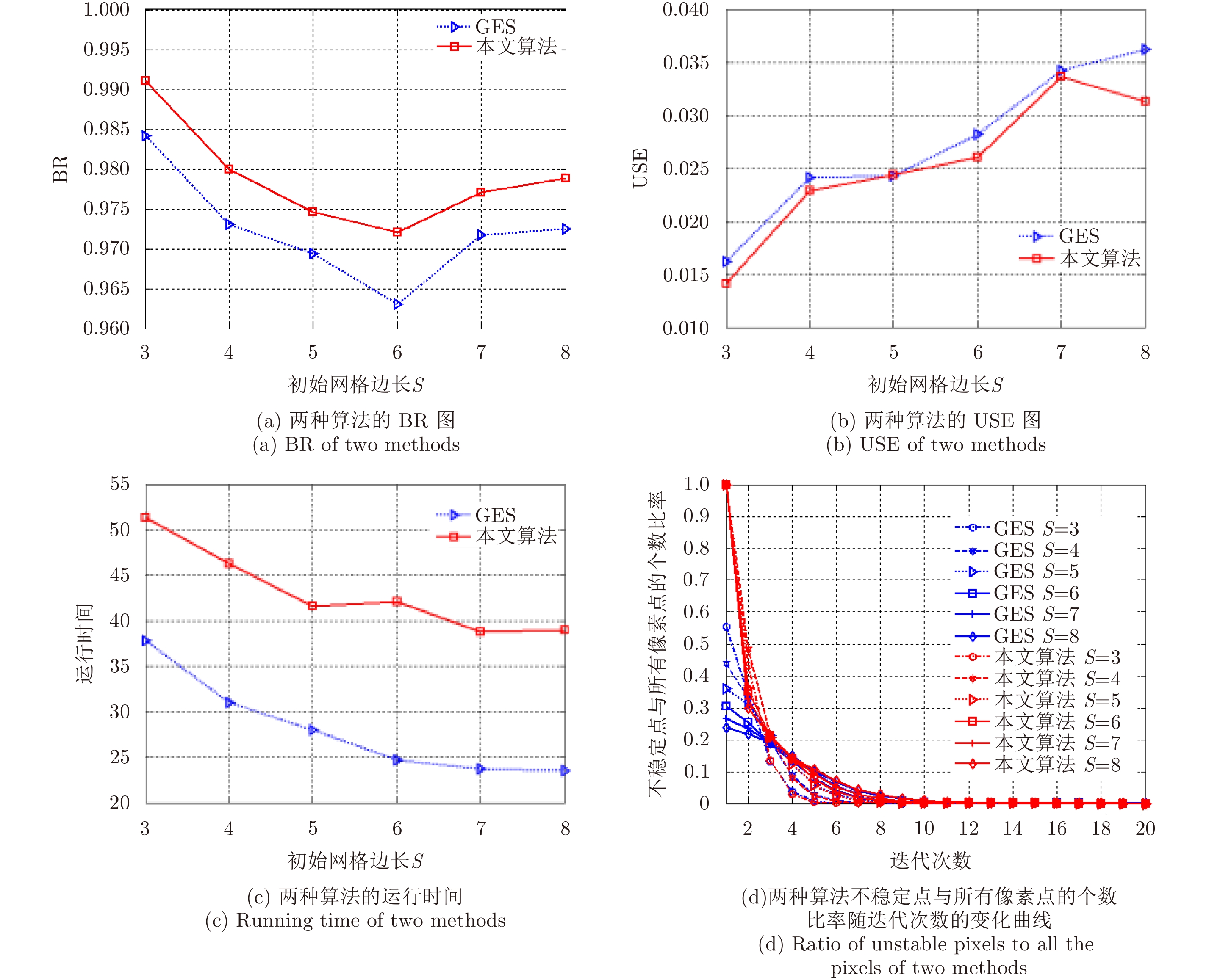
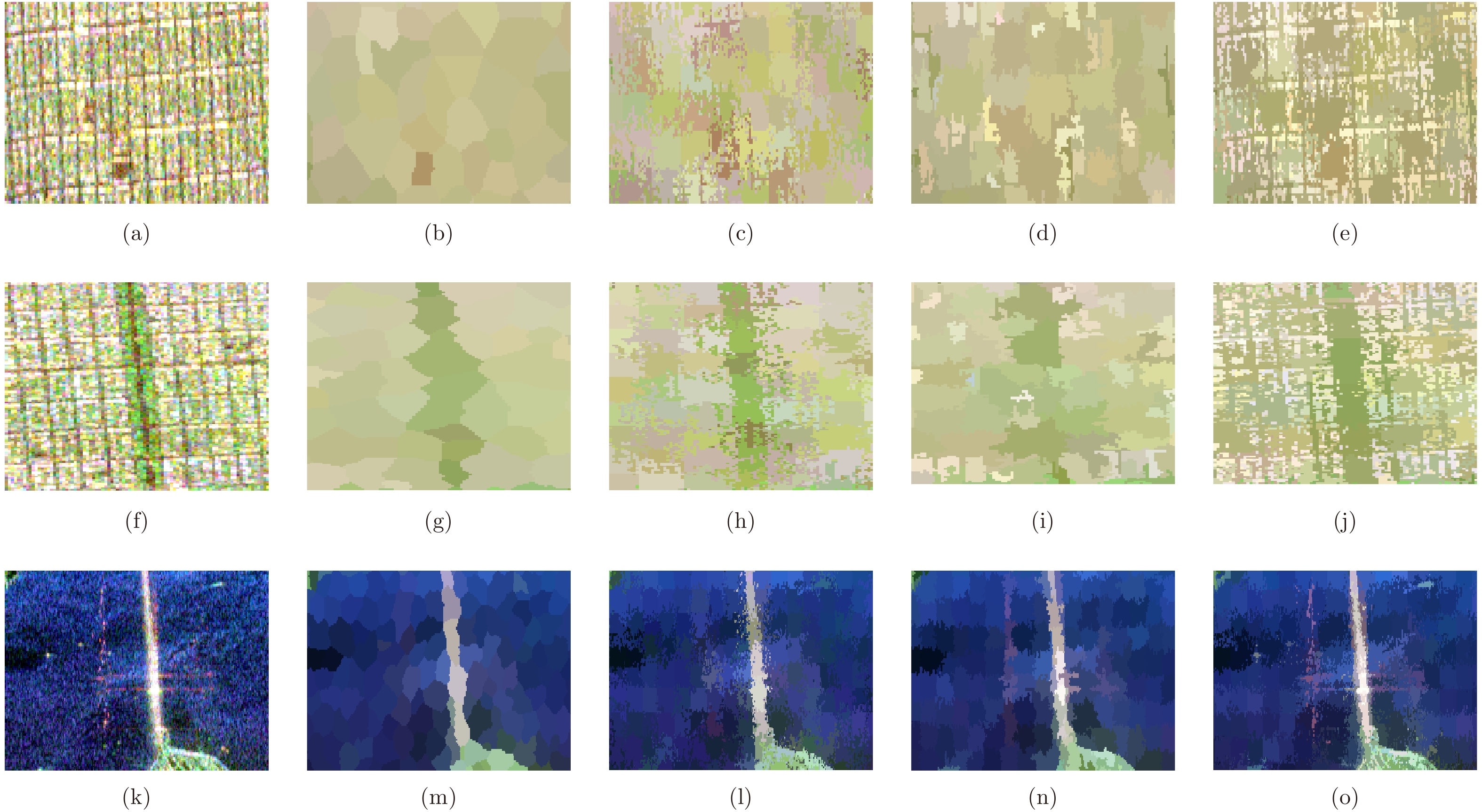
This paper presents a novel Synthetic Aperture Radar (SAR)-image-change-detection method, which integrates effective-image preprocessing and Convolutional Neural Network (CNN) classification. To validate the efficiency of the proposed method, two SAR images of the same devastated region obtained by TerraSAR-X before and after the 2011 Tohoku earthquake are investigated. During image preprocessing, the image backgrounds such as mountains and water bodies are extracted and removed using Digital Elevation Model (DEM) model and Otsu’s thresholding method. A CNN is employed to automatically extract hierarchical feature representation from the data. The SAR image is then classified with the theoretically obtained features. The classification accuracies of the training and testing datasets are 98.25% and 97.86%, respectively. The changed areas between two SAR images are detected using image difference method. The accuracy and efficiency of the proposed method are validated. In addition, with other traditional methods as comparison, this paper presents change-detection results using the proposed method. Results show that the proposed method has higher accuracy in comparison with traditional change-detection methods.
This paper presents a novel Synthetic Aperture Radar (SAR)-image-change-detection method, which integrates effective-image preprocessing and Convolutional Neural Network (CNN) classification. To validate the efficiency of the proposed method, two SAR images of the same devastated region obtained by TerraSAR-X before and after the 2011 Tohoku earthquake are investigated. During image preprocessing, the image backgrounds such as mountains and water bodies are extracted and removed using Digital Elevation Model (DEM) model and Otsu’s thresholding method. A CNN is employed to automatically extract hierarchical feature representation from the data. The SAR image is then classified with the theoretically obtained features. The classification accuracies of the training and testing datasets are 98.25% and 97.86%, respectively. The changed areas between two SAR images are detected using image difference method. The accuracy and efficiency of the proposed method are validated. In addition, with other traditional methods as comparison, this paper presents change-detection results using the proposed method. Results show that the proposed method has higher accuracy in comparison with traditional change-detection methods.


 微信 | 公众平台

