
 作者中心
作者中心 专家审稿
专家审稿 责编办公
责编办公 编辑办公
编辑办公
Electromagnetic Scattering Modeling of Rough Surfaces and Selection of Chang’e-7 SAR Polarimetric Lunar Calibration Fields
-
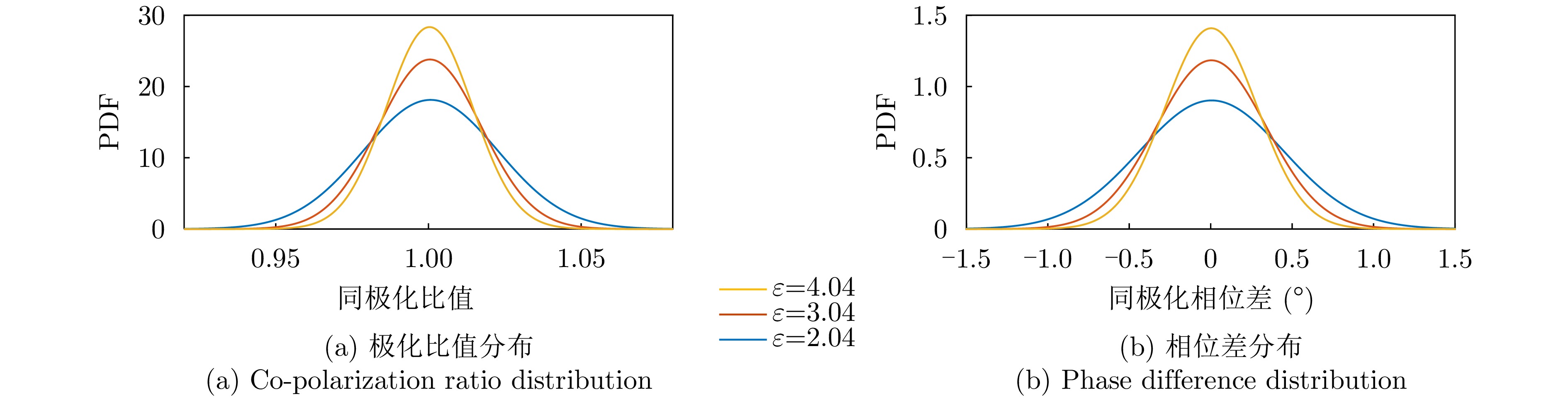
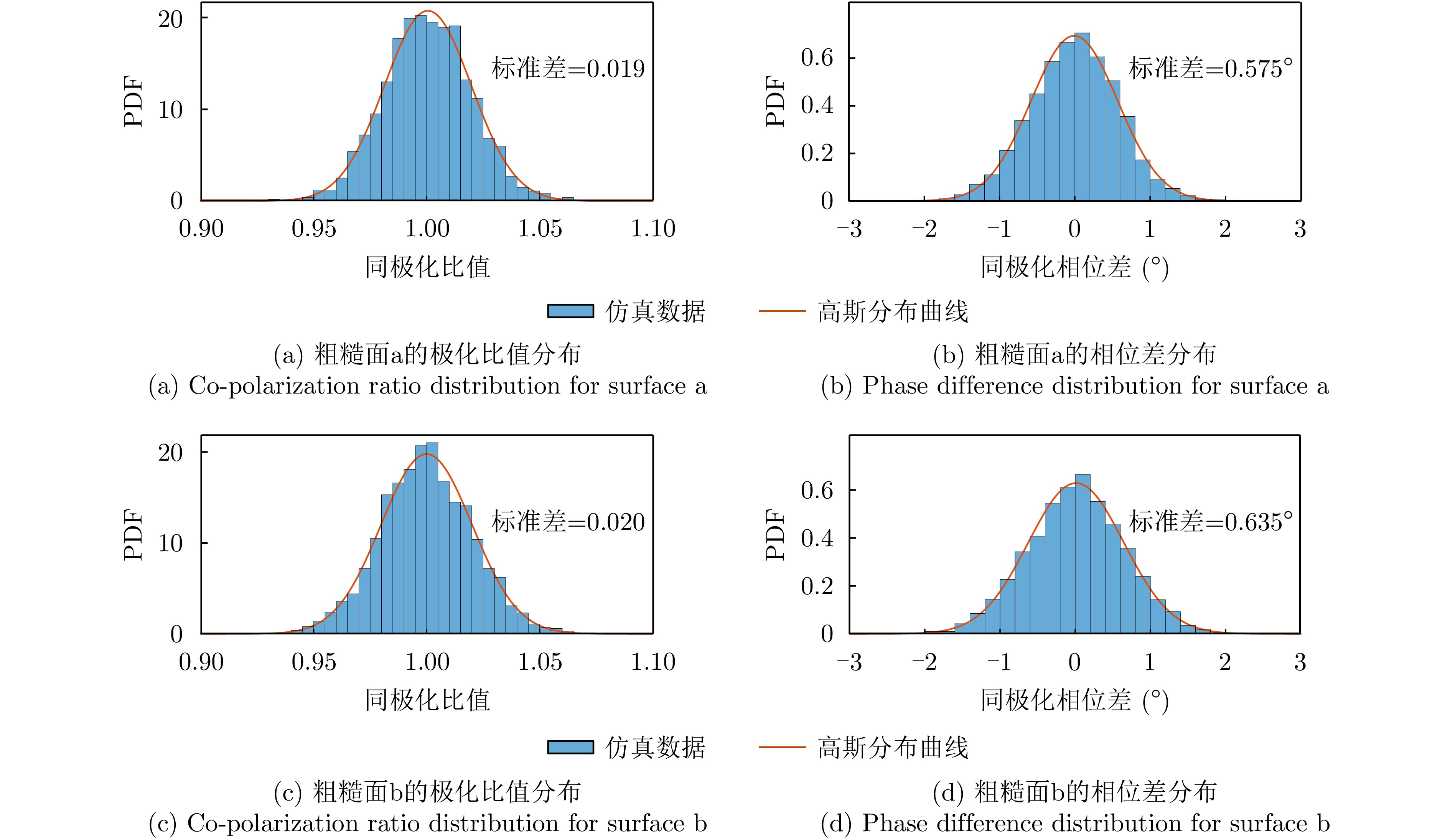
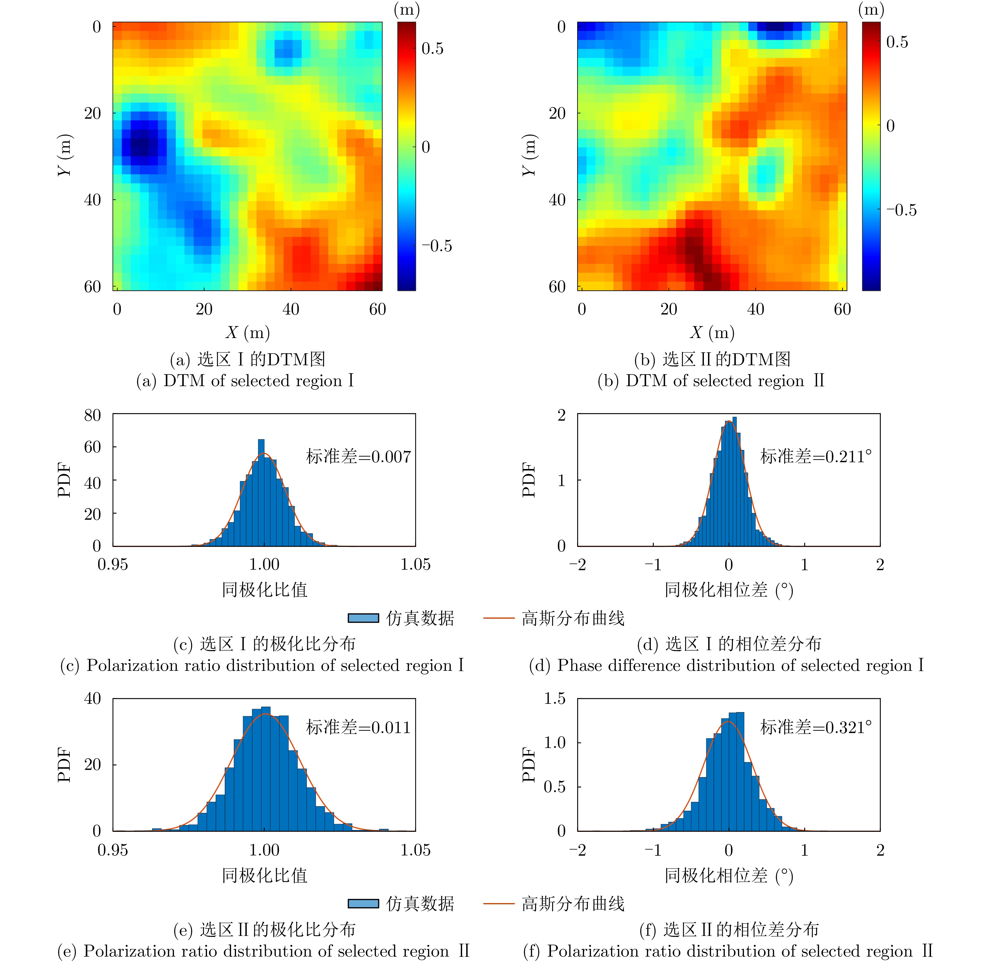
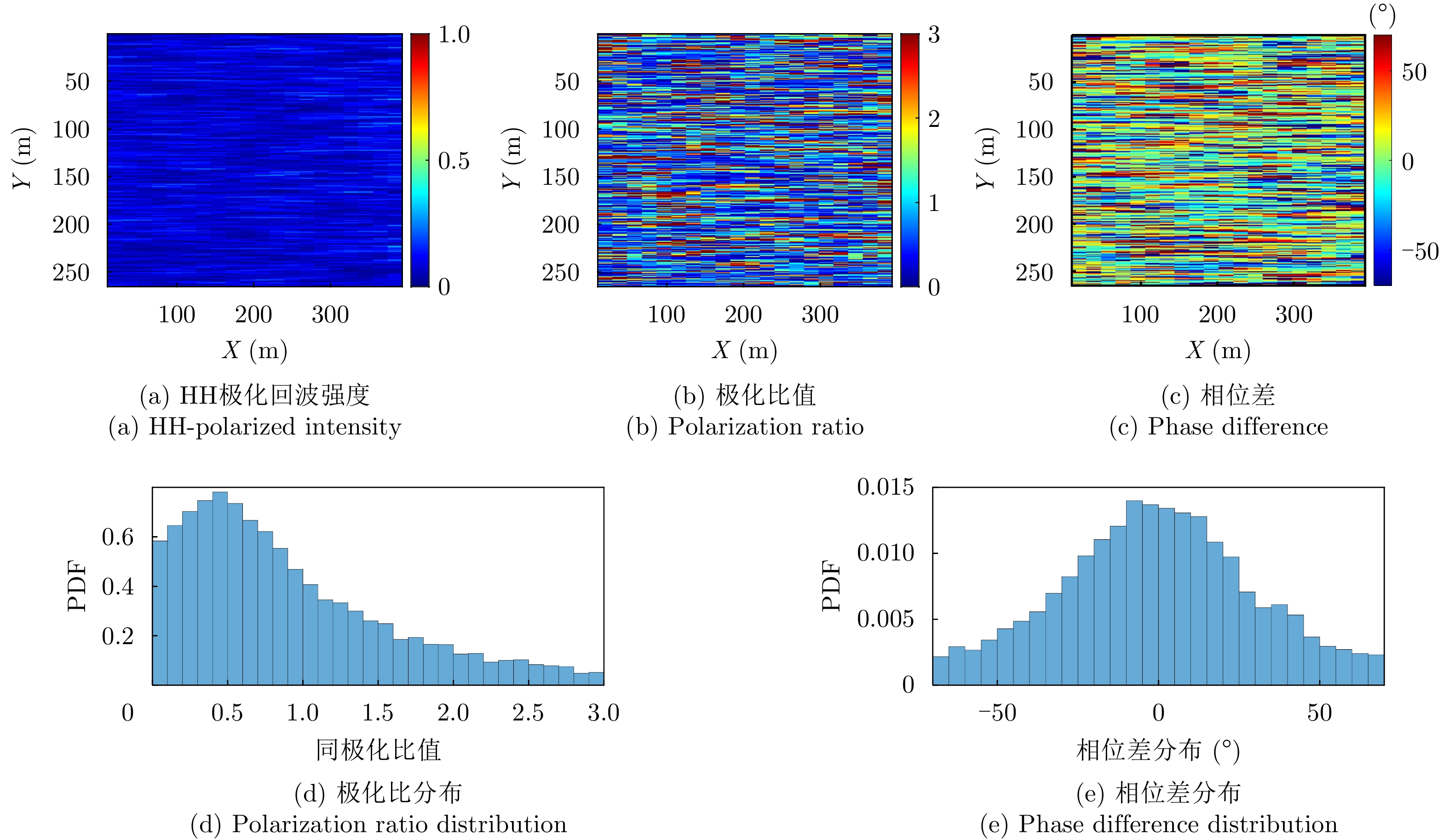
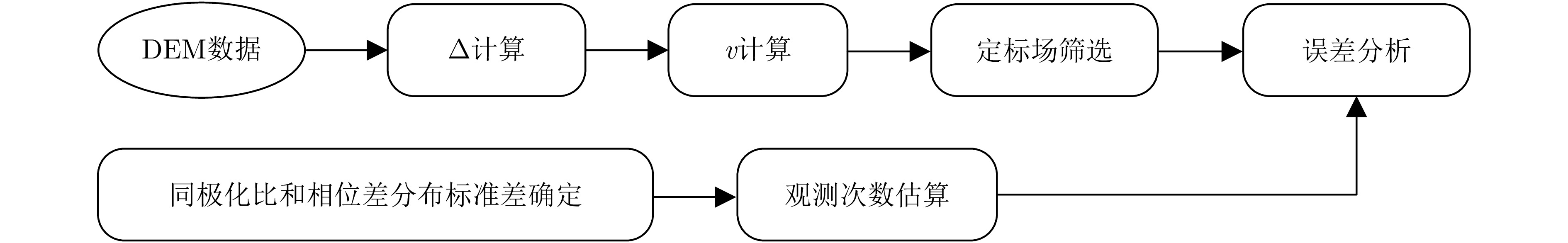
摘要: 嫦娥七号将搭载全极化合成孔径雷达,对月球极区地形与物质特性开展探测。极化合成孔径雷达要求极化定标,而传统地面定标方法在月球探测任务中难以应用,需要发展新的月面极化相对定标方法。针对月表相对定标问题,该文采用垂直观测,分析同极化比$ {\sigma _{{\text{HH}}}} $/$ {\sigma _{{\text{VV}}}} $,HH和VV相位差与斜坡间关系,提出参数v衡量极化旋转角分布均匀性并用于筛选月球定标场。仿真实验表明,极化旋转角越均匀,极化比分布越趋于1,相位差分布越趋近于0°。该文结合粗糙面电磁散射回波和月船二号实测数据,建立统计模型约束下的定标所需最小观测次数估算方法,为月球极化SAR系统的相对定标提供了理论依据和技术路径。Abstract: Chang’e-7 will carry a fully polarimetric Synthetic Aperture Radar (SAR) to investigate the topography and material properties of the lunar polar regions, which necessitates reliable polarimetric calibration. However, conventional ground-based calibration strategies are infeasible for lunar missions, underscoring the need for new relative polarimetric calibration methods tailored to the lunar surface. To address this challenge, we adopt a normal-incidence observation geometry and analyze how the co-polarization ratio $ {\sigma _{{\text{HH}}}} $/$ {\sigma _{{\text{VV}}}} $ and the HH-VV phase difference vary with local slope, where $ \sigma $ denotes the backscattering coefficients. H and V represent horizontal and vertical polarizations, respectively. We introduce a parameter v to quantify the uniformity of the polarization orientation angle distribution and use it to identify suitable lunar calibration sites. Simulation results show that, as terrain slopes become more uniform, the copolarization ratio distribution converges toward unity and the phase difference distribution approaches 0°. Combining rough-surface electromagnetic scattering simulations with Chandrayaan-2 polarimetric observations, we further develop a statistically constrained estimator for determining the minimum number of observations required for robust calibration. This work provides both a theoretical basis and a practical pathway for achieving relative calibration of lunar polarimetric SAR systems.
-
Key words:
- Deep space exploration /
- Moon /
- SAR calibration /
- Chang’e-7 /
- SAR polarization
-
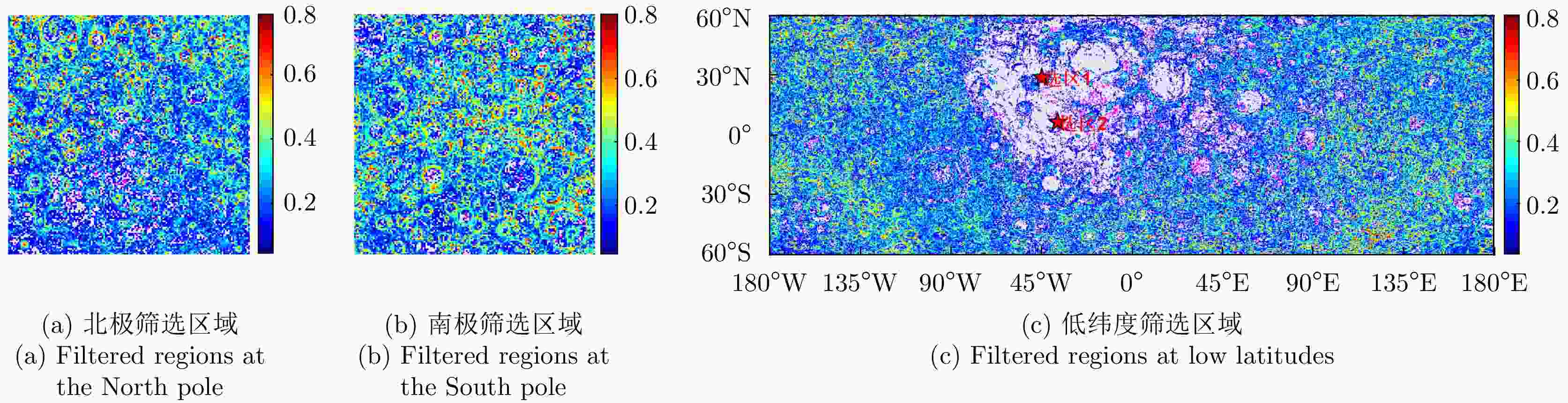
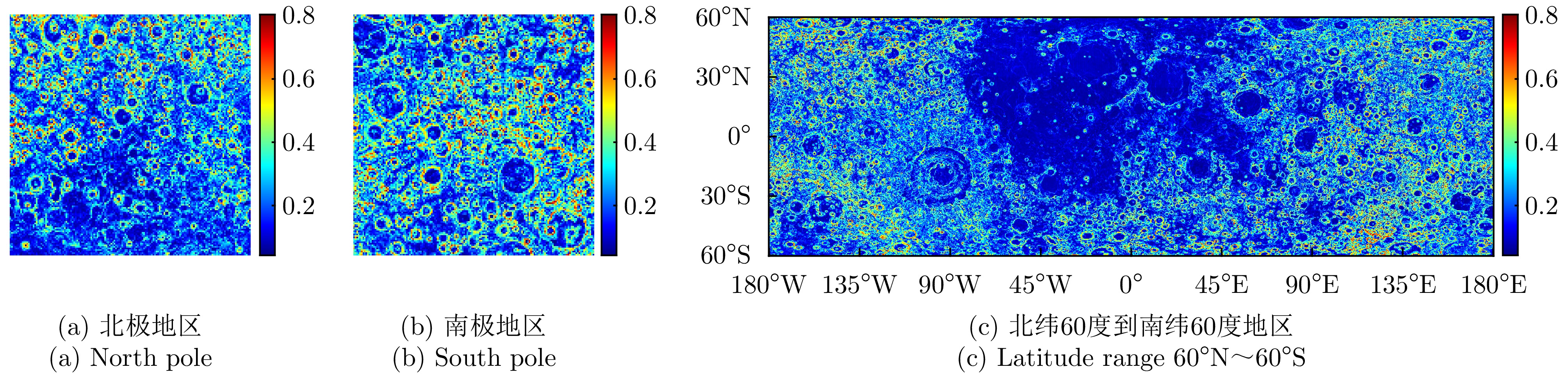
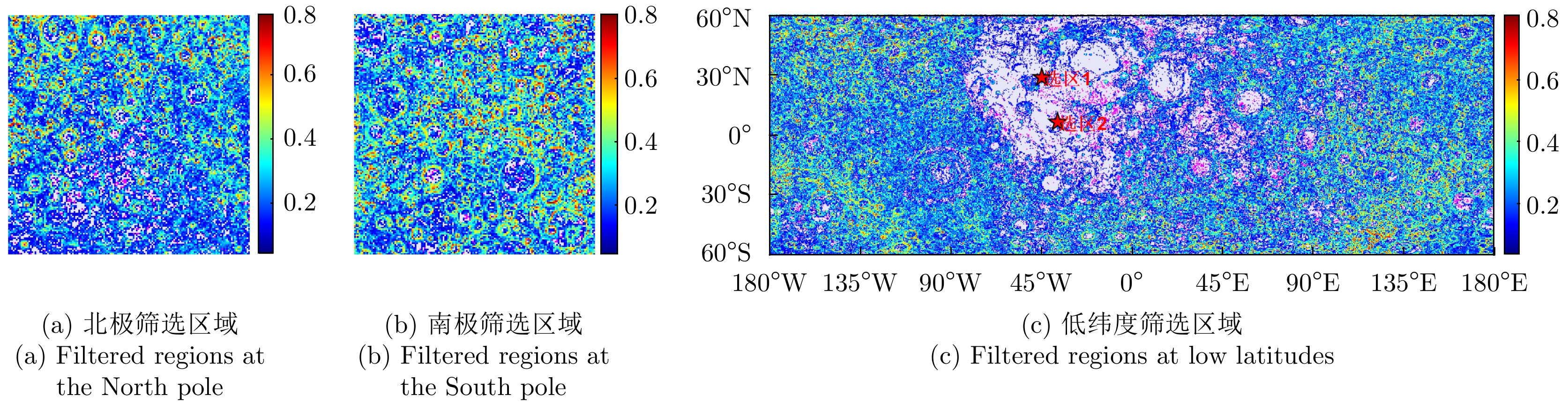
图 7 基于参数v阈值的潜在定标场分布图
Figure 7. Distribution map of potential calibration sites based on the v-parameter threshold
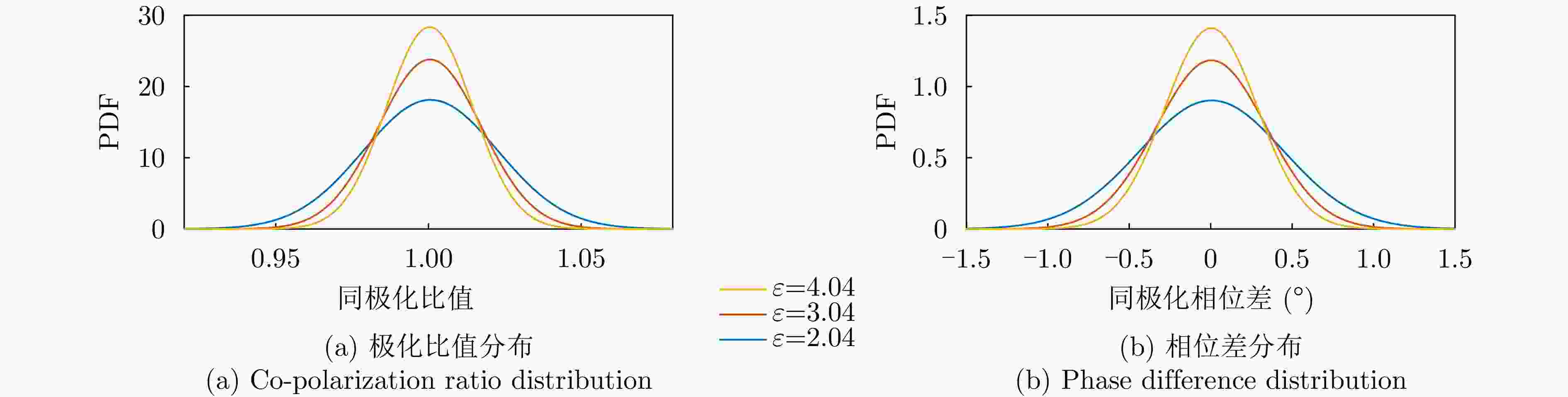
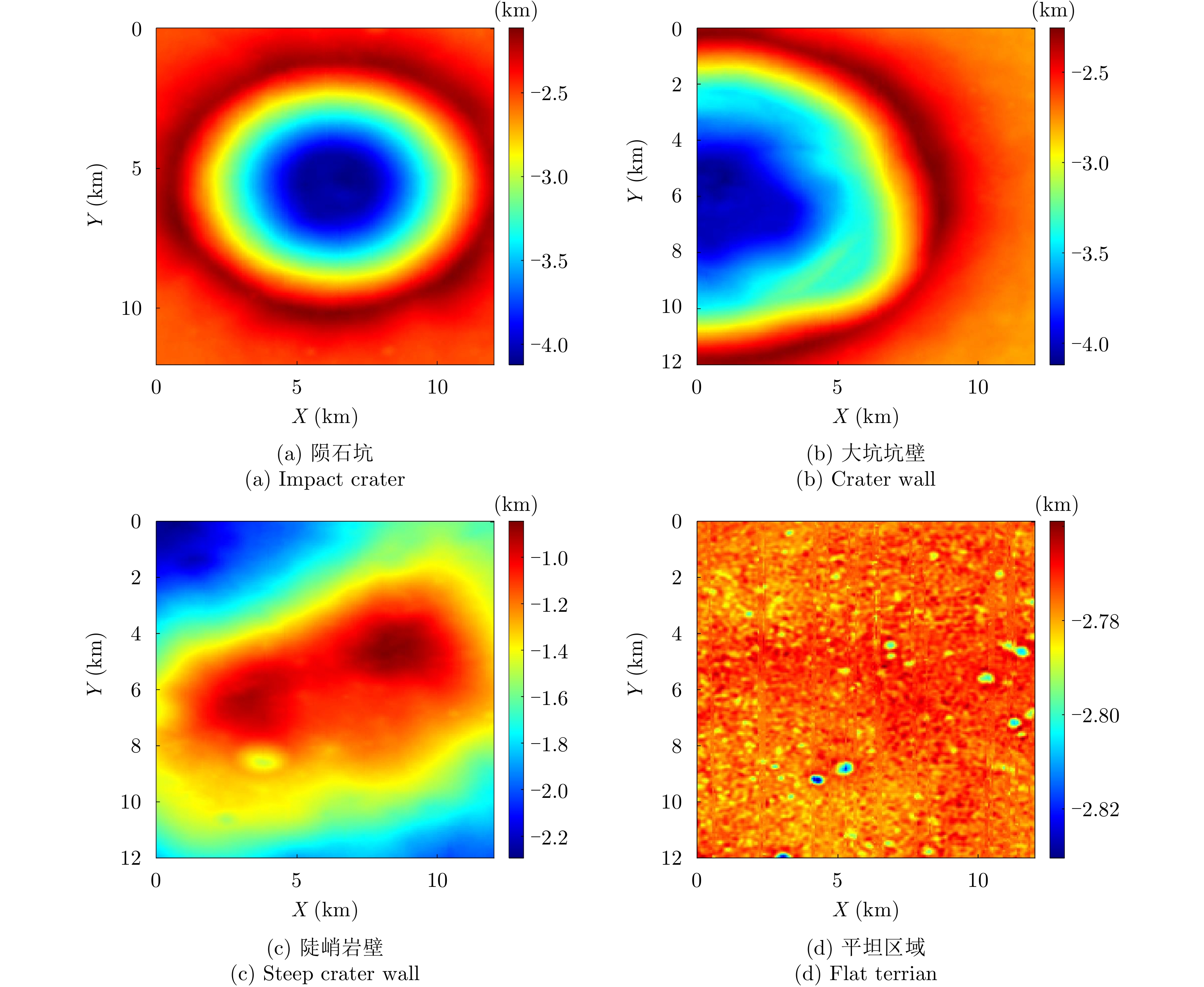
图 10 不同波段下的介电常数分析图
Figure 10. Comparison of simulated polarimetric backscattering echoes
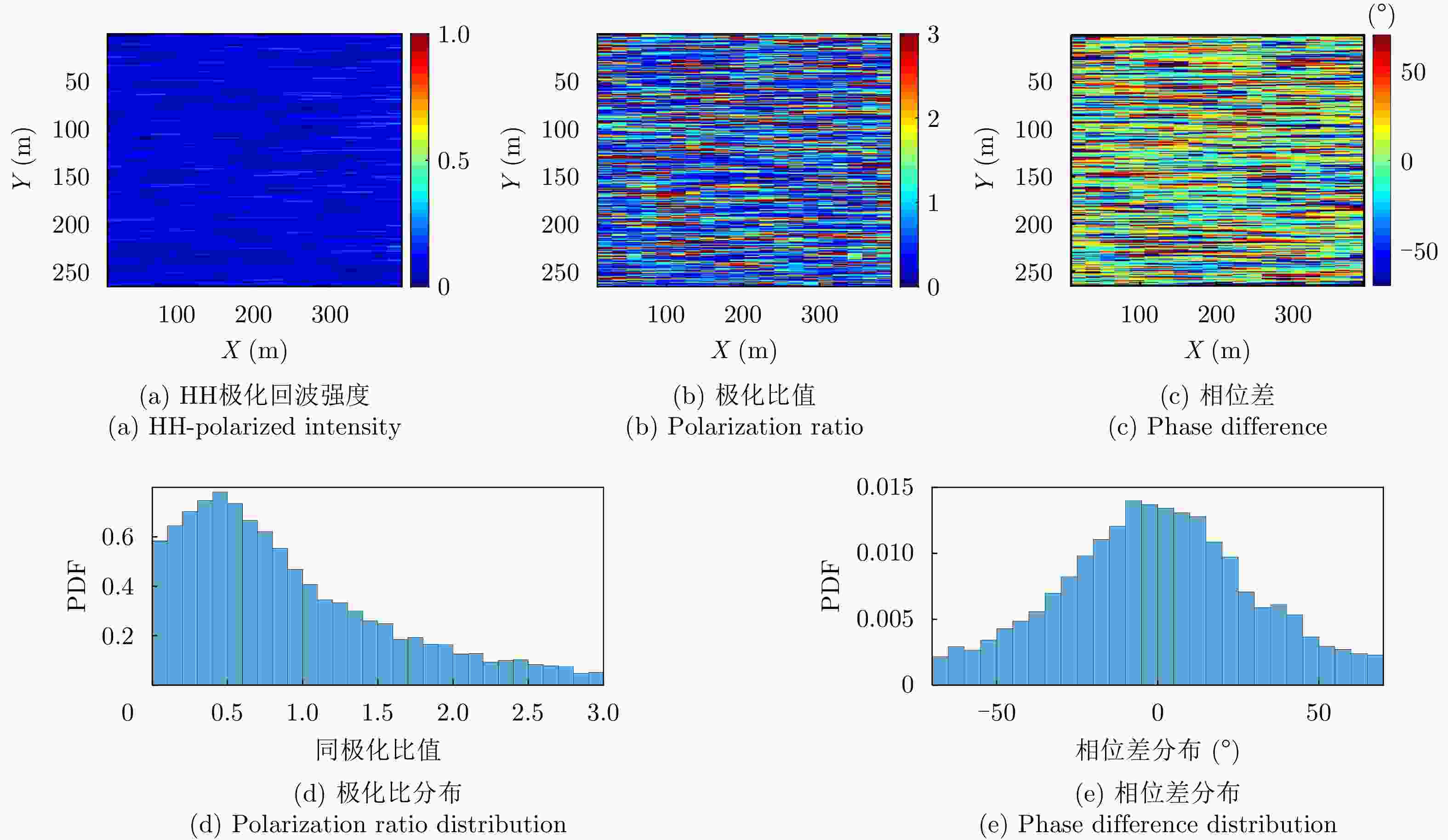
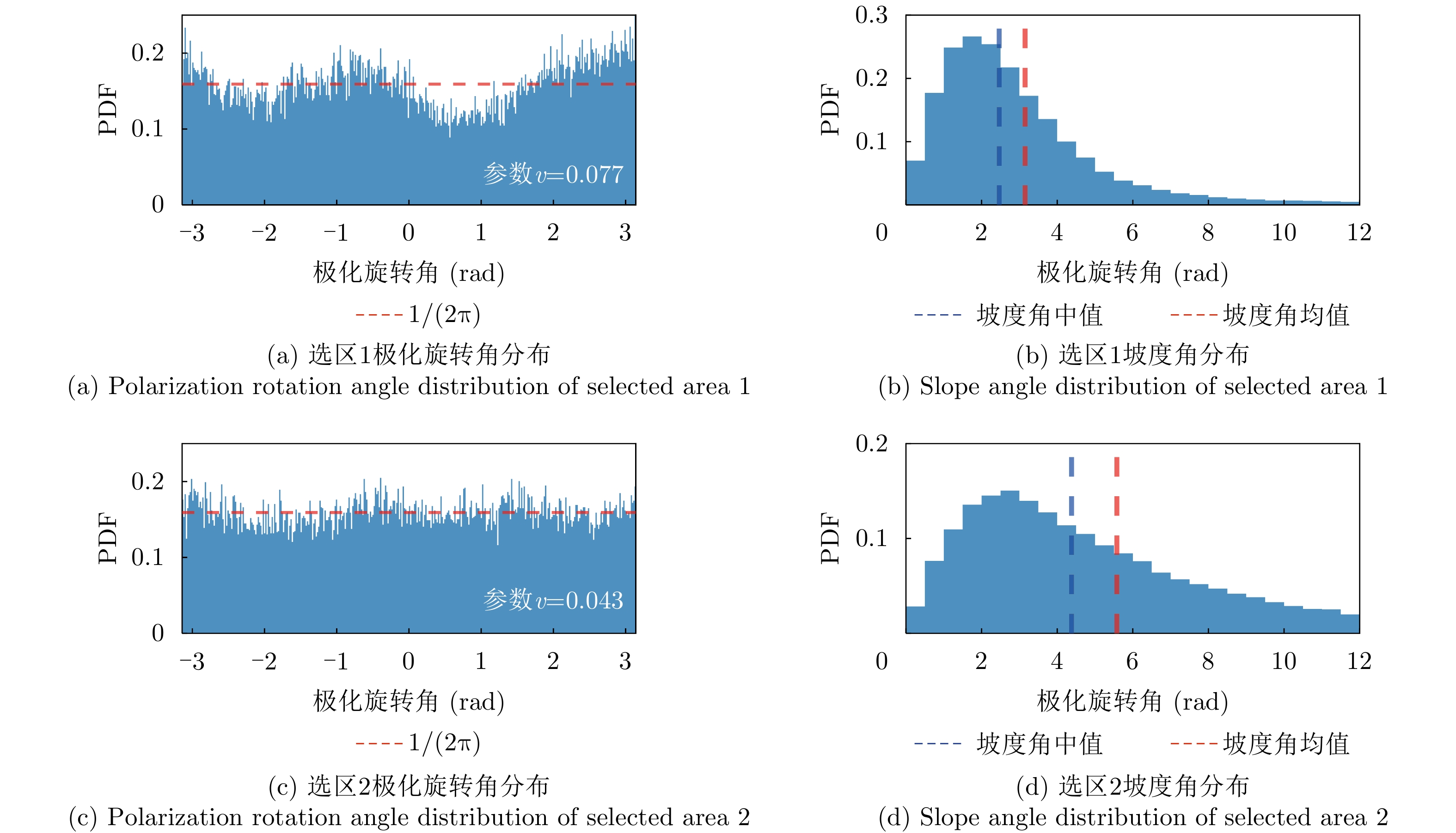
图 13 选区的极化回波统计分布
Figure 13. Statistical distribution of polarized backscatter in selected region
-
[1] LEE J S, GRUNES M R, and DE GRANDI G. Polarimetric SAR speckle filtering and its implication for classification[J]. IEEE Transactions on Geoscience and Remote Sensing, 1999, 37(5): 2363–2373. doi: 10.1109/36.789635. [2] CLOUDE S R and POTTIER E. A review of target decomposition theorems in radar polarimetry[J]. IEEE Transactions on Geoscience and Remote Sensing, 1996, 34(2): 498–518. doi: 10.1109/36.485127. [3] CAMPBELL D B, CAMPBELL B A, CARTER L M, et al. No evidence for thick deposits of ice at the lunar south pole[J]. Nature, 2006, 443(7113): 835–837. doi: 10.1038/nature05167. [4] GAO Yao, ZHAO Fei, HOU Wentao, et al. Analysis of rock abundance on lunar surface and near-surface using Mini-RF SAR data[J]. IEEE Journal of Selected Topics in Applied Earth Observations and Remote Sensing, 2023, 16: 9590–9605. doi: 10.1109/JSTARS.2023.3323510. [5] SPUDIS P D, BUSSEY D B J, BALOGA S M, et al. Initial results for the north pole of the moon from Mini-SAR, Chandrayaan-1 mission[J]. Geophysical Research Letters, 2010, 37(6): L06204. doi: 10.1029/2009GL042259. [6] RANEY R K, SPUDIS P D, BUSSEY B, et al. The lunar Mini-RF radars: Hybrid polarimetric architecture and initial results[J]. Proceedings of the IEEE, 2011, 99(5): 808–823. doi: 10.1109/JPROC.2010.2084970. [7] SPUDIS P D, BUSSEY D B J, BALOGA S M, et al. Evidence for water ice on the Moon: Results for anomalous polar craters from the LRO mini-RF imaging radar[J]. Journal of Geophysical Research: Planets, 2013, 118(10): 2016–2029. doi: 10.1002/jgre.20156. [8] BHIRAVARASU S S, CHAKRABORTY T, PUTREVU D, et al. Chandrayaan-2 dual-frequency synthetic aperture radar (DFSAR): Performance characterization and initial results[J]. The Planetary Science Journal, 2021, 2(4): 134. doi: 10.3847/PSJ/abfdbf. [9] WANG Yingjie, WANG Robert, LIU Kaiyu, et al. Lunar microwave imaging radar (LMIR)[C]. The 14th European Conference on Synthetic Aperture Radar, Leipzig, Germany, 2022: 1–3. [10] WANG Chi, JIA Yingzhuo, XUE Changbin, et al. Scientific objectives and payload configuration of the Chang’E-7 mission[J]. National Science Review, 2024, 11(2): nwad329. doi: 10.1093/nsr/nwad329. [11] VAN ZYL J J. Calibration of polarimetric radar images using only image parameters and trihedral corner reflector responses[J]. IEEE Transactions on Geoscience and Remote Sensing, 1990, 28(3): 337–348. doi: 10.1109/36.54360. [12] SARABANDI K. Calibration of a polarimetric synthetic aperture radar using a known distributed target[C]. IEEE International Geoscience and Remote Sensing Symposium, Tokyo, Japan, 1993: 968–970. doi: 10.1109/IGARSS.1993.322167. [13] MCKERRACHER P L, JENSEN J R, SEQUEIRA H B, et al. Mini-RF calibration, a unique approach to on-orbit synthetic aperture radar system calibration[C]. The 41st Lunar and Planetary Science Conference (LPSC XLI), The Woodlands, USA, 2010: 2352. [14] TANG Zhencheng, LIU Jianjun, WANG Xing, et al. Physical and mechanical characteristics of lunar soil at the Chang’E-4 landing site[J]. Geophysical Research Letters, 2020, 47(22): e2020GL089499. doi: 10.1029/2020GL089499. [15] WU Bo, LI Yuan, LIU W C, et al. Centimeter-resolution topographic modeling and fine-scale analysis of craters and rocks at the Chang’E-4 landing site[J]. Earth and Planetary Science Letters, 2021, 553: 116666. doi: 10.1016/j.epsl.2020.116666. [16] LI Yueyang and FA Wenzhe. Centimeter-scale surface roughness of the Chang’E landing regions and implications for radar scattering mechanisms[J]. IEEE Transactions on Geoscience and Remote Sensing, 2024, 62: 4510316. doi: 10.1109/TGRS.2024.3454034. [17] ULABY F T and LONG D G. Microwave Radar and Radiometric Remote Sensing[M]. Ann Arbor, USA: University of Michigan Press, 2014: 451–452. [18] FUNG A K. Microwave Scattering and Emission Models and Their Applications[M]. Boston, USA, Artech House, 1994: 232–245. [19] PANCIERA R, TANASE M A, LOWELL K, et al. Evaluation of IEM, Dubois, and Oh radar backscatter models using airborne L-band SAR[J]. IEEE Transactions on Geoscience and Remote Sensing, 2014, 52(8): 4966–4979. doi: 10.1109/TGRS.2013.2286203. [20] CHEN Kunshan, WU T D, and FUNG A K. A study of backscattering from multiscale rough surface[J]. Journal of Electromagnetic Waves and Applications, 1998, 12(7): 961–979. doi: 10.1163/156939398X01187. [21] YANG Ying, CHEN Kunshan, and JIANG Rui. Modeling and analysis of microwave emission from multiscale soil surfaces using AIEM model[J]. Remote Sensing, 2022, 14(22): 5899. doi: 10.3390/rs14225899. [22] GUO Mingde, CHEN Kunshan, YANG Ying, et al. On the MCF model for predicting radar ocean backscatter[J]. IEEE Transactions on Geoscience and Remote Sensing, 2024, 62: 2002715. doi: 10.1109/TGRS.2024.3370630. [23] JIN Yaqiu and XU Feng. Polarimetric Scattering and SAR Information Retrieval[M]. Hoboken, USA: John Wiley & Sons Singapore Pte. Ltd., 2013: 1–27. doi: 10.1002/9781118188149. [24] TSANG L and KONG J A. Scattering of Electromagnetic Waves: Advanced Topics[M]. New York, USA: John Wiley & Sons, Inc., 2001: 66–72. doi: 10.1002/0471224278. [25] NGHIEM S V, YUEH S H, KWOK R, et al. Symmetry properties in polarimetric remote sensing[J]. Radio Science, 1992, 27(5): 693–711. doi: 10.1029/92RS01230. [26] SMITH D E, ZUBER M T, JACKSON G B, et al. The lunar orbiter laser altimeter investigation on the lunar reconnaissance orbiter mission[J]. Space Science Reviews, 2010, 150(1/4): 209–241. doi: 10.1007/s11214-009-9512-y. [27] SU Yan, WANG Ruigang, DENG Xiangjin, et al. Hyperfine structure of regolith unveiled by Chang’E-5 lunar regolith penetrating radar[J]. IEEE Transactions on Geoscience and Remote Sensing, 2022, 60: 5110414. doi: 10.1109/TGRS.2022.3148200. [28] CASELLA G and BERGER R L. Statistical Inference[M]. 2nd ed. Pacific Grove, USA: Thomson Learning, 2002: 432–442. -

 下载:
下载:


图(13) / 表(1)
计量
- 文章访问数:
- HTML全文浏览量:
- PDF下载量:
- 被引次数: 0

