SAR Dataset of Fudan University 2022No.1
FUSAR-Ship, a high-resolution SAR ship dataset built by Professor Feng Xu's team at the Key Laboratory of Information Science of Electromagnetic Waves, Fudan University, is a standard ship target identification dataset based on the domestic GF-3 satellite.
FUSAR-Ship dataset includes samples of 15 ship categories, 98 ship subcategories, and many non-ship interference targets. It consists of 16144 image slices, including 6252 ship chips with AIS messages, 2045 strong scatterers, 1461 coastal lands & islands, 1010 bridges, 1624 lands, and 3752 sea clutter. These samples are cropped from 126 scene GF-3 images. Moreover, these scenes are distributed in the estuary, the middle and lower reaches of the Yangtze River, the Huanghai Sea, and the East China Sea.
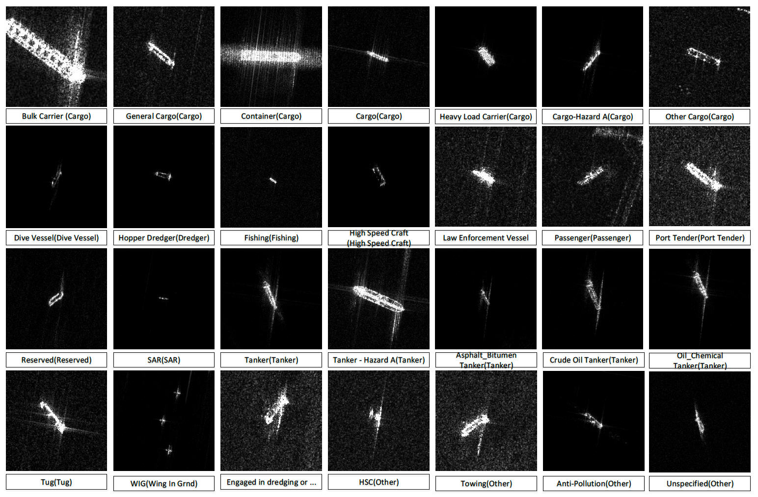
The annotation of the samples is consistent, in terms of the definition of the classes, how bounding boxes are placed, and how viewpoints and truncation are defined. And the samples are fixed to a size of 512 × 512 pixels around the center points. Fig. 1 shows the different categories of ships in FUSAR-Ship.

Fig. 1. Different categories of ships in FUSAR-Ship.
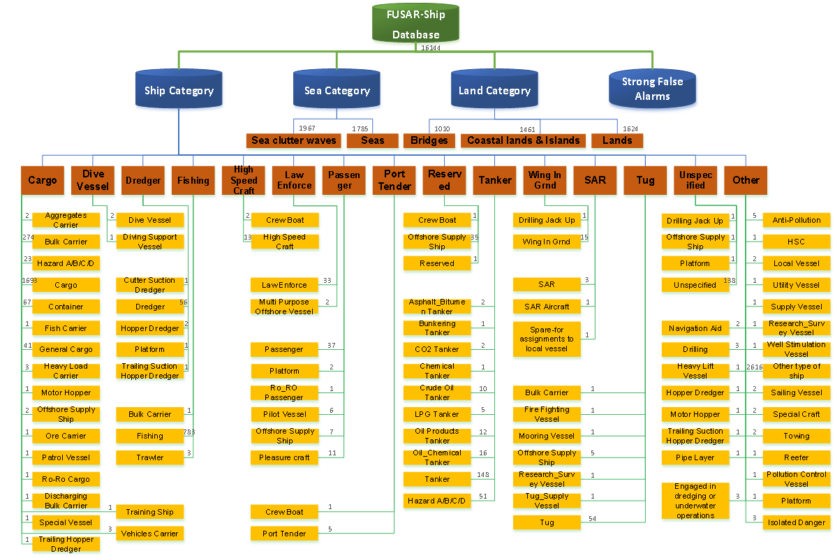
Fig. 2 shows the taxonomy of FUSAR-Ship dataset. The root node is Maritime Object which is split into two branches, namely Ship and NonShip. The Ship node comprises nearly all categories of ships, e.g., Cargo, Tanker, and Fisher. From Figure 15, some of these nodes have subcategory nodes, e.g., the Cargo node is composed of Bulk Carrier, General Cargo, Container and Other Cargo nodes. On the other hand, the NonShip node has three childnodes, i.e., Land, Sea and Strong Scatterers (e.g., as buoy, windmill, and sea ranch). For instance, the Land node includes typical nature and manmade nearshore architectures including Bridges & Coastlines, Coastal Lands & Islands and Random Land Surfaces. In sum, the maritime object taxonomy is composed of four levels.

Fig. 2. The taxonomy of the FUSAR-Ship dataset.
The current data reference format is as follows:
[1]. Xiyue HOU, Wei AO, Qian SONG, Jian LAI, Haipeng WANG, Feng XU. FUSAR-Ship: building a high-resolution SAR-AIS matchup dataset of Gaofen-3 for ship detection and recognition[J]. Science China(Information Sciences),2020,63(04):40-58.
[2]. Wei AO, Feng XU, Yongchen LI and Haipeng WANG. Detection and Discrimination of Ship Targets in Complex Background From Spaceborne ALOS-2 SAR Images[J]. IEEE Journal of Selected Topics in Applied Earth Observations and Remote Sensing, vol. 11, no. 2, pp. 536-550, 2018.
- 2022 No.1
Download
Register
Data Usage Protocol of Journal of Radars
The data can be used free of charge for scientific research, teaching and so on, but the data source should be marked in the reference according to the citation format.
Data use for commercial purposes requires permission from the Editorial Department of Journal of Radars.


 Submit Manuscript
 Peer Review
 Editor Work
 微信 | 公众平台

