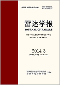
Volume 3 Issue 3
Jun.  2014
Turn off MathJax
Article Contents
Liu Jia-yin, Wen Shuang-yan, Zhang Hong-yi, HONG Wen. Geo-correction Algorithm Based on Equivalent RD Model for ScanSAR of HJ-1-C Satellite[J]. Journal of Radars, 2014, 3(3): 361-367. doi: 10.3724/SP.J.1300.2013.13050
Citation: Liu Jia-yin, Wen Shuang-yan, Zhang Hong-yi, HONG Wen. Geo-correction Algorithm Based on Equivalent RD Model for ScanSAR of HJ-1-C Satellite[J]. Journal of Radars, 2014, 3(3): 361-367. doi: 10.3724/SP.J.1300.2013.13050

Geo-correction Algorithm Based on Equivalent RD Model for ScanSAR of HJ-1-C Satellite

doi: 10.3724/SP.J.1300.2013.13050
  • Received Date: 2013-06-09
  • Rev Recd Date: 2013-10-17
  • Publish Date: 2014-06-28
  • HJ-1C satellite was the first synthetic aperture radar satellite for civil use in China, it had the strip and scan mode. According to the characteristics of ScanSAR of HJ-1C satellite, a geo-correct algorithm based on equivalent RD model was given in this paper on the base of ECS image processing algorithm and traditional Range-Doppler location method. First azimuth mosaic was presented by time serial relationship, then the different burst was stitched by range, the equivalent parameters were fitted to location on RD model. At last the ScanSAR image was geo-corrected. The HJ-1C satellite data results showed that the location accuracy of ScanSAR of HJ-1C satellite less than 100 m and the geo-correct algorithm was realized in 10 s under 24 cores parallel.


  • loading
  • 加载中

Catalog

    通讯作者: 陈斌, bchen63@163.com
    • 1. 

      沈阳化工大学材料科学与工程学院 沈阳 110142

    1. 本站搜索
    2. 百度学术搜索
    3. 万方数据库搜索
    4. CNKI搜索
    Article views(2716) PDF downloads(2134) Cited by()
    Proportional views
    Related

    /

    DownLoad:  Full-Size Img  PowerPoint